Nine Acre Withy Bed

Wood, Forest in Dorset

England

Nine Acre Withy Bed

Looking east along the Roman Road at Two Gates The thick fog in this photo was coming in from the sea (to the right) and making driving on this narrow (but straight) road quite difficult. It had been sunny only a few hours earlier, which shows how quickly the weather can change on this high ground (238m above sea level). The Roman road eventually leads to Dorchester.
Looking east along the Roman Road at Two Gates Credit: Jim Champion

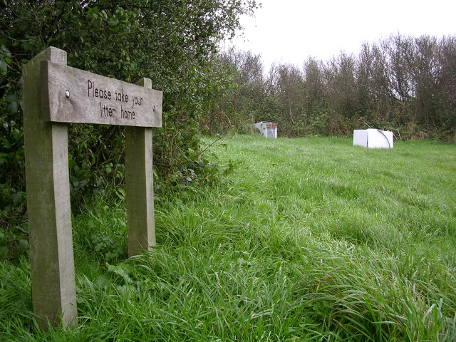
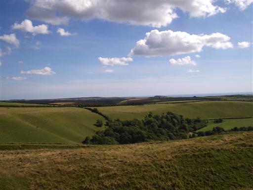
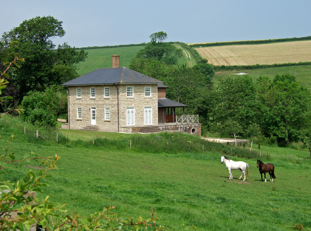
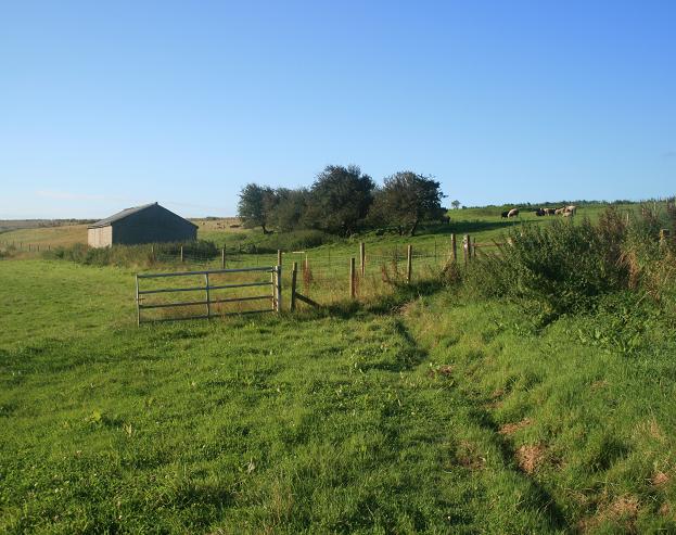
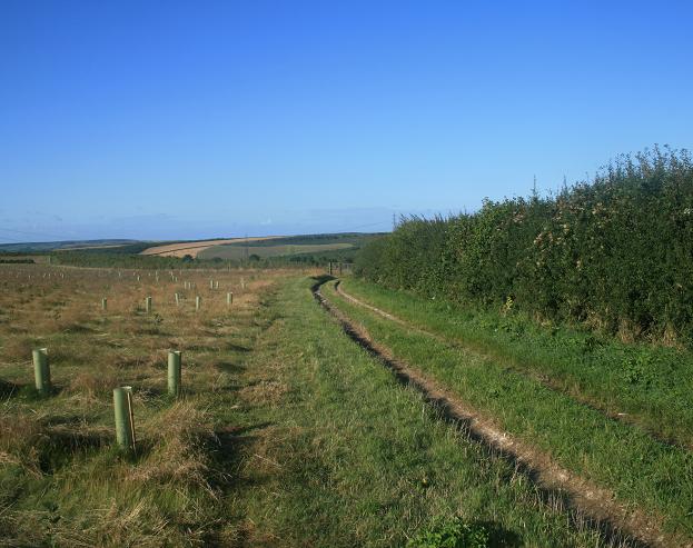
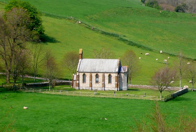
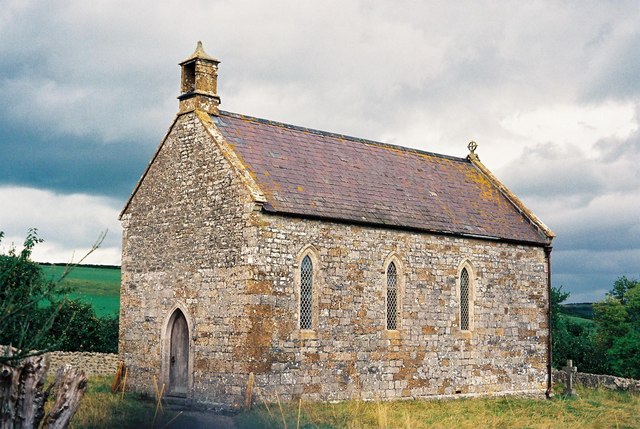
Nine Acre Withy Bed is a woodland area located in the county of Dorset, England. Covering an approximate area of nine acres, it is known for its lush and diverse landscape, making it a popular destination for nature enthusiasts and hikers alike.

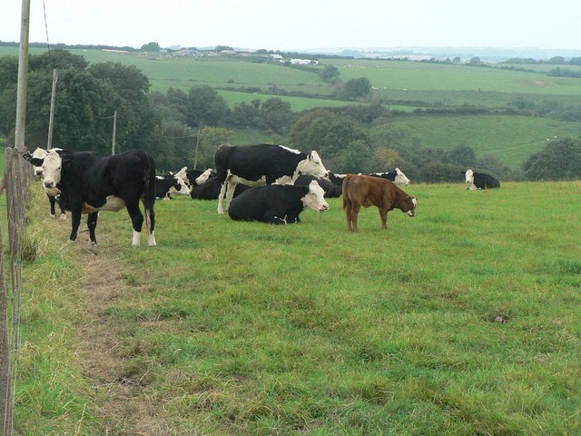
The withy bed refers to the presence of willow trees, which are abundant in the area. These trees not only add to the scenic beauty of the woodland but also serve as an important habitat for various species of birds, insects, and small mammals.

The woodland features a mix of both deciduous and evergreen trees, creating a vibrant and colorful environment throughout the year. The ground beneath is covered in a thick layer of moss and ferns, adding to the overall charm of the place.

Visitors to Nine Acre Withy Bed can explore the numerous walking trails that wind their way through the woodland, offering breathtaking views of the surrounding landscape. The trails are well-maintained, making it accessible for people of all ages and abilities.

The woodland is also home to a variety of wildflowers, including bluebells, primroses, and wood anemones, which carpet the forest floor during the spring months. This creates a picturesque scene that attracts photographers and nature lovers from far and wide.

Overall, Nine Acre Withy Bed in Dorset is a captivating woodland area that showcases the natural beauty of the region. Its diverse flora and fauna, coupled with its well-maintained trails, make it a must-visit destination for anyone seeking a peaceful and immersive experience in nature.

If you have any feedback on the listing, please let us know in the comments section below.

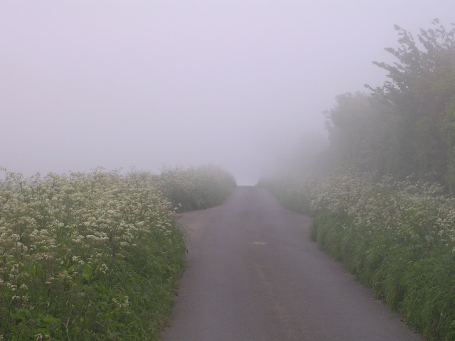
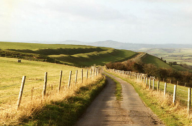
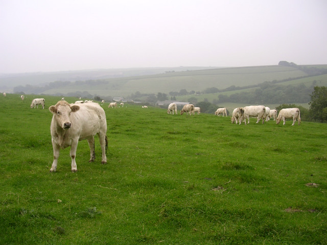
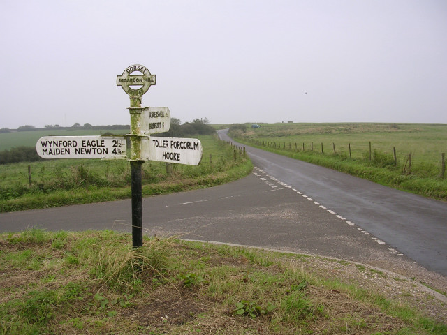
Nine Acre Withy Bed Images

Images are sourced within 2km of 50.752306/-2.618963 or Grid Reference SY5694. Thanks to Geograph Open Source API. All images are credited.

Looking east along the Roman Road at Two Gates The thick fog in this photo was coming in from the sea (to the right) and making driving on this narrow (but straight) road quite difficult. It had been sunny only a few hours earlier, which shows how quickly the weather can change on this high ground (238m above sea level). The Roman road eventually leads to Dorchester.
Looking east along the Roman Road at Two Gates
The thick fog in this photo was coming in from the sea (to the right) and making driving on this narrow (but straight) road quite difficult. It had been sunny only a few hours earlier, which shows how quickly the weather can change on this high ground (238m above sea level). The Roman road eventually leads to Dorchester.
Eggardon hillfort Rampart of hill fort visible by minor road running north west to Powerstock
Eggardon hillfort
Rampart of hill fort visible by minor road running north west to Powerstock
View from Shatcombe Lane towards Eggardon Hill Farm Looking southeast from Shatcombe Lane, with Eggardon Hill Farm in the valley below. According to the map this field has 'celtic field systems' i.e. the earthwork remains of Bronze Age farming. Now it is home to some white bullocks.
View from Shatcombe Lane towards Eggardon Hill Farm
Looking southeast from Shatcombe Lane, with Eggardon Hill Farm in the valley below. According to the map this field has 'celtic field systems' i.e. the earthwork remains of Bronze Age farming. Now it is home to some white bullocks.
Road junction and signpost on Eggardon Hill This junction marks the higher end of Shatcombe Lane. The Eggardon Hill trig point can be seen on the horizon, left of centre. The top of the directional signpost features the number "548948" which I only later realised was the OS grid reference for this sign.
Road junction and signpost on Eggardon Hill
This junction marks the higher end of Shatcombe Lane. The Eggardon Hill trig point can be seen on the horizon, left of centre. The top of the directional signpost features the number "548948" which I only later realised was the OS grid reference for this sign.
Flytipping at Shatcombe Lane picnic Area, Eggardon Hill A nearby sign (not pictured) asks visitors to PLEASE LEAVE THIS AREA AS YOU WOULD HOPE TO FIND IT. Someone obviously hoped to find it containing a broken fridge and washing machine. Why bring it up here to the top of a remote Dorset hill?
Flytipping at Shatcombe Lane picnic Area, Eggardon Hill
A nearby sign (not pictured) asks visitors to PLEASE LEAVE THIS AREA AS YOU WOULD HOPE TO FIND IT. Someone obviously hoped to find it containing a broken fridge and washing machine. Why bring it up here to the top of a remote Dorset hill?
View from Eggardon Hill to the sea
West Compton: parish church of St. Michael Although the village is immediately west of Compton Valence, the name West Compton actually refers to Compton Abbas, some 20 miles away – to which parish it was originally a detachment.
West Compton: parish church of St. Michael
Although the village is immediately west of Compton Valence, the name West Compton actually refers to Compton Abbas, some 20 miles away – to which parish it was originally a detachment.
House on the road southwest of Wynford Eagle
Bridleway as seen from the Roman road Note the high and sturdy gates/fencing beyond the metal gate - this area has been extensively planted to new woodland so high fences have been erected to keep deer away from the trees.
Bridleway as seen from the Roman road
Note the high and sturdy gates/fencing beyond the metal gate - this area has been extensively planted to new woodland so high fences have been erected to keep deer away from the trees.
Isolated farm building Isolated farm building as viewed from the north east on Jubilee Trail.  Building currently used to shelter sheep.
Isolated farm building
Isolated farm building as viewed from the north east on Jubilee Trail. Building currently used to shelter sheep.
New tree planting Looking south along the bridleway, there are many acres of newly planted trees to the east.
New tree planting
Looking south along the bridleway, there are many acres of newly planted trees to the east.
Toller Porcorum: Barrowland Lane This lane goes straight down the western edge of this gridsquare, and the picture looks north right from where it enters the next square west.

The Rampisham radio masts can be seen in the background, as they can from many vantage points in this area.
Toller Porcorum: Barrowland Lane
This lane goes straight down the western edge of this gridsquare, and the picture looks north right from where it enters the next square west. The Rampisham radio masts can be seen in the background, as they can from many vantage points in this area.
Toller Porcorum: cows at Woolcombe Farm The calf does not match the colour of the adults.
Toller Porcorum: cows at Woolcombe Farm
The calf does not match the colour of the adults.
Toller Porcorum: Shatcombe Lane The lane to Wynford Eagle from the top of Eggardon Hill: the edge of the square must be very close to the rather strange looking tree.
Toller Porcorum: Shatcombe Lane
The lane to Wynford Eagle from the top of Eggardon Hill: the edge of the square must be very close to the rather strange looking tree.
Wynford Eagle: cows As soon as I reached the field gate, each cow turned round to keep an eye on me, while those that were lying down stood up. A minute later, they had all without exception ventured forth: see <a href="https://www.geograph.org.uk/photo/550585">SY5695 : This way, please!</a> and <a href="https://www.geograph.org.uk/photo/550588">SY5695 : Lots of cows</a>.
Wynford Eagle: cows
As soon as I reached the field gate, each cow turned round to keep an eye on me, while those that were lying down stood up. A minute later, they had all without exception ventured forth: see SY5695 : This way, please! and SY5695 : Lots of cows.
This way, please! All these cows (<a href="https://www.geograph.org.uk/photo/550581">SY5695 : Wynford Eagle: cows</a>) came towards me as soon as I had reached the gate! See also <a href="https://www.geograph.org.uk/photo/550588">SY5695 : Lots of cows</a>.
This way, please!
All these cows (SY5695 : Wynford Eagle: cows) came towards me as soon as I had reached the gate! See also SY5695 : Lots of cows.
Lots of cows I don't know whether these cows (<a href="https://www.geograph.org.uk/photo/550581">SY5695 : Wynford Eagle: cows</a> and <a href="https://www.geograph.org.uk/photo/550585">SY5695 : This way, please!</a>) thought I had something that might interest them, but they all came over to the gate to see me. One felt rather guilty leaving them without having offered them something!
Lots of cows
I don't know whether these cows (SY5695 : Wynford Eagle: cows and SY5695 : This way, please!) thought I had something that might interest them, but they all came over to the gate to see me. One felt rather guilty leaving them without having offered them something!
Slobbery nose A very slobbery nose on one of these cows: <a href="https://www.geograph.org.uk/photo/550581">SY5695 : Wynford Eagle: cows</a>
Slobbery nose
A very slobbery nose on one of these cows: SY5695 : Wynford Eagle: cows
Show me another place!

Nine Acre Withy Bed is located at Grid Ref: SY5694 (Lat: 50.752306, Lng: -2.618963)

Unitary Authority: Dorset

Police Authority: Dorset

What 3 Words

///protected.mild.presuming. Near Maiden Newton, Dorset

Related Wikis

West Compton, Dorset

West Compton is a hamlet and civil parish in the county of Dorset, England. It lies in western Dorset, about 7 miles to the east of the town of Bridport...

Wynford Eagle

Wynford Eagle is a hamlet and small parish in Dorset, England, situated approximately 1.5 miles (2.4 km) southwest of Maiden Newton and 7.5 miles (12.1...

Eggardon Hill

Eggardon Hill is a prehistoric hillfort on a hill in Dorset, England. It is located on chalk uplands approximately four miles to the east of the town of...

Toller Fratrum

Toller Fratrum () is a very small village and civil parish in Dorset, England, near Maiden Newton, anciently in Tollerford Hundred. The name is taken from...

Toller railway station

Toller was a railway station on the Bridport Railway in the west of the English county of Dorset. The station served the village of Toller Porcorum. Opened...

Toller Porcorum

Toller Porcorum () is a village and civil parish in Dorset, England, situated in the Toller valley 10 miles (16 km) northwest of Dorchester. In the 2011...

Compton Valence

Compton Valence is a small village and civil parish in the county of Dorset in southern England. It lies approximately 7 miles (11 km) west of the county...

Tollerford Hundred

Tollerford Hundred was a hundred in the county of Dorset, England, containing the following parishes: Chilfrome East Chelborough Evershot Frome St Quintin...

Nearby Amenities

Located within 500m of 50.752306,-2.618963
Ford: yes
Lat/Long: 50.7516654/-2.6204533
Post Box
Collection Times: Mo-Fr 10:45; Sa 09:00
Operator: Royal Mail
Post Box Design: hovis
Post Box Mounting: wooden_post
Post Box Type: lamp
Ref: DT2 3
Royal Cypher: GR
Royal Cypher Wikidata: Q33102273
Lat/Long: 50.7541835/-2.6141465
The data included in this document is from www.openstreetmap.org. The data is made available under ODbL.

Have you been to Nine Acre Withy Bed?

Leave your review of Nine Acre Withy Bed below (or comments, questions and feedback).