West Auckland

Civil Parish in Durham

England

West Auckland

Burnshouse Lane looking East Burnshouse Lane with its new cycle friendly surface.
Burnshouse Lane looking East Credit: Peter Bainbridge

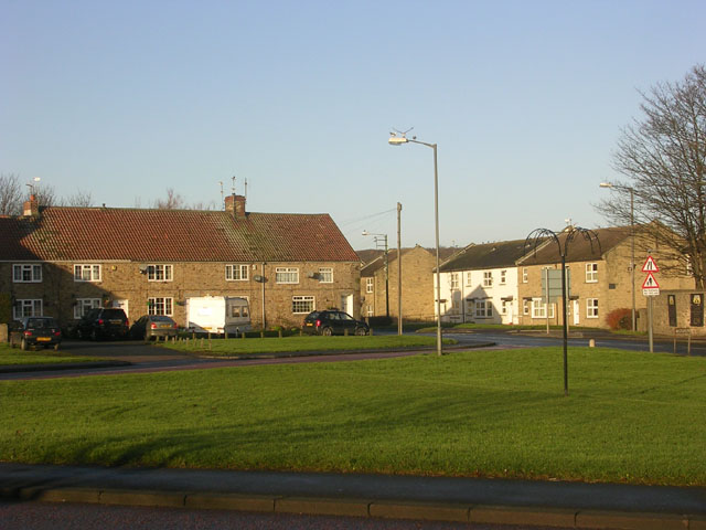
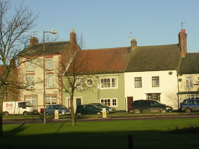
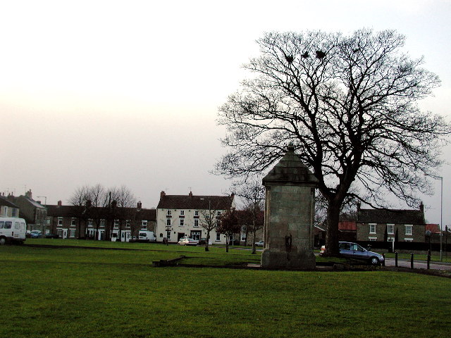
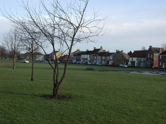
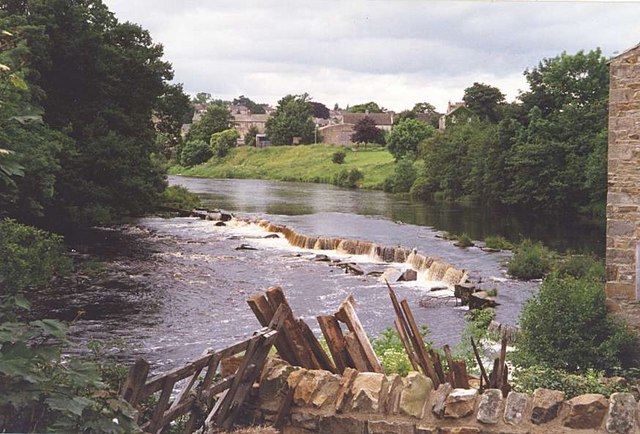
West Auckland is a civil parish located in County Durham, in the northeast region of England. It is situated about 9 miles west of the city of Durham and has a population of around 6,000 residents. The parish includes the villages of West Auckland and St. Helen Auckland.

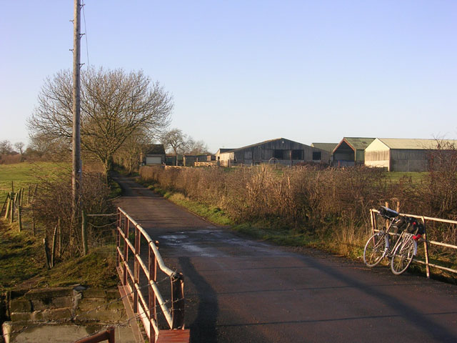
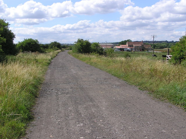
Historically, West Auckland was a mining village, with coal mining being the primary industry in the area. However, the decline of the coal mining industry in the late 20th century led to a shift towards other sectors such as agriculture and tourism. Today, the village has a mix of residential areas, farmland, and small businesses.

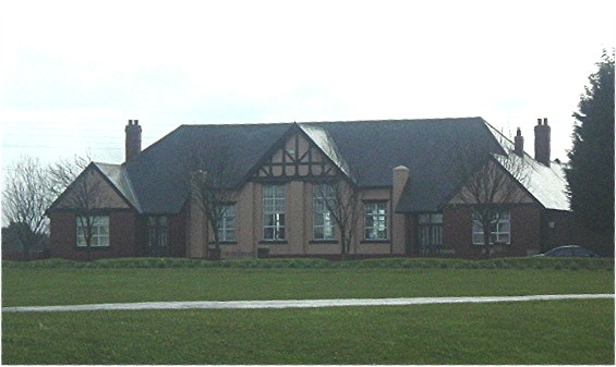
One of the notable landmarks in West Auckland is the West Auckland Memorial Community Centre, a purpose-built facility that serves as a hub for various community activities and events. The village also has a primary school and a few local shops, pubs, and restaurants.

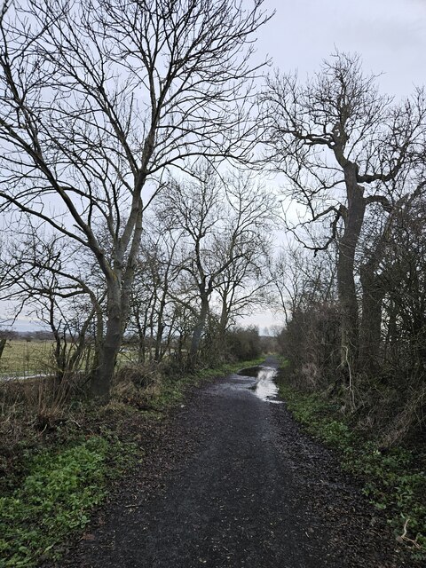
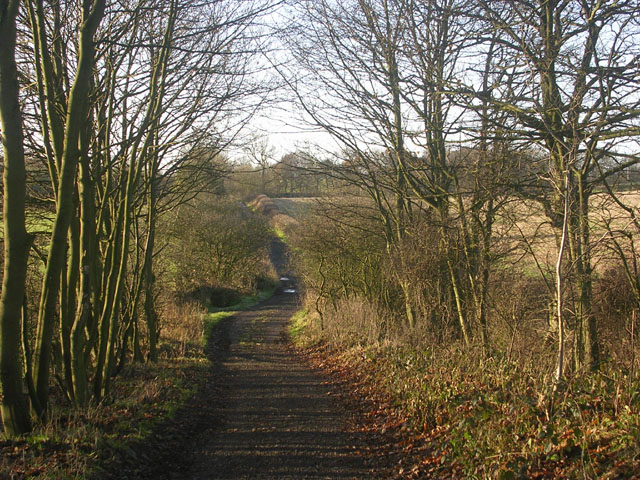
Surrounded by picturesque countryside, West Auckland offers a range of outdoor activities for residents and visitors alike. The area is known for its scenic walking trails, including the popular Auckland Way, which follows the path of a former railway line. Additionally, the nearby Bishop Auckland Golf Club provides opportunities for golf enthusiasts.

Overall, West Auckland is a quiet and charming village that retains its rural character while offering easy access to the amenities and attractions of Durham city.

If you have any feedback on the listing, please let us know in the comments section below.

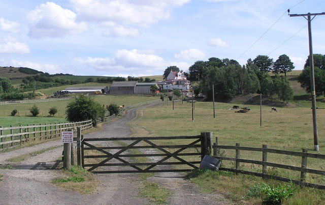
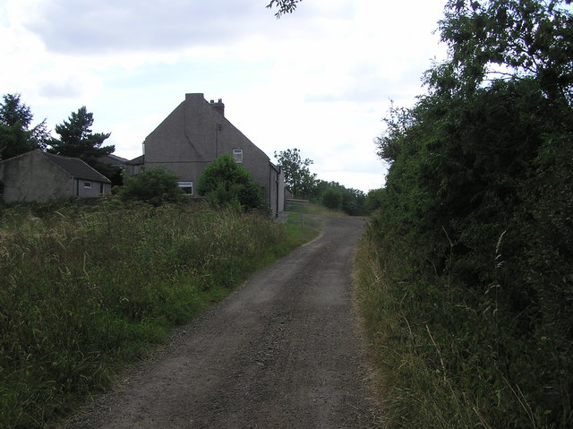
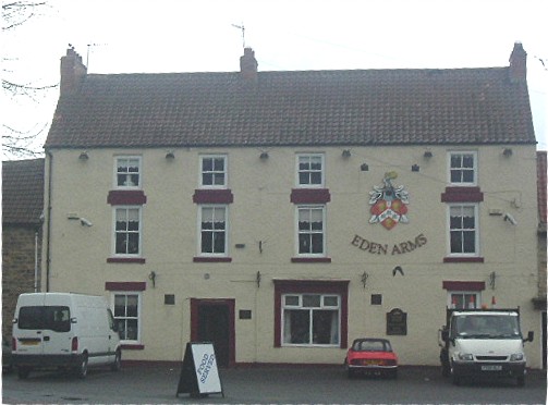
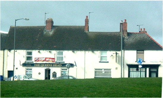
West Auckland Images

Images are sourced within 2km of 54.629976/-1.719963 or Grid Reference NZ1826. Thanks to Geograph Open Source API. All images are credited.

Burnshouse Lane looking East Burnshouse Lane with its new cycle friendly surface.
Burnshouse Lane looking East
Burnshouse Lane with its new cycle friendly surface.
West end of West Auckland West Auckland is one of the many attractive "green" villages of Durham, although in the case of West Auckland, the village is dominated by the passage of heavy traffic. The A68 is leading off into the distance, the A688 is in the immediate foreground.
West end of West Auckland
West Auckland is one of the many attractive "green" villages of Durham, although in the case of West Auckland, the village is dominated by the passage of heavy traffic. The A68 is leading off into the distance, the A688 is in the immediate foreground.
West Auckland village centre West Auckland is one of the many attractive "green" villages of County Durham. In the case of West Auckland, unfortunately the charm of the village is impaired by the passage of heavy traffic. The main road in the foreground is common to the A68 and A688.
West Auckland village centre
West Auckland is one of the many attractive "green" villages of County Durham. In the case of West Auckland, unfortunately the charm of the village is impaired by the passage of heavy traffic. The main road in the foreground is common to the A68 and A688.
Hummerbeck Lane, West Auckland Hummerbeck Lane with Low Hummerbeck Farm. This lane follows the line of the Roman Road from Binchester (Vindamora) to Bowes (Lavatris). Recently, the lane has been designated as part of the Walney to Wear Cycle Route (National Cycle Network, Regional Route 20), and affords a traffic-free but rather muddy route for cyclists between Bishop Auckland and Barnard Castle.
Hummerbeck Lane, West Auckland
Hummerbeck Lane with Low Hummerbeck Farm. This lane follows the line of the Roman Road from Binchester (Vindamora) to Bowes (Lavatris). Recently, the lane has been designated as part of the Walney to Wear Cycle Route (National Cycle Network, Regional Route 20), and affords a traffic-free but rather muddy route for cyclists between Bishop Auckland and Barnard Castle.
Hummerbeck Lane, West Auckland Hummerbeck Lane follows the line of the Roman Road from Binchester (Vindamora) to Bowes (Lavatris). Recently, the lane has been designated as part of the Walney to Wear Cycle Route (National Cycle Network, Regional Route 20), and affords a traffic-free but rather muddy route for cyclists between Bishop Auckland and Barnard Castle. View looking south-west.
Hummerbeck Lane, West Auckland
Hummerbeck Lane follows the line of the Roman Road from Binchester (Vindamora) to Bowes (Lavatris). Recently, the lane has been designated as part of the Walney to Wear Cycle Route (National Cycle Network, Regional Route 20), and affords a traffic-free but rather muddy route for cyclists between Bishop Auckland and Barnard Castle. View looking south-west.
Monument  at West Auckland Monument dedicated to the Diamond Jubilee of 1897. (Queen Victoria). On village green.
Monument at West Auckland
Monument dedicated to the Diamond Jubilee of 1897. (Queen Victoria). On village green.
West Auckland village green Looking ESE towards where the A68 enters Chapel Street. The taller building (far right on Front Street), which was once the Co-op butchers-cum-stables, became a Village Centre at the Millennium.
West Auckland village green
Looking ESE towards where the A68 enters Chapel Street. The taller building (far right on Front Street), which was once the Co-op butchers-cum-stables, became a Village Centre at the Millennium.
Church & churchyard of St Helen Auckland Small church dating from the mid-twelfth century
Church & churchyard of St Helen Auckland
Small church dating from the mid-twelfth century
Church of St Helen Auckland
The River Gaunless at West Auckland
Broom Mill and disused railway This is a  former Corn Mill near the River Gaunless. And the trackbed of the old Stockton and Darlington Railway.
Broom Mill and disused railway
This is a former Corn Mill near the River Gaunless. And the trackbed of the old Stockton and Darlington Railway.
Disused Railway : Bankfoot Farm Stockton and Darlington Railway and road to Bankfoot Farm. Off to the left on Burnshouse Lane, the old St.Helens (Auckland) Colliery Branch Line.
Disused Railway : Bankfoot Farm
Stockton and Darlington Railway and road to Bankfoot Farm. Off to the left on Burnshouse Lane, the old St.Helens (Auckland) Colliery Branch Line.
Backsandsides This was the site of the Brusselton & Ladysmith Colliery, With the N.E.R Brusselton Branch Line, connecting to the main S&D line east of Broom Mill.
Backsandsides
This was the site of the Brusselton & Ladysmith Colliery, With the N.E.R Brusselton Branch Line, connecting to the main S&D line east of Broom Mill.
Bridge House Hummerbeck Lane, on the Walney to Wear Cycle Route. Regional Route 20. Bishop Auckland to Barnard Castle.
Bridge House
Hummerbeck Lane, on the Walney to Wear Cycle Route. Regional Route 20. Bishop Auckland to Barnard Castle.
Eden Arms where the West Auckland FC's 'World Cup' once rested. West Auckland FC won the Sir Thomas Lipton Trophy in Italy twice consecutively (1909.1911) and thus got to keep it. The Eden Arms was its first resting place. The building is listed see <span class="nowrap"><a title="http://www.durham-pa.gov.uk/durhamcc/K2P.nsf/K2PDetail?readform&PRN=D14047" rel="nofollow ugc noopener" href="http://www.durham-pa.gov.uk/durhamcc/K2P.nsf/K2PDetail?readform&PRN=D14047">Link</a><img style="margin-left:2px;" alt="External link" title="External link - shift click to open in new window" src="https://s1.geograph.org.uk/img/external.png" width="10" height="10"/></span>
Eden Arms where the West Auckland FC's 'World Cup' once rested.
West Auckland FC won the Sir Thomas Lipton Trophy in Italy twice consecutively (1909.1911) and thus got to keep it. The Eden Arms was its first resting place. The building is listed see LinkExternal link
Queens Head, West Auckland Near Millbank Corner - on the right. The building on the corner was once (some 50 years ago) 'Millie's pie shop'. see <span class="nowrap"><a title="http://www.durham-pa.gov.uk/durhamcc/K2P.nsf/K2PDetail?readform&PRN=D14568" rel="nofollow ugc noopener" href="http://www.durham-pa.gov.uk/durhamcc/K2P.nsf/K2PDetail?readform&PRN=D14568">Link</a><img style="margin-left:2px;" alt="External link" title="External link - shift click to open in new window" src="https://s1.geograph.org.uk/img/external.png" width="10" height="10"/></span>
Queens Head, West Auckland
Near Millbank Corner - on the right. The building on the corner was once (some 50 years ago) 'Millie's pie shop'. see LinkExternal link
The Memorial Hall Darlington Road, West Auckland
The Memorial Hall
Darlington Road, West Auckland
St Helen Auckland church porch Sad that in this day and age 'the ever open door' of our churches have had to be replaced by locked steel porticos.
St Helen Auckland church porch
Sad that in this day and age 'the ever open door' of our churches have had to be replaced by locked steel porticos.
Show me another place!

West Auckland is located at Grid Ref: NZ1826 (Lat: 54.629976, Lng: -1.719963)

Unitary Authority: County Durham

Police Authority: Durham

What 3 Words

///blanket.lectures.inclines. Near Evenwood, Co. Durham

Related Wikis

West Auckland Town F.C.

West Auckland Town Football Club is a football club from West Auckland, near Bishop Auckland in County Durham, England, competing in the Northern League...

West Auckland, County Durham

West Auckland ( AWK-lənd) is a village and civil parish in County Durham, England, to the west of Bishop Auckland on the A688 road. It is reputed to have...

Etherley

Etherley is a civil parish in County Durham, England. It had a population of 2,060 at the 2011 Census. == References ==
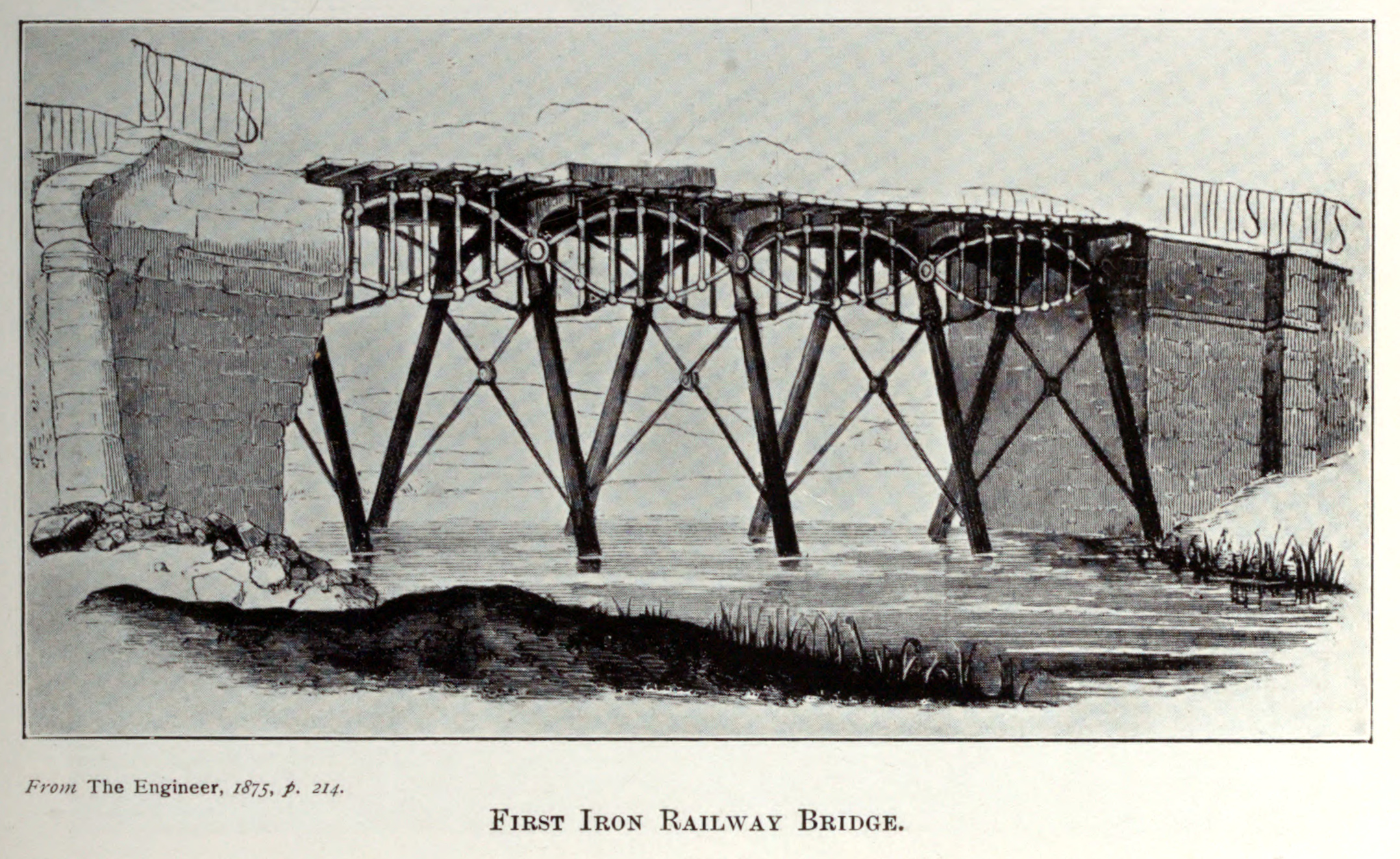
Gaunless Bridge

Gaunless Bridge was a railway bridge on the Stockton and Darlington Railway. It was completed in 1823 and is one of the first railway bridges to be constructed...

West Auckland railway station

West Auckland railway station served the villages of St Helen Auckland and West Auckland in County Durham, England, between 1833 and 1962. It was on the...

A688 road

The A688 is a road in County Durham in North East England. It begins at the junction with the A67 road in Barnard Castle and continues in a north easterly...

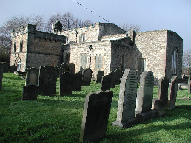
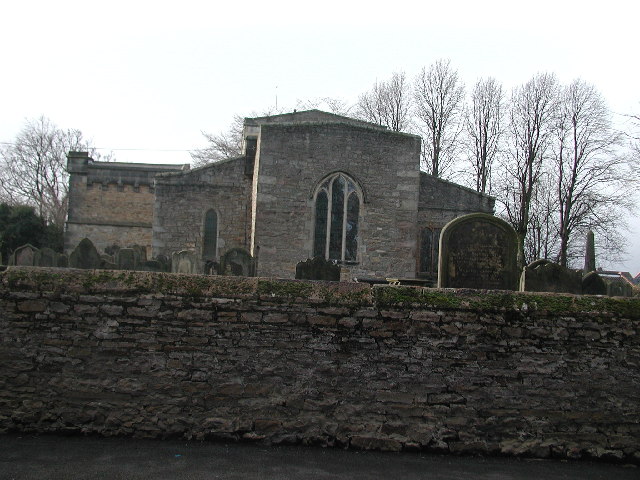
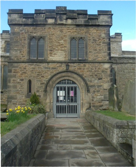
Church of St Helen, St Helen Auckland

The Church of St Helen is a Church of England parish church in St Helen Auckland, County Durham. It is a Grade I listed building. == History == The church...

St Helen Auckland

St Helen Auckland is a village in County Durham, in England. It is south-west of Bishop Auckland. It is named after St. Helen in distinction from Bishop...

Nearby Amenities

Located within 500m of 54.629976,-1.719963
Mini Roundabout
Direction: clockwise
Lat/Long: 54.6315358/-1.7197959
Mini Roundabout
Direction: clockwise
Lat/Long: 54.6315565/-1.7237238
West Auckland
Place: village
Source: NPE
Wikidata: Q1957386
Wikipedia: en:West Auckland, County Durham
Lat/Long: 54.6314622/-1.7227625
Bus Stop
Station Rd
Naptan AtcoCode: 13004023B
Naptan Bearing: NE
Naptan CommonName: Station Rd
Naptan Indicator: north east bound
Naptan Landmark: Landmark not known
Naptan NaptanCode: durawdpd
Naptan Notes: Opposite boundary 40-42 Station Road (A688)- West Auckland
Naptan Street: A688 Station Road
Naptan Verified: no
Shelter: yes
Source: naptan_import
Lat/Long: 54.6339552/-1.7179686
Bus Stop
Station Rd
Naptan AtcoCode: 13004023F
Naptan Bearing: SW
Naptan CommonName: Station Rd
Naptan Indicator: south west bound
Naptan Landmark: Landmark not known
Naptan NaptanCode: durawdpg
Naptan Notes: Outside boundary of 30-32 Station Road (A688)- West Auckland
Naptan Street: A688 Station Road
Shelter: no
Source: naptan_import
Lat/Long: 54.6336046/-1.7181171
Bus Stop
Post Office
Naptan AtcoCode: 13004024B
Naptan Bearing: NE
Naptan CommonName: Post Office
Naptan Indicator: north east bound
Naptan Landmark: Landmark not known
Naptan NaptanCode: durawdpj
Naptan Notes: Opposite 50 Front Street- West Auckland
Naptan Street: Front Street
Naptan Verified: no
Shelter: no
Source: naptan_import
Lat/Long: 54.631703/-1.7195024
Bus Stop
Post Office
Naptan AtcoCode: 13004024F
Naptan Bearing: SW
Naptan CommonName: Post Office
Naptan Indicator: south west bound
Naptan Landmark: Landmark not known
Naptan NaptanCode: durawdpm
Naptan Notes: Opposite 50 Front Street- West Auckland
Naptan Street: Front Street
Naptan Verified: no
Shelter: no
Source: naptan_import
Lat/Long: 54.6316216/-1.719286
Bus Stop
Darlington Road (Factories)
Naptan AtcoCode: 13004025D
Naptan Bearing: SE
Naptan CommonName: Darlington Road (Factories)
Naptan Indicator: south east bound
Naptan Landmark: Landmark not known
Naptan NaptanCode: durawdpt
Naptan Notes: Outside Cemetery (Opposite Smurfit)- Darlington Road (A68)- West Auckland
Naptan Street: A68 Darlington Road
Naptan Verified: no
Shelter: no
Source: naptan_import
Lat/Long: 54.6278602/-1.7133949
Bus Stop
Darlington Road (Factories)
Naptan AtcoCode: 13004025H
Naptan Bearing: NW
Naptan CommonName: Darlington Road (Factories)
Naptan Indicator: north west bound
Naptan Landmark: Landmark not known
Naptan NaptanCode: durawdpw
Naptan Notes: Opposite Cemetery- Darlington Road (A68)- West Auckland
Naptan Street: A68 Darlington Road
Naptan Verified: no
Shelter: no
Source: naptan_import
Lat/Long: 54.6277256/-1.7134733
Bus Stop
Club
Bus: yes
Naptan AtcoCode: 13004026C
Naptan Bearing: E
Naptan CommonName: Club
Naptan Indicator: east bound
Naptan Landmark: Landmark not known
Naptan NaptanCode: durawdta
Naptan Notes: Outside 32 Front Street (A688)- West Auckland
Naptan Street: A688 Front Street
Public Transport: platform
Shelter: yes
Source: naptan_import
Lat/Long: 54.6320782/-1.7196873
Bus Stop
Club
Naptan AtcoCode: 13004026G
Naptan Bearing: W
Naptan CommonName: Club
Naptan Indicator: west bound
Naptan Landmark: Landmark not known
Naptan NaptanCode: durawdtd
Naptan Notes: Opposite Boundary of 24-26 Front Street (A688)- West Auckland
Naptan Street: A688 Front Street
Shelter: yes
Source: naptan_import
Tactile Paving: no
Lat/Long: 54.6319011/-1.7200879
Bus Stop
Brewery
Bench: yes
Bus: yes
Departures Board: timetable
Naptan AtcoCode: 13004027B
Naptan Bearing: NE
Naptan CommonName: Brewery
Naptan Indicator: north east bound
Naptan Landmark: Landmark not known
Naptan NaptanCode: durawdtg
Naptan Notes: Opposite 7 Front Street- West Auckland
Naptan Street: A688 Front Street
Naptan Verified: yes
Public Transport: platform
Shelter: yes
Source: naptan_import
Lat/Long: 54.6317549/-1.7225383
Bus Stop
Brewery
Naptan AtcoCode: 13004027F
Naptan Bearing: SW
Naptan CommonName: Brewery
Naptan Indicator: south west bound
Naptan Landmark: Landmark not known
Naptan NaptanCode: durawdtj
Naptan Notes: Opposite The Manor House Hotel & Country Club- Front Street- West Auckland
Naptan Street: A688 Front Street
Shelter: yes
Source: naptan_import
Lat/Long: 54.6315625/-1.7231938
Bus Stop
Old Eden Garage
Naptan AtcoCode: 13004029A
Naptan Bearing: N
Naptan CommonName: Old Eden Garage
Naptan Indicator: north bound
Naptan Landmark: Landmark not known
Naptan NaptanCode: durawdtw
Naptan Notes: S of 104 Staindrop Road (A688)- S of junction with Copeland Road- West Auckland
Naptan Street: A688 Staindrop Road
Naptan Verified: no
Shelter: yes
Source: naptan_import
Lat/Long: 54.6282747/-1.725505
Bus Stop
Old Eden Garage
Naptan AtcoCode: 13004029E
Naptan Bearing: S
Naptan CommonName: Old Eden Garage
Naptan Indicator: south bound
Naptan Landmark: Landmark not known
Naptan NaptanCode: durawdwa
Naptan Notes: Outside boundary of 45-47 Staindrop Road (A688)- West Auckland
Naptan Street: A688 Staindrop Road
Naptan Verified: no
Shelter: no
Source: naptan_import
Lat/Long: 54.6291547/-1.7251583
Bus Stop
Copeland Rd-Robson Rd
Naptan AtcoCode: 13004030C
Naptan Bearing: E
Naptan CommonName: Copeland Rd-Robson Rd
Naptan Indicator: east bound
Naptan Landmark: Landmark not known
Naptan NaptanCode: durawdwd
Naptan Notes: Outside Boundary of 20-22 Copeland Road- West Auckland
Naptan Street: Copeland Road
Naptan Verified: no
Shelter: no
Source: naptan_import
Lat/Long: 54.6288431/-1.7264771
Bus Stop
145-7 Oakley Green
Naptan AtcoCode: 13004051B
Naptan Bearing: NE
Naptan CommonName: 145-7 Oakley Green
Naptan Indicator: north east bound
Naptan Landmark: Landmark not known
Naptan NaptanCode: durawgmd
Naptan Notes: Adjecent to Boundary of 145-147 Sycamore Grove- West Auckland
Naptan Street: Oakley Green
Naptan Verified: no
Shelter: no
Source: naptan_import
Lat/Long: 54.6330676/-1.7150469
Bus Stop
118 Oakley Green
Naptan AtcoCode: 13004052F
Naptan Bearing: SW
Naptan CommonName: 118 Oakley Green
Naptan Indicator: south west bound
Naptan Landmark: Landmark not known
Naptan NaptanCode: durawgmg
Naptan Notes: Opposite Footpath West of 118 Oakley Green- West Auckland
Naptan Street: Oakley Green
Naptan Verified: no
Shelter: no
Source: naptan_import
Lat/Long: 54.6320217/-1.7136135
Bus Stop
10 Oakley Green
Naptan AtcoCode: 13004054A
Naptan Bearing: N
Naptan CommonName: 10 Oakley Green
Naptan Indicator: north bound
Naptan Landmark: Landmark not known
Naptan NaptanCode: durawgmj
Naptan Notes: Outside 10 Oakley Green- West Auckland
Naptan Street: Oakley Green
Naptan Verified: no
Shelter: no
Source: naptan_import
Lat/Long: 54.6311984/-1.7189327
Bus Stop
Meadow View
Naptan AtcoCode: 13004055E
Naptan Bearing: S
Naptan CommonName: Meadow View
Naptan Indicator: south bound
Naptan Landmark: Landmark not known
Naptan NaptanCode: durawgmp
Naptan Notes: Opposite 9 Meadow View- West Auckland
Naptan Street: Meadow View
Naptan Verified: no
Source: naptan_import
Lat/Long: 54.6335121/-1.7168098
Bus Stop
Oakley Grange Farm
Naptan AtcoCode: 13004059D
Naptan Bearing: SE
Naptan CommonName: Oakley Grange Farm
Naptan Indicator: south east bound
Naptan Landmark: Landmark not known
Naptan NaptanCode: durawgmt
Naptan Notes: East of Oakley Grange Farm- Darlington Road (A68)- West Auckland
Naptan Street: A68 West Auckland Road
Naptan Verified: no
Shelter: no
Source: naptan_import
Lat/Long: 54.6303784/-1.7179934
Bus Stop
Oakley Grange Farm
Naptan AtcoCode: 13004059H
Naptan Bearing: NW
Naptan CommonName: Oakley Grange Farm
Naptan Indicator: north west bound
Naptan Landmark: Landmark not known
Naptan NaptanCode: durawgmw
Naptan Notes: Outside Oakley Grange Farm- Darlington Road (A68)- West Auckland
Naptan Street: A68 West Auckland Road
Naptan Verified: no
Shelter: no
Source: naptan_import
Lat/Long: 54.6304244/-1.7184578
Bus Stop
Oakley Green
Naptan AtcoCode: 13004770G
Naptan Bearing: W
Naptan CommonName: Oakley Green
Naptan Indicator: west bound
Naptan Landmark: opp no 34
Naptan NaptanCode: durdgjap
Naptan Notes: Adjacent to Junction with East Green- Oakley Green- West Auckland
Naptan Street: Oakley Green
Naptan Verified: no
Shelter: no
Source: naptan_import
Lat/Long: 54.6312817/-1.7161127
Turning Circle
Lat/Long: 54.6314692/-1.7185268
Post Office
West Auckland Post Office
Addr City: Bishop Auckland
Addr Postcode: DL14 9HL
Addr Suburb: West Auckland
Brand: Post Office
Brand Wikidata: Q1783168
Contact Website: https://www.postoffice.co.uk/branch-finder/3933091/west-auckland
Ref Pol Id: 124649
Lat/Long: 54.6313269/-1.7203992
Mini Roundabout
Lat/Long: 54.6320318/-1.7189901
Spar
Addr City: Bishop Auckland
Addr Housename: The Old Church Hall
Addr Postcode: DL14 9HE
Addr Street: Station Road
Addr Village: West Auckland
Brand: Spar
Brand Wikidata: Q610492
Fhrs Id: 302643
Opening Hours: Mo-Su 07:00-22:00
Shop: convenience
Source Addr: FHRS Open Data
Lat/Long: 54.6336992/-1.7189355
Bench
Lat/Long: 54.6332719/-1.718751
Atm
Lat/Long: 54.6336614/-1.7186971
Historic: mine_shaft
Source: OS 1:25k
Lat/Long: 54.626254/-1.7236536
Post Box
Brand: Royal Mail
Brand Wikidata: Q638098
Mapillary: 510342184413716
Operator: Royal Mail
Operator Wikidata: Q638098
Post Box Mounting: stone_wall
Post Box Type: wall
Ref: DL14 14
Survey Date: 2022-09-07
Lat/Long: 54.6318502/-1.7250822
Post Box
Ref: DL14 121
Lat/Long: 54.6287948/-1.7269784
Post Box
Ref: DL14 250
Lat/Long: 54.6298899/-1.7218848
Post Box
Ref: DL14 104
Lat/Long: 54.6314269/-1.7188333
Crossing
Crossing Island: yes
Lat/Long: 54.6316815/-1.7226359
Crossing
Crossing Island: yes
Lat/Long: 54.6319189/-1.7205692
Crossing
Crossing Island: yes
Lat/Long: 54.632113/-1.718898
Historic: memorial
Memorial: war_memorial
Lat/Long: 54.6314457/-1.7233775
Best One
Addr City: Bishop Auckland
Addr Housenumber: 46
Addr Postcode: DL14 9HE
Addr Street: Station Road
Addr Village: West Auckland
Brand Wikidata: Q4896532
Contact Website: https://stores.best-one.co.uk/best-one-ad12f69b8359
Fhrs Id: 304699
Shop: convenience
Source Addr: FHRS Open Data
Lat/Long: 54.633957/-1.717582
Cafe
The Well
Addr City: Bishop Auckland
Addr Housenumber: 46
Addr Postcode: DL14 9HJ
Addr Street: East Green
Addr Village: West Auckland
Fhrs Id: 304170
Source Addr: FHRS Open Data
Lat/Long: 54.6316966/-1.7185718
Fast Food
Smith's Fish & Chips
Addr City: Bishop Auckland
Addr Housenumber: 34
Addr Postcode: DL14 9HE
Addr Street: Station Road
Addr Village: West Auckland
Cuisine: fish_and_chips
Fhrs Id: 1104094
Source Addr: FHRS Open Data
Lat/Long: 54.6337249/-1.7178731
Morrisons Daily
Addr City: Bishop Auckland
Addr Housenumber: 39
Addr Postcode: DL14 9HL
Addr Street: Front Street
Addr Village: West Auckland
Brand: Morrisons Daily
Brand Wikidata: Q99752411
Fhrs Id: 304742
Shop: convenience
Source Addr: FHRS Open Data
Website: https://my.morrisons.com/storefinder/61150/morrisons-daily-west-auckland-front-street
Lat/Long: 54.6313248/-1.7204359
Tenthirteen Tattoo
Mapillary: 130827463027778
Shop: tattoo
Lat/Long: 54.6314086/-1.7198914
Ivy Cottage Farms Ltd
Addr City: Bishop Auckland
Addr Housenumber: 37
Addr Postcode: DL14 9HL
Addr Street: Front Street
Addr Village: West Auckland
Fhrs Id: 303765
Shop: butcher
Source Addr: FHRS Open Data
Lat/Long: 54.6313473/-1.7202938
Chisholm
Addr City: Bishop Auckland
Addr Housenumber: 30
Addr Postcode: DL14 9HW
Addr Street: Front Street
Addr Suburb: West Auckland
Fhrs Id: 421755
Shop: bookmaker
Lat/Long: 54.6321383/-1.7199357
Place Of Worship
West Auckland Vineyard Church
Addr City: Bishop Auckland
Addr Housename: Aptec Enterprise Park
Addr Housenumber: 3
Addr Postcode: DL14 9PD
Addr Street: Darlington Road
Addr Village: West Auckland
Denomination: evangelical
Fhrs Id: 851999
Religion: christian
Source Addr: FHRS Open Data
Website: https://www.westaucklandvineyard.net/
Lat/Long: 54.6300054/-1.7131246
Former pant
Disused Amenity: drinking_water
Image: https://www.geograph.org.uk/photo/5827311
Wikidata: Q26585132
Lat/Long: 54.6314226/-1.7233729
Ford: yes
Image: https://www.geograph.org.uk/photo/4389325
Lat/Long: 54.6334355/-1.7244426
Oakley Grange Farm
Place: farm
Lat/Long: 54.6302682/-1.7185664
Fast Food
Lucky 8
Addr City: Bishop Auckland
Addr Housenumber: 71
Addr Postcode: DL14 9HL
Addr Street: Front Street
Addr Suburb: West Auckland
Contact Facebook: thelucky8takeaway
Cuisine: chinese
Fhrs Id: 466699
Mapillary: 492771325105403
Lat/Long: 54.6309164/-1.7242592
Board Type: notice
Information: board
Tourism: information
Lat/Long: 54.6317408/-1.719005
Defibrillator
Defibrillator Location: in park, just north of world cup memorial in West Auckland
Emergency: defibrillator
Indoor: no
Lat/Long: 54.6318938/-1.7200423
Waste Basket
Lat/Long: 54.6319077/-1.7200376
World Cup Winners 1909
Board Type: history
Information: board
Tourism: information
Lat/Long: 54.6318934/-1.7200832
First World Cup Winners
Artwork Type: sculpture
Tourism: artwork
Lat/Long: 54.631768/-1.7200383
Bench
Lat/Long: 54.6316182/-1.7225951
Bench
Lat/Long: 54.6315739/-1.7229733
Waste Basket
Lat/Long: 54.6319512/-1.7209335
Dentist
West Auckland Dental Practice
Addr City: Bishop Auckland
Addr Housenumber: 26
Addr Postcode: DL14 9HW
Addr Street: Front Street
Addr Suburb: West Auckland
Source Addr: website
Website: http://westaucklanddentalpractice.co.uk/
Lat/Long: 54.6321306/-1.7201127
Waste Basket
Lat/Long: 54.6319365/-1.7187984
Bench
Lat/Long: 54.6319504/-1.7187904
Beauty and the Beach
Addr Housenumber: 5
Addr Street: Station Road
Note: House number assumed, none displayed.
Shop: beauty
Survey Date: 2021-12-30
Lat/Long: 54.6323626/-1.7190801
Waste Basket
Lat/Long: 54.6332972/-1.7187381
Barrier: cycle_barrier
Lat/Long: 54.6326089/-1.7187998
Addr Housenumber: 1
Addr Street: Station Road
Survey Date: 2021-12-30
Lat/Long: 54.6321941/-1.7190446
Addr Housenumber: 3
Addr Street: Station Road
Note: House number assumed, none displayed.
Survey Date: 2021-12-30
Lat/Long: 54.6323255/-1.719073
Addr Housenumber: 7
Addr Street: Station Road
Survey Date: 2021-12-30
Lat/Long: 54.63242/-1.7190967
Addr Housenumber: 9
Addr Street: Station Road
Survey Date: 2021-12-30
Lat/Long: 54.6324615/-1.7191015
Addr Housenumber: 11
Addr Street: Station Road
Survey Date: 2021-12-30
Lat/Long: 54.6324993/-1.7191115
Addr Housenumber: 13
Addr Street: Station Road
Survey Date: 2021-12-30
Lat/Long: 54.6325372/-1.7191179
Addr Housenumber: 15
Addr Street: Station Road
Survey Date: 2021-12-30
Lat/Long: 54.6325708/-1.7191209
Addr Housename: The Old School House
Addr Housenumber: 2
Addr Street: Station Road
Survey Date: 2021-12-30
Lat/Long: 54.6326965/-1.7186967
Addr Housenumber: 1
Addr Street: Arnold Street
Survey Date: 2021-12-30
Lat/Long: 54.6336103/-1.71756
Addr Housenumber: 2
Addr Street: Arnold Street
Survey Date: 2021-12-30
Lat/Long: 54.6335586/-1.7175497
Addr Housenumber: 3
Addr Street: Arnold Street
Note: House number assumed, none displayed.
Survey Date: 2021-12-30
Lat/Long: 54.6335208/-1.7175383
Addr Housenumber: 4
Addr Street: Arnold Street
Survey Date: 2021-12-30
Lat/Long: 54.633474/-1.7175221
Addr Housenumber: 20
Addr Street: Arnold Street
Survey Date: 2021-12-30
Lat/Long: 54.6334245/-1.7177047
Addr Housenumber: 5
Addr Street: Arnold Street
Survey Date: 2021-12-30
Lat/Long: 54.6334304/-1.7175067
Addr Housenumber: 6
Addr Street: Arnold Street
Note: House number assumed, none displayed.
Survey Date: 2021-12-30
Lat/Long: 54.6333855/-1.7174932
Addr Housenumber: 19
Addr Street: Arnold Street
Survey Date: 2021-12-30
Lat/Long: 54.6333743/-1.7177005
Addr Housenumber: 18
Addr Street: Arnold Street
Survey Date: 2021-12-30
Lat/Long: 54.6333318/-1.7176806
Addr Housenumber: 7
Addr Street: Arnold Street
Survey Date: 2021-12-30
Lat/Long: 54.6333418/-1.7174819
Addr Housenumber: 8
Addr Street: Arnold Street
Survey Date: 2021-12-30
Lat/Long: 54.6332945/-1.7174627
Addr Housenumber: 17
Addr Street: Arnold Street
Survey Date: 2021-12-30
Lat/Long: 54.633287/-1.7176615
Addr Housenumber: 9
Addr Street: Arnold Street
Survey Date: 2021-12-30
Lat/Long: 54.6332474/-1.7174517
Addr Housenumber: 10
Addr Street: Arnold Street
Survey Date: 2021-12-30
Lat/Long: 54.633202/-1.7174392
Addr Housenumber: 11
Addr Street: Arnold Street
Survey Date: 2021-12-30
Lat/Long: 54.6331556/-1.717429
Addr Housenumber: 12
Addr Street: Arnold Street
Survey Date: 2021-12-30
Lat/Long: 54.6331017/-1.7174101
Addr Housenumber: 13
Addr Street: Arnold Street
Note: House number assumed, none displayed.
Survey Date: 2021-12-30
Lat/Long: 54.6330571/-1.717394
Addr Housenumber: 14
Addr Street: Arnold Street
Survey Date: 2021-12-30
Lat/Long: 54.6330193/-1.7173849
Addr Housenumber: 15
Addr Street: Arnold Street
Note: House number assumed, none displayed.
Survey Date: 2021-12-30
Lat/Long: 54.6329728/-1.7173642
Addr Housenumber: 16
Addr Street: Arnold Street
Survey Date: 2021-12-30
Lat/Long: 54.6329263/-1.717354
Addr Housenumber: 26
Addr Street: Mill Race
Survey Date: 2021-12-30
Lat/Long: 54.6329412/-1.71761
Addr Housenumber: 25
Addr Street: Mill Race
Survey Date: 2021-12-30
Lat/Long: 54.632928/-1.717741
Addr Housenumber: 24
Addr Street: Mill Race
Survey Date: 2021-12-30
Lat/Long: 54.6329066/-1.7178469
Addr Housenumber: 1
Addr Street: Mill Race
Survey Date: 2021-12-30
Lat/Long: 54.6327239/-1.7178266
Addr Housenumber: 23
Addr Street: Mill Race
Survey Date: 2021-12-30
Lat/Long: 54.6328981/-1.7179685
Addr Housenumber: 22
Addr Street: Mill Race
Survey Date: 2021-12-30
Lat/Long: 54.6328871/-1.7181054
Addr Housenumber: 21
Addr Street: Mill Race
Survey Date: 2021-12-30
Lat/Long: 54.6328758/-1.7182236
Power: pole
Lat/Long: 54.6255166/-1.7208309
Bench
Lat/Long: 54.6317413/-1.7227192
West Barbers
Male: yes
Mapillary: 130827463027778
Shop: hairdresser
Lat/Long: 54.6313869/-1.7200001
Oakleaf
Addr City: Bishop Auckland
Addr Housenumber: 19
Addr Postcode: DL14 9HW
Addr Street: Front Street
Addr Suburb: West Auckland
Fhrs Id: 1636561
Fixme: Not clear what this is!
Mapillary: 379838857670716
Old Name: Janie's Pantry
Lat/Long: 54.6321173/-1.7210139
Sir Thomas
Contact Facebook: SirThomasBarbers
Male: yes
Mapillary: 379838857670716
Shop: hairdresser
Lat/Long: 54.6321158/-1.7209388
Give Way
Direction: forward
Lat/Long: 54.6313426/-1.724529
Bicycle Parking
Bicycle Parking: stands
Capacity: 8
Covered: no
Lat/Long: 54.6313244/-1.7225523
Bench
Lat/Long: 54.6314579/-1.7246516
Bench
Lat/Long: 54.6313343/-1.7213593
The data included in this document is from www.openstreetmap.org. The data is made available under ODbL.

Have you been to West Auckland?

Leave your review of West Auckland below (or comments, questions and feedback).