Werrington

Civil Parish in Staffordshire Staffordshire Moorlands

England

Werrington

Car park for the Red Cow public house On the A52, Ash Bank Road
Car park for the Red Cow public house Credit: Eirian Evans

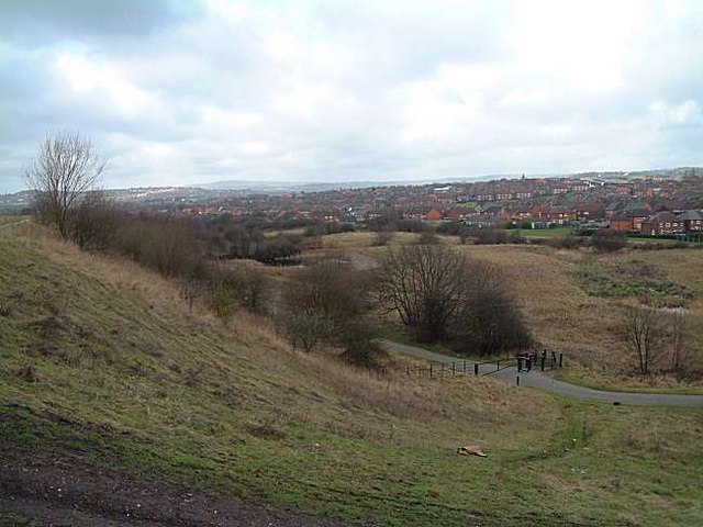
Werrington is a civil parish located in the Staffordshire Moorlands district of Staffordshire, England. It is situated approximately 6 miles northwest of the city of Stoke-on-Trent and about 2 miles southeast of the town of Cheadle. The village lies on the eastern edge of the Staffordshire Moorlands and is surrounded by picturesque countryside.

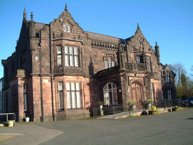
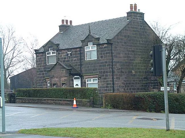
Werrington is a small, rural community with a population of around 1,500 people. The village is known for its historic buildings, including the Grade I listed Werrington Hall, a stately home dating back to the 18th century. The hall is set within beautiful parkland and gardens and is a prominent feature of the village.

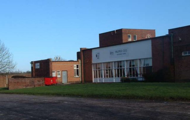
The village itself offers a range of amenities to its residents, including a primary school, a post office, a village hall, and a few local shops. There are also several churches in the area, reflecting the strong sense of community in Werrington.

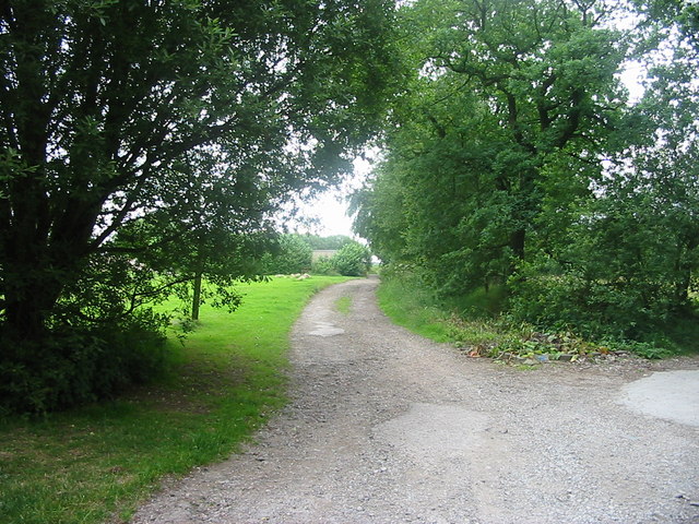
The surrounding countryside provides plenty of opportunities for outdoor activities, with numerous walking and cycling routes to explore. The nearby Deep Hayes Country Park offers a tranquil setting for nature lovers, with its woodland, lake, and wildlife.

Overall, Werrington is a charming village with a rich history and a close-knit community. Its rural location and natural beauty make it an attractive place to live for those seeking a peaceful and idyllic lifestyle.

If you have any feedback on the listing, please let us know in the comments section below.
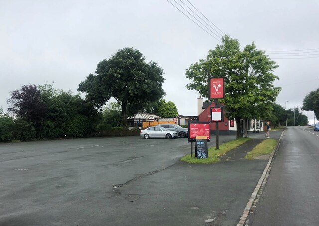
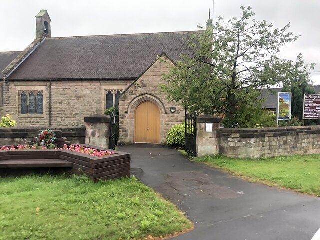
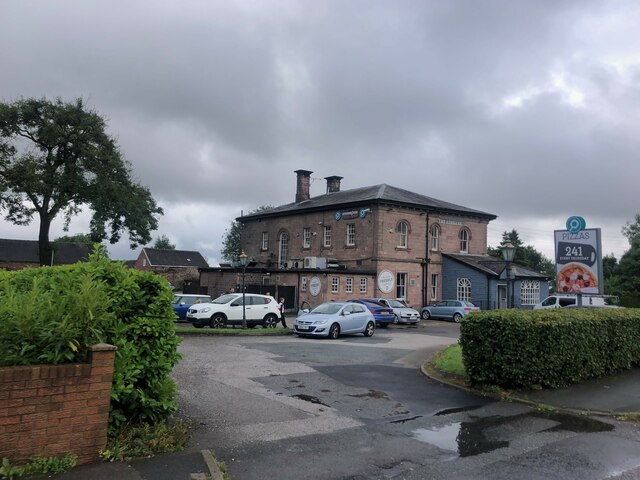
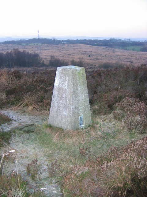
Werrington Images

Images are sourced within 2km of 53.020795/-2.099433 or Grid Reference SJ9347. Thanks to Geograph Open Source API. All images are credited.

Car park for the Red Cow public house On the A52, Ash Bank Road
Car park for the Red Cow public house
On the A52, Ash Bank Road
St Philip's Church, Werrington
The Ashbank Pizza and carvery at Werrington
The Ashbank
Pizza and carvery at Werrington
Wetley Moor Trigpoint on the edge of a substantial heather moorland remnant.  Near Stoke on Trent, the  Pennine grits are making their presence felt with characteristic low fertility.
Wetley Moor
Trigpoint on the edge of a substantial heather moorland remnant. Near Stoke on Trent, the Pennine grits are making their presence felt with characteristic low fertility.
Wetley Moor Entrance One of the many access points to Wetley Moor off Brookhouse Lane. The moor is common land and is an area of Special Scientific Interest.
Wetley Moor Entrance
One of the many access points to Wetley Moor off Brookhouse Lane. The moor is common land and is an area of Special Scientific Interest.
Ash Hall Job Meigh (a local potter) became the owner of the Ash Estate on 27th of March 1837. Construction of the house must have begun almost immediately because the date “1837” appears on the rainwater heads on the front of the building.

1840 account of the hall: "The exterior is of hard stone, (gotten on the estate,) of an Ash colour, giving the building an air of antiquity which harmonizes with the stile (sic.) of the architecture, being that of the manor house or Tudor era, with oriel windows, surmounted with pediments or pointed gables. An elegant portico, composed of three Gothic arches, turreted and embattled, adorns the front. The adjoining lawn is tastefully laid out and planted; and altogether, we must characterize Ash Hall as one of the most beautiful seats we have had occasion to notice.”
Ash Hall
Job Meigh (a local potter) became the owner of the Ash Estate on 27th of March 1837. Construction of the house must have begun almost immediately because the date “1837” appears on the rainwater heads on the front of the building. 1840 account of the hall: "The exterior is of hard stone, (gotten on the estate,) of an Ash colour, giving the building an air of antiquity which harmonizes with the stile (sic.) of the architecture, being that of the manor house or Tudor era, with oriel windows, surmounted with pediments or pointed gables. An elegant portico, composed of three Gothic arches, turreted and embattled, adorns the front. The adjoining lawn is tastefully laid out and planted; and altogether, we must characterize Ash Hall as one of the most beautiful seats we have had occasion to notice.”
Stonehouse Farm, Hulme
Willfield Conference Centre Was part of Willfield School - Lauder Place North, Off Beverley Drive Bentilee.

Now houses: Willfield Neighbourhood College; Willfield Conference Centre; Willfield Youth Club; Bentilee Volunteers Office.
Willfield Conference Centre
Was part of Willfield School - Lauder Place North, Off Beverley Drive Bentilee. Now houses: Willfield Neighbourhood College; Willfield Conference Centre; Willfield Youth Club; Bentilee Volunteers Office.
Smallbrook Farm, Staffordshire Moorlands on the A520 Leek Road from Weston Coyney to Cellarhead
Smallbrook Farm, Staffordshire Moorlands
on the A520 Leek Road from Weston Coyney to Cellarhead
Moorville Hall Hotel Moorville Hall Hotel, Leek Road, Werrington, Ash Bank, Stoke on Trent
Moorville Hall Hotel
Moorville Hall Hotel, Leek Road, Werrington, Ash Bank, Stoke on Trent
Moorside High School, Cellarhead Moorside High School is based in Cellarhead, Werrington. It has around 800 students aged between 11-18.
Moorside High School, Cellarhead
Moorside High School is based in Cellarhead, Werrington. It has around 800 students aged between 11-18.
The Windmill Public House Situated on Ash Bank Road. Just to the left of the pub is an old windmill and in the grounds is a transmission mast.
The Windmill Public House
Situated on Ash Bank Road. Just to the left of the pub is an old windmill and in the grounds is a transmission mast.
Methodist Church, Werrington Methodist Church, Ash Bank, Werrington, Staffordshire Moorlands
Methodist Church, Werrington
Methodist Church, Ash Bank, Werrington, Staffordshire Moorlands
St. Philip's Church, Werrington Corner of Ash bank Road and Salters Lane
St. Philip's Church, Werrington
Corner of Ash bank Road and Salters Lane
Cottages at Salters Lane, Werrington Ash Estate cottages on the corner of Ashbank road and Salters Lane

In 1854 Job Meigh (a famous potter) built a pair of labourers cottages at the corner of Salters Lane and Ash Bank Road. 

One of the occupiers was William Bonnell who was probably employed as the estate carpenter between about 1841 and 1871. He originally lived at Lawsons Farm on Brookhouse Lane but by 1871 was living in one of the new cottages.

See Job Meigh's hall:- <a title="https://www.geograph.org.uk/photo/335671" href="https://www.geograph.org.uk/photo/335671">Link</a>
Cottages at Salters Lane, Werrington
Ash Estate cottages on the corner of Ashbank road and Salters Lane In 1854 Job Meigh (a famous potter) built a pair of labourers cottages at the corner of Salters Lane and Ash Bank Road. One of the occupiers was William Bonnell who was probably employed as the estate carpenter between about 1841 and 1871. He originally lived at Lawsons Farm on Brookhouse Lane but by 1871 was living in one of the new cottages. See Job Meigh's hall:- Link
Windmill, Werrington Standing on the highest point of the village of Werrington is the Old Windmill. It is said to date from 1730.
The last miller was Mark Greatbatch who is listed in White's Gazetteer of 1851.
Towards the end of its life it was used for grinding coal for the manufacture of 'brickettes'
In the grounds is a transmission mast and nearby is The Windmill public house:- <a title="https://www.geograph.org.uk/photo/340367" href="https://www.geograph.org.uk/photo/340367">Link</a>
Windmill, Werrington
Standing on the highest point of the village of Werrington is the Old Windmill. It is said to date from 1730. The last miller was Mark Greatbatch who is listed in White's Gazetteer of 1851. Towards the end of its life it was used for grinding coal for the manufacture of 'brickettes' In the grounds is a transmission mast and nearby is The Windmill public house:- Link
Transmission Tower, Werrington Situated on the highest point in Werrington sits this transmission tower. It is in the grounds of an old windmill:-
<a title="https://www.geograph.org.uk/photo/341006" href="https://www.geograph.org.uk/photo/341006">Link</a>
Transmission Tower, Werrington
Situated on the highest point in Werrington sits this transmission tower. It is in the grounds of an old windmill:- Link
Bentilee Bentilee and Ubberly housing estates - seen from Mossfield
Bentilee
Bentilee and Ubberly housing estates - seen from Mossfield
Show me another place!

Werrington is located at Grid Ref: SJ9347 (Lat: 53.020795, Lng: -2.099433)

Administrative County: Staffordshire

District: Staffordshire Moorlands

Police Authority: Staffordshire

What 3 Words

///owls.title.alive. Near Longton, Staffordshire

Related Wikis

Armshead

Armshead is a village in Staffordshire, England. Population details for the 2011 census can be found under Cheddleton.

Ash Bank

Ash Bank is a small village in Stoke-on-Trent near to Werrington. Located in the village is Ash Hall, an 1830s mansion built by Broad Street Pottery Works...

HM Prison Werrington

HMYOI Werrington (also known as Werrington Juvenile Centre) is a male juveniles' prison located in the village of Werrington in Staffordshire, England...

Werrington, Staffordshire

Werrington is a village in the Staffordshire Moorlands district of Staffordshire, England, about 5 miles (8 km) east of Stoke-on-Trent city centre. The...

Hulme, Staffordshire

Hulme is a hamlet on the outskirts of the city of Stoke-on-Trent, in the English county of Staffordshire. Unlike Hulme End and Upper Hulme, Hulme village...

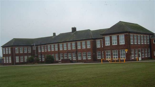
Discovery Academy, Stoke-on-Trent

Discovery Academy is a mixed secondary school located in the Bentilee area of Stoke-on-Trent in the English county of Staffordshire.The school was formed...

Bentilee

Bentilee is a housing estate in Stoke-on-Trent, Staffordshire, England, between Hanley and Longton, and parallel with Fenton. == History == Built in the...

Abbey Hulton

Abbey Hulton is an area of Stoke-on-Trent, Staffordshire, England, named after the abbey that existed between the 13th and 16th centuries. == History... ==

Nearby Amenities

Located within 500m of 53.020795,-2.099433
Traffic Signals
Lat/Long: 53.0227371/-2.0939476
Bus Stop
Shops
Bus: yes
Naptan AtcoCode: 3800C813700
Naptan Bearing: NW
Naptan CommonName: Shops
Naptan Indicator: Adj
Naptan Landmark: Shops
Naptan PlusbusZoneRef: STOKEOT
Naptan Street: Washerwall Lane
Naptan Verified: no
Public Transport: platform
Source: naptan_import
Lat/Long: 53.0236287/-2.0953726
Bus Stop
Clough Lane
Bus: yes
Naptan AtcoCode: 3800C815500
Naptan Bearing: E
Naptan CommonName: Clough Lane
Naptan Indicator: Opp
Naptan Landmark: Clough Lane
Naptan PlusbusZoneRef: STOKEOT
Naptan Street: Ash Bank Rd
Naptan Verified: no
Public Transport: platform
Source: naptan_import
Lat/Long: 53.0213137/-2.1011369
Bus Stop
Ash Bank Garage
Bus: yes
Naptan AtcoCode: 3800C815501
Naptan Bearing: W
Naptan CommonName: Ash Bank Garage
Naptan Indicator: Adj
Naptan Landmark: Ash Bank Garage
Naptan PlusbusZoneRef: STOKEOT
Naptan Street: Ash Bank Road
Naptan Verified: no
Public Transport: platform
Source: naptan_import
Lat/Long: 53.0211926/-2.1014318
Bus Stop
Washerwall Lane
Bus: yes
Naptan AtcoCode: 3800C860401
Naptan Bearing: NE
Naptan CommonName: Washerwall Lane
Naptan Indicator: Adj
Naptan Landmark: Washerwall Ln
Naptan PlusbusZoneRef: STOKEOT
Naptan Street: 343/345 Ash Bank Rd
Naptan Verified: no
Public Transport: platform
Source: naptan_import
Lat/Long: 53.0230999/-2.0934034
Bus Stop
St Philips Church
Bus: yes
Naptan AtcoCode: 3800C860402
Naptan Bearing: SW
Naptan CommonName: St Philips Church
Naptan Indicator: Adj
Naptan Landmark: St Philips Church
Naptan PlusbusZoneRef: STOKEOT
Naptan Street: Ash Bank Rd
Naptan Verified: no
Public Transport: platform
Source: naptan_import
Lat/Long: 53.0224608/-2.0945053
Bus Stop
The Lodge
Bench: no
Bin: no
Bus: yes
Lit: no
Naptan AtcoCode: 3800C860601
Naptan Bearing: E
Naptan CommonName: The Lodge
Naptan Indicator: Adj
Naptan Landmark: The Lodge
Naptan PlusbusZoneRef: STOKEOT
Naptan Street: 201 Ash Bank Rd
Naptan Verified: no
Public Transport: platform
Shelter: no
Source: naptan_import
Tactile Paving: no
Lat/Long: 53.0216421/-2.1059232
Bus Stop
Ash Bank Hotel
Bus: yes
Naptan AtcoCode: 3800C860602
Naptan Bearing: W
Naptan CommonName: Ash Bank Hotel
Naptan Indicator: Adj
Naptan Landmark: Ash Bank Hotel
Naptan PlusbusZoneRef: STOKEOT
Naptan Street: Ash Bank Rd
Naptan Verified: no
Public Transport: platform
Source: naptan_import
Lat/Long: 53.0214981/-2.1061614
Addr Housenumber: 1
Addr Street: Uplands Croft
Lat/Long: 53.0247057/-2.0995661
Addr Housenumber: 2
Addr Street: Uplands Croft
Lat/Long: 53.0244506/-2.0998081
Addr Housenumber: 1
Addr Street: Marsh Close
Lat/Long: 53.0251348/-2.0987987
Crossing
Crossing Island: yes
Lat/Long: 53.0217028/-2.1045407
Fast Food
Ash Bank Fish Bar
Addr Housenumber: 215
Addr Postcode: ST2 9EE
Addr Street: Ash Bank Road
Fhrs Id: 1259827
Source Addr: FHRS Open Data
Lat/Long: 53.0216955/-2.1032059
Restaurant
Red Onion
Addr Housenumber: 274
Addr Postcode: ST9 0JS
Addr Street: Ash Bank Road
Fhrs Id: 1259553
Source Addr: FHRS Open Data
Lat/Long: 53.0211027/-2.1014885
Headmasters
Brand: Headmasters
Brand Wikidata: Q113700332
Shop: hairdresser
Lat/Long: 53.0218246/-2.1038389
Place Of Worship
Werrington Methodist Church
Denomination: methodist
Node Id: 5047889231
Religion: christian
Source: OS-OpenData_StreetView
Source Name: OS Open Local Important Buildings Layer
Lat/Long: 53.0215448/-2.0999223
Barrier: yes
Lat/Long: 53.020486/-2.0922733
Defibrillator
Emergency: defibrillator
Indoor: no
Lat/Long: 53.0225255/-2.1046278
Barrier: stile
Material: wood
Step Count: 1
Stile: stepover
Lat/Long: 53.0234024/-2.1054933
Power: pole
Lat/Long: 53.0197311/-2.1015649
Power: pole
Lat/Long: 53.0194451/-2.1015438
Power: pole
Lat/Long: 53.0200188/-2.1015934
Power: pole
Lat/Long: 53.0191931/-2.1015215
Crossing
Crossing Island: yes
Lat/Long: 53.0216219/-2.1056403
Crossing
Crossing Island: yes
Lat/Long: 53.0215467/-2.1063894
The data included in this document is from www.openstreetmap.org. The data is made available under ODbL.

Have you been to Werrington?

Leave your review of Werrington below (or comments, questions and feedback).