Wellington

Civil Parish in Shropshire

England

Wellington

Wellington Market Street
Wellington Market Street Credit: Roy Hughes

Wellington is a civil parish located in the county of Shropshire, England. It is situated approximately 13 kilometers east of the county town of Shrewsbury and has a population of around 4,800 people. The parish covers an area of about 7.5 square kilometers and is bordered by the Wrekin Hill to the south.

Wellington has a rich history dating back to Roman times when it was an important settlement along the Watling Street, a major Roman road. The town's name is believed to originate from the Old English word "welling," meaning a spring or stream, and "ton," meaning a settlement. Throughout the centuries, Wellington has grown and developed into a bustling market town.

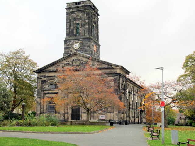
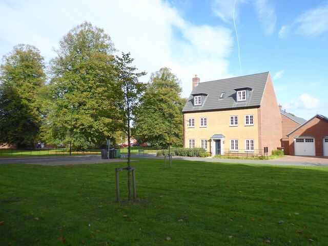
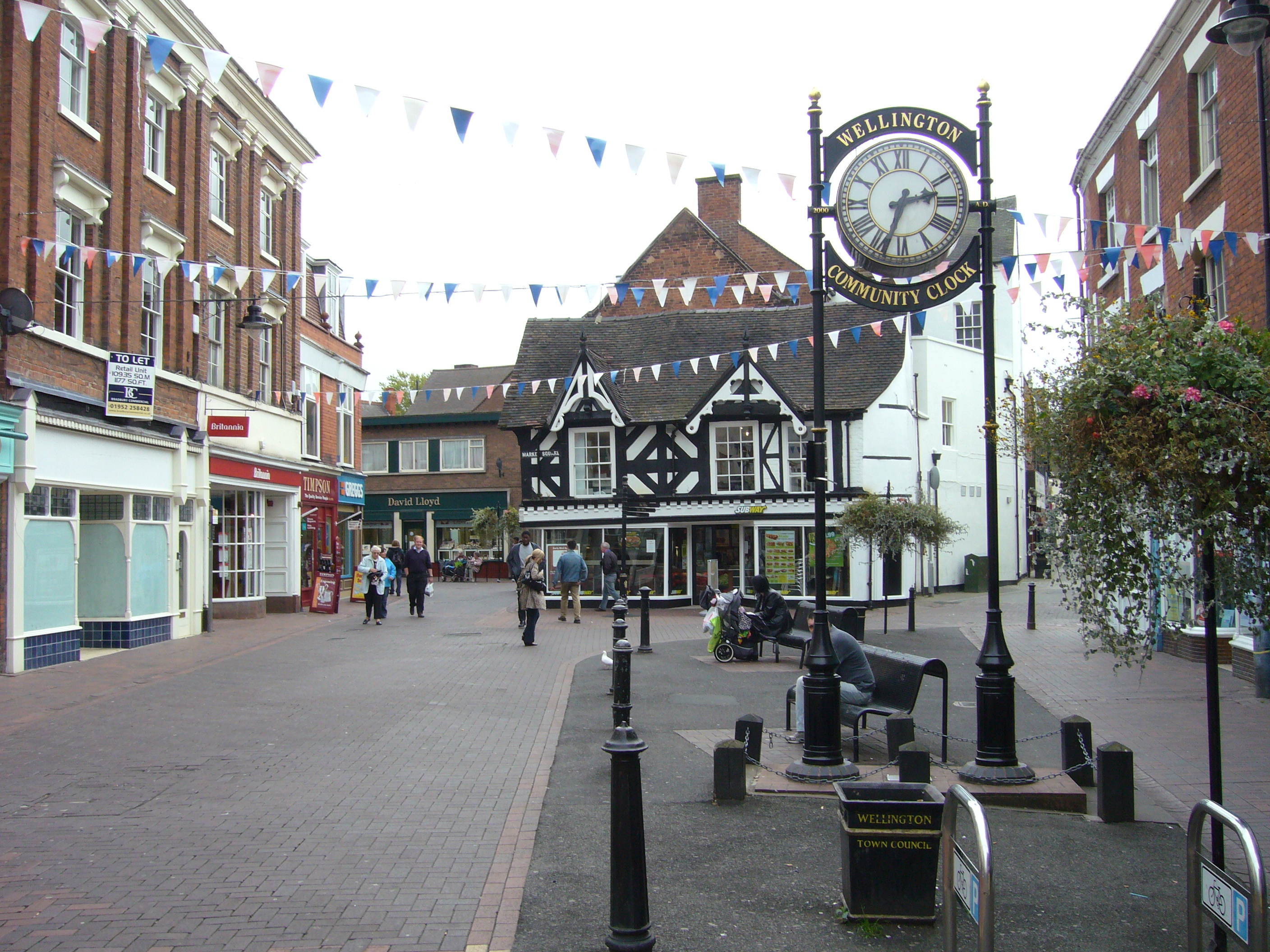
Today, Wellington is known for its attractive Georgian and Victorian architecture, which can be seen in the town center. The town offers a range of amenities and services, including shops, restaurants, cafes, and pubs. It also has a number of schools, a library, and a leisure center, providing recreational facilities for residents.

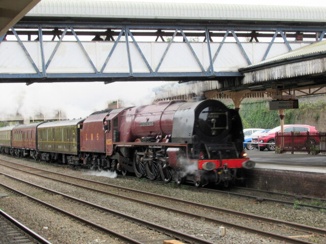
The parish is well-connected to other parts of Shropshire and the wider region. The A5 road runs through Wellington, providing easy access to Telford and Shrewsbury. The town also has a railway station, offering regular services to Birmingham, Shrewsbury, and other destinations.

In addition to its historical and architectural appeal, Wellington is surrounded by beautiful countryside, offering opportunities for outdoor activities such as walking, hiking, and cycling. The nearby Wrekin Hill is a popular spot for nature enthusiasts and offers stunning views from its summit.

Overall, Wellington, Shropshire is a charming and vibrant town with a rich history, offering a range of amenities and beautiful surroundings for residents and visitors alike.

If you have any feedback on the listing, please let us know in the comments section below.

Wellington Images

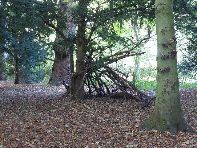
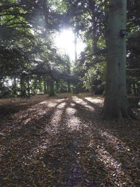
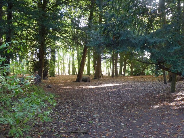
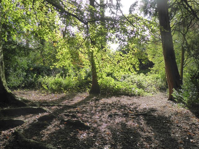
Images are sourced within 2km of 52.702497/-2.518473 or Grid Reference SJ6511. Thanks to Geograph Open Source API. All images are credited.

Wellington Market Street
Market Street Wellington
Walker Street Wellington
Station Road Wellington
The Parish Church of All Saints, Wellington
Wellington station with 6233 The Duchess of Sutherland approaching
6233 The Duchess of Sutherland passing Wellington station
New housing on Peregrine Way Part of a new housing estate opposite Apley Castle Park.
New housing on Peregrine Way
Part of a new housing estate opposite Apley Castle Park.
Visitor map at Apley Woods Marked on the OS map as Apley Castle Park, Apley Woods seems a reasonable name. The top right corner, under the key, marked as meadows here, is actually part of the new housing estate - see <a href="https://www.geograph.org.uk/photo/7078754">SJ6513 : New housing on Peregrine Way</a>.
The map offers two suggested routes, and the paths are colour-coded for accessibility. We had no pushchairs or wheelchairs, so having figured out the less 'accessible' areas just included short flights of shallow steps, we wandered along various paths within the shorter route.
Visitor map at Apley Woods
Marked on the OS map as Apley Castle Park, Apley Woods seems a reasonable name. The top right corner, under the key, marked as meadows here, is actually part of the new housing estate - see SJ6513 : New housing on Peregrine Way. The map offers two suggested routes, and the paths are colour-coded for accessibility. We had no pushchairs or wheelchairs, so having figured out the less 'accessible' areas just included short flights of shallow steps, we wandered along various paths within the shorter route.
Apley Woods It looks like someone has tried to build a shelter around this rather scruffy yew tree.
Apley Woods
It looks like someone has tried to build a shelter around this rather scruffy yew tree.
Apley Woods 1881 map of the area <span class="nowrap"><a title="https://maps.nls.uk/view/101594272#zoom=5&lat=2427&lon=3639&layers=BT" rel="nofollow ugc noopener" href="https://maps.nls.uk/view/101594272#zoom=5&lat=2427&lon=3639&layers=BT">Link</a><img style="margin-left:2px;" alt="External link" title="External link - shift click to open in new window" src="https://s1.geograph.org.uk/img/external.png" width="10" height="10"/></span>
Current Apley Woods website <span class="nowrap"><a title="https://www.apleywoods.co.uk" rel="nofollow ugc noopener" href="https://www.apleywoods.co.uk">Link</a><img style="margin-left:2px;" alt="External link" title="External link - shift click to open in new window" src="https://s1.geograph.org.uk/img/external.png" width="10" height="10"/></span>
Apley Woods
1881 map of the area LinkExternal link Current Apley Woods website LinkExternal link
Apley Woods : Badger sculpture Carved from a tree stump.
For a closer look see <a title="https://www.geograph.org.uk/photo/7079027" href="https://www.geograph.org.uk/photo/7079027">Link</a> and <a title="https://www.geograph.org.uk/photo/7079032" href="https://www.geograph.org.uk/photo/7079032">Link</a>.
Apley Woods : Badger sculpture
Carved from a tree stump. For a closer look see Link and Link.
Apley Woods : Badger sculpture Carved from a tree stump.
For other views see <a title="https://www.geograph.org.uk/photo/7079021" href="https://www.geograph.org.uk/photo/7079021">Link</a> and <a title="https://www.geograph.org.uk/photo/7079032" href="https://www.geograph.org.uk/photo/7079032">Link</a>.
Apley Woods : Badger sculpture
Carved from a tree stump. For other views see Link and Link.
Apley Woods : Badger sculpture Carved from a tree stump.
For other views see <a title="https://www.geograph.org.uk/photo/7079027" href="https://www.geograph.org.uk/photo/7079027">Link</a> and <a title="https://www.geograph.org.uk/photo/7079021" href="https://www.geograph.org.uk/photo/7079021">Link</a>.
Apley Woods : Badger sculpture
Carved from a tree stump. For other views see Link and Link.
Apley Woods : Roots of a fallen tree It must have fallen some years ago, judging by the regrowth seen here <a title="https://www.geograph.org.uk/photo/7079050" href="https://www.geograph.org.uk/photo/7079050">Link</a>.
Apley Woods : Roots of a fallen tree
It must have fallen some years ago, judging by the regrowth seen here Link.
Apley Woods : Regrowth of a fallen tree See <a title="https://www.geograph.org.uk/photo/7079048" href="https://www.geograph.org.uk/photo/7079048">Link</a> for the roots.
Apley Woods : Regrowth of a fallen tree
See Link for the roots.
Apley Woods Much of this mixed woodland is too dark for much of an understory. I guess more light gets in under the deciduous trees.
Apley Woods
Much of this mixed woodland is too dark for much of an understory. I guess more light gets in under the deciduous trees.
Show me another place!

Wellington is located at Grid Ref: SJ6511 (Lat: 52.702497, Lng: -2.518473)

Unitary Authority: Telford and Wrekin

Police Authority: West Mercia

What 3 Words

///marbles.shunning.transmitted. Near Wellington, Shropshire

Nearby Locations

Wellington Wellington

Related Wikis

Wellington railway station (Shropshire)

Wellington railway station serves the town of Wellington, Shropshire, England. It is situated on the former Great Western Railway's London Paddington...

Telford FM

107.4 Telford FM was an Independent Local Radio station broadcasting in Telford, Shropshire and the surrounding areas of Bridgnorth and Newport from 3...

The Severn (radio station)

The Severn was an Independent Local Radio station serving north & central Shropshire and the Telford & Wrekin area. The station was owned by MNA Broadcasting...

Wellington, Shropshire

Wellington is a constituent market town of Telford and a civil parish in the borough of Telford and Wrekin, Shropshire, England. It is situated 3 miles...

Nearby Amenities

Located within 500m of 52.702497,-2.518473
Wellington
Is In: Shropshire, England, United Kingdom
Is In Country: United Kingdom
Is In County: Shropshire
Is In Nation: England
Place: town
Wikidata: Q1898698
Wikipedia: en:Wellington, Shropshire
Lat/Long: 52.7000357/-2.5176603
Traffic Signals
Lat/Long: 52.699463/-2.5208954
Mini Roundabout
Direction: clockwise
Lat/Long: 52.7020305/-2.5150232
Bicycle Parking
Capacity: 8
Lat/Long: 52.7015608/-2.5163909
Post Box
Brand: Royal Mail
Brand Wikidata: Q638098
Fixme: reference code may be wrong
Note: Picked the ref up while partially inebriated. Might be wrong...
Operator: Royal Mail
Operator Wikidata: Q638098
Post Box Type: wall
Ref: TF1 13
Lat/Long: 52.7013015/-2.5173794
Tesco Express
Brand: Tesco Express
Brand Wikidata: Q98456772
Contact Website: https://www.tesco.com/store-locator/telford/haygate-rd
Shop: convenience
Source: local_knowledge
Lat/Long: 52.6994771/-2.5218597
Crossing
Button Operated: yes
Crossing: traffic_signals
Crossing Island: yes
Crossing Markings: dots
Tactile Paving: yes
Traffic Signals Sound: no
Traffic Signals Vibration: yes
Lat/Long: 52.7034996/-2.5245566
Mini Roundabout
Direction: clockwise
Lat/Long: 52.7024767/-2.5236887
Fuel
Morrisons
Brand: Morrisons
Brand Wikidata: Q922344
Brand Wikipedia: en:Morrisons
Compressed Air: yes
Opening Hours: Mo-Sa 06:00-22:00; Su 09:00-20:00
Operator: Morrisons
Website: https://my.morrisons.com/storefinder/49/wellington
Lat/Long: 52.7026054/-2.5233812
Turning Circle
Lat/Long: 52.6998118/-2.5156436
Kerb: raised
Lat/Long: 52.7011618/-2.5171907
Traffic Signals
Button Operated: yes
Crossing: traffic_signals
Tactile Paving: yes
Traffic Signals Sound: yes
Traffic Signals Vibration: yes
Lat/Long: 52.7005911/-2.521198
Traffic Signals
Lat/Long: 52.7008006/-2.5157187
Parking
Capacity: 20
Parking: surface
Lat/Long: 52.7025604/-2.5161667
Barrier: bollard
Bicycle: yes
Foot: yes
Lat/Long: 52.7001104/-2.5187157
Crossing
Crossing: traffic_signals
Lat/Long: 52.7033792/-2.5183499
Brand: Barclays
Brand Wikidata: Q245343
Brand Wikipedia: en:Barclays
Disused Shop: yes
Lat/Long: 52.702213/-2.5188097
Door: yes
Entrance: yes
Lat/Long: 52.7007624/-2.5189877
Turning Circle
Lat/Long: 52.6992648/-2.5163157
Barrier: bollard
Bicycle: yes
Foot: yes
Lat/Long: 52.7002218/-2.518005
Toilets
Fee: yes
Lat/Long: 52.6993074/-2.5188545
Turning Circle
Lat/Long: 52.7000966/-2.5166519
Crossing
Crossing: traffic_signals
Crossing Island: no
Tactile Paving: yes
Lat/Long: 52.6997279/-2.5153352
Barrier: cycle_barrier
Bicycle: no
Foot: yes
Lat/Long: 52.7017903/-2.5200757
Barrier: cycle_barrier
Bicycle: yes
Foot: yes
Lat/Long: 52.7017848/-2.5202199
Perry's Cycles
Addr City: Telford
Addr Housenumber: 33
Addr Postcode: TF1 1HJ
Addr Street: Tan Bank
Addr Suburb: Wellington
Opening Hours: Mo,Tu,Th,Fr,Sa 08:30-16:00
Shop: bicycle
Source: Local knowledge
Lat/Long: 52.6993131/-2.5173331
Mini Roundabout
Direction: clockwise
Lat/Long: 52.6984206/-2.519724
Crossing
Crossing: unmarked
Tactile Paving: yes
Lat/Long: 52.6982108/-2.5197417
Barrier: bollard
Bicycle: yes
Foot: yes
Lat/Long: 52.6998424/-2.515779
Car Wash
Automated: yes
Operator: Morrisons
Self Service: no
Lat/Long: 52.7027468/-2.5233649
Shop: vacant
Lat/Long: 52.7013682/-2.5188515
Crossing
Crossing: marked
Kerb: flush
Tactile Paving: yes
Lat/Long: 52.7010449/-2.5216661
Bicycle Parking
Bicycle Parking: stands
Capacity: 8
Covered: no
Lat/Long: 52.701086/-2.5218913
Bus Stop
Bench: no
Bin: no
Bus: yes
Public Transport: platform
Shelter: yes
Lat/Long: 52.7009249/-2.5218871
Recycling
Recycling Cans: yes
Recycling Glass: yes
Recycling Paper: yes
Recycling Textiles: yes
Lat/Long: 52.7017292/-2.5222796
Pritchard
Addr City: Telford
Addr Housenumber: 22-24
Addr Postcode: TF1 1QA
Addr Street: Haygate Road
Addr Suburb: Wellington
Shop: dry_cleaning
Lat/Long: 52.6989773/-2.5228529
Bank
TSB
Atm: yes
Brand: TSB
Brand Wikidata: Q7671560
Brand Wikipedia: en:TSB Bank (United Kingdom)
Lat/Long: 52.700121/-2.518882
Bank
Halifax
Atm: yes
Brand: Halifax
Brand Wikidata: Q3310164
Brand Wikipedia: en:Halifax (bank)
Lat/Long: 52.7002514/-2.5185957
Pub
The Plough Inn
Addr City: Telford
Addr Housenumber: 38
Addr Postcode: TF1 3AW
Addr Street: King Street
Addr Suburb: Wellington
Fhrs Id: 250249
Source Addr: FHRS Open Data
Lat/Long: 52.7032186/-2.5168821
Recycling
Recycling Cans: yes
Recycling Glass: yes
Recycling Paper: yes
Recycling Textiles: yes
Lat/Long: 52.6993563/-2.5164878
Pub
The Wellington Arms
Lat/Long: 52.7054045/-2.5179247
Hair Xtreme
Sex: female
Shop: hairdresser
Lat/Long: 52.7023425/-2.5197938
Man About Town
Sex: male
Shop: hairdresser
Lat/Long: 52.7023423/-2.5198908
Cafe
Lat/Long: 52.7023427/-2.5196967
Fast Food
Subway
Addr City: Telford
Addr Housenumber: 1
Addr Postcode: TF1 1DB
Addr Street: Market Square
Addr Suburb: Wellington
Brand: Subway
Brand Wikidata: Q244457
Brand Wikipedia: en:Subway (restaurant)
Contact Website: https://restaurants.subway.com/united-kingdom/en/wellington/1-market-square
Cuisine: sandwich
Fhrs Id: 249697
Source Addr: FHRS Open Data
Takeaway: yes
Lat/Long: 52.7007706/-2.5184988
Partners Chinese Supermarket
Addr City: Telford
Addr Housenumber: 37
Addr Postcode: TF1 3AE
Addr Street: Park Street
Addr Suburb: Wellington
Fhrs Id: 250112
Shop: supermarket
Source Addr: FHRS Open Data
Lat/Long: 52.7051318/-2.5177026
Post Office
Wellington Post Office
Addr City: Telford
Addr Postcode: TF1 1DT
Addr Suburb: Wellington
Branch: Wellington
Brand: Post Office
Brand Wikidata: Q1783168
Check Date: 2020-02-20
Contact Website: https://www.postoffice.co.uk/branch-finder/4906411/wellington
Ref Pol Id: 21580
Source: estimate
Lat/Long: 52.7009504/-2.5191807
Pub
The Park
Addr City: Telford
Addr Postcode: TF1 3AG
Addr Street: Whitchurch Road
Addr Suburb: Wellington
Fhrs Id: 250146
Source Addr: FHRS Open Data
Lat/Long: 52.7055918/-2.5172982
Grove House Hotel
Fixme: Stars?
Tourism: hotel
Lat/Long: 52.7066714/-2.5183902
Turning Circle
Lat/Long: 52.7064392/-2.5209827
Give Way
Direction: backward
Lat/Long: 52.7066212/-2.5197219
Turning Circle
Lat/Long: 52.7038998/-2.5242659
Crossing
Crossing: unmarked
Lat/Long: 52.7032772/-2.5221342
Turning Circle
Lat/Long: 52.7041266/-2.5234135
The Platelayer
Shop: vacant
Lat/Long: 52.7012997/-2.5168434
Bicycle Parking
Bicycle Parking: two-tier
Capacity: 64
Covered: yes
Lat/Long: 52.7013498/-2.5175129
Turning Circle
Lat/Long: 52.7002991/-2.5190795
Colemans
Opening Hours: Mo-Fr 09:00-17:30; Sa 10:00-15:00
Shop: estate_agent
Lat/Long: 52.7022866/-2.5187367
Fast Food
Kebab Ye
Addr City: Telford
Addr Housenumber: 27
Addr Postcode: TF1 1DG
Addr Street: Church Street
Addr Suburb: Wellington
Cuisine: kebab
Fhrs Id: 250117
Opening Hours: Mo-Su 15:00-22:50
Source Addr: FHRS Open Data
Lat/Long: 52.7023602/-2.5186637
Restaurant
La Rosa
Cuisine: italian
Lat/Long: 52.7020444/-2.5190124
Worldchoice
Shop: travel_agency
Lat/Long: 52.7019217/-2.5191342
Hamels
Shop: estate_agent
Lat/Long: 52.7019882/-2.5190927
Rizzo
Shop: hairdresser
Lat/Long: 52.7018086/-2.5191647
Pub
The Bacchus
Lat/Long: 52.7016863/-2.5191478
Fast Food
Tender Fried Chicken
Addr City: Telford
Addr Housenumber: 3
Addr Postcode: TF1 1DR
Addr Street: Church Street
Addr Suburb: Wellington
Cuisine: chicken
Fhrs Id: 249587
Source Addr: FHRS Open Data
Lat/Long: 52.7016184/-2.5191161
Barbers
Shop: estate_agent
Lat/Long: 52.7015582/-2.519096
Stubleys
Shop: furniture
Lat/Long: 52.7015531/-2.519211
Bar
The Beacon
Addr City: Telford
Addr Housenumber: 6-7
Addr Postcode: TF1 1BP
Addr Street: Market Square
Addr Suburb: Wellington
Fhrs Id: 1080923
Source Addr: FHRS Open Data
Lat/Long: 52.7012088/-2.5187745
Cafe
The Steaming Mug Coffee House
Addr City: Telford
Addr Housenumber: 13
Addr Postcode: TF1 1BU
Addr Street: Market Square
Addr Suburb: Wellington
Contact Facebook: https://www.facebook.com/thesteamingmugcoffeeco
Cuisine: coffee_shop
Fhrs Id: 953502
Lat/Long: 52.7011713/-2.5185231
Fast Food
Greggs
Addr City: Telford
Addr Housenumber: 1-3
Addr Postcode: TF1 1LU
Addr Street: New Street
Addr Suburb: Wellington
Brand: Greggs
Brand Wikidata: Q3403981
Brand Wikipedia: en:Greggs
Contact Website: https://www.greggs.co.uk/shop-finder?shop-code=1065
Cuisine: sandwich;bakery
Fhrs Id: 249141
Source Addr: FHRS Open Data
Takeaway: yes
Lat/Long: 52.7008097/-2.5182616
Shop: charity
Lat/Long: 52.7007829/-2.5179025
Pharmacy
Boots
Addr City: Telford
Addr Housenumber: 21-23
Addr Postcode: TF1 1LU
Addr Street: New Street
Addr Suburb: Wellington
Brand: Boots
Brand Wikidata: Q6123139
Brand Wikipedia: en:Boots (company)
Dispensing: yes
Fhrs Id: 250330
Healthcare: pharmacy
Source Addr: FHRS Open Data
Website: https://www.boots.com/stores/277-telford-wellington-tf1-1lu
Lat/Long: 52.7007564/-2.5174788
Iceland
Addr City: Telford
Addr Housenumber: 38-40
Addr Postcode: TF1 1NE
Addr Street: New Street
Addr Suburb: Wellington
Brand: Iceland
Brand Wikidata: Q721810
Brand Wikipedia: en:Iceland (supermarket)
Contact Website: https://www.iceland.co.uk/store-finder/store?StoreID=342&StoreName=WELLINGTON
Fhrs Id: 250006
Shop: frozen_food
Source Addr: FHRS Open Data
Lat/Long: 52.7003407/-2.5165157
Bank
Nationwide
Atm: yes
Brand: Nationwide
Brand Wikidata: Q846735
Brand Wikipedia: en:Nationwide Building Society
Contact Website: https://locations.nationwidebranches.co.uk/wellington/44-new-street
Lat/Long: 52.7002444/-2.5163641
Shop: yes
Lat/Long: 52.7003172/-2.5162377
Savers
Addr City: Telford
Addr Housenumber: 56-58
Addr Postcode: TF1 1NE
Addr Street: New Street
Addr Suburb: Wellington
Brand: Savers
Brand Wikidata: Q7428189
Brand Wikipedia: en:Savers (UK retailer)
Dispensing: no
Fhrs Id: 250092
Official Name: Savers Health & Beauty
Shop: chemist
Source Addr: FHRS Open Data
Lat/Long: 52.699965/-2.5160975
Jobcentre Plus
Brand: Jobcentre Plus
Brand Wikidata: Q6206793
Office: employment_agency
Lat/Long: 52.7000297/-2.5159129
Cafe
Outdoor Seating: separate
Lat/Long: 52.6999478/-2.5157539
Shop: yes
Lat/Long: 52.6999932/-2.5158312
Post Box
Brand: Royal Mail
Brand Wikidata: Q638098
Drive Through: no
Operator: Royal Mail
Operator Wikidata: Q638098
Lat/Long: 52.6998295/-2.5158308
Turning Circle
Lat/Long: 52.7049436/-2.5139399
Post Box
Operator: Royal Mail
Operator Wikidata: Q638098
Lat/Long: 52.7024806/-2.512523
Place Of Worship
Union Free Church
Denomination: baptist
Religion: christian
Lat/Long: 52.7021081/-2.5131567
Post Box
Operator: Royal Mail
Operator Wikidata: Q638098
Lat/Long: 52.7033433/-2.5163608
Turning Circle
Lat/Long: 52.7045736/-2.5167238
Turning Circle
Lat/Long: 52.7045301/-2.5150456
Crossing
Crossing: traffic_signals
Lat/Long: 52.7048626/-2.5174553
Bus Stop
Bus: yes
Public Transport: platform
Shelter: yes
Lat/Long: 52.7045883/-2.5171547
Addr City: Telford
Addr Postcode: TF1 1DT
Addr Street: Market Street
Addr Suburb: Wellington
Disused Shop: variety_store
Old Name: Wilko
Source Addr: FHRS Open Data
Lat/Long: 52.7007807/-2.5201442
Kwik-Fit
Brand: Kwik Fit
Brand Wikidata: Q958053
Brand Wikipedia: en:Kwik Fit
Shop: car_repair
Lat/Long: 52.7026923/-2.5186364
Shop: yes
Lat/Long: 52.7010527/-2.518427
Pub
White Lion
Addr City: Telford
Addr Housenumber: 9
Addr Postcode: TF1 1LP
Addr Street: Crown Street
Addr Suburb: Wellington
Fhrs Id: 1246417
Source Addr: FHRS Open Data
Wikidata: Q26504793
Lat/Long: 52.7005864/-2.5185358
Pub
Dun Cow
Addr City: Telford
Addr Housenumber: 4
Addr Postcode: TF1 1BJ
Addr Street: Duke Street
Addr Suburb: Wellington
Fhrs Id: 679331
Source Addr: FHRS Open Data
Wikidata: Q26580490
Lat/Long: 52.7006956/-2.5186855
Pub
The Raven
Addr City: Telford
Addr Housenumber: 3
Addr Postcode: TF1 1BD
Addr Street: Walker Street
Addr Suburb: Wellington
Fhrs Id: 460080
Source Addr: FHRS Open Data
Lat/Long: 52.7001194/-2.5185007
Cafe
Boardroom Gaming Cafe
Internet Access: wlan
Internet Access Fee: no
Outdoor Seating: no
Toilets: yes
Website: https://boardroomgamingcafe.co.uk/
Lat/Long: 52.7007862/-2.5178528
The Salvation Army
Shop: charity
Lat/Long: 52.7005342/-2.5171152
Cafe
Sofia's
Addr City: Telford
Addr Housenumber: 28
Addr Postcode: TF1 1NE
Addr Street: New Street
Addr Suburb: Wellington
Fhrs Id: 250110
Source Addr: FHRS Open Data
Lat/Long: 52.7005046/-2.5170058
Cafe
Morrisons Cafe
Diet Vegan: yes
Diet Vegetarian: yes
Indoor: yes
Opening Hours: Mo-Sa 08:00-18:00; Su 09:30-16:00
Lat/Long: 52.7023823/-2.5243232
Post Box
Brand: Royal Mail
Brand Wikidata: Q638098
Indoor: no
Operator: Royal Mail
Operator Wikidata: Q638098
Lat/Long: 52.7024055/-2.5238968
Telephone
Booth: KX100
Covered: booth
Operator: BT
Lat/Long: 52.6997861/-2.5195418
Restaurant
Taj Mahal
Addr City: Telford
Addr Housenumber: 29
Addr Postcode: TF1 1DZ
Addr Street: Bridge Road
Addr Suburb: Wellington
Cuisine: indian
Fhrs Id: 701886
Source Addr: FHRS Open Data
Lat/Long: 52.6996349/-2.5207618
Telephone
Check Date: 2024-04-23
Operator: BT
Lat/Long: 52.7013423/-2.5171446
Kaz's Kutz
Sex: male
Shop: hairdresser
Lat/Long: 52.7012615/-2.5127089
Atm
Check Date: 2021-10-06
Covered: yes
Indoor: no
Lat/Long: 52.7025621/-2.5239032
Covered: yes
Description: Map of Telford
Indoor: no
Information: map
Map Size: city
Map Type: street
Tourism: information
Lat/Long: 52.7026294/-2.5238896
Barrier: cycle_barrier
Bicycle: no
Foot: yes
Lat/Long: 52.7067336/-2.5192383
Barrier: cycle_barrier
Bicycle: no
Foot: yes
Lat/Long: 52.7069148/-2.5182381
Barrier: bollard
Bicycle: yes
Foot: yes
Motor Vehicle: no
Lat/Long: 52.7000635/-2.524515
Turning Circle
Lat/Long: 52.7012317/-2.5255498
Barrier: bollard
Bicycle: yes
Foot: yes
Lat/Long: 52.7002548/-2.5236041
Barrier: bollard
Bicycle: yes
Foot: yes
Lat/Long: 52.7000118/-2.5244612
Pub
The Three Crowns
Lat/Long: 52.6996379/-2.5148732
Pharmacy
Lloyds Pharmacy
Addr City: Telford
Addr Postcode: TF1 1SS
Addr Street: Chapel Lane
Addr Suburb: Wellington
Brand: Lloyds Pharmacy
Brand Wikidata: Q6662870
Brand Wikipedia: en:LloydsPharmacy
Dispensing: yes
Fhrs Id: 249149
Healthcare: pharmacy
Source Addr: FHRS Open Data
Lat/Long: 52.699761/-2.5145975
Pub
The Boot Micropub
Lat/Long: 52.7008635/-2.5186756
Shop: yes
Lat/Long: 52.7009243/-2.5186936
Shop: vacant
Lat/Long: 52.7009958/-2.5187169
Seaton Sports
Shop: sports
Lat/Long: 52.7010946/-2.5184649
Newsline
Shop: newsagent
Lat/Long: 52.701137/-2.5185004
Shop: vacant
Lat/Long: 52.7008876/-2.5183066
Restaurant
Ho Mei Village
Cuisine: chinese
Lat/Long: 52.7036665/-2.5177337
Crossing
Crossing: unmarked
Tactile Paving: yes
Lat/Long: 52.6985855/-2.5177528
Restaurant
Silver Fish
Addr City: Telford
Addr Housenumber: 10
Addr Postcode: TF1 1HJ
Addr Street: Tan Bank
Addr Suburb: Wellington
Fhrs Id: 249729
Source Addr: FHRS Open Data
Lat/Long: 52.6995699/-2.5179171
Ken Francis Butchers
Addr City: Telford
Addr Housenumber: 9
Addr Postcode: TF1 1DT
Addr Street: Market Street
Addr Suburb: Wellington
Fhrs Id: 249253
Shop: butcher
Source Addr: FHRS Open Data
Lat/Long: 52.7009655/-2.5194704
Toilets
Check Date: 2024-04-23
Fee: no
Source: survey
Lat/Long: 52.7012996/-2.5167114
Atm
TSB
Brand: TSB
Brand Wikidata: Q7671560
Brand Wikipedia: en:TSB Bank (United Kingdom)
Operator: TSB
Operator Wikidata: Q7671560
Lat/Long: 52.700109/-2.5188359
Atm
TSB
Brand: TSB
Brand Wikidata: Q7671560
Brand Wikipedia: en:TSB Bank (United Kingdom)
Operator: TSB
Operator Wikidata: Q7671560
Lat/Long: 52.7001147/-2.5188188
Crossing
Crossing: zebra
Tactile Paving: yes
Lat/Long: 52.6991121/-2.5193441
Wellington
Naptan AtcoCode: 9100WELNGTN
Network: National Rail
Network Website: https://www.nationalrail.co.uk/stations/wln/
Network Wikidata: Q26334
Public Transport: station
Railway: station
Ref Crs: WLN
Wheelchair: yes
Wikidata: Q1851350
Wikipedia: en:Wellington railway station (Shropshire)
Lat/Long: 52.7014362/-2.5167193
Bus Stop
Bus: yes
Naptan AtcoCode: 3590E001100
Naptan NaptanCode: teladagm
Network: Arriva
Network Wikidata: Q680991
Network Wikipedia: en:Arriva
Operator: Arriva
Public Transport: platform
Shelter: no
Lat/Long: 52.7017602/-2.5138797
Bus Stop
Bus: yes
Network: Arriva
Network Wikidata: Q680991
Network Wikipedia: en:Arriva
Operator: Arriva
Public Transport: platform
Shelter: no
Lat/Long: 52.7013539/-2.5132545
Pub
The William Withering
Addr City: Telford
Addr Housenumber: 43-45
Addr Postcode: TF1 1LU
Addr Street: New Street
Addr Suburb: Wellington
Brand: Wetherspoon
Brand Wikidata: Q6109362
Brand Wikipedia: en:Wetherspoons
Camra: yes
Diet Gluten Free: yes
Diet Lactose Free: yes
Diet Vegetarian: yes
Fhrs Id: 250190
Food: yes
Internet Access: wlan
Name Etymology Wikidata: Q715949
Name Etymology Wikipedia: en:William Withering
Opening Hours: Su-Th 08:00-00:00; Fr,Sa 08:00-01:00
Opening Hours Kitchen: 08:00-23:00
Opening Hours Url: https://www.jdwetherspoon.com/pubs/all-pubs/england/shropshire/the-william-withering-wellington
Outdoor Seating: yes
Phone: +44 1952 642800
Real Ale: yes
Real Cider: yes
Smoking Outside: separated
Source: local knowledge
Source Addr: jdwetherspoon.com
Source Addr Date: 2017-03-11
Source Phone: jdwetherspoon.com
Source Phone Date: 2017-03-11
Website: https://www.jdwetherspoon.com/pubs/all-pubs/england/shropshire/the-william-withering-wellington
Wheelchair: yes
Lat/Long: 52.7005527/-2.5167493
Barrier: cycle_barrier
Lat/Long: 52.7047157/-2.5203582
Generator Method: photovoltaic
Generator Output Electricity: yes
Generator Source: solar
Generator Type: solar_photovoltaic_panel
Location: roof
Power: generator
Lat/Long: 52.7039467/-2.5238326
Generator Method: photovoltaic
Generator Output Electricity: yes
Generator Source: solar
Generator Type: solar_photovoltaic_panel
Location: roof
Power: generator
Lat/Long: 52.7044782/-2.5250718
Barrier: bollard
Bicycle: yes
Bollard: fixed
Foot: yes
Motor Vehicle: no
Lat/Long: 52.7013543/-2.5254261
Generator Method: photovoltaic
Generator Output Electricity: yes
Generator Source: solar
Generator Type: solar_photovoltaic_panel
Location: roof
Power: generator
Lat/Long: 52.7013398/-2.5125137
Generator Method: photovoltaic
Generator Output Electricity: yes
Generator Source: solar
Generator Type: solar_photovoltaic_panel
Location: roof
Power: generator
Lat/Long: 52.7016356/-2.5135517
Generator Method: photovoltaic
Generator Output Electricity: yes
Generator Source: solar
Generator Type: solar_photovoltaic_panel
Location: roof
Power: generator
Lat/Long: 52.7017737/-2.5137341
Generator Method: photovoltaic
Generator Output Electricity: yes
Generator Source: solar
Generator Type: solar_photovoltaic_panel
Location: roof
Power: generator
Lat/Long: 52.7027717/-2.5150605
Generator Method: photovoltaic
Generator Output Electricity: yes
Generator Source: solar
Generator Type: solar_photovoltaic_panel
Location: roof
Power: generator
Lat/Long: 52.7027774/-2.5150015
Cycleway: asl
Lat/Long: 52.7005531/-2.5152643
Cycleway: asl
Lat/Long: 52.7008912/-2.5152214
Traffic Signals
Crossing: traffic_signals
Lat/Long: 52.7008684/-2.5152281
Traffic Signals
Crossing: traffic_signals
Lat/Long: 52.7005953/-2.5152629
Generator Method: photovoltaic
Generator Output Electricity: yes
Generator Source: solar
Generator Type: solar_photovoltaic_panel
Location: roof
Power: generator
Lat/Long: 52.701534/-2.5197463
Crossing
Crossing: uncontrolled
Crossing Island: no
Crossing Markings: zebra
Crossing Ref: zebra
Source: bing
Tactile Paving: yes
Lat/Long: 52.701933/-2.5145763
Generator Method: photovoltaic
Generator Output Electricity: yes
Generator Source: solar
Generator Type: solar_photovoltaic_panel
Location: roof
Power: generator
Lat/Long: 52.7002362/-2.5246359
Crossing
Crossing: zebra
Tactile Paving: yes
Lat/Long: 52.6990655/-2.5194488
Bicycle Repair Station
Lastcheck Status: needs_maintenance
Service Bicycle Pump: yes
Service Bicycle Stand: yes
Service Bicycle Tools: yes
Lat/Long: 52.701337/-2.5175541
Crossing
Crossing: unmarked
Crossing Island: no
Crossing Markings: no
Tactile Paving: yes
Lat/Long: 52.7018094/-2.5150402
Give Way
Direction: forward
Lat/Long: 52.7036673/-2.5250296
Crossing
Crossing: traffic_signals
Crossing Island: no
Crossing Markings: dots
Tactile Paving: yes
Lat/Long: 52.7039453/-2.5249658
Give Way
Direction: backward
Lat/Long: 52.7036248/-2.5254677
Clock
Wellington Clock
Display: analog
Support: pole
Lat/Long: 52.7010708/-2.5186142
Childcare
Lat/Long: 52.7031909/-2.5187148
Bench
Backrest: yes
Material: metal
Seats: 3
Lat/Long: 52.7017983/-2.5182573
Bench
Backrest: yes
Material: metal
Seats: 3
Lat/Long: 52.7016766/-2.5185002
Bench
Backrest: yes
Material: metal
Seats: 3
Lat/Long: 52.701945/-2.5179979
Bench
Backrest: yes
Material: metal
Seats: 3
Lat/Long: 52.7020113/-2.5180371
Traffic Signals
Crossing: traffic_signals
Lat/Long: 52.7007549/-2.5154038
Crossing
Crossing: traffic_signals
Crossing Island: no
Lat/Long: 52.7006328/-2.5152612
Waste Basket
Material: metal
Lat/Long: 52.7016713/-2.5185197
Waste Basket
Material: metal
Lat/Long: 52.7005576/-2.5225077
Entrance: emergency
Lat/Long: 52.7031048/-2.5238209
Barrier: bollard
Bollard: fixed
Lat/Long: 52.6985078/-2.5174105
Barrier: bollard
Bicycle: yes
Foot: yes
Lat/Long: 52.6996985/-2.5152694
Crossing
Crossing: zebra
Tactile Paving: yes
Lat/Long: 52.7010293/-2.5166135
Crossing
Crossing: zebra
Tactile Paving: yes
Lat/Long: 52.7009473/-2.5160971
Crossing
Crossing: zebra
Tactile Paving: yes
Lat/Long: 52.7010259/-2.5161045
Crossing
Crossing: zebra
Crossing Island: no
Tactile Paving: yes
Lat/Long: 52.7009326/-2.5165579
Crossing
Crossing: zebra
Tactile Paving: yes
Lat/Long: 52.7011298/-2.5162056
Crossing
Crossing: unmarked
Crossing Island: yes
Crossing Markings: no
Tactile Paving: yes
Lat/Long: 52.7021885/-2.5153871
Access: no
Advertising: billboard
Man Made: advertising
Message: commercial
Sides: 1
Support: trunk
Lat/Long: 52.7021216/-2.5155748
Bench
Backrest: yes
Material: metal
Seats: 3
Lat/Long: 52.7018249/-2.5181383
Waste Basket
Operator: Telford and Wrekin Council
Operator Type: Council
Lat/Long: 52.7001752/-2.518084
Crossing
Crossing: zebra
Tactile Paving: yes
Lat/Long: 52.6990025/-2.519519
Crossing
Crossing: zebra
Tactile Paving: yes
Lat/Long: 52.6987573/-2.5189233
Crossing
Crossing: zebra
Tactile Paving: yes
Lat/Long: 52.6987201/-2.5191617
Crossing
Crossing: zebra
Tactile Paving: yes
Lat/Long: 52.6988084/-2.5191841
Crossing
Crossing: zebra
Lat/Long: 52.6989112/-2.5190885
Crossing
Crossing: marked
Lat/Long: 52.7022764/-2.5237483
Crossing
Crossing: marked
Lat/Long: 52.7019026/-2.5237529
Crossing
Crossing: marked
Lat/Long: 52.7020329/-2.5237216
Crossing
Crossing: marked
Lat/Long: 52.7021811/-2.523697
Crossing
Crossing: marked
Lat/Long: 52.702313/-2.5236728
Crossing
Crossing: uncontrolled
Crossing Island: no
Crossing Markings: lines
Tactile Paving: no
Lat/Long: 52.7023113/-2.5228037
Crossing
Crossing: unmarked
Crossing Island: yes
Tactile Paving: yes
Lat/Long: 52.7023571/-2.522618
Post Box
Post Box Design: type_c
Post Box Type: pillar
Royal Cypher: EIIR
Royal Cypher Wikidata: Q33102113
Lat/Long: 52.6997433/-2.5197333
Post Box
Post Box Type: meter
Lat/Long: 52.6997412/-2.5197548
We Buy Any Car
Brand: We Buy Any Car
Brand Wikidata: Q7977432
Shop: car
Lat/Long: 52.7016518/-2.5225505
Saturday Cycles
Addr City: Wellington
Addr Street: Market Approach
Opening Hours: Tu,Th,Fr,Sa 08:30-16:30; We 08:30-12:30
Phone: +44 7726 164148
Shop: bicycle
Lat/Long: 52.7007332/-2.5188928
Cafe
Gratitude Cafe
Addr City: Telford
Addr Housenumber: 10
Addr Postcode: TF1 1BJ
Addr Street: Duke Street
Addr Suburb: Wellington
Contact Phone: +44 1952 243977
Contact Website: https://www.gratitudeeventscafe.co.uk/
Fhrs Id: 997347
Opening Hours: Mo-Sa 09:00-16:00; Su 10:00-14:00
Lat/Long: 52.7005219/-2.518655
Marketplace
Market Annexe
Contact Facebook: https://www.facebook.com/marketwellington/
Lat/Long: 52.7001072/-2.5192411
Vision Express
Addr City: Telford
Addr Housenumber: 6
Addr Postcode: TF1 1BD
Addr Street: Walker Street
Addr Suburb: Wellington
Brand: Vision Express
Brand Wikidata: Q7936150
Contact Website: https://www.visionexpress.com/opticians/telford/wellington
Opening Hours: Mo-Fr 09:00-17:30; Sa 09:00-17:00; We,Su off
Shop: optician
Lat/Long: 52.7001494/-2.5187844
Cinema
Wellington Orbit
Addr City: Telford
Addr Housenumber: 1
Addr Postcode: TF1 1BY
Addr Street: Station Road
Addr Suburb: Wellington
Contact Phone: +44 1952 743377
Contact Website: https://wellingtonorbit.co.uk/
Fhrs Id: 1057150
Opening Hours: Mo 18:00-21:00; Tu-Sa 10:00-21:00; Su 13:00-21:00
Lat/Long: 52.701273/-2.5185734
Wellington Community Art Gallery
Addr City: Telford
Addr Housenumber: 8-10
Addr Postcode: TF1 1BJ
Addr Street: Duke Street
Addr Suburb: Wellington
Contact Facebook: https://www.facebook.com/WellingtonCommunityArtGallery
Contact Website: https://welliart.com/
Fee: no
Short Name: WelliArt
Tourism: gallery
Lat/Long: 52.7005945/-2.5186651
Nightclub
Addr City: Telford
Addr Housename: The Coach House
Addr Postcode: TF1 1PY
Addr Street: The Parade
Addr Suburb: Wellington
Contact Email: matureclubuk@gmail.com
Contact Facebook: https://www.facebook.com/matureclubuk
Contact Phone: +44 7967 224365
Fhrs Id: 1535852
Opening Hours: Fr-Sa 22:00-28:00
Lat/Long: 52.7009275/-2.5169625
Barrier: lift_gate
Bicycle: yes
Foot: yes
Motorcar: yes
Motorcycle: yes
Lat/Long: 52.7008508/-2.5206026
Traffic Calming: hump
Lat/Long: 52.7027007/-2.5125769
Crossing
Crossing: unmarked
Crossing Markings: no
Lat/Long: 52.7040041/-2.517063
Crossing
Crossing: uncontrolled
Crossing Markings: yes
Lat/Long: 52.7041278/-2.5181004
Bus Stop
Bus: yes
Naptan AtcoCode: 3590E002300
Naptan NaptanCode: teladamd
Public Transport: platform
Shelter: yes
Lat/Long: 52.7040748/-2.5172019
Bus Stop
A
Bench: yes
Bus: yes
Local Ref: A
Public Transport: platform
Shelter: yes
Lat/Long: 52.701083/-2.5167297
Bus Stop
B
Bench: yes
Bus: yes
Local Ref: B
Public Transport: platform
Shelter: yes
Lat/Long: 52.7010366/-2.516453
Bus Stop
C
Bench: yes
Bus: yes
Local Ref: C
Public Transport: platform
Shelter: yes
Lat/Long: 52.701007/-2.516264
Bus Stop
D
Bench: yes
Bus: yes
Local Ref: D
Public Transport: platform
Shelter: yes
Lat/Long: 52.7009651/-2.5159869
Bus Stop
E
Bench: yes
Bus: yes
Local Ref: E
Public Transport: platform
Shelter: yes
Lat/Long: 52.7010409/-2.5158586
Bus Stop
F
Bench: yes
Bus: yes
Local Ref: F
Public Transport: platform
Shelter: yes
Lat/Long: 52.7010585/-2.5159726
Traffic Calming: cushion
Lat/Long: 52.7007189/-2.5122207
Direction: both
Traffic Calming: cushion
Lat/Long: 52.7013535/-2.5131659
Crossing
Crossing: unmarked
Crossing Island: no
Crossing Markings: no
Tactile Paving: yes
Lat/Long: 52.7022339/-2.5153238
Crossing
Crossing: unmarked
Crossing Island: no
Crossing Markings: no
Tactile Paving: yes
Traffic Calming: table
Lat/Long: 52.7024204/-2.5123199
Cuisine: polish
Shop: convenience
Lat/Long: 52.700363/-2.5162956
Specsavers
Brand: Specsavers
Brand Wikidata: Q2000610
Shop: optician
Lat/Long: 52.7004154/-2.5163674
Cash Providers
Shop: second_hand
Lat/Long: 52.7004653/-2.5164726
Shelter
Shop: charity
Lat/Long: 52.7005031/-2.5165712
Cafe
Masovia Craft Bakery
Cuisine: polish
Ice Cream: yes
Shop: bakery
Lat/Long: 52.700202/-2.5163063
Cuisine: polish
Shop: vacant
Lat/Long: 52.6998948/-2.5160274
B&M
Shop: convenience
Lat/Long: 52.6998372/-2.5160475
Shop: yes
Lat/Long: 52.7005945/-2.5182308
Shop: yes
Lat/Long: 52.7003499/-2.5185949
Shop: yes
Lat/Long: 52.7004491/-2.5186211
Shop: yes
Lat/Long: 52.7011175/-2.5188772
American Nails
Shop: yes
Lat/Long: 52.7011036/-2.5191448
Restaurant
Spiceland
Cuisine: indian
Lat/Long: 52.7011525/-2.5194821
Zoetrends
Shop: yes
Lat/Long: 52.7011041/-2.5190127
Shop: yes
Lat/Long: 52.700972/-2.5183488
Shop: tattoo
Lat/Long: 52.7004166/-2.5181893
Shop: yes
Lat/Long: 52.7005027/-2.5182275
The Music Vault
Shop: music
Lat/Long: 52.7005824/-2.5183817
Betfred
Brand: Betfred
Brand Wikidata: Q4897425
Leisure: adult_gaming_centre
Shop: bookmaker
Lat/Long: 52.700729/-2.5183864
Samaritans
Shop: charity
Lat/Long: 52.7006583/-2.518379
Shop: jewelry
Lat/Long: 52.7006677/-2.5181946
Shop: locksmith
Lat/Long: 52.7006669/-2.5180645
Shop: beauty
Lat/Long: 52.7003516/-2.5179076
Shop: vacant
Lat/Long: 52.7003243/-2.5183891
Heron Foods
Shop: convenience
Lat/Long: 52.7007973/-2.5176991
The Daberhashery
Shop: fabric
Lat/Long: 52.700742/-2.5188068
Shop: vacant
Lat/Long: 52.700739/-2.5186786
The Spec's Factory
Shop: optician
Lat/Long: 52.7007466/-2.5187507
H5 Barber
Shop: hairdresser
Lat/Long: 52.7006047/-2.5169563
Card Factory
Brand: Card Factory
Brand Wikidata: Q5038192
Shop: gift
Lat/Long: 52.7007205/-2.5174055
Karen J. Boulton
Shop: optician
Lat/Long: 52.7006497/-2.5171145
Ladbrokes
Leisure: adult_gaming_centre
Lat/Long: 52.7006321/-2.5170493
Beauty HQ
Shop: hairdresser
Lat/Long: 52.7006659/-2.5171855
Spinning Around Records
Shop: music
Lat/Long: 52.7006831/-2.5172514
Baker & Son Schoolwear
Shop: clothes
Lat/Long: 52.7007031/-2.5173376
Pub
The White Lion
Lat/Long: 52.7004167/-2.5183671
Shop: yes
Lat/Long: 52.7004028/-2.5193822
Entrance: main
Lat/Long: 52.7008328/-2.5201147
Cutting Lounge
Shop: yes
Lat/Long: 52.7007429/-2.5204463
Save It! Discount Store
Shop: yes
Lat/Long: 52.7009237/-2.5211853
get connected
Opening Hours: Mo-Fr 09:00-17:30; Sa 10:00-16:00
Shop: mobile_phone
Lat/Long: 52.7007794/-2.5203471
Repair Xperts
Shop: mobile_phone
Lat/Long: 52.7007961/-2.5202854
Cafe
Lat/Long: 52.700493/-2.5206703
Shop: yes
Lat/Long: 52.7006364/-2.5207427
Office: estate_agent
Lat/Long: 52.7006169/-2.5208259
Shop: carpet
Lat/Long: 52.7005336/-2.5209975
Pub
Pheasant Inn
Addr Street: Market Street
Lat/Long: 52.7008042/-2.5207937
Shop: yes
Lat/Long: 52.7009477/-2.5197235
DB Computing
Shop: yes
Lat/Long: 52.7009578/-2.5196229
Fridge Comic Books
Shop: yes
Lat/Long: 52.7009659/-2.5195511
Mannley's
Office: estate_agent
Lat/Long: 52.7009115/-2.5199132
Shop: vacant
Lat/Long: 52.7009785/-2.5193889
Indoor: yes
Shop: yes
Lat/Long: 52.7006669/-2.5195129
Indoor: yes
Shop: yes
Lat/Long: 52.7006754/-2.5194459
Natural Nails
Opening Hours: Mo-Sa 09:00-18:00
Shop: beauty
Lat/Long: 52.7011431/-2.5187532
Totally Wicked
Shop: e-cigarette
Lat/Long: 52.7010208/-2.5189986
Post Box
Collection Times: Mo-Fr 17:30; Sa 12:30
Ref: TF1 336
Royal Cypher: EIIR
Lat/Long: 52.7010338/-2.5191139
American Nails
Shop: yes
Lat/Long: 52.7011106/-2.5192554
Restaurant
Fish Fare
Cuisine: fish_and_chips
Lat/Long: 52.7011183/-2.5193386
dbroberts
Shop: yes
Lat/Long: 52.7010586/-2.5198596
Chill Out Skate Shop
Shop: yes
Lat/Long: 52.7010346/-2.519936
Shop: yes
Lat/Long: 52.7010155/-2.5200078
Party STARS
Shop: party
Lat/Long: 52.7010001/-2.5200614
John Biddle Opticians
Shop: optician
Lat/Long: 52.7009773/-2.5201345
FRO.blinds
Shop: yes
Lat/Long: 52.7010822/-2.5197811
Shop: vacant
Lat/Long: 52.7010931/-2.519692
Cake Box
Shop: yes
Lat/Long: 52.7011017/-2.5196269
Cafe
Garden Room Bistro
Lat/Long: 52.7009623/-2.5201888
Dr Wango Chinese Medicine Clinic
Shop: yes
Lat/Long: 52.7009412/-2.5202592
Harwood
Office: estate_agent
Lat/Long: 52.7009021/-2.5203954
Covered: yes
Indoor: no
Shop: yes
Lat/Long: 52.7008709/-2.5196913
Covered: yes
Indoor: no
Shop: yes
Lat/Long: 52.7006661/-2.5196148
Covered: yes
Indoor: no
Shop: yes
Lat/Long: 52.7009196/-2.5197148
Shop: yes
Lat/Long: 52.7009034/-2.5198361
Shop: yes
Lat/Long: 52.7007855/-2.5198482
Shop: yes
Lat/Long: 52.7006853/-2.5199326
Shop: yes
Lat/Long: 52.7006125/-2.5198634
Shop: yes
Lat/Long: 52.7006489/-2.5198987
Entrance: yes
Lat/Long: 52.7004285/-2.5193135
Indoor: yes
Shop: yes
Lat/Long: 52.7008221/-2.5191327
Indoor: yes
Shop: yes
Lat/Long: 52.7007717/-2.5191146
Entrance: yes
Lat/Long: 52.7009852/-2.5195145
Door: yes
Entrance: yes
Lat/Long: 52.7006193/-2.5196329
Entrance: yes
Lat/Long: 52.7010273/-2.5191282
Indoor: yes
Shop: yes
Lat/Long: 52.7006872/-2.5191012
Bench
Lat/Long: 52.7036611/-2.5247815
Parcel Locker
Brand: InPost
Brand Wikidata: Q3182097
Covered: yes
Indoor: no
Parcel Mail In: yes
Parcel Pickup: yes
Lat/Long: 52.702688/-2.5238796
Parcel Locker
Brand: Amazon Locker
Brand Wikidata: Q16974764
Indoor: yes
Parcel Mail In: yes
Parcel Pickup: yes
Lat/Long: 52.703026/-2.5238319
Entrance: main
Lat/Long: 52.7024092/-2.5239238
Shop: yes
Lat/Long: 52.7003678/-2.5184997
Shop: yes
Lat/Long: 52.7006567/-2.5185514
Shop: yes
Lat/Long: 52.700714/-2.5185473
Fast Food
Lat/Long: 52.7008912/-2.5166376
Bench
Lat/Long: 52.7007274/-2.5167489
Bench
Lat/Long: 52.7000017/-2.5188316
Bench
Lat/Long: 52.6999647/-2.5187223
Waste Basket
Lat/Long: 52.7000163/-2.5188095
Bicycle Parking
Lat/Long: 52.7001293/-2.5187089
Bench
Lat/Long: 52.7001512/-2.5186506
Bench
Lat/Long: 52.7001407/-2.5186781
Shop: charity
Lat/Long: 52.7001923/-2.5181872
Shop: yes
Lat/Long: 52.700623/-2.5178976
Shop: yes
Lat/Long: 52.7005901/-2.5178982
Shop: yes
Lat/Long: 52.7005572/-2.5178989
Shop: yes
Lat/Long: 52.7004438/-2.5180397
Shop: yes
Lat/Long: 52.7004893/-2.5180431
Shop: charity
Lat/Long: 52.7005336/-2.5180558
Shop: yes
Lat/Long: 52.7005702/-2.5180498
Shop: e-cigarette
Lat/Long: 52.7006153/-2.5180558
Bicycle Parking
Capacity: 6
Lat/Long: 52.6999928/-2.515908
Waste Basket
Lat/Long: 52.700178/-2.5161213
Waste Basket
Lat/Long: 52.7003991/-2.5179499
Bench
Lat/Long: 52.700252/-2.51798
Shop: yes
Lat/Long: 52.7002829/-2.5181343
PDSA
Shop: charity
Lat/Long: 52.7004816/-2.5169165
British Heart Foundation
Brand: British Heart Foundation
Brand Wikidata: Q4970039
Shop: charity
Website: https://www.bhf.org.uk/what-we-do/find-bhf-near-you/wellington-bhf-shop
Lat/Long: 52.7004454/-2.5167871
Shop: yes
Lat/Long: 52.7003889/-2.5166329
Vape Hut
Shop: e-cigarette
Lat/Long: 52.7002837/-2.5164103
Shop: yes
Lat/Long: 52.7001585/-2.5162674
Shop: jewelry
Lat/Long: 52.7001065/-2.5162118
Shop: yes
Lat/Long: 52.7000769/-2.5161809
Shop: yes
Lat/Long: 52.700046/-2.5161535
Shop: vacant
Lat/Long: 52.7000175/-2.5161266
Shop: yes
Lat/Long: 52.7002191/-2.5161159
Magdalenka
Cuisine: polish
Shop: convenience
Lat/Long: 52.7002565/-2.5161756
Shop: yes
Lat/Long: 52.7002939/-2.5162091
Shop: mobile_phone
Lat/Long: 52.7005848/-2.5172652
Cash Converters
Brand: Cash Converters
Brand Wikidata: Q5048645
Shop: pawnbroker
Website: https://www.cashconverters.co.uk/stores/telford
Lat/Long: 52.7006258/-2.5174288
West Midlands Air Ambulance Charity
Shop: charity
Lat/Long: 52.7006596/-2.5175516
Silicon Valley Ltd
Shop: yes
Lat/Long: 52.700675/-2.5176515
Leisure: adult_gaming_centre
Lat/Long: 52.7006856/-2.5177165
Shop: vacant
Lat/Long: 52.7006933/-2.5178017
Shop: beauty
Lat/Long: 52.7006896/-2.5178835
Leisure: adult_gaming_centre
Lat/Long: 52.7007912/-2.5180525
Shop: yes
Lat/Long: 52.7007863/-2.5179653
Barrier: kerb
Kerb: flush
Tactile Paving: yes
Lat/Long: 52.7035608/-2.5245635
Barrier: kerb
Kerb: flush
Tactile Paving: yes
Lat/Long: 52.7034512/-2.5245459
Charging Station
Access: customers
Capacity: 2
Operator: GeniePoint
Lat/Long: 52.7023714/-2.522808
Bicycle Parking
Covered: no
Lat/Long: 52.7021236/-2.5179646
Entrance: main
Lat/Long: 52.6995732/-2.5160964
Community Centre
Telford & Wrekin Interfaith Council
Lat/Long: 52.7007657/-2.5175824
Rowton Brewery
Craft: brewery
Website: http://www.rowtonbrewery.com/
Lat/Long: 52.7009192/-2.5209903
Entrance: main
Lat/Long: 52.7009911/-2.5154227
Your Move
Office: estate_agent
Lat/Long: 52.7007528/-2.5210969
Gymophobics
Leisure: fitness_centre
Lat/Long: 52.7007896/-2.5211264
Bus Stop
Bench: yes
Bin: yes
Bus: yes
Public Transport: platform
Shelter: yes
Tactile Paving: yes
Lat/Long: 52.7026409/-2.5229672
Bus Stop
Bench: yes
Bin: no
Bus: yes
Public Transport: platform
Shelter: yes
Lat/Long: 52.7025391/-2.5226227
Leisure: fitness_centre
Lat/Long: 52.7021801/-2.519429
Bus Stop
Bus: yes
Public Transport: platform
Lat/Long: 52.6999234/-2.5209121
Barrier: cycle_barrier
Lat/Long: 52.7064547/-2.5218554
Fast Food
Pepe's
Brand: Pepe's
Brand Wikidata: Q120645662
Cuisine: chicken
Takeaway: yes
Lat/Long: 52.702654/-2.5223249
Shop: yes
Lat/Long: 52.7024362/-2.5223268
Office: newspaper
Lat/Long: 52.7027035/-2.5223281
Fast Food
Lat/Long: 52.7026092/-2.5223227
Leisure: picnic_table
Lat/Long: 52.6990876/-2.5214153
The data included in this document is from www.openstreetmap.org. The data is made available under ODbL.

Have you been to Wellington?

Leave your review of Wellington below (or comments, questions and feedback).