Upper Denton
Civil Parish in Cumberland Carlisle
England
Upper Denton

Upper Denton is a civil parish located in the county of Cumberland, England. Situated in the northern part of the country, it lies within the district of Carlisle. The village of Upper Denton itself is nestled in the scenic countryside, surrounded by rolling hills and picturesque landscapes.
The parish covers an area of approximately 4 square kilometers and has a population of around 200 residents. The village is predominantly rural, with a small number of residential properties and agricultural farmland. The community is known for its tranquility and peaceful atmosphere, offering a retreat from the hustle and bustle of city life.
Upper Denton has a rich history, with evidence of human habitation dating back to ancient times. The area is home to several historic landmarks, including St. Cuthbert's Church, a Grade II listed building that dates back to the 12th century. The church's architecture showcases Norman influences and provides a glimpse into the area's past.
While Upper Denton is primarily a residential area, it benefits from its close proximity to larger towns and cities. The parish is located just a short drive away from the market town of Brampton, which offers a range of amenities including shops, schools, and healthcare facilities.
Overall, Upper Denton is a charming and idyllic village that provides a peaceful living environment for its residents. With its stunning natural surroundings and rich historical heritage, it offers a glimpse into the beauty and tranquility of rural Cumberland.
If you have any feedback on the listing, please let us know in the comments section below.
Upper Denton Images
Images are sourced within 2km of 54.980283/-2.598871 or Grid Reference NY6165. Thanks to Geograph Open Source API. All images are credited.


Upper Denton is located at Grid Ref: NY6165 (Lat: 54.980283, Lng: -2.598871)
Administrative County: Cumbria
District: Carlisle
Police Authority: Cumbria
What 3 Words
///jiffy.poses.schematic. Near Greenhead, Northumberland
Nearby Locations
Related Wikis

Upper Denton
Upper Denton is a small village and civil parish in the north of Cumbria, England, about 1 km north of the A69 road linking Haltwhistle and Brampton. The...

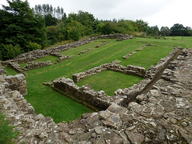
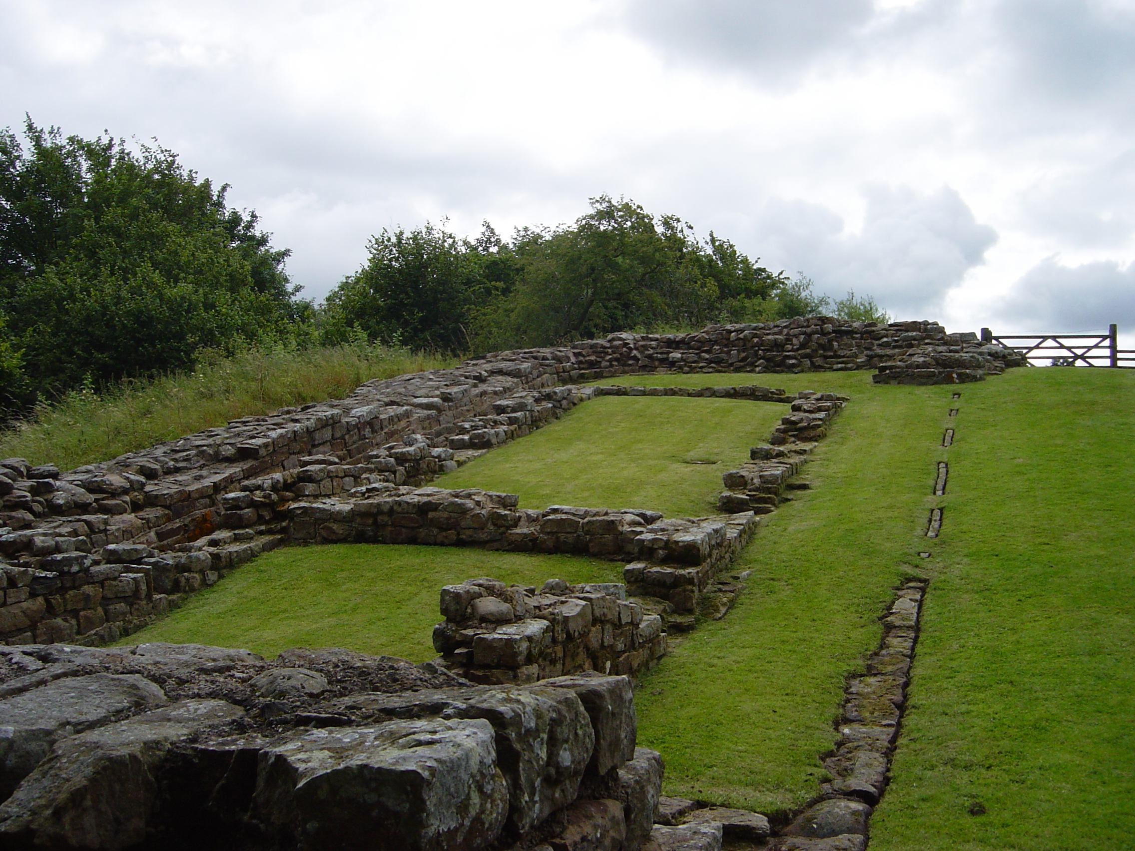
Banna (Birdoswald)
Birdoswald Roman Fort was known as Banna ("horn" in Celtic) in Roman times, reflecting the geography of the site on a triangular spur of land bounded by...

Birdoswald
Birdoswald is a former farm in the civil parish of Waterhead in the English county of Cumberland. It stands on the site of the Roman fort of Banna. �...

Milecastle 49
Milecastle 49 (Harrows Scar) was a milecastle on Hadrian's Wall (grid reference NY6202866407). == Description == Milecastle 49 is immediately west of the...
Milecastle 50TW
Milecastle 50TW (High House) was a milecastle on the Turf Wall section of Hadrian's Wall (grid reference NY60716583). The milecastle is located close...
Milecastle 50
Milecastle 50 (High House) was a milecastle on Hadrian's Wall (grid reference NY60676601). == Description == Milecastle 50 is west of Birdoswald fort....

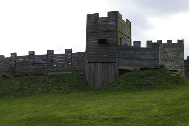
Limes (Roman Empire)
Līmes (Latin, singular; plural: līmitēs) is a modern term used primarily for the Germanic border defence or delimiting system of Ancient Rome marking the...
Milecastle 48
Milecastle 48 (Poltross Burn), is a milecastle on Hadrian's Wall (grid reference NY6340666195). Its remains lie near the village of Gilsland in Cumbria...
Nearby Amenities
Located within 500m of 54.980283,-2.598871Have you been to Upper Denton?
Leave your review of Upper Denton below (or comments, questions and feedback).