Threshfield

Civil Parish in Yorkshire Craven

England

Threshfield

Height Laithe The public bridleway passes through a gate (on which the photographer is leaning) and heads off along the line of the wall towards the left of the view. A public footpath joins the bridleway over a stile just the far side of the stone barn, which, however, drops one directly in front of the cattle taking shelter from the bitter wind behind the ruins of a further wall. Since this seemed gratuitously confrontational (and though the cattle seemed laid back, the dog had it in mind to change that situation) we had skirted to the right of the barn to join the bridleway by the muddy tracks over the shoulder of the hillside on the right on the view, which seemed to make everyone's life more relaxed.
Height Laithe Credit: Andy Waddington

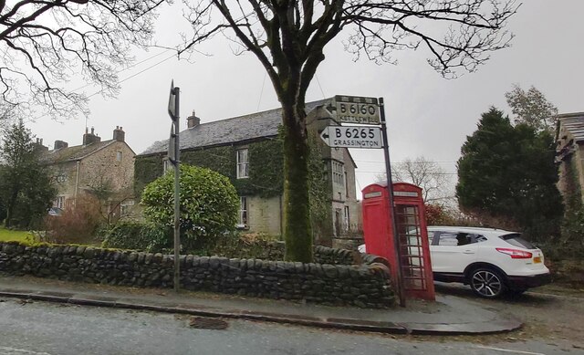
Threshfield is a civil parish located in the Craven district of North Yorkshire, England. Situated in the beautiful Yorkshire Dales National Park, it is a picturesque village with a population of around 1,000 residents. The village lies on the River Wharfe, approximately 1.5 miles south of Grassington, a popular tourist destination.

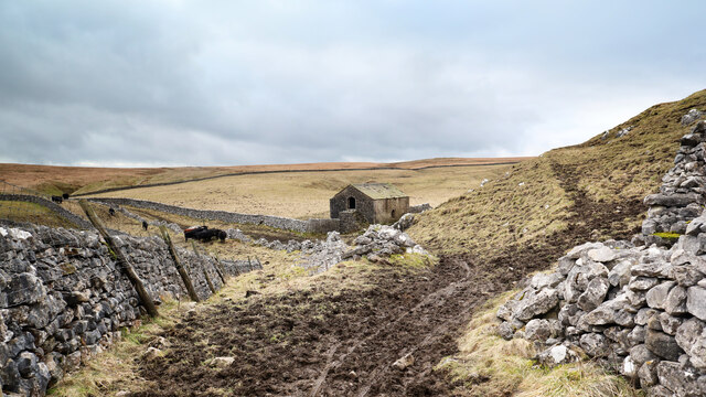
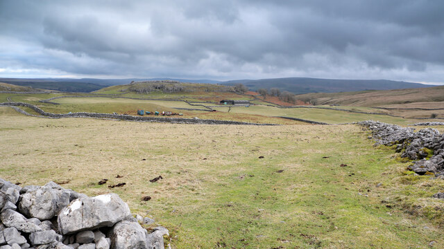
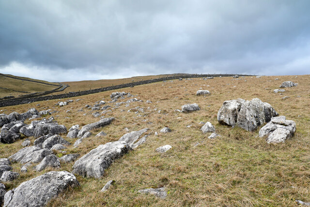
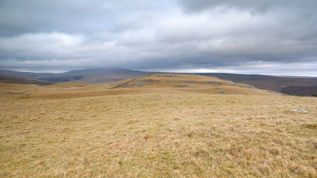
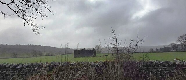
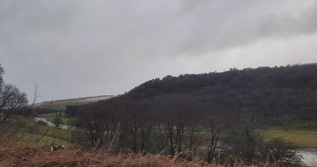
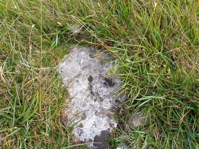
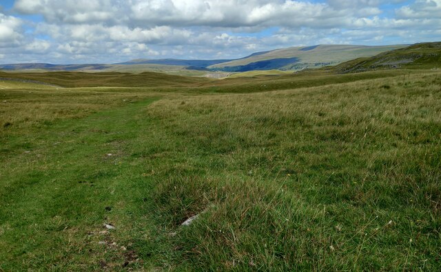
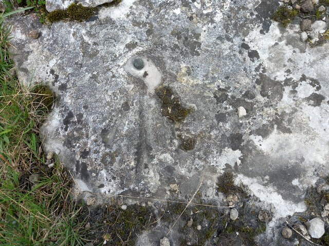
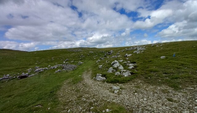
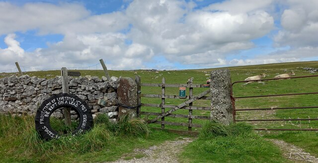
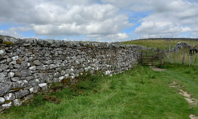
Threshfield is known for its stunning natural surroundings, with rolling hills, green pastures, and charming stone-built houses. The village is surrounded by breathtaking countryside, offering numerous opportunities for outdoor activities such as hiking, cycling, and fishing. The area is also known for its limestone scenery, with impressive rock formations and underground caves.

The village itself has a close-knit community and a range of amenities to cater to residents and visitors alike. There is a primary school, a post office, a village hall, a cricket field, and a football pitch. The local pub, The Old Hall Inn, is a popular spot for locals and tourists to enjoy a pint and a meal, offering a warm and friendly atmosphere.

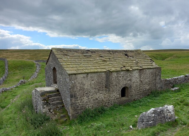
Threshfield also has a rich history, with evidence of human occupation dating back to the Roman period. The nearby Grassington Moor is home to ancient monuments, such as the Grimwith stone circle, adding to the area's historical significance.

Overall, Threshfield offers a tranquil and idyllic setting, perfect for those seeking a peaceful retreat or a base to explore the stunning Yorkshire Dales.

If you have any feedback on the listing, please let us know in the comments section below.

Threshfield Images

Images are sourced within 2km of 54.072215/-2.044712 or Grid Reference SD9764. Thanks to Geograph Open Source API. All images are credited.

Height Laithe The public bridleway passes through a gate (on which the photographer is leaning) and heads off along the line of the wall towards the left of the view. A public footpath joins the bridleway over a stile just the far side of the stone barn, which, however, drops one directly in front of the cattle taking shelter from the bitter wind behind the ruins of a further wall. Since this seemed gratuitously confrontational (and though the cattle seemed laid back, the dog had it in mind to change that situation) we had skirted to the right of the barn to join the bridleway by the muddy tracks over the shoulder of the hillside on the right on the view, which seemed to make everyone's life more relaxed.
Height Laithe
The public bridleway passes through a gate (on which the photographer is leaning) and heads off along the line of the wall towards the left of the view. A public footpath joins the bridleway over a stile just the far side of the stone barn, which, however, drops one directly in front of the cattle taking shelter from the bitter wind behind the ruins of a further wall. Since this seemed gratuitously confrontational (and though the cattle seemed laid back, the dog had it in mind to change that situation) we had skirted to the right of the barn to join the bridleway by the muddy tracks over the shoulder of the hillside on the right on the view, which seemed to make everyone's life more relaxed.
Looking to the settlement above Cow Close Wood The immediate foreground is a path leading vaguely from the public bridleway above Height Laithe towards Height House. The hill beyond is marked with two antiquities, a "Settlement" and a "Hut circle and enclosure". Presumably these are different stages of development of a prehistoric community on the limestone hilltop where there is plenty of stone for building, a good view, and good soil suitable for farming. The more modern farm buildings, having less need for defence, perhaps, favour a more sheltered location below the hill, though today they find themselves on the windward side in a gusty and bitter breeze.
Looking to the settlement above Cow Close Wood
The immediate foreground is a path leading vaguely from the public bridleway above Height Laithe towards Height House. The hill beyond is marked with two antiquities, a "Settlement" and a "Hut circle and enclosure". Presumably these are different stages of development of a prehistoric community on the limestone hilltop where there is plenty of stone for building, a good view, and good soil suitable for farming. The more modern farm buildings, having less need for defence, perhaps, favour a more sheltered location below the hill, though today they find themselves on the windward side in a gusty and bitter breeze.
Limestone boulders on Malham Moor Just west of the bridleway from Height Laithe towards Mastiles Lane, just after crossing Malham Moor Lane, a vague track diverges to loop back and rejoin the right of way. From a geographer's point of view, its main benefit is in reaching a position which is assuredly inside the same square as the view to the west over the higher parts of the moor.
Limestone boulders on Malham Moor
Just west of the bridleway from Height Laithe towards Mastiles Lane, just after crossing Malham Moor Lane, a vague track diverges to loop back and rejoin the right of way. From a geographer's point of view, its main benefit is in reaching a position which is assuredly inside the same square as the view to the west over the higher parts of the moor.
Limestone Knoll on Malham Moor The public bridleway from Malham Moor Lane towards Mastiles Lane passes to the west of this limestone knoll which has a marked antiquity on the map, a "Homestead", smaller than a "Settlement" and perilously close to the edge of Threshfield Quarry, which is just over the horizon on the right of the photograph and has removed a huge chunk of the reef knoll. Further away, the cloud is just enveloping the top of Great Whernside beyond Wharfedale in the increasingly bitter westerly wind.
Limestone Knoll on Malham Moor
The public bridleway from Malham Moor Lane towards Mastiles Lane passes to the west of this limestone knoll which has a marked antiquity on the map, a "Homestead", smaller than a "Settlement" and perilously close to the edge of Threshfield Quarry, which is just over the horizon on the right of the photograph and has removed a huge chunk of the reef knoll. Further away, the cloud is just enveloping the top of Great Whernside beyond Wharfedale in the increasingly bitter westerly wind.
Threshfield
Threshfield
Ruin near Chester Wood
Wharfedale near Kirk Bank
Kilnsey, Malham Moor gatepost The benchmark is cut into a stone gatepost on the east side of the bridleway.
Kilnsey, Malham Moor gatepost
The benchmark is cut into a stone gatepost on the east side of the bridleway.
Kilnsey, Malham Moor gatepost There is a benchmark cut into the stone gatepost on the east side of the bridleway.
Kilnsey, Malham Moor gatepost
There is a benchmark cut into the stone gatepost on the east side of the bridleway.
Kilnsey, Malham Moor The rivet benchmark is cut into a rock on the east side of the bridleway.
Kilnsey, Malham Moor
The rivet benchmark is cut into a rock on the east side of the bridleway.
Kilnsey, Malham Moor There is a rivet benchmark cut into the rock on the east side of the bridleway.
Kilnsey, Malham Moor
There is a rivet benchmark cut into the rock on the east side of the bridleway.
Kilnsey, Malham Moor The rivet benchmark is cut into a rock on the north-east side of the footpath.
Kilnsey, Malham Moor
The rivet benchmark is cut into a rock on the north-east side of the footpath.
Kilnsey, Malham Moor There is a rivet benchmark cut into the rock on the north-east side of the footpath.
Kilnsey, Malham Moor
There is a rivet benchmark cut into the rock on the north-east side of the footpath.
Skirethorn, Malham Moor Lane The benchmark is cut into a left hand gatepost on the north side of the lane.
Skirethorn, Malham Moor Lane
The benchmark is cut into a left hand gatepost on the north side of the lane.
Skirethorn, Malham Moor Lane There is a benchmark cut into the left hand gatepost on the north side of the lane.
Skirethorn, Malham Moor Lane
There is a benchmark cut into the left hand gatepost on the north side of the lane.
Skirethorn, Height field barn The benchmark is cut into the north facing wall of Height field barn located on the bridle path.
Skirethorn, Height field barn
The benchmark is cut into the north facing wall of Height field barn located on the bridle path.
Skirethorn, Height field barn There is a benchmark cut into the north facing wall of Height field barn located on the bridle path.
Skirethorn, Height field barn
There is a benchmark cut into the north facing wall of Height field barn located on the bridle path.
Skirethorn, Higher Heights According to the OS benchmark database there is a benchmark cut into this stretch of wall, at a very low height. Nothing was found.
Skirethorn, Higher Heights
According to the OS benchmark database there is a benchmark cut into this stretch of wall, at a very low height. Nothing was found.
Show me another place!

Threshfield is located at Grid Ref: SD9764 (Lat: 54.072215, Lng: -2.044712)

Division: West Riding

Administrative County: North Yorkshire

District: Craven

Police Authority: North Yorkshire

What 3 Words

///signs.gobblers.sock. Near Grassington, North Yorkshire

Related Wikis

Threshfield

Threshfield is a small village and civil parish in the Craven district of North Yorkshire, England with a population of 980 residents, reducing to 968...

Upper Wharfedale School

Upper Wharfedale School is a coeducational secondary school located in Threshfield, North Yorkshire, England. The school is named after Wharfedale, one...

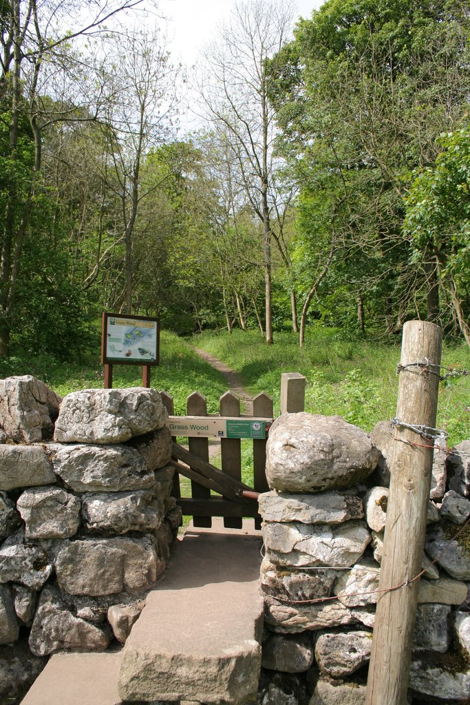
Grass Wood, Wharfedale

Grass Wood is an ancient woodland of 88 hectares (220 acres) in Wharfedale, North Yorkshire, England, that has an exceptional ground flora of woodland...

Grassington & Threshfield railway station

Grassington & Threshfield railway station (or Threshfield station) was a railway station that served the town of Grassington and village of Threshfield...

Swinden Quarry

Swinden Quarry is 0.62 miles (1 km) north of the village of Cracoe, and 1.9 miles (3 km) south-west of Grassington in North Yorkshire, England. It is owned...

Linton Falls Hydro

Linton Falls Hydro is a hydroelectric generating power station located on the Linton Falls Weir of the River Wharfe, near Grassington, North Yorkshire...

Linton, North Yorkshire

Linton is a village and civil parish in the Craven district of North Yorkshire, England. The population as of the 2011 census was 176. It lies not far...

Grassington

Grassington is a village and civil parish in North Yorkshire, England. The population of the parish at the 2011 Census was 1,126. Historically part of...

Related Videos

Grassington - Hebden - Linton Falls Circular Route | Beautiful Yorkshire Dales National Park Walk

In this Yorkshire walking guide we will show you step-by-step how to complete a circular route starting in Grassington in the ...

Walk With Us in the Yorkshire Dales - Grassington, Linton Falls & Burnsall

Our hiking videos are quite niche and won't appeal to everyone but those who do watch say they really enjoy them. HIKING GEAR ...

Grassington, Walking tour, Full Village and Linton Falls, 4K, #asmr

Embark on an enchanting journey through Grassington, nestled in the picturesque Yorkshire Dales. Explore the charm and beauty ...

Grassington in Yorkshire Dales Walking Tour | Most Beautiful Village in England

Grassington is a small town in Wharfedale, north of Skipton in the Yorkshire Dales National Park of northern England. A pretty ...

Nearby Amenities

Located within 500m of 54.072215,-2.044712
Parking
Guest parking
Access: customers
Lat/Long: 54.0725292/-2.0413684
Round Hill
Natural: peak
Source: OS 1:25k
Lat/Long: 54.0748146/-2.0400386
lime kiln
Historic: archaeological_site
Source: OS 1853
Lat/Long: 54.0742403/-2.0436866
lime kiln
Historic: archaeological_site
Source: OS 1853
Lat/Long: 54.0705577/-2.0408601
Barrier: stile
Material: wood
Source: survey;gps
Stile: stepover
Lat/Long: 54.0735132/-2.0447814
Power: pole
Lat/Long: 54.0706388/-2.0375615
Power: pole
Lat/Long: 54.0709497/-2.0384666
Power: pole
Lat/Long: 54.0714755/-2.0400242
Power: pole
Lat/Long: 54.0718921/-2.0412651
Power: pole
Lat/Long: 54.0716688/-2.0424422
Power: pole
Lat/Long: 54.0713452/-2.0440686
The data included in this document is from www.openstreetmap.org. The data is made available under ODbL.

Have you been to Threshfield?

Leave your review of Threshfield below (or comments, questions and feedback).