Sturton Grange

Civil Parish in Yorkshire Leeds

England

Sturton Grange

Almost at the end of M1 Looking north east along the last few hundred metres of the M1 heading towards Junction 48 at Hook Moor, where it joins A1(M) which has reached J43. The overbridge in the middle distance is carrying the northbound carriageway of A1(M). These roads date from major upgrades and alterations in 1999.
Almost at the end of M1 Credit: Gordon Hatton

Sturton Grange is a small civil parish located in the county of Yorkshire, England. Situated approximately 7 miles southeast of the city of Leeds, it falls within the metropolitan borough of the City of Leeds. The parish covers an area of around 2 square miles and is home to a population of approximately 300 residents.

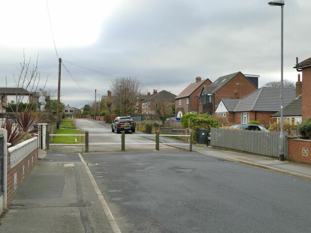
The area is predominantly rural, characterized by open fields, farmlands, and scattered residential properties. Sturton Grange is known for its picturesque countryside, with rolling hills and beautiful landscapes that attract nature enthusiasts and hikers alike.

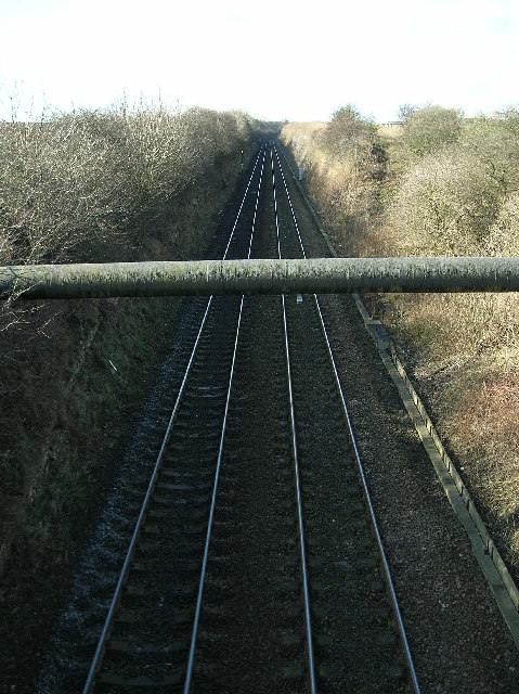
The parish is well-connected to the surrounding areas, with major road links such as the A1(M) and M1 passing nearby, providing easy access to Leeds, Wakefield, and other neighboring towns. Public transportation is also available, with regular bus services connecting Sturton Grange to nearby towns and cities.

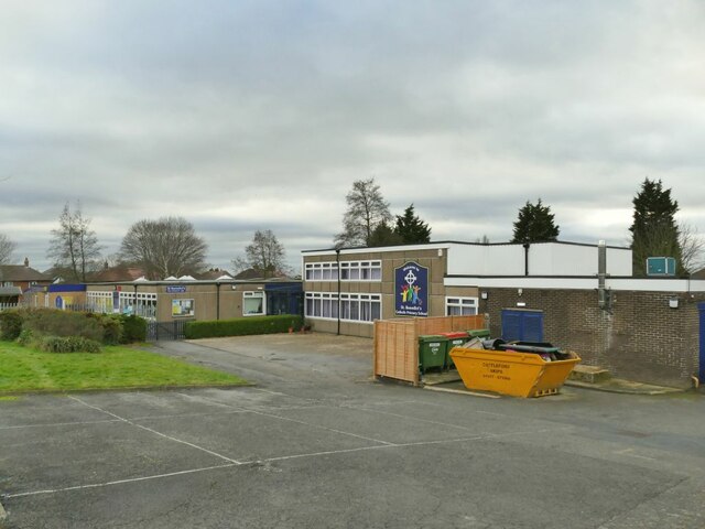
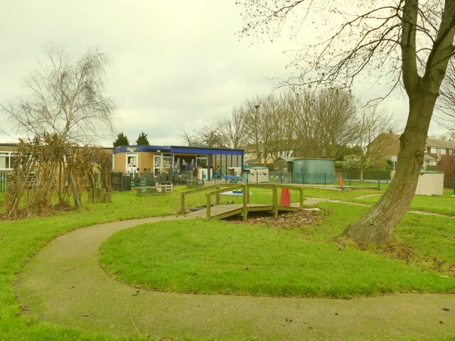
Despite its small size, Sturton Grange offers a range of amenities and facilities to its residents. There is a local primary school, a community center, and a village hall that hosts various events and activities throughout the year. The parish also has several small businesses, including shops, cafes, and pubs, catering to the needs of the local community.

Overall, Sturton Grange provides a quiet and peaceful living environment, surrounded by natural beauty and offering easy access to nearby urban centers.

If you have any feedback on the listing, please let us know in the comments section below.

Sturton Grange Images

Images are sourced within 2km of 53.796056/-1.354222 or Grid Reference SE4233. Thanks to Geograph Open Source API. All images are credited.

Almost at the end of M1 Looking north east along the last few hundred metres of the M1 heading towards Junction 48 at Hook Moor, where it joins A1(M) which has reached J43. The overbridge in the middle distance is carrying the northbound carriageway of A1(M). These roads date from major upgrades and alterations in 1999.
Almost at the end of M1
Looking north east along the last few hundred metres of the M1 heading towards Junction 48 at Hook Moor, where it joins A1(M) which has reached J43. The overbridge in the middle distance is carrying the northbound carriageway of A1(M). These roads date from major upgrades and alterations in 1999.
M1 heading south west from Hook Moor The beginnings of M1 at its northern end where is cuts through a shallow cutting where the Roman Road once crossed. Signs in the distance herald the approach in 1 mile to J47.
M1 heading south west from Hook Moor
The beginnings of M1 at its northern end where is cuts through a shallow cutting where the Roman Road once crossed. Signs in the distance herald the approach in 1 mile to J47.
M1 Northbound from Parlington Interchange, near Garforth Leeds Image of the M1 northbound heading towards its junction with the A1M. Image taken, after a snowfall, from the Parlington Interchange which is the junction of the B1217 Aberford Road with the M1.
M1 Northbound from Parlington Interchange, near Garforth Leeds
Image of the M1 northbound heading towards its junction with the A1M. Image taken, after a snowfall, from the Parlington Interchange which is the junction of the B1217 Aberford Road with the M1.
Garforth station: former station building There has been a station here since 1834. The two-storey building seen here is probably the original station building, no longer in railway use (currently an Italian restaurant), but the lower building to the left still includes a ticket office staffed at peak times.
Garforth station: former station building
There has been a station here since 1834. The two-storey building seen here is probably the original station building, no longer in railway use (currently an Italian restaurant), but the lower building to the left still includes a ticket office staffed at peak times.
Garforth station: quarter-mile post A cast iron post on the westbound platform, indicating a quarter mile.
Garforth station: quarter-mile post
A cast iron post on the westbound platform, indicating a quarter mile.
Garforth station: westbound arrival Northern's Sprinter unit 158756 arrives with the 13.12 to Halifax (originating at Hull) with quite a few passengers waiting to board.
Garforth station: westbound arrival
Northern's Sprinter unit 158756 arrives with the 13.12 to Halifax (originating at Hull) with quite a few passengers waiting to board.
Garforth station: historic footbridge There has been a station at Garforth since 1834 but the footbridge was only added c.1900. It is listed grade II (list entry 1393728) as "an attractive example of the standard North Eastern Railway design".

Update April 2023 - the bridge is about to be removed (despite its listed status) to enable electrification work on the line, and given to the narrow-gauge Bredgar and Wormshill Railway in Kent <a title="https://www.geograph.org.uk/stuff/list.php?label=Bredgar+Wormshill+Light+Railway&gridref=TQ8758" href="https://www.geograph.org.uk/stuff/list.php?label=Bredgar+Wormshill+Light+Railway&gridref=TQ8758">Link</a>
Garforth station: historic footbridge
There has been a station at Garforth since 1834 but the footbridge was only added c.1900. It is listed grade II (list entry 1393728) as "an attractive example of the standard North Eastern Railway design". Update April 2023 - the bridge is about to be removed (despite its listed status) to enable electrification work on the line, and given to the narrow-gauge Bredgar and Wormshill Railway in Kent Link
Garforth station: road bridge The bridge was built in the early 1830s to the designs of engineer James Walker to carry the Aberford Road (now A642) over the Leeds-Selby railway line adjacent to Garforth station. Listed at Grade II (list entry 1419088) as "an original ... distinctive, single-span overbridge with unprecedented span of 60ft (18.2m) ... demonstrating a high level of craftsmanship in its construction, detailing, and dressing" (the same notes apply to other similar bridges on the line). The flat arch is certainly remarkable.
Garforth station: road bridge
The bridge was built in the early 1830s to the designs of engineer James Walker to carry the Aberford Road (now A642) over the Leeds-Selby railway line adjacent to Garforth station. Listed at Grade II (list entry 1419088) as "an original ... distinctive, single-span overbridge with unprecedented span of 60ft (18.2m) ... demonstrating a high level of craftsmanship in its construction, detailing, and dressing" (the same notes apply to other similar bridges on the line). The flat arch is certainly remarkable.
Garforth station: through TransPennine train A Nova 1 (Class 802) unit passes through on the late running 11.42 Newcastle-Liverpool service.
Garforth station: through TransPennine train
A Nova 1 (Class 802) unit passes through on the late running 11.42 Newcastle-Liverpool service.
Garforth station: cycle storage A 'double deck' cycle rack, unused on a Saturday but probably used by commuters midweek (and given how much space is allocated to car parking at this station, a bit more space could have been given to a larger facility at ground level, much easier to use).
Garforth station: cycle storage
A 'double deck' cycle rack, unused on a Saturday but probably used by commuters midweek (and given how much space is allocated to car parking at this station, a bit more space could have been given to a larger facility at ground level, much easier to use).
Garforth station: car park (1) Garforth is the principal commuter station in East Leeds, and the car park has been extended in recent years to a length of c.250 metres, occupying about 0.8ha.  This is the older part immediately outside the station but it has been resurfaced.
Garforth station: car park (1)
Garforth is the principal commuter station in East Leeds, and the car park has been extended in recent years to a length of c.250 metres, occupying about 0.8ha. This is the older part immediately outside the station but it has been resurfaced.
Garforth station: car park (2) Garforth is the principal commuter station in East Leeds, and the car park has been extended in recent years to a length of c.250 metres, occupying about 0.8ha.  This is the extension, on the site of former railway goods sidings.
Garforth station: car park (2)
Garforth is the principal commuter station in East Leeds, and the car park has been extended in recent years to a length of c.250 metres, occupying about 0.8ha. This is the extension, on the site of former railway goods sidings.
St Benedict's Catholic Primary School, Garforth On Station Fields.
St Benedict's Catholic Primary School, Garforth
On Station Fields.
St Benedict's Catholic Primary School, Garforth - garden Quite an attractive garden area for this suburban school.
St Benedict's Catholic Primary School, Garforth - garden
Quite an attractive garden area for this suburban school.
Barrier on Station Fields, Garforth This would have been a through road from Church Lane to the railway station, but this barrier now prevents through motor traffic while permitting pedestrians and cyclists to pass.
Barrier on Station Fields, Garforth
This would have been a through road from Church Lane to the railway station, but this barrier now prevents through motor traffic while permitting pedestrians and cyclists to pass.
Oak Crescent, Garforth The 'Crescent' is laid out, not as a smooth curve, but as a series of four straight sections. The single yellow lines indicate a parking restriction which applies from 10am to 2pm; probably intended to deter commuters from parking here for the nearby railway station.
Oak Crescent, Garforth
The 'Crescent' is laid out, not as a smooth curve, but as a series of four straight sections. The single yellow lines indicate a parking restriction which applies from 10am to 2pm; probably intended to deter commuters from parking here for the nearby railway station.
Garforth St Mary: north side Viewed from Oak Crescent.
Garforth St Mary: north side
Viewed from Oak Crescent.
Garforth St Mary: south side with main entrance The adjacent church hall and trees prevent a wider view of the south side of the building.
Garforth St Mary: south side with main entrance
The adjacent church hall and trees prevent a wider view of the south side of the building.
Show me another place!

Sturton Grange is located at Grid Ref: SE4233 (Lat: 53.796056, Lng: -1.354222)

Division: West Riding

Administrative County: West Yorkshire

District: Leeds

Police Authority: West Yorkshire

What 3 Words

///refuses.comically.scorpions. Near Garforth, West Yorkshire

Related Wikis

Sturton Grange

Sturton Grange is a civil parish in the City of Leeds in West Yorkshire, England. It has a population of 417, reducing to 403 at the 2011 Census.Most of...

Garforth Town A.F.C.

Garforth Town Association Football Club is a football club based in Garforth, West Yorkshire, England. They are members of the Northern Counties East League...

Roman Road railway station (Yorkshire)

Roman Road railway station was a station on the Leeds and Selby Railway, near Micklefield, in West Yorkshire, England. The station was one of the shortest...

East Garforth railway station

East Garforth railway station serves Garforth in West Yorkshire, England. It is on the Selby Line, and operated by Northern. The station was opened by...

Nearby Amenities

Located within 500m of 53.796056,-1.354222
Noexit: yes
Lat/Long: 53.7929366/-1.3584347
The data included in this document is from www.openstreetmap.org. The data is made available under ODbL.

Have you been to Sturton Grange?

Leave your review of Sturton Grange below (or comments, questions and feedback).