Stourport-on-Severn

Civil Parish in Worcestershire Wyre Forest

England

Stourport-on-Severn

St David's Close, Lickhill
St David's Close, Lickhill Credit: Alex McGregor

Stourport-on-Severn is a civil parish located in Worcestershire, England. Situated on the banks of the River Severn, it is a small town with a population of around 20,000 residents. The town is known for its historic significance as a canal town and has retained its original charm, making it a popular tourist destination.

Stourport-on-Severn was established in the late 18th century as a result of the construction of the Staffordshire and Worcestershire Canal. This canal played a crucial role in connecting the town to other major cities, facilitating trade and transportation of goods. Today, remnants of this canal system can still be seen, adding to the town's character.

The town boasts a variety of architectural styles, including Georgian and Victorian buildings, which are well-preserved and add to the town's unique identity. The River Severn, which flows through the town, provides opportunities for activities such as boating and fishing, attracting outdoor enthusiasts.

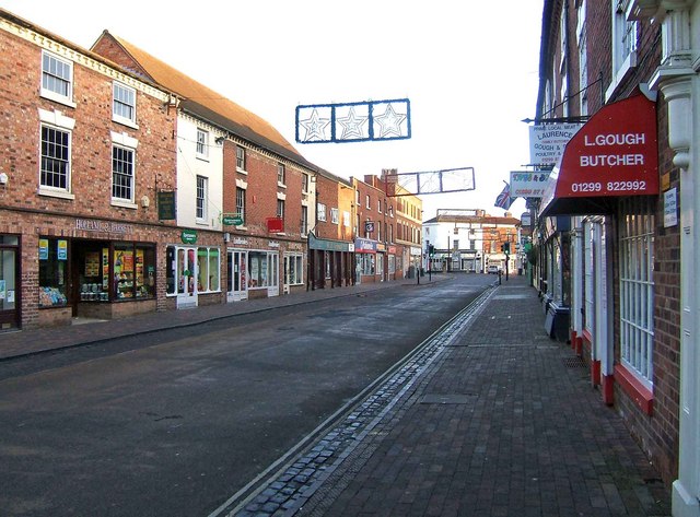
Stourport-on-Severn is also home to the popular Stourport Riverside Marina, which offers moorings for boats and a range of amenities for boating enthusiasts. The town center features a mix of local shops, pubs, and restaurants, catering to both residents and visitors.

In terms of amenities, Stourport-on-Severn has several schools, including primary and secondary schools, ensuring education is easily accessible for families. The town also has a hospital, leisure center, and various recreational facilities, making it an attractive place to live.

Overall, Stourport-on-Severn is a picturesque town with a rich history, offering a blend of natural beauty and modern amenities. Whether it is exploring the canal system, enjoying water activities, or simply appreciating the town's architectural heritage, Stourport-on-Severn has something to offer for everyone.

If you have any feedback on the listing, please let us know in the comments section below.

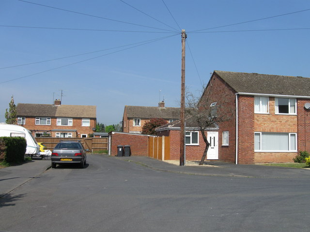
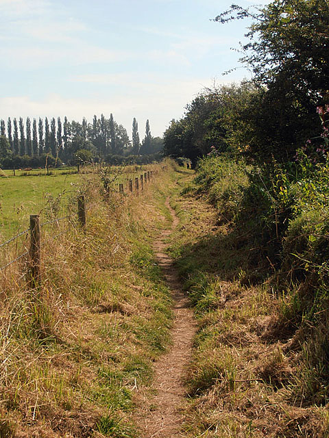
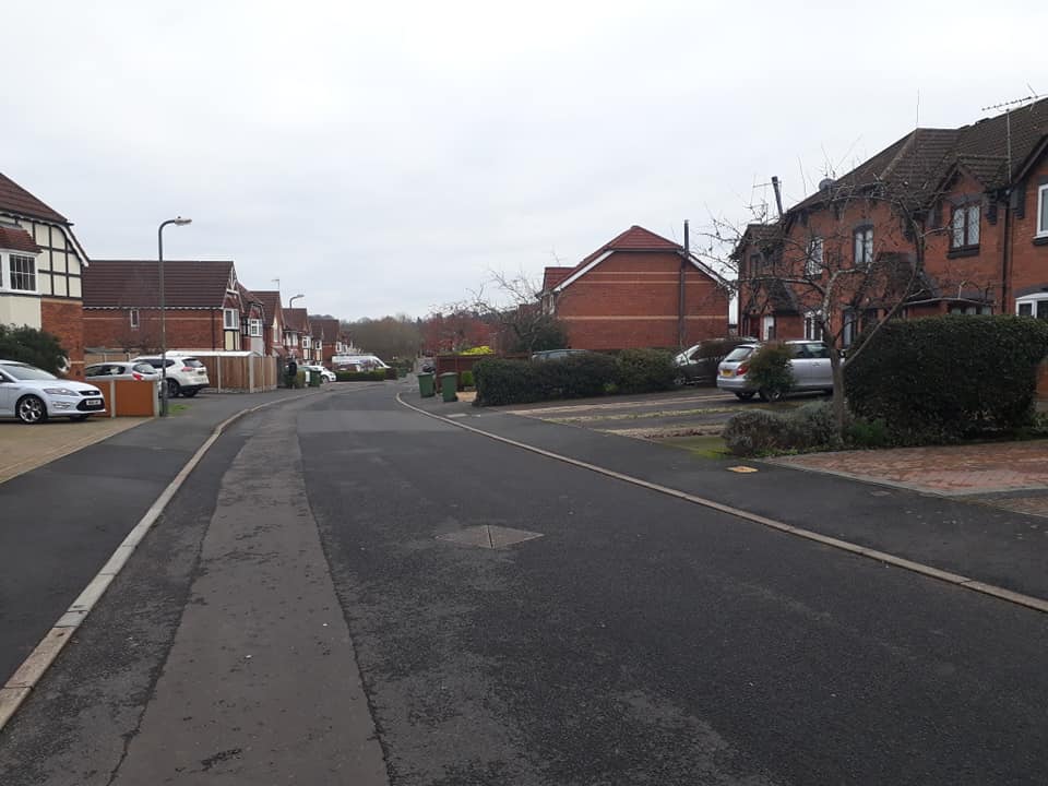
Stourport-on-Severn Images

Images are sourced within 2km of 52.344811/-2.279905 or Grid Reference SO8171. Thanks to Geograph Open Source API. All images are credited.

St David's Close, Lickhill
Footbridge over the Gladder Brook at its confluence with the River Severn, near Stourport-on-Severn Around Stourport-on-Severm there are public footpaths on both sides of the River Severn. In this view across the river, a footbridge takes the footpath on the other side of the river across the Gladder Brook, at the point of its confluence with the River Severn. There was still a carpet of snow on the adjacent field. The name Gladder apparently comes from Anglo-Saxon and means clear.
Footbridge over the Gladder Brook at its confluence with the River Severn, near Stourport-on-Severn
Around Stourport-on-Severm there are public footpaths on both sides of the River Severn. In this view across the river, a footbridge takes the footpath on the other side of the river across the Gladder Brook, at the point of its confluence with the River Severn. There was still a carpet of snow on the adjacent field. The name Gladder apparently comes from Anglo-Saxon and means clear.
Gate on the Severn Way by Lickhill Manor Caravan Park, near Stourport-on-Severn The notice is really a reminder that the path here is still on Lickhill Manor Caravan Park property, as the preceding field, behind the camera position, is also their land. The River Severn is on the left, out of view.
Gate on the Severn Way by Lickhill Manor Caravan Park, near Stourport-on-Severn
The notice is really a reminder that the path here is still on Lickhill Manor Caravan Park property, as the preceding field, behind the camera position, is also their land. The River Severn is on the left, out of view.
Two log seats overlooking the River Severn, near Stourport-on-Severn There seems to have been some clearance here fairly recently. These two seats give an excellent view of the river, but unfortunately it was not a day for sitting around!
Two log seats overlooking the River Severn, near Stourport-on-Severn
There seems to have been some clearance here fairly recently. These two seats give an excellent view of the river, but unfortunately it was not a day for sitting around!
Bewdley Road North entering Stourport
Lickhill Manor The impressive Georgian-style Lickhill Manor viewed from the Severn Way.  The house actually predates the Georgian period and was built around 1700.  During the Second World War the building was commandeered to take the overflow of expectant mothers from Birmingham.  On the 29 December 1941, it was the birthplace of Moody Blues band member Ray Thomas.  The building is Grade II* listed.

Historic England description:
Country house. c1700, but possibly built in 2 distinct phases. Brick with graded slate roof. Entrance front of 3 storeys and 7 bays, the upper storey a different brick and bond, possibly extending a house of the late C17, in the early C18. Central door with 6-fielded panels in shouldered architrave and segmentally arched pediment. Flush framed 12-pane sash windows with flat arched gauged brick heads with stuccoed key stones, and moulded stone sills, aligned on each floor. Sill band to first floor, modillion eaves cornice. Rear elevation similar, but superior quality of detailing suggests that this was intended as the principal front. Central doorway with shouldered architrave with keystone and segmentally arched pediment on consoles. 12-pane sash windows have flat arched brick heads with fluted stuccoed keystones and moulded sills. Doorway inserted in former window opening to lower right. Parapet wall across both gables, linking 2 parallel ridges. Gable end stacks with projecting capping. Internally, a series of panelled rooms, to ground and first floor, at least one of the early C18 with bolection moulding to fireplaces and door surrounds. Others may be later C18, and there was some later C19 remodelling by the Crane family, whose monograms appear in painted plaster in a ceiling. Floral fresco painting to ceiling in one ground floor room. Small room to front has C17-style panelling, either a good copy, or surviving from an earlier building. Early C18 staircase with moulded string and turned balusters. Late C19 armorial glass in stair windows. 
Source:<span class="nowrap"><a title="https://historicengland.org.uk/listing/the-list/list-entry/1209461" rel="nofollow ugc noopener" href="https://historicengland.org.uk/listing/the-list/list-entry/1209461">Link</a><img style="margin-left:2px;" alt="External link" title="External link - shift click to open in new window" src="https://s1.geograph.org.uk/img/external.png" width="10" height="10"/></span>
Lickhill Manor
The impressive Georgian-style Lickhill Manor viewed from the Severn Way. The house actually predates the Georgian period and was built around 1700. During the Second World War the building was commandeered to take the overflow of expectant mothers from Birmingham. On the 29 December 1941, it was the birthplace of Moody Blues band member Ray Thomas. The building is Grade II* listed. Historic England description: Country house. c1700, but possibly built in 2 distinct phases. Brick with graded slate roof. Entrance front of 3 storeys and 7 bays, the upper storey a different brick and bond, possibly extending a house of the late C17, in the early C18. Central door with 6-fielded panels in shouldered architrave and segmentally arched pediment. Flush framed 12-pane sash windows with flat arched gauged brick heads with stuccoed key stones, and moulded stone sills, aligned on each floor. Sill band to first floor, modillion eaves cornice. Rear elevation similar, but superior quality of detailing suggests that this was intended as the principal front. Central doorway with shouldered architrave with keystone and segmentally arched pediment on consoles. 12-pane sash windows have flat arched brick heads with fluted stuccoed keystones and moulded sills. Doorway inserted in former window opening to lower right. Parapet wall across both gables, linking 2 parallel ridges. Gable end stacks with projecting capping. Internally, a series of panelled rooms, to ground and first floor, at least one of the early C18 with bolection moulding to fireplaces and door surrounds. Others may be later C18, and there was some later C19 remodelling by the Crane family, whose monograms appear in painted plaster in a ceiling. Floral fresco painting to ceiling in one ground floor room. Small room to front has C17-style panelling, either a good copy, or surviving from an earlier building. Early C18 staircase with moulded string and turned balusters. Late C19 armorial glass in stair windows. Source:LinkExternal link
The River Severn View up the River Severn from near Lickhill Manor.
The River Severn
View up the River Severn from near Lickhill Manor.
The Severn Way near Lickhill The Severn Way near Lickhill to the north of Stourport-on-Severn.
The Severn Way near Lickhill
The Severn Way near Lickhill to the north of Stourport-on-Severn.
Camp site at Lickhill
The Severn Way at Lickhill
Lickhill Manor, Stourport-on-Severn A pleasing early Georgian house, mostly dating from c1700, the top storey added perhaps about twenty years later. Keystones, platband and a fine doorcase. Grade II* listed.
The house, the back of which overlooks the River Severn, is now associated with the surrounding caravan park.
Lickhill Manor, Stourport-on-Severn
A pleasing early Georgian house, mostly dating from c1700, the top storey added perhaps about twenty years later. Keystones, platband and a fine doorcase. Grade II* listed. The house, the back of which overlooks the River Severn, is now associated with the surrounding caravan park.
Metal platform along the Severn Way Footpath On the east bank of the River Severn near Severnside Caravan Park.
Metal platform along the Severn Way Footpath
On the east bank of the River Severn near Severnside Caravan Park.
Woodgreen Farm at Lickhill Viewed from the Severn Way Footpath along the River Severn.
Woodgreen Farm at Lickhill
Viewed from the Severn Way Footpath along the River Severn.
Cows and pasture along the River Severn Viewed from the Severn Way Footpath.
Cows and pasture along the River Severn
Viewed from the Severn Way Footpath.
Dead tree along the River Severn On the opposite bank is Ribbesford Woods.
Dead tree along the River Severn
On the opposite bank is Ribbesford Woods.
Jacob Sheep grazing near the River Severn
Ancient tree stump in a field Along the Severn Way footpath near Stourport-on-Severn.
Ancient tree stump in a field
Along the Severn Way footpath near Stourport-on-Severn.
Severn Way Footpath heading towards Stourport-on-Severn
Show me another place!

Stourport-on-Severn is located at Grid Ref: SO8171 (Lat: 52.344811, Lng: -2.279905)

Administrative County: Worcestershire

District: Wyre Forest

Police Authority: West Mercia

What 3 Words

///lawn.free.hint. Near Stourport-on-Severn, Worcestershire

Related Wikis

Stourport-on-Severn railway station

Stourport-on-Severn railway station was the main station in Stourport-on-Severn, Worcestershire, England. The station, originally named 'Stourport', opened...

Stourport-on-Severn

Stourport-on-Severn, often shortened to Stourport, is a town and civil parish in the Wyre Forest District of North Worcestershire, England, a few miles...

The Stourport High School and Sixth Form Centre

The Stourport High School & VIth Form Centre, formerly known as the Stourport High School and Language College, opened to students in 1956 as an 11-18...

Burlish Halt railway station

Burlish Halt railway station was a station on the Severn Valley Railway in Stourport-on-Severn, Worcestershire, England. The halt opened on 31 March 1930...

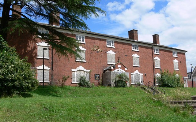
Tontine Buildings, Stourport

The Tontine Buildings is a former hotel in Stourport-on-Severn, Worcestershire, built in the late 18th century by the Staffordshire and Worcestershire...

Stourport Boat Club

Stourport Boat Club is a rowing club on the River Severn, based at the Riverside, Dunley Road, Stourport-on-Severn, Worcestershire. == History == The club...

Areley Hall

Areley Hall is a Grade II listed country house near Areley Kings in Stourport-on-Severn, Worcestershire, England. It is not to be confused with nearby...

Stourport Swifts F.C.

Stourport Swifts Football Club are a football team from Stourport-on-Severn, and one of the oldest non-league teams in the country. The Swifts currently...

Nearby Amenities

Located within 500m of 52.344811,-2.279905
Pub
Rising Sun
Real Ale: yes
Source: survey
Lat/Long: 52.3425819/-2.2772952
Poundstretcher
Brand: Poundstretcher
Brand Wikidata: Q7235675
Shop: variety_store
Source: survey
Website: https://www.poundstretcher.co.uk/stourport-852
Lat/Long: 52.3425678/-2.2777831
Fast Food
Rainbow Pizza House
Cuisine: pizza
Source: survey
Lat/Long: 52.3422516/-2.2777926
Fast Food
Spice Island
Cuisine: indian
Source: survey
Lat/Long: 52.3422663/-2.2779649
Pub
Worley's At The Swan
Outdoor Seating: yes
Source: survey
Lat/Long: 52.3406409/-2.278175
Bar
Liberty's Sports Bar
Lat/Long: 52.3429708/-2.2765011
Fast Food
China Chef
Cuisine: chinese
Lat/Long: 52.3422914/-2.2781545
Place Of Worship
Vernon Hall Stourport Free Church
Religion: christian
Source: survey
Lat/Long: 52.3418047/-2.2800687
Place Of Worship
Kingdom Hall of Jehovah's Witnesses
Denomination: jehovahs_witness
Religion: christian
Source: survey
Wheelchair: no
Lat/Long: 52.3410339/-2.279454
Fast Food
Stourport Kebab and Pizza House
Cuisine: kebab;pizza
Source: survey
Lat/Long: 52.3415486/-2.277645
Fast Food
Pat's Fish Bar
Cuisine: fish_and_chips
Source: survey
Lat/Long: 52.342147/-2.2774897
Bus Stop
Bus: yes
Public Transport: platform
Shelter: no
Source: survey
Lat/Long: 52.3428606/-2.2852733
Bus Stop
Bus: yes
Public Transport: platform
Shelter: no
Source: survey
Lat/Long: 52.3429394/-2.2856698
Bus Stop
Vernon Road
Bench: no
Bin: no
Bus: yes
Lit: no
Naptan AtcoCode: 2000G045392
Naptan Bearing: SE
Naptan CommonName: Vernon Road
Naptan Crossing: Vernon Road
Naptan Indicator: adj
Naptan NaptanCode: wocgagjw
Naptan PlusbusZoneRef: KDRMNST
Naptan Street: Lickhill Road
Naptan Verified: no
Public Transport: platform
Shelter: no
Source: naptan_import
Tactile Paving: no
Lat/Long: 52.3411803/-2.2804303
Bus Stop
Park Avenue
Bus: yes
Naptan AtcoCode: 2000G045393
Naptan Bearing: SE
Naptan CommonName: Park Avenue
Naptan Crossing: Park Avenue
Naptan Indicator: adj
Naptan NaptanCode: wocgagma
Naptan PlusbusZoneRef: KDRMNST
Naptan Street: Lickhill Road
Naptan Verified: no
Public Transport: platform
Source: naptan_import
Lat/Long: 52.3428148/-2.2849178
Bus Stop
Park Avenue
Bus: yes
Naptan AtcoCode: 2000G045394
Naptan Bearing: NW
Naptan CommonName: Park Avenue
Naptan Crossing: Park Avenue
Naptan Indicator: opp
Naptan NaptanCode: wocgagmd
Naptan PlusbusZoneRef: KDRMNST
Naptan Street: Lickhill Road
Naptan Verified: no
Public Transport: platform
Source: naptan_import
Lat/Long: 52.3428851/-2.2855788
Bus Stop
Old Police Station
Bus: yes
Naptan AtcoCode: 2000G045617
Naptan Bearing: N
Naptan CommonName: Police Station
Naptan Indicator: adj
Naptan Landmark: Police Station
Naptan NaptanCode: wocgmjdw
Naptan PlusbusZoneRef: KDRMNST
Naptan Street: Bewdley Road
Naptan Verified: no
Public Transport: platform
Source: naptan_import
Lat/Long: 52.343281/-2.277878
Bus Stop
Brinton Arms
Bus: yes
Naptan AtcoCode: 2000G045619
Naptan Bearing: N
Naptan CommonName: Brinton Arms
Naptan Indicator: opp
Naptan Landmark: Brinton Arms Inn
Naptan NaptanCode: wocgmjga
Naptan PlusbusZoneRef: KDRMNST
Naptan Street: Bewdley Road
Naptan Verified: no
Public Transport: platform
Source: naptan_import
Lat/Long: 52.3469645/-2.2827864
Bus Stop
Bus: yes
Naptan AtcoCode: 2000G195896
Naptan Bearing: S
Naptan Indicator: opp
Naptan NaptanCode: wocdpjam
Naptan PlusbusZoneRef: KDRMNST
Naptan Street: Minster Road
Naptan Verified: no
Public Transport: platform
Source: naptan_import
Lat/Long: 52.3470082/-2.274975
Bus Stop
Bus: yes
Naptan AtcoCode: 2000G195898
Naptan Bearing: S
Naptan CommonName: Brindley Arms
Naptan Indicator: opp
Naptan Landmark: Brindley Arms
Naptan NaptanCode: wocdpjat
Naptan PlusbusZoneRef: KDRMNST
Naptan Street: Minster Road
Naptan Verified: no
Public Transport: platform
Source: naptan_import
Lat/Long: 52.3445319/-2.2756633
Bus Stop
Vernon Road(Stourport)-Lickhill Mid Schools
Bus: yes
Naptan AtcoCode: 2000G196000
Naptan Bearing: NE
Naptan CommonName: Vernon Road(Stourport)-Lickhill Mid Schools
Naptan Indicator: Adj
Naptan Landmark: Tan Lane School
Naptan NaptanCode: wocdpjda
Naptan PlusbusZoneRef: KDRMNST
Naptan Street: Vernon Road
Naptan Verified: no
Public Transport: platform
Source: naptan_import
Lat/Long: 52.3425841/-2.2798667
Bus Stop
Bus: yes
Naptan AtcoCode: 2000G201200
Naptan Bearing: N
Naptan Indicator: adj
Naptan NaptanCode: wocdgtgp
Naptan PlusbusZoneRef: KDRMNST
Naptan Street: Minster Road
Naptan Verified: no
Public Transport: platform
Source: naptan_import
Lat/Long: 52.3440654/-2.275901
Bus Stop
Brinton Arms
Bus: yes
Naptan AtcoCode: 2000G500618
Naptan Bearing: N
Naptan CommonName: Brinton Arms
Naptan Indicator: Adj
Naptan Landmark: Brinton Arms Inn
Naptan NaptanCode: wocgajdw
Naptan PlusbusZoneRef: KDRMNST
Naptan Street: Bewdley Road
Naptan Verified: no
Public Transport: platform
Source: naptan_import
Lat/Long: 52.3469702/-2.2829142
Bus Stop
High School
Bus: yes
Naptan AtcoCode: 2000G612331
Naptan Bearing: SE
Naptan CommonName: High School
Naptan Indicator: adj
Naptan Landmark: High School
Naptan NaptanCode: wocgjwpa
Naptan PlusbusZoneRef: KDRMNST
Naptan Street: Windermere Way
Naptan Verified: no
Public Transport: platform
Source: naptan_import
Lat/Long: 52.3486949/-2.2772187
Bus Stop
Vale Road
Bus: yes
Naptan AtcoCode: 2000G663013
Naptan Bearing: NE
Naptan CommonName: Vale Road
Naptan Indicator: adj
Naptan NaptanCode: wocgamtp
Naptan PlusbusZoneRef: KDRMNST
Naptan Street: Vale Road
Naptan Verified: no
Public Transport: platform
Source: naptan_import
Lat/Long: 52.3409138/-2.2767503
Bus Stop
High School
Bus: yes
Naptan AtcoCode: 2000G712331
Naptan Bearing: NW
Naptan CommonName: High School
Naptan Indicator: opp
Naptan Landmark: High School
Naptan NaptanCode: wocgpdam
Naptan PlusbusZoneRef: KDRMNST
Naptan Street: Windermere Way
Naptan Verified: no
Public Transport: platform
Source: naptan_import
Lat/Long: 52.3483372/-2.2763944
Bus Stop
Vernon Road
Bench: no
Bin: no
Bus: yes
Lit: no
Naptan AtcoCode: 2000G745392
Naptan Bearing: NW
Naptan BusStopType: CUS
Naptan CommonName: Vernon Road
Naptan Crossing: Vernon Road
Naptan Indicator: opp
Naptan NaptanCode: wocgpdad
Naptan PlusbusZoneRef: KDRMNST
Naptan Street: Lickhill Road
Naptan Verified: no
Public Transport: platform
Shelter: no
Source: naptan_import
Tactile Paving: no
Lat/Long: 52.3411063/-2.280583
Bus Stop
Vernon Road
Bus: yes
Naptan AtcoCode: 2000G745617
Naptan Bearing: N
Naptan CommonName: Vernon Road
Naptan Crossing: Vernon Road
Naptan Indicator: adj
Naptan NaptanCode: wocgpdap
Naptan PlusbusZoneRef: KDRMNST
Naptan Street: Bewdley Road
Naptan Verified: no
Public Transport: platform
Source: naptan_import
Lat/Long: 52.3438907/-2.2786126
Turning Circle
Lat/Long: 52.3467/-2.2742229
Turning Circle
Lat/Long: 52.3445268/-2.2770229
Note: former site of hospital named Lucy Baldwin Unit
Lat/Long: 52.3458172/-2.2851681
Mini Roundabout
Lat/Long: 52.3428134/-2.2807504
Post Office
Stourport-on-Severn Post Office
Brand: Post Office
Brand Wikidata: Q1783168
Check Date: 2023-09-27
Operator: Co-op Food
Ref Pol Id: 10259
Wheelchair: yes
Lat/Long: 52.3420637/-2.2779559
Barrier: arch
Lat/Long: 52.3476631/-2.2771468
Stourport Tennis and Squash Club
Leisure: sports_centre
Lat/Long: 52.3431748/-2.2812233
War Memorial
Historic: memorial
Lat/Long: 52.340781/-2.2772271
Cafe
Mimi's
Outdoor Seating: yes
Lat/Long: 52.3405788/-2.2782112
Worley's Strings
Shop: musical_instrument
Lat/Long: 52.3405213/-2.2783354
Traffic Signals
Crossing: traffic_signals
Kerb: lowered
Tactile Paving: yes
Lat/Long: 52.3437159/-2.2756123
Traffic Signals
Crossing: traffic_signals
Kerb: lowered
Tactile Paving: yes
Lat/Long: 52.3435739/-2.2758752
Traffic Signals
Crossing: traffic_signals
Kerb: lowered
Tactile Paving: yes
Lat/Long: 52.3433947/-2.2759951
Swan Business Units
Office: yes
Lat/Long: 52.3406271/-2.278769
Traffic Signals
Traffic Signals: signal
Lat/Long: 52.3435846/-2.2754512
Lombard Street Motors
Shop: car
Lat/Long: 52.3414547/-2.2780692
Bar
Brinton Arms
Lat/Long: 52.3469344/-2.2833314
Bench
Backrest: yes
Lat/Long: 52.3434385/-2.2752686
Bench
Backrest: yes
Lat/Long: 52.3435074/-2.2752655
Bench
Backrest: yes
Lat/Long: 52.3440969/-2.2732354
Bench
Backrest: yes
Lat/Long: 52.3439333/-2.2732998
Bench
Backrest: yes
Lat/Long: 52.3436671/-2.2728666
Bench
Backrest: yes
Lat/Long: 52.3426405/-2.2749333
Drinking Water
Lat/Long: 52.3436548/-2.2733682
Bench
Backrest: yes
Lat/Long: 52.3435975/-2.2736069
Bench
Backrest: yes
Lat/Long: 52.3435425/-2.2735131
Bench
Backrest: yes
Lat/Long: 52.3406772/-2.2772033
Bench
Backrest: yes
Lat/Long: 52.3407063/-2.2771148
Bench
Backrest: yes
Lat/Long: 52.3407755/-2.2769243
Bench
Backrest: yes
Lat/Long: 52.3430106/-2.2845205
Bench
Backrest: yes
Lat/Long: 52.3432253/-2.2844454
Bench
Backrest: yes
Lat/Long: 52.3435784/-2.2839935
Bench
Backrest: yes
Lat/Long: 52.3437062/-2.2836528
Bench
Backrest: yes
Lat/Long: 52.3438988/-2.2832532
Bench
Backrest: yes
Lat/Long: 52.3438676/-2.2834704
Bench
Backrest: yes
Lat/Long: 52.3440143/-2.2831593
Bench
Backrest: yes
Lat/Long: 52.3442642/-2.2826591
Bench
Backrest: yes
Lat/Long: 52.3439225/-2.2869077
Bench
Backrest: yes
Lat/Long: 52.3437685/-2.2867282
Crossing
Crossing: marked
Lat/Long: 52.3434299/-2.2766009
Mooch Gifts
Shop: gift
Lat/Long: 52.3405203/-2.2778733
Newtown
Is In: Worcestershire
Place: suburb
Lat/Long: 52.3468836/-2.275428
Post Box
Lat/Long: 52.3476187/-2.2742654
Leisure: picnic_table
Lat/Long: 52.3450237/-2.2859799
Leisure: picnic_table
Lat/Long: 52.3448592/-2.2847035
Leisure: picnic_table
Lat/Long: 52.3447074/-2.2837324
Bench
Lat/Long: 52.3454814/-2.2868138
Bench
Lat/Long: 52.3444114/-2.2834101
Leisure: playground
Lat/Long: 52.3445005/-2.2832129
Leisure: playground
Lat/Long: 52.3440646/-2.2833765
Bench
Lat/Long: 52.3441728/-2.2834972
Leisure: picnic_table
Lat/Long: 52.3439335/-2.2838218
Boys School Plaque
Historic: memorial
Material: stone
Memorial: plaque
Lat/Long: 52.3436067/-2.278028
Traffic Signals
Crossing: traffic_signals
Kerb: lowered
Tactile Paving: yes
Lat/Long: 52.3434257/-2.2757086
Traffic Signals
Traffic Signals: signal
Lat/Long: 52.3474376/-2.2747981
Thompson & Parkes
Addr Housenumber: 106
Addr Postcode: DY13 8AB
Addr Street: Minster Road
Opening Hours: Mo-Fr 07:45-17:30; Sa 08:00-18:00; Su 10:00-16:00
Phone: +44 1299 534545
Shop: doityourself
Lat/Long: 52.343937/-2.2751449
Generator Method: photovoltaic
Generator Output Electricity: yes
Generator Source: solar
Generator Type: solar_photovoltaic_panel
Location: roof
Power: generator
Lat/Long: 52.3476408/-2.2846466
Generator Method: photovoltaic
Generator Output Electricity: yes
Generator Source: solar
Generator Type: solar_photovoltaic_panel
Location: roof
Power: generator
Lat/Long: 52.3477015/-2.2845635
Generator Method: photovoltaic
Generator Output Electricity: yes
Generator Source: solar
Generator Type: solar_photovoltaic_panel
Location: roof
Power: generator
Lat/Long: 52.3472501/-2.2835188
Generator Method: photovoltaic
Generator Output Electricity: yes
Generator Source: solar
Generator Type: solar_photovoltaic_panel
Location: roof
Power: generator
Lat/Long: 52.3456435/-2.2784467
Generator Method: photovoltaic
Generator Output Electricity: yes
Generator Source: solar
Generator Type: solar_photovoltaic_panel
Location: roof
Power: generator
Lat/Long: 52.345129/-2.2768186
Generator Method: photovoltaic
Generator Output Electricity: yes
Generator Source: solar
Generator Type: solar_photovoltaic_panel
Location: roof
Power: generator
Lat/Long: 52.3449897/-2.276313
Fast Food
Greggs
Addr Country: GB
Addr Housename: Stourport Service Station
Addr Postcode: DY13 8YJ
Addr Street: Vale Road
Brand: Greggs
Brand Wikidata: Q3403981
Brand Wikipedia: en:Greggs
Contact Website: https://www.greggs.co.uk/shop-finder?shop-code=5574
Cuisine: sandwich;bakery
Fhrs Id: 1298434
Takeaway: yes
Lat/Long: 52.3418439/-2.2768856
ABK Security Services Ltd.
Office: yes
Phone: +44 1562747207
Lat/Long: 52.3432315/-2.2776569
Speed Camera
Source: survey
Lat/Long: 52.347258/-2.2749057
Turning Circle
Source: Bing
Lat/Long: 52.3439443/-2.2780001
Leisure: outdoor_seating
Lat/Long: 52.3405483/-2.2782349
Cafe
School Gardens Bistro
Outdoor Seating: yes
Lat/Long: 52.3427198/-2.2785948
Leisure: outdoor_seating
Lat/Long: 52.3426423/-2.2784378
School Gardens Retirement Living
Landuse: residential
Residential: apartments
Lat/Long: 52.3424916/-2.2792108
Post Box
Mapillary: 492798295404995
Operator: Royal Mail
Operator Wikidata: Q638098
Post Box Mounting: wooden_post
Post Box Type: lamp
Lat/Long: 52.3433577/-2.2755173
The data included in this document is from www.openstreetmap.org. The data is made available under ODbL.

Have you been to Stourport-on-Severn?

Leave your review of Stourport-on-Severn below (or comments, questions and feedback).