Stourport-on-Severn

Settlement in Worcestershire Wyre Forest

England

Stourport-on-Severn

Entrance to Stourport Marina, Nelson Road, Stourport-on-Severn This is one of the entrances to the large Stourport Marina. The Marina is adjacent to and connected to the River Severn.
Entrance to Stourport Marina, Nelson Road, Stourport-on-Severn Credit: P L Chadwick

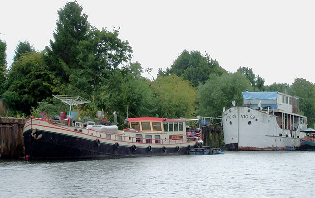
Stourport-on-Severn is a town located in the county of Worcestershire, England. It lies on the banks of the River Severn and is approximately 17 miles north of the city of Worcester. With a population of around 20,000, Stourport-on-Severn is known for its historic significance as a canal town.

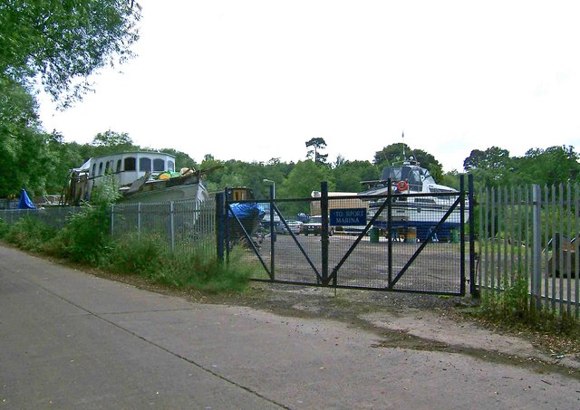
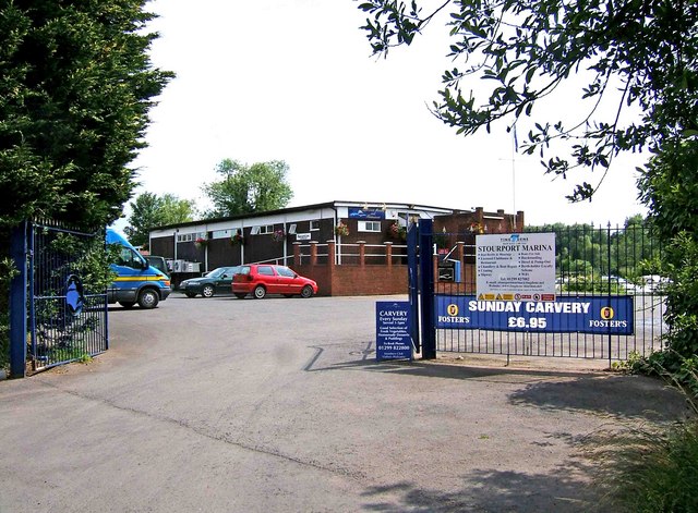
The town was founded in 1770 by James Brindley, who was instrumental in the construction of the Staffordshire and Worcestershire Canal. Stourport quickly grew as a major inland port, connecting the Midlands with the River Severn and providing a vital transport link for goods such as coal, iron, and timber. Today, the town's canal system is still a prominent feature, with the Stourport Basins serving as a marina for boating enthusiasts.

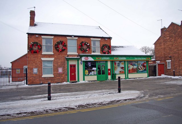
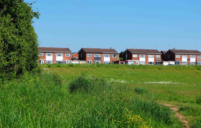
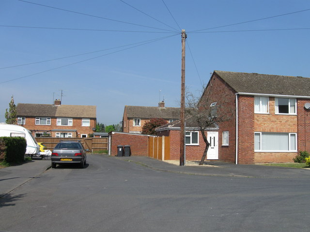
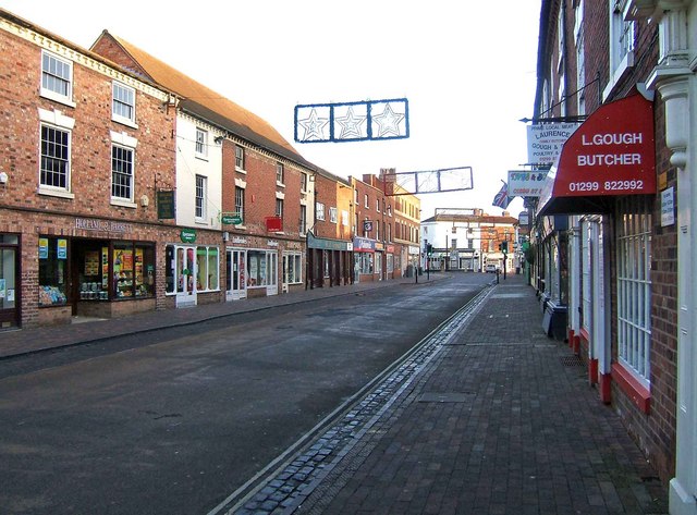
Stourport-on-Severn offers a range of attractions and amenities for both residents and visitors. The town center boasts a variety of shops, restaurants, and pubs, catering to different tastes and preferences. The Riverside Meadows provide a picturesque setting for leisurely walks along the river, while the nearby Hartlebury Common offers opportunities for outdoor activities such as hiking and cycling.

Historical landmarks in Stourport-on-Severn include the Clock Warehouse, which dates back to the 18th century and now houses a museum showcasing the town's history. The town also hosts various events throughout the year, including the Stourport Regatta, attracting participants and spectators from all over the region.

Overall, Stourport-on-Severn is a charming town with a rich heritage, offering a blend of history, natural beauty, and modern amenities. It continues to be a popular destination for those seeking a relaxing break or a glimpse into the region's industrial past.

If you have any feedback on the listing, please let us know in the comments section below.

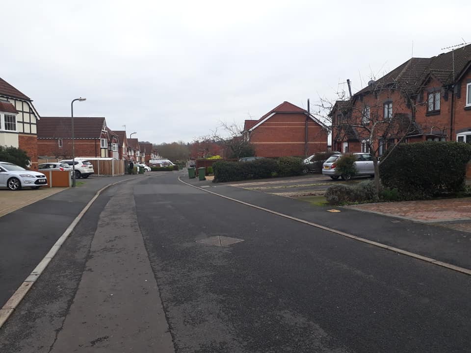
Stourport-on-Severn Images

Images are sourced within 2km of 52.340445/-2.278175 or Grid Reference SO8171. Thanks to Geograph Open Source API. All images are credited.

Entrance to Stourport Marina, Nelson Road, Stourport-on-Severn This is one of the entrances to the large Stourport Marina. The Marina is adjacent to and connected to the River Severn.
Entrance to Stourport Marina, Nelson Road, Stourport-on-Severn
This is one of the entrances to the large Stourport Marina. The Marina is adjacent to and connected to the River Severn.
Nelson Road, Stourport-on-Severn This is part of Nelson Road. On the left, behind the metal railings, is Stourport Marina. <a href="https://www.geograph.org.uk/photo/1373705">SO8169 : Entrance to Stourport Marina, Nelson Road, Stourport-on-Severn</a>. Apart from giving access to the marina, Nelson Road serves as one of the main roads through a dreary industrial estate, near the River Severn, and tucked well away from the main part of the town. There is little point in coming down here unless you have specific business with one of the firms based on the estate.
Nelson Road, Stourport-on-Severn
This is part of Nelson Road. On the left, behind the metal railings, is Stourport Marina. SO8169 : Entrance to Stourport Marina, Nelson Road, Stourport-on-Severn. Apart from giving access to the marina, Nelson Road serves as one of the main roads through a dreary industrial estate, near the River Severn, and tucked well away from the main part of the town. There is little point in coming down here unless you have specific business with one of the firms based on the estate.
Start of private road to Lincomb Lock on the River Severn At the end of Nelson Road, on the Sandy Lane Industrial Estate, this private road commences and gives authorised vehicles access to Lincomb Lock. The lock is the highest on the River Severn; the official head of navigation being just upstream of Stourport Bridge.
Start of private road to Lincomb Lock on the River Severn
At the end of Nelson Road, on the Sandy Lane Industrial Estate, this private road commences and gives authorised vehicles access to Lincomb Lock. The lock is the highest on the River Severn; the official head of navigation being just upstream of Stourport Bridge.
Urban fringe seen from Nelson Road, Stourport-on-Severn The industrial structures are on the very edge of Sandy Lane Industrial Estate. Viewed from across the field adjacent to part of Nelson Road.
Urban fringe seen from Nelson Road, Stourport-on-Severn
The industrial structures are on the very edge of Sandy Lane Industrial Estate. Viewed from across the field adjacent to part of Nelson Road.
Industrial buildings in Nelson Road, Stourport-on-Severn These buildings are in Nelson Road, which is part of the Sandy Lane Industrial Estate. This is one of the parts of Stourport that tourists don't normally visit.
Industrial buildings in Nelson Road, Stourport-on-Severn
These buildings are in Nelson Road, which is part of the Sandy Lane Industrial Estate. This is one of the parts of Stourport that tourists don't normally visit.
Stourport Marina Clubhouse, Nelson Road, Stourport-on-Severn The Marina's Clubhouse and restaurant is open to visitors as well as members, and is licensed. The signs proclaim the lunchtime Sunday Carvery, but you would have to know this place exists, as "passing trade" would be virtually non-existent. These premises are right at the far end of the Sandy Lane Industrial Estate. Another entrance to the marina itself is at: <a href="https://www.geograph.org.uk/photo/1373705">SO8169 : Entrance to Stourport Marina, Nelson Road, Stourport-on-Severn</a>.
Stourport Marina Clubhouse, Nelson Road, Stourport-on-Severn
The Marina's Clubhouse and restaurant is open to visitors as well as members, and is licensed. The signs proclaim the lunchtime Sunday Carvery, but you would have to know this place exists, as "passing trade" would be virtually non-existent. These premises are right at the far end of the Sandy Lane Industrial Estate. Another entrance to the marina itself is at: SO8169 : Entrance to Stourport Marina, Nelson Road, Stourport-on-Severn.
Footbridge over entrance to Severn Side Marina on the River Severn
Londis Store & Areley Kings Post Office, 63 Areley Common, Areley Kings, Stourport-on-Severn Londis is the local convenience store for this area. It also includes the Areley Kings Post Office. This is one of the few post offices in the Stourport-on-Severn area to survive. In recent years the numbers have been savagely reduced by well over half.

Photographed on Boxing Day, with seasonal snow, the store was displaying four giant decorative holly wreaths on the outside.
Londis Store & Areley Kings Post Office, 63 Areley Common, Areley Kings, Stourport-on-Severn
Londis is the local convenience store for this area. It also includes the Areley Kings Post Office. This is one of the few post offices in the Stourport-on-Severn area to survive. In recent years the numbers have been savagely reduced by well over half. Photographed on Boxing Day, with seasonal snow, the store was displaying four giant decorative holly wreaths on the outside.
Moored boats south-east of Stourport, Worcestershire These are on the River Severn near Stourport Marina. The large white vessel is a historic "Victualling Inshore Craft", steam powered and  built circa 1946 similar to the old Clyde Puffers, and now apparently used as a multistorey houseboat. It seems it has been here since before 1990.
See <span class="nowrap"><a title="http://www.tradboat2.co.uk/sourcepages/clydepuffers/clydepuffersource%20page.htm" rel="nofollow ugc noopener" href="http://www.tradboat2.co.uk/sourcepages/clydepuffers/clydepuffersource%20page.htm">Link</a><img style="margin-left:2px;" alt="External link" title="External link - shift click to open in new window" src="https://s1.geograph.org.uk/img/external.png" width="10" height="10"/></span>

The foreground cruise boat is called Eva May, and I have found out nothing about it.
Moored boats south-east of Stourport, Worcestershire
These are on the River Severn near Stourport Marina. The large white vessel is a historic "Victualling Inshore Craft", steam powered and built circa 1946 similar to the old Clyde Puffers, and now apparently used as a multistorey houseboat. It seems it has been here since before 1990. See LinkExternal link The foreground cruise boat is called Eva May, and I have found out nothing about it.
Houseboat south-east of Stourport, Worcestershire These boats are on moored on the River Severn near Stourport Marina. The large white vessel is a historic "Victualling Inshore Craft", steam powered and  built circa 1946 similar to the old Clyde Puffers, and now apparently used as a three storey houseboat. It seems it has been here since before 1990. See <span class="nowrap"><a title="http://www.tradboat2.co.uk/sourcepages/clydepuffers/clydepuffersource%20page.htm" rel="nofollow ugc noopener" href="http://www.tradboat2.co.uk/sourcepages/clydepuffers/clydepuffersource%20page.htm">Link</a><img style="margin-left:2px;" alt="External link" title="External link - shift click to open in new window" src="https://s1.geograph.org.uk/img/external.png" width="10" height="10"/></span>

Interesting history from the defunct Stourbridge Yacht Club website:

Quote: An "Old Puffer" Victual's Inshore Coaster number 99, originally a world War 2 supply ship from Scotland she was sailed in the 70's south, around the coast and up the River Severn, where she moored at Stourport at the parade. There she was converted into a Restaurant for a short while, but due to a strange fire that broke out in three different places at the same time, soon fall into disuse. She was sold off soon after the fire and moved to its present mooring just south of Stourport by Stourport Marina. She now sits on the River bed only re-floating when the River is in flood. She is now not able to negotiate Lincomb lock due to the hull expanding with the heat from the fire, now being too wide to enter the lock chamber.
Houseboat south-east of Stourport, Worcestershire
These boats are on moored on the River Severn near Stourport Marina. The large white vessel is a historic "Victualling Inshore Craft", steam powered and built circa 1946 similar to the old Clyde Puffers, and now apparently used as a three storey houseboat. It seems it has been here since before 1990. See LinkExternal link Interesting history from the defunct Stourbridge Yacht Club website: Quote: An "Old Puffer" Victual's Inshore Coaster number 99, originally a world War 2 supply ship from Scotland she was sailed in the 70's south, around the coast and up the River Severn, where she moored at Stourport at the parade. There she was converted into a Restaurant for a short while, but due to a strange fire that broke out in three different places at the same time, soon fall into disuse. She was sold off soon after the fire and moved to its present mooring just south of Stourport by Stourport Marina. She now sits on the River bed only re-floating when the River is in flood. She is now not able to negotiate Lincomb lock due to the hull expanding with the heat from the fire, now being too wide to enter the lock chamber.
River cliff  south-east of Stourport, Worcestershire The area including this exposure of Permo-Triassic sandstone here by the River Severn is marked on maps as Redstone Rock.

The Virtual-Tourist website includes this information:
"At this place was a famous hermitage, cut out of the sandstone rock, where in the 16th century, Bishop Latimer at Hartlebury, only half-a-mile away, described it as ‘able to lodge 500 men and ready to lodge thieves as true men. I would not have hermits master of such dens’. For centuries before that, the hermits were keepers of the (nearby) ferry and, among them, in the 12th century, so the legend goes, lived Layamon, the famous monk who was author of ”A Chronicle of British History”. <span class="nowrap"><a title="http://www.virtualtourist.com/travel/Europe/United_Kingdom/England/Worcestershire/Stourport-304787/Things_To_Do-Stourport-TG-C-1.html" rel="nofollow ugc noopener" href="http://www.virtualtourist.com/travel/Europe/United_Kingdom/England/Worcestershire/Stourport-304787/Things_To_Do-Stourport-TG-C-1.html">Link</a><img style="margin-left:2px;" alt="External link" title="External link - shift click to open in new window" src="https://s1.geograph.org.uk/img/external.png" width="10" height="10"/></span>
River cliff south-east of Stourport, Worcestershire
The area including this exposure of Permo-Triassic sandstone here by the River Severn is marked on maps as Redstone Rock. The Virtual-Tourist website includes this information: "At this place was a famous hermitage, cut out of the sandstone rock, where in the 16th century, Bishop Latimer at Hartlebury, only half-a-mile away, described it as ‘able to lodge 500 men and ready to lodge thieves as true men. I would not have hermits master of such dens’. For centuries before that, the hermits were keepers of the (nearby) ferry and, among them, in the 12th century, so the legend goes, lived Layamon, the famous monk who was author of ”A Chronicle of British History”. LinkExternal link
Footpath through field at The Snipes, Areley Kings, Worcs This area is known locally as The Snipes. This footpath on the other side of the trees meets a public bridleway. Turning right and following the bridleway will eventually bring you out on Marlborough Drive. That road is the edge of the built-up area.
Footpath through field at The Snipes, Areley Kings, Worcs
This area is known locally as The Snipes. This footpath on the other side of the trees meets a public bridleway. Turning right and following the bridleway will eventually bring you out on Marlborough Drive. That road is the edge of the built-up area.
Looking from The Snipes towards Windsor Drive, Areley Kings, Worcs The houses in the distance are on Windsor Drive, which is the edge of the built-up area.
Looking from The Snipes towards Windsor Drive, Areley Kings, Worcs
The houses in the distance are on Windsor Drive, which is the edge of the built-up area.
St David's Close, Lickhill
Footbridge over the Gladder Brook at its confluence with the River Severn, near Stourport-on-Severn Around Stourport-on-Severm there are public footpaths on both sides of the River Severn. In this view across the river, a footbridge takes the footpath on the other side of the river across the Gladder Brook, at the point of its confluence with the River Severn. There was still a carpet of snow on the adjacent field. The name Gladder apparently comes from Anglo-Saxon and means clear.
Footbridge over the Gladder Brook at its confluence with the River Severn, near Stourport-on-Severn
Around Stourport-on-Severm there are public footpaths on both sides of the River Severn. In this view across the river, a footbridge takes the footpath on the other side of the river across the Gladder Brook, at the point of its confluence with the River Severn. There was still a carpet of snow on the adjacent field. The name Gladder apparently comes from Anglo-Saxon and means clear.
Gate on the Severn Way by Lickhill Manor Caravan Park, near Stourport-on-Severn The notice is really a reminder that the path here is still on Lickhill Manor Caravan Park property, as the preceding field, behind the camera position, is also their land. The River Severn is on the left, out of view.
Gate on the Severn Way by Lickhill Manor Caravan Park, near Stourport-on-Severn
The notice is really a reminder that the path here is still on Lickhill Manor Caravan Park property, as the preceding field, behind the camera position, is also their land. The River Severn is on the left, out of view.
Two log seats overlooking the River Severn, near Stourport-on-Severn There seems to have been some clearance here fairly recently. These two seats give an excellent view of the river, but unfortunately it was not a day for sitting around!
Two log seats overlooking the River Severn, near Stourport-on-Severn
There seems to have been some clearance here fairly recently. These two seats give an excellent view of the river, but unfortunately it was not a day for sitting around!
River Severn near Stourport-on-Severn River Severn downstream from Stourport-on-Severn.
River Severn near Stourport-on-Severn
River Severn downstream from Stourport-on-Severn.
Show me another place!

Stourport-on-Severn is located at Grid Ref: SO8171 (Lat: 52.340445, Lng: -2.278175)

Administrative County: Worcestershire

District: Wyre Forest

Police Authority: West Mercia

What 3 Words

///pardon.drag.shock. Near Stourport-on-Severn, Worcestershire

Related Wikis

Stourport-on-Severn

Stourport-on-Severn, often shortened to Stourport, is a town and civil parish in the Wyre Forest District of North Worcestershire, England, a few miles...

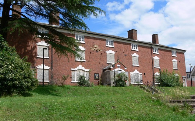
Tontine Buildings, Stourport

The Tontine Buildings is a former hotel in Stourport-on-Severn, Worcestershire, built in the late 18th century by the Staffordshire and Worcestershire...

Stourport Boat Club

Stourport Boat Club is a rowing club on the River Severn, based at the Riverside, Dunley Road, Stourport-on-Severn, Worcestershire. == History == The club...

Stourport-on-Severn railway station

Stourport-on-Severn railway station was the main station in Stourport-on-Severn, Worcestershire, England. The station, originally named 'Stourport', opened...

Stourport Swifts F.C.

Stourport Swifts Football Club are a football team from Stourport-on-Severn, and one of the oldest non-league teams in the country. The Swifts currently...

Droitwich Spa F.C.

Droitwich Spa Football Club is a football club representing the town of Droitwich Spa, Worcestershire, England. They are currently members of the Midland...

River Stour, Worcestershire

The Stour (, rhymes with "flour") is a river flowing through the counties of Worcestershire, the West Midlands and Staffordshire in the West Midlands region...

Areley Hall

Areley Hall is a Grade II listed country house near Areley Kings in Stourport-on-Severn, Worcestershire, England. It is not to be confused with nearby...

Nearby Amenities

Located within 500m of 52.340445,-2.278175
Stourport-on-Severn
Place: town
Population: 20292
Wikidata: Q2299073
Lat/Long: 52.339638/-2.2811646
Seamark Type: gate
Waterway: lock_gate
Lat/Long: 52.3379505/-2.2808467
Seamark Type: gate
Waterway: lock_gate
Lat/Long: 52.3375429/-2.2810759
Seamark Type: gate
Waterway: lock_gate
Lat/Long: 52.3372301/-2.2810477
Seamark Type: gate
Waterway: lock_gate
Lat/Long: 52.3370127/-2.2810229
Cafe
Blossom's Tea Rooms
Lat/Long: 52.3386638/-2.2781584
Waste Disposal
Note: For use by boaters
Operator: British Waterways
Waste: trash
Lat/Long: 52.3377983/-2.2782722
Sanitary Dump Station
Note: Pumpout facility for boats
Operator: British Waterways
Sanitary Dump Station Suction: yes
Lat/Long: 52.3377518/-2.2782395
Toilets
Access: customers
Note: For use by boaters only - British Waterways (BW) key required. Shower facilities also available.
Operator: British Waterways
Lat/Long: 52.3377231/-2.2782985
Access: private
Note: For use by boaters only - British Waterways (BW) key required
Self Service: yes
Shop: laundry
Lat/Long: 52.3377493/-2.2782985
Pub
Rising Sun
Real Ale: yes
Source: survey
Lat/Long: 52.3425819/-2.2772952
Poundstretcher
Brand: Poundstretcher
Brand Wikidata: Q7235675
Shop: variety_store
Source: survey
Website: https://www.poundstretcher.co.uk/stourport-852
Lat/Long: 52.3425678/-2.2777831
Fast Food
Rainbow Pizza House
Cuisine: pizza
Source: survey
Lat/Long: 52.3422516/-2.2777926
Fast Food
Spice Island
Cuisine: indian
Source: survey
Lat/Long: 52.3422663/-2.2779649
Pub
Worley's At The Swan
Outdoor Seating: yes
Source: survey
Lat/Long: 52.3406409/-2.278175
Bank
TSB
Brand: TSB
Brand Wikidata: Q7671560
Brand Wikipedia: en:TSB Bank (United Kingdom)
Lat/Long: 52.3403561/-2.2782352
Restaurant
Golden Country
Cuisine: chinese
Source: survey
Lat/Long: 52.340222/-2.2784698
Lawrence Gough
Shop: butcher
Source: survey
Lat/Long: 52.3399721/-2.2790135
Andy's Barber Shop
Shop: hairdresser
Source: survey
Wheelchair: limited
Lat/Long: 52.339283/-2.2804177
Restaurant
The Windlass Cafe and Restaurant
Source: survey
Lat/Long: 52.3367722/-2.2790503
Limekiln Chandlery
Shop: ship_chandler
Lat/Long: 52.3381169/-2.2779762
Post Box
Brand: Royal Mail
Brand Wikidata: Q638098
Operator: Royal Mail
Operator Wikidata: Q638098
Ref: DY13 64
Lat/Long: 52.338147/-2.2779417
Fast Food
Stourport Tandoori
Cuisine: indian
Source: survey
Lat/Long: 52.3391445/-2.2800077
Disused Amenity: bank
Old Name: HSBC Bank
Operational Status: closed
Lat/Long: 52.3396993/-2.2800935
Pub
The Wheatsheaf
Source: survey
Lat/Long: 52.339805/-2.279754
Bar
Liberty's Sports Bar
Lat/Long: 52.3429708/-2.2765011
Fast Food
China Chef
Cuisine: chinese
Lat/Long: 52.3422914/-2.2781545
Place Of Worship
Vernon Hall Stourport Free Church
Religion: christian
Source: survey
Lat/Long: 52.3418047/-2.2800687
Place Of Worship
Kingdom Hall of Jehovah's Witnesses
Denomination: jehovahs_witness
Religion: christian
Source: survey
Wheelchair: no
Lat/Long: 52.3410339/-2.279454
Fast Food
Stourport Kebab and Pizza House
Cuisine: kebab;pizza
Source: survey
Lat/Long: 52.3415486/-2.277645
Fast Food
Pat's Fish Bar
Cuisine: fish_and_chips
Source: survey
Lat/Long: 52.342147/-2.2774897
Mini Roundabout
Direction: clockwise
Lat/Long: 52.3392801/-2.2806345
Bus Stop
High Street
Bench: yes
Bin: yes
Bus: yes
Lit: yes
Naptan AtcoCode: 2000G045200
Naptan Bearing: NE
Naptan CommonName: High Street
Naptan Indicator: adj
Naptan NaptanCode: wocgagjd
Naptan PlusbusZoneRef: KDRMNST
Naptan Street: High Street
Naptan Verified: no
Public Transport: platform
Shelter: yes
Source: naptan_import
Tactile Paving: no
Lat/Long: 52.3395975/-2.2801213
Bus Stop
York Street
Bus: yes
Naptan AtcoCode: 2000G045201
Naptan Bearing: NW
Naptan CommonName: York Street
Naptan Indicator: top end of
Naptan NaptanCode: wocgagjg
Naptan PlusbusZoneRef: KDRMNST
Naptan Street: York Street
Naptan Verified: no
Public Transport: platform
Source: naptan_import
Lat/Long: 52.338979/-2.2798293
Bus Stop
Vernon Road
Bench: no
Bin: no
Bus: yes
Lit: no
Naptan AtcoCode: 2000G045392
Naptan Bearing: SE
Naptan CommonName: Vernon Road
Naptan Crossing: Vernon Road
Naptan Indicator: adj
Naptan NaptanCode: wocgagjw
Naptan PlusbusZoneRef: KDRMNST
Naptan Street: Lickhill Road
Naptan Verified: no
Public Transport: platform
Shelter: no
Source: naptan_import
Tactile Paving: no
Lat/Long: 52.3411803/-2.2804303
Bus Stop
Old Police Station
Bus: yes
Naptan AtcoCode: 2000G045617
Naptan Bearing: N
Naptan CommonName: Police Station
Naptan Indicator: adj
Naptan Landmark: Police Station
Naptan NaptanCode: wocgmjdw
Naptan PlusbusZoneRef: KDRMNST
Naptan Street: Bewdley Road
Naptan Verified: no
Public Transport: platform
Source: naptan_import
Lat/Long: 52.343281/-2.277878
Bus Stop
Bus: yes
Naptan AtcoCode: 2000G195898
Naptan Bearing: S
Naptan CommonName: Brindley Arms
Naptan Indicator: opp
Naptan Landmark: Brindley Arms
Naptan NaptanCode: wocdpjat
Naptan PlusbusZoneRef: KDRMNST
Naptan Street: Minster Road
Naptan Verified: no
Public Transport: platform
Source: naptan_import
Lat/Long: 52.3445319/-2.2756633
Bus Stop
Vernon Road(Stourport)-Lickhill Mid Schools
Bus: yes
Naptan AtcoCode: 2000G196000
Naptan Bearing: NE
Naptan CommonName: Vernon Road(Stourport)-Lickhill Mid Schools
Naptan Indicator: Adj
Naptan Landmark: Tan Lane School
Naptan NaptanCode: wocdpjda
Naptan PlusbusZoneRef: KDRMNST
Naptan Street: Vernon Road
Naptan Verified: no
Public Transport: platform
Source: naptan_import
Lat/Long: 52.3425841/-2.2798667
Bus Stop
Bus: yes
Naptan AtcoCode: 2000G201200
Naptan Bearing: N
Naptan Indicator: adj
Naptan NaptanCode: wocdgtgp
Naptan PlusbusZoneRef: KDRMNST
Naptan Street: Minster Road
Naptan Verified: no
Public Transport: platform
Source: naptan_import
Lat/Long: 52.3440654/-2.275901
Bus Stop
Vale Road
Bus: yes
Naptan AtcoCode: 2000G663013
Naptan Bearing: NE
Naptan CommonName: Vale Road
Naptan Indicator: adj
Naptan NaptanCode: wocgamtp
Naptan PlusbusZoneRef: KDRMNST
Naptan Street: Vale Road
Naptan Verified: no
Public Transport: platform
Source: naptan_import
Lat/Long: 52.3409138/-2.2767503
Bus Stop
Vernon Road
Bench: no
Bin: no
Bus: yes
Lit: no
Naptan AtcoCode: 2000G745392
Naptan Bearing: NW
Naptan BusStopType: CUS
Naptan CommonName: Vernon Road
Naptan Crossing: Vernon Road
Naptan Indicator: opp
Naptan NaptanCode: wocgpdad
Naptan PlusbusZoneRef: KDRMNST
Naptan Street: Lickhill Road
Naptan Verified: no
Public Transport: platform
Shelter: no
Source: naptan_import
Tactile Paving: no
Lat/Long: 52.3411063/-2.280583
Bus Stop
Vernon Road
Bus: yes
Naptan AtcoCode: 2000G745617
Naptan Bearing: N
Naptan CommonName: Vernon Road
Naptan Crossing: Vernon Road
Naptan Indicator: adj
Naptan NaptanCode: wocgpdap
Naptan PlusbusZoneRef: KDRMNST
Naptan Street: Bewdley Road
Naptan Verified: no
Public Transport: platform
Source: naptan_import
Lat/Long: 52.3438907/-2.2786126
Bus Stop
Mitton Street
Bus: yes
Naptan AtcoCode: 2000G763013
Naptan Bearing: S
Naptan CommonName: Mitton Street
Naptan Indicator: adj
Naptan NaptanCode: wocgpawm
Naptan PlusbusZoneRef: KDRMNST
Naptan Street: Mitton Street
Naptan Verified: no
Public Transport: platform
Source: naptan_import
Lat/Long: 52.3405612/-2.2737056
Traffic Signals
Crossing: traffic_signals
Traffic Signals: signal
Lat/Long: 52.3405029/-2.277005
Turning Circle
Lat/Long: 52.3445268/-2.2770229
Mini Roundabout
Lat/Long: 52.3428134/-2.2807504
Post Office
Stourport-on-Severn Post Office
Brand: Post Office
Brand Wikidata: Q1783168
Check Date: 2023-09-27
Operator: Co-op Food
Ref Pol Id: 10259
Wheelchair: yes
Lat/Long: 52.3420637/-2.2779559
Seamark Type: gate
Waterway: lock_gate
Lat/Long: 52.336578/-2.2799167
Seamark Type: gate
Waterway: lock_gate
Lat/Long: 52.3367714/-2.2801141
Seamark Type: gate
Waterway: lock_gate
Lat/Long: 52.3372275/-2.2812035
Seamark Type: gate
Waterway: lock_gate
Lat/Long: 52.3385669/-2.2779642
Seamark Type: gate
Waterway: lock_gate
Lat/Long: 52.3387866/-2.2778768
Stourport Tennis and Squash Club
Leisure: sports_centre
Lat/Long: 52.3431748/-2.2812233
York Street Boatyard (Limekiln)
Leisure: marina
Seamark Harbour Category: marina
Seamark Type: harbour
Lat/Long: 52.3382615/-2.2789632
Community Centre
Elizabeth Mills Day Centre
Lat/Long: 52.3403377/-2.2818153
Library
Stourport Library
Internet Access: yes
Lat/Long: 52.3394761/-2.2831361
Theatre
The Civic Theatre
Lat/Long: 52.3397268/-2.2834365
War Memorial
Historic: memorial
Lat/Long: 52.340781/-2.2772271
Pub
The Wharf
Lat/Long: 52.337419/-2.2797017
Cafe
Mimi's
Outdoor Seating: yes
Lat/Long: 52.3405788/-2.2782112
Worley's Strings
Shop: musical_instrument
Lat/Long: 52.3405213/-2.2783354
Traffic Signals
Traffic Signals: signal
Lat/Long: 52.3403392/-2.2784357
Traffic Signals
Button Operated: yes
Crossing: traffic_signals
Kerb: lowered
Tactile Paving: yes
Traffic Signals: signal
Traffic Signals Sound: yes
Traffic Signals Vibration: yes
Lat/Long: 52.3392022/-2.2803512
Noexit: yes
Lat/Long: 52.3391668/-2.2803842
Traffic Signals
Crossing: traffic_signals
Kerb: lowered
Tactile Paving: yes
Lat/Long: 52.3437159/-2.2756123
Traffic Signals
Crossing: traffic_signals
Kerb: lowered
Tactile Paving: yes
Lat/Long: 52.3435739/-2.2758752
Traffic Signals
Crossing: traffic_signals
Kerb: lowered
Tactile Paving: yes
Lat/Long: 52.3433947/-2.2759951
Swan Business Units
Office: yes
Lat/Long: 52.3406271/-2.278769
Seamark Type: gate
Waterway: lock_gate
Lat/Long: 52.3377493/-2.2809593
Seamark Type: gate
Waterway: lock_gate
Lat/Long: 52.336797/-2.2809996
Canal Heritage Room
Operator: Stourport Forward
Tourism: museum
Lat/Long: 52.3366821/-2.2791337
Drinking Water
Note: Water point for boat use only
Operator: British Waterways
Lat/Long: 52.337806/-2.2782651
Drinking Water
Lat/Long: 52.3377981/-2.2782422
Traffic Signals
Traffic Signals: signal
Lat/Long: 52.3435846/-2.2754512
Lombard Street Motors
Shop: car
Lat/Long: 52.3414547/-2.2780692
Traffic Signals
Traffic Signals: signal
Lat/Long: 52.3398584/-2.2749889
Traffic Signals
Crossing: traffic_signals
Traffic Signals: signal
Lat/Long: 52.3398727/-2.2752782
Traffic Signals
Crossing: traffic_signals
Traffic Signals: signal
Lat/Long: 52.3398375/-2.2753709
Traffic Signals
Crossing: traffic_signals
Traffic Signals: signal
Lat/Long: 52.3397877/-2.275215
Bench
Backrest: no
Lat/Long: 52.3365201/-2.2801083
Bench
Backrest: yes
Lat/Long: 52.3363062/-2.2794821
Bench
Backrest: no
Lat/Long: 52.3369331/-2.279816
Bench
Backrest: no
Lat/Long: 52.3367807/-2.2794405
Bench
Backrest: yes
Lat/Long: 52.340398/-2.2774187
Bench
Backrest: yes
Lat/Long: 52.3402443/-2.2774281
Covered: no
Leisure: picnic_table
Lat/Long: 52.3377976/-2.2830507
Bench
Backrest: yes
Lat/Long: 52.3369546/-2.2818893
Bench
Backrest: yes
Lat/Long: 52.3368458/-2.2815514
Bench
Backrest: no
Lat/Long: 52.3390664/-2.2776297
Bench
Backrest: yes
Lat/Long: 52.3400787/-2.2785191
Bench
Backrest: yes
Check Date: 2023-05-12
Lat/Long: 52.3396084/-2.2801874
Seamark Type: gate
Waterway: lock_gate
Lat/Long: 52.3373358/-2.2800631
Seamark Type: gate
Waterway: lock_gate
Lat/Long: 52.3371199/-2.2801663
Sharmic Engineering
Man Made: works
Lat/Long: 52.3413686/-2.2717165
Bench
Backrest: yes
Lat/Long: 52.3434385/-2.2752686
Bench
Backrest: yes
Lat/Long: 52.3435074/-2.2752655
Bench
Backrest: yes
Lat/Long: 52.3426405/-2.2749333
Drinking Water
Lat/Long: 52.3436548/-2.2733682
Bench
Backrest: yes
Lat/Long: 52.3435975/-2.2736069
Bench
Backrest: yes
Lat/Long: 52.3435425/-2.2735131
Information: map
Tourism: information
Lat/Long: 52.3366714/-2.281126
Information: map
Tourism: information
Lat/Long: 52.3377055/-2.280888
Information: map
Tourism: information
Lat/Long: 52.3375613/-2.2784411
Leisure: miniature_golf
Lat/Long: 52.3380064/-2.2839118
Miniature Railway
Attraction: train
Lat/Long: 52.3385799/-2.2836466
Putting Green
Attraction: putting_green
Lat/Long: 52.3379506/-2.2835286
Go-Karts
Attraction: go_carts
Lat/Long: 52.3383718/-2.2840538
Crazy Golf
Attraction: crazy_golf
Lat/Long: 52.3378506/-2.2839358
Leisure: picnic_table
Lat/Long: 52.3392239/-2.2848681
Leisure: picnic_table
Lat/Long: 52.3392214/-2.2851564
Climbing Frame
Tourism: theme_park
Lat/Long: 52.3390985/-2.2851015
Bench
Backrest: no
Lat/Long: 52.33951/-2.2775701
Bench
Backrest: yes
Lat/Long: 52.3406772/-2.2772033
Bench
Backrest: yes
Lat/Long: 52.3407063/-2.2771148
Bench
Backrest: yes
Lat/Long: 52.3407755/-2.2769243
Bench
Backrest: yes
Lat/Long: 52.3400098/-2.2773354
Bench
Backrest: yes
Lat/Long: 52.3397492/-2.2774333
Bench
Backrest: yes
Lat/Long: 52.33968/-2.2799592
Bench
Backrest: yes
Lat/Long: 52.3396599/-2.2799973
Check Date: 2023-01-06
Information: map
Tourism: information
Lat/Long: 52.3395523/-2.2802088
Information: map
Map Type: information
Tourism: information
Lat/Long: 52.3392662/-2.2807605
Bench
Backrest: yes
Lat/Long: 52.3368901/-2.27833
Bench
Backrest: yes
Lat/Long: 52.3369311/-2.2784346
Bench
Backrest: yes
Lat/Long: 52.337553/-2.2784829
Courthouse
Coroners Court
Lat/Long: 52.3393931/-2.2830356
Man Made: mast
Tower Construction: freestanding
Tower Type: communication
Lat/Long: 52.3403941/-2.2718764
Barrier: cycle_barrier
Bicycle: dismount
Foot: yes
Horse: no
Motor Vehicle: no
Lat/Long: 52.3409964/-2.2844511
Crossing
Crossing: marked
Lat/Long: 52.3434299/-2.2766009
Crossing
Crossing: marked
Lat/Long: 52.3388813/-2.2739191
Mini Roundabout
Lat/Long: 52.3378211/-2.2745951
Traffic Signals
Button Operated: yes
Crossing: traffic_signals
Kerb: lowered
Tactile Paving: yes
Traffic Signals: signal
Traffic Signals Sound: yes
Traffic Signals Vibration: yes
Lat/Long: 52.3379118/-2.2750109
Barrier: cycle_barrier
Lat/Long: 52.3386054/-2.2778644
Traffic Signals
Traffic Signals: signal
Lat/Long: 52.3388456/-2.2813432
Waterway: boatyard
Lat/Long: 52.3380614/-2.2812254
Cafe
Oliver's Coffee (Boat)
Outdoor Seating: yes
Lat/Long: 52.3369478/-2.2805761
Leisure: pitch
Lit: no
Sport: skateboard
Lat/Long: 52.3376845/-2.2830889
Cafe
Passage Cafe
Outdoor Seating: yes
Lat/Long: 52.3402367/-2.2780693
Cafe
Little Big Town Kindergarten
Lat/Long: 52.3392901/-2.2809249
Painters Solicitors
Office: lawyer
Lat/Long: 52.3394123/-2.2814076
Restaurant
Hope & Anchor
Lat/Long: 52.3394467/-2.2809042
Fast Food
Jayne's Plaice
Lat/Long: 52.3387734/-2.2816395
Mantons Jewellers
Shop: jewelry
Lat/Long: 52.3400564/-2.2788494
Bentley's Gifts
Shop: gift
Lat/Long: 52.3398663/-2.2792061
Mooch Gifts
Shop: gift
Lat/Long: 52.3405203/-2.2778733
Drinkers World
Shop: alcohol
Lat/Long: 52.3389742/-2.2809458
Leisure: picnic_table
Lat/Long: 52.33862/-2.277998
Mitton
Is In: Worcestershire
Place: suburb
Lat/Long: 52.3384609/-2.2766833
Fast Food
La Villa
Lat/Long: 52.3386916/-2.2817341
Post Box
Post Box Type: pillar
Ref: DY13 630
Lat/Long: 52.3390974/-2.2749296
Information: board
Tourism: information
Lat/Long: 52.3403364/-2.2773125
Traffic Signals
Crossing: traffic_signals
Traffic Signals: signal
Lat/Long: 52.3403892/-2.2770794
Traffic Signals
Crossing: traffic_signals
Traffic Signals: signal
Lat/Long: 52.3404389/-2.2768038
Crossing
Crossing: marked
Crossing Markings: yes
Lat/Long: 52.3381797/-2.2745113
Crossing
Crossing: marked
Crossing Markings: yes
Lat/Long: 52.3380883/-2.2744171
Crossing
Crossing: marked
Crossing Markings: yes
Tactile Paving: yes
Lat/Long: 52.3388494/-2.2744353
Boys School Plaque
Historic: memorial
Material: stone
Memorial: plaque
Lat/Long: 52.3436067/-2.278028
Traffic Signals
Crossing: traffic_signals
Kerb: lowered
Tactile Paving: yes
Lat/Long: 52.3434257/-2.2757086
Crossing
Crossing: marked
Lat/Long: 52.3403503/-2.2769534
Crossing
Crossing: marked
Crossing Markings: yes
Tactile Paving: yes
Lat/Long: 52.3380795/-2.2745649
Traffic Signals
Traffic Signals: signal
Lat/Long: 52.3377687/-2.2762325
Baldwin House
Email: enquiries@baldwinhouse.co.uk
Guest House: bed_and_breakfast
Internet Access: yes
Internet Access Fee: customers
Operator: Dave Percival
Payment Cash: yes
Payment Credit Cards: yes
Payment Debit Cards: yes
Phone: +44 1299 877 221
Smoking: no
Tourism: guest_house
Website: https://www.baldwinhouse.co.uk/
Lat/Long: 52.3380142/-2.2769931
Thompson & Parkes
Addr Housenumber: 106
Addr Postcode: DY13 8AB
Addr Street: Minster Road
Opening Hours: Mo-Fr 07:45-17:30; Sa 08:00-18:00; Su 10:00-16:00
Phone: +44 1299 534545
Shop: doityourself
Lat/Long: 52.343937/-2.2751449
Dentist
Mitton Dental Surgery
Addr Housenumber: 26a-26b
Addr Street: Mitton Gardens
Healthcare: dentist
Lat/Long: 52.3410809/-2.2756207
Harper Envirosafe Ltd
Addr City: Stourport-on-Severn
Addr Housename: Anglo House
Addr Postcode: DY13 9AW
Addr Street: Worcester Road
Consulting: Asbestos_Surveys;Asbestos_Management;Asbestos_Removal;CDM_Advisors;Health_&_Safety_Consultants
Office: consulting
Lat/Long: 52.3408824/-2.2732676
Barrier: lift_gate
Lat/Long: 52.3386708/-2.2790698
Bicycle Parking
Bicycle Parking: stands
Capacity: 10
Covered: yes
Fee: no
Lat/Long: 52.3394746/-2.2829146
Fast Food
Greggs
Addr Country: GB
Addr Housename: Stourport Service Station
Addr Postcode: DY13 8YJ
Addr Street: Vale Road
Brand: Greggs
Brand Wikidata: Q3403981
Brand Wikipedia: en:Greggs
Contact Website: https://www.greggs.co.uk/shop-finder?shop-code=5574
Cuisine: sandwich;bakery
Fhrs Id: 1298434
Takeaway: yes
Lat/Long: 52.3418439/-2.2768856
Covered: no
Leisure: picnic_table
Lat/Long: 52.3380891/-2.2826591
Covered: no
Leisure: picnic_table
Lat/Long: 52.3380826/-2.2828268
Covered: no
Leisure: picnic_table
Lat/Long: 52.3379621/-2.2826162
Covered: no
Leisure: picnic_table
Lat/Long: 52.3377417/-2.2828898
Leisure: picnic_table
Lat/Long: 52.3392584/-2.2850101
Atm
Fee: no
Lat/Long: 52.3410643/-2.2727738
Bench
Backrest: yes
Lat/Long: 52.3400455/-2.2784221
ABK Security Services Ltd.
Office: yes
Phone: +44 1562747207
Lat/Long: 52.3432315/-2.2776569
Police
Lat/Long: 52.3395979/-2.283565
Turning Circle
Source: Bing
Lat/Long: 52.3439443/-2.2780001
Flamingo Amusements
Leisure: amusement_arcade
Lat/Long: 52.3390239/-2.2812969
Rendezvous Amusements
Leisure: amusement_arcade
Lat/Long: 52.33886/-2.2815356
Cafe
Lat/Long: 52.3389288/-2.2814283
The Co-operative Funeralcare
Brand: The Co-operative Funeralcare
Brand Wikidata: Q7726521
Operator: Central England Co-operative
Operator Wikidata: Q16986583
Shop: funeral_directors
Website: https://stores.centralengland.coop/stourport-on-severn/6-bridge-st
Lat/Long: 52.3387887/-2.2812018
Shelter
Shelter Type: public_transport
Lat/Long: 52.3396175/-2.2801255
Social Facility
William Bullock Close
Social Facility: nursing_home
Social Facility For: senior
Lat/Long: 52.3403414/-2.2824835
Social Facility
Sion Gardens
Social Facility: nursing_home
Social Facility For: senior
Lat/Long: 52.3401626/-2.2809755
Leisure: outdoor_seating
Lat/Long: 52.3405483/-2.2782349
Parking
Lat/Long: 52.3398864/-2.2790294
Leisure: bowling_alley
Lat/Long: 52.3372289/-2.2816817
Man Made: crane
Lat/Long: 52.3374282/-2.2785888
Folliott's Manor
Place: neighbourhood
Lat/Long: 52.3372819/-2.2750508
Bus Stop
Tesco
Bus: yes
Public Transport: platform
Lat/Long: 52.3379956/-2.2753468
Historic: monument
Monument: statue
Lat/Long: 52.3407846/-2.2763687
Cafe
School Gardens Bistro
Outdoor Seating: yes
Lat/Long: 52.3427198/-2.2785948
Leisure: outdoor_seating
Lat/Long: 52.3426423/-2.2784378
School Gardens Retirement Living
Landuse: residential
Residential: apartments
Lat/Long: 52.3424916/-2.2792108
Post Box
Mapillary: 492798295404995
Operator: Royal Mail
Operator Wikidata: Q638098
Post Box Mounting: wooden_post
Post Box Type: lamp
Lat/Long: 52.3433577/-2.2755173
Barrier: bollard
Bollard: fixed
Material: metal
Lat/Long: 52.3378683/-2.2759368
Barrier: bollard
Bollard: fixed
Material: metal
Lat/Long: 52.337822/-2.2757913
The data included in this document is from www.openstreetmap.org. The data is made available under ODbL.

Have you been to Stourport-on-Severn?

Leave your review of Stourport-on-Severn below (or comments, questions and feedback).