Stone

Civil Parish in Kent Dartford

England

Stone

Looking down the line from Stone Crossing footbridge Looking at the railway line heading towards Greenhithe. The path heads down to the platform for wheelchairs and prams.
Looking down the line from Stone Crossing footbridge Credit: David Anstiss

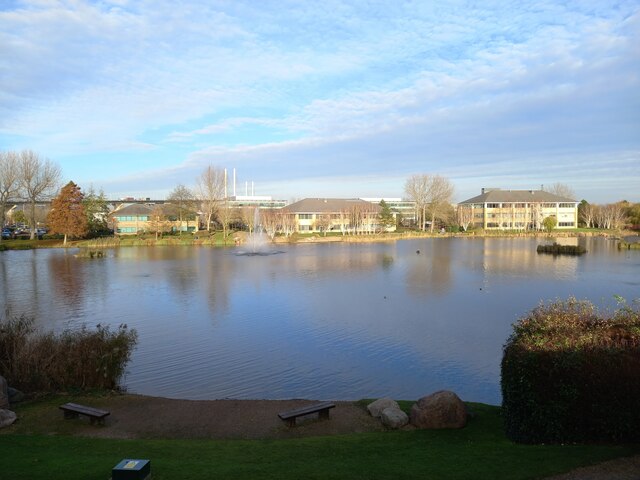
Stone, Kent is a civil parish located in the district of Dartford, in the county of Kent, England. It covers an area of approximately 3.5 square miles and is situated about 4 miles east of Dartford town center. The parish is bordered by the River Thames to the north, providing beautiful scenic views and recreational opportunities.

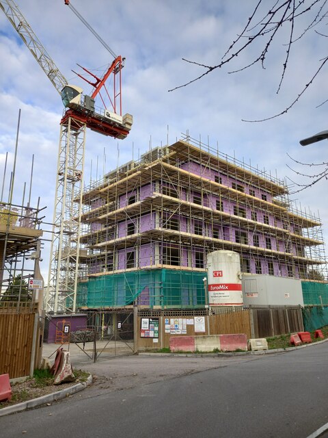
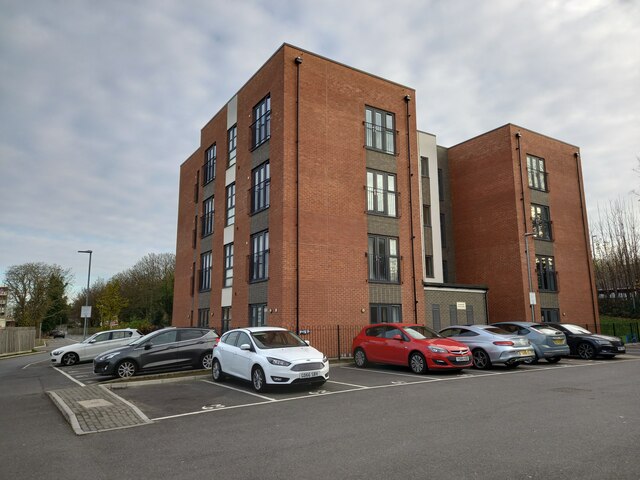
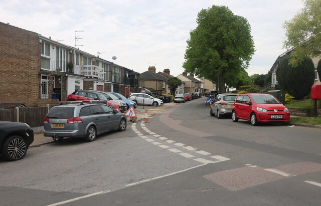
Stone has a population of around 3,500 people, making it a small but vibrant community. The area has a rich history, with evidence of human habitation dating back to the Roman period. Today, it is primarily a residential area with a mix of housing styles, including modern developments and period properties.

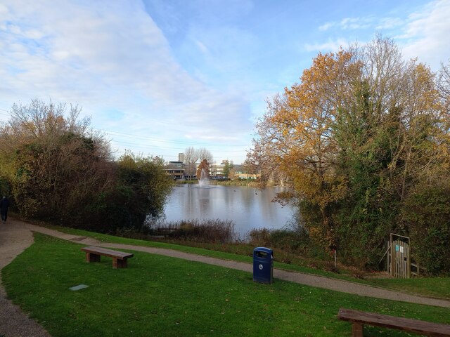
The parish has a range of amenities to cater to the needs of its residents. There are several local shops, including convenience stores, a post office, and a pharmacy, providing essential services. For leisure and recreation, Stone Recreation Ground offers green spaces, a children's playground, and sports facilities, including a football pitch and tennis courts.

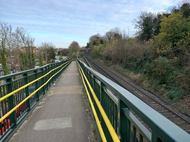
Stone is well-connected to other parts of the county and beyond. The A2 road runs through the parish, connecting it to Dartford and Gravesend. The nearby Stone Crossing railway station provides regular train services to London and other major cities.

Overall, Stone, Kent is a picturesque and welcoming civil parish, offering a peaceful and convenient place to live, with a strong sense of community and easy access to amenities and transportation links.

If you have any feedback on the listing, please let us know in the comments section below.
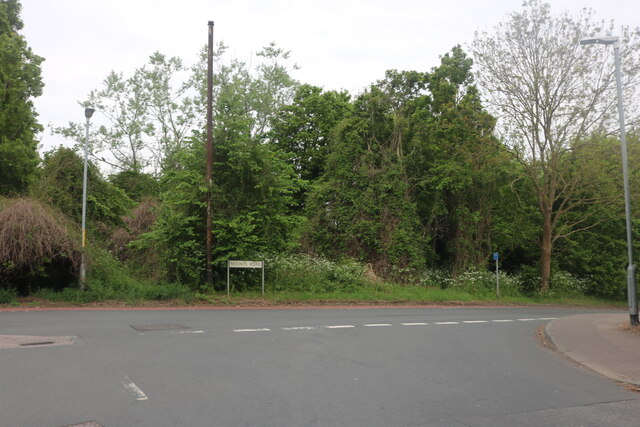
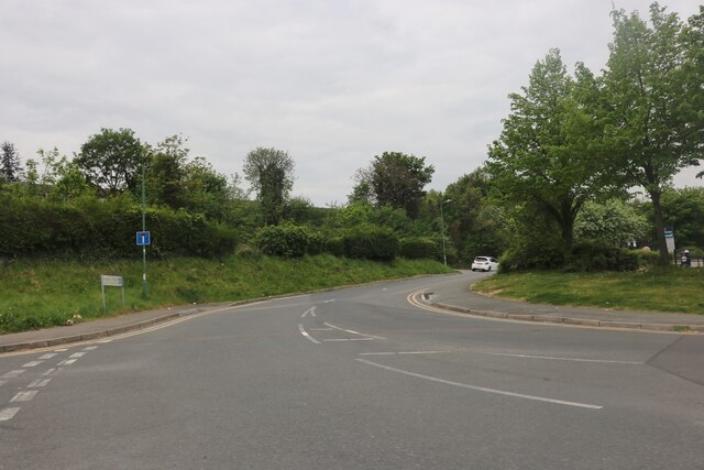
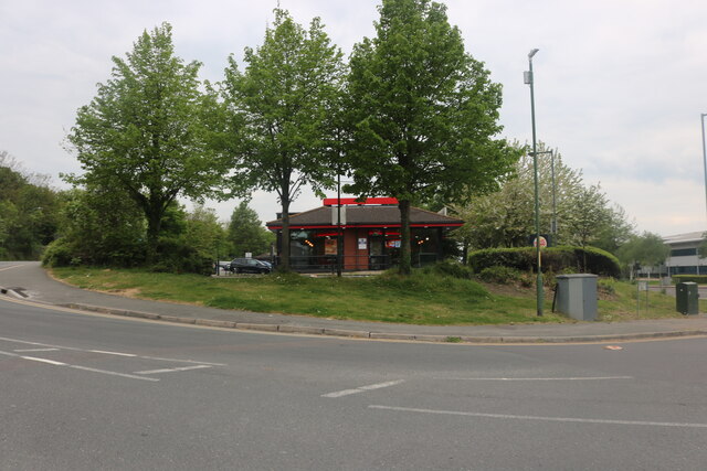
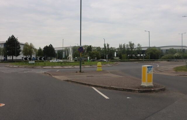
Stone Images

Images are sourced within 2km of 51.448215/0.260999 or Grid Reference TQ5774. Thanks to Geograph Open Source API. All images are credited.

Looking down the line from Stone Crossing footbridge Looking at the railway line heading towards Greenhithe. The path heads down to the platform for wheelchairs and prams.
Looking down the line from Stone Crossing footbridge
Looking at the railway line heading towards Greenhithe. The path heads down to the platform for wheelchairs and prams.
Construction of Braeburn Heights This is one of two large blocks of housing being built on Barley Close.
Construction of Braeburn Heights
This is one of two large blocks of housing being built on Barley Close.
Housing on Barley Close This block of flats is beside a road running parallel to the Gravesend to Dartford railway line (beyond the trees on the right).

Barley Close (on the left) is only used to access various block of housing (behind the viewer). The road leads forwards to Charles Street and then Crossways Boulevard (the A206).
Housing on Barley Close
This block of flats is beside a road running parallel to the Gravesend to Dartford railway line (beyond the trees on the right). Barley Close (on the left) is only used to access various block of housing (behind the viewer). The road leads forwards to Charles Street and then Crossways Boulevard (the A206).
View across Cotton Lake Looking from Galleon Boulevard. Various offices have their buildings in the Crossways Business Park.

The footpath in the foreground leads around the lake.
View across Cotton Lake
Looking from Galleon Boulevard. Various offices have their buildings in the Crossways Business Park. The footpath in the foreground leads around the lake.
Mariner House, Moat Housing Headquarters building within the Crossways Business Park.
On Galleon Boulevard.
Mariner House, Moat Housing
Headquarters building within the Crossways Business Park. On Galleon Boulevard.
Cotton Lake and fountain Looking across Cotton Lake from office carparks on Galleon Boulevard.
More offices that are part of Crossways Business Park are seen across the lake.

In the background is the Queen Elizabeth Bridge heading over the River Thames towards Essex.
Cotton Lake and fountain
Looking across Cotton Lake from office carparks on Galleon Boulevard. More offices that are part of Crossways Business Park are seen across the lake. In the background is the Queen Elizabeth Bridge heading over the River Thames towards Essex.
The Wharf pub sign Shepherd Neame run pub sign beside Galleons Boulevard in the Crossways Business Park.
The Wharf pub sign
Shepherd Neame run pub sign beside Galleons Boulevard in the Crossways Business Park.
Dartford West Tunnel Entrance
Mounts Road at the end of Knockhall Road
Mounts Road, Greenhithe
Charles Street, Stone It's closed to the residential part half way along.
Charles Street, Stone
It's closed to the residential part half way along.
Burger King on Charles Street, Stone
Roundabout on Crossways Boulevard, Stone From Charles Street
Roundabout on Crossways Boulevard, Stone
From Charles Street
Tesla dealership on Crossways Boulevard, Stone Seen from Anchor Boulevard
Tesla dealership on Crossways Boulevard, Stone
Seen from Anchor Boulevard
Anchor Boulevard, Stone This is clearly not a public access road.
Anchor Boulevard, Stone
This is clearly not a public access road.
Roundabout on Crossways Boulevard, Stone The Dartford Bridge approach is opposite
Roundabout on Crossways Boulevard, Stone
The Dartford Bridge approach is opposite
Eagles Road, Greenhithe
London Road at the junction of The Avenue
Show me another place!

Stone is located at Grid Ref: TQ5774 (Lat: 51.448215, Lng: 0.260999)

Administrative County: Kent

District: Dartford

Police Authority: Kent

What 3 Words

///tummy.soup.rental. Near Stone, Kent

Nearby Locations

Stone Horns Cross Stone

Related Wikis

Stone Crossing railway station

Stone Crossing railway station is located on the North Kent line, north-east of the village of Stone and east of Dartford. It was originally named Stone...

Stone, Kent

Stone is a village in the Borough of Dartford in Kent, England. It is located 2.5 miles east of Dartford. == History == Iron Age pottery and artefacts...

Thames Europort

Thames Europort is a roll-on/roll-off port facility at Stone in Kent, England, close to Dartford. The facility is situated on the southern side of the...

Stone House Hospital

Stone House Hospital was a hospital and former mental illness treatment facility in Stone, near Dartford, Kent, in the United Kingdom. == History == Stone...

Bluewater (shopping centre)

Bluewater Shopping Centre (commonly referred to as Bluewater) is an out-of-town shopping centre in Stone (postally Greenhithe), Kent, England, just outside...

Greenhithe railway station

Greenhithe railway station (also known as Greenhithe for Bluewater) serves the village of Greenhithe in north Kent and Bluewater Shopping Centre. It is...
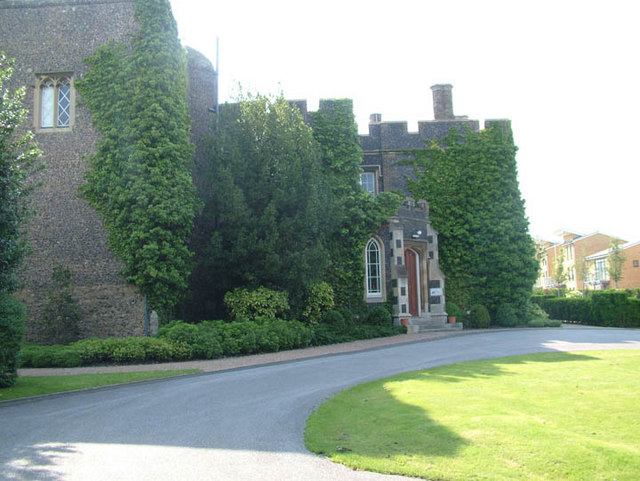
Stone Castle

Stone Castle is a castle at Stone, near Bluewater in Kent, England. It was built between 1135 and 1140 on the site where William the Conqueror signed a...

Fantaseas

Fantaseas was a chain of indoor waterparks situated in the United Kingdom that opened in the late 1980s, but due to various technical and financial difficulties...

Nearby Amenities

Located within 500m of 51.448215,0.260999
Traffic Signals
Traffic Signals: signal
Lat/Long: 51.4464889/0.264805
Nisa Local
Brand: Nisa Local
Brand Wikidata: Q16999069
Check Date: 2023-06-25
Contact Website: https://www.nisalocally.co.uk/stores/kent/greenhithe/229-london-rd
Opening Hours: Mo-Th 07:00-20:00; Fr,Sa 07:00-21:00; Su 10:00-17:00
Shop: convenience
Lat/Long: 51.4455599/0.2602452
Barrier: kissing_gate
Lat/Long: 51.4441014/0.2608797
Pharmacy
Stone Pharmacy
Addr City: Dartford
Addr Housenumber: 229
Addr Postcode: DA9 9DF
Addr Street: London Road
Alt Name: Nisa Local
Contact Website: https://www.stonepharmacy.co.uk/
Fhrs Id: 932202
Source Addr: FHRS Open Data
Lat/Long: 51.4454785/0.2603112
Post Box
Operator: Royal Mail
Operator Wikidata: Q638098
Ref: DA9 356
Lat/Long: 51.4455727/0.2601772
Restaurant
The British Raj
Check Date: 2023-06-25
Lat/Long: 51.4455348/0.2601293
Post Box
Operator: Royal Mail
Operator Wikidata: Q638098
Ref: DA9 99
Lat/Long: 51.4462731/0.2641417
Crossing
Crossing: traffic_signals
Crossing Ref: pelican
Lat/Long: 51.4464461/0.2645401
Parking
Fee: yes
Lat/Long: 51.4462807/0.2645312
Traffic Signals
Traffic Signals: signal
Lat/Long: 51.4464951/0.2649167
Saxon Park Play Area
Leisure: playground
Lat/Long: 51.4489841/0.2672443
Bicycle Parking
Capacity: 10
Lat/Long: 51.4472108/0.265115
Bicycle Parking
Capacity: 10
Lat/Long: 51.4472691/0.2649663
Bicycle Parking
Capacity: 10
Lat/Long: 51.4474951/0.2650232
Bicycle Parking
Capacity: 10
Lat/Long: 51.4475723/0.2648656
Post Box
Operator: Royal Mail
Operator Wikidata: Q638098
Ref: DA9 48
Lat/Long: 51.450421/0.2657579
Railway Disused: level_crossing
Lat/Long: 51.4514257/0.2643245
Addr Country: GB
Addr Street: Orchard Terrace
Lat/Long: 51.4509377/0.2614513
Bicycle Parking
Bicycle Parking: stands
Capacity: 6
Covered: no
Lat/Long: 51.4516582/0.2654414
Horns Cross
Place: locality
Source: npe
Lat/Long: 51.4467913/0.2639246
Bus Stop
Stone Crossing
Bus: yes
Naptan AtcoCode: 2400A009020A
Naptan Bearing: W
Naptan CommonName: Stone Crossing
Naptan Indicator: W-bound
Naptan Landmark: Charles Street
Naptan NaptanCode: kntajwmt
Naptan Street: Crossways Blvd
Naptan Verified: no
Public Transport: platform
Source: naptan_import
Lat/Long: 51.451983/0.2640919
Bus Stop
The Bull
Local Ref: adj
Naptan AtcoCode: 2400A018760A
Naptan Bearing: W
Naptan BusStopType: MKD
Naptan CommonName: The Bull
Naptan Indicator: adj
Naptan Landmark: Horns Cross
Naptan NaptanCode: kntatmwg
Naptan RevisionNumber: 1
Naptan Status: act
Naptan Street: London Road
Naptan Verified: no
Public Transport: platform
Ref: 58742
Shelter: yes
Source: naptan_import
Source Date: 2011-03-07
Lat/Long: 51.4462478/0.2630816
Bus Stop
Elm Road
Local Ref: opp
Naptan AtcoCode: 2400A018770A
Naptan Bearing: W
Naptan BusStopType: MKD
Naptan CommonName: Elm Road
Naptan Indicator: opp
Naptan Landmark: Elm Road
Naptan NaptanCode: kntatmwj
Naptan RevisionNumber: 2
Naptan Status: act
Naptan Street: London Road
Naptan Verified: no
Public Transport: platform
Ref: 50259
Shelter: yes
Source: naptan_import
Source Date: 2018-05-22
Lat/Long: 51.4455604/0.2596523
Bus Stop
Elm Road
Local Ref: adj
Naptan AtcoCode: 2400A018870A
Naptan Bearing: E
Naptan BusStopType: MKD
Naptan CommonName: Elm Road
Naptan Indicator: adj
Naptan Landmark: Elm Road
Naptan NaptanCode: kntatpaw
Naptan RevisionNumber: 2
Naptan Status: act
Naptan Street: London Road
Naptan Verified: no
Public Transport: platform
Ref: 48533
Shelter: yes
Source: naptan_import
Source Date: 2018-05-22
Lat/Long: 51.4457214/0.2599103
Bus Stop
The Bull
Local Ref: opp
Naptan AtcoCode: 2400A018880A
Naptan Bearing: E
Naptan BusStopType: MKD
Naptan CommonName: The Bull
Naptan Indicator: opp
Naptan Landmark: Horns Cross
Naptan NaptanCode: kntatpda
Naptan RevisionNumber: 1
Naptan Status: act
Naptan Street: London Road
Naptan Verified: no
Public Transport: platform
Ref: 71389
Shelter: yes
Source: naptan_import
Source Date: 2010-09-24
Lat/Long: 51.4464331/0.2636733
Bus Stop
Stone Crossing Railway Station
Bus: yes
Flag: no
Naptan AtcoCode: 2400A060770R
Naptan Bearing: N
Naptan BusStopType: CUS
Naptan CommonName: Stone Crossing Railway Station
Naptan Indicator: o/s
Naptan Landmark: O/S Stn Entrance
Naptan NaptanCode: kntgawpt
Naptan Street: Stone Cross Rd
Naptan Verified: no
Public Transport: platform
Source: naptan_import
Lat/Long: 51.451312/0.2643753
Railway Disused: level_crossing
Lat/Long: 51.4513937/0.2643277
Entrance: main
Lat/Long: 51.4516752/0.2654155
Speed Camera
Maxspeed: 40 mph
Lat/Long: 51.4468018/0.2673078
Crossing
Crossing: traffic_signals
Crossing Ref: pelican
Lat/Long: 51.4464837/0.2644539
Elm Road
Bus: yes
Public Transport: stop_position
Lat/Long: 51.4456303/0.2596221
Elm Road
Bus: yes
Public Transport: stop_position
Lat/Long: 51.4456805/0.2599481
The Bull
Bus: yes
Public Transport: stop_position
Lat/Long: 51.4462949/0.2630642
The Bull
Bus: yes
Public Transport: stop_position
Lat/Long: 51.4463767/0.2636909
Stone Crossing
Local Ref: 1
Public Transport: stop_position
Railway: stop
Ref: 1
Train: yes
Lat/Long: 51.4514236/0.2606114
Stone Crossing
Local Ref: 2
Public Transport: stop_position
Railway: stop
Ref: 2
Train: yes
Lat/Long: 51.4514252/0.2641023
Stone Crossing
Naptan AtcoCode: 9100STCR
Network: National Rail
Network Website: https://www.nationalrail.co.uk/stations/scg/
Network Wikidata: Q26334
Operator: Southeastern
Operator Website: https://www.southeasternrailway.co.uk/travel-information/more-travel-help/station-information/stations/stone-crossing
Operator Wikidata: Q1696490
Public Transport: station
Railway: station
Ref Crs: SCG
Source: NPE
Wikidata: Q3341228
Wikipedia: en:Stone Crossing railway station
Lat/Long: 51.4514164/0.2634425
Addr City: Greenhithe
Addr Housenumber: 16A-16C
Addr Postcode: DA9 9PX
Addr Street: Bishops Court
Addr Suburb: Stone
Entrance: main
Lat/Long: 51.4483385/0.2647613
Addr City: Greenhithe
Addr Housenumber: 13-15
Addr Postcode: DA9 9PX
Addr Street: Bishops Court
Addr Suburb: Stone
Entrance: main
Lat/Long: 51.4484503/0.2647486
Addr Housenumber: 4
Addr Postcode: DA9 9PS
Addr Street: Chalice Way
Addr Suburb: Stone
Entrance: main
Lat/Long: 51.4488798/0.2644395
Crossing
Crossing: traffic_signals
Crossing Island: yes
Tactile Paving: yes
Lat/Long: 51.4465196/0.2652257
Bench
Lat/Long: 51.446801/0.2649309
Bench
Lat/Long: 51.4466942/0.2651231
Waste Basket
Lat/Long: 51.4467068/0.2651035
Waste Basket
Lat/Long: 51.44679/0.2649492
Access: private
Addr City: Greenhithe
Addr Housenumber: 26-37
Addr Postcode: DA9 9UL
Addr Street: Dulcie Close
Entrance: yes
Lat/Long: 51.4472752/0.2648495
Access: private
Addr City: Greenhithe
Addr Housenumber: 20-25
Addr Postcode: DA9 9UL
Addr Street: Dulcie Close
Entrance: yes
Lat/Long: 51.4470955/0.2651722
Access: private
Addr City: Greenhithe
Addr Housenumber: 1-12
Addr Postcode: DA9 9UL
Addr Street: Dulcie Close
Entrance: yes
Lat/Long: 51.4475774/0.2647292
Entrance: secondary
Lat/Long: 51.4475506/0.2645363
Entrance: secondary
Lat/Long: 51.4472461/0.2646575
Street Lamp
Lat/Long: 51.4476852/0.2648621
Street Lamp
Lat/Long: 51.4475789/0.2648508
Street Lamp
Lat/Long: 51.4473863/0.2648497
Street Lamp
Lat/Long: 51.4472285/0.2651014
Street Lamp
Lat/Long: 51.4470726/0.2649396
Street Lamp
Lat/Long: 51.4471171/0.265239
Street Lamp
Lat/Long: 51.4470707/0.2647203
Street Lamp
Lat/Long: 51.4472009/0.2654729
Access: private
Addr City: Greenhithe
Addr Housenumber: 26
Addr Postcode: DA9 9PN
Addr Street: Cooper Close
Entrance: yes
Lat/Long: 51.4496978/0.2646796
Addr City: Greenhithe
Addr Housenumber: 152-154
Addr Postcode: DA9 9JW
Addr Street: London Road
Addr Suburb: Stone
Entrance: main
Lat/Long: 51.4469025/0.2677217
Addr City: Greenhithe
Addr Housenumber: 23
Addr Postcode: DA9 9PU
Addr Street: Unicorn Walk
Addr Suburb: Stone
Entrance: main
Lat/Long: 51.4481835/0.2659361
Addr City: Greenhithe
Addr Housenumber: 24
Addr Postcode: DA9 9PU
Addr Street: Unicorn Walk
Addr Suburb: Stone
Entrance: main
Lat/Long: 51.4482239/0.2659288
Addr City: Greenhithe
Addr Housenumber: 25-28
Addr Postcode: DA9 9PU
Addr Street: Unicorn Walk
Addr Suburb: Stone
Entrance: main
Lat/Long: 51.4482312/0.2661185
Addr City: Greenhithe
Addr Housenumber: 29
Addr Postcode: DA9 9PU
Addr Street: Unicorn Walk
Addr Suburb: Stone
Entrance: main
Lat/Long: 51.4481723/0.266283
Addr City: Greenhithe
Addr Housenumber: 30
Addr Postcode: DA9 9PU
Addr Street: Unicorn Walk
Addr Suburb: Stone
Entrance: main
Lat/Long: 51.4482111/0.2663069
Addr City: Greenhithe
Addr Housenumber: 19-22
Addr Postcode: DA9 9PU
Addr Street: Unicorn Walk
Addr Suburb: Stone
Entrance: main
Lat/Long: 51.4481248/0.2657518
Addr City: Greenhithe
Addr Housenumber: 17
Addr Postcode: DA9 9PU
Addr Street: Unicorn Walk
Addr Suburb: Stone
Entrance: main
Lat/Long: 51.4482384/0.2657046
Addr City: Greenhithe
Addr Housenumber: 18
Addr Postcode: DA9 9PU
Addr Street: Unicorn Walk
Addr Suburb: Stone
Entrance: main
Lat/Long: 51.448244/0.2657958
Addr City: Greenhithe
Addr Housenumber: 41-46
Addr Postcode: DA9 9PU
Addr Street: Unicorn Walk
Addr Suburb: Stone
Entrance: main
Lat/Long: 51.4483687/0.2661469
Addr City: Greenhithe
Addr Housenumber: 35-40
Addr Postcode: DA9 9PU
Addr Street: Unicorn Walk
Addr Suburb: Stone
Entrance: main
Lat/Long: 51.4483608/0.2662734
Addr City: Greenhithe
Addr Housenumber: 31-34
Addr Postcode: DA9 9PU
Addr Street: Unicorn Walk
Addr Suburb: Stone
Entrance: main
Lat/Long: 51.4482766/0.266433
Addr City: Greenhithe
Addr Housenumber: 15
Addr Postcode: DA9 9PU
Addr Street: Unicorn Walk
Addr Suburb: Stone
Entrance: main
Lat/Long: 51.448426/0.265721
Addr City: Greenhithe
Addr Housenumber: 16
Addr Postcode: DA9 9PU
Addr Street: Unicorn Walk
Addr Suburb: Stone
Entrance: main
Lat/Long: 51.4484144/0.2657761
Addr City: Greenhithe
Addr Housenumber: 9-14
Addr Postcode: DA9 9PU
Addr Street: Unicorn Walk
Addr Suburb: Stone
Entrance: main
Lat/Long: 51.4485294/0.2658246
Addr City: Greenhithe
Addr Housenumber: 3-8
Addr Postcode: DA9 9PU
Addr Street: Unicorn Walk
Addr Suburb: Stone
Entrance: main
Lat/Long: 51.4486293/0.2657702
Addr City: Greenhithe
Addr Housenumber: 2
Addr Postcode: DA9 9PU
Addr Street: Unicorn Walk
Addr Suburb: Stone
Entrance: main
Lat/Long: 51.4487478/0.265755
Addr City: Greenhithe
Addr Housenumber: 1
Addr Postcode: DA9 9PU
Addr Street: Unicorn Walk
Addr Suburb: Stone
Entrance: main
Lat/Long: 51.4487424/0.2656975
Addr City: Greenhithe
Addr Housenumber: 47-50
Addr Postcode: DA9 9PU
Addr Street: Unicorn Walk
Addr Suburb: Stone
Entrance: main
Lat/Long: 51.4486147/0.2660686
Addr City: Greenhithe
Addr Housenumber: 52
Addr Postcode: DA9 9PU
Addr Street: Unicorn Walk
Addr Suburb: Stone
Entrance: main
Lat/Long: 51.4487302/0.2660877
Addr City: Greenhithe
Addr Housenumber: 51
Addr Postcode: DA9 9PU
Addr Street: Unicorn Walk
Addr Suburb: Stone
Entrance: main
Lat/Long: 51.4487186/0.2661427
Addr Housenumber: 1-4
Addr Postcode: DA9 9PT
Addr Street: Swallow Close
Addr Suburb: Stone
Entrance: main
Lat/Long: 51.4485792/0.2664463
Addr Postcode: DA9 9PT
Addr Street: Swallow Close
Addr Suburb: Stone
Entrance: main
Lat/Long: 51.4485788/0.2665909
Addr Housenumber: 11-16
Addr Postcode: DA9 9PT
Addr Street: Swallow Close
Addr Suburb: Stone
Entrance: main
Lat/Long: 51.4485723/0.2667176
Addr Housenumber: 17
Addr Postcode: DA9 9PT
Addr Street: Swallow Close
Addr Suburb: Stone
Entrance: main
Lat/Long: 51.4485669/0.2669071
Addr Housenumber: 18
Addr Postcode: DA9 9PT
Addr Street: Swallow Close
Addr Suburb: Stone
Entrance: main
Lat/Long: 51.4486026/0.2668972
Bench
Lat/Long: 51.4490575/0.2678074
Addr City: Greenhithe
Addr Housenumber: 26
Addr Postcode: DA9 9PT
Addr Street: Swallow Close
Addr Suburb: Stone
Entrance: main
Lat/Long: 51.4484338/0.2676723
Addr City: Greenhithe
Addr Housenumber: 28
Addr Postcode: DA9 9PT
Addr Street: Swallow Close
Addr Suburb: Stone
Entrance: main
Lat/Long: 51.448433/0.2677021
Addr City: Greenhithe
Addr Housenumber: 25
Addr Postcode: DA9 9PT
Addr Street: Swallow Close
Addr Suburb: Stone
Entrance: main
Lat/Long: 51.4484064/0.2676082
Addr City: Greenhithe
Addr Housenumber: 27
Addr Postcode: DA9 9PT
Addr Street: Swallow Close
Addr Suburb: Stone
Entrance: main
Lat/Long: 51.4484006/0.2677618
Addr City: Greenhithe
Addr Housenumber: 30
Addr Postcode: DA9 9PT
Addr Street: Swallow Close
Addr Suburb: Stone
Entrance: main
Lat/Long: 51.4484166/0.2678048
Addr City: Greenhithe
Addr Housenumber: 29
Addr Postcode: DA9 9PT
Addr Street: Swallow Close
Addr Suburb: Stone
Entrance: main
Lat/Long: 51.448386/0.2677934
Addr City: Greenhithe
Addr Housenumber: 31-34
Addr Postcode: DA9 9PT
Addr Street: Swallow Close
Addr Suburb: Stone
Entrance: main
Lat/Long: 51.4484107/0.267966
Addr City: Greenhithe
Addr Housenumber: 36
Addr Postcode: DA9 9PT
Addr Street: Swallow Close
Addr Suburb: Stone
Entrance: main
Lat/Long: 51.448409/0.2681136
Addr City: Greenhithe
Addr Housenumber: 35
Addr Postcode: DA9 9PT
Addr Street: Swallow Close
Addr Suburb: Stone
Entrance: main
Lat/Long: 51.4483777/0.2681435
Addr Housenumber: 43-48
Addr Postcode: DA9 9PT
Addr Street: Swallow Close
Addr Suburb: Stone
Entrance: main
Lat/Long: 51.4486737/0.2678069
Addr Housenumber: 37-42
Addr Postcode: DA9 9PT
Addr Street: Swallow Close
Addr Suburb: Stone
Entrance: main
Lat/Long: 51.4485961/0.2678197
Addr City: Greenhithe
Addr Housenumber: 21-22
Addr Postcode: DA9 9PU
Addr Street: Unicorn Walk
Addr Suburb: Stone
Entrance: main
Lat/Long: 51.4483793/0.2668693
Addr City: Greenhithe
Addr Housenumber: 19=20
Addr Postcode: DA9 9PU
Addr Street: Unicorn Walk
Addr Suburb: Stone
Entrance: main
Lat/Long: 51.4484225/0.2668718
Addr City: Greenhithe
Addr Housenumber: 23-24
Addr Postcode: DA9 9PU
Addr Street: Unicorn Walk
Addr Suburb: Stone
Entrance: main
Lat/Long: 51.4483276/0.2669077
Addr Housenumber: 22-44
Addr Postcode: DA9 9PS
Addr Street: Chalice Way
Addr Suburb: Stone
Entrance: main
Lat/Long: 51.4488255/0.2654996
Entrance: emergency
Lat/Long: 51.4488403/0.2652775
Addr City: Greenhithe
Addr Housenumber: 29-22
Addr Postcode: DA9 9PX
Addr Street: Bishops Court
Addr Suburb: Stone
Entrance: main
Lat/Long: 51.4483225/0.2651568
Addr City: Greenhithe
Addr Housenumber: 24
Addr Postcode: DA9 9PX
Addr Street: Bishops Court
Addr Suburb: Stone
Entrance: main
Lat/Long: 51.4484373/0.2652064
Addr City: Greenhithe
Addr Housenumber: 23
Addr Postcode: DA9 9PX
Addr Street: Bishops Court
Addr Suburb: Stone
Entrance: main
Lat/Long: 51.4484253/0.265284
Addr City: Greenhithe
Addr Housenumber: 18
Addr Postcode: DA9 9PX
Addr Street: Bishops Court
Addr Suburb: Stone
Entrance: main
Lat/Long: 51.4482346/0.2651476
Addr City: Greenhithe
Addr Housenumber: 17
Addr Postcode: DA9 9PX
Addr Street: Bishops Court
Addr Suburb: Stone
Entrance: main
Lat/Long: 51.4482114/0.265199
Addr Housenumber: 1-12
Addr Postcode: DA9 9PX
Addr Street: Bishops Court
Addr Suburb: Stone
Entrance: main
Lat/Long: 51.4486238/0.2647546
Addr Housenumber: 6-16
Addr Postcode: DA9 9PS
Addr Street: Chalice Way
Addr Suburb: Stone
Entrance: main
Lat/Long: 51.4489055/0.2646113
Addr Housenumber: 2
Addr Postcode: DA9 9PS
Addr Street: Chalice Way
Addr Suburb: Stone
Entrance: main
Lat/Long: 51.4489087/0.2644243
Addr Housenumber: 18
Addr Postcode: DA9 9PS
Addr Street: Chalice Way
Addr Suburb: Stone
Entrance: main
Lat/Long: 51.448885/0.2647935
Addr Housenumber: 20
Addr Postcode: DA9 9PS
Addr Street: Chalice Way
Addr Suburb: Stone
Entrance: main
Lat/Long: 51.4488544/0.2647959
Addr Housenumber: 30
Addr Postcode: DA9 9PS
Addr Street: Chalice Way
Addr Suburb: Stone
Entrance: main
Lat/Long: 51.4485689/0.2652735
Addr Housenumber: 28
Addr Postcode: DA9 9PS
Addr Street: Chalice Way
Addr Suburb: Stone
Entrance: main
Lat/Long: 51.4485672/0.2653053
Addr Housenumber: 29
Addr Postcode: DA9 9PS
Addr Street: Chalice Way
Addr Suburb: Stone
Entrance: main
Lat/Long: 51.4485793/0.265259
Addr Housenumber: 27
Addr Postcode: DA9 9PS
Addr Street: Chalice Way
Addr Suburb: Stone
Entrance: main
Lat/Long: 51.4485724/0.2653306
Addr Housenumber: 25
Addr Postcode: DA9 9PS
Addr Street: Chalice Way
Addr Suburb: Stone
Entrance: main
Lat/Long: 51.4485688/0.2654027
Addr Housenumber: 26
Addr Postcode: DA9 9PS
Addr Street: Chalice Way
Addr Suburb: Stone
Entrance: main
Lat/Long: 51.4485635/0.2653774
Addr City: Greenhithe
Addr Housenumber: 1
Addr Postcode: DA9 9BG
Addr Street: Stanley Close
Addr Suburb: Stone
Entrance: main
Lat/Long: 51.4479668/0.2649667
Addr City: Greenhithe
Addr Housenumber: 2
Addr Postcode: DA9 9BG
Addr Street: Stanley Close
Addr Suburb: Stone
Entrance: main
Lat/Long: 51.4479436/0.2649692
Addr City: Greenhithe
Addr Housenumber: 4
Addr Postcode: DA9 9BG
Addr Street: Stanley Close
Addr Suburb: Stone
Entrance: main
Lat/Long: 51.447949/0.2651134
Addr City: Greenhithe
Addr Housenumber: 3
Addr Postcode: DA9 9BG
Addr Street: Stanley Close
Addr Suburb: Stone
Entrance: main
Lat/Long: 51.4479723/0.2651115
Addr City: Greenhithe
Addr Housenumber: 8
Addr Postcode: DA9 9BG
Addr Street: Stanley Close
Addr Suburb: Stone
Entrance: main
Lat/Long: 51.4479551/0.2652862
Addr City: Greenhithe
Addr Housenumber: 7
Addr Postcode: DA9 9BG
Addr Street: Stanley Close
Addr Suburb: Stone
Entrance: main
Lat/Long: 51.4479784/0.2652843
Addr City: Greenhithe
Addr Housenumber: 6
Addr Postcode: DA9 9BG
Addr Street: Stanley Close
Addr Suburb: Stone
Entrance: main
Lat/Long: 51.4479496/0.265142
Addr City: Greenhithe
Addr Housenumber: 5
Addr Postcode: DA9 9BG
Addr Street: Stanley Close
Addr Suburb: Stone
Entrance: main
Lat/Long: 51.4479729/0.2651395
Addr City: Greenhithe
Addr Housenumber: 12
Addr Postcode: DA9 9BG
Addr Street: Stanley Close
Addr Suburb: Stone
Entrance: main
Lat/Long: 51.4479612/0.26545
Addr City: Greenhithe
Addr Housenumber: 11
Addr Postcode: DA9 9BG
Addr Street: Stanley Close
Addr Suburb: Stone
Entrance: main
Lat/Long: 51.4479845/0.265448
Addr City: Greenhithe
Addr Housenumber: 10
Addr Postcode: DA9 9BG
Addr Street: Stanley Close
Addr Suburb: Stone
Entrance: main
Lat/Long: 51.4479558/0.2653057
Addr City: Greenhithe
Addr Housenumber: 9
Addr Postcode: DA9 9BG
Addr Street: Stanley Close
Addr Suburb: Stone
Entrance: main
Lat/Long: 51.447979/0.2653032
Stone Park War Memorial
Historic: memorial
Memorial: war_memorial
Wikidata: Q94609985
Lat/Long: 51.4451294/0.2576796
Post Office
Horns Cross Post Office
Brand: Post Office
Brand Wikidata: Q1783168
Check Date: 2023-09-27
Operator: Co-op Food
Operator Wikidata: Q3277439
Ref Pol Id: 18343
Website: https://www.postoffice.co.uk/branch-finder/0770140/horns-cross
Lat/Long: 51.4462836/0.2641828
The data included in this document is from www.openstreetmap.org. The data is made available under ODbL.

Have you been to Stone?

Leave your review of Stone below (or comments, questions and feedback).