Alkrington Garden Village

Settlement in Lancashire

England

Alkrington Garden Village

Eroded bank of River Irk The river side path to Rhodes is in danger of being lost with the very sandy unprotected banks of the river collapsing.
Eroded bank of River Irk Credit: Kevin Waterhouse

Alkrington Garden Village is a suburban area located in the borough of Rochdale in Lancashire, England. Situated approximately 7 miles north of Manchester city center, it is known for its picturesque surroundings and well-planned residential development.

Originally established in the 1920s, Alkrington Garden Village was designed as a self-contained community with a strong emphasis on green spaces and a harmonious blend of housing and nature. The village features a mix of housing types, including detached and semi-detached houses, as well as apartments, providing options for a diverse range of residents.

The area is characterized by its tree-lined streets, landscaped gardens, and open spaces, creating a serene and peaceful atmosphere. The village is home to several parks and recreational areas, offering residents ample opportunities for outdoor activities and leisure pursuits.

In addition to its natural beauty, Alkrington Garden Village boasts a range of amenities and services to cater to its residents' needs. These include local shops, supermarkets, schools, healthcare facilities, and community centers. The village also benefits from excellent transport links, with easy access to major roads and public transportation, making it convenient for commuting to nearby towns and cities.

Alkrington Garden Village has a strong sense of community, with various social and recreational activities organized for residents throughout the year. The village has its own residents' association, which works diligently to foster a sense of belonging and ensure the well-being of the community.

Overall, Alkrington Garden Village offers a high quality of life, combining the tranquility of a suburban setting with the convenience of nearby urban centers. Its commitment to green spaces and community spirit make it a desirable place to live in Lancashire.

If you have any feedback on the listing, please let us know in the comments section below.

Alkrington Garden Village Images

Images are sourced within 2km of 53.537056/-2.205021 or Grid Reference SD8604. Thanks to Geograph Open Source API. All images are credited.

Eroded bank of River Irk The river side path to Rhodes is in danger of being lost with the very sandy unprotected banks of the river collapsing.
Eroded bank of River Irk
The river side path to Rhodes is in danger of being lost with the very sandy unprotected banks of the river collapsing.
Weir on the River Irk The former sluice above the weir served the now demolished Lands End Bleach Works
Weir on the River Irk
The former sluice above the weir served the now demolished Lands End Bleach Works
M60 motorway bridge over the River Irk The weir in the foreground does not seem to appear on any OS map, it was probably built when the motorway was constructed.
M60 motorway bridge over the River Irk
The weir in the foreground does not seem to appear on any OS map, it was probably built when the motorway was constructed.
Surfaced path to Boothroyden Road This path appears to have been upgraded fairly recently but on published OS maps has not been marked or given public right of way status.
Surfaced path to Boothroyden Road
This path appears to have been upgraded fairly recently but on published OS maps has not been marked or given public right of way status.
M60 motorway underpass For the bridleway from Rhodes fishing lodges to Blackley
M60 motorway underpass
For the bridleway from Rhodes fishing lodges to Blackley
Weir on the River Irk The river is in a man made channel flowing between several reservoirs for the demolished Calico Print Works at Rhodes.
Weir on the River Irk
The river is in a man made channel flowing between several reservoirs for the demolished Calico Print Works at Rhodes.
Series of weirs on the River Irk The course of the river has been straightened by this man made channel by Alkrington Woods.
Series of weirs on the River Irk
The course of the river has been straightened by this man made channel by Alkrington Woods.
Gated housing New houses on Viscount Drive at Rhodes, separated from Manchester Old Road by fencing and locked gate.
Gated housing
New houses on Viscount Drive at Rhodes, separated from Manchester Old Road by fencing and locked gate.
Path out of Alkrington Woods Approaching Manchester New Road. This path is marked as a restricted byway by OS maps.
Path out of Alkrington Woods
Approaching Manchester New Road. This path is marked as a restricted byway by OS maps.
St Thomas More RC Church On Kirkway, Alkrington Garden Village
St Thomas More RC Church
On Kirkway, Alkrington Garden Village
Alkrington Hall
Alkrington Hall
River Irk
River Irk
Edgar Wood The former Dusty Miller <a href="https://www.geograph.org.uk/photo/2666576">SD8605 : Dusty Miller</a> is now the Edgar Wood. A Craft Union pub.  It is named after the world acclaimed Middleton architect, Edgar Wood <span class="nowrap"><a title="http://middletonheritage.co.uk/arts-and-crafts-trail/" rel="nofollow ugc noopener" href="http://middletonheritage.co.uk/arts-and-crafts-trail/">Link</a><img style="margin-left:2px;" alt="External link" title="External link - shift click to open in new window" src="https://s1.geograph.org.uk/img/external.png" width="10" height="10"/></span>  

<a href="https://www.geograph.org.uk/photo/6992739">SD8605 : Sign of the Edgar Wood</a>.
Edgar Wood
The former Dusty Miller SD8605 : Dusty Miller is now the Edgar Wood. A Craft Union pub. It is named after the world acclaimed Middleton architect, Edgar Wood LinkExternal link SD8605 : Sign of the Edgar Wood.
Sign of the Edgar Wood Sign for the Edgar Wood <a href="https://www.geograph.org.uk/photo/6992736">SD8605 : Edgar Wood</a>.
Sign of the Edgar Wood
Sign for the Edgar Wood SD8605 : Edgar Wood.
Tesco Extra 
The filling station at the superstore which was built on the site of the former Middleton civic buildings. In the background is the now derelict Grade II listed <span class="nowrap"><a title="https://historicengland.org.uk/listing/the-list/list-entry/1356232" rel="nofollow ugc noopener" href="https://historicengland.org.uk/listing/the-list/list-entry/1356232">Link</a><img style="margin-left:2px;" alt="External link" title="External link - shift click to open in new window" src="https://s1.geograph.org.uk/img/external.png" width="10" height="10"/></span> Warwick Mill.
Tesco Extra
The filling station at the superstore which was built on the site of the former Middleton civic buildings. In the background is the now derelict Grade II listed LinkExternal link Warwick Mill.
Warwick Mill 
The  Grade II listed <span class="nowrap"><a title="https://historicengland.org.uk/listing/the-list/list-entry/1356232" rel="nofollow ugc noopener" href="https://historicengland.org.uk/listing/the-list/list-entry/1356232">Link</a><img style="margin-left:2px;" alt="External link" title="External link - shift click to open in new window" src="https://s1.geograph.org.uk/img/external.png" width="10" height="10"/></span> Warwick Mill is presently in somewhat derelict state.
Warwick Mill
The Grade II listed LinkExternal link Warwick Mill is presently in somewhat derelict state.
Warwick House 
The property dated 1990 appears to be the offices for a large number of companies with addresses divided between Conway House, Balmoral House and Windsor House.

Note: Photograph is for record purposes only. The photographer has no personal connection with any of the businesses depicted.
Warwick House
The property dated 1990 appears to be the offices for a large number of companies with addresses divided between Conway House, Balmoral House and Windsor House. Note: Photograph is for record purposes only. The photographer has no personal connection with any of the businesses depicted.
Middleton Arena 
Construction of the Middleton Arena was completed in December 2008 and the Arena officially opened for business on 4th January 2009.

It was built on Corporation Street (since renamed LCpl Joel Halliwell VC Way) on the site formerly occupied by the Hippodrome Nightclub (previously The Empire Cinema) and the old civic amenity site. To make way for construction the Hippodrome was levelled in August 2007.

Operated by yourtrust (formerly Link4Life) the arena comprises a gymnasium, swimming pools, sauna and steam rooms, sports hall & squash and a cafe. <span class="nowrap"><a title="https://www.yourtrustrochdale.co.uk/venues/middleton-arena/" rel="nofollow ugc noopener" href="https://www.yourtrustrochdale.co.uk/venues/middleton-arena/">Link</a><img style="margin-left:2px;" alt="External link" title="External link - shift click to open in new window" src="https://s1.geograph.org.uk/img/external.png" width="10" height="10"/></span>
Middleton Arena
Construction of the Middleton Arena was completed in December 2008 and the Arena officially opened for business on 4th January 2009. It was built on Corporation Street (since renamed LCpl Joel Halliwell VC Way) on the site formerly occupied by the Hippodrome Nightclub (previously The Empire Cinema) and the old civic amenity site. To make way for construction the Hippodrome was levelled in August 2007. Operated by yourtrust (formerly Link4Life) the arena comprises a gymnasium, swimming pools, sauna and steam rooms, sports hall & squash and a cafe. LinkExternal link
Show me another place!

Alkrington Garden Village is located at Grid Ref: SD8604 (Lat: 53.537056, Lng: -2.205021)

Unitary Authority: Rochdale

Police Authority: Greater Manchester

What 3 Words

///rice.soup.noise. Near Middleton, Manchester

Related Wikis

Our Lady's Roman Catholic High School, Manchester

Our Lady's Roman Catholic High School, also known as Our Lady's RC High School, is a coeducational Roman Catholic secondary school located in the Higher...
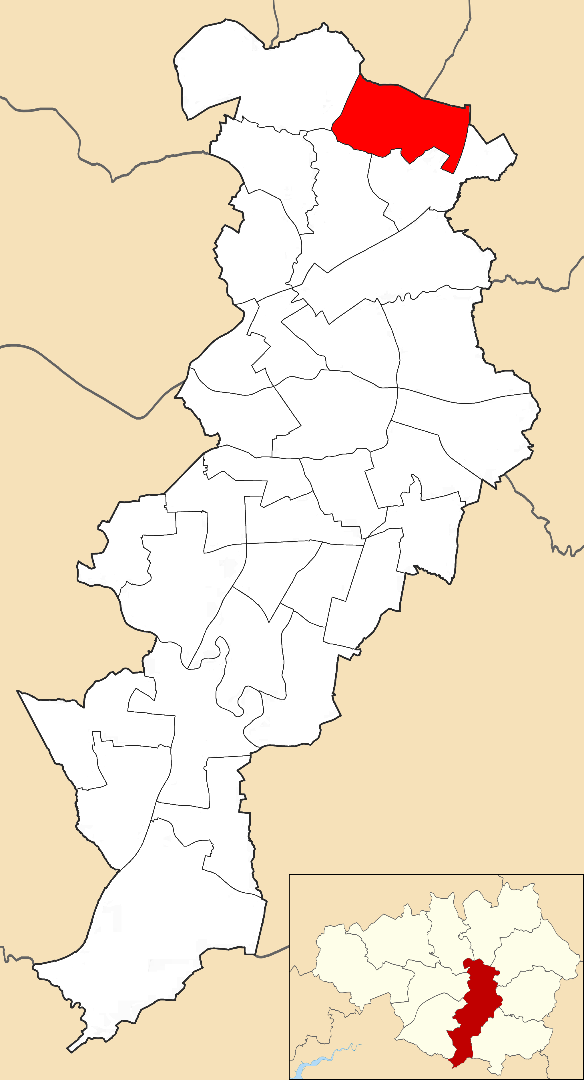
Alkrington

Alkrington Garden Village is a suburban area of Middleton, in the Metropolitan Borough of Rochdale, Greater Manchester, England.Historically a part of...

Middleton bus station

Middleton bus station is a bus station located in the town of Middleton in Greater Manchester. The bus station is found next to the Middleton Shopping...

Charlestown, Manchester

Charlestown is a ward in the suburban north of the city of Manchester, England. The population of the ward at the 2011 census was 14,332. Voters from this...

Plant Hill Arts College

Plant Hill Arts College (formally Plant Hill High School) was an 11-16 community school, serving boys and girls predominantly from the suburb of Blackley...

Co-op Academy Manchester

Co-op Academy Manchester, formerly known as The Co-operative Academy of Manchester is a non-selective, mixed secondary school in Blackley, Manchester....

Municipal Borough of Middleton

The Municipal Borough of Middleton was, from 1886 to 1974, a municipal borough in the administrative county of Lancashire, England, coterminous with the...

Booth Hall Children's Hospital

Booth Hall Children's Hospital was a children's hospital at Blackley in Manchester. It was managed by Central Manchester University Hospitals NHS Foundation...

Nearby Amenities

Located within 500m of 53.537056,-2.205021
Motorway Junction
Alkrington Interchange
Ref: 20
Lat/Long: 53.5373896/-2.210242
Turning Circle
Lat/Long: 53.5341195/-2.2100555
Turning Circle
Lat/Long: 53.534714/-2.2114384
Turning Circle
Lat/Long: 53.5411109/-2.2064821
Turning Circle
Lat/Long: 53.5392696/-2.2077008
Turning Circle
Lat/Long: 53.5401775/-2.2059413
Turning Circle
Lat/Long: 53.5388648/-2.2044009
Turning Circle
Lat/Long: 53.5347859/-2.2021734
Turning Circle
Lat/Long: 53.5336738/-2.2001048
Turning Circle
Lat/Long: 53.5350715/-2.2042762
Traffic Signals
Source: bing
Lat/Long: 53.5335661/-2.2073313
Bus Stop
Alkrington, Manchester New Road / opposite Woodlands Way
Bus: yes
Naptan AtcoCode: 1800NE15271
Naptan Bearing: SW
Naptan CommonName: Manchester New Road/Woodlands Way
Naptan Indicator: O/s House 247
Naptan Landmark: HOUSE 247
Naptan NaptanCode: mandwtaw
Naptan PlusbusZoneRef: MNCRPIC
Naptan ShortCommonName: Woodlands Way
Naptan Street: M/CR NEW ROAD
Naptan Verified: no
Network: TfGM
Operator: TfGM
Public Transport: platform
Source: naptan_import
Lat/Long: 53.5386363/-2.2027848
Bus Stop
Alkrington, Manchester New Road / opposite Mossway
Bus: yes
Naptan AtcoCode: 1800NE04761
Naptan Bearing: NE
Naptan CommonName: Manchester New Road/Mossway
Naptan Indicator: Bus Layby
Naptan Landmark: HOUSE 322
Naptan NaptanCode: mandwjwg
Naptan PlusbusZoneRef: MNCRPIC
Naptan ShortCommonName: Mossway
Naptan Street: M/CR NEW ROAD
Naptan Verified: no
Network: TfGM
Operator: TfGM
Public Transport: platform
Source: naptan_import
Lat/Long: 53.5351429/-2.2061931
Bus Stop
Alkrington, Manchester New Road / near Mossway
Bus: yes
Naptan AtcoCode: 1800NE43311
Naptan Bearing: SW
Naptan CommonName: Manchester New Road/Mossway
Naptan Indicator: House 333
Naptan Landmark: HOUSE 333
Naptan NaptanCode: mangdpdp
Naptan Notes: INDICATOR AMENDED
Naptan PlusbusZoneRef: MNCRPIC
Naptan ShortCommonName: Mossway
Naptan Street: M/CR NEW ROAD
Naptan Verified: no
Network: TfGM
Operator: TfGM
Public Transport: platform
Source: naptan_import
Lat/Long: 53.5348736/-2.2059956
Bus Stop
Alkrington, Manchester New Road / opposite Mainway
Bus: yes
Naptan AtcoCode: 1800NE43331
Naptan Bearing: NE
Naptan CommonName: Manchester New Road/Moss Lane
Naptan Indicator: House No. 300
Naptan Landmark: HOUSE 300
Naptan NaptanCode: mangdpdt
Naptan PlusbusZoneRef: MNCRPIC
Naptan ShortCommonName: Moss Lane
Naptan Street: Manchester New Road
Naptan Verified: no
Network: TfGM
Operator: TfGM
Public Transport: platform
Source: naptan_import
Lat/Long: 53.5365744/-2.2048421
Bus Stop
Alkrington, Manchester New Road / near Mainway
Bus: yes
Naptan AtcoCode: 1800NE43341
Naptan Bearing: SW
Naptan CommonName: Manchester New Road/Mainway
Naptan Indicator: Near Phone Box
Naptan Landmark: PLAYING FIELDS
Naptan NaptanCode: mangdpdw
Naptan PlusbusZoneRef: MNCRPIC
Naptan ShortCommonName: Mainway
Naptan Street: Manchester New Road
Naptan Verified: no
Network: TfGM
Operator: TfGM
Public Transport: platform
Source: naptan_import
Lat/Long: 53.5371239/-2.2041355
Bus Stop
Alkrington Garden Village, Mainway / opposite Manor Road
Bus: yes
Naptan AtcoCode: 1800NE43351
Naptan Bearing: W
Naptan CommonName: Mainway/Manor Road
Naptan Indicator: O/s House 64
Naptan Landmark: HOUSE 64
Naptan NaptanCode: mangdpga
Naptan PlusbusZoneRef: MNCRPIC
Naptan ShortCommonName: Manor Road
Naptan Street: MAINWAY
Naptan Verified: no
Network: TfGM
Operator: TfGM
Public Transport: platform
Source: naptan_import
Lat/Long: 53.5372402/-2.1991266
Bus Stop
Alkrington Garden Village, Mainway / near Manor Road
Bus: yes
Naptan AtcoCode: 1800NE43371
Naptan Bearing: E
Naptan CommonName: Mainway/Manor Road
Naptan Indicator: O/s House 43
Naptan Landmark: HOUSE 43
Naptan NaptanCode: mangdpgj
Naptan PlusbusZoneRef: MNCRPIC
Naptan ShortCommonName: Manor Road
Naptan Street: MAINWAY
Naptan Verified: no
Network: TfGM
Operator: TfGM
Public Transport: platform
Source: naptan_import
Lat/Long: 53.5374843/-2.1982677
Bus Stop
Alkrington, Mainway / near Manchester New Road
Bus: yes
Naptan AtcoCode: 1800NE43381
Naptan Bearing: E
Naptan CommonName: Mainway/Manchester New Road
Naptan Indicator: Nr House 269
Naptan Landmark: HOUSE 269
Naptan NaptanCode: mangdpgm
Naptan PlusbusZoneRef: MNCRPIC
Naptan ShortCommonName: Manchester New Rd
Naptan Street: MAINWAY
Naptan Verified: no
Network: TfGM
Operator: TfGM
Public Transport: platform
Source: naptan_import
Lat/Long: 53.537467/-2.2032469
Bus Stop
Alkrington, Manchester New Road / near Woodlands Way
Bus: yes
Naptan AtcoCode: 1800NE43401
Naptan Bearing: NE
Naptan CommonName: Manchester New Road/Woodlands Way
Naptan Indicator: House 238
Naptan Landmark: HOUSE 238
Naptan NaptanCode: mangdpgp
Naptan Notes: INDICATOR AMENDED
Naptan PlusbusZoneRef: MNCRPIC
Naptan ShortCommonName: Woodlands Way
Naptan Street: M/CR NEW ROAD
Naptan Verified: no
Network: TfGM
Operator: TfGM
Public Transport: platform
Source: naptan_import
Lat/Long: 53.5397701/-2.2020357
Bus Stop
Alkrington, Manchester New Road / opposite Hall Drive
Bus: yes
Naptan AtcoCode: 1800NE43411
Naptan Bearing: SW
Naptan CommonName: Manchester New Road/Kingsway
Naptan Indicator: Os Hairdressers
Naptan Landmark: PROPERTY 215
Naptan NaptanCode: mangdpgt
Naptan PlusbusZoneRef: MNCRPIC
Naptan ShortCommonName: Kingsway
Naptan Street: M/CR NEW ROAD
Naptan Verified: no
Network: TfGM
Operator: TfGM
Public Transport: platform
Source: naptan_import
Lat/Long: 53.5403827/-2.2012389
Turning Circle
Lat/Long: 53.5341157/-2.2003592
Turning Circle
Lat/Long: 53.5356824/-2.2037973
Traffic Signals
Lat/Long: 53.5333338/-2.2075175
Traffic Signals
Lat/Long: 53.5333394/-2.2077922
Traffic Signals
Lat/Long: 53.5333559/-2.2076289
Traffic Signals
Lat/Long: 53.5335352/-2.2072326
Traffic Signals
Source: bing
Lat/Long: 53.5343531/-2.2068061
Traffic Signals
Source: bing
Lat/Long: 53.5345777/-2.2068114
Traffic Signals
Source: bing
Lat/Long: 53.5346757/-2.2067445
Traffic Signals
Source: bing
Lat/Long: 53.5346453/-2.2063031
Crossing
Crossing: unmarked
Lat/Long: 53.5376898/-2.2038029
Power: tower
Source: Bing
Lat/Long: 53.5340874/-2.2089296
Power: tower
Source: Bing
Lat/Long: 53.5373874/-2.211149
Place Of Worship
Lat/Long: 53.5395118/-2.201687
Chambers and Perkins Ironmongery
Shop: hardware
Lat/Long: 53.5328375/-2.2074856
Fast Food
Shimla Spice
Cuisine: indian
Lat/Long: 53.5329436/-2.2074116
Fast Food
Wing Wah
Cuisine: chinese
Lat/Long: 53.5328996/-2.2074464
Generator Method: photovoltaic
Generator Output Electricity: yes
Generator Source: solar
Generator Type: solar_photovoltaic_panel
Location: roof
Power: generator
Lat/Long: 53.5369999/-2.212176
Generator Method: photovoltaic
Generator Output Electricity: yes
Generator Source: solar
Generator Type: solar_photovoltaic_panel
Location: roof
Power: generator
Lat/Long: 53.5369983/-2.2119883
Generator Method: photovoltaic
Generator Output Electricity: yes
Generator Source: solar
Generator Type: solar_photovoltaic_panel
Location: roof
Power: generator
Lat/Long: 53.5370063/-2.2118944
Generator Method: photovoltaic
Generator Output Electricity: yes
Generator Source: solar
Generator Type: solar_photovoltaic_panel
Location: roof
Power: generator
Lat/Long: 53.5357661/-2.2121653
Generator Method: photovoltaic
Generator Output Electricity: yes
Generator Source: solar
Generator Type: solar_photovoltaic_panel
Location: roof
Power: generator
Lat/Long: 53.5358139/-2.2120634
Generator Method: photovoltaic
Generator Output Electricity: yes
Generator Source: solar
Generator Type: solar_photovoltaic_panel
Location: roof
Power: generator
Lat/Long: 53.5358697/-2.2119722
Generator Method: photovoltaic
Generator Output Electricity: yes
Generator Source: solar
Generator Type: solar_photovoltaic_panel
Location: roof
Power: generator
Lat/Long: 53.5359079/-2.2118944
Generator Method: photovoltaic
Generator Output Electricity: yes
Generator Source: solar
Generator Type: solar_photovoltaic_panel
Location: roof
Power: generator
Lat/Long: 53.535943/-2.2118247
Generator Method: photovoltaic
Generator Output Electricity: yes
Generator Source: solar
Generator Type: solar_photovoltaic_panel
Location: roof
Power: generator
Lat/Long: 53.5359526/-2.2110871
Generator Method: photovoltaic
Generator Output Electricity: yes
Generator Source: solar
Generator Type: solar_photovoltaic_panel
Location: roof
Power: generator
Lat/Long: 53.5359095/-2.2111675
Generator Method: photovoltaic
Generator Output Electricity: yes
Generator Source: solar
Generator Type: solar_photovoltaic_panel
Location: roof
Power: generator
Lat/Long: 53.5358649/-2.2112533
Generator Method: photovoltaic
Generator Output Electricity: yes
Generator Source: solar
Generator Type: solar_photovoltaic_panel
Location: roof
Power: generator
Lat/Long: 53.5358219/-2.2113392
Generator Method: photovoltaic
Generator Output Electricity: yes
Generator Source: solar
Generator Type: solar_photovoltaic_panel
Location: roof
Power: generator
Lat/Long: 53.5357326/-2.2115135
Generator Method: photovoltaic
Generator Output Electricity: yes
Generator Source: solar
Generator Type: solar_photovoltaic_panel
Location: roof
Power: generator
Lat/Long: 53.5356927/-2.2115994
Generator Method: photovoltaic
Generator Output Electricity: yes
Generator Source: solar
Generator Type: solar_photovoltaic_panel
Location: roof
Power: generator
Lat/Long: 53.5356433/-2.2106794
Generator Method: photovoltaic
Generator Output Electricity: yes
Generator Source: solar
Generator Type: solar_photovoltaic_panel
Location: roof
Power: generator
Lat/Long: 53.5355955/-2.2107813
Generator Method: photovoltaic
Generator Output Electricity: yes
Generator Source: solar
Generator Type: solar_photovoltaic_panel
Location: roof
Power: generator
Lat/Long: 53.5355397/-2.2108886
Generator Method: photovoltaic
Generator Output Electricity: yes
Generator Source: solar
Generator Type: solar_photovoltaic_panel
Location: roof
Power: generator
Lat/Long: 53.535503/-2.2109664
Generator Method: photovoltaic
Generator Output Electricity: yes
Generator Source: solar
Generator Type: solar_photovoltaic_panel
Location: roof
Power: generator
Lat/Long: 53.5354488/-2.2110763
Generator Method: photovoltaic
Generator Output Electricity: yes
Generator Source: solar
Generator Type: solar_photovoltaic_panel
Location: roof
Power: generator
Lat/Long: 53.535401/-2.2111541
Generator Method: photovoltaic
Generator Output Electricity: yes
Generator Source: solar
Generator Type: solar_photovoltaic_panel
Location: roof
Power: generator
Lat/Long: 53.5348319/-2.211417
Generator Method: photovoltaic
Generator Output Electricity: yes
Generator Source: solar
Generator Type: solar_photovoltaic_panel
Location: roof
Power: generator
Lat/Long: 53.5400573/-2.2058028
Generator Method: photovoltaic
Generator Output Electricity: yes
Generator Source: solar
Generator Type: solar_photovoltaic_panel
Location: roof
Power: generator
Lat/Long: 53.5405857/-2.2035458
Generator Method: photovoltaic
Generator Output Electricity: yes
Generator Source: solar
Generator Type: solar_photovoltaic_panel
Location: roof
Power: generator
Lat/Long: 53.5330139/-2.2038046
Generator Method: photovoltaic
Generator Output Electricity: yes
Generator Source: solar
Generator Type: solar_photovoltaic_panel
Location: roof
Power: generator
Lat/Long: 53.5330004/-2.2037389
Generator Method: photovoltaic
Generator Output Electricity: yes
Generator Source: solar
Generator Type: solar_photovoltaic_panel
Location: roof
Power: generator
Lat/Long: 53.5330155/-2.2036759
Generator Method: photovoltaic
Generator Output Electricity: yes
Generator Source: solar
Generator Type: solar_photovoltaic_panel
Location: roof
Power: generator
Lat/Long: 53.533037/-2.2038234
Generator Method: photovoltaic
Generator Output Electricity: yes
Generator Source: solar
Generator Type: solar_photovoltaic_panel
Location: roof
Power: generator
Lat/Long: 53.5330498/-2.2040179
Generator Method: photovoltaic
Generator Output Electricity: yes
Generator Source: solar
Generator Type: solar_photovoltaic_panel
Location: roof
Power: generator
Lat/Long: 53.5330753/-2.204034
Barrier: kerb
Lat/Long: 53.5330489/-2.207397
Crossing
Lat/Long: 53.5334378/-2.2077722
Traffic Signals
Traffic Signals: signal
Traffic Signals Direction: forward
Lat/Long: 53.5330642/-2.2074785
Crossing
Lat/Long: 53.5345668/-2.2067647
Crossing
Lat/Long: 53.5335457/-2.2075707
Crossing
Crossing: marked
Lat/Long: 53.5406432/-2.2011654
Crossing
Crossing: marked
Lat/Long: 53.5367382/-2.2046004
Barrier: stile
Lat/Long: 53.5368541/-2.2046517
The data included in this document is from www.openstreetmap.org. The data is made available under ODbL.

Have you been to Alkrington Garden Village?

Leave your review of Alkrington Garden Village below (or comments, questions and feedback).