Alkrington

Settlement in Lancashire

England

Alkrington

Eroded bank of River Irk The river side path to Rhodes is in danger of being lost with the very sandy unprotected banks of the river collapsing.
Eroded bank of River Irk Credit: Kevin Waterhouse

Alkrington is a small village located in Lancashire, England. Situated approximately 9 miles north of Manchester city center, it falls within the Metropolitan Borough of Rochdale.

The village is known for its picturesque setting, surrounded by beautiful countryside and green spaces. Alkrington Woods, a local nature reserve, offers residents and visitors the opportunity to enjoy leisurely walks and observe a variety of wildlife. The village also benefits from its close proximity to Heaton Park, one of the largest municipal parks in Europe, providing ample recreational opportunities for outdoor enthusiasts.

Alkrington has a rich history, with evidence of Roman settlements in the area. Over the years, the village has developed into a close-knit community, offering a range of amenities and services to its residents. These include a primary school, a local convenience store, a post office, and several pubs and restaurants.

Transport links in Alkrington are excellent, with regular bus services connecting the village to neighboring towns and cities. The nearby M60 motorway provides easy access to Manchester and other parts of the country.

With its tranquil surroundings and convenient location, Alkrington offers a peaceful and idyllic living environment. The village's strong community spirit, combined with its natural beauty and amenities, make it an attractive place to reside for families and individuals seeking a quieter lifestyle within easy reach of urban amenities.

If you have any feedback on the listing, please let us know in the comments section below.

Alkrington Images

Images are sourced within 2km of 53.532466/-2.2126835 or Grid Reference SD8604. Thanks to Geograph Open Source API. All images are credited.

Eroded bank of River Irk The river side path to Rhodes is in danger of being lost with the very sandy unprotected banks of the river collapsing.
Eroded bank of River Irk
The river side path to Rhodes is in danger of being lost with the very sandy unprotected banks of the river collapsing.
Weir on the River Irk The former sluice above the weir served the now demolished Lands End Bleach Works
Weir on the River Irk
The former sluice above the weir served the now demolished Lands End Bleach Works
M60 motorway bridge over the River Irk The weir in the foreground does not seem to appear on any OS map, it was probably built when the motorway was constructed.
M60 motorway bridge over the River Irk
The weir in the foreground does not seem to appear on any OS map, it was probably built when the motorway was constructed.
Surfaced path to Boothroyden Road This path appears to have been upgraded fairly recently but on published OS maps has not been marked or given public right of way status.
Surfaced path to Boothroyden Road
This path appears to have been upgraded fairly recently but on published OS maps has not been marked or given public right of way status.
M60 motorway underpass For the bridleway from Rhodes fishing lodges to Blackley
M60 motorway underpass
For the bridleway from Rhodes fishing lodges to Blackley
Weir on the River Irk The river is in a man made channel flowing between several reservoirs for the demolished Calico Print Works at Rhodes.
Weir on the River Irk
The river is in a man made channel flowing between several reservoirs for the demolished Calico Print Works at Rhodes.
Series of weirs on the River Irk The course of the river has been straightened by this man made channel by Alkrington Woods.
Series of weirs on the River Irk
The course of the river has been straightened by this man made channel by Alkrington Woods.
Gated housing New houses on Viscount Drive at Rhodes, separated from Manchester Old Road by fencing and locked gate.
Gated housing
New houses on Viscount Drive at Rhodes, separated from Manchester Old Road by fencing and locked gate.
Path out of Alkrington Woods Approaching Manchester New Road. This path is marked as a restricted byway by OS maps.
Path out of Alkrington Woods
Approaching Manchester New Road. This path is marked as a restricted byway by OS maps.
St Thomas More RC Church On Kirkway, Alkrington Garden Village
St Thomas More RC Church
On Kirkway, Alkrington Garden Village
Alkrington Hall
Alkrington Hall
River Irk
River Irk
Rochdale Road The A664 at the junction with Old Road.
Rochdale Road
The A664 at the junction with Old Road.
Wooded path in Boggart Hole Clough Close to the Rochdale Road entrance near the junction with Charlestown Road.
An urban country park in Blackley
Wooded path in Boggart Hole Clough
Close to the Rochdale Road entrance near the junction with Charlestown Road. An urban country park in Blackley
Bridge over Boggart Hole Brook The stream at this point flows through a man made channel and there may have been another footbridge with steps coming down to the stream wall.
Bridge over Boggart Hole Brook
The stream at this point flows through a man made channel and there may have been another footbridge with steps coming down to the stream wall.
Footbridge in Boggart Hole Clough The path on this bridge over the brook leads to Oak Bank Avenue. The bridge piers and abutments appear to have masonry that is too grand for this setting.
Footbridge in Boggart Hole Clough
The path on this bridge over the brook leads to Oak Bank Avenue. The bridge piers and abutments appear to have masonry that is too grand for this setting.
Boating Lake Pavilion In Boggart Hole Clough
Boating Lake Pavilion
In Boggart Hole Clough
Harpurhey Baths & Laundry The former facility on Rochdale Road
Harpurhey Baths & Laundry
The former facility on Rochdale Road
Show me another place!

Alkrington is located at Grid Ref: SD8604 (Lat: 53.532466, Lng: -2.2126835)

Unitary Authority: Rochdale

Police Authority: Greater Manchester

What 3 Words

///lace.pretty.carbon. Near Blackley, Manchester

Related Wikis

Our Lady's Roman Catholic High School, Manchester

Our Lady's Roman Catholic High School, also known as Our Lady's RC High School, is a coeducational Roman Catholic secondary school located in the Higher...

Plant Hill Arts College

Plant Hill Arts College (formally Plant Hill High School) was an 11-16 community school, serving boys and girls predominantly from the suburb of Blackley...

Co-op Academy Manchester

Co-op Academy Manchester, formerly known as The Co-operative Academy of Manchester is a non-selective, mixed secondary school in Blackley, Manchester....

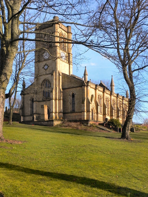
Church of St Peter, Blackley

The Church of St Peter in Old Market Street, Blackley, Manchester, England, is a Gothic Revival church of 1844 by E. H. Shellard. It was a Commissioners...

Booth Hall Children's Hospital

Booth Hall Children's Hospital was a children's hospital at Blackley in Manchester. It was managed by Central Manchester University Hospitals NHS Foundation...

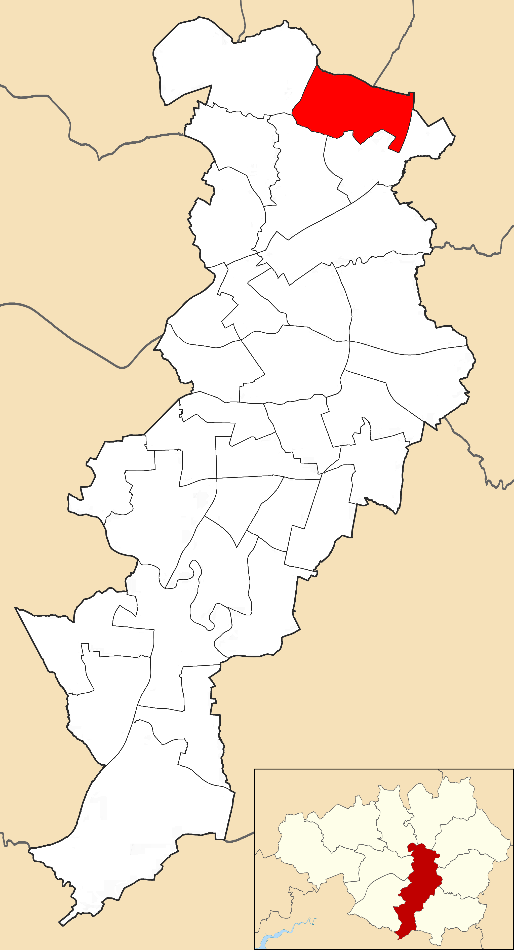
Charlestown, Manchester

Charlestown is a ward in the suburban north of the city of Manchester, England. The population of the ward at the 2011 census was 14,332. Voters from this...

Blackley

Blackley is a suburban area of Manchester, England. Historically in Lancashire, it is approximately 4.5 miles (7.2 km) north of Manchester city centre...
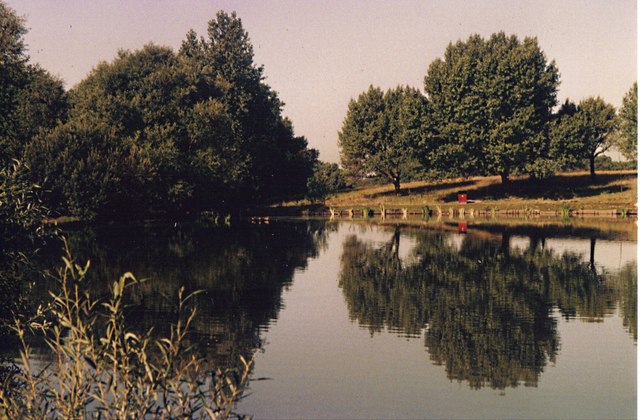
Boggart Hole Clough

Boggart Hole Clough is a large woodland and urban country park in Blackley, a suburb of Manchester, England. It occupies an area of approximately 76 hectares...

Nearby Amenities

Located within 500m of 53.532466,-2.2126835
Turning Circle
Lat/Long: 53.5290332/-2.2134286
Turning Circle
Lat/Long: 53.5289333/-2.212363
Turning Circle
Lat/Long: 53.5318926/-2.2188592
Turning Circle
Lat/Long: 53.5330341/-2.2195137
Turning Circle
Lat/Long: 53.5293107/-2.216315
Turning Circle
Lat/Long: 53.5312157/-2.213149
Turning Circle
Lat/Long: 53.5310994/-2.212227
Turning Circle
Lat/Long: 53.530738/-2.2085525
Turning Circle
Lat/Long: 53.531533/-2.2075492
Mini Roundabout
Lat/Long: 53.5361089/-2.2155744
Turning Circle
Lat/Long: 53.5341195/-2.2100555
Turning Circle
Lat/Long: 53.534714/-2.2114384
Turning Circle
Lat/Long: 53.535354/-2.2160293
Crossing
Crossing: unmarked
Lat/Long: 53.5291567/-2.2106779
Turning Circle
Lat/Long: 53.5313443/-2.2061502
Turning Circle
Lat/Long: 53.5311453/-2.2073518
Turning Circle
Lat/Long: 53.5302729/-2.2155229
Turning Circle
Lat/Long: 53.5303292/-2.2169149
Turning Circle
Lat/Long: 53.5305333/-2.2163248
Turning Circle
Lat/Long: 53.5288442/-2.2094313
Turning Circle
Lat/Long: 53.5284362/-2.2151041
Turning Circle
Lat/Long: 53.5318597/-2.2164106
Turning Circle
Lat/Long: 53.5304225/-2.2076649
Traffic Signals
Source: bing
Lat/Long: 53.5335661/-2.2073313
Turning Circle
Lat/Long: 53.528152/-2.2126963
Bus Stop
Higher Blackley, Victoria Avenue / near Cecil Road
Bus: yes
Naptan AtcoCode: 1800NB43231
Naptan Bearing: W
Naptan CommonName: Victoria Avenue/Cecil Road
Naptan Indicator: O/s House 133
Naptan Landmark: HOUSE 133
Naptan NaptanCode: mandmamw
Naptan PlusbusZoneRef: MNCRPIC
Naptan ShortCommonName: Cecil Road
Naptan Street: VICTORIA AVENUE
Naptan Verified: no
Network: TfGM
Operator: TfGM
Public Transport: platform
Source: naptan_import
Lat/Long: 53.5339011/-2.2170954
Bus Stop
Higher Blackley, Victoria Avenue / opposite Cecil Road
Bus: yes
Naptan AtcoCode: 1800NB43241
Naptan Bearing: E
Naptan CommonName: Victoria Avenue/Cecil Road
Naptan Indicator: O/s House 120
Naptan Landmark: HOUSE 120
Naptan NaptanCode: mandmapa
Naptan PlusbusZoneRef: MNCRPIC
Naptan ShortCommonName: Cecil Road
Naptan Street: VICTORIA AVENUE
Naptan Verified: no
Network: TfGM
Operator: TfGM
Public Transport: platform
Source: naptan_import
Lat/Long: 53.5339916/-2.2167488
Bus Stop
Higher Blackley, Victoria Avenue / Rochdale Road (Stop A)
Bus: yes
Local Ref: A
Naptan AtcoCode: 1800NB43251
Naptan Bearing: E
Naptan Landmark: CENTRAL HOUSE
Naptan NaptanCode: MANDMAPD
Naptan Street: Victoria Avenue
Network: TfGM
Operator: TfGM
Public Transport: platform
Ref: A
Lat/Long: 53.5334647/-2.2114966
Bus Stop
Higher Blackley, Victoria Avenue / near Hill Lane
Bus: yes
Naptan AtcoCode: 1800NB43261
Naptan Bearing: W
Naptan CommonName: Victoria Avenue/Lion and Lamb
Naptan Indicator: O/s House 79
Naptan Landmark: HOUSE 75
Naptan NaptanCode: mandmapg
Naptan PlusbusZoneRef: MNCRPIC
Naptan ShortCommonName: Lion and Lamb
Naptan Street: VICTORIA AVENUE
Naptan Verified: no
Network: TfGM
Operator: TfGM
Public Transport: platform
Source: naptan_import
Lat/Long: 53.5335299/-2.2135932
Bus Stop
Victoria Ave East/Rochdale Rd (Stop E)
Bus: yes
Local Ref: E
Naptan AtcoCode: 1800NB43271
Naptan Bearing: E
Naptan CommonName: Victoria Ave East/Rochdale Rd (Stop E)
Naptan Indicator: Stop E
Naptan Landmark: TESCO CAR-PARK
Naptan NaptanCode: mandmapj
Naptan PlusbusZoneRef: MNCRPIC
Naptan ShortCommonName: Rochdale Rd
Naptan Street: VICTORIA AVE E
Naptan Verified: no
Network: TfGM
Public Transport: platform
Source: naptan_import
Lat/Long: 53.5318353/-2.2060261
Bus Stop
Higher Blackley, Rochdale Road / Victoria Avenue (Stop C)
Bench: yes
Bus: yes
Local Ref: C
Naptan AtcoCode: 1800NB43301
Naptan Bearing: N
Naptan NaptanCode: MANDMAPW
Naptan Street: Rochdale Road
Network: TfGM
Operator: TfGM
Public Transport: platform
Ref: C
Shelter: yes
Lat/Long: 53.5317609/-2.2089454
Bus Stop
Higher Blackley, Rochdale Road / Victoria Avenue (Stop D)
Bus: yes
Local Ref: D
Naptan AtcoCode: 1800NB43911
Naptan Bearing: S
Naptan Landmark: OS ROW OF SHOPS
Naptan NaptanCode: MANDMDGT
Naptan Street: Rochdale Road
Network: TfGM
Operator: TfGM
Public Transport: platform
Ref: D
Lat/Long: 53.5318042/-2.2085691
Bus Stop
Higher Blackley, Rochdale Road / near Hilldale Avenue
Bus: yes
Naptan AtcoCode: 1800NB43921
Naptan Bearing: N
Naptan CommonName: Rochdale Road/Hilldale Avenue
Naptan Indicator: House No. 1283
Naptan Landmark: HOUSE 1283
Naptan NaptanCode: mandmdgw
Naptan PlusbusZoneRef: MNCRPIC
Naptan ShortCommonName: Hilldale Avenue
Naptan Street: ROCHDALE ROAD
Naptan Verified: no
Network: TfGM
Operator: TfGM
Public Transport: platform
Shelter: yes
Source: naptan_import
Lat/Long: 53.5300633/-2.2103102
Bus Stop
Higher Blackley, Rochdale Road / opposite Hilldale Avenue
Bus: yes
Naptan AtcoCode: 1800NB43931
Naptan Bearing: S
Naptan CommonName: Rochdale Road/Hilldale Avenue
Naptan Indicator: House 1102
Naptan Landmark: HOUSE 1102
Naptan NaptanCode: mandmdja
Naptan PlusbusZoneRef: MNCRPIC
Naptan ShortCommonName: Hilldale Avenue
Naptan Street: ROCHDALE ROAD
Naptan Verified: no
Network: TfGM
Operator: TfGM
Public Transport: platform
Shelter: yes
Source: naptan_import
Lat/Long: 53.5289866/-2.2108247
Bus Stop
Higher Blackley, Victoria Avenue East / Rochdale Road (Stop F)
Bus: yes
Local Ref: F
Naptan AtcoCode: 1800NB01201
Naptan Bearing: W
Naptan CommonName: Victoria Ave East/Rochdale Rd (Stop F)
Naptan Indicator: Stop F
Naptan Landmark: TESCO
Naptan NaptanCode: mandjgwd
Naptan PlusbusZoneRef: MNCRPIC
Naptan ShortCommonName: Rochdale Rd
Naptan Street: VICTORIA AVE E
Naptan Verified: no
Network: TfGM
Operator: TfGM
Public Transport: platform
Ref: F
Source: naptan_import
Lat/Long: 53.5316556/-2.2060253
Bus Stop
Higher Blackley, Victoria Road / Rochdale Road (Stop B)
Bus: yes
Local Ref: B
Naptan AtcoCode: 1800NB15051
Naptan Bearing: W
Naptan Landmark: CHURCH
Naptan NaptanCode: MANDJTAD
Naptan Street: Victoria Avenue
Network: TfGM
Operator: TfGM
Public Transport: platform
Ref: B
Lat/Long: 53.5327698/-2.2097498
Bus Stop
Plant Hill, Plant Hill Road / opposite Mirfield Road
Bus: yes
Naptan AtcoCode: 1800NB15081
Naptan Bearing: N
Naptan CommonName: Plant Hill Road/Mirfield Road
Naptan Indicator: O/s House 58
Naptan Landmark: HOUSE 58
Naptan NaptanCode: mandjtam
Naptan PlusbusZoneRef: MNCRPIC
Naptan ShortCommonName: Mirfield Road
Naptan Street: PLANT HILL ROAD
Naptan Verified: no
Network: TfGM
Operator: TfGM
Public Transport: platform
Source: naptan_import
Lat/Long: 53.5312001/-2.2195256
Bus Stop
Plant Hill Road/Mirfield Road
Bus: yes
Naptan AtcoCode: 1800NB15091
Naptan Bearing: S
Naptan CommonName: Plant Hill Road/Mirfield Road
Naptan Indicator: O/s House 63
Naptan Landmark: HOUSE 63
Naptan NaptanCode: mandjtap
Naptan PlusbusZoneRef: MNCRPIC
Naptan ShortCommonName: Mirfield Road
Naptan Street: PLANT HILL ROAD
Naptan Verified: no
Network: TfGM
Public Transport: platform
Source: naptan_import
Lat/Long: 53.5309669/-2.2192528
Doctors
Higher Blackley Medical Centre
Healthcare: doctor
Historic: monument
Lat/Long: 53.5343981/-2.2191963
Turning Circle
Lat/Long: 53.5319319/-2.2126469
Turning Circle
Lat/Long: 53.5311695/-2.2169685
Check Date: 2018-04-07
Disused Amenity: bank
Old Name: Barclays
Lat/Long: 53.5322923/-2.2087643
Atm
Cash In: no
Check Date: 2023-05-09
Operator: Tesco
Lat/Long: 53.5324062/-2.2062174
Traffic Signals
Source: bing
Lat/Long: 53.5322952/-2.207977
Traffic Signals
Lat/Long: 53.5322922/-2.2084941
Traffic Signals
Lat/Long: 53.5324981/-2.2078938
Traffic Signals
Lat/Long: 53.5325763/-2.2085928
Traffic Signals
Lat/Long: 53.532556/-2.2080502
Traffic Signals
Lat/Long: 53.5333338/-2.2075175
Traffic Signals
Lat/Long: 53.5333394/-2.2077922
Traffic Signals
Lat/Long: 53.5333559/-2.2076289
Traffic Signals
Lat/Long: 53.5335352/-2.2072326
Traffic Signals
Source: bing
Lat/Long: 53.5343531/-2.2068061
Traffic Signals
Source: bing
Lat/Long: 53.5345777/-2.2068114
Traffic Signals
Source: bing
Lat/Long: 53.5346757/-2.2067445
Traffic Signals
Source: bing
Lat/Long: 53.5346453/-2.2063031
Library
The Avenue Library
Lat/Long: 53.5325031/-2.2076185
Power: tower
Source: Bing
Lat/Long: 53.5340874/-2.2089296
A & C Booth
Shop: greengrocer
Lat/Long: 53.5332704/-2.2128052
Around a Pound
Shop: variety_store
Lat/Long: 53.5330724/-2.2129533
Aubrey Lee
Shop: estate_agent
Lat/Long: 53.5320021/-2.2083261
Blackley Carpets
Shop: carpet
Lat/Long: 53.5322279/-2.2081563
Blackley Pound Store
Shop: variety_store
Lat/Long: 53.5327373/-2.2086948
Addr City: Manchester
Addr Housenumber: 65
Addr Postcode: M9 0RD
Addr Street: Victoria Avenue
Fixme: Boots closed. Was available to let in 2020. Needs a survey. https://www.loopnet.co.uk/Listing/65-Victoria-Ave-Manchester/21819933/
Shop: yes
Lat/Long: 53.5333869/-2.2129751
Fast Food
Britannia Pizza
Cuisine: pizza
Lat/Long: 53.5318209/-2.2084655
Fast Food
Canton Palace
Cuisine: chinese
Lat/Long: 53.5318856/-2.2135238
Chambers and Perkins Ironmongery
Shop: hardware
Lat/Long: 53.5328375/-2.2074856
Fast Food
Jonesy's
Cuisine: fish_and_chips
Lat/Long: 53.5317225/-2.2085395
Ladbrokes
Brand: Ladbrokes
Brand Wikidata: Q1799875
Brand Wikipedia: en:Ladbrokes Coral
Shop: bookmaker
Lat/Long: 53.5317782/-2.208496
Magimark
Shop: convenience
Lat/Long: 53.5333688/-2.2127726
Mary Kershaw
Shop: florist
Lat/Long: 53.5314287/-2.2087856
Mini Market
Shop: convenience
Lat/Long: 53.5325301/-2.213404
N S News
Shop: newsagent
Lat/Long: 53.5321723/-2.2082085
Nisa
Brand: Nisa
Brand Wikidata: Q16999069
Brand Wikipedia: en:Nisa (retailer)
Shop: convenience
Lat/Long: 53.5329663/-2.2130382
Numark
Shop: chemist
Lat/Long: 53.533176/-2.212888
Fast Food
Perfect Pizza
Cuisine: pizza
Lat/Long: 53.5327745/-2.2088403
Fast Food
Red Food Balti House
Cuisine: indian
Lat/Long: 53.5326803/-2.2133126
Fast Food
Shimla Spice
Cuisine: indian
Lat/Long: 53.5329436/-2.2074116
St Vincents
Second Hand: yes
Shop: clothes
Lat/Long: 53.5316203/-2.2086092
Steve's Barbers
Shop: hairdresser
Lat/Long: 53.5326143/-2.2133474
The Bakery
Shop: bakery
Lat/Long: 53.5330336/-2.212986
The Cooperative
Shop: funeral_directors
Lat/Long: 53.5324254/-2.2091172
Fast Food
The Frying Plaice
Cuisine: fish_and_chips
Lat/Long: 53.5329275/-2.2130839
Fast Food
Tiffin Bites
Cuisine: indian
Lat/Long: 53.5313343/-2.2088509
Fast Food
Wing Wah
Cuisine: chinese
Lat/Long: 53.5328996/-2.2074464
Post Box
Lat/Long: 53.530675/-2.2145315
Atm
Lat/Long: 53.5307178/-2.2142116
Post Office
Victoria Avenue Post Office
Addr Postcode: M9 6RA
Branch: Victoria Avenue
Brand: Post Office
Brand Wikidata: Q1783168
Check Date: 2022-08-04
Opening Hours: Mo-Fr 08:00-17:30
Ref Pol Id: 13985
Website: https://www.postoffice.co.uk/branch-finder/3714225/victoria-avenue
Lat/Long: 53.5324064/-2.2090179
Shop: chemist
Lat/Long: 53.5332744/-2.212102
Shop: butcher
Lat/Long: 53.5333766/-2.2128706
Dentist
J20 Dental
Healthcare: dentist
Lat/Long: 53.5327353/-2.2075883
Restaurant
Bay Tree
Lat/Long: 53.5310969/-2.2090842
Generator Method: photovoltaic
Generator Output Electricity: yes
Generator Source: solar
Generator Type: solar_photovoltaic_panel
Location: roof
Power: generator
Lat/Long: 53.5309484/-2.2069699
Generator Method: photovoltaic
Generator Output Electricity: yes
Generator Source: solar
Generator Type: solar_photovoltaic_panel
Location: roof
Power: generator
Lat/Long: 53.5289683/-2.2081339
Generator Method: photovoltaic
Generator Output Electricity: yes
Generator Source: solar
Generator Type: solar_photovoltaic_panel
Location: roof
Power: generator
Lat/Long: 53.5289986/-2.2080642
Generator Method: photovoltaic
Generator Output Electricity: yes
Generator Source: solar
Generator Type: solar_photovoltaic_panel
Location: roof
Power: generator
Lat/Long: 53.5291788/-2.207627
Generator Method: photovoltaic
Generator Output Electricity: yes
Generator Source: solar
Generator Type: solar_photovoltaic_panel
Location: roof
Power: generator
Lat/Long: 53.5292409/-2.2074553
Generator Method: photovoltaic
Generator Output Electricity: yes
Generator Source: solar
Generator Type: solar_photovoltaic_panel
Location: roof
Power: generator
Lat/Long: 53.5360084/-2.2151989
Generator Method: photovoltaic
Generator Output Electricity: yes
Generator Source: solar
Generator Type: solar_photovoltaic_panel
Location: roof
Power: generator
Lat/Long: 53.5362347/-2.2149414
Generator Method: photovoltaic
Generator Output Electricity: yes
Generator Source: solar
Generator Type: solar_photovoltaic_panel
Location: roof
Power: generator
Lat/Long: 53.5362746/-2.2148636
Generator Method: photovoltaic
Generator Output Electricity: yes
Generator Source: solar
Generator Type: solar_photovoltaic_panel
Location: roof
Power: generator
Lat/Long: 53.5357661/-2.2121653
Generator Method: photovoltaic
Generator Output Electricity: yes
Generator Source: solar
Generator Type: solar_photovoltaic_panel
Location: roof
Power: generator
Lat/Long: 53.5358139/-2.2120634
Generator Method: photovoltaic
Generator Output Electricity: yes
Generator Source: solar
Generator Type: solar_photovoltaic_panel
Location: roof
Power: generator
Lat/Long: 53.5358697/-2.2119722
Generator Method: photovoltaic
Generator Output Electricity: yes
Generator Source: solar
Generator Type: solar_photovoltaic_panel
Location: roof
Power: generator
Lat/Long: 53.5359079/-2.2118944
Generator Method: photovoltaic
Generator Output Electricity: yes
Generator Source: solar
Generator Type: solar_photovoltaic_panel
Location: roof
Power: generator
Lat/Long: 53.535943/-2.2118247
Generator Method: photovoltaic
Generator Output Electricity: yes
Generator Source: solar
Generator Type: solar_photovoltaic_panel
Location: roof
Power: generator
Lat/Long: 53.5359526/-2.2110871
Generator Method: photovoltaic
Generator Output Electricity: yes
Generator Source: solar
Generator Type: solar_photovoltaic_panel
Location: roof
Power: generator
Lat/Long: 53.5359095/-2.2111675
Generator Method: photovoltaic
Generator Output Electricity: yes
Generator Source: solar
Generator Type: solar_photovoltaic_panel
Location: roof
Power: generator
Lat/Long: 53.5358649/-2.2112533
Generator Method: photovoltaic
Generator Output Electricity: yes
Generator Source: solar
Generator Type: solar_photovoltaic_panel
Location: roof
Power: generator
Lat/Long: 53.5358219/-2.2113392
Generator Method: photovoltaic
Generator Output Electricity: yes
Generator Source: solar
Generator Type: solar_photovoltaic_panel
Location: roof
Power: generator
Lat/Long: 53.5357326/-2.2115135
Generator Method: photovoltaic
Generator Output Electricity: yes
Generator Source: solar
Generator Type: solar_photovoltaic_panel
Location: roof
Power: generator
Lat/Long: 53.5356927/-2.2115994
Generator Method: photovoltaic
Generator Output Electricity: yes
Generator Source: solar
Generator Type: solar_photovoltaic_panel
Location: roof
Power: generator
Lat/Long: 53.5356433/-2.2106794
Generator Method: photovoltaic
Generator Output Electricity: yes
Generator Source: solar
Generator Type: solar_photovoltaic_panel
Location: roof
Power: generator
Lat/Long: 53.5355955/-2.2107813
Generator Method: photovoltaic
Generator Output Electricity: yes
Generator Source: solar
Generator Type: solar_photovoltaic_panel
Location: roof
Power: generator
Lat/Long: 53.5355397/-2.2108886
Generator Method: photovoltaic
Generator Output Electricity: yes
Generator Source: solar
Generator Type: solar_photovoltaic_panel
Location: roof
Power: generator
Lat/Long: 53.535503/-2.2109664
Generator Method: photovoltaic
Generator Output Electricity: yes
Generator Source: solar
Generator Type: solar_photovoltaic_panel
Location: roof
Power: generator
Lat/Long: 53.5354488/-2.2110763
Generator Method: photovoltaic
Generator Output Electricity: yes
Generator Source: solar
Generator Type: solar_photovoltaic_panel
Location: roof
Power: generator
Lat/Long: 53.535401/-2.2111541
Generator Method: photovoltaic
Generator Output Electricity: yes
Generator Source: solar
Generator Type: solar_photovoltaic_panel
Location: roof
Power: generator
Lat/Long: 53.5353707/-2.2121921
Generator Method: photovoltaic
Generator Output Electricity: yes
Generator Source: solar
Generator Type: solar_photovoltaic_panel
Location: roof
Power: generator
Lat/Long: 53.5352767/-2.2123906
Generator Method: photovoltaic
Generator Output Electricity: yes
Generator Source: solar
Generator Type: solar_photovoltaic_panel
Location: roof
Power: generator
Lat/Long: 53.5354409/-2.2126293
Generator Method: photovoltaic
Generator Output Electricity: yes
Generator Source: solar
Generator Type: solar_photovoltaic_panel
Location: roof
Power: generator
Lat/Long: 53.5353867/-2.2127393
Generator Method: photovoltaic
Generator Output Electricity: yes
Generator Source: solar
Generator Type: solar_photovoltaic_panel
Location: roof
Power: generator
Lat/Long: 53.5352193/-2.2125167
Generator Method: photovoltaic
Generator Output Electricity: yes
Generator Source: solar
Generator Type: solar_photovoltaic_panel
Location: roof
Power: generator
Lat/Long: 53.5348319/-2.211417
Generator Method: photovoltaic
Generator Output Electricity: yes
Generator Source: solar
Generator Type: solar_photovoltaic_panel
Location: roof
Power: generator
Lat/Long: 53.5347602/-2.2116932
Generator Method: photovoltaic
Generator Output Electricity: yes
Generator Source: solar
Generator Type: solar_photovoltaic_panel
Location: roof
Power: generator
Lat/Long: 53.534706/-2.2117335
Generator Method: photovoltaic
Generator Output Electricity: yes
Generator Source: solar
Generator Type: solar_photovoltaic_panel
Location: roof
Power: generator
Lat/Long: 53.5346103/-2.2124845
Generator Method: photovoltaic
Generator Output Electricity: yes
Generator Source: solar
Generator Type: solar_photovoltaic_panel
Location: roof
Power: generator
Lat/Long: 53.5352735/-2.2136244
Generator Method: photovoltaic
Generator Output Electricity: yes
Generator Source: solar
Generator Type: solar_photovoltaic_panel
Location: roof
Power: generator
Lat/Long: 53.5353373/-2.2134984
Generator Method: photovoltaic
Generator Output Electricity: yes
Generator Source: solar
Generator Type: solar_photovoltaic_panel
Location: roof
Power: generator
Lat/Long: 53.5352623/-2.2132596
Generator Method: photovoltaic
Generator Output Electricity: yes
Generator Source: solar
Generator Type: solar_photovoltaic_panel
Location: roof
Power: generator
Lat/Long: 53.5351747/-2.2134233
Generator Method: photovoltaic
Generator Output Electricity: yes
Generator Source: solar
Generator Type: solar_photovoltaic_panel
Location: roof
Power: generator
Lat/Long: 53.5350232/-2.2137934
Generator Method: photovoltaic
Generator Output Electricity: yes
Generator Source: solar
Generator Type: solar_photovoltaic_panel
Location: roof
Power: generator
Lat/Long: 53.5351173/-2.2171542
Generator Method: photovoltaic
Generator Output Electricity: yes
Generator Source: solar
Generator Type: solar_photovoltaic_panel
Location: roof
Power: generator
Lat/Long: 53.5351013/-2.2170362
Generator Method: photovoltaic
Generator Output Electricity: yes
Generator Source: solar
Generator Type: solar_photovoltaic_panel
Location: roof
Power: generator
Lat/Long: 53.5349148/-2.2152606
Generator Method: photovoltaic
Generator Output Electricity: yes
Generator Source: solar
Generator Type: solar_photovoltaic_panel
Location: roof
Power: generator
Lat/Long: 53.5324598/-2.2144264
Generator Method: photovoltaic
Generator Output Electricity: yes
Generator Source: solar
Generator Type: solar_photovoltaic_panel
Location: roof
Power: generator
Lat/Long: 53.5335136/-2.2174627
Generator Method: photovoltaic
Generator Output Electricity: yes
Generator Source: solar
Generator Type: solar_photovoltaic_panel
Location: roof
Power: generator
Lat/Long: 53.5335582/-2.2176933
Generator Method: photovoltaic
Generator Output Electricity: yes
Generator Source: solar
Generator Type: solar_photovoltaic_panel
Location: roof
Power: generator
Lat/Long: 53.5336188/-2.2182941
Generator Method: photovoltaic
Generator Output Electricity: yes
Generator Source: solar
Generator Type: solar_photovoltaic_panel
Location: roof
Power: generator
Lat/Long: 53.5336315/-2.2184148
Generator Method: photovoltaic
Generator Output Electricity: yes
Generator Source: solar
Generator Type: solar_photovoltaic_panel
Location: roof
Power: generator
Lat/Long: 53.533708/-2.2191471
Generator Method: photovoltaic
Generator Output Electricity: yes
Generator Source: solar
Generator Type: solar_photovoltaic_panel
Location: roof
Power: generator
Lat/Long: 53.5337208/-2.2192436
Generator Method: photovoltaic
Generator Output Electricity: yes
Generator Source: solar
Generator Type: solar_photovoltaic_panel
Location: roof
Power: generator
Lat/Long: 53.5337575/-2.219595
Crossing
Crossing: unmarked
Lat/Long: 53.5335781/-2.2120568
Crossing
Button Operated: yes
Crossing: traffic_signals
Lat/Long: 53.5335089/-2.2129306
Toilets
Lat/Long: 53.532506/-2.2074709
Crossing
Crossing: marked
Lat/Long: 53.5338349/-2.2159157
Crossing
Crossing: marked
Lat/Long: 53.534227/-2.2196141
Barrier: kerb
Lat/Long: 53.5330489/-2.207397
Crossing
Crossing: marked
Crossing Island: no
Lat/Long: 53.5295161/-2.210591
Crossing
Crossing: marked
Lat/Long: 53.5325149/-2.2080814
Crossing
Crossing: marked
Lat/Long: 53.5324067/-2.2079901
Crossing
Lat/Long: 53.5334378/-2.2077722
Traffic Signals
Traffic Signals: signal
Traffic Signals Direction: forward
Lat/Long: 53.5330642/-2.2074785
Crossing
Lat/Long: 53.5345668/-2.2067647
Crossing
Lat/Long: 53.5335457/-2.2075707
Fast Food
Ali Babar
Cuisine: kebab
Lat/Long: 53.5321026/-2.2082818
Entrance: main
Lat/Long: 53.5321224/-2.2064633
Post Box
Lat/Long: 53.5324589/-2.2089406
Place Of Worship
Religion: christian
Lat/Long: 53.5323199/-2.2087634
Access: yes
Leisure: pitch
Sport: soccer
Surface: grass
Lat/Long: 53.534777/-2.217845
Leisure: picnic_table
Lat/Long: 53.5347085/-2.2183132
The data included in this document is from www.openstreetmap.org. The data is made available under ODbL.

Have you been to Alkrington?

Leave your review of Alkrington below (or comments, questions and feedback).