St. Ives

Civil Parish in Cornwall

England

St. Ives

St Ives Harbour
St Ives Harbour Credit: David Robinson

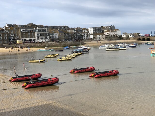
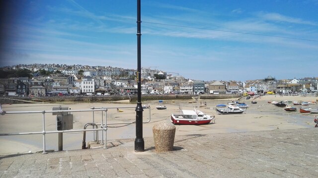
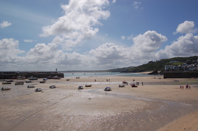
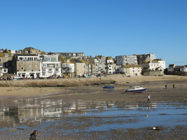
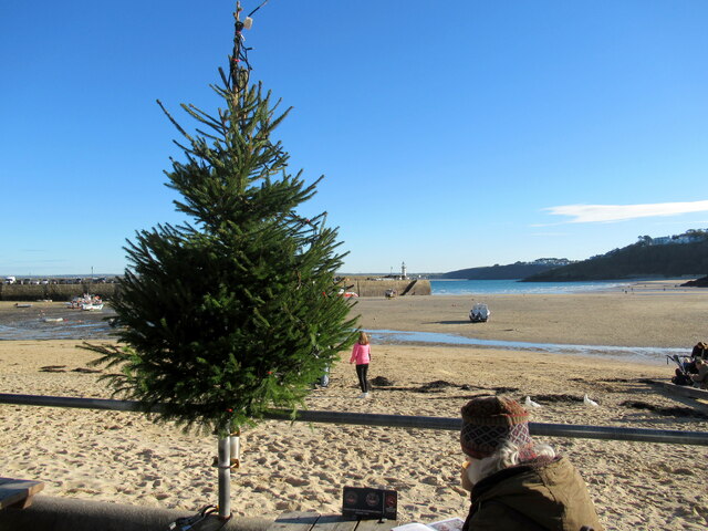
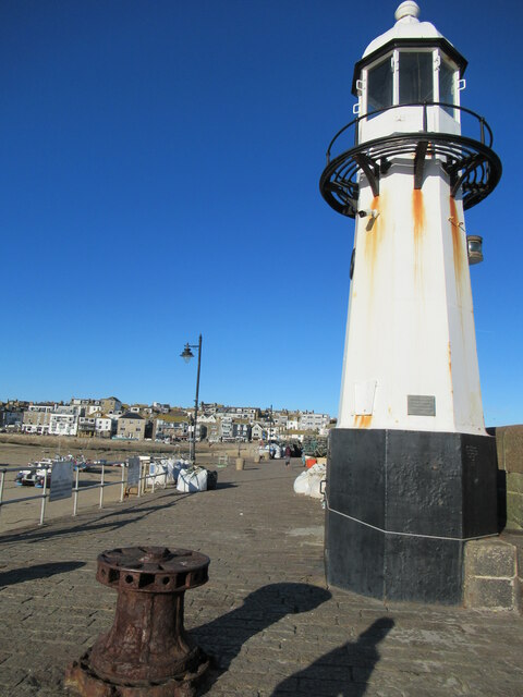
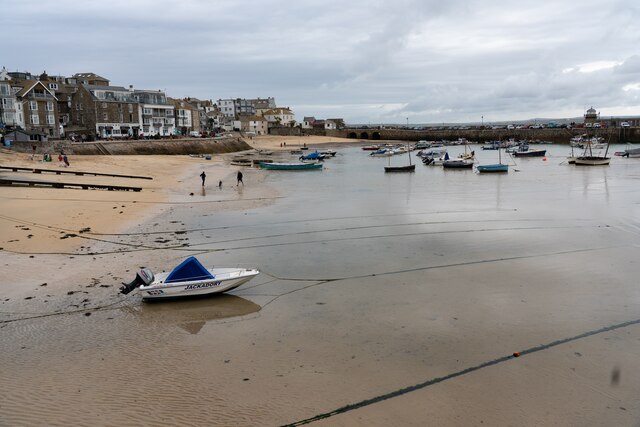
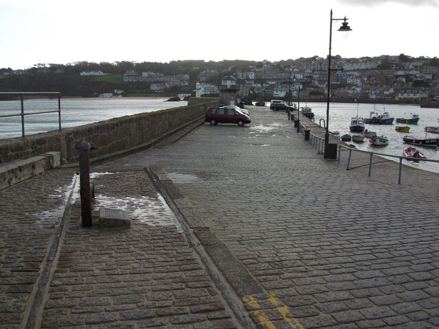
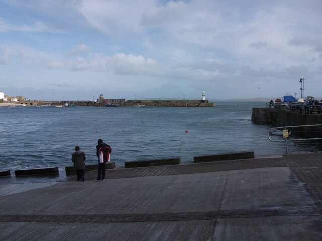
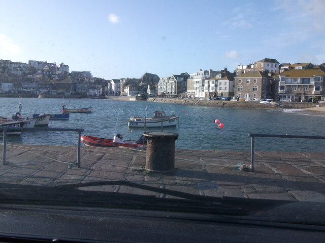
St. Ives is a picturesque seaside town located in Cornwall, England. It is known for its stunning beaches, crystal-clear waters, and charming harbor lined with colorful fishing boats. The town is also famous for its vibrant art scene, with numerous galleries showcasing the work of local artists as well as pieces by renowned international artists.

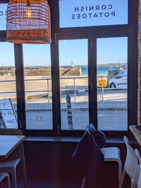
St. Ives is a popular tourist destination, attracting visitors from around the world who come to enjoy its natural beauty, cultural attractions, and relaxed atmosphere. The town is home to a variety of shops, cafes, and restaurants offering a range of dining options, from traditional Cornish pasties to gourmet seafood dishes.

In addition to its beaches and art galleries, St. Ives offers a range of outdoor activities such as surfing, hiking, and exploring the nearby coastal cliffs and countryside. The town is also a great base for exploring other attractions in Cornwall, including the iconic St. Michael's Mount and the beautiful gardens at Trebah and the Lost Gardens of Heligan. With its stunning scenery and laid-back vibe, St. Ives is a must-visit destination for anyone looking to experience the beauty of Cornwall.

If you have any feedback on the listing, please let us know in the comments section below.
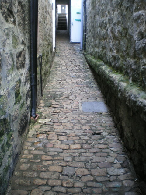
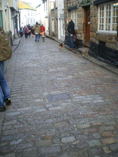
St. Ives Images

Images are sourced within 2km of 50.196893/-5.480305 or Grid Reference SW5138. Thanks to Geograph Open Source API. All images are credited.

St Ives Harbour
St Ives Harbour
St. Ives Harbour A view over St. Ives Harbour, taken looking south from Smeaton's Pier.
St. Ives Harbour
A view over St. Ives Harbour, taken looking south from Smeaton's Pier.
St Ives beach at low tide Many small boats stranded by the receding tide in St Ives Harbour.
St Ives beach at low tide
Many small boats stranded by the receding tide in St Ives Harbour.
St Ives harbour from the Harbour Fish & Chips Restaurant
Fish & Chip lunches, Harbour Fish & Chips Restaurant, St Ives
Low tide reflections, St Ives harbour
Christmas tree at St Ives harbour
Smeaton's Pier, St Ives
Harbour Sand beach at St Ives
Smeatons Pier Smeatons Pier in St. Ives, photographed from beside the Harbour Master's Office.
Smeatons Pier
Smeatons Pier in St. Ives, photographed from beside the Harbour Master's Office.
Slipway by RNLI Station in St. Ives The slipway by the lifeboat station in St. Ives, looking over the harbour to Smeatons Pier.
Slipway by RNLI Station in St. Ives
The slipway by the lifeboat station in St. Ives, looking over the harbour to Smeatons Pier.
View over St. Ives Harbour A view of St. Ives Harbour, looking back from Smeatons Pier.
View over St. Ives Harbour
A view of St. Ives Harbour, looking back from Smeatons Pier.
The Rum & Crab bar, The Wharf Originally built in the early 19th century, and presumably used in connection with the fishing trade or as a wharfside store, this unusual-looking building was known as the Copper Kettle (cafe?) and Wimpy Bar by the time it was Grade II listed <span class="nowrap"><a title="https://britishlistedbuildings.co.uk/101327835-the-copper-kettle-and-wimpey-bar-st-ives#.Ydi9vP7P3IU" rel="nofollow ugc noopener" href="https://britishlistedbuildings.co.uk/101327835-the-copper-kettle-and-wimpey-bar-st-ives#.Ydi9vP7P3IU">Link</a><img style="margin-left:2px;" alt="External link" title="External link - shift click to open in new window" src="https://s1.geograph.org.uk/img/external.png" width="10" height="10"/></span> & <span class="nowrap"><a title="https://historicengland.org.uk/listing/the-list/list-entry/1327835" rel="nofollow ugc noopener" href="https://historicengland.org.uk/listing/the-list/list-entry/1327835">Link</a><img style="margin-left:2px;" alt="External link" title="External link - shift click to open in new window" src="https://s1.geograph.org.uk/img/external.png" width="10" height="10"/></span> in 1972.
The Rum & Crab bar, The Wharf
Originally built in the early 19th century, and presumably used in connection with the fishing trade or as a wharfside store, this unusual-looking building was known as the Copper Kettle (cafe?) and Wimpy Bar by the time it was Grade II listed LinkExternal link & LinkExternal link in 1972.
Cobbled street surface in Custom House Passage Unlike some of the other 18th century street surfaces around St Ives such as <a href="https://www.geograph.org.uk/photo/4928337">SW5140 : Fore Street, St Ives</a> <a href="https://www.geograph.org.uk/photo/3135725">SW5140 : Bailey's Lane, St. Ives</a> and <a href="https://www.geograph.org.uk/photo/7057826">SW5140 : Cobbled street surface on Mount Zion</a>, Custom House Passage seems to have avoided being listed. That must be an oversight, as these stones look even less disturbed and relaid than many on the more heavily trafficked roads.
Cobbled street surface in Custom House Passage
Unlike some of the other 18th century street surfaces around St Ives such as SW5140 : Fore Street, St Ives SW5140 : Bailey's Lane, St. Ives and SW5140 : Cobbled street surface on Mount Zion, Custom House Passage seems to have avoided being listed. That must be an oversight, as these stones look even less disturbed and relaid than many on the more heavily trafficked roads.
71 & 73 Fore Street, St Ives Although the frontage looks like a single former house, the address is given as nos 71 and 73, which is actually a pair of mid 19th century cottages with a twin entrance just inside the street-facing doorway. They are now in use as a small art gallery, and were Grade II listed <span class="nowrap"><a title="https://britishlistedbuildings.co.uk/101312628-71-and-73-fore-street-st-ives#.YdjBLf7P3IU" rel="nofollow ugc noopener" href="https://britishlistedbuildings.co.uk/101312628-71-and-73-fore-street-st-ives#.YdjBLf7P3IU">Link</a><img style="margin-left:2px;" alt="External link" title="External link - shift click to open in new window" src="https://s1.geograph.org.uk/img/external.png" width="10" height="10"/></span> & <span class="nowrap"><a title="https://historicengland.org.uk/listing/the-list/list-entry/1312628" rel="nofollow ugc noopener" href="https://historicengland.org.uk/listing/the-list/list-entry/1312628">Link</a><img style="margin-left:2px;" alt="External link" title="External link - shift click to open in new window" src="https://s1.geograph.org.uk/img/external.png" width="10" height="10"/></span> in 1972.
71 & 73 Fore Street, St Ives
Although the frontage looks like a single former house, the address is given as nos 71 and 73, which is actually a pair of mid 19th century cottages with a twin entrance just inside the street-facing doorway. They are now in use as a small art gallery, and were Grade II listed LinkExternal link & LinkExternal link in 1972.
75 Fore Street, St Ives Now trading as an off-licence outlet for alcohol sales, no 75 Fore Street is described as "An early 19th century fronting to a building of probable earlier origin" in its 1972 Grade II listing details <span class="nowrap"><a title="https://britishlistedbuildings.co.uk/101327759-75-fore-street-st-ives#.YeCoHv7P3IU" rel="nofollow ugc noopener" href="https://britishlistedbuildings.co.uk/101327759-75-fore-street-st-ives#.YeCoHv7P3IU">Link</a><img style="margin-left:2px;" alt="External link" title="External link - shift click to open in new window" src="https://s1.geograph.org.uk/img/external.png" width="10" height="10"/></span> & <span class="nowrap"><a title="https://historicengland.org.uk/listing/the-list/list-entry/1327759" rel="nofollow ugc noopener" href="https://historicengland.org.uk/listing/the-list/list-entry/1327759">Link</a><img style="margin-left:2px;" alt="External link" title="External link - shift click to open in new window" src="https://s1.geograph.org.uk/img/external.png" width="10" height="10"/></span> It was most likely built as cottages or a house.
75 Fore Street, St Ives
Now trading as an off-licence outlet for alcohol sales, no 75 Fore Street is described as "An early 19th century fronting to a building of probable earlier origin" in its 1972 Grade II listing details LinkExternal link & LinkExternal link It was most likely built as cottages or a house.
Cobbled street surface in Virgin Street In common with a number of other similar streets and paths in the central part of St Ives, the original 18th century granite cobbles here were given a Grade II listing <span class="nowrap"><a title="https://britishlistedbuildings.co.uk/101327810-the-street-surface-st-ives#.YeKZSv7P3IU" rel="nofollow ugc noopener" href="https://britishlistedbuildings.co.uk/101327810-the-street-surface-st-ives#.YeKZSv7P3IU">Link</a><img style="margin-left:2px;" alt="External link" title="External link - shift click to open in new window" src="https://s1.geograph.org.uk/img/external.png" width="10" height="10"/></span> & <span class="nowrap"><a title="https://historicengland.org.uk/listing/the-list/list-entry/1327810" rel="nofollow ugc noopener" href="https://historicengland.org.uk/listing/the-list/list-entry/1327810">Link</a><img style="margin-left:2px;" alt="External link" title="External link - shift click to open in new window" src="https://s1.geograph.org.uk/img/external.png" width="10" height="10"/></span> in 1972.
Cobbled street surface in Virgin Street
In common with a number of other similar streets and paths in the central part of St Ives, the original 18th century granite cobbles here were given a Grade II listing LinkExternal link & LinkExternal link in 1972.
Cobbled street surface on Fore Street, looking north Part of the extensive granite cobbled street surface of Fore Street, which dates back probably to the 18th century, and was Grade II listed <span class="nowrap"><a title="https://britishlistedbuildings.co.uk/101143372-the-street-surface-st-ives#.YeRDX_7P3IU" rel="nofollow ugc noopener" href="https://britishlistedbuildings.co.uk/101143372-the-street-surface-st-ives#.YeRDX_7P3IU">Link</a><img style="margin-left:2px;" alt="External link" title="External link - shift click to open in new window" src="https://s1.geograph.org.uk/img/external.png" width="10" height="10"/></span> & <span class="nowrap"><a title="https://historicengland.org.uk/listing/the-list/list-entry/1143372" rel="nofollow ugc noopener" href="https://historicengland.org.uk/listing/the-list/list-entry/1143372">Link</a><img style="margin-left:2px;" alt="External link" title="External link - shift click to open in new window" src="https://s1.geograph.org.uk/img/external.png" width="10" height="10"/></span> in 1972.
Cobbled street surface on Fore Street, looking north
Part of the extensive granite cobbled street surface of Fore Street, which dates back probably to the 18th century, and was Grade II listed LinkExternal link & LinkExternal link in 1972.
Show me another place!

St. Ives is located at Grid Ref: SW5138 (Lat: 50.196893, Lng: -5.480305)

Unitary Authority: Cornwall

Police Authority: Devon & Cornwall

What 3 Words

///hiring.amid.round. Near St Ives, Cornwall

Related Wikis

St Ives School (academy)

St Ives School is a coeducational secondary school with academy status, located in St Ives, Cornwall, England. == Barbara Hepworth == Notable sculptor...

Tregenna Castle

Tregenna Castle, (Cornish: Kastel Tregenow, meaning "Kenow’s settlement") in St Ives, Cornwall, was built by Samuel Stephens in the 18th century and is...

Carbis Bay Hotel

Carbis Bay Hotel is a hotel in Carbis Bay near St Ives, Cornwall. It is the most prominent building in Carbis Bay, overlooking the beach. == History... ==

47th G7 summit

The 47th G7 summit was held from 11 to 13 June 2021 in Cornwall, England, during the United Kingdom's tenure of the presidency of the Group of Seven (G7...

Nearby Amenities

Located within 500m of 50.196893,-5.480305
Mini Roundabout
Lat/Long: 50.1989094/-5.4750669
Hiking: yes
Information: guidepost
Source: GPS survey
Tourism: information
Lat/Long: 50.1980379/-5.4869293
Hiking: yes
Information: guidepost
Source: GPS survey
Tourism: information
Lat/Long: 50.1958771/-5.4816225
Hiking: yes
Information: guidepost
Source: GPS survey
Tourism: information
Lat/Long: 50.1961724/-5.4822394
Power: pole
Lat/Long: 50.1977177/-5.4855734
Power: pole
Lat/Long: 50.1985436/-5.4852301
Power: pole
Lat/Long: 50.1969485/-5.4859033
Power: pole
Lat/Long: 50.1962737/-5.4868099
Power: pole
Lat/Long: 50.1933907/-5.4775912
Power: pole
Lat/Long: 50.1930353/-5.4790342
Power: pole
Lat/Long: 50.1927382/-5.4805604
Generator Method: photovoltaic
Generator Output Electricity: small_installation
Generator Source: solar
Generator Type: solar_photovoltaic_panel
Location: roof
Power: generator
Source: bing
Lat/Long: 50.1980886/-5.4758357
Generator Method: photovoltaic
Generator Output Electricity: small_installation
Generator Source: solar
Generator Type: solar_photovoltaic_panel
Location: roof
Power: generator
Source: bing
Lat/Long: 50.1952006/-5.4746649
Generator Method: photovoltaic
Generator Output Electricity: small_installation
Generator Source: solar
Generator Type: solar_photovoltaic_panel
Location: roof
Power: generator
Source: bing
Lat/Long: 50.1944536/-5.4745951
Power: pole
Lat/Long: 50.2001215/-5.4845408
Power: pole
Lat/Long: 50.1993677/-5.4848814
Leisure: picnic_table
Lat/Long: 50.1933993/-5.479517
Man Made: communications_tower
Operator: Vodafone
Lat/Long: 50.1974576/-5.4830374
Location Transition: yes
Power: pole
Lat/Long: 50.2000734/-5.4783663
Location Transition: yes
Power: pole
Lat/Long: 50.2001987/-5.4799756
Power: pole
Lat/Long: 50.1998244/-5.479002
Power: pole
Transformer: distribution
Lat/Long: 50.1995789/-5.4782523
Power: pole
Lat/Long: 50.1994244/-5.4779077
Power: pole
Lat/Long: 50.19896/-5.4774396
Power: pole
Lat/Long: 50.1984955/-5.4769783
Location Transition: yes
Power: pole
Lat/Long: 50.1980792/-5.4765263
Location Transition: yes
Power: pole
Lat/Long: 50.1942313/-5.4750431
Power: pole
Lat/Long: 50.1937685/-5.4759027
Carbis Water
Power: substation
Voltage: 11000
Lat/Long: 50.1958569/-5.474168
Venns Estate
Power: substation
Voltage: 11000
Lat/Long: 50.1966983/-5.4740949
Barrier: stile
Stile: stepover
Lat/Long: 50.1969376/-5.481325
Toilets
Access: customers
Lat/Long: 50.198211/-5.4736875
Barrier: stile
Stile: stepover
Lat/Long: 50.1980461/-5.482308
Entrance: yes
Lat/Long: 50.1982789/-5.4737373
Hiking: yes
Information: guidepost
Tourism: information
Lat/Long: 50.1969393/-5.4813379
Information: board
Tourism: information
Lat/Long: 50.196894/-5.481565
Entrance: yes
Lat/Long: 50.1983548/-5.4736803
Charging Station
Lat/Long: 50.1982231/-5.4740042
The data included in this document is from www.openstreetmap.org. The data is made available under ODbL.

Have you been to St. Ives?

Leave your review of St. Ives below (or comments, questions and feedback).