Southminster

Civil Parish in Essex Maldon

England

Southminster

Sheep in field, Asheldham Chase As seen from public footpath.
Sheep in field, Asheldham Chase Credit: Roger Jones

Southminster is a civil parish located in the Maldon district of Essex, England. It is situated on the Dengie peninsula, which stretches out into the North Sea. The parish covers an area of approximately 17 square kilometers and has a population of around 4,500 people.

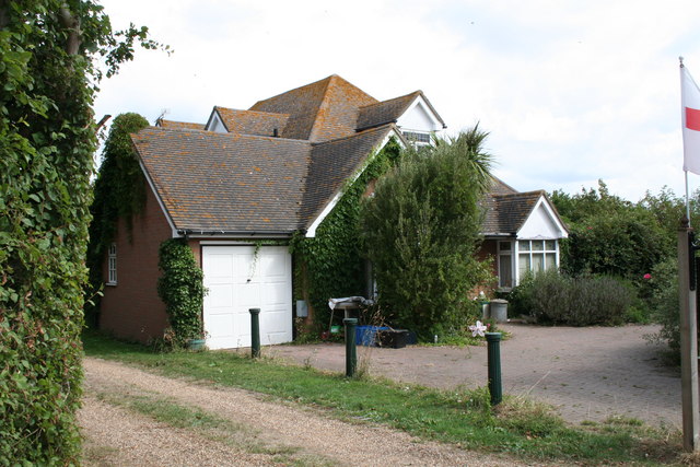
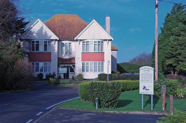
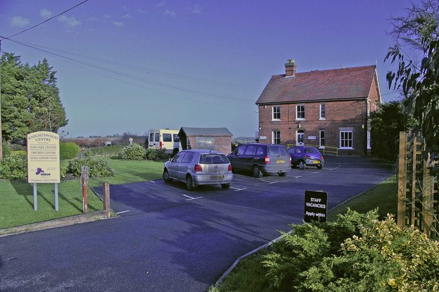
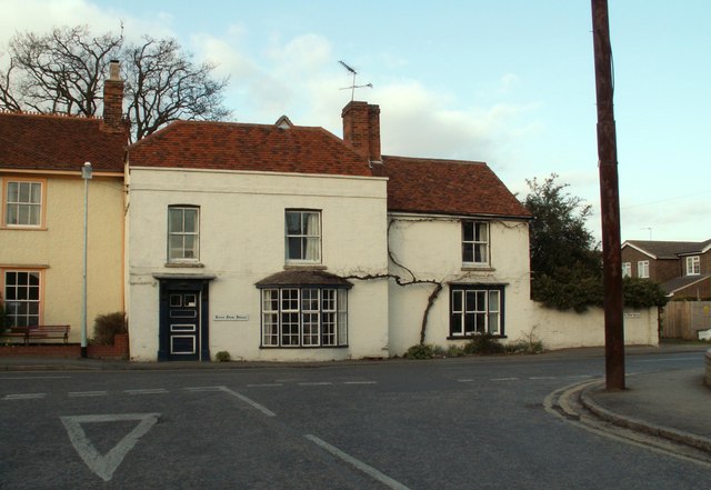
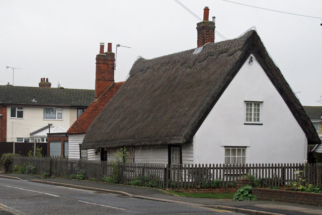
The town of Southminster itself is a small and charming community, with a picturesque high street lined with historic buildings. It is primarily a residential area, with a mix of housing styles ranging from traditional cottages to modern developments. The town center offers a range of amenities, including local shops, cafes, pubs, and a supermarket. There is also a weekly market held in the town, providing residents with fresh produce and other goods.

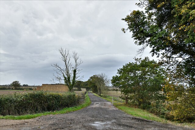
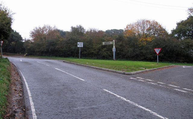
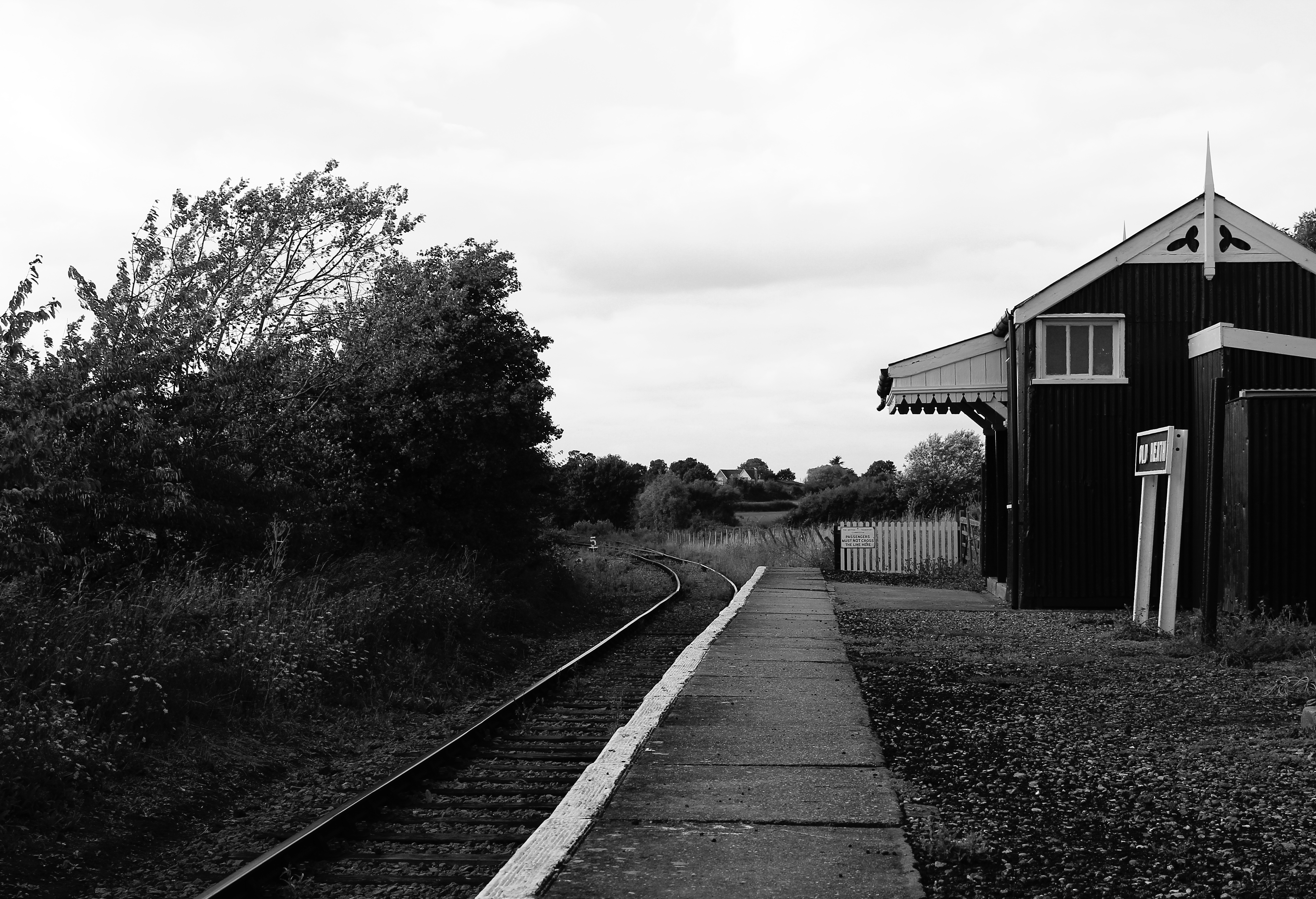
Southminster is well-connected to other parts of Essex and beyond. The town has its own railway station, offering regular services to London Liverpool Street, making it an attractive location for commuters. Additionally, the A132 road passes through the parish, providing easy access to nearby towns and the wider road network.

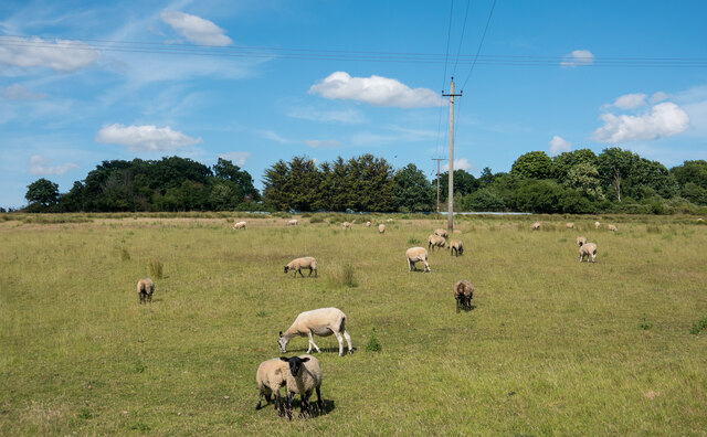
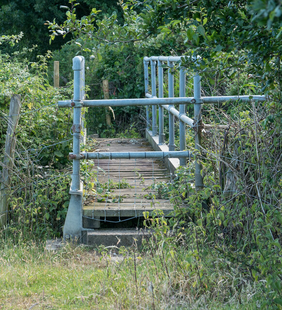
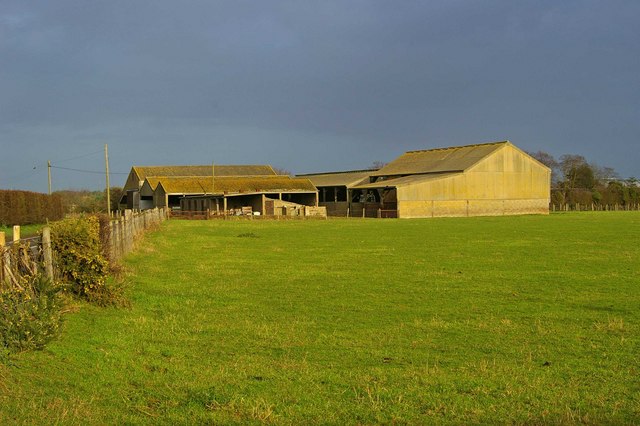
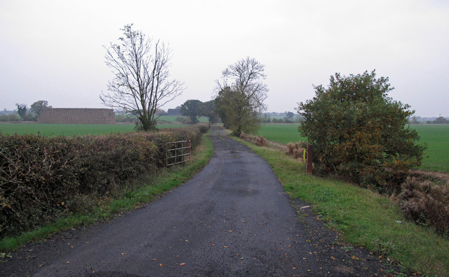
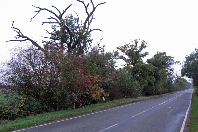
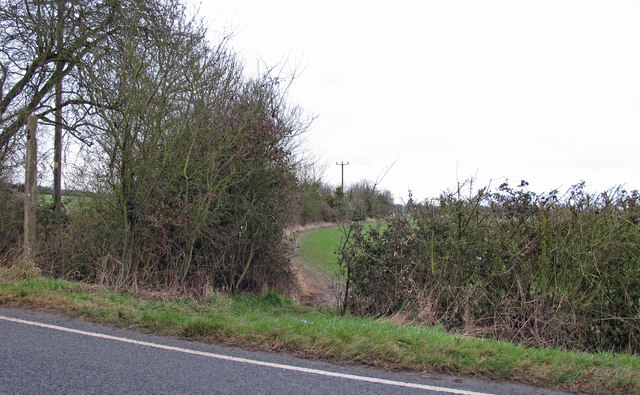
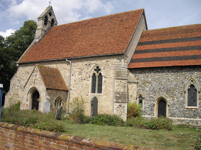
The surrounding countryside is predominantly agricultural, with vast fields and farmland stretching out towards the coast. The area is known for its scenic beauty, with several nature reserves and walking trails for residents and visitors to enjoy. The Dengie peninsula is also home to several historic landmarks, including the 12th-century St. Leonard's Church and the iconic Bradwell Power Station.

Overall, Southminster offers a peaceful and idyllic living environment, with its rural charm, excellent transport links, and close-knit community.

If you have any feedback on the listing, please let us know in the comments section below.

Southminster Images

Images are sourced within 2km of 51.660829/0.83642 or Grid Reference TQ9699. Thanks to Geograph Open Source API. All images are credited.

Sheep in field, Asheldham Chase As seen from public footpath.
Sheep in field, Asheldham Chase
As seen from public footpath.
Off-putting stile, Asheldham This stile at the entrance to a footbridge on a public footpath is to my mind unnecessarily difficult to use.
Off-putting stile, Asheldham
This stile at the entrance to a footbridge on a public footpath is to my mind unnecessarily difficult to use.
Asheldham, Farm track/ public footpath
Hay harvest, Badnocks Farm, Essex On the Dengie peninsula, the hay is bound into brick-shaped bales which can be economically stacked onto a lorry.
Hay harvest, Badnocks Farm, Essex
On the Dengie peninsula, the hay is bound into brick-shaped bales which can be economically stacked onto a lorry.
Asheldham Lodge, Essex A fine large modern detached house.
Asheldham Lodge, Essex
A fine large modern detached house.
Squeaks House This is Squeaks House in Steeple Rd Southminster. It is a care home for the elderly with space for 29 residents
Squeaks House
This is Squeaks House in Steeple Rd Southminster. It is a care home for the elderly with space for 29 residents
Bridge on Sheepcotes Lane Sheepcotes Lane runs from Southminster to Foxhall Rd. It is a “route with public access” as far as the Bridge. Beyond that it is a bridle path that runs to the left of Sheepcotes farmhouse.
Bridge on Sheepcotes Lane
Sheepcotes Lane runs from Southminster to Foxhall Rd. It is a “route with public access” as far as the Bridge. Beyond that it is a bridle path that runs to the left of Sheepcotes farmhouse.
Oldmoor Farm Barns These asbestos barns can be found on Tillingham Road northeast of Southminster
Oldmoor Farm Barns
These asbestos barns can be found on Tillingham Road northeast of Southminster
Knightswood Centre This is the Knightswood Centre it is a charitable day care centre for older people see <span class="nowrap"><a title="http://www.dengieprojecttrust.org.uk/index.html" rel="nofollow ugc noopener" href="http://www.dengieprojecttrust.org.uk/index.html">Link</a><img style="margin-left:2px;" alt="External link" title="External link - shift click to open in new window" src="https://s1.geograph.org.uk/img/external.png" width="10" height="10"/></span> . It is located on a bend in Steeple Rd Southminster.
Knightswood Centre
This is the Knightswood Centre it is a charitable day care centre for older people see LinkExternal link . It is located on a bend in Steeple Rd Southminster.
Asheldham Brook Asheldham Brook looking rather sluggish despite recent rain.
Asheldham Brook
Asheldham Brook looking rather sluggish despite recent rain.
An old house in Southminster This house, which looks like it is early 18th century, is called Home Farm House that indicates there was once a farm here, but now it is surrounded by houses. The road junction is on the B.1021
An old house in Southminster
This house, which looks like it is early 18th century, is called Home Farm House that indicates there was once a farm here, but now it is surrounded by houses. The road junction is on the B.1021
Graveyard Gate Just beyond this lych gate is a narrow strip of land which may well be the remains of a previously larger cemetery.

Smoke from a nearby bonfire slightly gives the background the appearance of being wrapped in mist: if you look carefully you can see the outline of a dark ghostly figure walking amongst the graves.
Graveyard Gate
Just beyond this lych gate is a narrow strip of land which may well be the remains of a previously larger cemetery. Smoke from a nearby bonfire slightly gives the background the appearance of being wrapped in mist: if you look carefully you can see the outline of a dark ghostly figure walking amongst the graves.
Farm track and footpath Public footpath on track to Sheepcotes
Farm track and footpath
Public footpath on track to Sheepcotes
Older houses, Northend A group of older houses, most likely C19 or earlier: this part of Southminster has a few older buildings from C17 onwards.
Older houses, Northend
A group of older houses, most likely C19 or earlier: this part of Southminster has a few older buildings from C17 onwards.
Foxhall Rd junction with Tillingham Road Note sign for Dengie Public Weighbridge.
Foxhall Rd junction with Tillingham Road
Note sign for Dengie Public Weighbridge.
Thatched cottage with weatherboarding Cottage, C17 or earlier; timber framed and weatherboarded; thatched roof

Listed building see: <span class="nowrap"><a title="http://list.english-heritage.org.uk/resultsingle.aspx?uid=1237492" rel="nofollow ugc noopener" href="http://list.english-heritage.org.uk/resultsingle.aspx?uid=1237492">Link</a><img style="margin-left:2px;" alt="External link" title="External link - shift click to open in new window" src="https://s1.geograph.org.uk/img/external.png" width="10" height="10"/></span> for more info
Thatched cottage with weatherboarding
Cottage, C17 or earlier; timber framed and weatherboarded; thatched roof Listed building see: LinkExternal link for more info
Trees and hedgerow on Foxhall Road verge The Dengie (pronounced with a soft G) Peninsula is an area of South Essex, bounded by the River Blackwater to the north, the River Crouch to the south  and the North Sea to the east. The western Boundary of the old "Dengie Hundred" ran from (and included) North Fambridge to Woodham Walter: The nearby town of Maldon was not part of the Dengie Hundred as it was a borough in its own right. See <span class="nowrap"><a title="http://en.wikipedia.org/wiki/File:Essex_Hundreds_1830.png" rel="nofollow ugc noopener" href="http://en.wikipedia.org/wiki/File:Essex_Hundreds_1830.png">Link</a><img style="margin-left:2px;" alt="External link" title="External link - shift click to open in new window" src="https://s1.geograph.org.uk/img/external.png" width="10" height="10"/></span> for a map of the Essex Hundreds.

The area has a relatively low population density, with large areas of farm and marsh land. The largest towns are Burnham on Crouch with a population of c. 7,500 and Southminster with a population of c. 3,800.

Useful links:
Dengie 100  <span class="nowrap"><a title="http://www.dengie.org.uk/" rel="nofollow ugc noopener" href="http://www.dengie.org.uk/">Link</a><img style="margin-left:2px;" alt="External link" title="External link - shift click to open in new window" src="https://s1.geograph.org.uk/img/external.png" width="10" height="10"/></span>
Essex-family-history <span class="nowrap"><a title="http://www.essex-family-history.co.uk/history.htm" rel="nofollow ugc noopener" href="http://www.essex-family-history.co.uk/history.htm">Link</a><img style="margin-left:2px;" alt="External link" title="External link - shift click to open in new window" src="https://s1.geograph.org.uk/img/external.png" width="10" height="10"/></span>
wikipedia <span class="nowrap"><a title="http://en.wikipedia.org/wiki/Dengie_peninsula" rel="nofollow ugc noopener" href="http://en.wikipedia.org/wiki/Dengie_peninsula">Link</a><img style="margin-left:2px;" alt="External link" title="External link - shift click to open in new window" src="https://s1.geograph.org.uk/img/external.png" width="10" height="10"/></span>
Trees and hedgerow on Foxhall Road verge
The Dengie (pronounced with a soft G) Peninsula is an area of South Essex, bounded by the River Blackwater to the north, the River Crouch to the south and the North Sea to the east. The western Boundary of the old "Dengie Hundred" ran from (and included) North Fambridge to Woodham Walter: The nearby town of Maldon was not part of the Dengie Hundred as it was a borough in its own right. See LinkExternal link for a map of the Essex Hundreds. The area has a relatively low population density, with large areas of farm and marsh land. The largest towns are Burnham on Crouch with a population of c. 7,500 and Southminster with a population of c. 3,800. Useful links: Dengie 100 LinkExternal link Essex-family-history LinkExternal link wikipedia LinkExternal link
Footpath entrance off Steeple Road Footpath runs along field boundary.
Footpath entrance off Steeple Road
Footpath runs along field boundary.
Show me another place!

Southminster is located at Grid Ref: TQ9699 (Lat: 51.660829, Lng: 0.83642)

Administrative County: Essex

District: Maldon

Police Authority: Essex

What 3 Words

///dude.husky.rare. Near Southminster, Essex

Nearby Locations

Pandole Wood Southminster

Related Wikis

Southminster railway station

Southminster railway station is the eastern terminus of the Crouch Valley Line in Essex, England, serving the town of Southminster and other settlements...

Southminster

Southminster is a village and civil parish on the Dengie Peninsula in the Maldon district of Essex in the East of England. It lies about 3 miles (4.8 km...

Goldsands Road Pit

Goldsands Road Pit is a 1.3-hectare (3.2-acre) geological Site of Special Scientific Interest in Southminster in Essex. It is a Geological Conservation...

Asheldham

Asheldham is a village and civil parish in Essex, England. It is located about 14 km (8.7 mi) southeast of Maldon and is 26 km (16 mi) east-southeast from...

Mangapps Railway Museum

Mangapps Railway Museum (previously Mangapps Farm Railway Museum) is a heritage railway centre located near Burnham-on-Crouch in Essex, England. The 0...

St Mary's Church, Burnham on Crouch

St Mary's Church is a Church of England church in Burnham on Crouch, Essex. It is Grade II* listed == References ==

Ormiston Rivers Academy

Ormiston Rivers Academy (formerly St Peter's High School) is a secondary school and sixth form with academy status located in Burnham-on-Crouch, Essex...

Dengie

Dengie is a village and civil parish in the Maldon district of Essex, England, with a population of 119 at the 2011 census.It gives its name to the Dengie...

Nearby Amenities

Located within 500m of 51.660829,0.83642
Southminster
Is In: Essex, England, UK
Is In Country: UK
Is In County: Essex
Place: village
Source: NPE
Lat/Long: 51.6618541/0.8300674
Southminster
Public Transport: stop_position
Railway: stop
Train: yes
Lat/Long: 51.660963/0.8355477
Bus Stop
North End
Bus: yes
Naptan AtcoCode: 150012007001
Naptan Bearing: E
Naptan CommonName: North End
Naptan Crossing: Homefield
Naptan Indicator: E-bound
Naptan Landmark: North End
Naptan NaptanCode: esxawtdw
Naptan Street: North End
Naptan Verified: no
Public Transport: platform
Source: naptan_import
Lat/Long: 51.664885/0.8333615
Bus Stop
Southminster Railway Station
Bus: yes
Naptan AtcoCode: 1500IM1498
Naptan Bearing: S
Naptan CommonName: Southminster Railway Station
Naptan Indicator: o/s
Naptan Landmark: Southminster Railway Station
Naptan NaptanCode: esxadjta
Naptan Street: Tattersalls Chase
Naptan Verified: no
Public Transport: platform
Shelter: yes
Source: naptan_import
Lat/Long: 51.6608613/0.8353713
Entrance: main
Lat/Long: 51.6620409/0.8302248
Post Box
Collection Times: Mo-Fr 16:45; Sa 11:30
Operator: Royal Mail
Operator Wikidata: Q638098
Post Box Type: lamp
Ref: CM0 229
Royal Cypher: EIIR
Royal Cypher Wikidata: Q33102113
Source: survey
Lat/Long: 51.6609787/0.835427
Recycling
Recycling Type: container
Lat/Long: 51.6626846/0.8307021
Post Box
Operator: Royal Mail
Operator Wikidata: Q638098
Lat/Long: 51.6627293/0.8309124
Post Box
Collection Times: Mo-Fr 17:00; Sa 12:00
Operator: Royal Mail
Operator Wikidata: Q638098
Post Box Type: pillar
Ref: CM0 236
Royal Cypher: EIIR
Royal Cypher Wikidata: Q33102113
Source: survey
Lat/Long: 51.6622999/0.8296596
Southminster swimming pool
Covered: yes
Leisure: sports_centre
Location: indoor
Sport: swimming
Lat/Long: 51.6609567/0.8307947
Railway: buffer_stop
Lat/Long: 51.661218/0.8356837
Communication Mobile Phone: yes
Man Made: mast
Tower Type: communication
Lat/Long: 51.662207/0.8369336
Man Made: mast
Tower Construction: lattice
Tower Type: communication
Lat/Long: 51.6597271/0.8347525
Southminster
Naptan AtcoCode: 9100SMINSTR
Network: National Rail
Network Website: https://www.nationalrail.co.uk/stations/smn/
Network Wikidata: Q26334
Public Transport: station
Railway: station
Ref Crs: SMN
Source: NPE
Train: yes
Wikidata: Q2501276
Wikipedia: en:Southminster railway station
Lat/Long: 51.6606424/0.8353716
Bicycle Parking
Bicycle Parking: stands
Capacity: 20
Lat/Long: 51.6610478/0.8355471
The data included in this document is from www.openstreetmap.org. The data is made available under ODbL.

Have you been to Southminster?

Leave your review of Southminster below (or comments, questions and feedback).