South Petherwin

Civil Parish in Cornwall

England

South Petherwin

St Paternus's Church
St Paternus's Church Credit: Paul Barnett

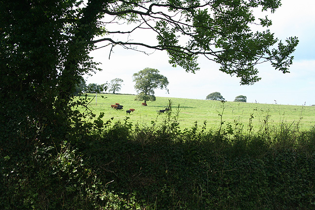
South Petherwin is a civil parish located in the county of Cornwall, England. It covers an area of approximately 8.5 square miles and is situated about 5 miles north of the town of Launceston. The parish is nestled in the picturesque countryside, surrounded by rolling hills and farmland.

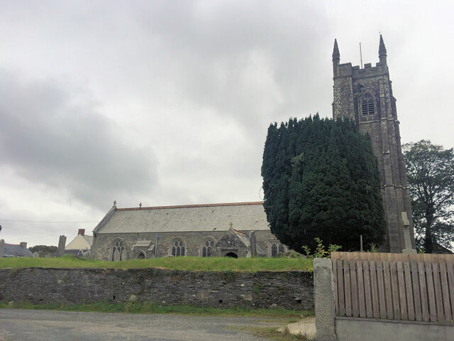
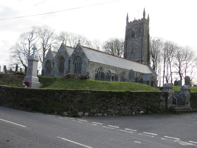
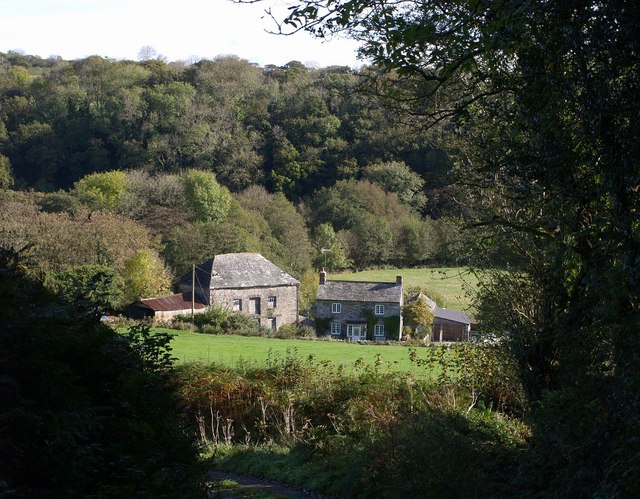
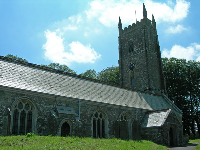
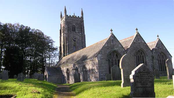
The village of South Petherwin is the main settlement within the parish. It has a small population of around 600 residents. The village is characterized by charming traditional cottages, a historic church, and a few local amenities including a village hall and a primary school.

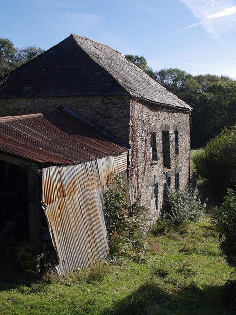
The parish is known for its rich history, with evidence of human habitation dating back to the Bronze Age. The area has also witnessed Roman and Saxon influences over the centuries. Visitors can explore ancient sites such as the Trelaske Round, a well-preserved circular earthwork believed to be an Iron Age fortification.

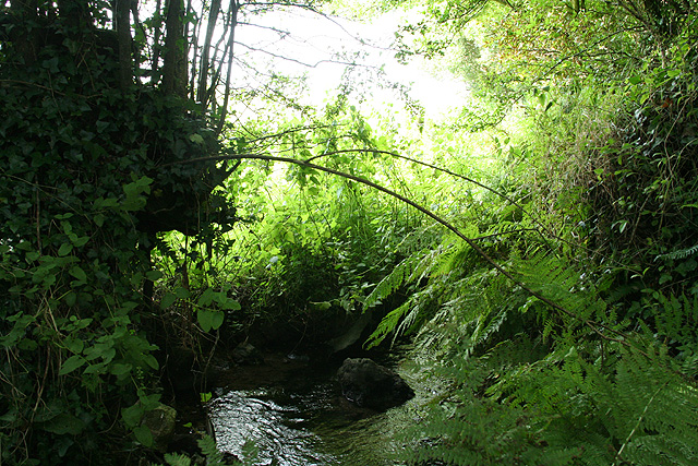
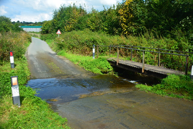
In terms of natural beauty, South Petherwin offers stunning walks and scenery. The area is home to several nature reserves, including the Petherwin Marsh Local Nature Reserve, which provides a habitat for various bird species and other wildlife.

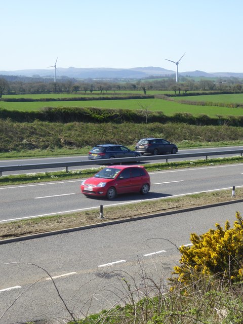
South Petherwin benefits from its proximity to the larger town of Launceston, which offers a wider range of amenities, including shops, restaurants, and recreational facilities. The parish is also well-connected to the rest of Cornwall and beyond, with good road links to nearby towns and cities.

Overall, South Petherwin is a tranquil and picturesque parish, steeped in history and offering a peaceful rural lifestyle for its residents.

If you have any feedback on the listing, please let us know in the comments section below.

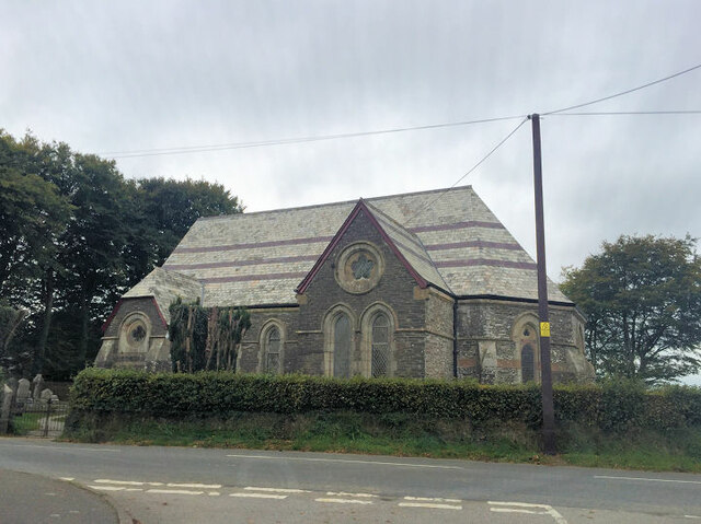
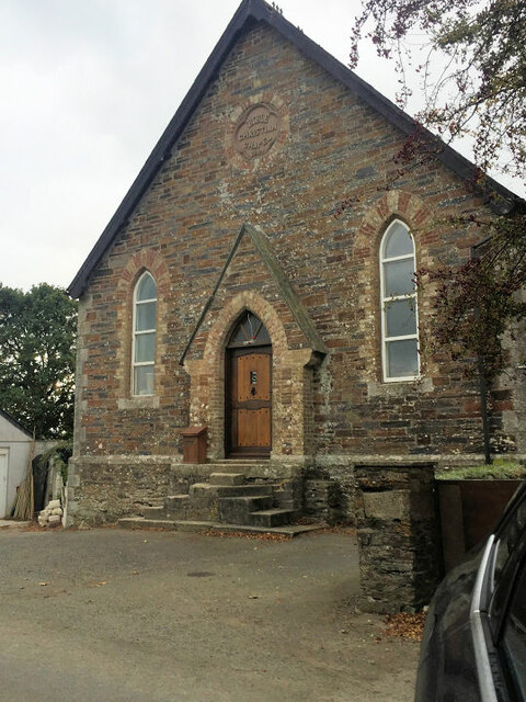
South Petherwin Images

Images are sourced within 2km of 50.610622/-4.394082 or Grid Reference SX3081. Thanks to Geograph Open Source API. All images are credited.

St Paternus's Church
South Petherwin Methodist Church
Former Bible Christian Chapel
The Church of St Paternus at South Petherwin Viewed from the north-east.
The Church of St Paternus at South Petherwin
Viewed from the north-east.
Old Milestone by the B3254, Trecrogo Lane End Carved stone post by the B3254, in parish of SOUTH PETHERWIN (NORTH CORNWALL District), Trecrogo turn; opposite Endlea Cottage (toll house?) with catslide roof, by the road, on West side of road. Launceston pillar, erected by the Launceston turnpike trust in the 18th century. 

Inscription reads:-
L
3 

Grade II Listed. List Entry Number: 1392044
<span class="nowrap"><a title="https://historicengland.org.uk/listing/the-list/list-entry/1392044" rel="nofollow ugc noopener" href="https://historicengland.org.uk/listing/the-list/list-entry/1392044">Link</a><img style="margin-left:2px;" alt="External link" title="External link - shift click to open in new window" src="https://s1.geograph.org.uk/img/external.png" width="10" height="10"/></span>

Milestone Society National ID: CW_LALK03.
Old Milestone by the B3254, Trecrogo Lane End
Carved stone post by the B3254, in parish of SOUTH PETHERWIN (NORTH CORNWALL District), Trecrogo turn; opposite Endlea Cottage (toll house?) with catslide roof, by the road, on West side of road. Launceston pillar, erected by the Launceston turnpike trust in the 18th century. Inscription reads:- L 3 Grade II Listed. List Entry Number: 1392044 LinkExternal link Milestone Society National ID: CW_LALK03.
Old Milestone by the B3254, East Petherwin Launceston pillar by the B3254, in parish of South Petherwin (North Cornwall District), East Petherwin, 130m North East of the vicarage, in rock cutting, set in niche.

Inscription reads:-
L
2
(To Launceston)

Lost since 1970 

(Grade II listed) List Entry Number: 1303507
<span class="nowrap"><a title="https://historicengland.org.uk/listing/the-list/list-entry/1303507" rel="nofollow ugc noopener" href="https://historicengland.org.uk/listing/the-list/list-entry/1303507">Link</a><img style="margin-left:2px;" alt="External link" title="External link - shift click to open in new window" src="https://s1.geograph.org.uk/img/external.png" width="10" height="10"/></span>

Milestone Society National ID: CW_LALK02
Old Milestone by the B3254, East Petherwin
Launceston pillar by the B3254, in parish of South Petherwin (North Cornwall District), East Petherwin, 130m North East of the vicarage, in rock cutting, set in niche. Inscription reads:- L 2 (To Launceston) Lost since 1970 (Grade II listed) List Entry Number: 1303507 LinkExternal link Milestone Society National ID: CW_LALK02
Old Milestone by the B3254, Trecrogo Lane End Carved stone post by the B3254, in parish of SOUTH PETHERWIN (NORTH CORNWALL District), Trecrogo turn; opposite Endlea Cottage (toll house?) with catslide roof, by the road, on West side of road. Launceston pillar, erected by the Launceston turnpike trust in the 18th century. 

Inscription reads:-
L
3 

Grade II listed. 
List Entry Number: 1392044 <span class="nowrap"><a title="https://historicengland.org.uk/listing/the-list/list-entry/1392044" rel="nofollow ugc noopener" href="https://historicengland.org.uk/listing/the-list/list-entry/1392044">Link</a><img style="margin-left:2px;" alt="External link" title="External link - shift click to open in new window" src="https://s1.geograph.org.uk/img/external.png" width="10" height="10"/></span>

Milestone Society National ID: CW_LALK03.
Old Milestone by the B3254, Trecrogo Lane End
Carved stone post by the B3254, in parish of SOUTH PETHERWIN (NORTH CORNWALL District), Trecrogo turn; opposite Endlea Cottage (toll house?) with catslide roof, by the road, on West side of road. Launceston pillar, erected by the Launceston turnpike trust in the 18th century. Inscription reads:- L 3 Grade II listed. List Entry Number: 1392044 LinkExternal link Milestone Society National ID: CW_LALK03.
Lewannick: Trelaske Mill Private property but viewed from the lane that runs past. The long leat – well over a mile in length – that served the mill has been ploughed out but the building retains its machinery
Lewannick: Trelaske Mill
Private property but viewed from the lane that runs past. The long leat – well over a mile in length – that served the mill has been ploughed out but the building retains its machinery
South Petherwin: near Botathan Road junction to the west of South Petherwin village. Turn left for Kennard House, the A30 to Exeter and the A395 to Camelford. Looking east
South Petherwin: near Botathan
Road junction to the west of South Petherwin village. Turn left for Kennard House, the A30 to Exeter and the A395 to Camelford. Looking east
South Petherwin: stream near Trecongdon A tributary of the river Inny. Looking north
South Petherwin: stream near Trecongdon
A tributary of the river Inny. Looking north
South Petherwin: near Trecongdon Looking north-north-west
South Petherwin: near Trecongdon
Looking north-north-west
Trelaske Mill Not a great deal has changed since <a href="https://www.geograph.org.uk/photo/62603">SX2980 : Lewannick: Trelaske Mill</a> was taken in March 1995.
Trelaske Mill
Not a great deal has changed since SX2980 : Lewannick: Trelaske Mill was taken in March 1995.
Trelaske Mill <a href="https://www.geograph.org.uk/photo/589557">SX2980 : Trelaske Mill</a> and the adjacent farmhouse seen from the steep lane from Trelaske House. The buildings are in the valley of the River Inny. On the eastern slope is Honiton Wood.
Trelaske Mill
SX2980 : Trelaske Mill and the adjacent farmhouse seen from the steep lane from Trelaske House. The buildings are in the valley of the River Inny. On the eastern slope is Honiton Wood.
Trekelland Ford This ford is found on a tributary of the River Inny.
Trekelland Ford
This ford is found on a tributary of the River Inny.
A30 by-passing Tregadillett Looking south towards two nearby wind turbines
A30 by-passing Tregadillett
Looking south towards two nearby wind turbines
Entrance to Patron's Wood
Launceston Industrial Park The extensive industrial area just south of Launceston continues to attract units.
Launceston Industrial Park
The extensive industrial area just south of Launceston continues to attract units.
South Petherwin Church South Petherwin Church is dedicated to St. Paternus (Padern).
South Petherwin Church
South Petherwin Church is dedicated to St. Paternus (Padern).
Show me another place!

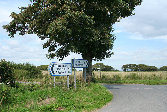
South Petherwin is located at Grid Ref: SX3081 (Lat: 50.610622, Lng: -4.394082)

Unitary Authority: Cornwall

Police Authority: Devon & Cornwall

What 3 Words

///unions.ripen.marketing. Near Launceston, Cornwall

Related Wikis

South Petherwin

South Petherwin (Cornish: Paderwynn Dheghow) is a village and civil parish in east Cornwall, England, United Kingdom. It is in the Registration District...

Daw's House

Daw's House is a hamlet in the parish of South Petherwin, Cornwall, England, on the outskirts of the significant town of Launceston. == References ==

St Thomas the Apostle Rural

St Thomas the Apostle Rural, also known as St Thomas-by-Launceston (Cornish: Sen Tommos Lannstefan) is a civil parish in east Cornwall, England, United...

Launceston F.C.

Launceston Football Club (Cornish: Klub Pel-droes Lannstevan) is a football club based in Launceston, Cornwall, England. They are currently members of...

Nearby Amenities

Located within 500m of 50.610622,-4.394082
South Petherwin
Is In: Cornwall, England, UK
Name Kw: Peder Wynn Soth
Place: village
Lat/Long: 50.6122953/-4.3895138
Bus Stop
Alvia Cottage
Bus: yes
Naptan AtcoCode: 0800COA10632
Naptan Bearing: N
Naptan CommonName: Alvia Cottage
Naptan NaptanCode: cordtpgp
Naptan Street: B3254
Naptan Verified: no
Public Transport: platform
Source: naptan_import
Lat/Long: 50.6121103/-4.3903042
Bus Stop
Post Office
Bus: yes
Naptan AtcoCode: 0800COA10633
Naptan Bearing: NW
Naptan CommonName: Post Office
Naptan NaptanCode: cordtpgt
Naptan Street: B3254
Naptan Verified: no
Public Transport: platform
Shelter: yes
Source: naptan_import
Lat/Long: 50.6115459/-4.3901908
Post Box
Brand: Royal Mail
Brand Wikidata: Q638098
Operator: Royal Mail
Operator Wikidata: Q638098
Post Box Type: lamp
Royal Cypher: EIIR
Source: drive-by survey
Lat/Long: 50.6115204/-4.3902288
Power: pole
Lat/Long: 50.6102841/-4.4010034
Power: pole
Lat/Long: 50.6102909/-4.3994853
Power: pole
Lat/Long: 50.6099113/-4.3985277
Power: pole
Lat/Long: 50.6092985/-4.3969882
Power: pole
Lat/Long: 50.6087539/-4.3956015
Power: pole
Lat/Long: 50.6090671/-4.3941101
Power: pole
Lat/Long: 50.6095011/-4.3920529
Power: pole
Lat/Long: 50.6097854/-4.3907762
Power: pole
Lat/Long: 50.6099947/-4.389647
Power: pole
Lat/Long: 50.6103045/-4.388271
Defibrillator
Access: yes
Defibrillator Location: outside public toilets, South Pertherwin
Emergency: defibrillator
Indoor: no
Lat/Long: 50.6115036/-4.3895897
Pub
Frog and Bucket
Lat/Long: 50.6113674/-4.3884353
Booth: K6
Covered: booth
Disused Amenity: telephone
Man Made: telephone_box
Lat/Long: 50.6116011/-4.3899176
The data included in this document is from www.openstreetmap.org. The data is made available under ODbL.

Have you been to South Petherwin?

Leave your review of South Petherwin below (or comments, questions and feedback).