Skillington

Civil Parish in Lincolnshire South Kesteven

England

Skillington

An industrial landscape It doesn't look like one, but the field in front of us, apart from the bank in the immediate nearground, is a couple of metres lower than the natural ground surface.  This is part of the area that in the middle to late 20th century was strip-mined for iron ore, and the land returned to agriculture afterward.

This is a compound image stitched from 12 individual ones to form a panorama around 90 degrees wide.
An industrial landscape Credit: Bob Harvey

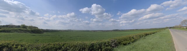
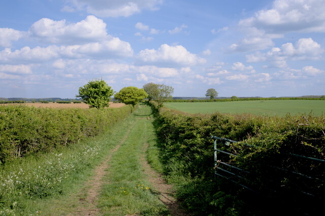
Skillington is a civil parish located in the southern part of Lincolnshire, England. Situated approximately 10 miles south of Grantham, it covers an area of around 4 square miles. The parish is characterized by its rural landscape, with rolling hills and picturesque countryside.

The village of Skillington itself is small, with a population of around 250 residents. It is known for its charming and traditional English village atmosphere. The architecture of the village mainly consists of quaint cottages and farmhouses, giving it a timeless appeal.

Skillington is surrounded by farmland, and agriculture plays a significant role in the local economy. The fertile soil and favorable climate make it ideal for growing crops and rearing livestock. As a result, farming is a common occupation among the residents.

Despite its small size, Skillington offers a range of amenities and facilities to its residents. These include a primary school, a village hall, a church, and a pub. The community is close-knit and actively participates in various social and cultural events throughout the year.

The parish enjoys excellent transport links, with the A1 road passing nearby, providing easy access to other parts of Lincolnshire and neighboring counties. The nearby market town of Grantham offers additional services and amenities, including shops, supermarkets, and healthcare facilities.

Skillington is a peaceful and idyllic place to live, offering a tranquil setting away from the hustle and bustle of larger urban areas. Its natural beauty and sense of community make it a desirable location for those seeking a rural lifestyle in Lincolnshire.

If you have any feedback on the listing, please let us know in the comments section below.
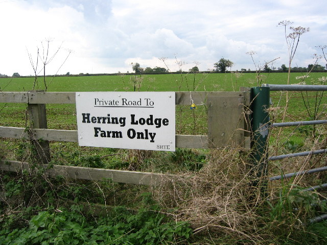
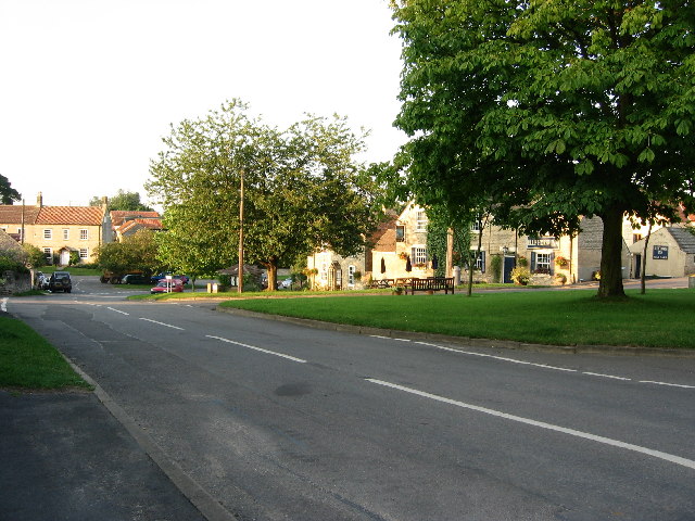
Skillington Images

Images are sourced within 2km of 52.823001/-0.669567 or Grid Reference SK8925. Thanks to Geograph Open Source API. All images are credited.

An industrial landscape It doesn't look like one, but the field in front of us, apart from the bank in the immediate nearground, is a couple of metres lower than the natural ground surface.  This is part of the area that in the middle to late 20th century was strip-mined for iron ore, and the land returned to agriculture afterward.

This is a compound image stitched from 12 individual ones to form a panorama around 90 degrees wide.
An industrial landscape
It doesn't look like one, but the field in front of us, apart from the bank in the immediate nearground, is a couple of metres lower than the natural ground surface. This is part of the area that in the middle to late 20th century was strip-mined for iron ore, and the land returned to agriculture afterward. This is a compound image stitched from 12 individual ones to form a panorama around 90 degrees wide.
Public footpath A pleasant way to spend an afternoon, walking below the sound of skylarks along this track to Woolsthorpe.
Public footpath
A pleasant way to spend an afternoon, walking below the sound of skylarks along this track to Woolsthorpe.
The Drift More like The Flow. Rain plus the use of off-road vehicles has rendered this part of the Viking Way impassable to walkers. See also <a href="https://www.geograph.org.uk/photo/4733412">SK8824 : The Viking Way at Cringle Brook</a> which shows that this has been an issue for some time.
The Drift
More like The Flow. Rain plus the use of off-road vehicles has rendered this part of the Viking Way impassable to walkers. See also SK8824 : The Viking Way at Cringle Brook which shows that this has been an issue for some time.
Track to Skillington Buckminster Lane.
Track to Skillington
Buckminster Lane.
The Drift Forms the county boundary between Leicestershire (left) and Lincolnshire.
The Drift
Forms the county boundary between Leicestershire (left) and Lincolnshire.
The beginning of a footpath to Skillington
The Drift Forms the county boundary between Leicestershire (left) and Lincolnshire.
The Drift
Forms the county boundary between Leicestershire (left) and Lincolnshire.
Limestone quarry, near Buckminster This large limestone quarry is now being used as a landfill site at its eastern end and, takes up a fair proportion of the square. Note the straight sides of the rockface
Limestone quarry, near Buckminster
This large limestone quarry is now being used as a landfill site at its eastern end and, takes up a fair proportion of the square. Note the straight sides of the rockface
Landfill site in quarry near Buckminster Access to the land fill is top left. The whole site takes up over half the square. Photograph taken from the same point as <a title="www.geograph.org.uk/photo/38271" href="https://www.geograph.org.uk/photo/38271">Link</a>
Landfill site in quarry near Buckminster
Access to the land fill is top left. The whole site takes up over half the square. Photograph taken from the same point as Link
Farmland near Stoke Rochford
Bee Hives at Herring's Lodge Farm These metal bee hives are on the old railway track at Herring's Lodge Farm
Bee Hives at Herring's Lodge Farm
These metal bee hives are on the old railway track at Herring's Lodge Farm
Old Railway track near Stoke Rochford
Farmland near Stoke Rochford
Radio mast Between Skillington and Woolsthorpe
Radio mast
Between Skillington and Woolsthorpe
Woolsthorpe Line Nature Reserve A small, fenced-off area along a disused railway line. The large limestone quarry <a href="https://www.geograph.org.uk/photo/38271">SK9024 : Limestone quarry, near Buckminster</a> is to the immediate north (right)
Woolsthorpe Line Nature Reserve
A small, fenced-off area along a disused railway line. The large limestone quarry SK9024 : Limestone quarry, near Buckminster is to the immediate north (right)
Cotswold Farm Derived from 'cots' = a hollow or sheep enclosure, and 'wold' = an upland common, the main feature this part of Lincolnshire shares with the famous Cotswolds of south-west England is the limestone used in many of the finer old buildings.
Cotswold Farm
Derived from 'cots' = a hollow or sheep enclosure, and 'wold' = an upland common, the main feature this part of Lincolnshire shares with the famous Cotswolds of south-west England is the limestone used in many of the finer old buildings.
Landfilled cutting This looks like an old railway line, and suffering the fate of many of these fine old features by being filled in.
Landfilled cutting
This looks like an old railway line, and suffering the fate of many of these fine old features by being filled in.
Show me another place!

Skillington is located at Grid Ref: SK8925 (Lat: 52.823001, Lng: -0.669567)

Administrative County: Lincolnshire

District: South Kesteven

Police Authority: Lincolnshire

What 3 Words

///chosen.archduke.improves. Near Colsterworth, Lincolnshire

Related Wikis

Skillington

Skillington is a village and civil parish in the South Kesteven district of Lincolnshire, England. The population of the civil parish at the 2021 census...

Stoke Rochford

Stoke Rochford is a small English village and civil parish 5.5 miles (9 km) south of Grantham in the South Kesteven district of Lincolnshire. The population...

RAF Buckminster

Royal Air Force Buckminster or more simply RAF Buckminster is a former Royal Flying Corps and Royal Air Force station 2.25 miles (3.62 km) west of Colsterworth...

St Andrew and St Mary's Church, Stoke Rochford

St Andrew and St Mary's Church is a Grade I listed Church of England parish church dedicated to Saint Andrew and Saint Mary, in the parish of Easton and...

Nearby Amenities

Located within 500m of 52.823001,-0.669567
Pub
The Cross Swords
Addr City: Skillington
Addr Postcode: NG33 5HB
Addr Street: The Square
Fhrs Authority: South Kesteven
Fhrs Id: 238205
Fhrs Local Authority Id: 5673
Lat/Long: 52.8217981/-0.6677643
Bus Stop
Blue Horse Inn
Bus: yes
Naptan AtcoCode: 2700LSTG3182
Naptan Bearing: SW
Naptan CommonName: Blue Horse Inn
Naptan Indicator: adj
Naptan Landmark: Blue Horse Inn
Naptan NaptanCode: linawmwm
Naptan Street: Colsterworth Road
Naptan Verified: no
Public Transport: platform
Shelter: yes
Source: naptan_import
Lat/Long: 52.8217964/-0.6681273
Pub
The Blue Horse Inn
Lat/Long: 52.8214953/-0.6680572
Post Box
Ele: 111.8782959
Post Box Type: lamp
Lat/Long: 52.8214923/-0.6688484
Telephone
Defibrillator
Booth: K6
Covered: booth
Defibrillator Location: inside red phone box, Middle Street, Skillington
Ele: 111.3977051
Emergency: defibrillator
Lat/Long: 52.8214595/-0.6688444
Weston's Farm
Place: farm
Source: Bing
Lat/Long: 52.8209373/-0.664876
Power: pole
Lat/Long: 52.82673/-0.6670242
Power: pole
Lat/Long: 52.8235728/-0.6683035
Power: pole
Lat/Long: 52.8225031/-0.6687351
Power: pole
Lat/Long: 52.8225875/-0.6689336
Power: pole
Lat/Long: 52.8227237/-0.6685313
Power: pole
Lat/Long: 52.8256798/-0.6674372
Power: pole
Lat/Long: 52.8232261/-0.6677373
Power: pole
Lat/Long: 52.8246555/-0.6678717
Power: pole
Lat/Long: 52.8262872/-0.6654349
Power: pole
Lat/Long: 52.8255529/-0.6658825
Power: pole
Lat/Long: 52.8246907/-0.6663492
Power: pole
Lat/Long: 52.823903/-0.6666791
Power: pole
Lat/Long: 52.8236388/-0.6670654
Skillington
Is In: Lincolnshire, England, UK, GB
Place: village
Lat/Long: 52.821347/-0.668428
Power: pole
Lat/Long: 52.8189513/-0.6714454
Power: pole
Lat/Long: 52.8196134/-0.6704919
Power: pole
Lat/Long: 52.8204198/-0.6695263
Direction: ESE
Generator Method: photovoltaic
Generator Output Electricity: yes
Generator Source: solar
Generator Type: solar_photovoltaic_panel
Location: roof
Power: generator
Lat/Long: 52.8202242/-0.6679823
Direction: SE
Generator Method: photovoltaic
Generator Output Electricity: yes
Generator Source: solar
Generator Type: solar_photovoltaic_panel
Location: roof
Power: generator
Lat/Long: 52.8195242/-0.6694253
Direction: SSW
Generator Output Electricity: yes
Generator Source: solar
Generator Type: solar_photovoltaic_panel
Location: roof
Power: generator
Lat/Long: 52.8206755/-0.6689411
Direction: SSW
Generator Method: photovoltaic
Generator Output Electricity: yes
Generator Source: solar
Generator Type: solar_photovoltaic_panel
Location: roof
Power: generator
Lat/Long: 52.8206609/-0.6688928
Direction: ESE
Generator Method: photovoltaic
Generator Output Electricity: yes
Generator Source: solar
Generator Type: solar_photovoltaic_panel
Location: roof
Note: solar hot water?
Power: generator
Lat/Long: 52.8207871/-0.668459
Direction: E
Generator Method: photovoltaic
Generator Output Electricity: yes
Generator Source: solar
Generator Type: solar_photovoltaic_panel
Location: roof
Note: solar hot water?
Power: generator
Lat/Long: 52.8207766/-0.6681063
The data included in this document is from www.openstreetmap.org. The data is made available under ODbL.

Have you been to Skillington?

Leave your review of Skillington below (or comments, questions and feedback).