Skillington

Settlement in Lincolnshire South Kesteven

England

Skillington

Clearing a disused railway NW of Woolsthorpe by Colsterworth: aerial 2021 (1)
Clearing a disused railway NW of Woolsthorpe by Colsterworth: aerial 2021 (1) Credit: Chris

Skillington is a small village located in the county of Lincolnshire, England. Situated approximately 10 miles southwest of Grantham and 20 miles northeast of Stamford, it falls within the South Kesteven district. With a population of around 300 residents, Skillington is known for its peaceful and picturesque countryside surroundings.

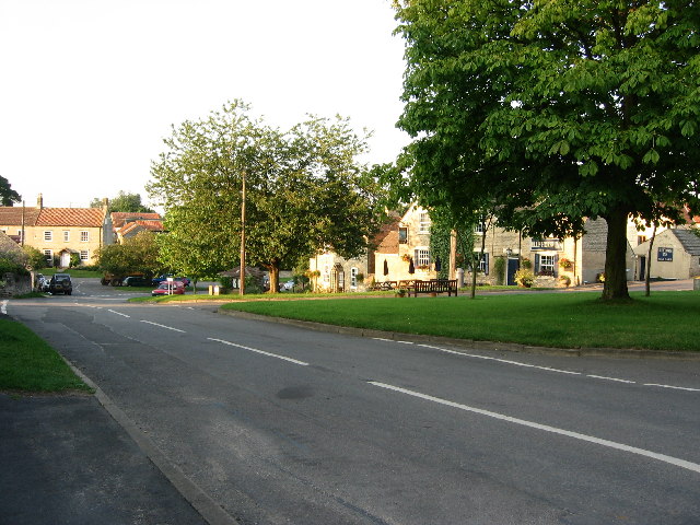
The village is characterized by its traditional English architecture, with many well-preserved stone cottages and buildings dating back several centuries. The centerpiece of Skillington is the All Saints Church, a beautiful medieval structure that has stood since the 12th century. This historic church attracts visitors from near and far, with its stunning stained glass windows and intricate stone carvings.

Although small in size, Skillington offers its residents a strong sense of community. The village has a local pub, The Cross Swords, which serves as a gathering place for locals and visitors alike. Additionally, there is a village hall that hosts various community events throughout the year, including fairs, dances, and charity fundraisers.

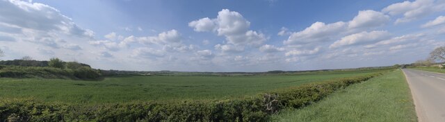
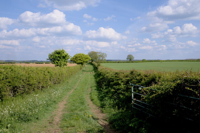
Skillington is surrounded by rolling hills and fields, making it an ideal location for outdoor enthusiasts. The village is located near the Viking Way, a long-distance footpath that stretches across Lincolnshire, offering opportunities for hiking and exploring the beautiful countryside. The nearby Vale of Belvoir also provides stunning views and is popular for walks and picnics.

Overall, Skillington is a charming and tranquil village that offers a close-knit community, historic architecture, and scenic landscapes, making it an appealing destination for those seeking a peaceful retreat in the heart of Lincolnshire.

If you have any feedback on the listing, please let us know in the comments section below.
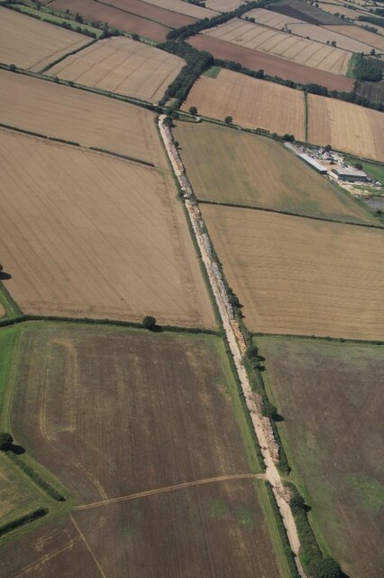
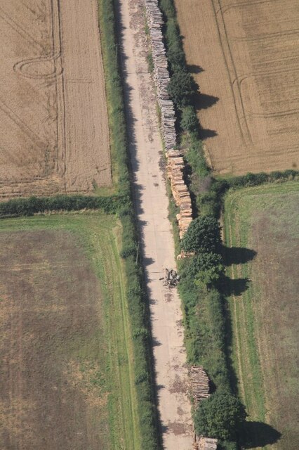
Skillington Images

Images are sourced within 2km of 52.821764/-0.668284 or Grid Reference SK8925. Thanks to Geograph Open Source API. All images are credited.

Clearing a disused railway NW of Woolsthorpe by Colsterworth: aerial 2021 (1)
Clearing a disused railway NW of Woolsthorpe by Colsterworth: aerial 2021 (2)
Limestone Quarry near Woolsthorpe by Colsterworth: aerial 2021 (1)
Limestone Quarry near Woolsthorpe by Colsterworth: aerial 2021 (2)
An industrial landscape It doesn't look like one, but the field in front of us, apart from the bank in the immediate nearground, is a couple of metres lower than the natural ground surface.  This is part of the area that in the middle to late 20th century was strip-mined for iron ore, and the land returned to agriculture afterward.

This is a compound image stitched from 12 individual ones to form a panorama around 90 degrees wide.
An industrial landscape
It doesn't look like one, but the field in front of us, apart from the bank in the immediate nearground, is a couple of metres lower than the natural ground surface. This is part of the area that in the middle to late 20th century was strip-mined for iron ore, and the land returned to agriculture afterward. This is a compound image stitched from 12 individual ones to form a panorama around 90 degrees wide.
Public footpath A pleasant way to spend an afternoon, walking below the sound of skylarks along this track to Woolsthorpe.
Public footpath
A pleasant way to spend an afternoon, walking below the sound of skylarks along this track to Woolsthorpe.
The Drift More like The Flow. Rain plus the use of off-road vehicles has rendered this part of the Viking Way impassable to walkers. See also <a href="https://www.geograph.org.uk/photo/4733412">SK8824 : The Viking Way at Cringle Brook</a> which shows that this has been an issue for some time.
The Drift
More like The Flow. Rain plus the use of off-road vehicles has rendered this part of the Viking Way impassable to walkers. See also SK8824 : The Viking Way at Cringle Brook which shows that this has been an issue for some time.
Track to Skillington Buckminster Lane.
Track to Skillington
Buckminster Lane.
The Drift Forms the county boundary between Leicestershire (left) and Lincolnshire.
The Drift
Forms the county boundary between Leicestershire (left) and Lincolnshire.
The beginning of a footpath to Skillington
The Drift Forms the county boundary between Leicestershire (left) and Lincolnshire.
The Drift
Forms the county boundary between Leicestershire (left) and Lincolnshire.
Limestone quarry, near Buckminster This large limestone quarry is now being used as a landfill site at its eastern end and, takes up a fair proportion of the square. Note the straight sides of the rockface
Limestone quarry, near Buckminster
This large limestone quarry is now being used as a landfill site at its eastern end and, takes up a fair proportion of the square. Note the straight sides of the rockface
Landfill site in quarry near Buckminster Access to the land fill is top left. The whole site takes up over half the square. Photograph taken from the same point as <a title="www.geograph.org.uk/photo/38271" href="https://www.geograph.org.uk/photo/38271">Link</a>
Landfill site in quarry near Buckminster
Access to the land fill is top left. The whole site takes up over half the square. Photograph taken from the same point as Link
Farmland near Stoke Rochford
Bee Hives at Herring's Lodge Farm These metal bee hives are on the old railway track at Herring's Lodge Farm
Bee Hives at Herring's Lodge Farm
These metal bee hives are on the old railway track at Herring's Lodge Farm
Old Railway track near Stoke Rochford
Farmland near Stoke Rochford
Show me another place!

Skillington is located at Grid Ref: SK8925 (Lat: 52.821764, Lng: -0.668284)

Division: Parts of Kesteven

Administrative County: Lincolnshire

District: South Kesteven

Police Authority: Lincolnshire

What 3 Words

///motored.vipers.daisy. Near Colsterworth, Lincolnshire

Related Wikis

Skillington

Skillington is a village and civil parish in the South Kesteven district of Lincolnshire, England. The population of the civil parish at the 2021 census...

RAF Buckminster

Royal Air Force Buckminster or more simply RAF Buckminster is a former Royal Flying Corps and Royal Air Force station 2.25 miles (3.62 km) west of Colsterworth...

Stoke Rochford

Stoke Rochford is a small English village and civil parish 5.5 miles (9 km) south of Grantham in the South Kesteven district of Lincolnshire. The population...

St Andrew and St Mary's Church, Stoke Rochford

St Andrew and St Mary's Church is a Grade I listed Church of England parish church dedicated to Saint Andrew and Saint Mary, in the parish of Easton and...

Isaac Newton's apple tree

Isaac Newton's apple tree at Woolsthorpe Manor represents the inspiration behind Sir Isaac Newton's theory of gravity. While the precise details of the...
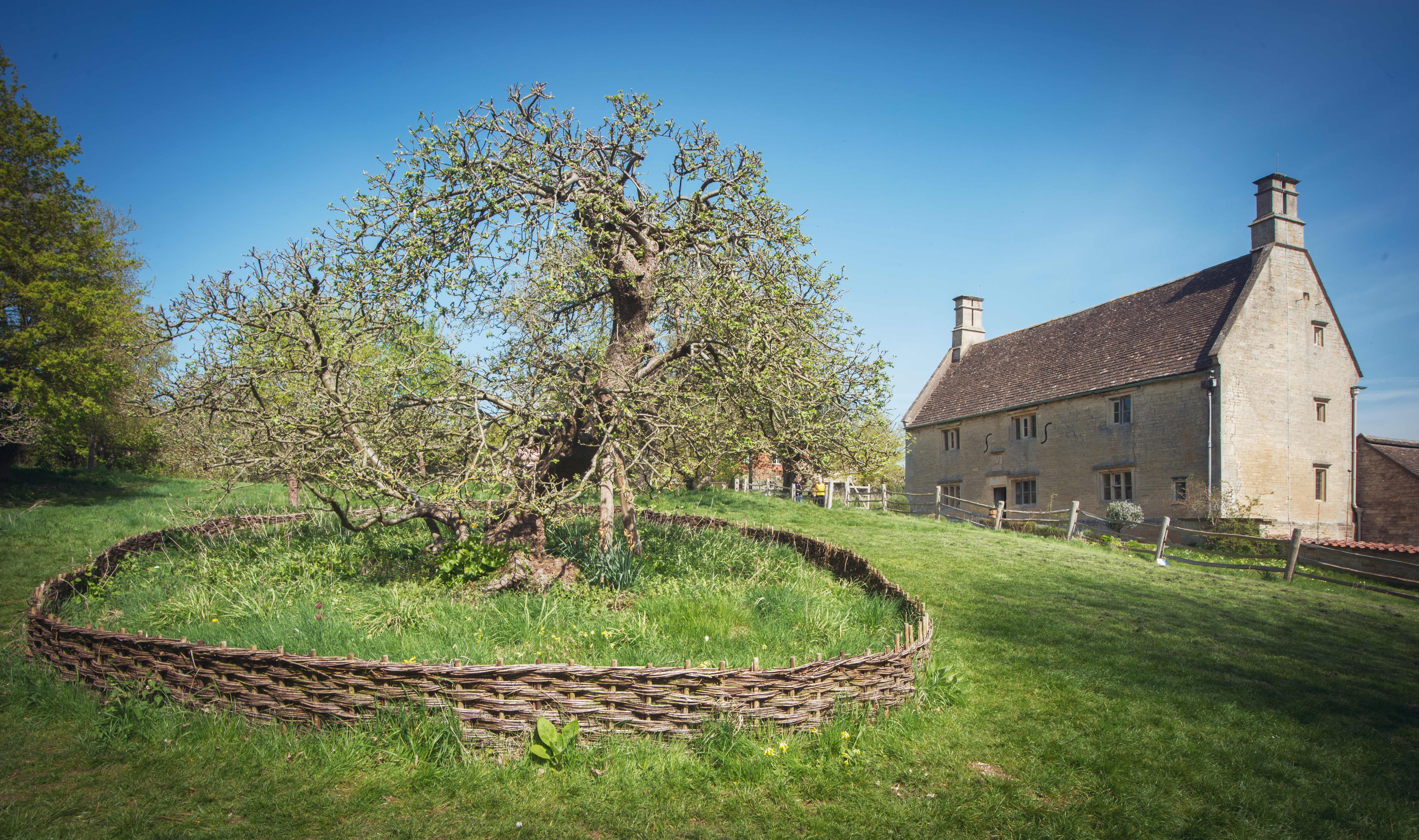
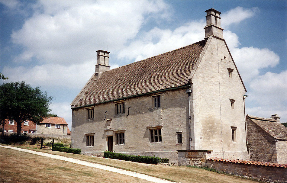
Woolsthorpe Manor

Woolsthorpe Manor in Woolsthorpe-by-Colsterworth, near Grantham, Lincolnshire, England, is the birthplace and was the family home of Sir Isaac Newton....

Stainby railway station

Stainby railway station was a station in Stainby, Lincolnshire, England. It was on a small, single-stop branch from Great Ponton which connected it to...

Woolsthorpe-by-Colsterworth

Woolsthorpe-by-Colsterworth (to distinguish it from Woolsthorpe-by-Belvoir in the same county) is a hamlet in the South Kesteven district of Lincolnshire...

Related Videos

GUNBY AND STAINBY: South Kesteven Parish #4 of 83

SOUTH KESTEVEN PARISH #4: GUNBY AND STAINBY Today we come to Gunby and Stainby, a parish which contains the two ...

St Andrew and St Mary's church in Stoke Rochford.

Music: Young Me Dreaming Musician: Carl Storm St. Andrew and St. Mary, Stoke Rochford, is one of the most beautiful churches ...

SKILLINGTON: South Kesteven Parish #5 of 83

SOUTH KESTEVEN PARISH #5: SKILLINGTON Skillington is a small village in the South Kesteven district of Lincolnshire whose ...

Nearby Amenities

Located within 500m of 52.821764,-0.668284
Pub
The Cross Swords
Addr City: Skillington
Addr Postcode: NG33 5HB
Addr Street: The Square
Fhrs Authority: South Kesteven
Fhrs Id: 238205
Fhrs Local Authority Id: 5673
Lat/Long: 52.8217981/-0.6677643
Bus Stop
Blue Horse Inn
Bus: yes
Naptan AtcoCode: 2700LSTG3182
Naptan Bearing: SW
Naptan CommonName: Blue Horse Inn
Naptan Indicator: adj
Naptan Landmark: Blue Horse Inn
Naptan NaptanCode: linawmwm
Naptan Street: Colsterworth Road
Naptan Verified: no
Public Transport: platform
Shelter: yes
Source: naptan_import
Lat/Long: 52.8217964/-0.6681273
Pub
The Blue Horse Inn
Lat/Long: 52.8214953/-0.6680572
Post Box
Ele: 111.8782959
Post Box Type: lamp
Lat/Long: 52.8214923/-0.6688484
Telephone
Defibrillator
Booth: K6
Covered: booth
Defibrillator Location: inside red phone box, Middle Street, Skillington
Ele: 111.3977051
Emergency: defibrillator
Lat/Long: 52.8214595/-0.6688444
Weston's Farm
Place: farm
Source: Bing
Lat/Long: 52.8209373/-0.664876
Power: pole
Lat/Long: 52.8235728/-0.6683035
Power: pole
Lat/Long: 52.8225031/-0.6687351
Power: pole
Lat/Long: 52.8225875/-0.6689336
Power: pole
Lat/Long: 52.8227237/-0.6685313
Power: pole
Lat/Long: 52.8256798/-0.6674372
Power: pole
Lat/Long: 52.8232261/-0.6677373
Power: pole
Lat/Long: 52.8246555/-0.6678717
Power: pole
Lat/Long: 52.8255529/-0.6658825
Power: pole
Lat/Long: 52.8246907/-0.6663492
Power: pole
Lat/Long: 52.823903/-0.6666791
Power: pole
Lat/Long: 52.8236388/-0.6670654
Skillington
Is In: Lincolnshire, England, UK, GB
Place: village
Lat/Long: 52.821347/-0.668428
Power: pole
Lat/Long: 52.8180881/-0.672576
Power: pole
Lat/Long: 52.8189513/-0.6714454
Power: pole
Lat/Long: 52.8196134/-0.6704919
Power: pole
Lat/Long: 52.8204198/-0.6695263
Direction: ESE
Generator Method: photovoltaic
Generator Output Electricity: yes
Generator Source: solar
Generator Type: solar_photovoltaic_panel
Location: roof
Power: generator
Lat/Long: 52.8202242/-0.6679823
Direction: SE
Generator Method: photovoltaic
Generator Output Electricity: yes
Generator Source: solar
Generator Type: solar_photovoltaic_panel
Location: roof
Power: generator
Lat/Long: 52.8195242/-0.6694253
Direction: SSW
Generator Output Electricity: yes
Generator Source: solar
Generator Type: solar_photovoltaic_panel
Location: roof
Power: generator
Lat/Long: 52.8206755/-0.6689411
Direction: SSW
Generator Method: photovoltaic
Generator Output Electricity: yes
Generator Source: solar
Generator Type: solar_photovoltaic_panel
Location: roof
Power: generator
Lat/Long: 52.8206609/-0.6688928
Direction: ESE
Generator Method: photovoltaic
Generator Output Electricity: yes
Generator Source: solar
Generator Type: solar_photovoltaic_panel
Location: roof
Note: solar hot water?
Power: generator
Lat/Long: 52.8207871/-0.668459
Direction: E
Generator Method: photovoltaic
Generator Output Electricity: yes
Generator Source: solar
Generator Type: solar_photovoltaic_panel
Location: roof
Note: solar hot water?
Power: generator
Lat/Long: 52.8207766/-0.6681063
The data included in this document is from www.openstreetmap.org. The data is made available under ODbL.

Have you been to Skillington?

Leave your review of Skillington below (or comments, questions and feedback).