Skinburness

Settlement in Cumberland Allerdale

England

Skinburness

Groyne and beach at Skinburness
Groyne and beach at Skinburness Credit: Oliver Dixon

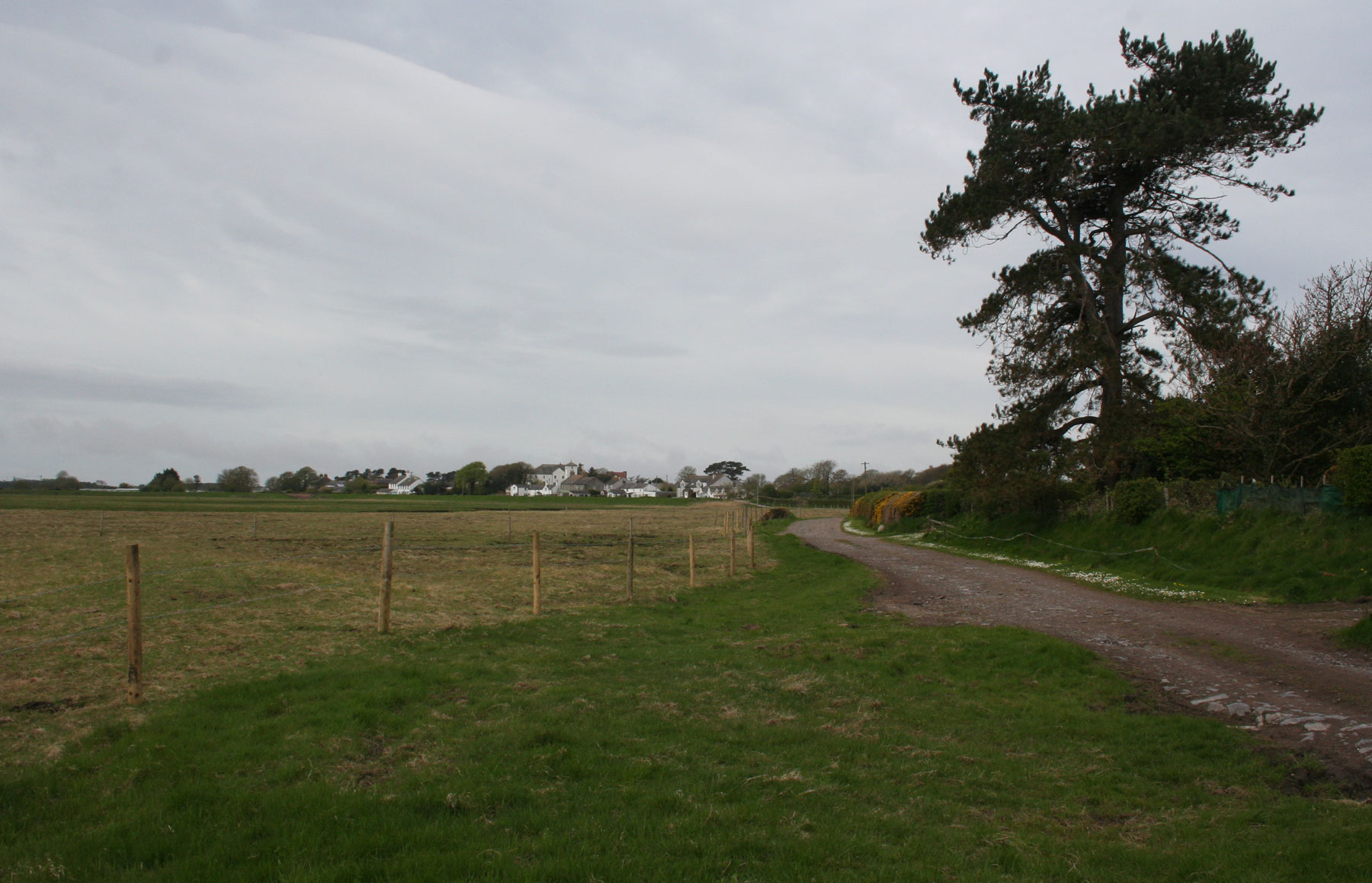
Skinburness is a small coastal village located in the county of Cumberland, in the Northwest of England. Situated on the Solway Firth, it is part of the larger district of Allerdale. The village is surrounded by picturesque countryside and offers stunning views of the Scottish coastline across the water.

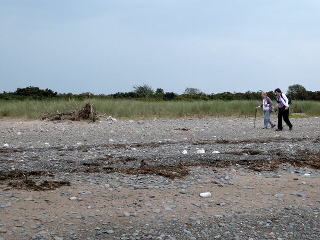
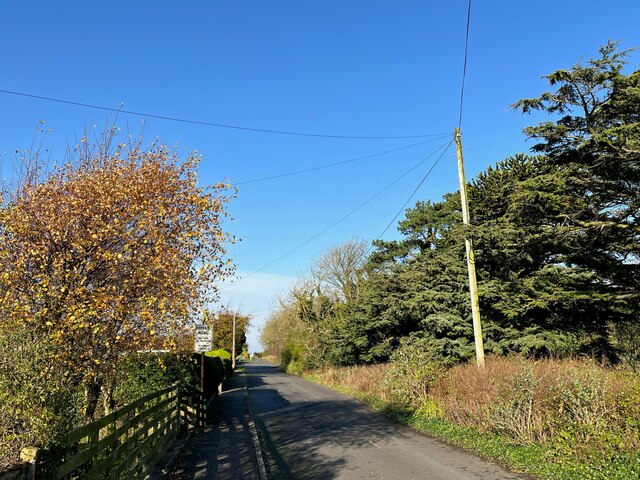
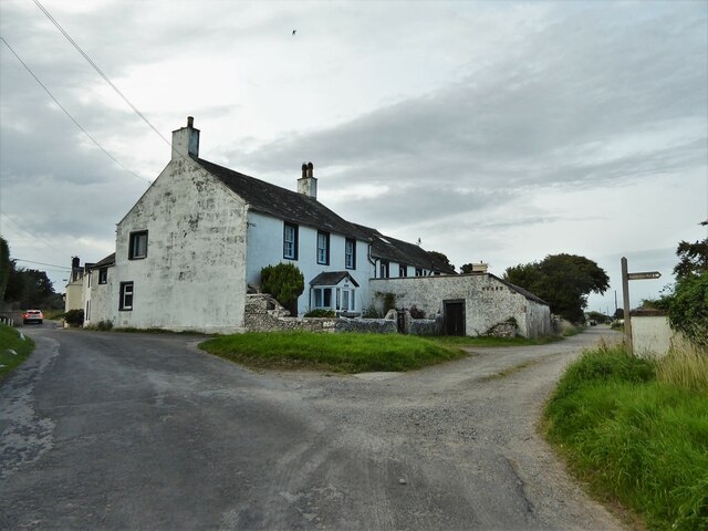
With a population of around 200 residents, Skinburness is known for its tranquil and idyllic atmosphere. The village primarily consists of traditional cottages and a few scattered farms, giving it a charming rural character. The landscape is dotted with rolling green fields and patches of woodland, providing ample opportunities for outdoor activities such as walking, cycling, and birdwatching.

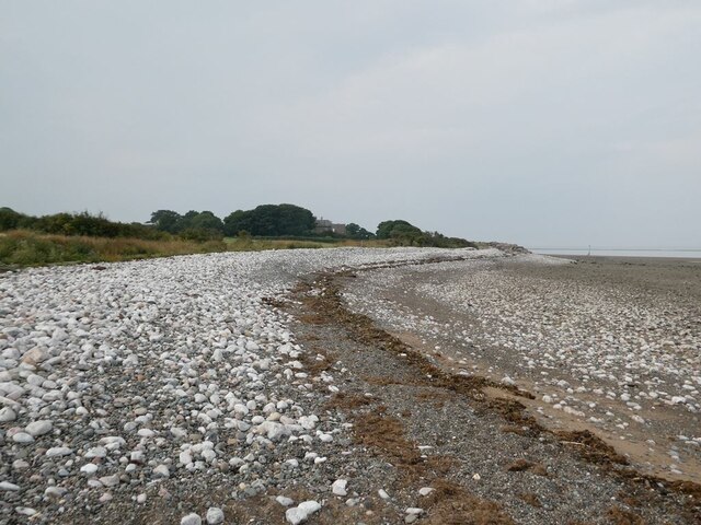
The village's proximity to the coast makes it a popular destination for beachgoers and water enthusiasts. It boasts a sandy beach that stretches for several miles, offering ample space for sunbathing, picnicking, and sandcastle building. The area is also known for its rich wildlife, with various species of birds, seals, and even occasional sightings of dolphins.

Despite its small size, Skinburness has a strong sense of community. It has a local pub that serves as a hub for social gatherings and events. The village is also home to a small primary school, ensuring that families with young children have access to educational facilities.

In conclusion, Skinburness is a charming coastal village in Cumberland that offers a peaceful retreat from urban life. Its natural beauty, friendly community, and proximity to the beach make it an appealing destination for both residents and visitors alike.

If you have any feedback on the listing, please let us know in the comments section below.

Skinburness Images

Images are sourced within 2km of 54.88747/-3.366537 or Grid Reference NY1255. Thanks to Geograph Open Source API. All images are credited.

Groyne and beach at Skinburness
Shingle beach at Skinburness It is apparent that the shore has retreated by about 100 metres since the OS 1:25,000 map was made.
Shingle beach at Skinburness
It is apparent that the shore has retreated by about 100 metres since the OS 1:25,000 map was made.
Shingle beach on the Grune peninsula It is apparent that the shore has retreated by about 100 metres since the OS 1:25,000 map was made.
Shingle beach on the Grune peninsula
It is apparent that the shore has retreated by about 100 metres since the OS 1:25,000 map was made.
Track and gate on the south side of the Grune peninsula
Shingle beach on the Grune peninsula
Shingle beach at Grune Cast
Dicktrod Lane, Skinburness Indicated on the sign to be a private road, Dicktrod Lane (Dick Trod Lane on Ordnance Survey Maps) was an established right of way between Skinburness and the shore at Skinburnessbank long before the housing estate it now serves was built.
Dicktrod Lane, Skinburness
Indicated on the sign to be a private road, Dicktrod Lane (Dick Trod Lane on Ordnance Survey Maps) was an established right of way between Skinburness and the shore at Skinburnessbank long before the housing estate it now serves was built.
The Cumbria Coastal Way at Guards Beside the Solway Firth, the sea defences that protect the coast north-east from Silloth and along Skinburness Bank end abruptly at Guards.  Coastal erosion has occurred beyond this point cutting the public footpath to Grune Point thus forcing walkers onto the shingle beach.
Grune House is in the right background.
The Cumbria Coastal Way at Guards
Beside the Solway Firth, the sea defences that protect the coast north-east from Silloth and along Skinburness Bank end abruptly at Guards. Coastal erosion has occurred beyond this point cutting the public footpath to Grune Point thus forcing walkers onto the shingle beach. Grune House is in the right background.
The Solway Firth Viewed across the Solway Firth from the beach at Guards, a slow moving April shower is moving south eastwards over Dumfriesshire.
The Solway Firth
Viewed across the Solway Firth from the beach at Guards, a slow moving April shower is moving south eastwards over Dumfriesshire.
Coastal path near Grune House The Cumbria Coastal Way passes between banks of gorse bushes north of Grune House.
Coastal path near Grune House
The Cumbria Coastal Way passes between banks of gorse bushes north of Grune House.
Coastal path near Grune House The Cumbria Coastal Way passes between banks of gorse bushes near Grune House.
Coastal path near Grune House
The Cumbria Coastal Way passes between banks of gorse bushes near Grune House.
Grune The sand and shingle spit leading up to Grune Point has been enclosed into fields of rough, heath like sheep pasture, characterised by coarse grasses, hawthorn and banks of gorse.
This is the route of the Cumbria Coastal Way.
Grune
The sand and shingle spit leading up to Grune Point has been enclosed into fields of rough, heath like sheep pasture, characterised by coarse grasses, hawthorn and banks of gorse. This is the route of the Cumbria Coastal Way.
Terraced sea defences With groynes into the sea
Terraced sea defences
With groynes into the sea
Whiteways Cottages at road junction The road to the right goes to Grune Point, the one to the left into Skinburness.
Whiteways Cottages at road junction
The road to the right goes to Grune Point, the one to the left into Skinburness.
Sea defences Off the England Coast Path, this part of the shore has no groynes.
Sea defences
Off the England Coast Path, this part of the shore has no groynes.
Grune House The last property before Grune Point
Grune House
The last property before Grune Point
Sea front housing On Skinburness Road
Sea front housing
On Skinburness Road
Building at entrance to former airfield This appears to be a former RAF guard house.
Building at entrance to former airfield
This appears to be a former RAF guard house.
Show me another place!

Skinburness is located at Grid Ref: NY1255 (Lat: 54.88747, Lng: -3.366537)

Administrative County: Cumbria

District: Allerdale

Police Authority: Cumbria

What 3 Words

///cuter.albums.dices. Near Silloth, Cumbria

Nearby Locations

Skinburness Cote Bank

Related Wikis

Skinburness

Skinburness is a village in Cumbria (historically Cumberland), England. It forms a residential area for the town of Silloth, and is about 10 miles west...

Milefortlet 10

Milefortlet 10 (East Cote) is conjectured to have been a Milefortlet of the Roman Cumbrian Coast defences, however no physical evidence exists to positively...

Milefortlet 9

Milefortlet 9 (Skinburness) was a Milefortlet of the Roman Cumbrian Coast defences. These milefortlets and intervening stone watchtowers extended from...
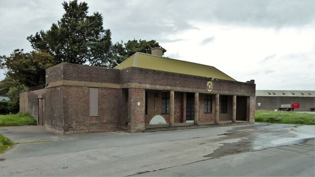
RAF Silloth

Royal Air Force Silloth, or more simply RAF Silloth, is a former Royal Air Force station one mile (1.6 km) north-east of Silloth, Cumbria, England, and...

Nearby Amenities

Located within 500m of 54.88747,-3.366537
Skinburness
Is In: Cumbria, England, UK
Place: village
Source: npe
Wikidata: Q7535435
Wikipedia: en:Skinburness
Lat/Long: 54.8906676/-3.3611833
Bus Stop
Moricambe Park
Naptan AtcoCode: 090002491737
Naptan Bearing: W
Naptan CommonName: Moricambe Park
Naptan Indicator: near
Naptan Landmark: junction with Moricambe Park
Naptan NaptanCode: cumagmpa
Naptan Street: Skinburness Road
Naptan Verified: no
Source: naptan_import
Lat/Long: 54.8874508/-3.3702913
Bus Stop
Skinburness Hotel
Bench: no
Covered: yes
Naptan AtcoCode: 090002491791
Naptan Bearing: W
Naptan CommonName: Skinburness Hotel
Naptan Indicator: Near
Naptan Landmark: Skinburness Hotel
Naptan NaptanCode: cumagmpd
Naptan Street: Skinburness Road
Naptan Verified: no
Shelter: yes
Source: naptan_import
Lat/Long: 54.890311/-3.3623662
Moricambe Park at Ryehills Road
Naptan AtcoCode: 090002493242
Naptan Bearing: NE
Naptan BusStopType: CUS
Naptan CommonName: Moricambe Park at Ryehills Road
Naptan Indicator: near
Naptan Landmark: junction with Moricambe Park
Naptan NaptanCode: cumagmwa
Naptan Street: Skinburness Road
Naptan Verified: no
Source: naptan_import
Lat/Long: 54.8875481/-3.370435
Turning Circle
Lat/Long: 54.886716/-3.3712453
Barrier: cattle_grid
Source: survey
Lat/Long: 54.8893364/-3.3608668
Post Box
Ref: CA7 144
Source: survey
Lat/Long: 54.8903456/-3.3623019
Waste Basket
Lat/Long: 54.8903305/-3.3623045
Turning Circle
Lat/Long: 54.8907311/-3.3652434
Turning Circle
Lat/Long: 54.8911741/-3.364267
Turning Circle
Lat/Long: 54.8905293/-3.3641447
Information: guidepost
Tourism: information
Lat/Long: 54.8898431/-3.3611497
Generator Method: photovoltaic
Generator Output Electricity: yes
Generator Source: solar
Generator Type: solar_photovoltaic_panel
Location: roof
Power: generator
Lat/Long: 54.8863879/-3.3710495
Generator Method: photovoltaic
Generator Output Electricity: yes
Generator Source: solar
Generator Type: solar_photovoltaic_panel
Location: roof
Power: generator
Lat/Long: 54.8890332/-3.3690175
Generator Method: photovoltaic
Generator Output Electricity: yes
Generator Source: solar
Generator Type: solar_photovoltaic_panel
Location: roof
Power: generator
Lat/Long: 54.8873912/-3.3708725
Generator Method: photovoltaic
Generator Output Electricity: yes
Generator Source: solar
Generator Type: solar_photovoltaic_panel
Location: roof
Power: generator
Lat/Long: 54.8863127/-3.3723721
Skinburness Bank
Place: locality
Lat/Long: 54.8917325/-3.3660305
Power: pole
Lat/Long: 54.8896532/-3.362456
Power: pole
Lat/Long: 54.889225/-3.3629503
Power: pole
Lat/Long: 54.8885751/-3.3636666
Power: pole
Lat/Long: 54.8850715/-3.3608944
Power: pole
Lat/Long: 54.8851052/-3.3610175
Power: pole
Lat/Long: 54.883478/-3.3633216
Power: pole
Lat/Long: 54.8843868/-3.3622018
Power: pole
Lat/Long: 54.8860069/-3.3614048
Power: pole
Lat/Long: 54.8869272/-3.361764
Power: pole
Lat/Long: 54.8877558/-3.362111
The data included in this document is from www.openstreetmap.org. The data is made available under ODbL.

Have you been to Skinburness?

Leave your review of Skinburness below (or comments, questions and feedback).