Skidby

Civil Parish in Yorkshire

England

Skidby

Infilled railway cutting, Little Weighton 2022 Sadly, the dramatic 83 ft. deep railway cutting at Little Weighton has been filled in. Much of the material came from the construction of flood alleviation ponds nearby.

Along with Drewton Tunnel, it was one of the wonders of the Hull, Barnsley & West Riding Junction Railway, 1885-1964.

See also <span class="nowrap"><a title="http://www.forgottenrelics.co.uk/tunnels/weighton.html," rel="nofollow ugc noopener" href="http://www.forgottenrelics.co.uk/tunnels/weighton.html,">Link</a><img style="margin-left:2px;" alt="External link" title="External link - shift click to open in new window" src="https://s1.geograph.org.uk/img/external.png" width="10" height="10"/></span> <a href="https://www.geograph.org.uk/photo/4405684">SE9933 : Remains of accommodation bridge in Little Weighton Cutting</a>, <a href="https://www.geograph.org.uk/photo/4405575">SE9833 : Little Weighton Cutting</a> and <a href="https://www.geograph.org.uk/photo/6718287">SE9932 : Site of the old railway cutting</a>.
Infilled railway cutting, Little Weighton 2022 Credit: Chris

The requested URL returned error: 429 Too Many Requests

If you have any feedback on the listing, please let us know in the comments section below.

Skidby Images

Images are sourced within 2km of 53.780158/-0.473378 or Grid Reference TA0032. Thanks to Geograph Open Source API. All images are credited.

Infilled railway cutting, Little Weighton 2022 Sadly, the dramatic 83 ft. deep railway cutting at Little Weighton has been filled in. Much of the material came from the construction of flood alleviation ponds nearby.

Along with Drewton Tunnel, it was one of the wonders of the Hull, Barnsley & West Riding Junction Railway, 1885-1964.

See also <span class="nowrap"><a title="http://www.forgottenrelics.co.uk/tunnels/weighton.html," rel="nofollow ugc noopener" href="http://www.forgottenrelics.co.uk/tunnels/weighton.html,">Link</a><img style="margin-left:2px;" alt="External link" title="External link - shift click to open in new window" src="https://s1.geograph.org.uk/img/external.png" width="10" height="10"/></span> <a href="https://www.geograph.org.uk/photo/4405684">SE9933 : Remains of accommodation bridge in Little Weighton Cutting</a>, <a href="https://www.geograph.org.uk/photo/4405575">SE9833 : Little Weighton Cutting</a> and <a href="https://www.geograph.org.uk/photo/6718287">SE9932 : Site of the old railway cutting</a>.
Infilled railway cutting, Little Weighton 2022
Sadly, the dramatic 83 ft. deep railway cutting at Little Weighton has been filled in. Much of the material came from the construction of flood alleviation ponds nearby. Along with Drewton Tunnel, it was one of the wonders of the Hull, Barnsley & West Riding Junction Railway, 1885-1964. See also LinkExternal link SE9933 : Remains of accommodation bridge in Little Weighton Cutting, SE9833 : Little Weighton Cutting and SE9932 : Site of the old railway cutting.
Farm entrance, Raywell Driveway to Woodhouse Farm opening on to the north side of Westfield Road
Farm entrance, Raywell
Driveway to Woodhouse Farm opening on to the north side of Westfield Road
Redundant railway bridge near Skidby Crossing Riplingham Road
Redundant railway bridge near Skidby
Crossing Riplingham Road
Bottoms  Road  Bridge  Riplingham  Road  (track) Bridge on dismantled railway line
Bottoms Road Bridge Riplingham Road (track)
Bridge on dismantled railway line
Bridleway  to  Eppleworth  Wood From Riplingham Road (track)
Bridleway to Eppleworth Wood
From Riplingham Road (track)
Farm  Tracks  meet  in  this  Wold  Valley It started out from Skidby as Riplingham Road but it deteriorates as you go west, as you can see it is now a dirt track
Farm Tracks meet in this Wold Valley
It started out from Skidby as Riplingham Road but it deteriorates as you go west, as you can see it is now a dirt track
Pylons near Rowley, East Yorks The power lines head towards Skidby, where they divert to the north slightly before ending up at the giant Creyke Beck substation.
Pylons near Rowley, East Yorks
The power lines head towards Skidby, where they divert to the north slightly before ending up at the giant Creyke Beck substation.
Field at Ralph Nook
Field at Ralph Nook
What's wrong with pick it up, bag it, bin it? Horse manure on Riplingham Road.
What's wrong with pick it up, bag it, bin it?
Horse manure on Riplingham Road.
Foggy November morning on the road from Little Weighton to Skidby
Passing Walk Farm on the way into Little Weighton Foggy November Saturday morning.
Passing Walk Farm on the way into Little Weighton
Foggy November Saturday morning.
Little Weighton Cutting The 85ft deep cutting with its accommodation bridge was, along with Drewton Tunnel, one of the wonders of the Hull, Barnsley & West Riding Junction Railway, 1885-1964.
See: <a href="https://www.geograph.org.uk/photo/4405684">SE9933 : Remains of accommodation bridge in Little Weighton Cutting</a>; <span class="nowrap"><a title="http://www.forgottenrelics.co.uk/tunnels/weighton.html" rel="nofollow ugc noopener" href="http://www.forgottenrelics.co.uk/tunnels/weighton.html">Link</a><img style="margin-left:2px;" alt="External link" title="External link - shift click to open in new window" src="https://s1.geograph.org.uk/img/external.png" width="10" height="10"/></span> and <span class="nowrap"><a title="http://www.disused-stations.org.uk/l/little_weighton/" rel="nofollow ugc noopener" href="http://www.disused-stations.org.uk/l/little_weighton/">Link</a><img style="margin-left:2px;" alt="External link" title="External link - shift click to open in new window" src="https://s1.geograph.org.uk/img/external.png" width="10" height="10"/></span>
Unfortunately it is gradually being filled in, with landfill. The bridge has been demolished, leaving just the side pillars looking like brick outcrops.
Little Weighton Cutting
The 85ft deep cutting with its accommodation bridge was, along with Drewton Tunnel, one of the wonders of the Hull, Barnsley & West Riding Junction Railway, 1885-1964. See: SE9933 : Remains of accommodation bridge in Little Weighton Cutting; LinkExternal link and LinkExternal link Unfortunately it is gradually being filled in, with landfill. The bridge has been demolished, leaving just the side pillars looking like brick outcrops.
Remains of accommodation bridge in Little Weighton Cutting The 83ft deep cutting with its accommodation bridge was, along with Drewton Tunnel, one of the wonders of the Hull, Barnsley & West Riding Junction Railway, 1885-1964.
See: <a href="https://www.geograph.org.uk/photo/4405575">SE9833 : Little Weighton Cutting</a>; <span class="nowrap"><a title="http://www.forgottenrelics.co.uk/tunnels/weighton.html" rel="nofollow ugc noopener" href="http://www.forgottenrelics.co.uk/tunnels/weighton.html">Link</a><img style="margin-left:2px;" alt="External link" title="External link - shift click to open in new window" src="https://s1.geograph.org.uk/img/external.png" width="10" height="10"/></span> and <span class="nowrap"><a title="http://www.disused-stations.org.uk/l/little_weighton/" rel="nofollow ugc noopener" href="http://www.disused-stations.org.uk/l/little_weighton/">Link</a><img style="margin-left:2px;" alt="External link" title="External link - shift click to open in new window" src="https://s1.geograph.org.uk/img/external.png" width="10" height="10"/></span>
Unfortunately it is gradually being filled in, with landfill. The bridge has been demolished, leaving just the abutmnents.

2022 update: It has now been completely filled in: see <a href="https://www.geograph.org.uk/photo/7088599">SE9833 : Infilled railway cutting, Little Weighton 2022</a>
Remains of accommodation bridge in Little Weighton Cutting
The 83ft deep cutting with its accommodation bridge was, along with Drewton Tunnel, one of the wonders of the Hull, Barnsley & West Riding Junction Railway, 1885-1964. See: SE9833 : Little Weighton Cutting; LinkExternal link and LinkExternal link Unfortunately it is gradually being filled in, with landfill. The bridge has been demolished, leaving just the abutmnents. 2022 update: It has now been completely filled in: see SE9833 : Infilled railway cutting, Little Weighton 2022
Riplingham Road from Bottoms Road Bridge The bridge carried the Hull, Barnsley & West Riding Junction Railway.
Riplingham Road from Bottoms Road Bridge
The bridge carried the Hull, Barnsley & West Riding Junction Railway.
Approaching Eppleworth The farmer has not cultivated the corners of this field.
Approaching Eppleworth
The farmer has not cultivated the corners of this field.
Ramsons in Eppleworth Wood Quite a sight (and smell!).
Ramsons in Eppleworth Wood
Quite a sight (and smell!).
Bridleway to Westfield Road Hessle Golf Club behind the hedge on the left.
Bridleway to Westfield Road
Hessle Golf Club behind the hedge on the left.
Trees on the edge of Hessle golf course
Show me another place!

Skidby is located at Grid Ref: TA0032 (Lat: 53.780158, Lng: -0.473378)

Division: East Riding

Unitary Authority: East Riding of Yorkshire

Police Authority: Humberside

What 3 Words

///fondest.seashell.mornings. Near Skidby, East Yorkshire

Nearby Locations

Skidby

Related Wikis

Eppleworth

Eppleworth is a hamlet in the East Riding of Yorkshire, England. It is situated on Westfields Road and lies 1 mile (1.6 km) to the south of Skidby and...

Skidby

Skidby is a small village and civil parish in Yorkshire Wolds of the East Riding of Yorkshire, England. It is situated about 6 miles (10 km) north-west...
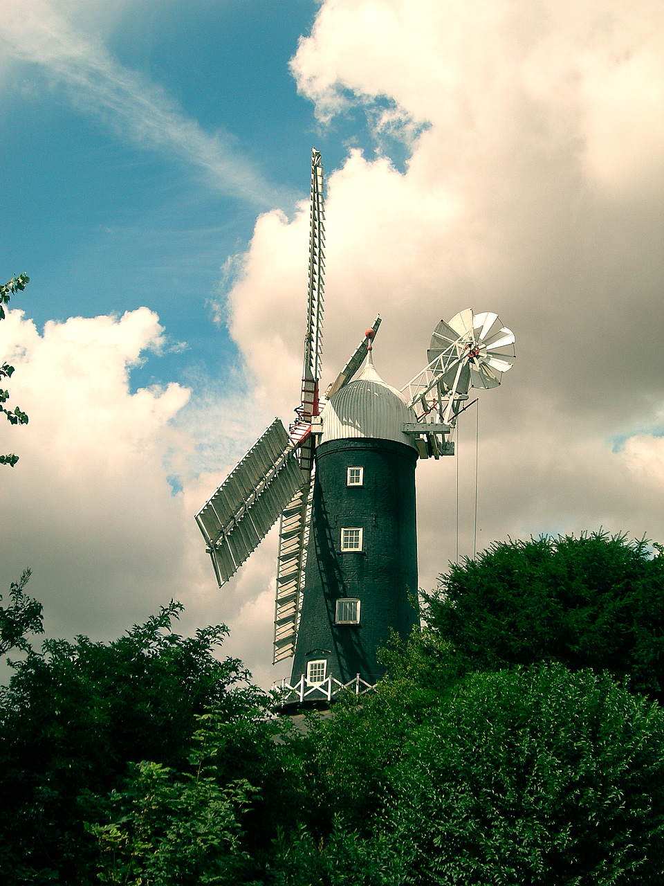
Skidby Windmill

Skidby Windmill is a Grade II* listed windmill at Skidby near Beverley, in the East Riding of Yorkshire, England.Originally built in 1821, the mill was...

Castle Hill Hospital

Castle Hill Hospital is an NHS hospital to the west of Cottingham, East Riding of Yorkshire, England, run by Hull University Teaching Hospitals NHS Trust...

Nearby Amenities

Located within 500m of 53.780158,-0.473378
Power: pole
Lat/Long: 53.7765714/-0.476588
Power: pole
Lat/Long: 53.7778621/-0.4762235
Power: pole
Lat/Long: 53.7793029/-0.4758201
Power: pole
Lat/Long: 53.7805772/-0.475712
Power: pole
Lat/Long: 53.78191/-0.4756618
Power: pole
Lat/Long: 53.7833473/-0.4755669
The data included in this document is from www.openstreetmap.org. The data is made available under ODbL.

Have you been to Skidby?

Leave your review of Skidby below (or comments, questions and feedback).