Skidbrooke with Saltfleet Haven

Civil Parish in Lincolnshire East Lindsey

England

Skidbrooke with Saltfleet Haven

Saltfleet Manor House As seen, the building is primarily 19th century, but it has origins back to the late 17th, as there is a fine oak staircase of that period, plus a record of the names of two (former residents?) inscribed with a date of 1673 in one of the upstairs rooms. The whole house was Grade II listed <span class="nowrap"><a title="https://historicengland.org.uk/listing/the-list/list-entry/1063062" rel="nofollow ugc noopener" href="https://historicengland.org.uk/listing/the-list/list-entry/1063062">Link</a><img style="margin-left:2px;" alt="External link" title="External link - shift click to open in new window" src="https://s1.geograph.org.uk/img/external.png" width="10" height="10"/></span> & <span class="nowrap"><a title="https://britishlistedbuildings.co.uk/101063062-the-manor-house-skidbrooke-with-saltfleet-haven" rel="nofollow ugc noopener" href="https://britishlistedbuildings.co.uk/101063062-the-manor-house-skidbrooke-with-saltfleet-haven">Link</a><img style="margin-left:2px;" alt="External link" title="External link - shift click to open in new window" src="https://s1.geograph.org.uk/img/external.png" width="10" height="10"/></span> in 1952.
Saltfleet Manor House Credit: Richard Law

Skidbrooke with Saltfleet Haven is a civil parish located in the county of Lincolnshire, England. It is situated on the eastern coast of the country, bordering the North Sea. The parish encompasses the villages of Skidbrooke and Saltfleet Haven, which are located approximately five miles apart.

Skidbrooke is a small village with a population of around 200 residents. It is known for its rural charm and picturesque landscapes. The village is surrounded by agricultural fields, and farming plays a significant role in the local economy. Skidbrooke is home to a few traditional cottages and farmhouses, which add to its quaint atmosphere.

Saltfleet Haven, on the other hand, is a coastal village with a population of around 400 residents. It is located near the mouth of the Saltfleetby-Theddlethorpe Dunes National Nature Reserve, which is a protected area known for its unique flora and fauna. The village offers stunning views of the North Sea and is a popular destination for nature enthusiasts and birdwatchers.

Both villages have a rich history dating back to medieval times. Skidbrooke is home to St. Botolph's Church, a Grade I listed building that dates back to the 12th century. The church features beautiful stained glass windows and architectural details, making it a notable landmark in the area.

Overall, Skidbrooke with Saltfleet Haven is a charming civil parish that offers a mix of rural and coastal landscapes, making it an attractive destination for both residents and visitors alike.

If you have any feedback on the listing, please let us know in the comments section below.

Skidbrooke with Saltfleet Haven Images

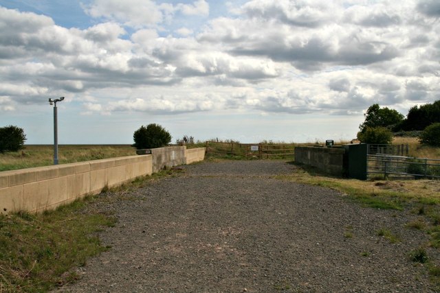
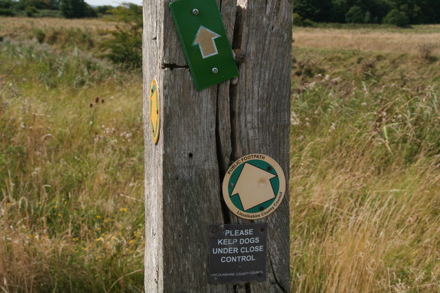
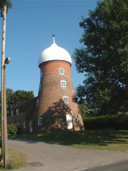
Images are sourced within 2km of 53.428849/0.20323 or Grid Reference TF4694. Thanks to Geograph Open Source API. All images are credited.

Saltfleet Manor House As seen, the building is primarily 19th century, but it has origins back to the late 17th, as there is a fine oak staircase of that period, plus a record of the names of two (former residents?) inscribed with a date of 1673 in one of the upstairs rooms. The whole house was Grade II listed <span class="nowrap"><a title="https://historicengland.org.uk/listing/the-list/list-entry/1063062" rel="nofollow ugc noopener" href="https://historicengland.org.uk/listing/the-list/list-entry/1063062">Link</a><img style="margin-left:2px;" alt="External link" title="External link - shift click to open in new window" src="https://s1.geograph.org.uk/img/external.png" width="10" height="10"/></span> & <span class="nowrap"><a title="https://britishlistedbuildings.co.uk/101063062-the-manor-house-skidbrooke-with-saltfleet-haven" rel="nofollow ugc noopener" href="https://britishlistedbuildings.co.uk/101063062-the-manor-house-skidbrooke-with-saltfleet-haven">Link</a><img style="margin-left:2px;" alt="External link" title="External link - shift click to open in new window" src="https://s1.geograph.org.uk/img/external.png" width="10" height="10"/></span> in 1952.
Saltfleet Manor House
As seen, the building is primarily 19th century, but it has origins back to the late 17th, as there is a fine oak staircase of that period, plus a record of the names of two (former residents?) inscribed with a date of 1673 in one of the upstairs rooms. The whole house was Grade II listed LinkExternal link & LinkExternal link in 1952.
Saltfleet Methodist Chapel Dated mainly to 1815, although the porch seen here was added in 1867. It was Grade II listed <span class="nowrap"><a title="https://historicengland.org.uk/listing/the-list/list-entry/1165896" rel="nofollow ugc noopener" href="https://historicengland.org.uk/listing/the-list/list-entry/1165896">Link</a><img style="margin-left:2px;" alt="External link" title="External link - shift click to open in new window" src="https://s1.geograph.org.uk/img/external.png" width="10" height="10"/></span> & <span class="nowrap"><a title="https://britishlistedbuildings.co.uk/101165896-methodist-chapel-skidbrooke-with-saltfleet-haven" rel="nofollow ugc noopener" href="https://britishlistedbuildings.co.uk/101165896-methodist-chapel-skidbrooke-with-saltfleet-haven">Link</a><img style="margin-left:2px;" alt="External link" title="External link - shift click to open in new window" src="https://s1.geograph.org.uk/img/external.png" width="10" height="10"/></span> in 1986.
Saltfleet Methodist Chapel
Dated mainly to 1815, although the porch seen here was added in 1867. It was Grade II listed LinkExternal link & LinkExternal link in 1986.
The New Inn at Saltfleet Despite the name, the New Inn dates from the mid 17th century, albeit with extensive alterations and updates over the intervening years. The oldest part is the tall, gabled section visible above the tree on the right and is L-shaped - also the roof of the rest of that older part is visible above the newer, main part of the pub, which was inserted into the angle in the mid 18th century. The whole structure attracted a Grade II listing <span class="nowrap"><a title="https://britishlistedbuildings.co.uk/101359992-the-new-inn-skidbrooke-with-saltfleet-haven" rel="nofollow ugc noopener" href="https://britishlistedbuildings.co.uk/101359992-the-new-inn-skidbrooke-with-saltfleet-haven">Link</a><img style="margin-left:2px;" alt="External link" title="External link - shift click to open in new window" src="https://s1.geograph.org.uk/img/external.png" width="10" height="10"/></span> & <span class="nowrap"><a title="https://historicengland.org.uk/listing/the-list/list-entry/1359992" rel="nofollow ugc noopener" href="https://historicengland.org.uk/listing/the-list/list-entry/1359992">Link</a><img style="margin-left:2px;" alt="External link" title="External link - shift click to open in new window" src="https://s1.geograph.org.uk/img/external.png" width="10" height="10"/></span> in 1967.
The New Inn at Saltfleet
Despite the name, the New Inn dates from the mid 17th century, albeit with extensive alterations and updates over the intervening years. The oldest part is the tall, gabled section visible above the tree on the right and is L-shaped - also the roof of the rest of that older part is visible above the newer, main part of the pub, which was inserted into the angle in the mid 18th century. The whole structure attracted a Grade II listing LinkExternal link & LinkExternal link in 1967.
Saltfleet village water pump A freshwater pump, made of limestone ashlar, and erected in 1899 to the memory of a local man who had recently been killed in conflict in South Africa. It was Grade II listed <span class="nowrap"><a title="https://historicengland.org.uk/listing/the-list/list-entry/1165914" rel="nofollow ugc noopener" href="https://historicengland.org.uk/listing/the-list/list-entry/1165914">Link</a><img style="margin-left:2px;" alt="External link" title="External link - shift click to open in new window" src="https://s1.geograph.org.uk/img/external.png" width="10" height="10"/></span> & <span class="nowrap"><a title="https://britishlistedbuildings.co.uk/101165914-pump-skidbrooke-with-saltfleet-haven" rel="nofollow ugc noopener" href="https://britishlistedbuildings.co.uk/101165914-pump-skidbrooke-with-saltfleet-haven">Link</a><img style="margin-left:2px;" alt="External link" title="External link - shift click to open in new window" src="https://s1.geograph.org.uk/img/external.png" width="10" height="10"/></span> in 1986.
Saltfleet village water pump
A freshwater pump, made of limestone ashlar, and erected in 1899 to the memory of a local man who had recently been killed in conflict in South Africa. It was Grade II listed LinkExternal link & LinkExternal link in 1986.
Sea Bank House, Saltfleet The heart of this (well-hidden) building is a 17th century farmhouse, which has had alterations and extensions over the years - it was originally a single-storey cottage, and one of the first alterations in the mid 18th century was to add an upper floor. It was Grade II listed <span class="nowrap"><a title="https://historicengland.org.uk/listing/the-list/list-entry/1063061" rel="nofollow ugc noopener" href="https://historicengland.org.uk/listing/the-list/list-entry/1063061">Link</a><img style="margin-left:2px;" alt="External link" title="External link - shift click to open in new window" src="https://s1.geograph.org.uk/img/external.png" width="10" height="10"/></span> & <span class="nowrap"><a title="https://britishlistedbuildings.co.uk/101063061-seabank-house-skidbrooke-with-saltfleet-haven" rel="nofollow ugc noopener" href="https://britishlistedbuildings.co.uk/101063061-seabank-house-skidbrooke-with-saltfleet-haven">Link</a><img style="margin-left:2px;" alt="External link" title="External link - shift click to open in new window" src="https://s1.geograph.org.uk/img/external.png" width="10" height="10"/></span> in 1983.
Sea Bank House, Saltfleet
The heart of this (well-hidden) building is a 17th century farmhouse, which has had alterations and extensions over the years - it was originally a single-storey cottage, and one of the first alterations in the mid 18th century was to add an upper floor. It was Grade II listed LinkExternal link & LinkExternal link in 1983.
Saltfleet Windmill ('The Mill') An early 19th century tower mill of brown & red brick, formerly producing flour from local wheat. In 1986 when it was Grade II listed <span class="nowrap"><a title="https://britishlistedbuildings.co.uk/101165939-windmill-skidbrooke-with-saltfleet-haven" rel="nofollow ugc noopener" href="https://britishlistedbuildings.co.uk/101165939-windmill-skidbrooke-with-saltfleet-haven">Link</a><img style="margin-left:2px;" alt="External link" title="External link - shift click to open in new window" src="https://s1.geograph.org.uk/img/external.png" width="10" height="10"/></span> & <span class="nowrap"><a title="https://historicengland.org.uk/listing/the-list/list-entry/1165939," rel="nofollow ugc noopener" href="https://historicengland.org.uk/listing/the-list/list-entry/1165939,">Link</a><img style="margin-left:2px;" alt="External link" title="External link - shift click to open in new window" src="https://s1.geograph.org.uk/img/external.png" width="10" height="10"/></span> the interior floors were described as being 'in a state of collapse' but that has presumably been rectified during its conversion to residential use. The domed cap is likely to have been restored at that stage too.
Saltfleet Windmill ('The Mill')
An early 19th century tower mill of brown & red brick, formerly producing flour from local wheat. In 1986 when it was Grade II listed LinkExternal link & LinkExternal link the interior floors were described as being 'in a state of collapse' but that has presumably been rectified during its conversion to residential use. The domed cap is likely to have been restored at that stage too.
Shingle Bank north-east of Howden's Pullover From the shore it looks like a line of sand dunes, which is probably what it once was - see <a href="https://www.geograph.org.uk/photo/3422292">TF4595 : Sand dunes in the middle of the beach</a> and  <a href="https://www.geograph.org.uk/photo/3616542">TF4595 : Off-shore sand dunes</a>.
Shingle Bank north-east of Howden's Pullover
From the shore it looks like a line of sand dunes, which is probably what it once was - see TF4595 : Sand dunes in the middle of the beach and TF4595 : Off-shore sand dunes.
Saltfleet: brick shed on a corner by Grayfleet Bank
Paradise: Public Bridleway past the newly fortified Great Eau Bridge, through Paradise, to the sea shore The sign says Public Footpath, but it is marked on the map as a Bridleway.
Paradise: Public Bridleway past the newly fortified Great Eau Bridge, through Paradise, to the sea shore
The sign says Public Footpath, but it is marked on the map as a Bridleway.
Shoot-out in Paradise (Saltfleet) Not the only local sign to have been used for target practice!
Shoot-out in Paradise (Saltfleet)
Not the only local sign to have been used for target practice!
Paradise: gate and opening on Public Bridleway from Paradise, to the sea shore Path is marked on map as a Bridleway, though the sign at the end says it is a Footpath.
Paradise: gate and opening on Public Bridleway from Paradise, to the sea shore
Path is marked on map as a Bridleway, though the sign at the end says it is a Footpath.
Paradise: Sign on gate across the Bridleway through Paradise to the sea shore
Paradise: bridge over the Great Eau and bridleway to the sea shore
Paradise: gate and openings on Public Bridleway from the Great Eau Bridge to the sea shore Path entering Saltfleetby-Theddlethorpe Dunes National Nature Reserve.
Paradise: gate and openings on Public Bridleway from the Great Eau Bridge to the sea shore
Path entering Saltfleetby-Theddlethorpe Dunes National Nature Reserve.
Paradise: one of the entrances to Saltfleetby-Theddlethorpe Dunes National Nature Reserve The main gate and Bridleway entrance are off to the right.
Paradise: one of the entrances to Saltfleetby-Theddlethorpe Dunes National Nature Reserve
The main gate and Bridleway entrance are off to the right.
Paradise: sign at entrance to Saltfleetby-Theddlethorpe Dunes National Nature Reserve
Paradise: Footpath sign at entrance to Saltfleetby-Theddlethorpe Dunes National Nature Reserve On the map this is marked as a Bridleway.
Paradise: Footpath sign at entrance to Saltfleetby-Theddlethorpe Dunes National Nature Reserve
On the map this is marked as a Bridleway.
Paradise: gate and opening on Public Bridleway from Paradise, to the sea shore
Show me another place!

Skidbrooke with Saltfleet Haven is located at Grid Ref: TF4694 (Lat: 53.428849, Lng: 0.20323)

Administrative County: Lincolnshire

District: East Lindsey

Police Authority: Lincolnshire

What 3 Words

///chaos.safest.whiplash. Near North Somercotes, Lincolnshire

Related Wikis

Saltfleet

Saltfleet is a coastal village in the East Lindsey district of Lincolnshire, England. It is approximately 8 miles (13 km) north of Mablethorpe and 11...

Great Eau

The Great Eau is a river in Lincolnshire, England, rising from the Chalk Streams of the Lincolnshire Wolds and running to Saltfleet Haven on the coast...

Lincolnshire Marsh

The Lincolnshire Marsh is a belt of reclaimed salt marsh and sand dune in Lincolnshire, England, between the Lincolnshire Wolds and the North Sea coast...

St Botolph's Church, Skidbrooke

St Botolph's Church is a redundant Anglican church near the village of Skidbrooke, Lincolnshire, England. It is recorded in the National Heritage List...

Have you been to Skidbrooke with Saltfleet Haven?

Leave your review of Skidbrooke with Saltfleet Haven below (or comments, questions and feedback).