Royal Wootton Bassett

Civil Parish in Wiltshire

England

Royal Wootton Bassett

27 High Street, Royal Wootton Bassett Behind the sham timbering is a sixteenth century timber framed house <span class="nowrap"><a title="https://historicengland.org.uk/listing/the-list/list-entry/1022696?section=official-list-entry" rel="nofollow ugc noopener" href="https://historicengland.org.uk/listing/the-list/list-entry/1022696?section=official-list-entry">Link</a><img style="margin-left:2px;" alt="External link" title="External link - shift click to open in new window" src="https://s1.geograph.org.uk/img/external.png" width="10" height="10"/></span>
27 High Street, Royal Wootton Bassett Credit: Jonathan Thacker

Royal Wootton Bassett is a civil parish located in the county of Wiltshire, England. It is situated approximately 5 miles southwest of Swindon and has a population of around 11,000 people. The town is known for its historic significance and its role in honoring fallen British soldiers.

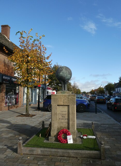
One of the most notable features of Royal Wootton Bassett is its connections to the military. The town gained its "Royal" prefix in 2011, in recognition of the respect and support it showed to the armed forces during the repatriation of fallen soldiers from the nearby RAF Lyneham airbase. For several years, the residents of Royal Wootton Bassett lined the streets to pay their respects as the funeral corteges passed through the town.

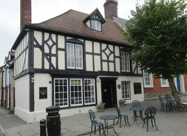
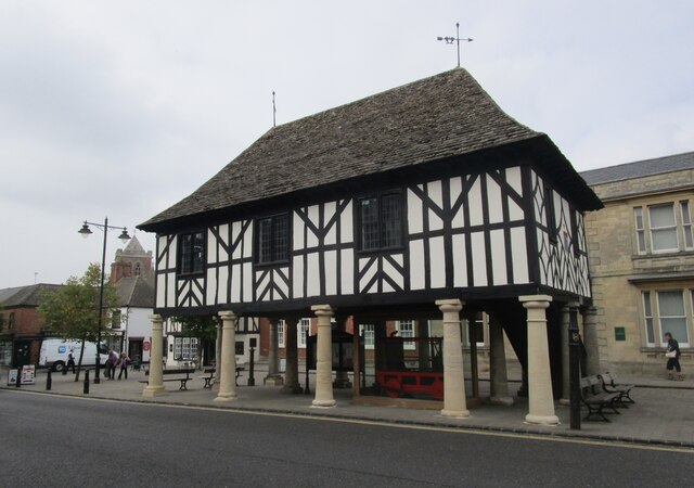
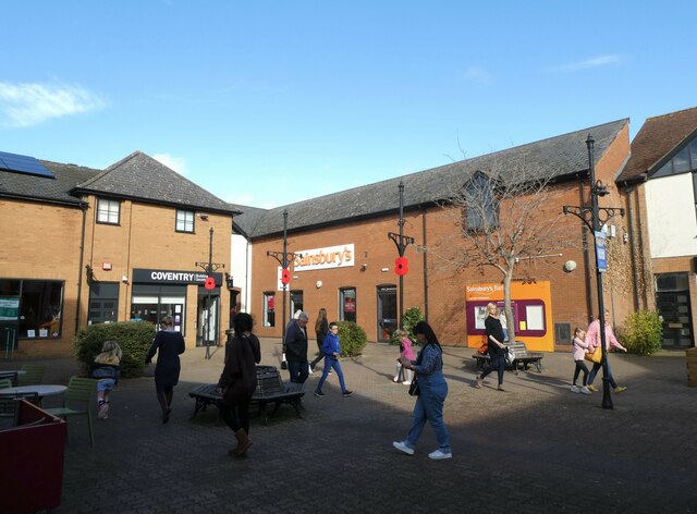
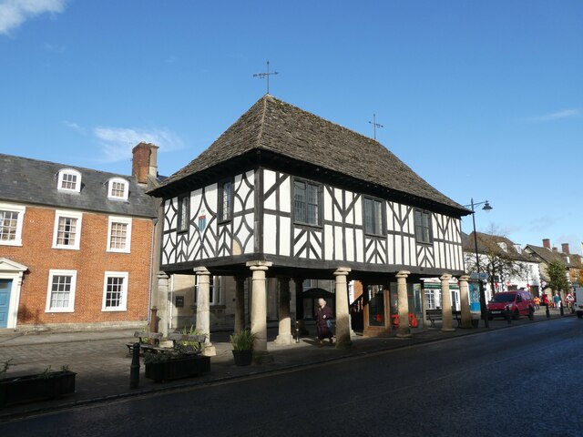
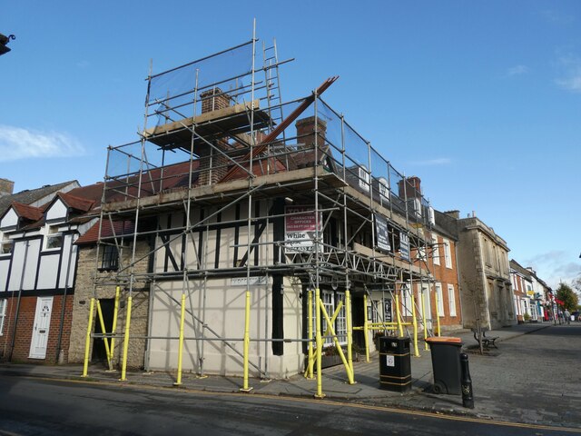
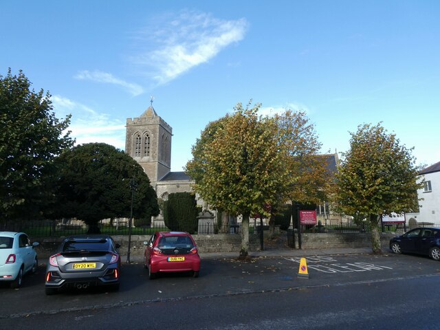
The town itself has a charming and traditional English feel, with a mix of old and new buildings. The High Street is lined with independent shops, cafes, and pubs, giving it a vibrant atmosphere. There are also several historic landmarks to explore, including the Market Cross, which dates back to the 16th century.

Surrounded by beautiful countryside, Royal Wootton Bassett offers ample opportunities for outdoor activities. The nearby Lydiard Park is a popular destination, with its stunning gardens, lakes, and woodlands. The town also has a strong sense of community, with various local events and festivals taking place throughout the year.

Overall, Royal Wootton Bassett is a picturesque and historic town with deep connections to the military and a strong sense of community.

If you have any feedback on the listing, please let us know in the comments section below.

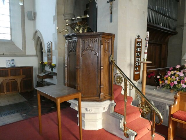
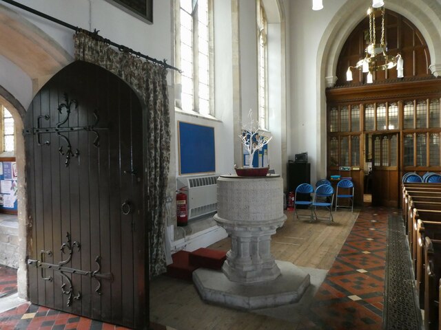
Royal Wootton Bassett Images

Images are sourced within 2km of 51.537071/-1.91023 or Grid Reference SU0682. Thanks to Geograph Open Source API. All images are credited.

27 High Street, Royal Wootton Bassett Behind the sham timbering is a sixteenth century timber framed house <span class="nowrap"><a title="https://historicengland.org.uk/listing/the-list/list-entry/1022696?section=official-list-entry" rel="nofollow ugc noopener" href="https://historicengland.org.uk/listing/the-list/list-entry/1022696?section=official-list-entry">Link</a><img style="margin-left:2px;" alt="External link" title="External link - shift click to open in new window" src="https://s1.geograph.org.uk/img/external.png" width="10" height="10"/></span>
27 High Street, Royal Wootton Bassett
Behind the sham timbering is a sixteenth century timber framed house LinkExternal link
Town Hall, Royal Wootton Bassett Now a museum. Dates from about 1700 <span class="nowrap"><a title="https://historicengland.org.uk/listing/the-list/list-entry/1363658?section=official-list-entry" rel="nofollow ugc noopener" href="https://historicengland.org.uk/listing/the-list/list-entry/1363658?section=official-list-entry">Link</a><img style="margin-left:2px;" alt="External link" title="External link - shift click to open in new window" src="https://s1.geograph.org.uk/img/external.png" width="10" height="10"/></span>
Town Hall, Royal Wootton Bassett
Now a museum. Dates from about 1700 LinkExternal link
Fundamental Motherhood, Royal Wootton Bassett A sculpture created by D. Landsown in 1967.
Fundamental Motherhood, Royal Wootton Bassett
A sculpture created by D. Landsown in 1967.
Borough Fields: October 2022
Royal Wootton Bassett: war memorial Many war memorials appeared in British towns and cities after the South African War of 1899-1902 (known popularly as the Boer War), but most were constructed after the First World War, known to contemporaries as the Great War (1914-19). These were updated after the Second World War (1939-45), usually by adding a plaque with the names of those killed in that conflict. Almost every town and village in Britain has a memorial erected after the Great War, the commonest types taking the form of a cross, an obelisk or a statue of a soldier. Some occupy a prominent public space; others stand in the local cemetery or can be found inside the local church. Memorials usually commemorate the inhabitants of a particular locality, the former pupils of a school, or the members of a military unit or branch of the armed forces. Other memorials, often bronze plaques placed indoors, commemorate the employees of a private company or public institution.
Royal Wootton Bassett: war memorial
Many war memorials appeared in British towns and cities after the South African War of 1899-1902 (known popularly as the Boer War), but most were constructed after the First World War, known to contemporaries as the Great War (1914-19). These were updated after the Second World War (1939-45), usually by adding a plaque with the names of those killed in that conflict. Almost every town and village in Britain has a memorial erected after the Great War, the commonest types taking the form of a cross, an obelisk or a statue of a soldier. Some occupy a prominent public space; others stand in the local cemetery or can be found inside the local church. Memorials usually commemorate the inhabitants of a particular locality, the former pupils of a school, or the members of a military unit or branch of the armed forces. Other memorials, often bronze plaques placed indoors, commemorate the employees of a private company or public institution.
Town Hall, Royal Wootton Bassett: October 2022 Listed buildings and structures are officially designated as being of special architectural, historical or cultural significance. There are over half a million listed structures in the United Kingdom, covered by around 375,000 listings.
Listed status is more commonly associated with buildings or groups of buildings, however it can cover many other structures, including bridges, headstones, steps, ponds, monuments, walls, phone boxes, wrecks, parks, and heritage sites, and in more recent times a road crossing (Abbey Road) and graffiti art (Banksy 'Spy-booth') have been included.

In England and Wales there are three main listing designations;
Grade I (2.5%) - exceptional interest, sometimes considered to be internationally important.
Grade II* (5.5%) - particularly important buildings of more than special interest. 
Grade II (92%) - nationally important and of special interest. 

There are also locally listed structures (at the discretion of local authorities) using A, B and C designations.

In Scotland three classifications are also used but the criteria are different. There are around 47,500 Listed buildings.
Category A (8%)- generally equivalent to Grade I and II* in England and Wales
Category B (51%)- this appears generally to cover the ground of Grade II, recognising national importance.
Category C (41%)- buildings of local importance, probably with some overlap with English Grade II.

In Northern Ireland the criteria are similar to Scotland, but the classifications are:
Grade A (2.3%)
Grade B+ (4.7%)
Grade B (93%)

Read more at Wikipedia <span class="nowrap"><a title="http://en.wikipedia.org/wiki/Listed_building" rel="nofollow ugc noopener" href="http://en.wikipedia.org/wiki/Listed_building">Link</a><img style="margin-left:2px;" alt="External link" title="External link - shift click to open in new window" src="https://s1.geograph.org.uk/img/external.png" width="10" height="10"/></span>
Town Hall, Royal Wootton Bassett: October 2022
Listed buildings and structures are officially designated as being of special architectural, historical or cultural significance. There are over half a million listed structures in the United Kingdom, covered by around 375,000 listings. Listed status is more commonly associated with buildings or groups of buildings, however it can cover many other structures, including bridges, headstones, steps, ponds, monuments, walls, phone boxes, wrecks, parks, and heritage sites, and in more recent times a road crossing (Abbey Road) and graffiti art (Banksy 'Spy-booth') have been included. In England and Wales there are three main listing designations; Grade I (2.5%) - exceptional interest, sometimes considered to be internationally important. Grade II* (5.5%) - particularly important buildings of more than special interest. Grade II (92%) - nationally important and of special interest. There are also locally listed structures (at the discretion of local authorities) using A, B and C designations. In Scotland three classifications are also used but the criteria are different. There are around 47,500 Listed buildings. Category A (8%)- generally equivalent to Grade I and II* in England and Wales Category B (51%)- this appears generally to cover the ground of Grade II, recognising national importance. Category C (41%)- buildings of local importance, probably with some overlap with English Grade II. In Northern Ireland the criteria are similar to Scotland, but the classifications are: Grade A (2.3%) Grade B+ (4.7%) Grade B (93%) Read more at Wikipedia LinkExternal link
Scaffolding on a building in the town centre
St Bartholomew, Royal Wootton Bassett: October 2022
St Bartholomew, Royal Wootton Bassett: altar (I)
St Bartholomew, Royal Wootton Bassett: altar (II)
St Bartholomew, Royal Wootton Bassett: stained glass window (A)
St Bartholomew, Royal Wootton Bassett: stained glass window (B)
St Bartholomew, Royal Wootton Bassett: stained glass window (C)
St Bartholomew, Royal Wootton Bassett: stained glass window (D)
St Bartholomew, Royal Wootton Bassett: Mothers' Union banner
St Bartholomew, Royal Wootton Bassett: altar (III)
St Bartholomew, Royal Wootton Bassett: pulpit
St Bartholomew, Royal Wootton Bassett: font
Show me another place!

Royal Wootton Bassett is located at Grid Ref: SU0682 (Lat: 51.537071, Lng: -1.91023)

Unitary Authority: Wiltshire

Police Authority: Wiltshire

What 3 Words

///organic.framework.season. Near Royal Wootton Bassett, Wiltshire

Related Wikis

Wootton Bassett Museum

Wootton Bassett Museum is a local museum in the market town of Royal Wootton Bassett, Wiltshire, England. It is housed in the town hall which is a Grade...

Aldbourne Heritage Centre

Aldbourne Heritage Centre is a local museum in North-East Wiltshire, England, next to The Crown Inn in the centre of Aldbourne. == History == It opened...

Wootton Bassett Road railway station

Wootton Bassett Road railway station was opened on 17 December 1840 as Hay Lane as the temporary terminus of the Great Western Railway (GWR) when it was...

Wootton Bassett Junction railway station

Wootton Bassett Junction railway station, formerly Wootton Bassett railway station, was a junction station in Wootton Bassett where the Great Western and...

Royal Wootton Bassett

Royal Wootton Bassett , formerly Wootton Bassett, is a market town and civil parish in Wiltshire, England, with a population of 13,570 at the 2021 Census...

Royal Wootton Bassett Town F.C.

Royal Wootton Bassett Town Football Club are an English football club based in the town of Royal Wootton Bassett in Wiltshire. The club has two senior...

Royal Wootton Bassett Academy

Royal Wootton Bassett Academy (RWBA) (formerly Wootton Bassett School) is a mixed secondary school and sixth form in the town of Royal Wootton Bassett...

Wootton Bassett Mud Spring

Wootton Bassett Mud Spring (grid reference SU078815) is an 8,000-square-metre (9,600 sq yd) geological Site of Special Scientific Interest in Wiltshire...

Nearby Amenities

Located within 500m of 51.537071,-1.91023
Wootton Bassett Junction
Railway: switch
Lat/Long: 51.5353062/-1.9063935
Traffic Sign: GB:575;GB:516
Traffic Sign Direction: backward
Lat/Long: 51.5368954/-1.9113996
Post Box
Brand: Royal Mail
Brand Wikidata: Q638098
Mapillary: 969649743674041
Operator: Royal Mail
Operator Wikidata: Q638098
Post Box Mounting: pier
Post Box Type: lamp
Ref: SN4 228
Royal Cypher: EIIR
Royal Cypher Wikidata: Q33102113
Survey Date: 2021-06-13
Lat/Long: 51.5384011/-1.9077743
Bus Stop
Richards Close
Bus: yes
Naptan AtcoCode: 4600WIA04451
Naptan Bearing: N
Naptan CommonName: Richards Close
Naptan Indicator: N-bound
Naptan NaptanCode: wildwdaj
Naptan Street: New Road
Naptan Verified: no
Public Transport: platform
Lat/Long: 51.5368338/-1.906171
Mini Roundabout
Direction: clockwise
Lat/Long: 51.5369498/-1.9059019
Mini Roundabout
Lat/Long: 51.5397284/-1.9141551
Turning Circle
Lat/Long: 51.5369927/-1.9038375
Turning Circle
Lat/Long: 51.5382185/-1.9065013
Railway: switch
Lat/Long: 51.5363738/-1.912866
Railway: switch
Lat/Long: 51.5358487/-1.9104251
Railway: buffer_stop
Lat/Long: 51.5362445/-1.9127605
Railway: switch
Lat/Long: 51.5360791/-1.911297
Railway: switch
Lat/Long: 51.5355551/-1.9078936
Railway: switch
Lat/Long: 51.5357382/-1.9088025
Railway: switch
Lat/Long: 51.5358673/-1.9095435
Railway: switch
Lat/Long: 51.5359521/-1.9102904
Wootton Bassett Junction
Railway: switch
Lat/Long: 51.5353454/-1.9064184
Railway: railway_crossing
Lat/Long: 51.5355193/-1.9074663
Railway: switch
Lat/Long: 51.5360058/-1.9108805
Railway: switch
Lat/Long: 51.5367714/-1.9115987
Park Floors & Walls Ltd
Addr City: Swindon
Addr Housenumber: 155
Addr Postcode: SN4 7AB
Addr Street: High Street
Addr Town: Royal Wootton Bassett
Shop: tiles
Website: http://www.parkflooringltd.com/
Lat/Long: 51.5406756/-1.9059474
Wootton Bassett Junction
Railway: junction
Lat/Long: 51.5356637/-1.9082988
Power: pole
Lat/Long: 51.5362216/-1.9130212
Power: pole
Lat/Long: 51.5359037/-1.9130346
Power: pole
Lat/Long: 51.5354274/-1.9130534
Power: pole
Lat/Long: 51.5351196/-1.9130668
Power: pole
Lat/Long: 51.5338699/-1.9131204
Crossing
Crossing: traffic_signals
Crossing Ref: pelican
Lat/Long: 51.5387978/-1.9078037
Dentist
The Cottage Dental and Implant Clinic
Addr City: Swindon
Addr Housenumber: 8
Addr Postcode: SN4 7AA
Addr Street: High Street
Addr Town: Royal Wootton Bassett
Healthcare: dentist
Survey Date: 2021-07-13
Website: https://www.cottageimplantclinic.co.uk/
Lat/Long: 51.5404616/-1.9065665
Bus Stop
Whitehall Lane
Bus: yes
Naptan AtcoCode: 4600WIA10549
Naptan Bearing: SW
Naptan CommonName: Whitehill Lane
Naptan Indicator: SW-bound
Naptan NaptanCode: wilawdmj
Naptan Street: High Street
Naptan Verified: no
Public Transport: platform
Lat/Long: 51.5386779/-1.9078433
Bus Stop
Whitehall Lane
Bus: yes
Naptan AtcoCode: 4600WIA10548
Naptan Bearing: NE
Naptan CommonName: Whitehill Lane
Naptan Indicator: NE-bound
Naptan NaptanCode: wilawdmg
Naptan Street: High Street
Naptan Verified: no
Public Transport: platform
Lat/Long: 51.5391434/-1.9075986
Traffic Sign: GB:575;GB:516
Traffic Sign Direction: forward
Lat/Long: 51.5355819/-1.9158456
The data included in this document is from www.openstreetmap.org. The data is made available under ODbL.

Have you been to Royal Wootton Bassett?

Leave your review of Royal Wootton Bassett below (or comments, questions and feedback).