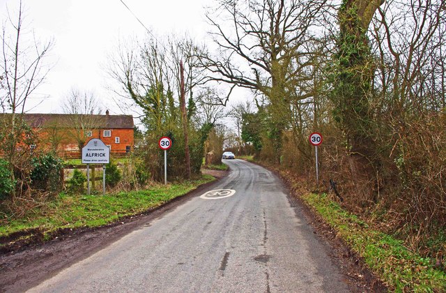
Alfrick

Settlement in Worcestershire Malvern Hills

England

Alfrick

Old Bridge Marker on Mousehole Bridge, Suckley parish Bridge Marker inscribed in a recess in the east parapet of Mousehole Bridge on Leigh Brook, southwest of Alfrick Pound. Suckley parish. Inscribed MARTLEY R D COUNCIL / 1928 (remainder illegible).

Milestone Society National ID: WO_SUCK01br
Old Bridge Marker on Mousehole Bridge, Suckley parish Credit: Roadside Relics

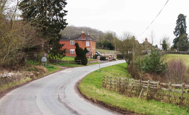
Alfrick is a picturesque village located in the county of Worcestershire, England. Situated approximately 10 miles southwest of Worcester, this rural settlement offers a peaceful and idyllic countryside retreat. Alfrick is part of the Malvern Hills District, known for its stunning landscapes and charming rural communities.

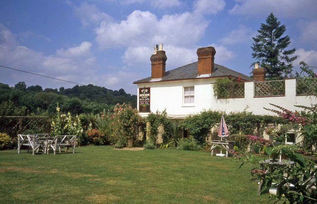
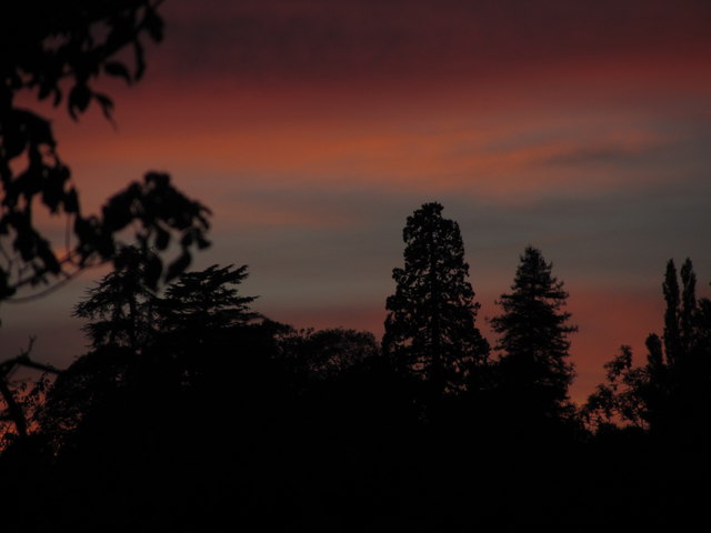
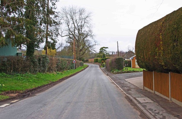
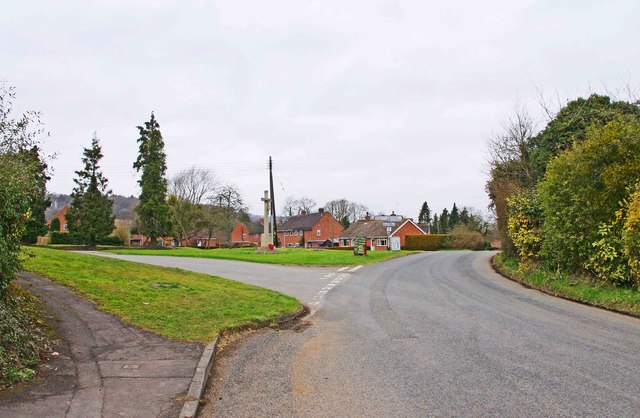
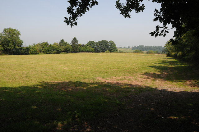
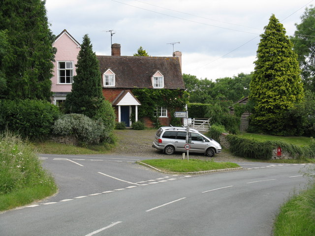
The village itself is small, with a population of around 500 residents. It is nestled amongst rolling green hills, offering breathtaking views of the surrounding countryside. Alfrick is characterized by its traditional cottages, many of which date back centuries, adding to the village's charm and historical appeal.

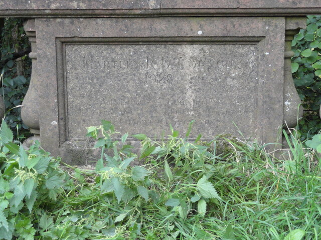
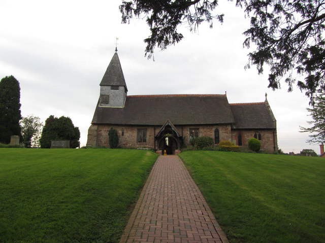
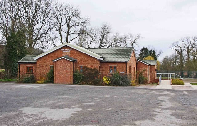
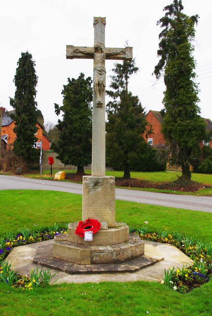
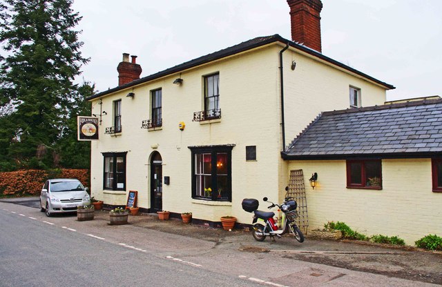
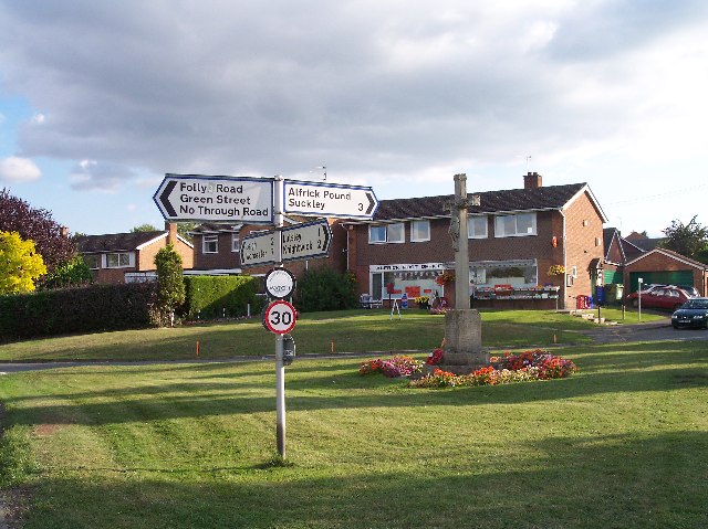
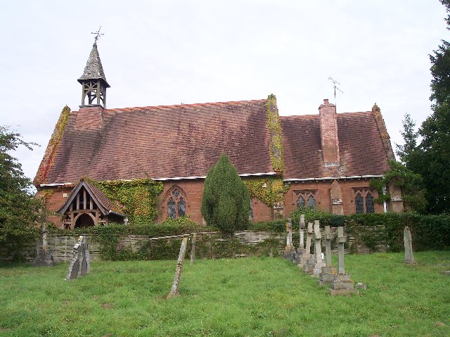
Despite its small size, Alfrick boasts a strong sense of community. The village features a local church, St. Mary Magdalene, which serves as a focal point for religious and social gatherings. The community also benefits from a village hall, providing a space for various events and activities.

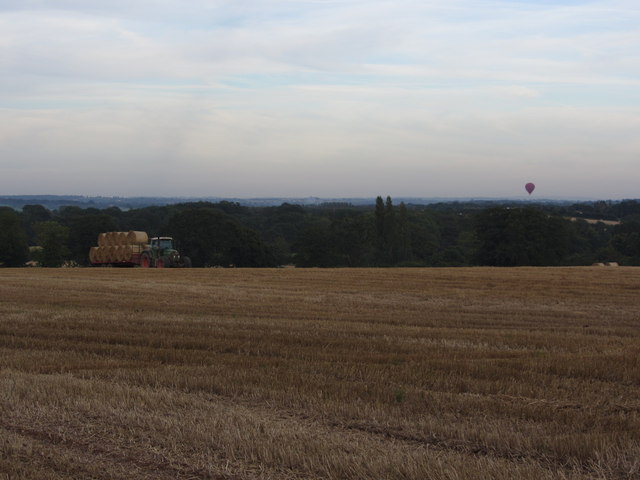
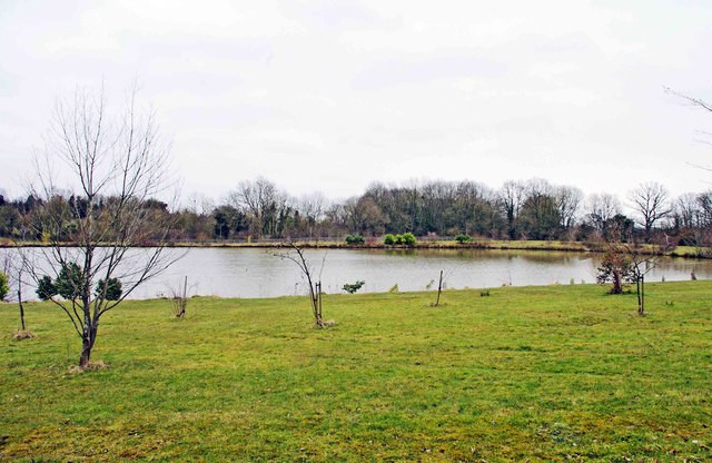
Nature enthusiasts will find plenty to explore in Alfrick. The village is surrounded by beautiful countryside, with numerous walking and hiking trails to discover. Additionally, the nearby Teme Valley offers opportunities for fishing and boating, making it a popular spot for outdoor enthusiasts.

While Alfrick may lack the amenities of larger towns, it compensates with its peaceful ambiance and natural beauty. Visitors seeking a tranquil escape from the bustling city life will find solace in this charming Worcestershire village.

If you have any feedback on the listing, please let us know in the comments section below.
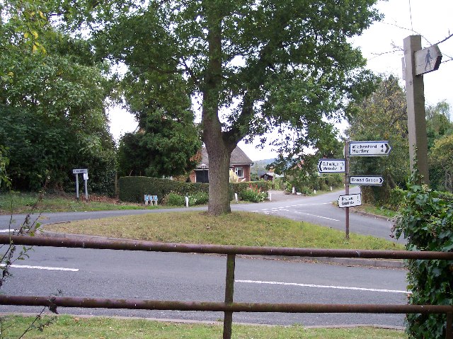
Alfrick Images

Images are sourced within 2km of 52.176245/-2.369178 or Grid Reference SO7453. Thanks to Geograph Open Source API. All images are credited.

Old Bridge Marker on Mousehole Bridge, Suckley parish Bridge Marker inscribed in a recess in the east parapet of Mousehole Bridge on Leigh Brook, southwest of Alfrick Pound. Suckley parish. Inscribed MARTLEY R D COUNCIL / 1928 (remainder illegible).

Milestone Society National ID: WO_SUCK01br
Old Bridge Marker on Mousehole Bridge, Suckley parish
Bridge Marker inscribed in a recess in the east parapet of Mousehole Bridge on Leigh Brook, southwest of Alfrick Pound. Suckley parish. Inscribed MARTLEY R D COUNCIL / 1928 (remainder illegible). Milestone Society National ID: WO_SUCK01br
Old Bridge Marker on Mousehole Bridge, Suckley parish Bridge Marker inscribed in a recess in the west parapet of Mousehole Bridge on Leigh Brook, southwest of Alfrick Pound. Suckley parish. Inscribed MOUSEHOLE BRIDGE (remainder illegible).

Milestone Society National ID: WO_SUCK02br
Old Bridge Marker on Mousehole Bridge, Suckley parish
Bridge Marker inscribed in a recess in the west parapet of Mousehole Bridge on Leigh Brook, southwest of Alfrick Pound. Suckley parish. Inscribed MOUSEHOLE BRIDGE (remainder illegible). Milestone Society National ID: WO_SUCK02br
Garden at the Fox & Hounds Inn Excellent country pub with a good-sized garden and children's play area for the summer months.
Garden at the Fox & Hounds Inn
Excellent country pub with a good-sized garden and children's play area for the summer months.
Gathering in the last of the harvest near Greenstreet Farm, Alfrick & hot air balloon
St Mary's Church, Alfrick
Evening light, Top Knapp, Alfrick
Alfrick & Lulsley Village Hall, Clay Green, Alfrick, Worcs The hall's origins lie in the first village hall, which opened in an ex-army wooden hut in 1923 on the opposite side of the road to the present building. In 1953 the present hall was opened with the name of Alfrick Peace Memorial Hall, to commemorate the dead of the two World Wars. Assets from the demolished hall in the neighbouring village of Lulsley were transferred to the hall in the 1980's, but eventually major work was required, and assisted by a lottery grant, this was completed in July 2010. The hall has all the facilities you would expect of a modern hall and is fully licensed. This is useful because the village has lost both its pubs, although one remains at Lulsley.
Alfrick & Lulsley Village Hall, Clay Green, Alfrick, Worcs
The hall's origins lie in the first village hall, which opened in an ex-army wooden hut in 1923 on the opposite side of the road to the present building. In 1953 the present hall was opened with the name of Alfrick Peace Memorial Hall, to commemorate the dead of the two World Wars. Assets from the demolished hall in the neighbouring village of Lulsley were transferred to the hall in the 1980's, but eventually major work was required, and assisted by a lottery grant, this was completed in July 2010. The hall has all the facilities you would expect of a modern hall and is fully licensed. This is useful because the village has lost both its pubs, although one remains at Lulsley.
Alfrick & Lulsley Community Shop Ltd (1), Clay Green, Alfrick, Worcs The village used to have a shop which closed in April 2011, when the owners retired. Now the village once again has a shop run by volunteers from the villages of Alfrick and Lulsley, which opened in 2012. Currently it is in temporary premises in the car park of the village hall, but eventually it is hoped that it could be in a permanent building. Very unusually for this type of arrangement, there is also a post office here.

<a href="https://www.geograph.org.uk/photo/3411223">SO7453 : Alfrick & Lulsley Community Shop Ltd (2), Clay Green, Alfrick, Worcs</a>.
Alfrick & Lulsley Community Shop Ltd (1), Clay Green, Alfrick, Worcs
The village used to have a shop which closed in April 2011, when the owners retired. Now the village once again has a shop run by volunteers from the villages of Alfrick and Lulsley, which opened in 2012. Currently it is in temporary premises in the car park of the village hall, but eventually it is hoped that it could be in a permanent building. Very unusually for this type of arrangement, there is also a post office here. SO7453 : Alfrick & Lulsley Community Shop Ltd (2), Clay Green, Alfrick, Worcs.
Alfrick & Lulsley Community Shop Ltd (2), Clay Green, Alfrick, Worcs The aims of the shop, according to its website, is to stock what the community wants to buy, to be an outlet for produce made and grown locally, to make a margin on what is sold in accordance with their business plan, to encourage a fast turnover of fresh and seasonal produce, and to be a centre for the community. The shop also includes a Post Office counter.

<a href="https://www.geograph.org.uk/photo/3411184">SO7453 : Alfrick & Lulsley Community Shop Ltd (1), Clay Green, Alfrick, Worcs</a>.
Alfrick & Lulsley Community Shop Ltd (2), Clay Green, Alfrick, Worcs
The aims of the shop, according to its website, is to stock what the community wants to buy, to be an outlet for produce made and grown locally, to make a margin on what is sold in accordance with their business plan, to encourage a fast turnover of fresh and seasonal produce, and to be a centre for the community. The shop also includes a Post Office counter. SO7453 : Alfrick & Lulsley Community Shop Ltd (1), Clay Green, Alfrick, Worcs.
The main road through the village, looking north west, Alfrick, Worcs Looking in the direction of the neighbouring village of Lulsley.
The main road through the village, looking north west, Alfrick, Worcs
Looking in the direction of the neighbouring village of Lulsley.
Looking towards the Village Green and War Memorial, Alfrick, Worcs The road to the left goes to Alfrick Pound and Suckley. The road on the right is the main road through the village and leads to the neighbouring village of Lulsley. Lulsley & Alfrick share the same Parish Council. 

For a closer view of the War Memorial, please see:- <a href="https://www.geograph.org.uk/photo/3411331">SO7453 : Alfrick War Memorial, Village Green, Alfrick, Worcs</a>.
Looking towards the Village Green and War Memorial, Alfrick, Worcs
The road to the left goes to Alfrick Pound and Suckley. The road on the right is the main road through the village and leads to the neighbouring village of Lulsley. Lulsley & Alfrick share the same Parish Council. For a closer view of the War Memorial, please see:- SO7453 : Alfrick War Memorial, Village Green, Alfrick, Worcs.
Alfrick War Memorial, Village Green, Alfrick, Worcs There are about 96 names on here, which shows the sacrifice made by the village in the two World Wars, as its population is only around 500. The memorial is thought to date from about 1920.

<a href="https://www.geograph.org.uk/photo/3411275">SO7453 : Looking towards the Village Green and War Memorial, Alfrick, Worcs</a>.
Alfrick War Memorial, Village Green, Alfrick, Worcs
There are about 96 names on here, which shows the sacrifice made by the village in the two World Wars, as its population is only around 500. The memorial is thought to date from about 1920. SO7453 : Looking towards the Village Green and War Memorial, Alfrick, Worcs.
Entrance to the village of Alfrick, Worcs Entering the village from the direction of Lulsley.
Entrance to the village of Alfrick, Worcs
Entering the village from the direction of Lulsley.
Entrance to the village of Lulsley, Worcs Entering the village from the direction of Alfrick. Just past the speed restriction signs, on the left, is the entrance to Ravenshill Woodland Reserve.
Entrance to the village of Lulsley, Worcs
Entering the village from the direction of Alfrick. Just past the speed restriction signs, on the left, is the entrance to Ravenshill Woodland Reserve.
Lake at Ravenshill near Lulsley, Worcs A large lake adjacent to the road between the villages of Alfrick and Lulsley.
Lake at Ravenshill near Lulsley, Worcs
A large lake adjacent to the road between the villages of Alfrick and Lulsley.
Fox & Hounds (1), Lulsley, Worcs The last surviving public house in the village of Lulsley and also serves the adjoining village of Alfrick, which no longer has any pubs. The Fox & Hounds has a restaurant, large car park at the rear, a beer garden and an outdoor play area for children.

<a href="https://www.geograph.org.uk/photo/3422859">SO7354 : Fox & Hounds (2) - sign, Lulsley, Worcs</a>.
Fox & Hounds (1), Lulsley, Worcs
The last surviving public house in the village of Lulsley and also serves the adjoining village of Alfrick, which no longer has any pubs. The Fox & Hounds has a restaurant, large car park at the rear, a beer garden and an outdoor play area for children. SO7354 : Fox & Hounds (2) - sign, Lulsley, Worcs.
Fox & Hounds (2) - sign, Lulsley, Worcs The sign is rather faded but shows an amusing picture of a fox and a hound by a bar.

A very common pub name, the sign of which would have been very easy to identify in the days when few people could read and write. Some pubs of this name may have been associated with a local fox hunt.

<a href="https://www.geograph.org.uk/photo/3422826">SO7354 : Fox & Hounds (1), Lulsley, Worcs</a>.
Fox & Hounds (2) - sign, Lulsley, Worcs
The sign is rather faded but shows an amusing picture of a fox and a hound by a bar. A very common pub name, the sign of which would have been very easy to identify in the days when few people could read and write. Some pubs of this name may have been associated with a local fox hunt. SO7354 : Fox & Hounds (1), Lulsley, Worcs.
Farmland near Alfrick Farmland to the south of the village of Alfrick.
Farmland near Alfrick
Farmland to the south of the village of Alfrick.
Show me another place!

Alfrick is located at Grid Ref: SO7453 (Lat: 52.176245, Lng: -2.369178)

Administrative County: Worcestershire

District: Malvern Hills

Police Authority: West Mercia

What 3 Words

///deep.solid.prefect. Near Evesbatch, Herefordshire

Related Wikis

Alfrick

Alfrick is a village and civil parish in the Malvern Hills district of Worcestershire, England, about seven miles west of Worcester. == Amenities == The...

Alfrick Pound

Alfrick Pound is a small village in the county of Worcestershire, England, in the United Kingdom. == Location == Alfrick Pound village is located on the...

Malvern Hills District

Malvern Hills is a local government district in Worcestershire, England. Its council is based in the town of Malvern, and its area covers most of the western...

Knightwick railway station

Knightwick railway station was a station in Knightwick, Worcestershire, England. The station was opened on 2 May 1874 and closed on 7 September 1964....

Broadwas

Broadwas, or Broadwas-on-Teme, is a village and civil parish (with Cotheridge) in the Malvern Hills district of Worcestershire, England. According to...
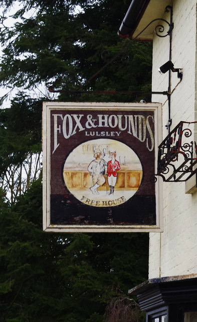
Lulsley

Lulsley is a village and civil parish in the Malvern Hills District of the county of Worcestershire, England, UK. == History == Lulsley was in the upper...

Osebury Rock

Osebury Rock (also known as Oseberrow or Rosebury) is a cliff on the River Teme near Lulsley in Worcestershire, England where fragmentary rocks of the...

Suckley railway station

Suckley railway station was a station in Suckley, Worcestershire, England. The station was opened on 1 March 1878 and closed on 7 September 1964. ��2...

Related Videos

Ankerdine hill

Ankerdine hill Misty day drone footage of Ankerdine hill in Worcestershire, taken with DJI mavic then edited and graded in Final ...

Driving On The B4197 From Knightwick To Martley, Worcestershire, England 26th June 2020

Driving along the B4197 from Knightwick through (or near to) Ankerdine Hill, Sunningdale Estate, Collins Green & Berrow Green ...

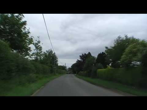
Driving Between Alfrick & Leigh, Worcestershire, England 21st June 2009

Driving between the Worcestershire villages of Alfrick & Leigh. Videoed on Sunday, 21st June 2009 To watch all of the day's ...

Nearby Amenities

Located within 500m of 52.176245,-2.369178
Alfrick
Place: village
Wikidata: Q2480323
Lat/Long: 52.1754374/-2.3685629
Alfrick- Upper House Bungalow
Naptan AtcoCode: 2000G069500
Naptan Bearing: NW
Naptan BusStopType: CUS
Naptan CommonName: Alfrick- Upper House Bungalow
Naptan Indicator: Opp
Naptan Landmark: Opp. Upper House Road
Naptan NaptanCode: wocgadgm
Naptan Street: Alfrick Road
Naptan Verified: no
Source: naptan_import
Lat/Long: 52.1731634/-2.3718342
Bus Stop
Post Office
Bus: yes
Naptan AtcoCode: 2000G069601
Naptan Bearing: SW
Naptan CommonName: Post Office
Naptan Indicator: Adj
Naptan Landmark: Post Office
Naptan NaptanCode: wocdwmjt
Naptan Street: Folly Road
Naptan Verified: no
Public Transport: platform
Source: naptan_import
Lat/Long: 52.1749888/-2.3682465
Alfrick- Green St Turn
Naptan AtcoCode: 2000G640012
Naptan Bearing: SW
Naptan BusStopType: CUS
Naptan CommonName: Alfrick- Green St Turn
Naptan Indicator: Adj
Naptan Landmark: Alfrick Court Road
Naptan NaptanCode: wocgmatm
Naptan Street: Green St
Naptan Verified: no
Source: naptan_import
Lat/Long: 52.1760541/-2.3732038
Townhall
Alfrick & Lulsley Village Hall
Addr Housename: Alfrick & Lulsley Village Hall
Old Name: Alfrick Peace Memorial Hall
Lat/Long: 52.1763797/-2.3699268
Barrier: stile
Foot: yes
Lat/Long: 52.1801492/-2.3685453
Post Box
Collection Times: Mo-Fr 17:00; Sa 10:45
Post Box Mounting: brick_pillar
Post Box Type: wall
Ref: WR6 266
Royal Cypher: GR
Royal Cypher Wikidata: Q33102273
Lat/Long: 52.1731208/-2.3714335
Barrier: stile
Foot: yes
Lat/Long: 52.1740186/-2.3689693
Barrier: stile
Foot: yes
Lat/Long: 52.1764989/-2.372621
Alfrick War Memorial
Historic: memorial
Memorial: war_memorial
Lat/Long: 52.1752629/-2.3682232
Post Box
Collection Times: Mo-Fr 17:00; Sa 09:00
Post Box Type: lamp
Ref: WR6 460
Royal Cypher: EIIR
Royal Cypher Wikidata: Q33102113
Lat/Long: 52.1750121/-2.3681552
Post Office
Alfrick Post Office
Addr City: Worcester
Addr Housename: Alfrick and Lulsley Community Shop Ltd
Addr Postcode: WR6 5HJ
Addr Street: Clay Green
Addr Village: Alfrick
Fixme: verify by survey
Opening Hours: Mo-Fr 11:00-16:00
Ref Pol Id: 123010
Source: pol_branch_list_2018-02
Lat/Long: 52.176447/-2.3695997
Generator Method: photovoltaic
Generator Output Electricity: yes
Generator Source: solar
Generator Type: solar_photovoltaic_panel
Location: roof
Power: generator
Lat/Long: 52.17305/-2.3699838
Generator Method: photovoltaic
Generator Output Electricity: yes
Generator Source: solar
Generator Type: solar_photovoltaic_panel
Location: roof
Power: generator
Lat/Long: 52.1734168/-2.3699382
Generator Method: photovoltaic
Generator Output Electricity: yes
Generator Source: solar
Generator Type: solar_photovoltaic_panel
Location: roof
Power: generator
Lat/Long: 52.1753216/-2.3694742
Generator Method: photovoltaic
Generator Output Electricity: yes
Generator Source: solar
Generator Type: solar_photovoltaic_panel
Location: roof
Power: generator
Lat/Long: 52.174829/-2.3676261
Generator Method: photovoltaic
Generator Output Electricity: yes
Generator Source: solar
Generator Type: solar_photovoltaic_panel
Location: roof
Power: generator
Lat/Long: 52.1746431/-2.3667987
Generator Method: photovoltaic
Generator Output Electricity: yes
Generator Source: solar
Generator Type: solar_photovoltaic_panel
Location: roof
Power: generator
Lat/Long: 52.1746826/-2.3664728
Generator Method: photovoltaic
Generator Output Electricity: yes
Generator Source: solar
Generator Type: solar_photovoltaic_panel
Location: roof
Power: generator
Lat/Long: 52.1747303/-2.3663279
Floods Dingle
Power: pole
Transformer: distribution
Voltage Primary: 11000
Lat/Long: 52.1797822/-2.3658586
Power: pole
Lat/Long: 52.1795183/-2.3653959
Power: pole
Lat/Long: 52.17858/-2.3655957
Clay Green
Power: pole
Transformer: distribution
Voltage Primary: 11000
Lat/Long: 52.1779866/-2.3676476
Power: pole
Lat/Long: 52.1778082/-2.3667102
Power: pole
Lat/Long: 52.1776416/-2.3657995
Power: pole
Lat/Long: 52.1768534/-2.365996
Power: pole
Lat/Long: 52.1763842/-2.3660483
Power: pole
Lat/Long: 52.1757123/-2.3650257
Power: pole
Lat/Long: 52.1751234/-2.3641446
Swan Alfrick
Location Transition: yes
Power: pole
Transformer: distribution
Voltage Primary: 11000
Lat/Long: 52.1746382/-2.3651518
Power: pole
Lat/Long: 52.1747245/-2.3641835
Power: pole
Lat/Long: 52.1741365/-2.3641963
Power: pole
Lat/Long: 52.1737989/-2.3635861
Alfrick Court
Power: pole
Transformer: distribution
Voltage Primary: 11000
Lat/Long: 52.1772942/-2.3751531
Power: pole
Lat/Long: 52.1770446/-2.3749097
Power: pole
Lat/Long: 52.1766926/-2.3746052
Power: pole
Lat/Long: 52.1757238/-2.3737979
Alfrick Village Hall
Power: pole
Transformer: distribution
Voltage Primary: 11000
Lat/Long: 52.1759878/-2.3702218
Power: pole
Lat/Long: 52.1757814/-2.3712873
Power: pole
Lat/Long: 52.1755906/-2.3721899
Power: pole
Lat/Long: 52.1753882/-2.3731434
Power: pole
Lat/Long: 52.1746957/-2.3718895
Location Transition: yes
Power: pole
Lat/Long: 52.1741694/-2.3672191
Alfrick Church
Power: pole
Transformer: distribution
Voltage Primary: 11000
Lat/Long: 52.174514/-2.3671507
Power: pole
Lat/Long: 52.1741307/-2.3674022
Power: pole
Lat/Long: 52.1738494/-2.3686279
Alfrick Grange
Power: pole
Transformer: distribution
Voltage Primary: 11000
Lat/Long: 52.1728436/-2.3689605
Power: pole
Lat/Long: 52.1737528/-2.3695479
Power: pole
Lat/Long: 52.1737582/-2.3690329
Power: pole
Lat/Long: 52.1737413/-2.3701568
Power: pole
Lat/Long: 52.173944/-2.3705303
Alfrick
Power: pole
Transformer: distribution
Voltage Primary: 11000
Lat/Long: 52.1735299/-2.3714241
Power: pole
Lat/Long: 52.1732787/-2.371978
Power: pole
Lat/Long: 52.1728658/-2.3729007
Cafe
Outdoor Seating: yes
Lat/Long: 52.1763515/-2.3694101
The data included in this document is from www.openstreetmap.org. The data is made available under ODbL.

Have you been to Alfrick?

Leave your review of Alfrick below (or comments, questions and feedback).