Alfreton

Settlement in Derbyshire Amber Va

England

Alfreton

Tesco superstore in Alfreton A significant presence in the centre of Alfreton. It looks much like any other Tesco.
Tesco superstore in Alfreton Credit: Bill Boaden

Alfreton is a town located in the county of Derbyshire, England. Situated in the Amber Valley district, it lies approximately 15 miles north of Derby and 18 miles south of Sheffield. With a population of around 23,000, Alfreton serves as a bustling commercial and industrial center.

The town has a rich history and was mentioned in the Domesday Book in 1086. It became an important market town during the Industrial Revolution, thanks to its proximity to coal mines and the construction of the Cromford Canal. Alfreton's growth was further facilitated by the arrival of the Midland Railway in the 19th century.

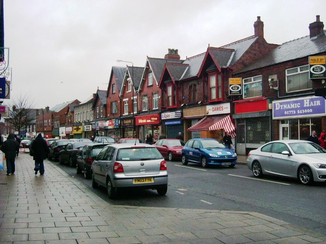
Today, Alfreton boasts a diverse economy with a mix of retail, manufacturing, and service industries. The town center is home to a range of shops, restaurants, and cafes, providing ample opportunities for both residents and visitors. There are also several large retail parks on the outskirts of town, attracting shoppers from the wider area.

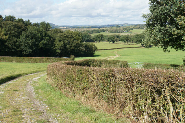
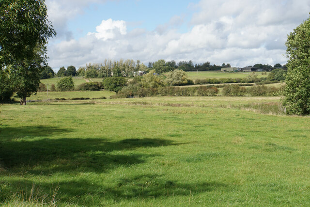
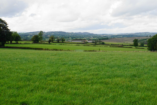
For outdoor enthusiasts, Alfreton offers easy access to the beautiful Derbyshire countryside. The nearby Peak District National Park provides opportunities for hiking, cycling, and exploring picturesque landscapes. Additionally, Alfreton Park, a local green space, offers recreational facilities, including a play area, sports fields, and a sensory garden.

Transportation in Alfreton is well-connected, with regular bus services and a train station that provides links to major cities in the region. The town is also conveniently located close to the M1 motorway, enabling easy access to other parts of the country.

Overall, Alfreton is a vibrant and historically significant town, offering a mix of amenities, employment opportunities, and natural beauty.

If you have any feedback on the listing, please let us know in the comments section below.

Alfreton Images

Images are sourced within 2km of 53.09753/-1.3876148 or Grid Reference SK4155. Thanks to Geograph Open Source API. All images are credited.

Tesco superstore in Alfreton A significant presence in the centre of Alfreton. It looks much like any other Tesco.
Tesco superstore in Alfreton
A significant presence in the centre of Alfreton. It looks much like any other Tesco.
The Old Market Square The town received a charter to hold a market in 1252, but the only market activity now is in the nearby market hall.
The Old Market Square
The town received a charter to hold a market in 1252, but the only market activity now is in the nearby market hall.
Church Street, Alfreton Leading to St Martin's Church, and on foot to the countryside beyond.
Church Street, Alfreton
Leading to St Martin's Church, and on foot to the countryside beyond.
Path to Shirland The path follows a farm track down to the valley of Alfreton Brook. The hills behind are the higher ground surrounding Ashover.
Path to Shirland
The path follows a farm track down to the valley of Alfreton Brook. The hills behind are the higher ground surrounding Ashover.
Path to Shirland Following a good farm track with a firm base. The ground slopes down towards Alfreton Brook. Some of the land ahead would be affected by the proposals for a new solar farm.
Path to Shirland
Following a good farm track with a firm base. The ground slopes down towards Alfreton Brook. Some of the land ahead would be affected by the proposals for a new solar farm.
Path to Alfreton There is a steady gentle climb to get to St Martin's Church, which is the first part of Alfreton that you reach.
Path to Alfreton
There is a steady gentle climb to get to St Martin's Church, which is the first part of Alfreton that you reach.
Farmland by Alfreton Brook The valley bottom which is designated a flood risk from the brook. Lower Delves Farm is in the trees on the opposite slope.
Farmland by Alfreton Brook
The valley bottom which is designated a flood risk from the brook. Lower Delves Farm is in the trees on the opposite slope.
Farmland north west of Alfreton This view will be severely affected by the proposed solar farm on the farmland.
Farmland north west of Alfreton
This view will be severely affected by the proposed solar farm on the farmland.
Crossroads Tavern A pub towards the eastern end of Alfreton's High Street. It is situated on a crossroads.
Crossroads Tavern
A pub towards the eastern end of Alfreton's High Street. It is situated on a crossroads.
High Street, Alfreton The traffic is not always as busy as this.
High Street, Alfreton
The traffic is not always as busy as this.
Institute Lane, Alfreton Now part of the pedestrianised precinct.
Institute Lane, Alfreton
Now part of the pedestrianised precinct.
Bus station in Alfreton
Alfreton Cemetery
Alfreton Cemetery
Alfreton Cemetery
Alfreton Cemetery
Crane hire depot The western end of Meadow Lane Industrial Estate. You can see the cranes from the surrounding countryside in the valley of Alfreton Brook.
Crane hire depot
The western end of Meadow Lane Industrial Estate. You can see the cranes from the surrounding countryside in the valley of Alfreton Brook.
Alfreton Sewage Treatment Works A necessary facility sited by Alfreton Brook.
Alfreton Sewage Treatment Works
A necessary facility sited by Alfreton Brook.
Alfreton Brook A very straight watercourse which will discharge into the River Amber.
Alfreton Brook
A very straight watercourse which will discharge into the River Amber.
The end of the footpath by the B6025 Until this point, there has been a footway by the road, even if badly maintained and little used, but it fades out altogether here.
The end of the footpath by the B6025
Until this point, there has been a footway by the road, even if badly maintained and little used, but it fades out altogether here.
Show me another place!

Alfreton is located at Grid Ref: SK4155 (Lat: 53.09753, Lng: -1.3876148)

Administrative County: Derbyshire

District: Amber Va

Police Authority: Derbyshire

What 3 Words

///form.admits.crest. Near Alfreton, Derbyshire

Nearby Locations

Alfreton Alfreton

Related Wikis

Alfreton War Memorial

Alfreton War Memorial is a 20th-century grade II listed war memorial in Alfreton, Derbyshire. == History == The war memorial was unveiled on 31 July 1927...
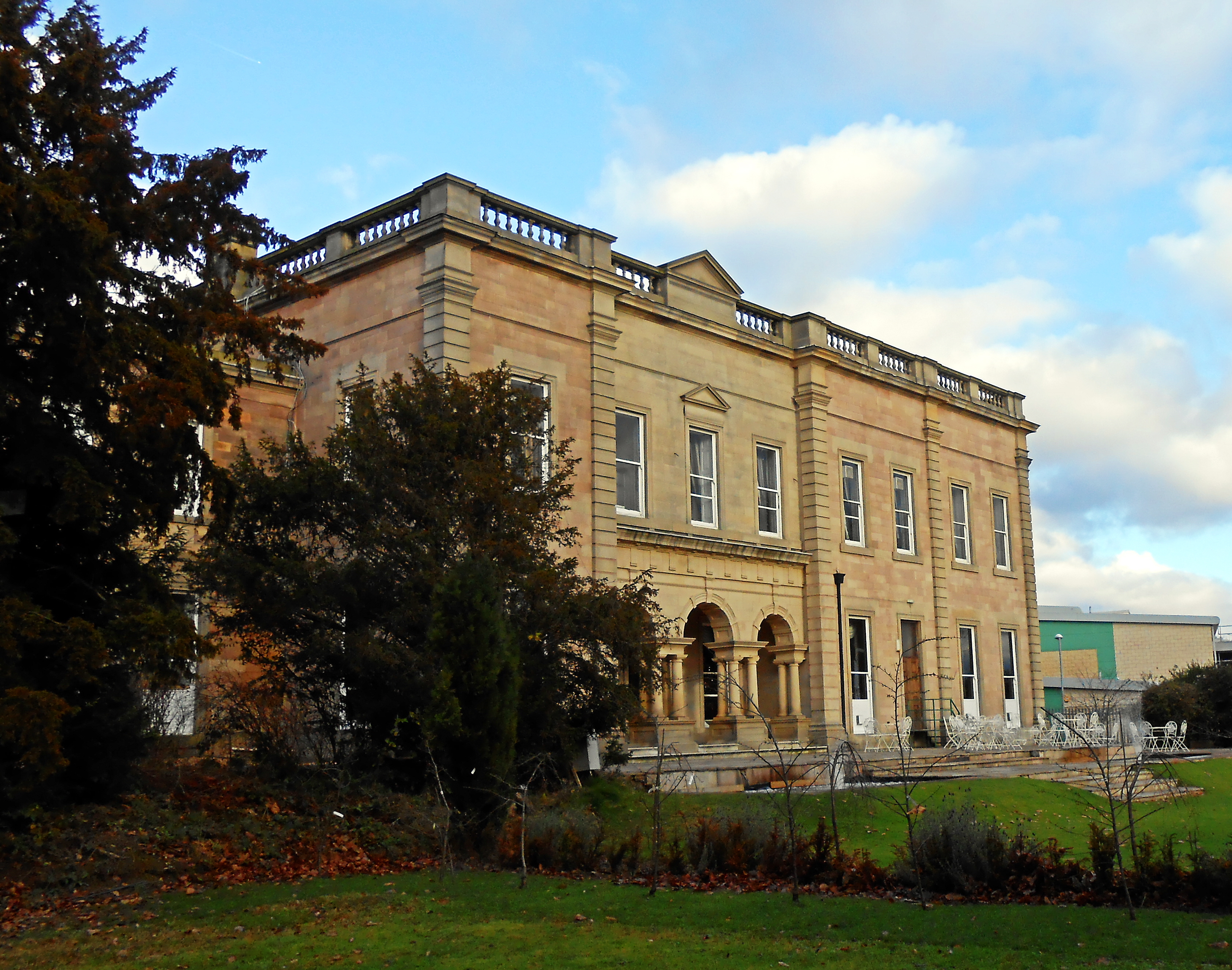
Alfreton Hall

Alfreton Hall is a country house in Alfreton, Derbyshire. It was at the heart of local social and industrial history in the county. The history of the...

Alfreton Urban District

Alfreton was an Urban District in Derbyshire, England from 1894 to 1974. It was created under the Local Government Act 1894. It was enlarged in 1935 when...

Alfreton

Alfreton ( AL-frih-tən) is a town and civil parish in the Amber Valley district of Derbyshire, England. The town was formerly a Norman Manor and later...

David Nieper Academy

David Nieper Academy is a co-educational secondary school and sixth form located in Alfreton in the English county of Derbyshire. == History == The school...

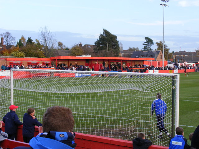
North Street (stadium)

North Street, currently known as the Impact Arena for sponsorship purposes, is a football stadium in Alfreton, Derbyshire, England. It is the home of Alfreton...

Alfreton railway station

Alfreton railway station serves the town of Alfreton in Derbyshire, England. The station is on the Erewash Valley Line 18+1⁄4 miles (29.4 km) north of...

Carnfield Hall

Carnfield Hall is a privately owned country house located at South Normanton, near Alfreton in Derbyshire, England. It is a Grade II* listed building...

Nearby Amenities

Located within 500m of 53.09753,-1.3876148
Traffic Signals
Crossing: no
Lat/Long: 53.0964616/-1.390688
Traffic Signals
Crossing: no
Traffic Signals Direction: backward
Lat/Long: 53.0978406/-1.3902527
Bus Station
Alfreton Bus Station
Bus: yes
Naptan AtcoCode: 100GDATC1151
Public Transport: station
Lat/Long: 53.0957447/-1.3877642
Toilets
Wheelchair: yes
Lat/Long: 53.095891/-1.3873217
Alfreton
Is In: Derbyshire, England, UK
Place: town
Wikidata: Q2462661
Wikipedia: en:Alfreton
Lat/Long: 53.0972537/-1.3900241
Bench
Created By: Potlatch 0.10f
Lat/Long: 53.0989002/-1.3856151
Bus Stop
Cressy Road
Bus: yes
Public Transport: platform
Shelter: yes
Lat/Long: 53.0973967/-1.3855956
Post Box
Brand: Royal Mail
Brand Wikidata: Q638098
Brand Wikipedia: en:Royal Mail
Operator: Royal Mail
Operator Wikidata: Q638098
Post Box Type: pillar
Ref: DE55 550
Royal Cypher: EIIR
Royal Cypher Wikidata: Q33102113
Lat/Long: 53.0967679/-1.381653
Bus Stop
Wilson Street
Bus: yes
Naptan AtcoCode: 1000DAMR4333
Naptan NaptanCode: dbsgmtpt
Public Transport: platform
Shelter: yes
Lat/Long: 53.0983469/-1.3828196
Bench
Lat/Long: 53.0983678/-1.3828872
Fast Food
Star Kebab House
Addr City: Alfreton
Addr Housenumber: 114
Addr Postcode: DE55 7HH
Addr Street: High Street
Cuisine: kebab_house
Fhrs Id: 579
Lat/Long: 53.0975134/-1.384871
Turning Circle
Lat/Long: 53.0999886/-1.3897651
Bench
Backrest: no
Created By: Potlatch 0.10f
Lat/Long: 53.0977873/-1.38827
Barrier: stile
Lat/Long: 53.099037/-1.393847
Bench
Lat/Long: 53.0984509/-1.3926574
Bench
Lat/Long: 53.0977044/-1.3858063
Four Horseshoes
Disused Amenity: pub
Note: Now for sale as offices
Lat/Long: 53.09682/-1.3904446
Turning Circle
Lat/Long: 53.0991384/-1.3807103
Turning Circle
Lat/Long: 53.0994671/-1.3829975
Post Box
Brand: Royal Mail
Brand Wikidata: Q638098
Brand Wikipedia: en:Royal Mail
Operator: Royal Mail
Operator Wikidata: Q638098
Ref: DE55 458
Lat/Long: 53.094546/-1.3851889
Ele: 127.4996338
Lat/Long: 53.0963208/-1.3829221
Ele: 129.4222412
Lat/Long: 53.0969287/-1.3829049
Ele: 124.6157227
Lat/Long: 53.0957629/-1.3830596
Bench
Ele: 137.1126709
Lat/Long: 53.0990883/-1.3938239
Barrier: stile
Steps: 2
Stile: stepover
Lat/Long: 53.0990031/-1.3942418
Post Box
Brand: Royal Mail
Brand Wikidata: Q638098
Brand Wikipedia: en:Royal Mail
Collection Times: Mo-Fr 17:00; Sa 09:30
Operator: Royal Mail
Operator Wikidata: Q638098
Ref: DE55 1395
Lat/Long: 53.0949509/-1.3896281
Post Box
Brand: Royal Mail
Brand Wikidata: Q638098
Brand Wikipedia: en:Royal Mail
Operator: Royal Mail
Operator Wikidata: Q638098
Post Box Design: type_c
Post Box Type: pillar
Ref: DE55 551
Royal Cypher: EIIR
Royal Cypher Wikidata: Q33102113
Lat/Long: 53.0973829/-1.3884438
Post Box
Brand: Royal Mail
Brand Wikidata: Q638098
Brand Wikipedia: en:Royal Mail
Operator: Royal Mail
Operator Wikidata: Q638098
Ref: DE55 777
Lat/Long: 53.0985784/-1.3832462
Barrier: cycle_barrier
Cycle Barrier: chicane
Ele: 117
Lat/Long: 53.0937964/-1.3888888
Ele: 121
Lat/Long: 53.0955332/-1.3890884
Restaurant
Sanam
Addr City: Alfreton
Addr Housenumber: 50-52
Addr Postcode: DE55 7DD
Addr Street: King Street
Cuisine: indian
Ele: 123
Fhrs Id: 599
Lat/Long: 53.0962431/-1.3909716
Pub
The Dog House
Addr City: Alfreton
Addr Housenumber: 32
Addr Postcode: DE55 7HL
Addr Street: Nottingham Road
Ele: 138
Fhrs Id: 200686
Lat/Long: 53.0970336/-1.3824157
Devonshire Arms
Beer Garden: yes
Disused Amenity: pub
Ele: 108
Note: Boarded up
Operator: Samuel Smith
Lat/Long: 53.0945062/-1.3918865
Ele: 128
Lat/Long: 53.0958415/-1.3887433
Bench
Ele: 116
Lat/Long: 53.0943011/-1.3917304
Ele: 130.6239014
Lat/Long: 53.097927/-1.3831327
Restaurant
Mumbai Masala
Addr City: Alfreton
Addr Housenumber: 1A
Addr Postcode: DE55 7BR
Addr Street: Cressy Road
Cuisine: indian
Ele: 134.2287598
Fhrs Id: 561
Lat/Long: 53.0974168/-1.3854088
Entrance: yes
Source: photographic_survey
Lat/Long: 53.0970474/-1.3882476
Harlequin School of Dance and Performing Arts
Door: hinged
Entrance: staircase
Level: 0
Note: Entrance to Harlequin Dance Studio, above Boots.
Wheelchair: no
Lat/Long: 53.0973354/-1.3880309
Entrance: yes
Source: photographic_survey
Lat/Long: 53.097352/-1.3877407
Entrance: yes
Source: photographic_survey
Lat/Long: 53.0961547/-1.3877926
Entrance: yes
Source: photographic_survey
Lat/Long: 53.0961473/-1.3881032
Entrance: yes
Source: photographic_survey
Lat/Long: 53.0968803/-1.3882794
Entrance: yes
Source: photographic_survey
Lat/Long: 53.0970001/-1.38824
Access: no
Entrance: yes
Source: photographic_survey
Lat/Long: 53.0973303/-1.3881192
Entrance: yes
Source: photographic_survey
Lat/Long: 53.0968016/-1.3882792
Entrance: yes
Source: photographic_survey
Lat/Long: 53.0969472/-1.3882315
Bus Stop
High Street
Bus: yes
Naptan AtcoCode: 1000DAHS6099
Naptan NaptanCode: dbsgpgmp
Public Transport: platform
Shelter: yes
Lat/Long: 53.0973935/-1.3885611
Max Spielmann
Brand: Max Spielmann
Brand Wikidata: Q76221051
Note: Included in Timpson shop
Shop: photo
Source: photographic_survey
Lat/Long: 53.0969441/-1.3881049
Access: yes
Door: double
Entrance: yes
Source: photographic_survey
Lat/Long: 53.0973276/-1.388232
Entrance: yes
Source: photographic_survey
Lat/Long: 53.0967442/-1.3882776
Entrance: yes
Source: photographic_survey
Lat/Long: 53.0961449/-1.3882027
Entrance: yes
Source: photographic_survey
Lat/Long: 53.0962056/-1.3876827
Entrance: yes
Source: photographic_survey
Lat/Long: 53.097348/-1.3878272
Entrance: yes
Source: photographic_survey
Lat/Long: 53.0961496/-1.3880076
Entrance: yes
Source: photographic_survey
Lat/Long: 53.09734/-1.3879425
Barrier: bollard
Bicycle: yes
Foot: yes
Lat/Long: 53.0971964/-1.3865327
Note: Filled in hole where ATM was
Lat/Long: 53.0975732/-1.3890164
SI RACHA
Door: hinged
Entrance: staircase
Level: 0
Note: Entrance to SI RACHA, a Thai massage establishment on the upper floor.
Wheelchair: no
Lat/Long: 53.0976875/-1.3868704
Crossing
Crossing: traffic_signals
Crossing Ref: puffin
Source: photographic_survey
Lat/Long: 53.0976558/-1.3856956
Crossing
Crossing: traffic_signals
Crossing Ref: puffin
Source: photographic_survey
Lat/Long: 53.097644/-1.3853645
Man Made: surveillance
Source: photographic_survey
Surveillance: outdoor
Lat/Long: 53.0977296/-1.3861445
Crossing
Button Operated: yes
Crossing: traffic_signals
Crossing Island: no
Crossing Ref: pelican
Source: photographic_survey
Tactile Paving: yes
Traffic Signals Sound: yes
Traffic Signals Vibration: yes
Lat/Long: 53.0975745/-1.3875101
Restaurant
Lakeside Garden
Addr City: Alfreton
Addr Street: High Street
Cuisine: chinese
Ele: 156
Outdoor Seating: no
Takeaway: only
Lat/Long: 53.0974564/-1.3893193
Cafe
Alfreton House Tea Rooms
Addr City: Alfreton
Addr Postcode: DE55 7HH
Addr Street: High Street
Fhrs Id: 581
Source: survey
Lat/Long: 53.0977443/-1.3850603
Cafe
Chatterbox Cafe
Addr City: Alfreton
Addr Postcode: DE55 7BQ
Addr Street: Severn Square
Fhrs Id: 591
Source: survey
Lat/Long: 53.0958808/-1.3872463
David Nieper Factory Shop
Addr City: Alfreton
Addr Postcode: DE55 7LE
Addr Street: Orange Street
Fhrs Id: 618
Shop: clothes
Source: survey
Lat/Long: 53.0958348/-1.3811319
Addr Housename: Speeds Court
Source: survey
Lat/Long: 53.0952133/-1.3913978
Addr City: Alfreton
Addr Country: GB
Addr Housenumber: 100
Addr Street: King Street
Source: survey
Lat/Long: 53.0955537/-1.3913032
Addr City: Alfreton
Addr Country: GB
Addr Housenumber: 20
Addr Street: Alma Street
Source: survey
Lat/Long: 53.0953664/-1.3821452
Car Wash
Shiny Hand Car Wash
Automated: no
Opening Hours: Mo-Su 08:00-18:00
Self Service: no
Source: survey
Lat/Long: 53.0983773/-1.3904226
Grit Bin
Source: survey
Lat/Long: 53.0947479/-1.3827886
War Memorial Alfreton
Historic: memorial
Memorial: war_memorial
Wikidata: Q26402770
Lat/Long: 53.0975149/-1.3904085
Alfreton Antiques Centre
Shop: antiques
Source: survey
Lat/Long: 53.0970431/-1.3903173
Chinatown
Cuisine: chinese
Disused Amenity: fast_food
Note: Shut
Source: survey
Lat/Long: 53.0963736/-1.3908751
Italianos
Cuisine: italian
Disused Amenity: restaurant
Source: survey
Lat/Long: 53.0970513/-1.3907471
Addr City: Alfreton
Addr Postcode: DE55 7AE
Addr Street: King Street
Cuisine: indian
Disused Amenity: restaurant
Old Name: New Bengal
Source: survey
Lat/Long: 53.0972984/-1.3901818
Fast Food
Subway
Addr City: Alfreton
Addr Housenumber: 22
Addr Postcode: DE55 7BN
Addr Street: High Street
Brand: Subway
Brand Wikidata: Q244457
Brand Wikipedia: en:Subway (restaurant)
Contact Website: https://restaurants.subway.com/united-kingdom/en/alfreton/22-high-street
Cuisine: sandwich
Fhrs Id: 14896
Source: survey
Takeaway: yes
Lat/Long: 53.0974069/-1.3891477
TBG Learning
Source: survey
Lat/Long: 53.0974934/-1.3897419
Brand Wikidata: Q8055678
Disused Amenity: yes
Lat/Long: 53.0974755/-1.3894332
Alfreton Snooker Club
Addr City: Alfreton
Addr Housename: Burtons Building
Addr Housenumber: 55-57
Addr Postcode: DE55 7DR
Addr Street: High Street
Alt Name: Snooker
Club: social
Fhrs Id: 572
Level: 1
Source Addr: FHRS
Lat/Long: 53.0977847/-1.3883472
Description: Alfreton House of Confinement
Information: board
Tourism: information
Lat/Long: 53.0942573/-1.3918009
Traffic Signals
Crossing: no
Lat/Long: 53.095435/-1.3911045
Traffic Signals
Crossing: no
Lat/Long: 53.0965245/-1.3906661
Childcare
Stepping Stones Nursery
Addr City: Alfreton
Addr Postcode: DE55 7JA
Lat/Long: 53.0945316/-1.3873565
Barrier: bollard
Motor Vehicle: no
Lat/Long: 53.0978872/-1.3893084
Tim Drapers Golder Holidays
Shop: travel_agency
Lat/Long: 53.0959597/-1.3872497
Crossing
Crossing: marked
Crossing Markings: yes
Lat/Long: 53.0949212/-1.3905219
Crossing
Crossing: marked
Crossing Markings: yes
Tactile Paving: yes
Lat/Long: 53.094966/-1.3896931
Sureview Cliffords
Shop: electrical
Lat/Long: 53.0972456/-1.3826459
King Street Barbers
Shop: hairdresser
Lat/Long: 53.0971158/-1.3907312
Sew n Sew
Shop: haberdashery
Lat/Long: 53.0969419/-1.3907393
Picture Framing
Note: That really is the largest name of the shop
Shop: picture_framing
Lat/Long: 53.0969756/-1.3907366
Derbyshire Properties
Office: estate_agent
Lat/Long: 53.0971576/-1.3907202
Super Tan
Leisure: tanning_salon
Lat/Long: 53.0972705/-1.3907151
Broadbents Solicitors
Office: solicitor
Lat/Long: 53.0972107/-1.3907175
Home Electrical
Shop: electrical
Lat/Long: 53.096058/-1.3910842
Embers
Shop: fireplace
Lat/Long: 53.0961336/-1.3910386
Simply Vintage
Shop: clothes
Lat/Long: 53.0960113/-1.3911137
Clare Sales School of Dance
Dance Teaching: yes
Leisure: dance
Level: 1
Note: Entrance at west
Lat/Long: 53.0960287/-1.3879947
Harlequin School of Dance and Performing Arts
Dance Teaching: yes
Leisure: dance
Level: 1
Lat/Long: 53.0971062/-1.3880552
Shop: vacant
Lat/Long: 53.0976454/-1.391008
polski sklep
Addr City: Alfreton
Addr Housenumber: 5-7
Addr Postcode: DE55 7FF
Addr Street: Rodgers Lane
Fhrs Id: 643720
Shop: convenience
Lat/Long: 53.0980558/-1.3856958
House Of Finesse
Shop: hairdresser
Lat/Long: 53.0975022/-1.3847087
Skintones
Shop: tattoo
Lat/Long: 53.0975103/-1.3848052
Bradley and Co
Office: accountant
Lat/Long: 53.0975119/-1.384942
Alfreton Town Hall
Level: 1
Note: Sign on side of building; no idea what it is used for now.
Lat/Long: 53.0974925/-1.3850104
Trafford Lowe Funeral Service
Addr City: Alfreton
Addr Housenumber: 23-25
Addr Postcode: DE55 7DR
Addr Street: High Street
Phone: +44 1773 602593
Shop: funeral_directors
Website: https://www.traffordlowefuneralservices.co.uk/
Lat/Long: 53.0976544/-1.3892376
The Beauty Club
Lat/Long: 53.0976721/-1.3895809
Cleaver Thompson
Office: solicitors
Lat/Long: 53.0972293/-1.3902515
Green & May
Office: estate_agent
Lat/Long: 53.0976737/-1.3896641
Team Bride
Shop: clothes
Lat/Long: 53.0976688/-1.38953
Shop: vacant
Lat/Long: 53.0968683/-1.3904151
Shop: vacant
Lat/Long: 53.0969183/-1.3904017
Alexandra Louise
Shop: hairdresser
Lat/Long: 53.0962081/-1.3907101
Dentist
Hafren House
Healthcare: dentist
Lat/Long: 53.0972399/-1.3853713
Hunt 4 Spares
Shop: car_parts
Lat/Long: 53.0972439/-1.3858842
Fifi Star Nails
Shop: vacant
Lat/Long: 53.0974383/-1.3892437
Hall and Benson
Office: estate_agent
Lat/Long: 53.0973932/-1.3890399
Entrance: main
Lat/Long: 53.0966261/-1.3803279
Quib's Quiffs
Shop: hairdresser
Lat/Long: 53.097998/-1.385685
Crossing
Button Operated: yes
Crossing: traffic_signals
Crossing Island: no
Crossing Ref: puffin
Source: photographic_survey
Tactile Paving: yes
Lat/Long: 53.0976178/-1.3899356
Crossing
Button Operated: yes
Crossing: traffic_signals
Crossing Island: no
Crossing Ref: puffin
Source: photographic_survey
Tactile Paving: yes
Lat/Long: 53.0975441/-1.390255
Crossing
Crossing: traffic_signals
Crossing Ref: puffin
Source: photographic_survey
Lat/Long: 53.0977236/-1.3855266
Crossing
Crossing: traffic_signals
Crossing Island: no
Crossing Ref: puffin
Source: photographic_survey
Lat/Long: 53.0975857/-1.3855258
Crossing
Button Operated: yes
Crossing: traffic_signals
Crossing Island: no
Crossing Ref: puffin
Source: photographic_survey
Tactile Paving: yes
Lat/Long: 53.0976977/-1.3902439
Crossing
Button Operated: yes
Crossing: traffic_signals
Crossing Island: no
Crossing Ref: puffin
Source: photographic_survey
Tactile Paving: yes
Lat/Long: 53.0976275/-1.3903786
Bench
Lat/Long: 53.0980412/-1.3851894
Bench
Lat/Long: 53.0980353/-1.3851514
Bench
Lat/Long: 53.097971/-1.3851682
Fountain
Lat/Long: 53.0974176/-1.3877004
Bench
Lat/Long: 53.0962575/-1.3882463
Bench
Lat/Long: 53.0963032/-1.3879746
Bench
Lat/Long: 53.0963005/-1.3880284
Bench
Lat/Long: 53.0962975/-1.3880815
Bench
Lat/Long: 53.0962554/-1.3879304
Bench
Lat/Long: 53.0962944/-1.3881374
Bench
Lat/Long: 53.0962848/-1.3879319
Bench
Lat/Long: 53.0962306/-1.3882486
Bench
Lat/Long: 53.0964037/-1.3871558
Bench
Lat/Long: 53.0964032/-1.3872117
Crossing
Button Operated: yes
Crossing: traffic_signals
Crossing Island: no
Tactile Paving: yes
Lat/Long: 53.0955388/-1.3882997
Crossing
Crossing: traffic_signals
Lat/Long: 53.0953992/-1.3894432
Bench
Backrest: no
Lat/Long: 53.0974464/-1.3878244
Bench
Lat/Long: 53.0976091/-1.3858146
Bench
Backrest: no
Lat/Long: 53.0975393/-1.3873424
Bench
Backrest: no
Lat/Long: 53.0974333/-1.3878651
Bench
Lat/Long: 53.0977651/-1.3854247
Bench
Backrest: no
Lat/Long: 53.0974116/-1.3879062
First World War memorial
Historic: memorial
Inscription: Sacred to the memory of the young men of the United Methodist Sunday School, who gave their lives in the Great War 1914-1918.
Lat/Long: 53.0987309/-1.3857983
Wyvern Dragon
Artist Name: Maggie
Artwork Type: sculpture
Ele: 40ft.
Note: Original dragon was installed in 1896 but was damaged in a storm in 2009. Local residents fundraised for a replacement, which was installed in December 2017.
Tourism: artwork
Lat/Long: 53.0975528/-1.3851382
Clock
Display: sundial
Support: pedestal
Lat/Long: 53.0985022/-1.3929581
Bench
Lat/Long: 53.0978128/-1.3852612
Bench
Ele: 116
Lat/Long: 53.0942854/-1.3917452
Telephone
Booth: K6
Covered: booth
Man Made: telephone_box
Operator: Decommissioned.
Payment: no
Lat/Long: 53.0977414/-1.3853911
Post Box
Brand: Royal Mail
Brand Wikidata: Q638098
Brand Wikipedia: en:Royal Mail
Operator: Royal Mail
Operator Wikidata: Q638098
Ref: DE55 711
Lat/Long: 53.1008609/-1.3883384
Bench
Backrest: no
Lat/Long: 53.0974637/-1.3904101
Bench
Lat/Long: 53.0998686/-1.3863588
Entrance: main
Lat/Long: 53.0975761/-1.3935133
Entrance: yes
Lat/Long: 53.0979725/-1.394951
Entrance: yes
Lat/Long: 53.0949603/-1.389606
Entrance: yes
Lat/Long: 53.0950598/-1.3896265
Entrance: yes
Lat/Long: 53.096419/-1.3872645
Bench
Lat/Long: 53.0963554/-1.3872284
Bench
Lat/Long: 53.0963547/-1.3873103
Entrance: main
Lat/Long: 53.0974478/-1.3949979
Entrance: main
Lat/Long: 53.0971814/-1.3927906
Social Facility
Ash Lea House
Addr City: Alfreton
Addr Postcode: DE55 7DT
Addr Street: Chesterfield Road
Fhrs Id: 557
Social Facility: group_home
Social Facility For: senior
Lat/Long: 53.0988316/-1.39079
Entrance: yes
Lat/Long: 53.0953507/-1.3892651
Entrance: yes
Lat/Long: 53.0979724/-1.3856413
Entrance: yes
Lat/Long: 53.0980462/-1.3856527
Entrance: yes
Lat/Long: 53.0980111/-1.3856482
Information: guidepost
Tourism: information
Lat/Long: 53.0977301/-1.3853149
Information: guidepost
Tourism: information
Lat/Long: 53.0974454/-1.3904171
Information: guidepost
Tourism: information
Lat/Long: 53.0977336/-1.3851848
Information: guidepost
Tourism: information
Lat/Long: 53.0983963/-1.3926181
Tourism: information
Lat/Long: 53.0957482/-1.3872878
Tourism: information
Lat/Long: 53.0957466/-1.3881874
Tourism: information
Lat/Long: 53.09984/-1.3853782
Atm
Brand: NatWest
Brand Wikidata: Q2740021
Check Date: 2022-12-29
Operator: NatWest
Operator Wikidata: Q2740021
Lat/Long: 53.0948992/-1.3895927
Bus Stop
King Street
Bench: no
Bin: no
Bus: yes
Departures Board: no
Public Transport: platform
Shelter: no
Tactile Paving: no
Lat/Long: 53.0990814/-1.3902402
Bus Stop
Wilson Street
Bus: yes
Public Transport: platform
Lat/Long: 53.0981867/-1.3815605
Direction: SSW
Generator Method: photovoltaic
Generator Output Electricity: yes
Generator Solar Modules: 66
Generator Source: solar
Generator Type: solar_photovoltaic_panel
Location: roof
Power: generator
Lat/Long: 53.0958207/-1.3812665
Direction: SSW
Generator Method: photovoltaic
Generator Output Electricity: yes
Generator Solar Modules: 66
Generator Source: solar
Generator Type: solar_photovoltaic_panel
Location: roof
Power: generator
Lat/Long: 53.0958025/-1.3810778
Direction: SSW
Generator Method: photovoltaic
Generator Output Electricity: yes
Generator Solar Modules: 75
Generator Source: solar
Generator Type: solar_photovoltaic_panel
Location: roof
Power: generator
Lat/Long: 53.0954809/-1.3813765
Direction: SSW
Generator Method: photovoltaic
Generator Output Electricity: yes
Generator Solar Modules: 48
Generator Source: solar
Generator Type: solar_photovoltaic_panel
Location: roof
Power: generator
Lat/Long: 53.0954358/-1.3812102
Direction: 215
Generator Method: photovoltaic
Generator Output Electricity: yes
Generator Solar Modules: 10
Generator Source: solar
Generator Type: solar_photovoltaic_panel
Location: roof
Power: generator
Lat/Long: 53.0956049/-1.3836322
Direction: SSW
Generator Method: photovoltaic
Generator Output Electricity: yes
Generator Solar Modules: 10
Generator Source: solar
Generator Type: solar_photovoltaic_panel
Location: roof
Power: generator
Lat/Long: 53.0971115/-1.3827939
Direction: SSW
Generator Method: photovoltaic
Generator Output Electricity: yes
Generator Solar Modules: 10
Generator Source: solar
Generator Type: solar_photovoltaic_panel
Location: roof
Power: generator
Lat/Long: 53.09718/-1.382444
Direction: 190
Generator Method: photovoltaic
Generator Output Electricity: yes
Generator Solar Modules: 12
Generator Source: solar
Generator Type: solar_photovoltaic_panel
Location: roof
Power: generator
Lat/Long: 53.0990068/-1.3808396
Direction: 145
Generator Method: photovoltaic
Generator Output Electricity: yes
Generator Solar Modules: 15
Generator Source: solar
Generator Type: solar_photovoltaic_panel
Location: roof
Power: generator
Lat/Long: 53.1001384/-1.3819002
Direction: 100
Generator Method: photovoltaic
Generator Output Electricity: yes
Generator Solar Modules: 6
Generator Source: solar
Generator Type: solar_photovoltaic_panel
Location: roof
Power: generator
Lat/Long: 53.0997465/-1.3842311
Direction: 280
Generator Method: photovoltaic
Generator Output Electricity: yes
Generator Solar Modules: 6
Generator Source: solar
Generator Type: solar_photovoltaic_panel
Location: roof
Power: generator
Lat/Long: 53.0997506/-1.38429
Direction: 80
Generator Method: photovoltaic
Generator Output Electricity: yes
Generator Solar Modules: 8
Generator Source: solar
Generator Type: solar_photovoltaic_panel
Location: roof
Power: generator
Lat/Long: 53.0994535/-1.3842581
Direction: 260
Generator Method: photovoltaic
Generator Output Electricity: yes
Generator Solar Modules: 8
Generator Source: solar
Generator Type: solar_photovoltaic_panel
Location: roof
Power: generator
Lat/Long: 53.0994445/-1.3843292
Direction: W
Generator Method: photovoltaic
Generator Output Electricity: yes
Generator Solar Modules: 8
Generator Source: solar
Generator Type: solar_photovoltaic_panel
Location: roof
Power: generator
Lat/Long: 53.0971391/-1.3854013
Direction: E
Generator Method: photovoltaic
Generator Output Electricity: yes
Generator Solar Modules: 5
Generator Source: solar
Generator Type: solar_photovoltaic_panel
Location: roof
Power: generator
Lat/Long: 53.0971512/-1.3853093
Direction: 175
Generator Method: photovoltaic
Generator Output Electricity: yes
Generator Solar Modules: 8
Generator Source: solar
Generator Type: solar_photovoltaic_panel
Location: roof
Power: generator
Lat/Long: 53.0989727/-1.3915883
Direction: 175
Generator Method: photovoltaic
Generator Output Electricity: yes
Generator Solar Modules: 8
Generator Source: solar
Generator Type: solar_photovoltaic_panel
Location: roof
Power: generator
Lat/Long: 53.0990002/-1.391594
Direction: S
Generator Method: photovoltaic
Generator Output Electricity: yes
Generator Solar Modules: 13
Generator Source: solar
Generator Type: solar_photovoltaic_panel
Location: roof
Power: generator
Lat/Long: 53.099794/-1.3897899
Direction: S
Generator Method: photovoltaic
Generator Output Electricity: yes
Generator Solar Modules: 12
Generator Source: solar
Generator Type: solar_photovoltaic_panel
Location: roof
Power: generator
Lat/Long: 53.1000915/-1.3892548
Direction: SW
Generator Method: photovoltaic
Generator Output Electricity: yes
Generator Solar Modules: 11
Generator Source: solar
Generator Type: solar_photovoltaic_panel
Location: roof
Power: generator
Lat/Long: 53.1001249/-1.3885103
Direction: S
Generator Method: photovoltaic
Generator Output Electricity: yes
Generator Solar Modules: 12
Generator Source: solar
Generator Type: solar_photovoltaic_panel
Location: roof
Power: generator
Lat/Long: 53.1007631/-1.3887371
Direction: W
Generator Method: photovoltaic
Generator Output Electricity: yes
Generator Solar Modules: 6
Generator Source: solar
Generator Type: solar_photovoltaic_panel
Location: roof
Power: generator
Lat/Long: 53.1007228/-1.3884877
Direction: E
Generator Method: photovoltaic
Generator Output Electricity: yes
Generator Solar Modules: 6
Generator Source: solar
Generator Type: solar_photovoltaic_panel
Location: roof
Power: generator
Lat/Long: 53.1007228/-1.3884528
Direction: S
Generator Method: photovoltaic
Generator Output Electricity: yes
Generator Solar Modules: 12
Generator Source: solar
Generator Type: solar_photovoltaic_panel
Location: roof
Power: generator
Lat/Long: 53.10104/-1.3892414
Direction: 170
Generator Method: photovoltaic
Generator Output Electricity: yes
Generator Solar Modules: 9
Generator Source: solar
Generator Type: solar_photovoltaic_panel
Location: roof
Power: generator
Lat/Long: 53.1013821/-1.3894702
Direction: 170
Generator Method: photovoltaic
Generator Output Electricity: yes
Generator Solar Modules: 6
Generator Source: solar
Generator Type: solar_photovoltaic_panel
Location: roof
Power: generator
Lat/Long: 53.1014878/-1.3884296
Direction: S
Generator Method: photovoltaic
Generator Output Electricity: yes
Generator Solar Modules: 17
Generator Source: solar
Generator Type: solar_photovoltaic_panel
Location: roof
Power: generator
Lat/Long: 53.1018758/-1.3871359
Direction: S
Generator Method: photovoltaic
Generator Output Electricity: yes
Generator Solar Modules: 17
Generator Source: solar
Generator Type: solar_photovoltaic_panel
Location: roof
Power: generator
Lat/Long: 53.1018718/-1.3870087
Direction: SSE
Generator Method: photovoltaic
Generator Output Electricity: yes
Generator Solar Modules: 18
Generator Source: solar
Generator Type: solar_photovoltaic_panel
Location: roof
Power: generator
Lat/Long: 53.1018823/-1.3862025
Direction: 170
Generator Method: photovoltaic
Generator Output Electricity: yes
Generator Solar Modules: 14
Generator Source: solar
Generator Type: solar_photovoltaic_panel
Location: roof
Power: generator
Lat/Long: 53.1017293/-1.3854917
Direction: 145
Generator Method: photovoltaic
Generator Output Electricity: yes
Generator Solar Modules: 17
Generator Source: solar
Generator Type: solar_photovoltaic_panel
Location: roof
Power: generator
Lat/Long: 53.1000126/-1.3847862
Direction: 195
Generator Method: photovoltaic
Generator Output Electricity: yes
Generator Solar Modules: 11
Generator Source: solar
Generator Type: solar_photovoltaic_panel
Location: roof
Power: generator
Lat/Long: 53.0942795/-1.3910948
Direction: S
Generator Method: photovoltaic
Generator Output Electricity: yes
Generator Solar Modules: 8
Generator Source: solar
Generator Type: solar_photovoltaic_panel
Location: roof
Power: generator
Lat/Long: 53.0965435/-1.3845234
Direction: S
Generator Method: photovoltaic
Generator Output Electricity: yes
Generator Solar Modules: 4
Generator Source: solar
Generator Type: solar_photovoltaic_panel
Location: roof
Power: generator
Lat/Long: 53.0965/-1.3845623
Direction: S
Generator Method: photovoltaic
Generator Output Electricity: yes
Generator Solar Modules: 4
Generator Source: solar
Generator Type: solar_photovoltaic_panel
Location: roof
Power: generator
Lat/Long: 53.0964992/-1.3844738
Direction: 170
Generator Method: photovoltaic
Generator Output Electricity: yes
Generator Solar Modules: 7
Generator Source: solar
Generator Type: solar_photovoltaic_panel
Location: roof
Power: generator
Lat/Long: 53.0955131/-1.3874564
Direction: 260
Generator Method: photovoltaic
Generator Output Electricity: yes
Generator Solar Modules: 9
Generator Source: solar
Generator Type: solar_photovoltaic_panel
Location: roof
Power: generator
Lat/Long: 53.0954792/-1.3874255
Direction: 170
Generator Method: photovoltaic
Generator Output Electricity: yes
Generator Solar Modules: 8
Generator Source: solar
Generator Type: solar_photovoltaic_panel
Location: roof
Power: generator
Lat/Long: 53.0956129/-1.3865887
Bus Stop
Alfreton Bus Station (Stand 5)
Bus: yes
Local Ref: 5
Public Transport: platform
Lat/Long: 53.0956977/-1.3882044
Bus Stop
Alfreton Bus Station (Stand 4)
Bus: yes
Local Ref: 4
Public Transport: platform
Lat/Long: 53.0957867/-1.3876261
Bus Stop
Alfreton Bus Station (Stand 3)
Bus: yes
Local Ref: 3
Public Transport: platform
Lat/Long: 53.0957672/-1.3878071
Bus Stop
Alfreton Bus Station (Stand 2)
Bus: yes
Local Ref: 2
Public Transport: platform
Lat/Long: 53.0957001/-1.3875691
Bus Stop
Alfreton Bus Station (Stand 1)
Bus: yes
Local Ref: 1
Public Transport: platform
Lat/Long: 53.0956653/-1.3877692
Bus Stop
King Street
Bus: yes
Lit: yes
Naptan AtcoCode: 1000DAKSN681
Naptan NaptanCode: dbsagajp
Public Transport: platform
Lat/Long: 53.0970444/-1.390659
Bus Stop
Ellesmere Avenue
Bus: yes
Naptan AtcoCode: 1000DANR4330
Naptan NaptanCode: dbsgwdtd
Public Transport: platform
Lat/Long: 53.0966365/-1.3809769
Bus Stop
Ellesmere Avenue
Bus: yes
Naptan AtcoCode: 1000DANR4329
Naptan NaptanCode: dbsagdjw
Public Transport: platform
Lat/Long: 53.0967287/-1.3814698
Traffic Signals
Crossing: no
Lat/Long: 53.0954295/-1.3907929
Direction: 170
Generator Method: photovoltaic
Generator Output Electricity: yes
Generator Solar Modules: 6
Generator Source: solar
Generator Type: solar_photovoltaic_panel
Location: roof
Power: generator
Lat/Long: 53.1014827/-1.3884827
Maisy Moo Fabrics
Addr City: Alfreton
Addr Housenumber: Room 10
Addr Postcode: DE55 7HH
Addr Street: High Street
Level: 2
Operator: Cerian Moncaster
Payment Cash: yes
Payment Contactless: yes
Payment Credit Cards: yes
Payment Debit Cards: yes
Payment Mastercard: yes
Payment Visa: yes
Phone: +44 7841 420236
Shop: supermarket
Website: https://www.maisymoofabrics.co.uk/
Lat/Long: 53.0978126/-1.3850782
Retro & Ink
Shop: tattoo
Lat/Long: 53.0976244/-1.3909035
Crossing
Button Operated: yes
Crossing: unmarked
Crossing Island: no
Tactile Paving: yes
Lat/Long: 53.0974675/-1.383846
Crossing
Button Operated: yes
Crossing: unmarked
Crossing Island: no
Tactile Paving: yes
Lat/Long: 53.0975156/-1.3837887
Crossing
Button Operated: yes
Crossing: unmarked
Crossing Island: no
Tactile Paving: yes
Lat/Long: 53.0977273/-1.3838992
Crossing
Button Operated: yes
Crossing: unmarked
Crossing Island: no
Tactile Paving: yes
Lat/Long: 53.0976125/-1.3843146
Crossing
Button Operated: yes
Crossing: unmarked
Crossing Island: no
Tactile Paving: yes
Lat/Long: 53.0975426/-1.3843116
Crossing
Button Operated: yes
Crossing: unmarked
Crossing Island: no
Tactile Paving: yes
Lat/Long: 53.0977039/-1.3838294
Traffic Signals
Crossing: no
Traffic Signals Direction: backward
Lat/Long: 53.0978198/-1.385541
Traffic Signals
Crossing: no
Traffic Signals Direction: backward
Lat/Long: 53.0976407/-1.3853087
Traffic Signals
Crossing: no
Traffic Signals Direction: backward
Lat/Long: 53.0976584/-1.3858042
Traffic Signals
Crossing: no
Traffic Signals Direction: backward
Lat/Long: 53.0974869/-1.3855286
Traffic Signals
Crossing: no
Traffic Signals Direction: forward
Lat/Long: 53.0955445/-1.3882484
Traffic Signals
Crossing: no
Traffic Signals Direction: backward
Lat/Long: 53.095532/-1.3883577
Traffic Signals
Crossing: no
Traffic Signals Direction: backward
Lat/Long: 53.0976294/-1.3904907
Cycleway: asl
Direction: backward
Lat/Long: 53.0976286/-1.3904297
Cycleway: asl
Direction: forward
Lat/Long: 53.0975956/-1.3897008
Traffic Signals
Crossing: no
Traffic Signals Direction: forward
Lat/Long: 53.0975887/-1.3896377
Cycleway: asl
Direction: backward
Lat/Long: 53.0978001/-1.3902506
Cycleway: asl
Direction: forward
Lat/Long: 53.0975179/-1.390266
Traffic Signals
Crossing: no
Traffic Signals Direction: forward
Lat/Long: 53.0974836/-1.3902801
Crossing
Button Operated: yes
Crossing: traffic_signals
Crossing Island: no
Tactile Paving: yes
Lat/Long: 53.0964925/-1.3906778
Crossing
Button Operated: yes
Crossing: traffic_signals
Crossing Island: no
Tactile Paving: yes
Lat/Long: 53.0954734/-1.3910966
Crossing
Button Operated: yes
Crossing: traffic_signals
Crossing Island: no
Tactile Paving: yes
Lat/Long: 53.0954189/-1.3909796
Crossing
Button Operated: yes
Crossing: traffic_signals
Crossing Island: no
Tactile Paving: yes
Lat/Long: 53.095494/-1.3908684
Crossing
Button Operated: yes
Crossing: traffic_signals
Crossing Island: no
Tactile Paving: yes
Lat/Long: 53.0954111/-1.3908426
Crossing
Button Operated: yes
Crossing: traffic_signals
Crossing Island: no
Tactile Paving: yes
Lat/Long: 53.0955461/-1.3907743
Traffic Signals
Crossing: no
Lat/Long: 53.0956814/-1.39094
Traffic Signals
Crossing: no
Lat/Long: 53.0954873/-1.3908259
Barrier: bollard
Lat/Long: 53.0971731/-1.3828528
Advertising: totem
Operator: Lidl
Lat/Long: 53.0974058/-1.3831544
Barrier: bollard
Num: 2
Lat/Long: 53.0976568/-1.3849015
Fixme: continue
Lat/Long: 53.0955318/-1.3935737
Cafe
Made at № 18
Lat/Long: 53.0977497/-1.3906978
Leisure: outdoor_seating
Lat/Long: 53.0978883/-1.3907076
Shop: vacant
Lat/Long: 53.0977195/-1.3905572
Atm
Lat/Long: 53.0975751/-1.386454
Atm
Brand: NatWest
Brand Wikidata: Q2740021
Operator: NatWest
Operator Wikidata: Q2740021
Lat/Long: 53.0976774/-1.3901039
Atm
Lat/Long: 53.0975656/-1.3888699
Atm
Lat/Long: 53.0976268/-1.3894248
Atm
Lat/Long: 53.0961665/-1.3883641
Bench
Lat/Long: 53.0984031/-1.392674
Enchanted Rose
Entrance: yes
Lat/Long: 53.0975637/-1.3888187
Eternal Beauty
Door: hinged
Entrance: staircase
Level: 0
Note: Entrance to Eternal Beauty, a nails/beauty/wax/massage establishment on the upper floor.
Wheelchair: no
Lat/Long: 53.0975644/-1.3888372
Door: automatic
Entrance: main
Wheelchair: yes
Lat/Long: 53.0965293/-1.3884713
Entrance: main
Lat/Long: 53.0980375/-1.3884139
Door: automatic
Entrance: main
Wheelchair: yes
Lat/Long: 53.0961052/-1.3883577
Janine Pauls Hairdressing
Door: hinged
Entrance: staircase
Level: 0
Note: Entrance to Janine Paul’s Hairdressing, a hair salon on the upper floor.
Wheelchair: no
Lat/Long: 53.0974663/-1.3865149
Pharmacy
Medicine STOP
Dispensing: yes
Drive Through: no
Healthcare: pharmacy
Wheelchair: yes
Lat/Long: 53.0976662/-1.3932755
£1 Plus & Convenience Store
Shop: convenience
Lat/Long: 53.0979622/-1.3856784
The data included in this document is from www.openstreetmap.org. The data is made available under ODbL.

Have you been to Alfreton?

Leave your review of Alfreton below (or comments, questions and feedback).