Perton

Civil Parish in Staffordshire South Staffordshire

England

Perton

Parkway, Perton Parkway is the main distributor road around Perton estate, and is almost entirely circumnavigated by bus route 10, the main service into Wolverhampton. The crash barriers protect a <a href="https://www.geograph.org.uk/photo/3896094">SJ8600 : Pedestrian subway under Parkway, Perton</a>.
Parkway, Perton Credit: Richard Vince

Perton is a civil parish located in the South Staffordshire district of Staffordshire, England. It is situated approximately six miles west of Wolverhampton and 14 miles north of the city of Dudley. Perton is a suburban area, bordered by open countryside to the west and south.

The history of Perton dates back to the Domesday Book in the 11th century when it was known as "Patitone." It remained a small rural settlement until the 1960s when it underwent significant development to accommodate the growing population.

Today, Perton is a thriving residential area with a population of around 8,000 people. It offers a range of amenities and services, including several local schools, a library, a community center, and a leisure center. The village center is known as "Perton Square," which is home to a variety of shops, restaurants, and pubs.

Perton is well-connected to neighboring towns and cities through its road network, with the A41 running through the parish, providing easy access to Wolverhampton and Telford. Public transportation is also available, with regular bus services connecting Perton to surrounding areas.

The parish is surrounded by beautiful countryside, offering residents and visitors opportunities for outdoor activities such as walking, cycling, and horse riding. There are also several parks and green spaces within the parish, providing recreational areas for families and individuals to enjoy.

Overall, Perton is a pleasant and convenient place to live, with a strong sense of community and a range of amenities to cater to its residents' needs.

If you have any feedback on the listing, please let us know in the comments section below.

Perton Images

Images are sourced within 2km of 52.597123/-2.223356 or Grid Reference SO8499. Thanks to Geograph Open Source API. All images are credited.

Parkway, Perton Parkway is the main distributor road around Perton estate, and is almost entirely circumnavigated by bus route 10, the main service into Wolverhampton. The crash barriers protect a <a href="https://www.geograph.org.uk/photo/3896094">SJ8600 : Pedestrian subway under Parkway, Perton</a>.
Parkway, Perton
Parkway is the main distributor road around Perton estate, and is almost entirely circumnavigated by bus route 10, the main service into Wolverhampton. The crash barriers protect a SJ8600 : Pedestrian subway under Parkway, Perton.
Pedestrian subway under Parkway, Perton This subway, in the northern part of the estate, links Browning Grove with Harald Close.
Pedestrian subway under Parkway, Perton
This subway, in the northern part of the estate, links Browning Grove with Harald Close.
Wrottesley Hall near Tettenhall The original hall was burnt down in 1897 the original being built in 1696.  This building is now divided into flats.
Wrottesley Hall near Tettenhall
The original hall was burnt down in 1897 the original being built in 1696. This building is now divided into flats.
Pear and Partridge Public House Perton
Potato Field, The Bradshaws, Staffordshire Potatoes are grown extensively around The Bradshaws.
Potato Field, The Bradshaws, Staffordshire
Potatoes are grown extensively around The Bradshaws.
Daffodils and spruce crop near The Bradshaws, Staffordshire Marked on the O.S. maps as "orchard" but in fact the field is used for growing young spruce trees for Christmas! Photographed in 2007.

The field is under a wheat crop in 2022.
Daffodils and spruce crop near The Bradshaws, Staffordshire
Marked on the O.S. maps as "orchard" but in fact the field is used for growing young spruce trees for Christmas! Photographed in 2007. The field is under a wheat crop in 2022.
Pine Trees on the Staffordshire Way, near Wrottesley Hall The Staffordshire Way skirts the immediate grounds of Wrottesley Hall, and here is  approaching the golf course.

Image on 9 July 2022: <a href="https://www.geograph.org.uk/photo/7228450">SJ8501 : Private road near Wrottesley Hall in Staffordshire</a>
Pine Trees on the Staffordshire Way, near Wrottesley Hall
The Staffordshire Way skirts the immediate grounds of Wrottesley Hall, and here is approaching the golf course. Image on 9 July 2022: SJ8501 : Private road near Wrottesley Hall in Staffordshire
Staffordshire Way with Redwood tree, near Wrottesley Hall The Staffordshire Way is clearly delineated through the rape field as it approaches Wrottesley, and its enormous Redwood trees.
Staffordshire Way with Redwood tree, near Wrottesley Hall
The Staffordshire Way is clearly delineated through the rape field as it approaches Wrottesley, and its enormous Redwood trees.
Disused Buildings, near Cranmoor Lodge Farm, Perton The Staffordshire Way passes these military style buildings, all disused but with roofs intact, in the corner of a large grass covered field. Apparently they are the remains of  2nd World War RAF Perton accommodation, later used to house Dutch Army barracks.

There are threats to close the footpath to enable development. The exact original use of all the buildings here can be dug out from these planning applications: <span class="nowrap"><a title="http://www.sstaffs.gov.uk/pdf/Regulatory%20Committee%2022nd%20May%202007.pdf" rel="nofollow ugc noopener" href="http://www.sstaffs.gov.uk/pdf/Regulatory%20Committee%2022nd%20May%202007.pdf">Link</a><img style="margin-left:2px;" alt="External link" title="External link - shift click to open in new window" src="https://s1.geograph.org.uk/img/external.png" width="10" height="10"/></span>

There is fascinating detail on this Dutch website (make sure you get the translated page) <span class="nowrap"><a title="http://translate.google.co.uk/translate?hl=en&sl=nl&u=http://www.prinsesirenebrigade.nl/wrottesleypark_nabij_wolverhampt.htm&ei=rQ-5SdSoHqKHjAfAmOCwCA&sa=X&oi=translate&resnum=1&ct=result&prev=/search%3Fq%3DCranmore%2BLodge%2Bfarm%2Bperton%26hl%3Den%26client%3Dfirefox-a%26rls%3Dorg.mozilla:en-GB:official%26hs%3DI25%26sa%3DN%26start%3D10" rel="nofollow ugc noopener" href="http://translate.google.co.uk/translate?hl=en&sl=nl&u=http://www.prinsesirenebrigade.nl/wrottesleypark_nabij_wolverhampt.htm&ei=rQ-5SdSoHqKHjAfAmOCwCA&sa=X&oi=translate&resnum=1&ct=result&prev=/search%3Fq%3DCranmore%2BLodge%2Bfarm%2Bperton%26hl%3Den%26client%3Dfirefox-a%26rls%3Dorg.mozilla:en-GB:official%26hs%3DI25%26sa%3DN%26start%3D10">Link</a><img style="margin-left:2px;" alt="External link" title="External link - shift click to open in new window" src="https://s1.geograph.org.uk/img/external.png" width="10" height="10"/></span>
Disused Buildings, near Cranmoor Lodge Farm, Perton
The Staffordshire Way passes these military style buildings, all disused but with roofs intact, in the corner of a large grass covered field. Apparently they are the remains of 2nd World War RAF Perton accommodation, later used to house Dutch Army barracks. There are threats to close the footpath to enable development. The exact original use of all the buildings here can be dug out from these planning applications: LinkExternal link There is fascinating detail on this Dutch website (make sure you get the translated page) LinkExternal link
Disused Buildings near Cranmoor Lodge Farm, Perton The Staffordshire Way passes these military style buildings, all disused but with roofs intact, in the corner of a large grass covered field. Apparently they are the remains of  2nd World War RAF Perton accommodation, later used as a Dutch Army barracks.

There are threats to close the footpath to enable development. The exact original use of all the buildings here can be dug out from these planning applications: <span class="nowrap"><a title="http://www.sstaffs.gov.uk/pdf/Regulatory%20Committee%2022nd%20May%202007.pdf" rel="nofollow ugc noopener" href="http://www.sstaffs.gov.uk/pdf/Regulatory%20Committee%2022nd%20May%202007.pdf">Link</a><img style="margin-left:2px;" alt="External link" title="External link - shift click to open in new window" src="https://s1.geograph.org.uk/img/external.png" width="10" height="10"/></span>

There is fascinating detail on this Dutch website (make sure you get the translated page) <span class="nowrap"><a title="http://translate.google.co.uk/translate?hl=en&sl=nl&u=http://www.prinsesirenebrigade.nl/wrottesleypark_nabij_wolverhampt.htm&ei=rQ-5SdSoHqKHjAfAmOCwCA&sa=X&oi=translate&resnum=1&ct=result&prev=/search%3Fq%3DCranmore%2BLodge%2Bfarm%2Bperton%26hl%3Den%26client%3Dfirefox-a%26rls%3Dorg.mozilla:en-GB:official%26hs%3DI25%26sa%3DN%26start%3D10" rel="nofollow ugc noopener" href="http://translate.google.co.uk/translate?hl=en&sl=nl&u=http://www.prinsesirenebrigade.nl/wrottesleypark_nabij_wolverhampt.htm&ei=rQ-5SdSoHqKHjAfAmOCwCA&sa=X&oi=translate&resnum=1&ct=result&prev=/search%3Fq%3DCranmore%2BLodge%2Bfarm%2Bperton%26hl%3Den%26client%3Dfirefox-a%26rls%3Dorg.mozilla:en-GB:official%26hs%3DI25%26sa%3DN%26start%3D10">Link</a><img style="margin-left:2px;" alt="External link" title="External link - shift click to open in new window" src="https://s1.geograph.org.uk/img/external.png" width="10" height="10"/></span>
Disused Buildings near Cranmoor Lodge Farm, Perton
The Staffordshire Way passes these military style buildings, all disused but with roofs intact, in the corner of a large grass covered field. Apparently they are the remains of 2nd World War RAF Perton accommodation, later used as a Dutch Army barracks. There are threats to close the footpath to enable development. The exact original use of all the buildings here can be dug out from these planning applications: LinkExternal link There is fascinating detail on this Dutch website (make sure you get the translated page) LinkExternal link
Potato fields near The Bradshaws, Staffordshire Bradshaws have large areas of fields locally dedicated to potatoes.
Potato fields near The Bradshaws, Staffordshire
Bradshaws have large areas of fields locally dedicated to potatoes.
Oak Trees in Potato Field, Wrottesley Park, Staffordshire Wonderful unique shapes and patterns are seen in every oak tree at the end of the winter.
Oak Trees in Potato Field, Wrottesley Park, Staffordshire
Wonderful unique shapes and patterns are seen in every oak tree at the end of the winter.
Public Footpath through Rapefield, Wrottesley, Staffordshire This rape crop is several weeks behind those in Eastern England. The Staffordshire  Way and Monarch's Way path is clearly delineated. The redwood (sequoia?) tree is one of several - typical of former Victorian country estates. The large isolated tree in the field is a sycamore.
Public Footpath through Rapefield, Wrottesley, Staffordshire
This rape crop is several weeks behind those in Eastern England. The Staffordshire Way and Monarch's Way path is clearly delineated. The redwood (sequoia?) tree is one of several - typical of former Victorian country estates. The large isolated tree in the field is a sycamore.
Oak Trees near Wrottesley Hall, Staffordshire The fields (including the rape field) and oak trees are in the square, even if Wrottesley Hall (distance) is not!!
Oak Trees near Wrottesley Hall, Staffordshire
The fields (including the rape field) and oak trees are in the square, even if Wrottesley Hall (distance) is not!!
Lane/Public Footpath, near Nurton, Staffordshire This well surfaced (cul-de-sac) lane is actually signposted as a public footpath!
In fact, it acts as a private access road to several seriously desirable detached residences in extensive landscaped gardens.
Lane/Public Footpath, near Nurton, Staffordshire
This well surfaced (cul-de-sac) lane is actually signposted as a public footpath! In fact, it acts as a private access road to several seriously desirable detached residences in extensive landscaped gardens.
Private Garden and Mini Golf Course, near Nurton, Staffordshire The last house on the surfaced part of the lane has extensive gardens including this immaculately presented miniature golf course. Shame about the power lines!!
Private Garden and Mini Golf Course, near Nurton, Staffordshire
The last house on the surfaced part of the lane has extensive gardens including this immaculately presented miniature golf course. Shame about the power lines!!
Lower Lake Perton The Lake sits alongside The Parkway Road.
Lower Lake Perton
The Lake sits alongside The Parkway Road.
Lower Lake
Lower Lake
Show me another place!

Perton is located at Grid Ref: SO8499 (Lat: 52.597123, Lng: -2.223356)

Administrative County: Staffordshire

District: South Staffordshire

Police Authority: Staffordshire

What 3 Words

///sober.number.monday. Near Pattingham, Staffordshire

Nearby Locations

Perton

Related Wikis

Nurton

Nurton is a hamlet in the South Staffordshire District, in the English county of Staffordshire. Nearby settlements include the city of Wolverhampton and...

Perton

Perton is a large village and civil parish located in the South Staffordshire District, Staffordshire, England. It lies 3 miles to the south of Codsall...
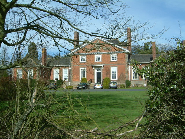
Wrottesley Hall

Wrottesley Hall is a 1923-built Grade II listed house in the civil parish of Perton, and historically part of Tettenhall in Staffordshire, England. The...

Wightwick

Wightwick ( WIT-ik) is a part of Tettenhall Wightwick ward in Wolverhampton, West Midlands, England. It is named after an ancient local family the "de...

Nearby Amenities

Located within 500m of 52.597123,-2.223356
Man Made: pipeline_marker
Source: visual survey;estimate
Substance: gas
Lat/Long: 52.5979873/-2.2235609
The data included in this document is from www.openstreetmap.org. The data is made available under ODbL.

Have you been to Perton?

Leave your review of Perton below (or comments, questions and feedback).