Pauntley

Civil Parish in Gloucestershire Forest of Dean

England

Pauntley

Bluebells and oaks Woodland edge by the lane to Ketford.
Bluebells and oaks Credit: Jonathan Billinger

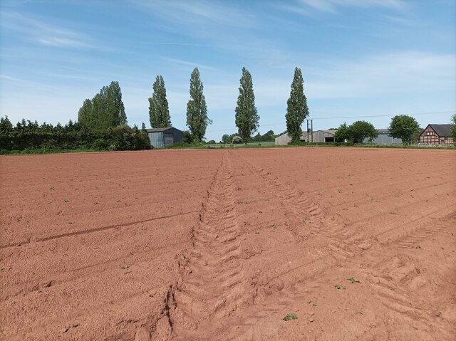
Pauntley is a small civil parish located in the county of Gloucestershire, England. It is situated in the Forest of Dean district, close to the border with Herefordshire. The parish covers an area of approximately 6 square miles and is home to a population of around 200 people.

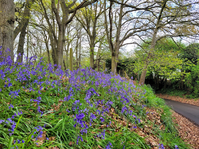
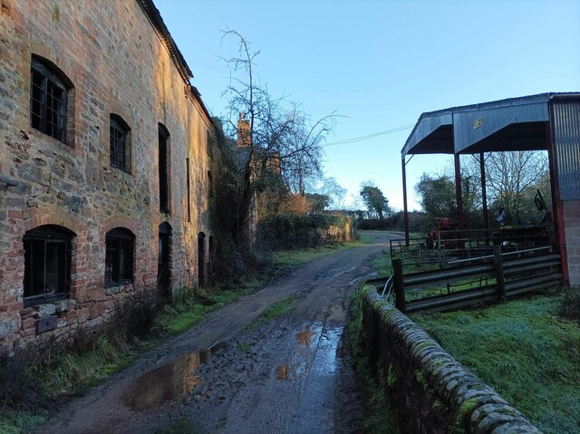
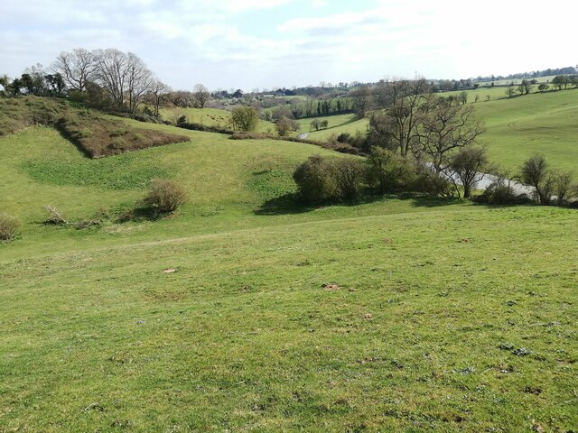
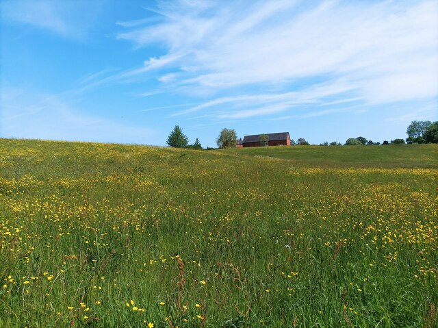
The village of Pauntley is set in a picturesque rural landscape, surrounded by rolling hills and lush green fields. It is known for its charming stone cottages and historic buildings, which give it a quaint and traditional feel. The centerpiece of the village is the 12th-century St. John the Evangelist Church, a Grade II listed building with a beautiful Norman tower.

Pauntley is also renowned for its natural beauty and is a popular destination for outdoor enthusiasts. The parish is crisscrossed by numerous footpaths and bridleways, providing excellent opportunities for walking, hiking, and horse riding. The nearby Malvern Hills and the Forest of Dean offer further opportunities for outdoor activities and exploration.

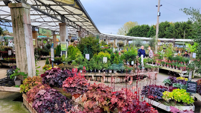
Despite its small size, Pauntley has a strong community spirit and a range of amenities for its residents. These include a village hall, a primary school, and a pub, providing a focal point for social gatherings and events.

Overall, Pauntley is a tranquil and idyllic village, offering a peaceful retreat for those seeking a slower pace of life and a connection with nature.

If you have any feedback on the listing, please let us know in the comments section below.

Pauntley Images

Images are sourced within 2km of 51.960116/-2.385636 or Grid Reference SO7329. Thanks to Geograph Open Source API. All images are credited.

Bluebells and oaks Woodland edge by the lane to Ketford.
Bluebells and oaks
Woodland edge by the lane to Ketford.
Covered area at the garden centre Three Shires Garden Centre in late January.
The bulk of the colour comes from primroses.
Covered area at the garden centre
Three Shires Garden Centre in late January. The bulk of the colour comes from primroses.
Plant area at Three Shires Garden Centre Some very colourful Heucheras in the foreground.
Plant area at Three Shires Garden Centre
Some very colourful Heucheras in the foreground.
Durbridge Mill buildings Buildings alongside the track through Durbridge Mill Farm.
Durbridge Mill buildings
Buildings alongside the track through Durbridge Mill Farm.
Fields near Welsh House Lane Grassy fields and rolling hills near Welsh House Lane.
Fields near Welsh House Lane
Grassy fields and rolling hills near Welsh House Lane.
Footpath towards vineyard A footpath through a muddy field leading towards Three Choirs Vineyard.
Footpath towards vineyard
A footpath through a muddy field leading towards Three Choirs Vineyard.
Field of buttercups A large field of buttercups and other wildflowers.
Field of buttercups
A large field of buttercups and other wildflowers.
Pond at Three Shires garden centre Carp are to be found here.
Pictured on a bright late-April morning.
Pond at Three Shires garden centre
Carp are to be found here. Pictured on a bright late-April morning.
Footbridge over the River Leadon There are a number of footpaths in the area, this footbridge enables walkers to cross the River Leadon near Durbridge Farm.
Footbridge over the River Leadon
There are a number of footpaths in the area, this footbridge enables walkers to cross the River Leadon near Durbridge Farm.
River Leadon near Durbridge Mill Trees reflected in the River Leadon which is flowing at a very low level after a prolong period of low rainfall. Note the exposed tree roots on the riverbank.
River Leadon near Durbridge Mill
Trees reflected in the River Leadon which is flowing at a very low level after a prolong period of low rainfall. Note the exposed tree roots on the riverbank.
Bridge reflected in the River Leadon Bridge reflected in the River Leadon near Durbridge Mill.
Bridge reflected in the River Leadon
Bridge reflected in the River Leadon near Durbridge Mill.
Building at Durbridge Mill The remains of a round building at Durbridge Mill near Poolhill, not sure what its original purpose was.
Building at Durbridge Mill
The remains of a round building at Durbridge Mill near Poolhill, not sure what its original purpose was.
Former mill buildings Former mill buildings at Durbridge Mill beside the River Leadon.
Former mill buildings
Former mill buildings at Durbridge Mill beside the River Leadon.
Old millwheel, Durbridge Mill
Traditional farm buildings, Durbridge Mill Traditional red-brick farm buildings at Durbridge Mill.
Traditional farm buildings, Durbridge Mill
Traditional red-brick farm buildings at Durbridge Mill.
Road to Durbridge Mill Road to Durbridge Mill which appears now to be a farm.
Road to Durbridge Mill
Road to Durbridge Mill which appears now to be a farm.
A Gloucestershire Vineyard The Three Choirs Vineyard with the Malvern hills in the distance.
A Gloucestershire Vineyard
The Three Choirs Vineyard with the Malvern hills in the distance.
Plant Area at Three Shires The purple plants in the foreground are Osteospermum.
Plant Area at Three Shires
The purple plants in the foreground are Osteospermum.
Show me another place!

Pauntley is located at Grid Ref: SO7329 (Lat: 51.960116, Lng: -2.385636)

Administrative County: Gloucestershire

District: Forest of Dean

Police Authority: Gloucestershire

What 3 Words

///tarnished.galloped.commit. Near Newent, Gloucestershire

Related Wikis

Brand Green

Brand Green is a village in Gloucestershire, England. == References == == External links == Media related to Brand Green at Wikimedia Commons

Collinpark Wood SSSI

Collinpark Wood (grid reference SO750278) is a 66.69-hectare (164.8-acre) biological Site of Special Scientific Interest in Gloucestershire, notified in...

Ketford Bank

Ketford Bank (grid reference SO723308) is a 0.69-hectare (1.7-acre) nature reserve in Gloucestershire.The site is owned and managed by the Gloucestershire...

Pauntley

Pauntley is a village and civil parish in the district of Forest of Dean, Gloucestershire, England. In 2019 it had a population of 304. == School == Pauntley...

Nearby Amenities

Located within 500m of 51.960116,-2.385636
Bus Stop
Compton Court
Naptan AtcoCode: 1600GL1431
Naptan Bearing: SW
Naptan CommonName: Compton Court
Naptan NaptanCode: gloapagj
Naptan Street: Pauntley Rd
Naptan Verified: no
Source: naptan_import
Lat/Long: 51.9563825/-2.3862351
Bus Stop
Compton Court
Naptan AtcoCode: 1600GL1432
Naptan Bearing: NE
Naptan CommonName: Compton Court
Naptan NaptanCode: gloapagm
Naptan Street: Pauntley Rd
Naptan Verified: no
Source: naptan_import
Lat/Long: 51.9564814/-2.386236
Bus Stop
Compton Green Nurseries
Naptan AtcoCode: 1600GLN081
Naptan Bearing: E
Naptan CommonName: Compton Green Nurseries
Naptan NaptanCode: gloapamw
Naptan Street: Pauntley Rd
Naptan Verified: no
Source: naptan_import
Lat/Long: 51.9565821/-2.3829189
Bus Stop
Compton Green Nurseries
Naptan AtcoCode: 1600GLN082
Naptan Bearing: W
Naptan CommonName: Compton Green Nurseries
Naptan NaptanCode: gloapapj
Naptan Street: Pauntley Rd
Naptan Verified: no
Source: naptan_import
Lat/Long: 51.956493/-2.3826853
Bus Stop
Compton Green Nurseries
Naptan AtcoCode: 1600GLN083
Naptan Bearing: NW
Naptan CommonName: Compton Green Nurseries
Naptan NaptanCode: gloapama
Naptan Street: Brand Green Lane
Naptan Verified: no
Source: naptan_import
Lat/Long: 51.9564015/-2.3831793
Bus Stop
Compton Green Nurseries
Naptan AtcoCode: 1600GLN084
Naptan Bearing: SE
Naptan CommonName: Compton Green Nurseries
Naptan NaptanCode: gloapamj
Naptan Street: Brand Green Lane
Naptan Verified: no
Source: naptan_import
Lat/Long: 51.956375/-2.3830335
Compton Green
Place: hamlet
Source: OS_OpenData_StreetView
Lat/Long: 51.9571604/-2.3839917
Power: pole
Lat/Long: 51.9607701/-2.3788619
Power: pole
Lat/Long: 51.9601148/-2.3812155
Power: pole
Lat/Long: 51.9605238/-2.3804136
Power: pole
Lat/Long: 51.959728/-2.381978
Power: pole
Lat/Long: 51.9593962/-2.3826284
Power: pole
Lat/Long: 51.9563908/-2.3817775
Compton Green
Power: pole
Transformer: distribution
Voltage Primary: 11000
Lat/Long: 51.9572066/-2.3825419
Power: pole
Lat/Long: 51.9574404/-2.3827645
Power: pole
Lat/Long: 51.9583661/-2.3833197
Power: pole
Lat/Long: 51.9591408/-2.3838126
Power: pole
Lat/Long: 51.9589256/-2.3847735
Power: pole
Lat/Long: 51.9584752/-2.3867342
Power: pole
Lat/Long: 51.9582818/-2.3875965
The Bull Patch
Power: pole
Transformer: distribution
Voltage Primary: 11000
Lat/Long: 51.9565871/-2.3881135
Elm Grove
Power: pole
Transformer: distribution
Voltage Primary: 11000
Lat/Long: 51.9572636/-2.3882644
Power: pole
Lat/Long: 51.9578173/-2.3884052
Power: pole
Lat/Long: 51.9583628/-2.3885474
Power: pole
Lat/Long: 51.958414/-2.3891442
Power: pole
Lat/Long: 51.9585636/-2.3908956
Power: pole
Lat/Long: 51.9575454/-2.3913476
Power: pole
Lat/Long: 51.9586024/-2.3913127
The data included in this document is from www.openstreetmap.org. The data is made available under ODbL.

Have you been to Pauntley?

Leave your review of Pauntley below (or comments, questions and feedback).