Oborne

Civil Parish in Dorset West Dorset

England

Oborne

Cattle grazing east of Sherborne
Cattle grazing east of Sherborne Credit: David Smith

Oborne is a civil parish located in the county of Dorset, England. It is situated approximately 2 miles north-east of the town of Sherborne and is part of the West Dorset district. The parish covers an area of approximately 6 square kilometers and has a population of around 200 residents.

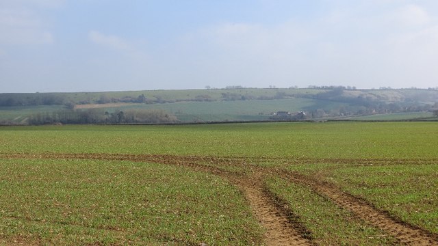
The village of Oborne is known for its picturesque countryside and charming rural setting. It is surrounded by rolling hills and farmland, providing a tranquil and idyllic atmosphere for its residents. The parish is predominantly residential, with a mix of traditional cottages and modern houses.

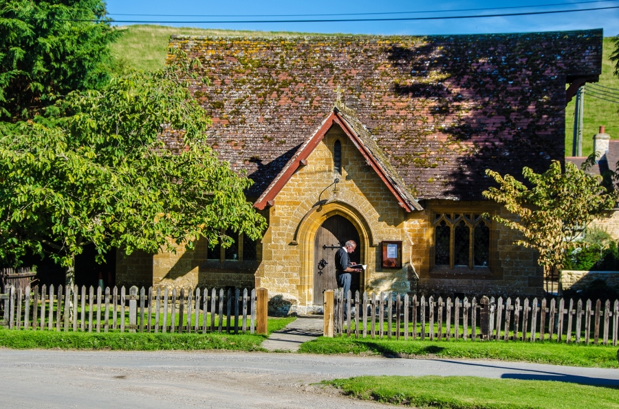
One of the notable landmarks in Oborne is the St. Cuthbert's Church, a Grade II listed building that dates back to the 15th century. The church serves as a place of worship for the local community and also attracts visitors interested in its historical and architectural significance.

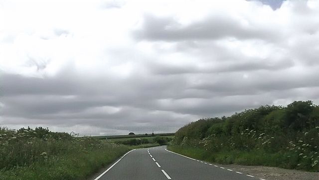
Oborne benefits from its proximity to Sherborne, which offers a wider range of amenities and services, including schools, shops, and healthcare facilities. The village is also well-connected by road, with the A303 and A30 providing easy access to other parts of Dorset and beyond.

Overall, Oborne is a charming and peaceful parish that appeals to those seeking a rural lifestyle while still having access to nearby amenities. Its beautiful surroundings and historic landmarks make it an attractive destination for both residents and visitors alike.

If you have any feedback on the listing, please let us know in the comments section below.
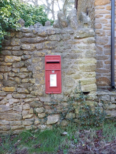
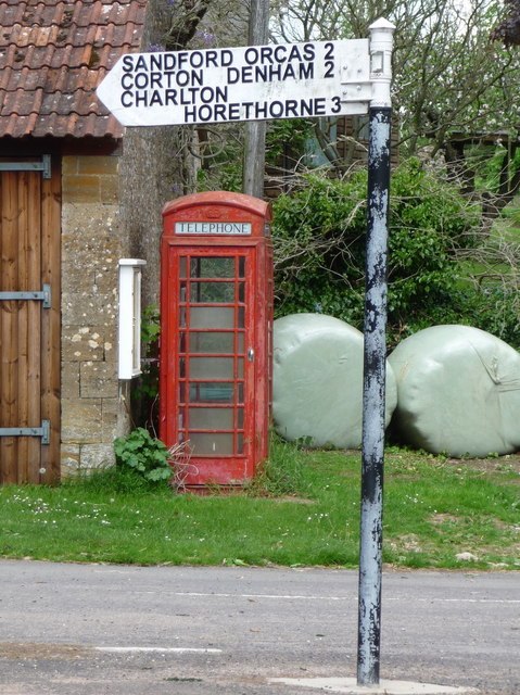
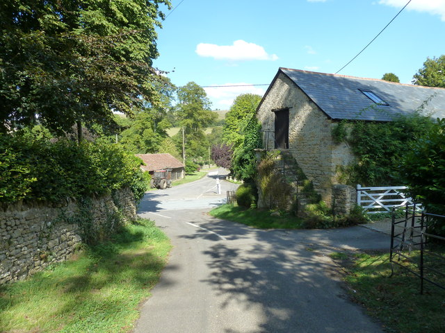
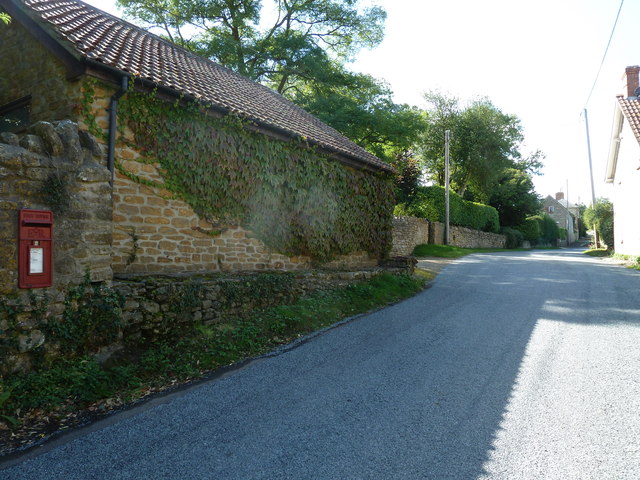
Oborne Images

Images are sourced within 2km of 50.969902/-2.498876 or Grid Reference ST6519. Thanks to Geograph Open Source API. All images are credited.

Cattle grazing east of Sherborne
Poyntington: postbox № DT9 12 A standard Elizabeth II-reign lamp box - designed to be and familiarly seen strapped to lampposts and telegraph poles, but in this instance set into a stone wall. It is emptied at 4:30pm on weekdays and at 7am on Saturdays.
Poyntington: postbox № DT9 12
A standard Elizabeth II-reign lamp box - designed to be and familiarly seen strapped to lampposts and telegraph poles, but in this instance set into a stone wall. It is emptied at 4:30pm on weekdays and at 7am on Saturdays.
Poyntington: phone box and finger-post A traditional red 'K6' telephone box stands alongside a barn at the junction in the centre of the village.
Poyntington: phone box and finger-post
A traditional red 'K6' telephone box stands alongside a barn at the junction in the centre of the village.
Rush hour in Poyntington
Traffic jam in Poyntington
B3145 approaching Poyntington
Crossroads near Poyntington
Fields near Milborne Wick The shadow of a pumping station can be seen on the left. Beside it and across the image runs the lane between Oborne and Milborne Wick.
Fields near Milborne Wick
The shadow of a pumping station can be seen on the left. Beside it and across the image runs the lane between Oborne and Milborne Wick.
Lime Tree Cottage, Poyntington There is an Ordnance Survey benchmark located on this cottage. For a full description, see <span class="nowrap"><a title="http://www.bench-marks.org.uk/bm64367" rel="nofollow ugc noopener" href="http://www.bench-marks.org.uk/bm64367">Link</a><img style="margin-left:2px;" alt="External link" title="External link - shift click to open in new window" src="https://s1.geograph.org.uk/img/external.png" width="10" height="10"/></span>. See also <a href="https://www.geograph.org.uk/photo/4355124">ST6520 : Benchmark, Lime Tree Cottage, Poyntington</a>.
Lime Tree Cottage, Poyntington
There is an Ordnance Survey benchmark located on this cottage. For a full description, see LinkExternal link. See also ST6520 : Benchmark, Lime Tree Cottage, Poyntington.
Benchmark, Lime Tree Cottage, Poyntington Ordnance Survey benchmark, described on database at <span class="nowrap"><a title="http://www.bench-marks.org.uk/bm64367" rel="nofollow ugc noopener" href="http://www.bench-marks.org.uk/bm64367">Link</a><img style="margin-left:2px;" alt="External link" title="External link - shift click to open in new window" src="https://s1.geograph.org.uk/img/external.png" width="10" height="10"/></span>. See also <a href="https://www.geograph.org.uk/photo/4355120">ST6520 : Lime Tree Cottage, Poyntington</a>.
Benchmark, Lime Tree Cottage, Poyntington
Ordnance Survey benchmark, described on database at LinkExternal link. See also ST6520 : Lime Tree Cottage, Poyntington.
Holway Hill Arable land on the dip slope above Poyntington.
Holway Hill
Arable land on the dip slope above Poyntington.
Holway Hill Big gates for big machinery.  Arable land on the limestone dip slope north of Sherborne.
Holway Hill
Big gates for big machinery. Arable land on the limestone dip slope north of Sherborne.
Signpost, Poyntington A wooden finger post on the B3145.
Signpost, Poyntington
A wooden finger post on the B3145.
Poyntington View from the road to the church of the crossroads at the centre of the village.
Poyntington
View from the road to the church of the crossroads at the centre of the village.
Poyntington Manor House Grade II* listed, the manor house dates from the late C15, refenestrated during the C16 and C17 (windows and doors etc.), and restored in the C19 and C20.
Poyntington Manor House
Grade II* listed, the manor house dates from the late C15, refenestrated during the C16 and C17 (windows and doors etc.), and restored in the C19 and C20.
Crossroads west of Poyntington Viewed from the B3145 Sherborne road, where the minor road from Sandford Orcas to Poyntington crosses left to right.
Crossroads west of Poyntington
Viewed from the B3145 Sherborne road, where the minor road from Sandford Orcas to Poyntington crosses left to right.
Root crops near Sandford Orcas Root crops of several varieties are widely grown as food for cattle and sheep.
Root crops near Sandford Orcas
Root crops of several varieties are widely grown as food for cattle and sheep.
Footpath near Sandford Orcas The footpath climbs steeply to run parallel with the road.
Footpath near Sandford Orcas
The footpath climbs steeply to run parallel with the road.
Show me another place!

Oborne is located at Grid Ref: ST6519 (Lat: 50.969902, Lng: -2.498876)

Administrative County: Dorset

District: West Dorset

Police Authority: Dorset

What 3 Words

///grazed.blurred.strutted. Near Milborne Port, Somerset

Related Wikis

Oborne

Oborne is a village and civil parish in north west Dorset, England, situated just north of the A30 road approximately 1 mile (1.6 km) northeast of Sherborne...

Frogden Quarry

Frogden Quarry (grid reference ST649183) is a 0.2 hectare geological Site of Special Scientific Interest in Dorset, England, notified in 1954, by geologist...

Poyntington

Poyntington is a village and civil parish in the county of Dorset in South West England. It lies on the edge of the Blackmore Vale about 2 miles (3.2 km...

Old St Cuthbert's Church, Oborne

The Old St Cuthbert's Church in Oborne, Dorset, England was built in 1533. It is recorded in the National Heritage List for England as a designated Grade...

The Gryphon School

The Gryphon School is a Church of England secondary school with academy status for 11 to 18-year-olds in Sherborne, Dorset, England. The school has been...

Miller's Hill, Milborne Wick

Miller's Hill, Milborne Wick (grid reference ST66312057) is a 0.6-hectare (1.5-acre) geological Site of Special Scientific Interest at Milborne Wick in...

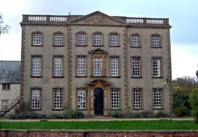
Sherborne House, Dorset

Sherborne House is a Grade I listed building. in Newland, Sherborne, Dorset, England. == History == Sherborne House was built c.1720 for Henry Seymour...

Milborne Wick Mission Church

Milborne Wick Mission Church is a Church of England church in Milborne Wick, Somerset, England. The church was built in 1891 and is a Grade II listed building...

Nearby Amenities

Located within 500m of 50.969902,-2.498876
Power: pole
Lat/Long: 50.9657543/-2.4968408
Power: pole
Lat/Long: 50.9661411/-2.4954606
The data included in this document is from www.openstreetmap.org. The data is made available under ODbL.

Have you been to Oborne?

Leave your review of Oborne below (or comments, questions and feedback).