Newport

Civil Parish in Essex Uttlesford

England

Newport

Chapel of St. Helen, Bonhunt Farm, Essex Standing in the grounds of Bonhunt farm, near Newport, is the small Chapel of St. Helen. It's a complete Norman structure with a thatched roof.
Chapel of St. Helen, Bonhunt Farm, Essex Credit: Robert Edwards

Newport is a civil parish located in the county of Essex, England. Situated in the Uttlesford district, it covers an area of approximately 11.8 square kilometers. The parish is predominantly rural, with a population of around 2,500 residents.

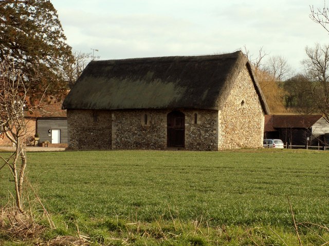
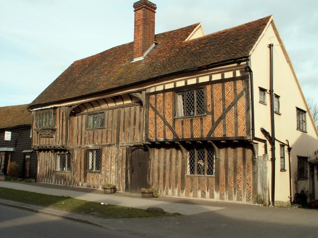
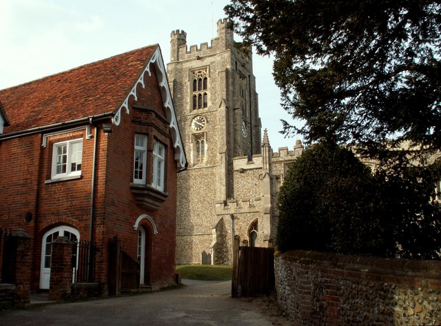
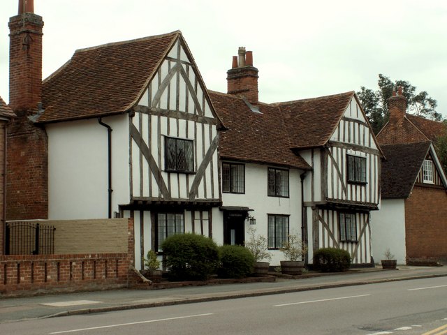
The village of Newport itself is the main settlement within the civil parish. It has a charming and picturesque character, with a mix of historic and modern buildings. The village is home to a range of amenities and services, including a post office, several shops, pubs, and a primary school.

Surrounded by beautiful countryside, Newport offers residents and visitors ample opportunities for outdoor activities. The village is located near the Flitch Way, a former railway line converted into a walking and cycling path, providing access to the surrounding countryside. The area is also dotted with numerous footpaths and bridleways, ideal for exploring the rural landscapes.

Newport has a strong community spirit, with various local events and activities taking place throughout the year. These include the Newport Carnival, which showcases the village's vibrant culture, and the Newport Show, an annual agricultural event that attracts visitors from far and wide.

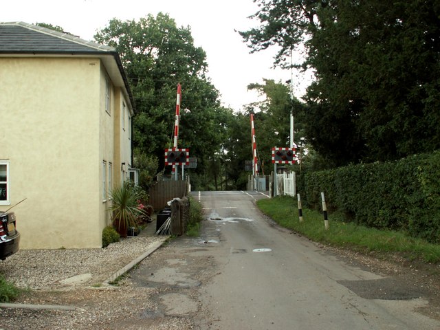
The parish is well-connected, with good transport links to nearby towns and cities. The M11 motorway is easily accessible, providing convenient access to London and Cambridge. The nearby railway station of Audley End offers regular services to London Liverpool Street and Cambridge.

Overall, Newport, Essex is a delightful civil parish that combines the tranquility of rural living with easy access to urban amenities and transport connections.

If you have any feedback on the listing, please let us know in the comments section below.

Newport Images

Images are sourced within 2km of 51.987041/0.212001 or Grid Reference TL5134. Thanks to Geograph Open Source API. All images are credited.

Chapel of St. Helen, Bonhunt Farm, Essex Standing in the grounds of Bonhunt farm, near Newport, is the small Chapel of St. Helen. It's a complete Norman structure with a thatched roof.
Chapel of St. Helen, Bonhunt Farm, Essex
Standing in the grounds of Bonhunt farm, near Newport, is the small Chapel of St. Helen. It's a complete Norman structure with a thatched roof.
Monk's Barn, Newport, Essex This wonderful 15th century house stands on the high street of Newport. It has fine exposed timbers and brick-nogging. Below the oriel window, on the left, is a fine carving of the crowned Madonna rising from the clouds.
Monk's Barn, Newport, Essex
This wonderful 15th century house stands on the high street of Newport. It has fine exposed timbers and brick-nogging. Below the oriel window, on the left, is a fine carving of the crowned Madonna rising from the clouds.
Church approach, Newport, Essex St. Mary the Virgin church at Newport, was once a collegiate church which explains its size. It is mostly 13th century but the tower was only built in 1858 by G. E. Pritchett.
Church approach, Newport, Essex
St. Mary the Virgin church at Newport, was once a collegiate church which explains its size. It is mostly 13th century but the tower was only built in 1858 by G. E. Pritchett.
Old Houses, Newport, Essex In an area of Newport known as the Green, stands a long row of fine houses. Some of them are good examples of timber-framed buildings.
Old Houses, Newport, Essex
In an area of Newport known as the Green, stands a long row of fine houses. Some of them are good examples of timber-framed buildings.
Railway crossing at Wendens Ambo, Essex The road in the photo is Rookery Lane.
Railway crossing at Wendens Ambo, Essex
The road in the photo is Rookery Lane.
Old cottages at Newport, Essex The road in the photo is Bury Water Lane.
Old cottages at Newport, Essex
The road in the photo is Bury Water Lane.
The Railway Station at Newport, Essex
Ringers Barn, on Debden Road
Tree plantation Forestry Commission tree plantation beside the M11 motorway at Norton End, Wendens Ambo.
Tree plantation
Forestry Commission tree plantation beside the M11 motorway at Norton End, Wendens Ambo.
Triangulation pillar at TL 501 348
Traffic on M11 near Newport
River Cam at Shortgrove Bridge The river Cam (or Granta) winding through the trees at Shortgrove Bridge, between Wendens Ambo and Saffron Walden
River Cam at Shortgrove Bridge
The river Cam (or Granta) winding through the trees at Shortgrove Bridge, between Wendens Ambo and Saffron Walden
The 'White Horse' inn on the B.1383 in Newport
The Old Vicarage, High Street, Newport Dating back to the 14th century, this was originally a hall house.
The Old Vicarage, High Street, Newport
Dating back to the 14th century, this was originally a hall house.
Lone tree with distant radar The Debden Radar in the background, which serves Stansted Airport, can be seen more closely in <a href="https://www.geograph.org.uk/photo/280029">TL5534 : Debden Radar</a>. The tree is near the Harcamlow Way.
Lone tree with distant radar
The Debden Radar in the background, which serves Stansted Airport, can be seen more closely in TL5534 : Debden Radar. The tree is near the Harcamlow Way.
Edge of Forty Acre Wood Part of the plantations surrounding Shortgrove Park, seen from the Harcamlow Way.
Edge of Forty Acre Wood
Part of the plantations surrounding Shortgrove Park, seen from the Harcamlow Way.
Newport fire station Newport fire station, Debden Road, Newport, Eseex
Newport fire station
Newport fire station, Debden Road, Newport, Eseex
Audley End station building A facade which is worthy of the stately home the station is named after, somewhat spoilt by the portacabin on the left which sells newspapers and confectionery (and the To Let sign for that matter).
Audley End station building
A facade which is worthy of the stately home the station is named after, somewhat spoilt by the portacabin on the left which sells newspapers and confectionery (and the To Let sign for that matter).
Show me another place!

Newport is located at Grid Ref: TL5134 (Lat: 51.987041, Lng: 0.212001)

Administrative County: Essex

District: Uttlesford

Police Authority: Essex

What 3 Words

///swimmer.musical.geek. Near Saffron Walden, Essex

Nearby Locations

Newport

Related Wikis

Joyce Frankland Academy

Joyce Frankland Academy, Newport, formerly Newport Free Grammar School, is a school in Newport, Essex, England. It was founded in 1588. The school is a...

Newport, Essex

Newport is a large village and civil parish in the Uttlesford district in Essex, near Saffron Walden. The village has a population of over 2,000, measured...

Leper Stone

The Leper Stone or Newport Stone (grid reference TL520349) is a large sarsen stone near the village of Newport, Essex, England. The name Leper Stone probably...

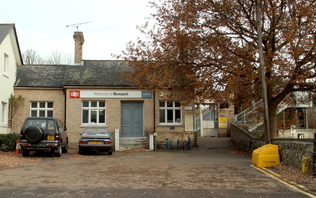
Newport railway station (Essex)

Newport railway station is on the West Anglia Main Line serving the village of Newport in Essex, England. It is 39 miles 72 chains (64.2 km) down the line...

Saffron Walden Rural District

Saffron Walden Rural District was a rural district in the county of Essex, England. It was created in 1894 and later enlarged by the addition of the parishes...

Chapel of St Helen

Chapel of St Helen (also St Helen's Chapel) is an ancient religious building in Wicken Bonhunt, north-west Essex. It dates from around the 11th century...

Debden Water SSSI

Debden Water SSSI is a 20.9-hectare (52-acre) biological Site of Special Scientific Interest which comprises two stretches of Debden Water, a small tributary...

Audley End railway station

Audley End railway station is on the West Anglia Main Line serving the village of Wendens Ambo and the town of Saffron Walden in Essex, England. It is...

Related Videos

How to Make a Travel Picnic — The Victorian Way

Buy your copy of our 'Victorian Way' cookery book: http://bit.ly/2RPyrvQ Visit Audley End House and Gardens for yourself: ...

Walking in The Rain in the Beautiful House and Gardens of Audley End svetlanakellett 2020

Walking in The Rain in the Beautiful House and Gardens of Audley End, UK Gentle Rain The Rain is just visible. Light Rain works ...

Audley End Autumn 2023 ( Saffron Walden, Essex, English Heritage )

Video shows our visit to Audley End a a 17th Century Jacobean Country House. Built on the site of Waldron monastery ...

Nearby Amenities

Located within 500m of 51.987041,0.212001
Crossing
Crossing: unmarked
Crossing Island: yes
Tactile Paving: yes
Lat/Long: 51.9901675/0.2138458
Bench
Lat/Long: 51.9895447/0.2141658
Post Box
Brand: Royal Mail
Brand Wikidata: Q638098
Brand Wikipedia: en:Royal Mail
Collection Times: Mo-Fr 09:00; Sa 07:00
Operator: Royal Mail
Operator Wikidata: Q638098
Post Box Type: lamp
Ref: CB11 98
Royal Cypher: EIIR
Royal Cypher Wikidata: Q33102113
Source: survey
Lat/Long: 51.9893787/0.2140421
Passing Place
Lat/Long: 51.9875517/0.2085996
Bus Stop
The Coach & Horses
Bus: yes
Naptan AtcoCode: 150018008007
Naptan Bearing: NW
Naptan CommonName: The Coach & Horses
Naptan Indicator: o/s
Naptan Landmark: The Coach & Horses
Naptan NaptanCode: esxdawpd
Naptan Street: Cambridge Road
Naptan Verified: no
Public Transport: platform
Source: naptan_import
Lat/Long: 51.9909861/0.2130982
Bus Stop
The Coach & Horses
Bus: yes
Naptan AtcoCode: 150018008008
Naptan Bearing: SE
Naptan CommonName: The Coach & Horses
Naptan Indicator: Opp
Naptan Landmark: The Coach & Horses
Naptan NaptanCode: esxdawpg
Naptan Street: Cambridge Road
Naptan Verified: no
Public Transport: platform
Source: naptan_import
Lat/Long: 51.9907915/0.2134687
Bus Stop
Gaces Acre
Bus: yes
Naptan AtcoCode: 150018008009
Naptan Bearing: N
Naptan CommonName: Gaces Acre
Naptan Indicator: Adj
Naptan Landmark: Gaces Acre
Naptan NaptanCode: esxdawpj
Naptan Street: Belmont Hill
Naptan Verified: no
Public Transport: platform
Source: naptan_import
Lat/Long: 51.9869802/0.2138036
Bus Stop
School Lane
Bus: yes
Naptan AtcoCode: 150018009004
Naptan Bearing: N
Naptan BusStopType: CUS
Naptan CommonName: School Lane
Naptan Crossing: Tenterfields
Naptan Indicator: N-bound
Naptan Landmark: School Lane
Naptan NaptanCode: esxdatpa
Naptan Street: School Lane
Naptan Verified: no
Public Transport: platform
Source: naptan_import
Lat/Long: 51.9862484/0.2091942
Bus Stop
The Old Forge
Bus: yes
Naptan AtcoCode: 150018009009
Naptan Bearing: N
Naptan CommonName: The Old Forge
Naptan Indicator: o/s
Naptan Landmark: The Old Forge
Naptan NaptanCode: esxdawpw
Naptan Street: High Street
Naptan Verified: no
Public Transport: platform
Source: naptan_import
Lat/Long: 51.9835822/0.2142186
Bus Stop
The Old Forge
Bus: yes
Naptan AtcoCode: 1500IM1064
Naptan Bearing: S
Naptan CommonName: The Old Forge
Naptan Indicator: Opp
Naptan Landmark: The Old Forge
Naptan NaptanCode: esxdawta
Naptan Street: High Street
Naptan Verified: no
Public Transport: platform
Source: naptan_import
Lat/Long: 51.983491/0.2142869
Bus Stop
Frambury Lane
Bus: yes
Naptan AtcoCode: 1500IM2745
Naptan Bearing: W
Naptan BusStopType: CUS
Naptan CommonName: Frambury Lane
Naptan Crossing: Frambury Lane
Naptan Indicator: Adj
Naptan Landmark: Frambury Lane
Naptan NaptanCode: esxdawdp
Naptan Street: Wicken Road
Naptan Verified: no
Public Transport: platform
Source: naptan_import
Lat/Long: 51.9834291/0.2080069
Bus Stop
Frambury Lane
Bus: yes
Naptan AtcoCode: 1500IM2745Y
Naptan Bearing: E
Naptan BusStopType: CUS
Naptan CommonName: Frambury Lane
Naptan Crossing: Frambury Lane
Naptan Indicator: Opp
Naptan Landmark: Frambury Lane
Naptan NaptanCode: esxjdgjp
Naptan Street: Wicken Road
Naptan Verified: no
Public Transport: platform
Source: naptan_import
Lat/Long: 51.9834832/0.207995
Bus Stop
JF Academy
Bus: yes
Naptan AtcoCode: 1500IM999
Naptan Bearing: NE
Naptan BusStopType: CUS
Naptan CommonName: Grammar School
Naptan Indicator: o/s
Naptan Landmark: Grammar School
Naptan NaptanCode: esxdatpd
Naptan Street: Bury Water Lane
Naptan Verified: no
Public Transport: platform
Source: naptan_import
Lat/Long: 51.9871808/0.2112647
Bus Stop
Gaces Acre
Bus: yes
Local Ref: 2
Naptan AtcoCode: 1500NEWPTGS1
Naptan Bearing: S
Naptan CommonName: Gaces Acre
Naptan Indicator: Stop 2
Naptan Landmark: Gaces Acre
Naptan NaptanCode: esxdawpm
Naptan Street: Belmont Hill
Naptan Verified: no
Public Transport: platform
Source: naptan_import
Lat/Long: 51.9867357/0.2139863
Bench
Lat/Long: 51.9868033/0.2138485
Nisa
Addr City: Saffron Walden
Addr Country: GB
Addr Postcode: CB11 3QY
Addr Street: High Street
Shop: convenience
Lat/Long: 51.9841699/0.2146629
Crossing
Crossing: marked
Crossing Ref: zebra
Lat/Long: 51.9839735/0.2144497
Railway: level_crossing
Lat/Long: 51.991459/0.2114055
Railway: level_crossing
Lat/Long: 51.9914462/0.2113588
Crossing
Crossing: marked
Crossing Ref: pelican
Source: survey
Lat/Long: 51.9868777/0.2138812
The Dell
Place: locality
Lat/Long: 51.986962/0.2127602
Atm
Lat/Long: 51.9841661/0.2146088
Post Box
Brand: Royal Mail
Brand Wikidata: Q638098
Brand Wikipedia: en:Royal Mail
Collection Times: Mo-Fr 17:00; Sa 11:30
Operator: Royal Mail
Operator Wikidata: Q638098
Post Box Design: type_a
Post Box Type: pillar
Ref: CB11 97
Royal Cypher: EIIR
Royal Cypher Wikidata: Q33102113
Source: survey
Lat/Long: 51.9840139/0.2143821
Post Box
Brand: Royal Mail
Brand Wikidata: Q638098
Brand Wikipedia: en:Royal Mail
Collection Times: Mo-Fr 09:00; Sa 07:00
Operator: Royal Mail
Operator Wikidata: Q638098
Post Box Type: lamp
Ref: CB11 99
Royal Cypher: EIIR
Royal Cypher Wikidata: Q33102113
Source: survey
Lat/Long: 51.9834192/0.2081998
Post Office
Newport Post Office
Addr City: Saffron Walden
Addr Country: GB
Addr Postcode: CB11 3QY
Addr Street: High Street
Opening Hours: We 11:00-15:00; Th 10:00-14:00
Ref Pol Id: 150622
Lat/Long: 51.9841509/0.2147836
Railway: crossing
Lat/Long: 51.9836325/0.2157691
Railway: crossing
Lat/Long: 51.9836341/0.2158209
Barrier: bollard
Lat/Long: 51.9828548/0.2138209
Barrier: bollard
Lat/Long: 51.9827775/0.2120409
Fixme: Needs survey.
Lat/Long: 51.988162/0.2076525
Crossing
Crossing: unmarked
Crossing Island: yes
Tactile Paving: yes
Lat/Long: 51.991412/0.2127914
Passing Place
Lat/Long: 51.9879618/0.2084879
Passing Place
Lat/Long: 51.9883579/0.2083616
Passing Place
Lat/Long: 51.989237/0.2080422
Pub
The Coach & Horses
Lat/Long: 51.9905664/0.2138109
Defibrillator
Defibrillator Location: On exterior wall of Newport Pharmacy, facing the High Street.
Emergency: defibrillator
Lat/Long: 51.9843865/0.2147484
Crossing
Crossing: unmarked
Crossing Island: yes
Tactile Paving: no
Lat/Long: 51.9879612/0.2136119
Traffic Mirror
Direction: 305
Lat/Long: 51.9868969/0.2087964
Traffic Mirror
Direction: 125
Lat/Long: 51.9867962/0.2082144
The data included in this document is from www.openstreetmap.org. The data is made available under ODbL.

Have you been to Newport?

Leave your review of Newport below (or comments, questions and feedback).