Broom's Barn

Settlement in Suffolk West Suffolk

England

Broom's Barn

Stubble field near A14
Stubble field near A14 Credit: Hugh Venables

Broom's Barn is a research facility located in the county of Suffolk, England. Situated near the village of Bacton, it is known for its contributions to agricultural and environmental research. The facility is operated by the Agricultural and Horticultural Development Board (AHDB) and is part of their Research and Development Division.

Covering an area of approximately 140 hectares, Broom's Barn is primarily focused on crop research and development. The facility conducts experiments and trials to enhance crop productivity, improve sustainability, and develop innovative farming techniques. Researchers at Broom's Barn explore a wide range of topics, including crop genetics, plant pathology, soil science, and pest management.

Equipped with state-of-the-art laboratories and field research facilities, Broom's Barn provides a conducive environment for scientists, agronomists, and farmers to collaborate and develop practical solutions for the agricultural sector. The facility also hosts various training programs and workshops to disseminate research findings and engage with the farming community.

The research conducted at Broom's Barn has a direct impact on the agricultural industry, not only in Suffolk but also across the United Kingdom. The findings and recommendations generated by the facility help farmers make informed decisions, adopt sustainable practices, and improve their crop yields.

Broom's Barn's long-standing reputation as a leading agricultural research institution has attracted partnerships with universities, government agencies, and international organizations. This collaboration further strengthens the facility's capabilities and ensures it remains at the forefront of agricultural innovation.

If you have any feedback on the listing, please let us know in the comments section below.

Broom's Barn Images

Images are sourced within 2km of 52.255335/0.56247195 or Grid Reference TL7565. Thanks to Geograph Open Source API. All images are credited.

Stubble field near A14
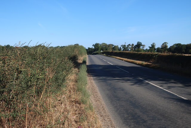
Minor road away from A14
Footpath to Robin's Hall
Footpath to Heath Farm
Sugar beet field near A14
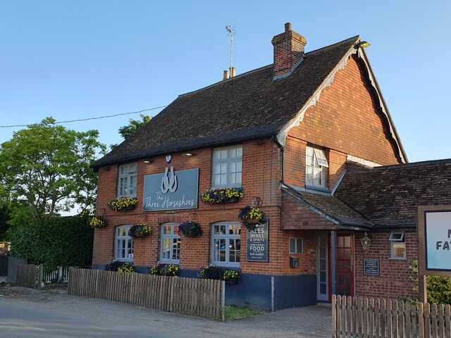
The Three Horseshoes, Barrow
Higham village sign Suffolk has 400 villages and towns with village or town signs, give or take one or two. 
The tradition of village signs is believed to have started in Norfolk early in the 20th century when Edward VII suggested that village signs would aid motorists and give a feature of interest on the Sandringham Estate.
Many of the signs  were made by Harry Carter, an art and woodwork master at Hamond’s Grammar School, in Swaffham.
Many have now been replaced with fibreglass or modern plastics. The story behind the sign is given as accurately as possible.
Higham village sign
Suffolk has 400 villages and towns with village or town signs, give or take one or two. The tradition of village signs is believed to have started in Norfolk early in the 20th century when Edward VII suggested that village signs would aid motorists and give a feature of interest on the Sandringham Estate. Many of the signs were made by Harry Carter, an art and woodwork master at Hamond’s Grammar School, in Swaffham. Many have now been replaced with fibreglass or modern plastics. The story behind the sign is given as accurately as possible.
Path to South Farm
Path to South Farm
Minor Road between Higham and Barrow
Minor Road near Denham End
The entrance to Church Farm It no longer appears to be a farm.
The entrance to Church Farm
It no longer appears to be a farm.
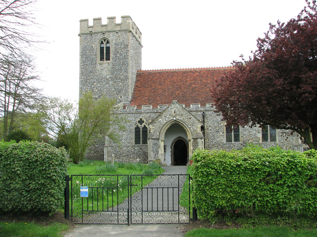
The church of All Saints in Barrow For more information go to: <a title="https://www.geograph.org.uk/photo/1916055" href="https://www.geograph.org.uk/photo/1916055">Link</a>.
The church of All Saints in Barrow
For more information go to: Link.
St Stephen's church in Higham For more information go to: <a title="https://www.geograph.org.uk/photo/1958761" href="https://www.geograph.org.uk/photo/1958761">Link</a>.
St Stephen's church in Higham
For more information go to: Link.
Houses north of Higham
Former goods shed at Higham railway station (closed)
Former goods shed at Higham railway station (closed) The building now houses a shop selling lamps and lighting.
Former goods shed at Higham railway station (closed)
The building now houses a shop selling lamps and lighting.
Railway buildings at Higham station (closed)
Victorian postbox at Higham railway station For a wider view of this location see > <a title="https://www.geograph.org.uk/photo/2930679" href="https://www.geograph.org.uk/photo/2930679">Link</a>.
Victorian postbox at Higham railway station
For a wider view of this location see > Link.
Show me another place!

Broom's Barn is located at Grid Ref: TL7565 (Lat: 52.255335, Lng: 0.56247195)

Administrative County: Suffolk

District: West Suffolk

Police Authority: Suffolk

What 3 Words

///ships.ratty.soggy. Near Bury St Edmunds, Suffolk

Nearby Locations

Broom's Barn

Related Wikis

Higham, West Suffolk

Higham is a village and civil parish in the West Suffolk district of Suffolk in the east of England. Located midway between Bury St Edmunds and Newmarket...

Higham railway station (Suffolk)

Higham railway station was a station serving Higham in the English county of Suffolk. It was opened by the Great Eastern Railway in 1854 when the railway...

A14 road (England)

The A14 is a major trunk road in England, running 127 miles (204 km) from Catthorpe Interchange, a major intersection at the southern end of the M6 and...

Denham Castle

Denham Castle, also known as Castle Holes, is a medieval motte and bailey castle near the village of Gazeley, Suffolk, England. The castle was also known...

Nearby Amenities

Located within 500m of 52.255335,0.56247195
Middle Green
Place: hamlet
Lat/Long: 52.2565694/0.5572124
Addr Housenumber: 78
Addr Street: Coalpit Lane
Lat/Long: 52.2524362/0.5659303
Defibrillator
Booth: K6
Covered: booth
Defibrillator Location: inside old red phone box in Higham, Middle Green
Disused Amenity: telephone
Emergency: defibrillator
Man Made: telephone_box
Ref GB The Circuit: 8E4A63C7-E2E9-4619-8DC0-AD7F0132587B
Lat/Long: 52.2573989/0.5576526
The data included in this document is from www.openstreetmap.org. The data is made available under ODbL.

Have you been to Broom's Barn?

Leave your review of Broom's Barn below (or comments, questions and feedback).