Little Paxton
Civil Parish in Huntingdonshire Huntingdonshire
England
Little Paxton

Little Paxton is a civil parish located in the district of Huntingdonshire, Cambridgeshire, England. It is situated approximately 2 miles south of St. Neots and covers an area of about 6 square miles. The parish is bordered by the River Great Ouse to the west and the A1 road to the east.
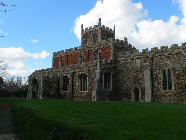
The village of Little Paxton has a population of around 3,000 residents, according to the latest census data. It is known for its picturesque surroundings, with the River Great Ouse providing a scenic backdrop. The village features a mix of historic buildings, including St. James' Church, which dates back to the 13th century.
Little Paxton offers a range of amenities and services to its residents. These include a primary school, a post office, a village hall, and a selection of local shops and businesses. The village also has several recreational facilities, such as a sports field, a playground, and a cricket club. The nearby Paxton Pits Nature Reserve provides opportunities for nature enthusiasts to explore and enjoy the local wildlife.
Transport links in Little Paxton are well-developed, with the A1 road providing easy access to nearby towns and cities. The village is also served by regular bus services, connecting it to St. Neots and other surrounding areas.
Overall, Little Paxton offers a peaceful and charming place to live, with its beautiful natural surroundings and range of amenities making it an attractive location for residents and visitors alike.
If you have any feedback on the listing, please let us know in the comments section below.
Little Paxton Images
Images are sourced within 2km of 52.25094/-0.265027 or Grid Reference TL1862. Thanks to Geograph Open Source API. All images are credited.


Little Paxton is located at Grid Ref: TL1862 (Lat: 52.25094, Lng: -0.265027)
Administrative County: Cambridgeshire
District: Huntingdonshire
Police Authority: Cambridgeshire
What 3 Words
///brownish.bibs.stroke. Near Little Paxton, Cambridgeshire
Nearby Locations
Related Wikis

Little Paxton
Little Paxton in Cambridgeshire, England is a village and civil parish that lies 5 miles (8.0 km) south of Huntingdon and 1.7 miles (2.7 km) north of St...
Southoe
Southoe is a small village and former civil parish, now in the parish of Southoe and Midloe, in Cambridgeshire, England. Southoe lies approximately 6 miles...
St Neots Rural District
St Neots was a rural district in Huntingdonshire, England from 1894 to 1974, around the northern and eastern sides of the urban area of St Neots. The district...
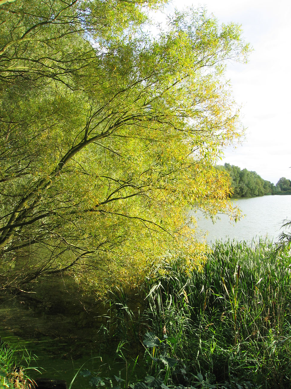
Paxton Pits Nature Reserve
Paxton Pits is an area of active and disused gravel pits at Little Paxton near St Neots in Cambridgeshire, England. The disused pits have been turned into...
Nearby Amenities
Located within 500m of 52.25094,-0.265027Have you been to Little Paxton?
Leave your review of Little Paxton below (or comments, questions and feedback).