Little Paxton

Settlement in Huntingdonshire Huntingdonshire

England

Little Paxton

Paxton Road, Great Paxton At the end of the road to Toseland.
Paxton Road, Great Paxton Credit: David Howard

Little Paxton is a charming village located in the district of Huntingdonshire, in the county of Cambridgeshire, England. Situated approximately 4 miles to the south of the market town of St. Neots, it is surrounded by picturesque countryside and offers a tranquil setting for its residents and visitors.

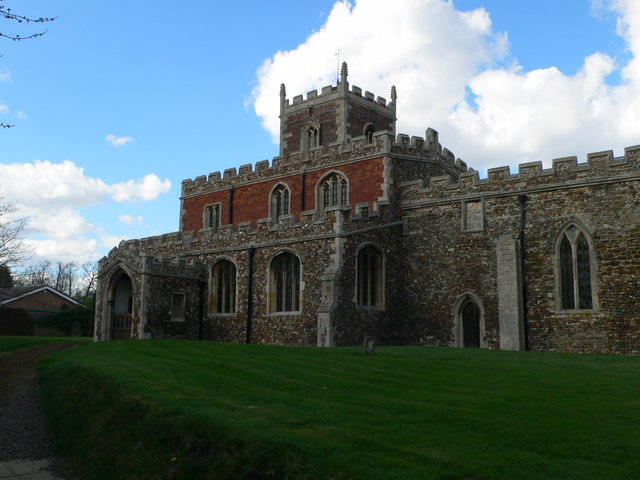
The village is known for its rich history, with evidence of human settlement dating back to the Roman times. Today, it retains its traditional character with a variety of historic buildings, including the 12th-century St. James' Church and the Grade II* listed Little Paxton Hall.

Despite its small size, Little Paxton provides a range of amenities to its residents. It is home to a primary school, a community center, and a local pub, The Anchor. The village also benefits from excellent transport links, with the A1 motorway passing nearby, connecting it to larger towns and cities in the region.

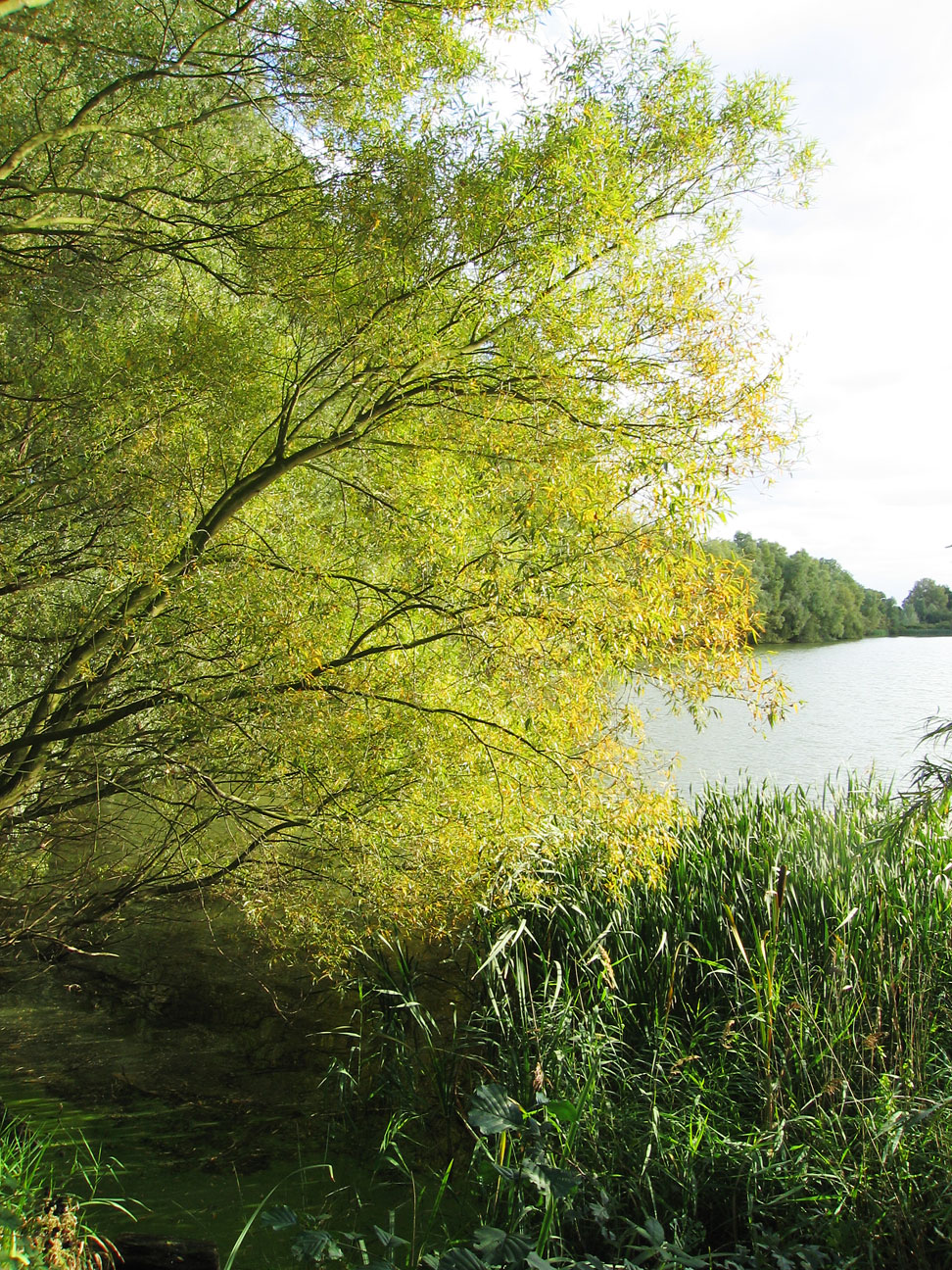
Nature enthusiasts will appreciate the village's proximity to Paxton Pits Nature Reserve, a popular local attraction. This 78-hectare site offers a diverse range of habitats, including lakes, meadows, and woodlands, providing opportunities for birdwatching, walking, and enjoying the outdoors.

Overall, Little Paxton is a close-knit community with a strong sense of pride in its history and natural surroundings. Its peaceful atmosphere, combined with its convenient location and amenities, make it an attractive place to live or visit for those seeking a tranquil village experience.

If you have any feedback on the listing, please let us know in the comments section below.

Little Paxton Images

Images are sourced within 2km of 52.250122/-0.260782 or Grid Reference TL1862. Thanks to Geograph Open Source API. All images are credited.

Paxton Road, Great Paxton At the end of the road to Toseland.
Paxton Road, Great Paxton
At the end of the road to Toseland.
Ibbetts in Great Paxton They sell agricultural machinery.
Ibbetts in Great Paxton
They sell agricultural machinery.
Little Paxton : River Kym ford
Southoe : Church of St Leonard Grade I listed - <span class="nowrap"><a title="https://historicengland.org.uk/listing/the-list/list-entry/1130254?section=official-list-entry" rel="nofollow ugc noopener" href="https://historicengland.org.uk/listing/the-list/list-entry/1130254?section=official-list-entry">Link</a><img style="margin-left:2px;" alt="External link" title="External link - shift click to open in new window" src="https://s1.geograph.org.uk/img/external.png" width="10" height="10"/></span>.
Southoe : Church of St Leonard
Grade I listed - LinkExternal link.
Longsands Road, St Neots Off Hawkesden Road.
Longsands Road, St Neots
Off Hawkesden Road.
Hawkesden Road, St Neots At its junction with Longsands Road.
Hawkesden Road, St Neots
At its junction with Longsands Road.
St Leonard's Church, Southoe
Corner House. Southoe
The end of High Street, Southoe This is as far as it goes.
The end of High Street, Southoe
This is as far as it goes.
Narrow path off High Street, Southoe
St Leonard's Church, Southoe
Thatched cottage on Bell Lane, Southoe
Town Orchard, Southoe
High Street, Southoe
Field by Bell Lane, Southoe
Car  park  and  playing  field  on  Island  Common
Car park and playing field on Island Common
Traffic  lights  at  northern  end  of  islands  common New Street joins Mill Lane. Going from St Neots to the A1
Traffic lights at northern end of islands common
New Street joins Mill Lane. Going from St Neots to the A1
Mill  Lane  entering  Little  Paxton  over  River  Great  Ouse As the river is split  around an island the raised footbridge is a very long one. Village name sign far right, obscured by leaves.
Mill Lane entering Little Paxton over River Great Ouse
As the river is split around an island the raised footbridge is a very long one. Village name sign far right, obscured by leaves.
Show me another place!

Little Paxton is located at Grid Ref: TL1862 (Lat: 52.250122, Lng: -0.260782)

Administrative County: Cambridgeshire

District: Huntingdonshire

Police Authority: Cambridgeshire

What 3 Words

///owned.grapes.greyhound. Near Little Paxton, Cambridgeshire

Related Wikis

Little Paxton

Little Paxton in Cambridgeshire, England is a village and civil parish that lies 5 miles (8.0 km) south of Huntingdon and 1.7 miles (2.7 km) north of St...

Southoe

Southoe is a small village and former civil parish, now in the parish of Southoe and Midloe, in Cambridgeshire, England. Southoe lies approximately 6 miles...

Paxton Pits Nature Reserve

Paxton Pits is an area of active and disused gravel pits at Little Paxton near St Neots in Cambridgeshire, England. The disused pits have been turned into...

St Neots Rural District

St Neots was a rural district in Huntingdonshire, England from 1894 to 1974, around the northern and eastern sides of the urban area of St Neots. The district...

Nearby Amenities

Located within 500m of 52.250122,-0.260782
Little Paxton
Created By: Potlatch 0.10c
Is In: Cambridgeshire
Place: village
Lat/Long: 52.2472939/-0.2614199
Created By: Merkaartor 0.12
Lat/Long: 52.2504658/-0.259391
Created By: Merkaartor 0.12
Lat/Long: 52.248982/-0.263213
Created By: Merkaartor 0.12
Lat/Long: 52.250727/-0.260928
Created By: Merkaartor 0.12
Lat/Long: 52.2514872/-0.2611049
Created By: Merkaartor 0.12
Lat/Long: 52.2516925/-0.2611612
Created By: Merkaartor 0.12
Lat/Long: 52.251785/-0.2611219
Created By: Merkaartor 0.12
Lat/Long: 52.2520734/-0.2609994
Created By: Merkaartor 0.12
Lat/Long: 52.2525512/-0.2607965
Created By: Merkaartor 0.12
Lat/Long: 52.2531144/-0.2611505
Created By: Merkaartor 0.12
Lat/Long: 52.2533/-0.2628323
Turning Loop
Lat/Long: 52.2510504/-0.2617487
Created By: Merkaartor 0.12
Lat/Long: 52.2516747/-0.2603726
Created By: Merkaartor 0.12
Lat/Long: 52.251623/-0.260021
Post Box
Created By: Merkaartor 0.12
Source: survey
Lat/Long: 52.2510208/-0.2611022
Created By: Merkaartor 0.12
Lat/Long: 52.2484523/-0.257836
Created By: Merkaartor 0.12
Lat/Long: 52.2488336/-0.2591067
Created By: Merkaartor 0.12
Lat/Long: 52.2490369/-0.25937
Created By: Merkaartor 0.12
Lat/Long: 52.249285/-0.2595519
Created By: Merkaartor 0.12
Lat/Long: 52.249519/-0.25963
Bus Stop
Bus: yes
Public Transport: platform
Source: survey
Lat/Long: 52.2483344/-0.2591818
Created By: Merkaartor 0.12
Lat/Long: 52.251306/-0.257191
Created By: Merkaartor 0.12
Lat/Long: 52.251456/-0.2571369
Created By: Merkaartor 0.12
Lat/Long: 52.249533/-0.255778
Turning Circle
Source: survey
Lat/Long: 52.2493129/-0.2570355
Created By: Merkaartor 0.12
Lat/Long: 52.2496382/-0.2572774
Created By: Merkaartor 0.12
Lat/Long: 52.2468433/-0.2583664
Created By: Merkaartor 0.12
Lat/Long: 52.2469369/-0.257749
Created By: Merkaartor 0.12
Lat/Long: 52.2470108/-0.2575295
Created By: Merkaartor 0.12
Lat/Long: 52.24712/-0.2573549
Created By: Merkaartor 0.12
Lat/Long: 52.2472833/-0.2572828
Created By: Merkaartor 0.12
Lat/Long: 52.2465369/-0.258567
Created By: Merkaartor 0.12
Lat/Long: 52.247037/-0.2619874
Created By: Merkaartor 0.12
Lat/Long: 52.246971/-0.262252
Created By: Merkaartor 0.12
Lat/Long: 52.2539863/-0.2594017
Created By: Merkaartor 0.12
Lat/Long: 52.2489288/-0.2665471
Created By: Merkaartor 0.12
Lat/Long: 52.2522918/-0.2662467
Bus Stop
Hawthorn Close
Bus: yes
Naptan AtcoCode: 0500HLITN003
Naptan Bearing: W
Naptan CommonName: Hawthorn Close
Naptan Indicator: opp
Naptan Landmark: Hawthorn Close
Naptan NaptanCode: cmbdpmpg
Naptan ShortCommonName: Hawthorn Close
Naptan Street: High Street
Naptan Verified: no
Public Transport: platform
Source: naptan_import
Lat/Long: 52.2498747/-0.2645754
Grove Road
Naptan AtcoCode: 0500HLITN006
Naptan Bearing: W
Naptan BusStopType: CUS
Naptan CommonName: Grove Road
Naptan Indicator: opp
Naptan Landmark: Grove Road
Naptan NaptanCode: cmbdpmpt
Naptan ShortCommonName: Grove Road
Naptan Street: High Street
Naptan Verified: no
Source: naptan_import
Lat/Long: 52.2503581/-0.2625934
Bus Stop
Boardman Close
Bus: yes
Naptan AtcoCode: 0500HLITN007
Naptan Bearing: N
Naptan CommonName: Boardman Close
Naptan Indicator: N-bound
Naptan Landmark: High Street
Naptan NaptanCode: cmbdpmpw
Naptan ShortCommonName: Boardman Close
Naptan Street: Gordon Road
Naptan Verified: no
Public Transport: platform
Source: naptan_import
Lat/Long: 52.2498742/-0.2584371
Bus Stop
Little Paxton Lane
Bus: yes
Naptan AtcoCode: 0500HLITN008
Naptan Bearing: N
Naptan CommonName: Little Paxton Lane
Naptan Indicator: opp
Naptan Landmark: Little Paxton Lane
Naptan NaptanCode: cmbdpmta
Naptan ShortCommonName: Little Paxton Lane
Naptan Street: Great North Road
Naptan Verified: no
Public Transport: platform
Source: naptan_import
Lat/Long: 52.2488724/-0.2661234
Bus Stop
Little Paxton Lane
Bus: yes
Naptan AtcoCode: 0500HLITN009
Naptan Bearing: S
Naptan CommonName: Little Paxton Lane
Naptan Indicator: near
Naptan Landmark: Little Paxton Lane
Naptan NaptanCode: cmbdpmtd
Naptan ShortCommonName: Little Paxton Lane
Naptan Street: Great North Road
Naptan Verified: no
Public Transport: platform
Source: naptan_import
Lat/Long: 52.2491294/-0.2658643
Bus Stop
Grove Road
Bus: yes
Naptan AtcoCode: 0500HLITN010
Naptan Bearing: E
Naptan CommonName: Grove Road
Naptan Indicator: near
Naptan Landmark: Grove Road
Naptan NaptanCode: cmbdpmtg
Naptan ShortCommonName: Grove Road
Naptan Street: High Street
Naptan Verified: no
Public Transport: platform
Source: naptan_import
Lat/Long: 52.2504208/-0.2625763
Hawthorn Close
Naptan AtcoCode: 0500HLITN011
Naptan Bearing: E
Naptan BusStopType: CUS
Naptan CommonName: Hawthorn Close
Naptan Indicator: near
Naptan Landmark: Hawthorn Close
Naptan NaptanCode: cmbdpmtj
Naptan ShortCommonName: Hawthorn Close
Naptan Street: High Street
Naptan Verified: no
Source: naptan_import
Lat/Long: 52.2499569/-0.2646601
Bus Stop
Boardman Close
Bus: yes
Naptan AtcoCode: 0500HLITN013
Naptan Bearing: S
Naptan CommonName: Boardman Close
Naptan Indicator: opp
Naptan Landmark: Boardman Close
Naptan NaptanCode: cmbdpmtp
Naptan ShortCommonName: Boardman Close
Naptan Street: Gordon Road
Naptan Verified: no
Public Transport: platform
Source: naptan_import
Lat/Long: 52.2487197/-0.2588046
Bus Stop
Reynolds Drive
Bus: yes
Naptan AtcoCode: 0500HLITN014
Naptan Bearing: N
Naptan CommonName: Reynolds Drive
Naptan Indicator: near
Naptan Landmark: Reynolds Drive
Naptan NaptanCode: cmbdpmtw
Naptan ShortCommonName: Reynolds Drive
Naptan Street: Gordon Road
Naptan Verified: no
Public Transport: platform
Source: naptan_import
Lat/Long: 52.2464323/-0.2591725
Post Office
Village Post Office and Stores
Source: ossv
Lat/Long: 52.2507668/-0.2612413
Power: pole
Lat/Long: 52.2541701/-0.2630899
Bench
Lat/Long: 52.2519931/-0.2593146
Bench
Lat/Long: 52.2526856/-0.2594432
Bench
Lat/Long: 52.2529138/-0.2593683
Bench
Lat/Long: 52.2524613/-0.2594926
Crossing
Lat/Long: 52.246597/-0.2591094
The data included in this document is from www.openstreetmap.org. The data is made available under ODbL.

Have you been to Little Paxton?

Leave your review of Little Paxton below (or comments, questions and feedback).