Broome

Settlement in Norfolk South Norfolk

England

Broome

Low Rd
Low Rd Credit: N Chadwick

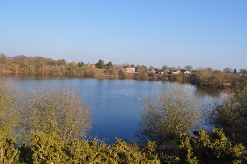
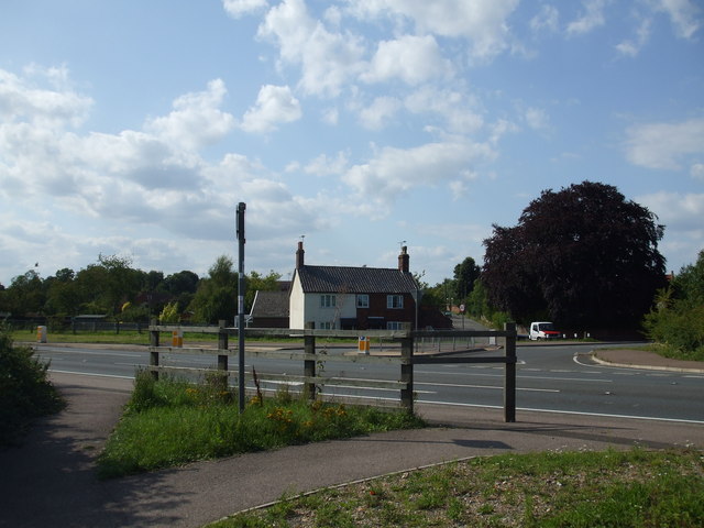
Broome is a small village located in the county of Norfolk, England. Situated approximately 11 miles southeast of Norwich, the village is part of the South Norfolk district. Broome is surrounded by picturesque countryside, with rolling fields and farmland stretching as far as the eye can see.

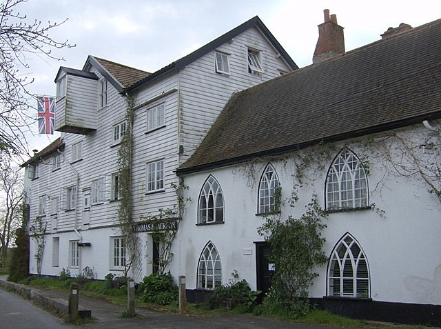
The village itself is characterized by its quaint charm and traditional English architecture. The houses are predominantly made of red brick, with thatched roofs and beautifully maintained gardens. The village center features a parish church, St. Michael's, which dates back to the 14th century and serves as a focal point for the community.

Broome boasts a strong sense of community, with a range of local amenities and activities available to residents and visitors alike. The village has a primary school, providing education for children aged 4 to 11, as well as a village hall that hosts various events and gatherings throughout the year. Additionally, there is a local pub, The Bell Inn, which offers a warm and welcoming atmosphere for locals and tourists to enjoy.

Surrounded by the Norfolk countryside, Broome is a haven for nature lovers. The village is within close proximity to several nature reserves and wildlife areas, providing ample opportunities for outdoor activities such as bird-watching, hiking, and cycling.

Overall, Broome offers a tranquil escape from the hustle and bustle of city life, with its idyllic setting, strong community spirit, and access to the beautiful Norfolk countryside.

If you have any feedback on the listing, please let us know in the comments section below.

Broome Images

Images are sourced within 2km of 52.470963/1.4602309 or Grid Reference TM3591. Thanks to Geograph Open Source API. All images are credited.

Low Rd
Low Rd
The Anchorage, Low Rd
Entering Bungay, B1062 <span class="nowrap"><a title="https://www.sabre-roads.org.uk/wiki/index.php?title=B1062" rel="nofollow ugc noopener" href="https://www.sabre-roads.org.uk/wiki/index.php?title=B1062">Link</a><img style="margin-left:2px;" alt="External link" title="External link - shift click to open in new window" src="https://s1.geograph.org.uk/img/external.png" width="10" height="10"/></span>
Entering Bungay, B1062
Entering Mettingham, B1062 <span class="nowrap"><a title="https://www.sabre-roads.org.uk/wiki/index.php?title=B1062" rel="nofollow ugc noopener" href="https://www.sabre-roads.org.uk/wiki/index.php?title=B1062">Link</a><img style="margin-left:2px;" alt="External link" title="External link - shift click to open in new window" src="https://s1.geograph.org.uk/img/external.png" width="10" height="10"/></span>
Entering Mettingham, B1062
Homestead Farm
Homestead Farm
Homestead Farm
Homestead Farm
B road junction The B1435 is a 1.7 mile long L-shaped road connecting Bungay town centre with the B1062 southern bypass in both directions <a href="https://www.geograph.org.uk/photo/7663361">TM3489 : B road junction</a> .
<span class="nowrap"><a title="https://www.sabre-roads.org.uk/wiki/index.php?title=B1435" rel="nofollow ugc noopener" href="https://www.sabre-roads.org.uk/wiki/index.php?title=B1435">Link</a><img style="margin-left:2px;" alt="External link" title="External link - shift click to open in new window" src="https://s1.geograph.org.uk/img/external.png" width="10" height="10"/></span>
B road junction
The B1435 is a 1.7 mile long L-shaped road connecting Bungay town centre with the B1062 southern bypass in both directions TM3489 : B road junction . LinkExternal link
Beccles Rd <span class="nowrap"><a title="https://www.sabre-roads.org.uk/wiki/index.php?title=B1062" rel="nofollow ugc noopener" href="https://www.sabre-roads.org.uk/wiki/index.php?title=B1062">Link</a><img style="margin-left:2px;" alt="External link" title="External link - shift click to open in new window" src="https://s1.geograph.org.uk/img/external.png" width="10" height="10"/></span>
Beccles Rd
Watch House Hill <span class="nowrap"><a title="https://www.sabre-roads.org.uk/wiki/index.php?title=B1062" rel="nofollow ugc noopener" href="https://www.sabre-roads.org.uk/wiki/index.php?title=B1062">Link</a><img style="margin-left:2px;" alt="External link" title="External link - shift click to open in new window" src="https://s1.geograph.org.uk/img/external.png" width="10" height="10"/></span>
Watch House Hill
Vicarage Lane
Vicarage Lane
Mettingham Village sign Village signs are typically placed along the principal road or in a prominent location such as a village green or close by the church. The design often depicts a particularly feature of the village or a scene from its history, heritage, or culture. They are typically made of wood or metal or a combination of both, the designs are often made by the local community.
Although they do appear in villages and towns all over the country they are more prominent in East Anglia than elsewhere in the country.
Mettingham Village sign
Village signs are typically placed along the principal road or in a prominent location such as a village green or close by the church. The design often depicts a particularly feature of the village or a scene from its history, heritage, or culture. They are typically made of wood or metal or a combination of both, the designs are often made by the local community. Although they do appear in villages and towns all over the country they are more prominent in East Anglia than elsewhere in the country.
Farmland towards Vicarage Farm Off the B1062.
Farmland towards Vicarage Farm
Off the B1062.
B1062 towards Bungay Looking west.
B1062 towards Bungay
Looking west.
Entering Bungay Heading south west on the Beccles Road (B1062).
Entering Bungay
Heading south west on the Beccles Road (B1062).
Elizabeth II postbox on the B1062, Mettingham Postbox No. NR35 3517.

See <a href="https://www.geograph.org.uk/photo/5169977">TM3589 : Close up, Elizabeth II postbox on the B1062, Mettingham</a> for close up.

See <a href="https://www.geograph.org.uk/photo/5169981">TM3589 : B1062, Mettingham</a> for context.
Elizabeth II postbox on the B1062, Mettingham
Postbox No. NR35 3517. See TM3589 : Close up, Elizabeth II postbox on the B1062, Mettingham for close up. See TM3589 : B1062, Mettingham for context.
Show me another place!

Broome is located at Grid Ref: TM3591 (Lat: 52.470963, Lng: 1.4602309)

Administrative County: Norfolk

District: South Norfolk

Police Authority: Norfolk

What 3 Words

///mirror.then.vacancies. Near Ditchingham, Norfolk

Nearby Locations

Broome Common Broome

Related Wikis

Broome, Norfolk

Broome is a village and civil parish in the English county of Norfolk. It is situated on the north bank of the River Waveney, which forms the border with...

Broome Heath Pit

Broome Heath Pit is a 1.2-hectare (3.0-acre) geological Site of Special Scientific Interest east of Ditchingham in Norfolk. It is a Geological Conservation...

Broome Heath

Broome Heath is a 31.7-hectare (78-acre) Local Nature Reserve in Ditchingham in Norfolk. It is owned by South Norfolk District Council and managed by...

Ditchingham railway station

Ditchingham was a railway station in Ditchingham, Norfolk on the Waveney Valley Line. Opened on 2 March 1863, it closed to passengers along with the rest...

Ditchingham

Ditchingham is a village and civil parish in the English county of Norfolk. It is located across the River Waveney from Bungay, Suffolk. == History... ==

Ellingham, Norfolk

Ellingham is a village and civil parish in the English county of Norfolk. The village is located 2.3 miles (3.7 km) north-east of Bungay and 13 miles...

Ellingham railway station

Ellingham is a former railway station in Ellingham, Norfolk. It was opened in 1863 as part of the Waveney Valley Line between Tivetshall and Beccles, Suffolk...

Bungay Town F.C.

Bungay Town Football Club is an English football club based in Bungay, Suffolk. The club are currently members of Anglian Combination Division One and...

Nearby Amenities

Located within 500m of 52.470963,1.4602309
Bus Stop
The Artichoke, adj
Bus: yes
Naptan AtcoCode: 2900B541
Naptan Bearing: SW
Naptan CommonName: The Artichoke
Naptan Indicator: adj
Naptan Landmark: public house
Naptan Locality: Broome
Naptan NaptanCode: nfoagmgd
Naptan ShortCommonName: The Artichoke
Naptan Street: Yarmouth Road
Naptan Verified: no
Public Transport: platform
Source: naptan_import
Lat/Long: 52.47159/1.4610707
Bus Stop
The Artichoke, opp
Bus: yes
Naptan AtcoCode: 2900B542
Naptan Bearing: NE
Naptan CommonName: The Artichoke
Naptan Indicator: opp
Naptan Landmark: public house
Naptan Locality: Broome
Naptan NaptanCode: nfoagmgj
Naptan ShortCommonName: The Artichoke
Naptan Street: Yarmouth Road
Naptan Verified: no
Public Transport: platform
Source: naptan_import
Lat/Long: 52.471861/1.4610331
Bus Stop
Sunley Close, opp
Bench: yes
Bus: yes
Naptan AtcoCode: 2900B543
Naptan Bearing: NW
Naptan CommonName: Sunley Close
Naptan Indicator: opp
Naptan Landmark: Village Hall
Naptan Locality: Broome
Naptan NaptanCode: nfoagmgm
Naptan Street: Sun Road
Naptan Verified: no
Public Transport: platform
Shelter: yes
Source: naptan_import
Tactile Paving: yes
Lat/Long: 52.4717592/1.4591129
Bus Stop
Sunley Close, adj
Bus: yes
Naptan AtcoCode: 2900B544
Naptan Bearing: SE
Naptan CommonName: Sunley Close
Naptan Indicator: adj
Naptan Landmark: village hall
Naptan Locality: Broome
Naptan NaptanCode: nfoagmgp
Naptan ShortCommonName: Sunley Close
Naptan Street: Sun Road
Naptan Verified: no
Public Transport: platform
Source: naptan_import
Lat/Long: 52.4717194/1.4594165
Bus Stop
Sun Road, adj
Bus: yes
Naptan AtcoCode: 2900B545
Naptan Bearing: SW
Naptan BusStopType: CUS
Naptan CommonName: Sun Road
Naptan Indicator: adj
Naptan Landmark: Sun Road
Naptan Locality: Broome
Naptan NaptanCode: nfoagmgt
Naptan Street: Loddon Road
Naptan Verified: no
Public Transport: platform
Source: naptan_import
Lat/Long: 52.4745698/1.4566797
Bus Stop
Sun Road, opp
Bus: yes
Naptan AtcoCode: 2900B546
Naptan Bearing: NE
Naptan BusStopType: CUS
Naptan CommonName: Sun Road
Naptan Indicator: opp
Naptan Landmark: Sun Road
Naptan Locality: Broome
Naptan NaptanCode: nfoagmgw
Naptan ShortCommonName: Sun Rd
Naptan Street: Loddon Road
Naptan Verified: no
Public Transport: platform
Source: naptan_import
Lat/Long: 52.4746608/1.4566426
Pub
Artichoke
Addr Housenumber: 162
Addr Postcode: NR35 2NZ
Addr Street: Yarmouth Road
Fhrs Id: 984847
Source Addr: FSA Food Hygiene Ratings Database
Lat/Long: 52.4717461/1.4613044
Broome
Place: village
Lat/Long: 52.4688109/1.4544313
Broome Village Sign
Historic: monument
Inscription: 2000
Material: wood
Start Date: 2000
Lat/Long: 52.4718809/1.458938
Post Box
Collection Times: Mo-Fr 17:45; Sa 10:00
Ref: NR35 3538
Lat/Long: 52.4717137/1.4591992
Post Box
Collection Times: Mo-Fr 18:00; Sa 08:00
Ref: NR35 3533
Lat/Long: 52.4682561/1.4548942
Bench
Backrest: yes
Colour: brown
Material: plastic
Seats: 3
Lat/Long: 52.4722676/1.4538468
Bench
Backrest: yes
Colour: brown
Inscription: Presented by Broome Parish Council with a grant from the Countryside Agency to commemorate the opening of the Broome bypass February 2002, Golden Jubilee year.
Material: plastic
Seats: 3
Lat/Long: 52.4676601/1.4618123
Barrier: bollard
Bollard: removable
Material: metal
Lat/Long: 52.4709011/1.4666693
Barrier: bollard
Bollard: removable
Material: metal
Lat/Long: 52.4709012/1.4666468
Barrier: bollard
Bollard: removable
Material: metal
Lat/Long: 52.4709009/1.4667191
Barrier: bollard
Bollard: removable
Material: metal
Lat/Long: 52.4709009/1.4667021
Barrier: bollard
Bollard: removable
Material: metal
Lat/Long: 52.470901/1.4666839
Give Way
Lat/Long: 52.4746769/1.4567933
Give Way
Lat/Long: 52.474988/1.4571451
Give Way
Lat/Long: 52.4746947/1.4571055
Give Way
Lat/Long: 52.4709997/1.4602482
Power: pole
Lat/Long: 52.4724375/1.459107
Power: pole
Lat/Long: 52.4732904/1.4589554
Power: pole
Lat/Long: 52.4737119/1.4593926
Power: pole
Lat/Long: 52.4748474/1.4604333
Bench
Description: Log bench
Lat/Long: 52.4711839/1.4541074
Broome Beacon
Historic: monument
Lat/Long: 52.4714928/1.4582943
Bench
Backrest: yes
Material: metal
Seats: 3
Lat/Long: 52.4715412/1.457944
The data included in this document is from www.openstreetmap.org. The data is made available under ODbL.

Have you been to Broome?

Leave your review of Broome below (or comments, questions and feedback).