Broome Common

Downs, Moorland in Norfolk South Norfolk

England

Broome Common

Low Rd
Low Rd Credit: N Chadwick

Broome Common is a picturesque area located in Norfolk, England. It encompasses a diverse landscape, including downs and moorland. Spanning over an area of approximately 2,000 acres, the common is characterized by its rolling hills, expansive heathland, and scattered woodlands.

The downs of Broome Common are synonymous with their gently sloping hills, offering breathtaking panoramic views of the surrounding countryside. These grassy slopes are home to a rich variety of plant species, including heather, gorse, and wildflowers, creating a vibrant tapestry of colors throughout the year.

The moorland sections of the common are characterized by their rugged terrain and open expanses. Here, visitors can immerse themselves in the tranquility of the vast heathlands, which are dotted with small pools and marshy areas. This unique habitat supports a range of wildlife, including birds such as curlews, skylarks, and lapwings.

Broome Common also boasts several woodlands, adding to its natural beauty. These woodlands consist of mixed deciduous trees, including oak, birch, and ash. They provide shelter and nesting sites for various bird species and serve as a haven for small mammals, such as foxes and rabbits.

The common is a popular destination for nature enthusiasts, hikers, and birdwatchers. It offers a network of footpaths and trails, allowing visitors to explore its diverse ecosystems and discover its hidden gems. Whether it's the panoramic views from the downs, the serenity of the moorland, or the enchantment of the woodlands, Broome Common is a true haven for those seeking solace in nature.

If you have any feedback on the listing, please let us know in the comments section below.

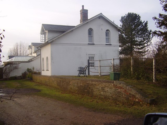
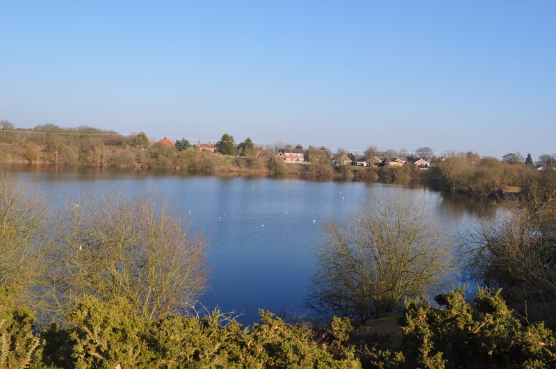
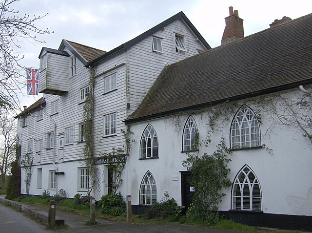
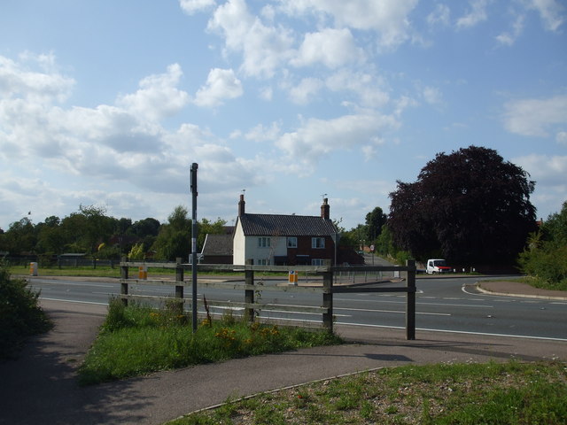
Broome Common Images

Images are sourced within 2km of 52.468769/1.4682028 or Grid Reference TM3591. Thanks to Geograph Open Source API. All images are credited.

Low Rd
Low Rd
The Anchorage, Low Rd
Entering Bungay, B1062 <span class="nowrap"><a title="https://www.sabre-roads.org.uk/wiki/index.php?title=B1062" rel="nofollow ugc noopener" href="https://www.sabre-roads.org.uk/wiki/index.php?title=B1062">Link</a><img style="margin-left:2px;" alt="External link" title="External link - shift click to open in new window" src="https://s1.geograph.org.uk/img/external.png" width="10" height="10"/></span>
Entering Bungay, B1062
Entering Mettingham, B1062 <span class="nowrap"><a title="https://www.sabre-roads.org.uk/wiki/index.php?title=B1062" rel="nofollow ugc noopener" href="https://www.sabre-roads.org.uk/wiki/index.php?title=B1062">Link</a><img style="margin-left:2px;" alt="External link" title="External link - shift click to open in new window" src="https://s1.geograph.org.uk/img/external.png" width="10" height="10"/></span>
Entering Mettingham, B1062
Homestead Farm
Homestead Farm
Homestead Farm
Homestead Farm
B road junction The B1435 is a 1.7 mile long L-shaped road connecting Bungay town centre with the B1062 southern bypass in both directions <a href="https://www.geograph.org.uk/photo/7663361">TM3489 : B road junction</a> .
<span class="nowrap"><a title="https://www.sabre-roads.org.uk/wiki/index.php?title=B1435" rel="nofollow ugc noopener" href="https://www.sabre-roads.org.uk/wiki/index.php?title=B1435">Link</a><img style="margin-left:2px;" alt="External link" title="External link - shift click to open in new window" src="https://s1.geograph.org.uk/img/external.png" width="10" height="10"/></span>
B road junction
The B1435 is a 1.7 mile long L-shaped road connecting Bungay town centre with the B1062 southern bypass in both directions TM3489 : B road junction . LinkExternal link
Beccles Rd <span class="nowrap"><a title="https://www.sabre-roads.org.uk/wiki/index.php?title=B1062" rel="nofollow ugc noopener" href="https://www.sabre-roads.org.uk/wiki/index.php?title=B1062">Link</a><img style="margin-left:2px;" alt="External link" title="External link - shift click to open in new window" src="https://s1.geograph.org.uk/img/external.png" width="10" height="10"/></span>
Beccles Rd
Watch House Hill <span class="nowrap"><a title="https://www.sabre-roads.org.uk/wiki/index.php?title=B1062" rel="nofollow ugc noopener" href="https://www.sabre-roads.org.uk/wiki/index.php?title=B1062">Link</a><img style="margin-left:2px;" alt="External link" title="External link - shift click to open in new window" src="https://s1.geograph.org.uk/img/external.png" width="10" height="10"/></span>
Watch House Hill
Vicarage Lane
Vicarage Lane
Mettingham Village sign Village signs are typically placed along the principal road or in a prominent location such as a village green or close by the church. The design often depicts a particularly feature of the village or a scene from its history, heritage, or culture. They are typically made of wood or metal or a combination of both, the designs are often made by the local community.
Although they do appear in villages and towns all over the country they are more prominent in East Anglia than elsewhere in the country.
Mettingham Village sign
Village signs are typically placed along the principal road or in a prominent location such as a village green or close by the church. The design often depicts a particularly feature of the village or a scene from its history, heritage, or culture. They are typically made of wood or metal or a combination of both, the designs are often made by the local community. Although they do appear in villages and towns all over the country they are more prominent in East Anglia than elsewhere in the country.
Beccles Road, Bungay; memorial street sign Peace Year commemoration street sign.
One of the 30 plus street signs commemorating the peace in 1919.
Beccles Road, Bungay; memorial street sign
Peace Year commemoration street sign. One of the 30 plus street signs commemorating the peace in 1919.
Farmland towards Vicarage Farm Off the B1062.
Farmland towards Vicarage Farm
Off the B1062.
B1062 towards Bungay Looking west.
B1062 towards Bungay
Looking west.
Entering Bungay Heading south west on the Beccles Road (B1062).
Entering Bungay
Heading south west on the Beccles Road (B1062).
Show me another place!

Broome Common is located at Grid Ref: TM3591 (Lat: 52.468769, Lng: 1.4682028)

Administrative County: Norfolk

District: South Norfolk

Police Authority: Norfolk

What 3 Words

///oppose.snooty.unlocking. Near Ditchingham, Norfolk

Nearby Locations

Broome Common Broome

Related Wikis

Broome, Norfolk

Broome is a village and civil parish in the English county of Norfolk. It is situated on the north bank of the River Waveney, which forms the border with...

Ellingham railway station

Ellingham is a former railway station in Ellingham, Norfolk. It was opened in 1863 as part of the Waveney Valley Line between Tivetshall and Beccles, Suffolk...

Broome Heath

Broome Heath is a 31.7-hectare (78-acre) Local Nature Reserve in Ditchingham in Norfolk. It is owned by South Norfolk District Council and managed by...

Broome Heath Pit

Broome Heath Pit is a 1.2-hectare (3.0-acre) geological Site of Special Scientific Interest east of Ditchingham in Norfolk. It is a Geological Conservation...

Ellingham, Norfolk

Ellingham is a village and civil parish in the English county of Norfolk. The village is located 2.3 miles (3.7 km) north-east of Bungay and 13 miles...

Mettingham

Mettingham is a village and civil parish in the north of the English county of Suffolk. It is 2 miles (3.2 km) east of the market town of Bungay in the...

Ditchingham railway station

Ditchingham was a railway station in Ditchingham, Norfolk on the Waveney Valley Line. Opened on 2 March 1863, it closed to passengers along with the rest...

Ditchingham

Ditchingham is a village and civil parish in the English county of Norfolk. It is located across the River Waveney from Bungay, Suffolk. == History... ==

Nearby Amenities

Located within 500m of 52.468769,1.4682028
Bench
Backrest: yes
Colour: brown
Inscription: Presented by Broome Parish Council with a grant from the Countryside Agency to commemorate the opening of the Broome bypass February 2002, Golden Jubilee year.
Material: plastic
Seats: 3
Lat/Long: 52.4676601/1.4618123
Bench
Backrest: yes
Colour: brown
Inscription: Presented by Broome Parish Council with a grant from the Countryside Agency to commemorate the opening of the Broome bypass February 2002, Golden Jubilee year.
Material: plastic
Seats: 3
Lat/Long: 52.4728153/1.468501
Barrier: bollard
Bollard: removable
Material: metal
Lat/Long: 52.4709011/1.4666693
Barrier: bollard
Bollard: removable
Material: metal
Lat/Long: 52.4709012/1.4666468
Barrier: bollard
Bollard: removable
Material: metal
Lat/Long: 52.4709009/1.4667191
Barrier: bollard
Bollard: removable
Material: metal
Lat/Long: 52.4709009/1.4667021
Barrier: bollard
Bollard: removable
Material: metal
Lat/Long: 52.470901/1.4666839
Power: pole
Lat/Long: 52.4683939/1.4686067
Power: pole
Lat/Long: 52.4672215/1.466336
Power: pole
Lat/Long: 52.466733/1.4654248
Power: pole
Lat/Long: 52.4712638/1.4740355
Power: pole
Lat/Long: 52.4706284/1.4728707
Power: pole
Lat/Long: 52.4699138/1.4714763
Power: pole
Lat/Long: 52.4691169/1.4699728
Power: pole
Lat/Long: 52.4677138/1.4672449
Power: pole
Lat/Long: 52.4662578/1.4644708
The data included in this document is from www.openstreetmap.org. The data is made available under ODbL.

Have you been to Broome Common?

Leave your review of Broome Common below (or comments, questions and feedback).