Little Eversden

Civil Parish in Cambridgeshire South Cambridgeshire

England

Little Eversden

Harlton, Assumption of the Blessed Virgin Mary <span class="nowrap"><a title="http://www.druidic.org/camchurch/churches/harlton.htm" rel="nofollow ugc noopener" href="http://www.druidic.org/camchurch/churches/harlton.htm">Link</a><img style="margin-left:2px;" alt="External link" title="External link - shift click to open in new window" src="https://s1.geograph.org.uk/img/external.png" width="10" height="10"/></span>
Harlton, Assumption of the Blessed Virgin Mary Credit: mym

Little Eversden is a civil parish located in the county of Cambridgeshire, England. It is situated approximately 8 miles west of the city of Cambridge. The parish is part of the South Cambridgeshire district and covers an area of around 3.5 square miles.

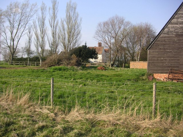
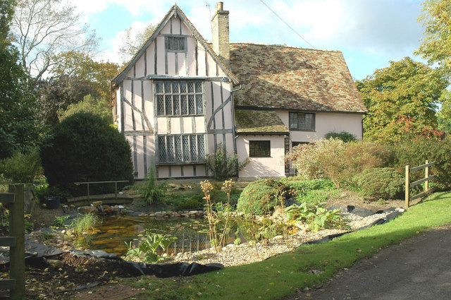
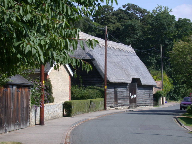
The village of Little Eversden is a small and picturesque settlement, characterized by its traditional English countryside charm. It is predominantly a residential area, with a relatively small population of around 250 residents. The village is known for its beautiful thatched cottages and well-manicured gardens.

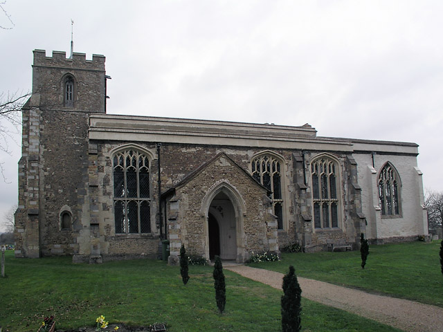
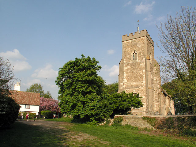
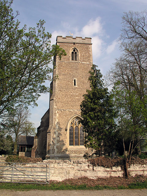
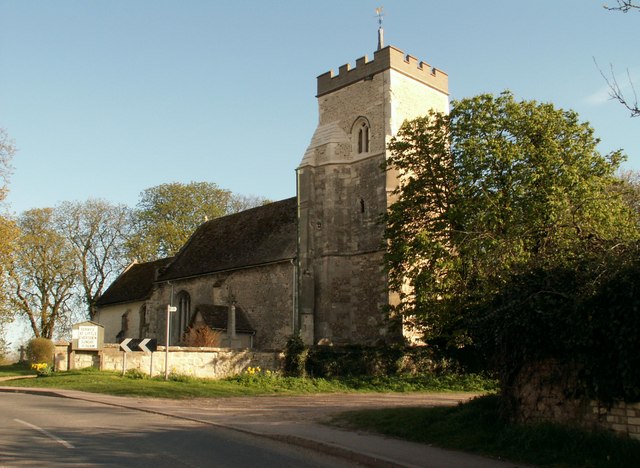
The heart of the village is centered around the Parish Church of St. Helen, an ancient building that dates back to the 13th century. The church serves as a focal point for the community and holds regular services and events.

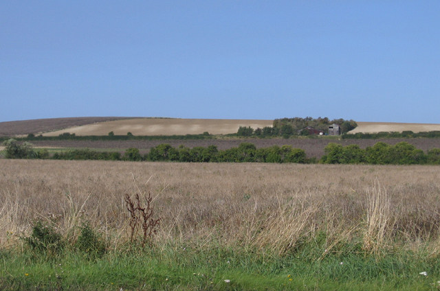
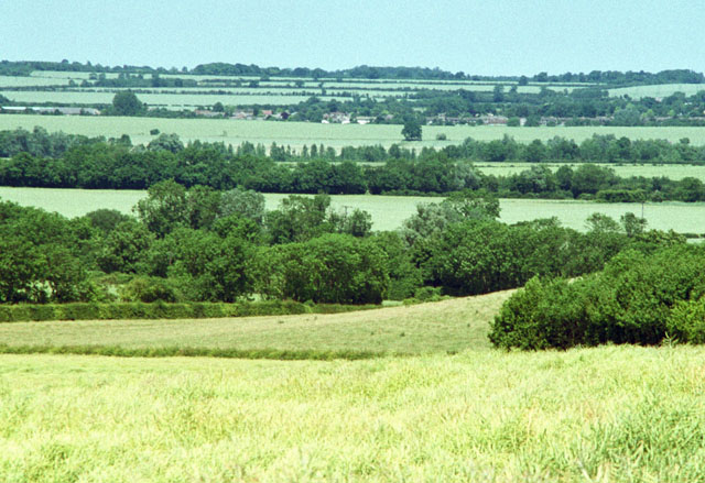
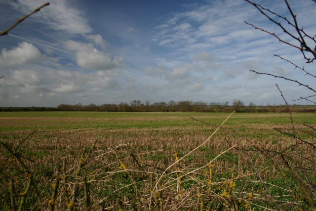
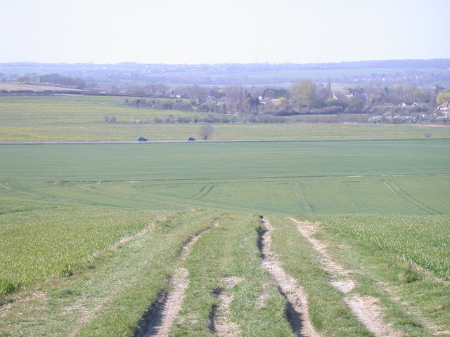
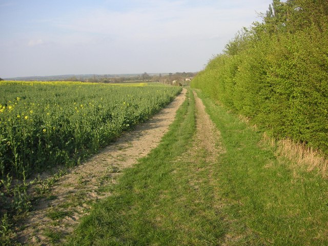
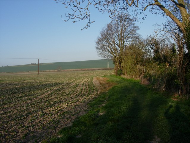
Little Eversden is surrounded by rolling farmland, providing stunning views of the countryside. The area is known for its agricultural heritage, with farming being an important part of the local economy. The village is also home to a number of footpaths and bridleways, making it a popular destination for outdoor enthusiasts and walkers.

Although small in size, Little Eversden boasts a strong sense of community spirit. The village has a primary school, a village hall, and a local pub which serves as a social hub for residents and visitors alike. The parish also hosts various community events throughout the year, including the annual village fete and Christmas festivities.

In summary, Little Eversden is a charming and close-knit village in Cambridgeshire, offering a tranquil and idyllic countryside setting for its residents and visitors.

If you have any feedback on the listing, please let us know in the comments section below.

Little Eversden Images

Images are sourced within 2km of 52.160781/0.0086 or Grid Reference TL3753. Thanks to Geograph Open Source API. All images are credited.

Harlton, Assumption of the Blessed Virgin Mary <span class="nowrap"><a title="http://www.druidic.org/camchurch/churches/harlton.htm" rel="nofollow ugc noopener" href="http://www.druidic.org/camchurch/churches/harlton.htm">Link</a><img style="margin-left:2px;" alt="External link" title="External link - shift click to open in new window" src="https://s1.geograph.org.uk/img/external.png" width="10" height="10"/></span>
Harlton, Assumption of the Blessed Virgin Mary
Great Eversden, St Mary <span class="nowrap"><a title="http://www.druidic.org/camchurch/churches/gteversden.htm" rel="nofollow ugc noopener" href="http://www.druidic.org/camchurch/churches/gteversden.htm">Link</a><img style="margin-left:2px;" alt="External link" title="External link - shift click to open in new window" src="https://s1.geograph.org.uk/img/external.png" width="10" height="10"/></span>
Great Eversden, St Mary
Little Eversden, St Helen <span class="nowrap"><a title="http://www.druidic.org/camchurch/churches/lteversden.htm" rel="nofollow ugc noopener" href="http://www.druidic.org/camchurch/churches/lteversden.htm">Link</a><img style="margin-left:2px;" alt="External link" title="External link - shift click to open in new window" src="https://s1.geograph.org.uk/img/external.png" width="10" height="10"/></span>
Little Eversden, St Helen
Little Eversden stripes, Cambs View across the square from the A603 Roman Road towards the eastern edge, south of Little Eversden; the 'chalk stripes' on the slope were formed by solifluction in a periglacial environment.
Little Eversden stripes, Cambs
View across the square from the A603 Roman Road towards the eastern edge, south of Little Eversden; the 'chalk stripes' on the slope were formed by solifluction in a periglacial environment.
Radio telescopes
Radio telescopes
Radio telescopes and dish telescope The large white dish is one of many radio telescopes in the area, belonging to the Mullard Observatory. The line of TV-antenna looking objects are part of The Cambridge Low-Frequency Synthesis Telescope (CLFST) running east-west in the area, searching for gamma ray bursters in the northern sky.
Radio telescopes and dish telescope
The large white dish is one of many radio telescopes in the area, belonging to the Mullard Observatory. The line of TV-antenna looking objects are part of The Cambridge Low-Frequency Synthesis Telescope (CLFST) running east-west in the area, searching for gamma ray bursters in the northern sky.
Fields and hillside view over Harlton View from the Barrington ridge (the local name for the high ground running east-west). It is made of clunch; a chalk-like rock that was used for local housing and is mined by Rugby cement in Barrington. It is filled with tiny fossils of shellfish from 90 million years ago.
Fields and hillside view over Harlton
View from the Barrington ridge (the local name for the high ground running east-west). It is made of clunch; a chalk-like rock that was used for local housing and is mined by Rugby cement in Barrington. It is filled with tiny fossils of shellfish from 90 million years ago.
Open farmland north of Little Eversden Looking west from the footpath that leads from Comberton to Little Eversden.
Open farmland north of Little Eversden
Looking west from the footpath that leads from Comberton to Little Eversden.
Footpath to Little Eversden This path links Comberton with Little Eversden. The houses in the distance are in the adjacent square.
Footpath to Little Eversden
This path links Comberton with Little Eversden. The houses in the distance are in the adjacent square.
Disused railway south of Comberton This railway line was closed in 1968 and now forms part of the University of Cambridge's Mullard Radio Astronomy Observatory. The bridge carries the Comberton Road.
Disused railway south of Comberton
This railway line was closed in 1968 and now forms part of the University of Cambridge's Mullard Radio Astronomy Observatory. The bridge carries the Comberton Road.
Disused railway south of Comberton Looking west from the same point as <a href="https://www.geograph.org.uk/photo/350423">TL3854 : Disused railway south of Comberton</a>.
Disused railway south of Comberton
Looking west from the same point as TL3854 : Disused railway south of Comberton.
Whole Way, Barrington View down from Barrington Ridge to the Roman Road (A603). The track turns off towards Harlton.
Whole Way, Barrington
View down from Barrington Ridge to the Roman Road (A603). The track turns off towards Harlton.
Manor Farm in Great Eversden Manor Farm in Great Eversden, photograph made from public footpath to bird reserve.
Manor Farm in Great Eversden
Manor Farm in Great Eversden, photograph made from public footpath to bird reserve.
Great Eversden from disused Eversden Quarry
Red House Farm at the West Entry of Great Eversden
View from Harlton Road Towards Radiotelescopes Radiotelescopes belonging to the Mullard Radio Astronomy Observatory viewed from Harlton Road
View from Harlton Road Towards Radiotelescopes
Radiotelescopes belonging to the Mullard Radio Astronomy Observatory viewed from Harlton Road
Five Gables Farm Five Gables Farm at Little Eversden, Cambridgeshire.
Five Gables Farm
Five Gables Farm at Little Eversden, Cambridgeshire.
Footpath south of Harlton The footpaths in the area are well kept, but there are more signs telling you to keep to them than there are telling you where they actually are.
Footpath south of Harlton
The footpaths in the area are well kept, but there are more signs telling you to keep to them than there are telling you where they actually are.
Show me another place!

Little Eversden is located at Grid Ref: TL3753 (Lat: 52.160781, Lng: 0.0086)

Administrative County: Cambridgeshire

District: South Cambridgeshire

Police Authority: Cambridgeshire

What 3 Words

///receive.consoles.blame. Near Comberton, Cambridgeshire

Related Wikis

Little Eversden

Little Eversden is a village approximately 7 miles (11 km) south-west of Cambridge, England. It has two main roads: Harlton Road which goes through Little...
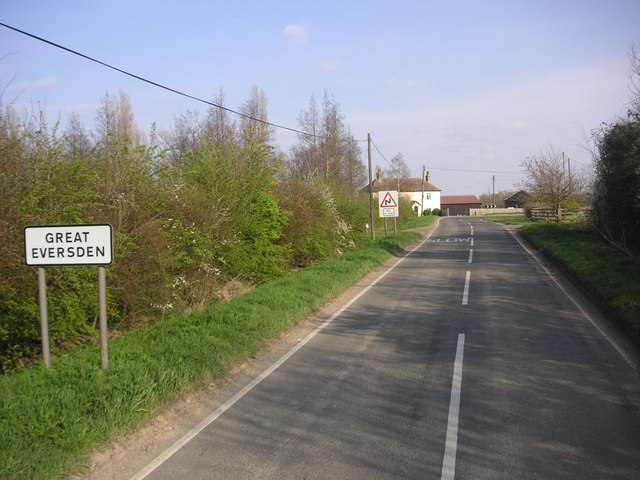
Great Eversden

Great Eversden is a village 6 miles south-west of Cambridge, England. The population of the civil parish at the 2011 Census was 241. The Prime Meridian...

Harlton

Harlton is a village and civil parish in Cambridgeshire in the United Kingdom. The village is 5 miles (8.0 km) south-west of Cambridge and neighbours Haslingfield...
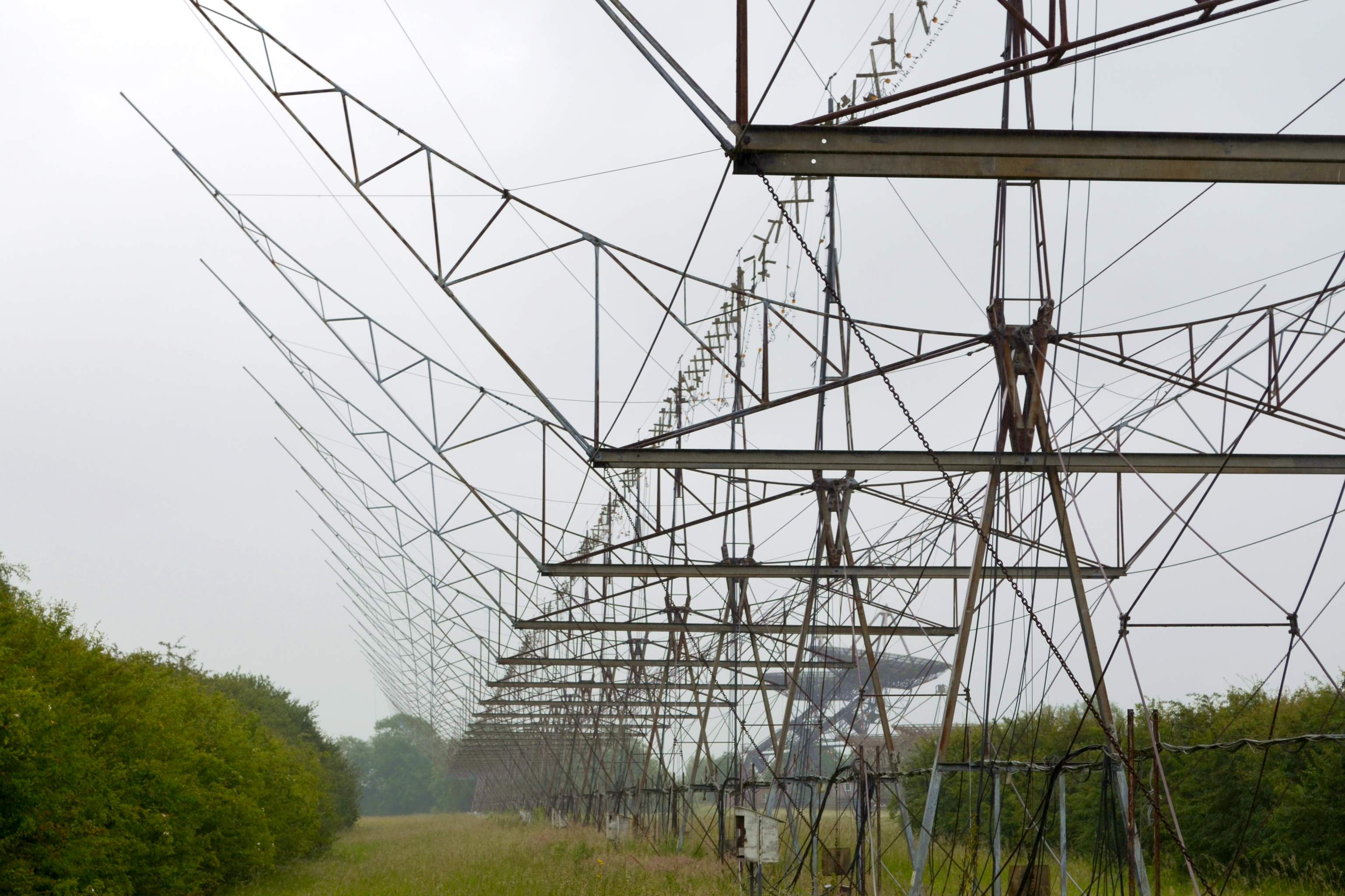
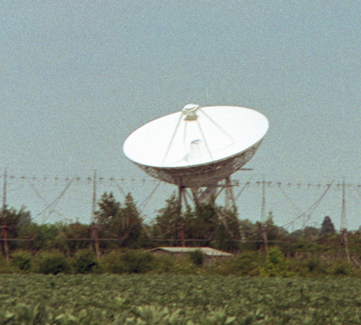
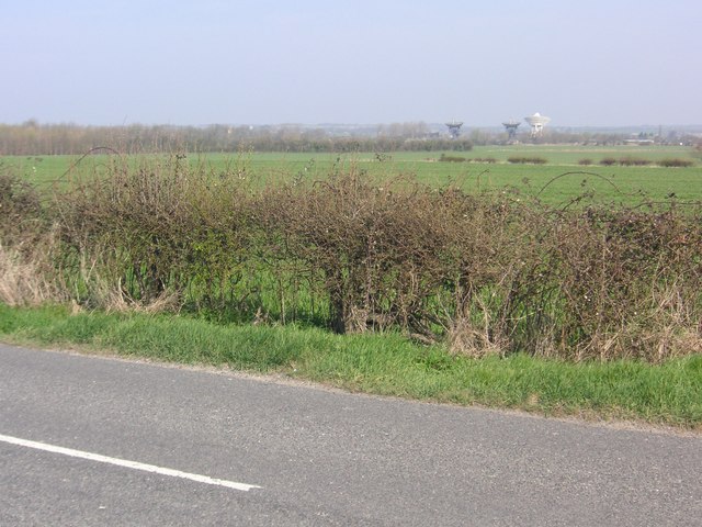
4C Array

The 4C Array is a cylindrical paraboloid radio telescope at the Mullard Radio Astronomy Observatory, near Cambridge, England. It is similar in design to...

Nearby Amenities

Located within 500m of 52.160781,0.0086
Little Eversden
Is In: Cambridgeshire, England, UK
Place: village
Population: 550
Source Population: http://www.scambs.gov.uk/CommunityandLiving/VillageServicesAndAmenities/
Source Ref Name: npe
Wikidata: Q4474505
Lat/Long: 52.1598426/0.0064052
Turning Circle
Lat/Long: 52.1596753/0.0020512
Post Box
Collection Times: Mo-Fr 09:00; Sa 07:00
Post Box Type: wall
Ref: CB23 409
Royal Cypher: VR
Royal Cypher Wikidata: Q33102356
Source: survey
Lat/Long: 52.161467/0.0065206
Power: pole
Lat/Long: 52.1576229/0.0069282
Power: pole
Lat/Long: 52.1566059/0.0091087
Power: pole
Lat/Long: 52.1572362/0.0077089
Power: pole
Lat/Long: 52.1580704/0.0052358
Power: pole
Lat/Long: 52.1583369/0.0040261
Power: pole
Lat/Long: 52.1611949/0.0016067
Power: pole
Lat/Long: 52.1627654/0.0040717
Power: pole
Lat/Long: 52.1644806/0.0103211
Power: pole
Lat/Long: 52.1634252/0.0090806
Power: pole
Lat/Long: 52.1617799/0.0025335
Power: pole
Lat/Long: 52.1629292/0.0080386
Power: pole
Lat/Long: 52.163978/0.0089076
Power: pole
Lat/Long: 52.1635009/0.0052302
Power: pole
Lat/Long: 52.163686/0.0059517
Power: pole
Lat/Long: 52.1622702/0.0032979
Power: pole
Lat/Long: 52.1633199/0.0068664
Power: pole
Lat/Long: 52.1638291/0.0077783
Power: pole
Lat/Long: 52.1588174/0.0042507
Barrier: kissing_gate
Lat/Long: 52.1607545/0.0058835
Addr Street: Mowlam Close
Lat/Long: 52.1639533/0.0114092
Barrier: kissing_gate
Foot: designated
Lat/Long: 52.1611386/0.0047169
Barrier: kissing_gate
Foot: designated
Lat/Long: 52.1618428/0.0022881
Bench
Lat/Long: 52.1614706/0.0037993
Information: guidepost
Tourism: information
Lat/Long: 52.1609272/0.0083953
Grit Bin
Lat/Long: 52.1630242/0.008522
Bench
Lat/Long: 52.162814/0.0079823
Information: guidepost
Tourism: information
Lat/Long: 52.1607635/0.0058687
Information: guidepost
Tourism: information
Lat/Long: 52.1616129/0.0099986
The data included in this document is from www.openstreetmap.org. The data is made available under ODbL.

Have you been to Little Eversden?

Leave your review of Little Eversden below (or comments, questions and feedback).