Landbeach

Civil Parish in Cambridgeshire South Cambridgeshire

England

Landbeach

Landbeach, All Saints <span class="nowrap"><a title="http://www.druidic.org/camchurch/churches/landbeach.htm" rel="nofollow ugc noopener" href="http://www.druidic.org/camchurch/churches/landbeach.htm">Link</a><img style="margin-left:2px;" alt="External link" title="External link - shift click to open in new window" src="https://s1.geograph.org.uk/img/external.png" width="10" height="10"/></span>
Landbeach, All Saints Credit: mym

Landbeach is a civil parish located in the county of Cambridgeshire, England. Situated approximately 6 miles north of the city of Cambridge, it covers an area of around 8 square miles. The parish is bordered by the A10 road to the west, the River Cam to the east, and the villages of Waterbeach to the north and Milton to the south.

Landbeach is primarily a rural area with a population of around 1,700 people. The village itself has a long history, dating back to Roman times, and is known for its traditional thatched cottages and picturesque countryside. The focal point of the village is its ancient parish church, St. John the Evangelist, which dates back to the 13th century.

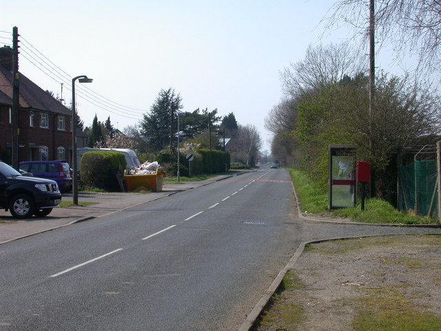
Despite its rural character, Landbeach has good transport links, with the A10 providing easy access to Cambridge and Ely. The nearby Waterbeach railway station also offers regular services to Cambridge, London, and other major cities.

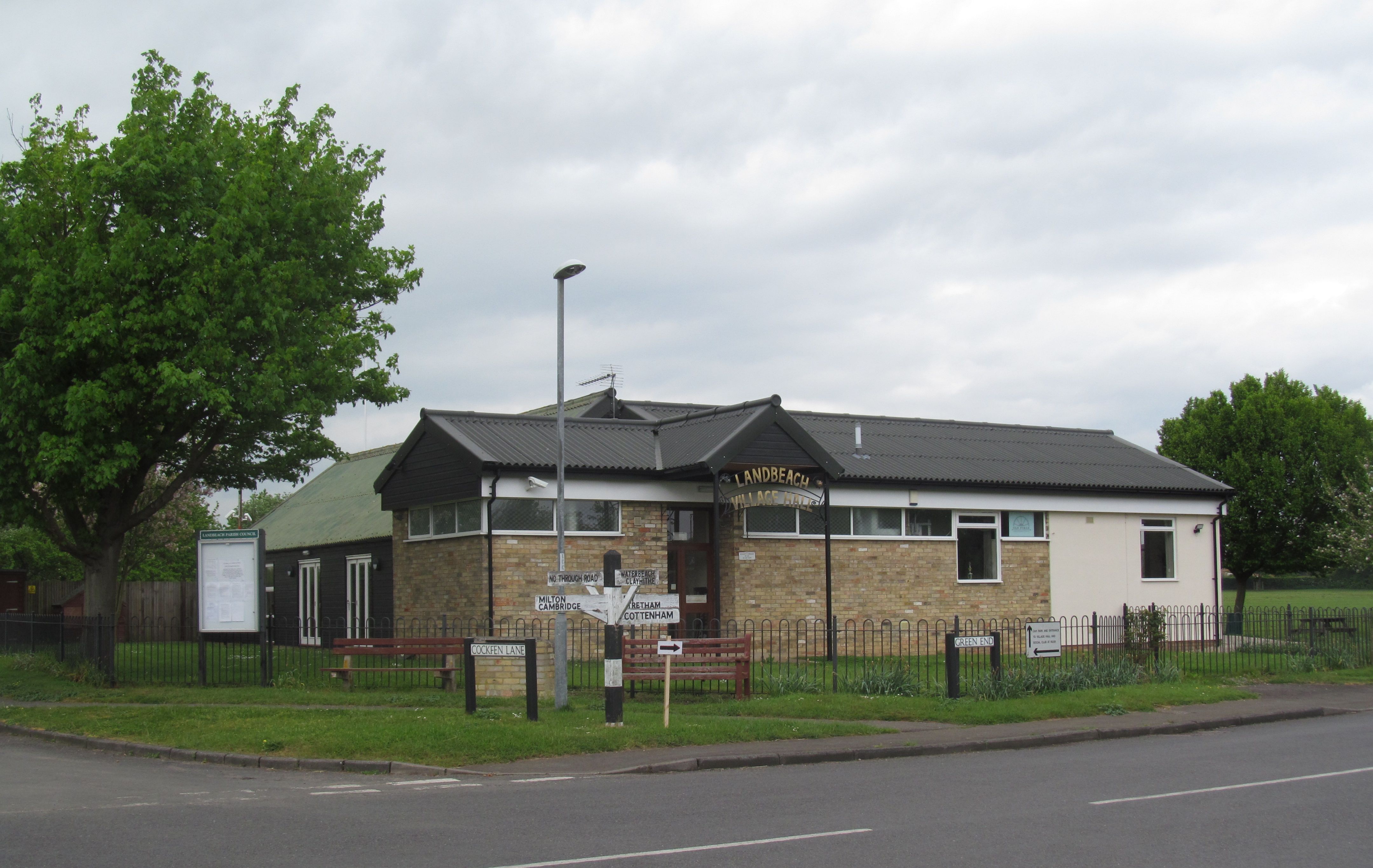
The village has a range of amenities, including a primary school, a village hall, and a community center. There is also a small convenience store and a pub, providing essential services and a social hub for the local community.

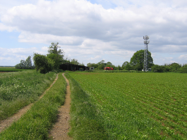
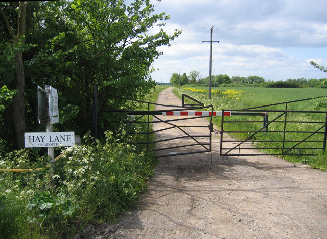
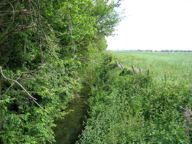
Landbeach is surrounded by agricultural land and nature reserves, making it an attractive location for outdoor activities such as walking and cycling. The area is also rich in wildlife, with many species of birds and mammals inhabiting the local wetlands and meadows.

Overall, Landbeach is a peaceful and scenic civil parish that offers a rural lifestyle within easy reach of the amenities and cultural attractions of Cambridge.

If you have any feedback on the listing, please let us know in the comments section below.

Landbeach Images

Images are sourced within 2km of 52.271517/0.160326 or Grid Reference TL4765. Thanks to Geograph Open Source API. All images are credited.

Landbeach, All Saints <span class="nowrap"><a title="http://www.druidic.org/camchurch/churches/landbeach.htm" rel="nofollow ugc noopener" href="http://www.druidic.org/camchurch/churches/landbeach.htm">Link</a><img style="margin-left:2px;" alt="External link" title="External link - shift click to open in new window" src="https://s1.geograph.org.uk/img/external.png" width="10" height="10"/></span>
Landbeach, All Saints
Landbeach and Milton Baptist Church A smaller version of its counterpart in Waterbeach (<a href="https://www.geograph.org.uk/photo/36455">TL4965 : Waterbeach Baptist Church</a>), and built in 1851. The Baptist church seems to have quite a strong presence in the villages around Cambridge.
Landbeach and Milton Baptist Church
A smaller version of its counterpart in Waterbeach (TL4965 : Waterbeach Baptist Church), and built in 1851. The Baptist church seems to have quite a strong presence in the villages around Cambridge.
Bungalows in Landbeach A long line of neat bungalows on the road between Landbeach and Waterbeach.
Bungalows in Landbeach
A long line of neat bungalows on the road between Landbeach and Waterbeach.
Beach Lode, Landbeach The building is New Farm, the road is Green End, and the ditch is Beach Lode. The road crosses the ditch by the 'sharp bend' sign in the distance. Beach Lode is medieval or earlier and was once used by goods barges.
Beach Lode, Landbeach
The building is New Farm, the road is Green End, and the ditch is Beach Lode. The road crosses the ditch by the 'sharp bend' sign in the distance. Beach Lode is medieval or earlier and was once used by goods barges.
Sign at entrance to Emmaus, Landbeach Emmaus is a charity that helps formerly homeless people to earn a living by repairing and selling donated items. The Cambridge site (actually in Green End, Landbeach, next to the A10) opened in 1992 and was the first Emmaus site in the UK.
Sign at entrance to Emmaus, Landbeach
Emmaus is a charity that helps formerly homeless people to earn a living by repairing and selling donated items. The Cambridge site (actually in Green End, Landbeach, next to the A10) opened in 1992 and was the first Emmaus site in the UK.
Track to farm buildings and mast, Cottenham, Cambs from Beach Road; to the right is part of the pre-inclosure Dunstall Field, an open arable field, and on the left Mason's Pastures, an old inclosure. <span class="nowrap"><a title="http://www.british-history.ac.uk/report.asp?compid=15322" rel="nofollow ugc noopener" href="http://www.british-history.ac.uk/report.asp?compid=15322">Link</a><img style="margin-left:2px;" alt="External link" title="External link - shift click to open in new window" src="https://s1.geograph.org.uk/img/external.png" width="10" height="10"/></span>
Track to farm buildings and mast, Cottenham, Cambs
from Beach Road; to the right is part of the pre-inclosure Dunstall Field, an open arable field, and on the left Mason's Pastures, an old inclosure. LinkExternal link
Hay Lane, Cottenham, Cambs an unadopted track with locked gates; view from its junction with Beach Road.
Hay Lane, Cottenham, Cambs
an unadopted track with locked gates; view from its junction with Beach Road.
Beach Ditch, between Cottenham and Landbeach, Cambs The parish boundaries in the fens were mostly fixed only in the 13th century; intercommonable pastures between Cottenham and Landbeach were divided in 1235 when the straight Beach Ditch was dug.
Beach Ditch, between Cottenham and Landbeach, Cambs
The parish boundaries in the fens were mostly fixed only in the 13th century; intercommonable pastures between Cottenham and Landbeach were divided in 1235 when the straight Beach Ditch was dug.
Permissive footpath, Landbeach, Cambs between Akeman Street Roman Road and Rectory Farm; one of the newly created conservation walks for the enjoyment of hedgerows and field grass margins that are being sympathetically managed to provide habitats for wildlife.  See defra <span class="nowrap"><a title="http://countrywalks.defra.gov.uk/DisplayImage.aspx?Type=Mapboard&IFN=051560010.pdf" rel="nofollow ugc noopener" href="http://countrywalks.defra.gov.uk/DisplayImage.aspx?Type=Mapboard&IFN=051560010.pdf">Link</a><img style="margin-left:2px;" alt="External link" title="External link - shift click to open in new window" src="https://s1.geograph.org.uk/img/external.png" width="10" height="10"/></span>
Permissive footpath, Landbeach, Cambs
between Akeman Street Roman Road and Rectory Farm; one of the newly created conservation walks for the enjoyment of hedgerows and field grass margins that are being sympathetically managed to provide habitats for wildlife. See defra LinkExternal link
Frith Fen Drove This is a no through bridleway, terminating at the top of this field.
Frith Fen Drove
This is a no through bridleway, terminating at the top of this field.
Frith Fen Unusually for the fenland area, this is an uncultivated grassy meadow, crossed by a bridleway which leads to Cambridge Research Park.
Frith Fen
Unusually for the fenland area, this is an uncultivated grassy meadow, crossed by a bridleway which leads to Cambridge Research Park.
Waterbeach cemetery Hangars of old Waterbeach Airfield in background
Waterbeach cemetery
Hangars of old Waterbeach Airfield in background
Phone Box, Denny End Road, Waterbeach
Car Dyke Watercourse running alongside A10 road
Car Dyke
Watercourse running alongside A10 road
Approach to junction on A10 Approach to minor road leading back to Landbeach, and connecting to Cottenham
Approach to junction on A10
Approach to minor road leading back to Landbeach, and connecting to Cottenham
Milestone beside A10, VI Miles to Cambridge Other faces are less clear, front is LVII (or maybe LVIII) Miles to London, reverse is illegible (probably X) miles to Ely.
Milestone beside A10, VI Miles to Cambridge
Other faces are less clear, front is LVII (or maybe LVIII) Miles to London, reverse is illegible (probably X) miles to Ely.
Flint House, Ely Road (A10), Waterbeach
Flintbridge Business Centre, Ely Road, Waterbeach Offices for Sunrise Systems Ltd <span class="nowrap"><a title="http://www.sunrise-sys.com/" rel="nofollow ugc noopener" href="http://www.sunrise-sys.com/">Link</a><img style="margin-left:2px;" alt="External link" title="External link - shift click to open in new window" src="https://s1.geograph.org.uk/img/external.png" width="10" height="10"/></span> and ECF Ltd.
Flintbridge Business Centre, Ely Road, Waterbeach
Offices for Sunrise Systems Ltd LinkExternal link and ECF Ltd.
Show me another place!

Landbeach is located at Grid Ref: TL4765 (Lat: 52.271517, Lng: 0.160326)

Administrative County: Cambridgeshire

District: South Cambridgeshire

Police Authority: Cambridgeshire

What 3 Words

///sourcing.kebab.tennis. Near Waterbeach, Cambridgeshire

Nearby Locations

Landbeach The Common

Related Wikis

Landbeach

Landbeach is a small fen-edge English village about three miles (5 km) north of Cambridge. The parish covers an area of 9 km2 (3.5 sq mi). == History... ==
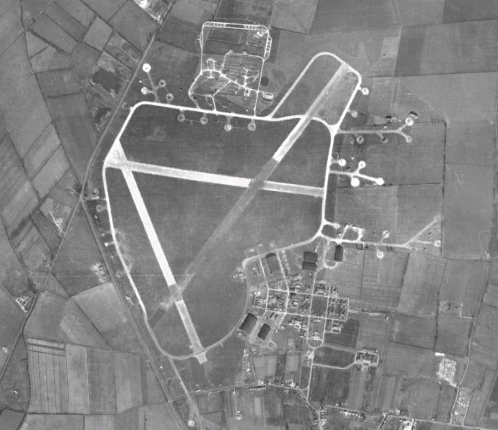
RAF Waterbeach

Royal Air Force Waterbeach or more simply RAF Waterbeach is a former Royal Air Force station located in Waterbeach, Cambridgeshire which is about 5.5 miles...

Waterbeach Barracks

Waterbeach Barracks is a former military installation in Waterbeach, Cambridgeshire. The site was an RAF Station, RAF Waterbeach and then used by the Royal...

Waterbeach

Waterbeach is an expanding village 6 miles (9.7 km) north of Cambridge on the edge of The Fens, in the South Cambridgeshire district of Cambridgeshire...

Fen Edge

Fen Edge is an area and collection of villages in the South Cambridgeshire district of Cambridgeshire, England. The five villages in Fen Edge are Cottenham...

Church of St John the Evangelist, Waterbeach

The Anglican Church of St John the Evangelist (also known as St John's Church) is the parish church of the village of Waterbeach in Cambridgeshire, England...

Waterbeach Abbey

Waterbeach Abbey was an abbey at Waterbeach in Cambridgeshire, England. It was established in 1294 by nuns from the Second Order of St. Francis who had...

Cottenham Village College

Cottenham Village College is an academy school located in Cottenham, Cambridgeshire, England. The school offers secondary education to pupils from the...

Nearby Amenities

Located within 500m of 52.271517,0.160326
Chamberlains Manor
Historic: archaeological_site
Ruins: yes
Lat/Long: 52.2679042/0.1640233
College House
Addr Housenumber: 82-84
Addr Street: Green End
Building: house
Source: dictaphone
Lat/Long: 52.270977/0.1632636
Hatley's Children's Pit
Addr Street: Green End
Natural: water
Operator: Waterbeach Angling Club
Source: dictaphone
Lat/Long: 52.2698434/0.162988
Man Made: pumping_station
Operator: Cambridge Water
Source: dictaphone
Utility: sewage
Lat/Long: 52.2693106/0.1623329
Old Beach Farm
Addr City: Landbeach
Addr Housename: Old Beach Farm
Addr Housenumber: 89
Addr Postcode: CB25 9FD
Addr Street: Green End
Building: house
Source Name: survey
Wikidata: Q26420289
Lat/Long: 52.2685526/0.161073
North Farm
Addr Housenumber: 91
Addr Street: Green End
Building: house
Source: survey
Wikidata: Q26473723
Lat/Long: 52.2687593/0.1613465
Skachbow Cottage
Addr Housenumber: 95
Building: house
Source Name: survey
Lat/Long: 52.2690088/0.1613412
Addr Housenumber: 40
Addr Postcode: CB25 9FD
Addr Street: Green End
Source Addr Housenumber: survey
Lat/Long: 52.2689804/0.1620452
Addr Housenumber: 99
Addr Street: Green End
Building: house
Source Name: survey
Lat/Long: 52.2692222/0.1616523
Virginia Cottage, unnamed
Addr Housenumber: 83-81
Building: house
Source Name: survey
Lat/Long: 52.267977/0.1607267
Jasmine Cottage, unnamed
Addr Housenumber: 79
Building: house
Source Name: survey
Lat/Long: 52.267744/0.1606463
Addr Housenumber: 65-73
Addr Street: Green End
Building: house
Lat/Long: 52.2673138/0.1610002
Addr Housenumber: 75
Addr Street: Green End
Building: house
Lat/Long: 52.2675765/0.1609252
Widow's Cottage
Addr Housenumber: 18
Addr Street: Green End
Building: house
Source Addr Housenumber: survey
Lat/Long: 52.2675655/0.161526
Clerk's Cottage
Addr Housenumber: 30
Addr Street: Green End
Building: house
Source Addr Housenumber: survey
Lat/Long: 52.2680686/0.1618964
Duck Cottage, unnamed
Addr Housenumber: 22-20
Addr Street: Green End
Building: house
Source Addr Housenumber: survey
Lat/Long: 52.2676476/0.1615984
Beach Farm
Addr Housenumber: 87
Building: house
Source Name: survey
Lat/Long: 52.2682002/0.1609896
Maple Lodge
Addr Housenumber: 97
Building: house
Source Name: survey
Lat/Long: 52.2690876/0.1615772
Addr Housenumber: 38
Addr Street: Green End
Building: house
Source Addr Housenumber: survey
Lat/Long: 52.2685232/0.1619967
Power: pole
Lat/Long: 52.2678667/0.1585567
Power: pole
Lat/Long: 52.2701941/0.1626749
Power: pole
Source: bing
Lat/Long: 52.271137/0.1637055
Power: pole
Lat/Long: 52.2699064/0.1625019
Power: pole
Source: bing
Lat/Long: 52.2694366/0.1614793
Power: pole
Lat/Long: 52.2705141/0.162874
Power: pole
Lat/Long: 52.2696602/0.1623429
Pole: air_to_ground
Power: pole
Lat/Long: 52.2686249/0.1621337
Power: pole
Source: bing
Lat/Long: 52.2686858/0.1598209
Power: pole
Lat/Long: 52.2692691/0.1622633
Power: pole
Source: bing
Lat/Long: 52.2711809/0.1632797
Power: pole
Lat/Long: 52.2690148/0.1622115
Power: pole
Lat/Long: 52.269391/0.1619373
Power: pole
Source: bing
Transformer: yes
Lat/Long: 52.2694838/0.1610085
Power: pole
Lat/Long: 52.2677319/0.1591372
Power: pole
Lat/Long: 52.267516/0.1601122
Barrier: bollard
Lat/Long: 52.2737686/0.1644561
Power: pole
Source: bing
Lat/Long: 52.2755761/0.1574618
Power: pole
Source: bing
Lat/Long: 52.2757861/0.1589531
Bench
Backrest: yes
Inscription: In commemoration of 40 years of peace 1945-1985
Material: wood
Openbenches Id: 23462
Lat/Long: 52.2671429/0.1610821
Direction: backward
Traffic Calming: choker
Lat/Long: 52.2676841/0.1614387
The data included in this document is from www.openstreetmap.org. The data is made available under ODbL.

Have you been to Landbeach?

Leave your review of Landbeach below (or comments, questions and feedback).