Laceby

Civil Parish in Lincolnshire

England

Laceby

Fields near Walk Farm
Fields near Walk Farm Credit: David Brown

Laceby is a civil parish located in the county of Lincolnshire, in the East Midlands region of England. It lies approximately 4 miles northeast of the port town of Grimsby and covers an area of around 3.5 square miles. The parish is primarily rural, with a population of just over 1,200 people.

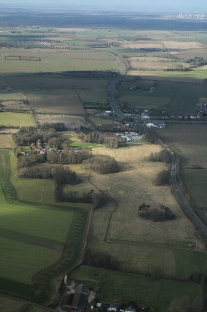
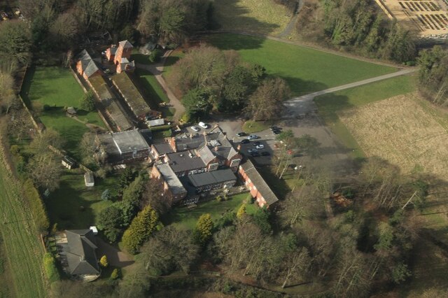
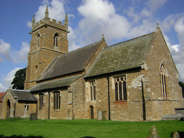
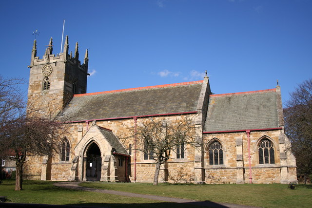
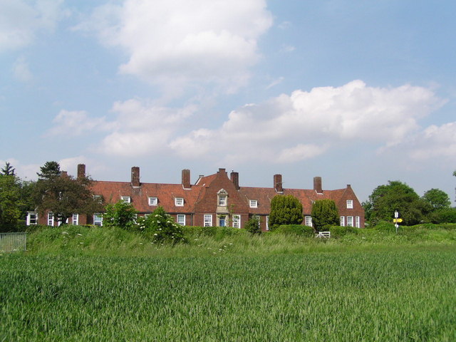
The village of Laceby itself is a picturesque settlement, boasting charming cottages and well-maintained gardens. It has a long history, dating back to at least the 11th century, and features several listed buildings, including All Saints Church, which dates back to the 13th century.

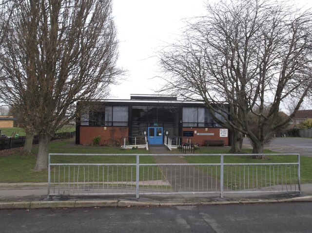
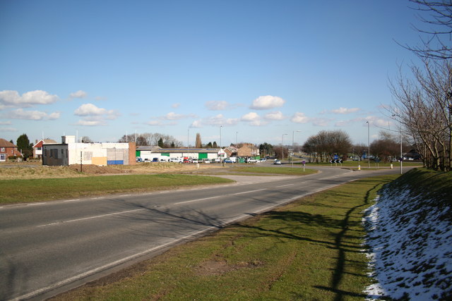
Laceby is well-served by amenities, with a village shop, a post office, and a primary school catering to the local community. The village also has a village hall, which is used for various events and gatherings throughout the year.

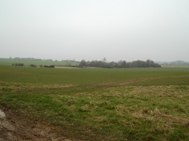
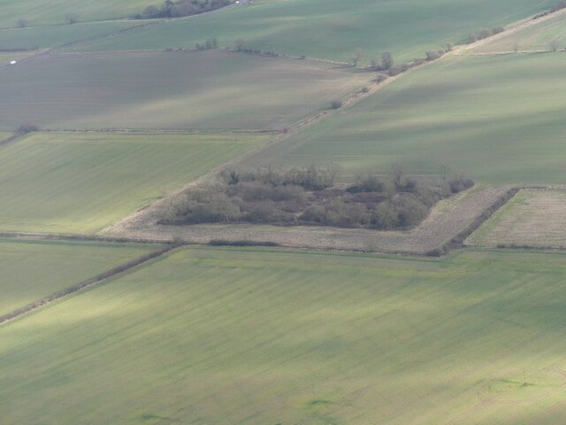
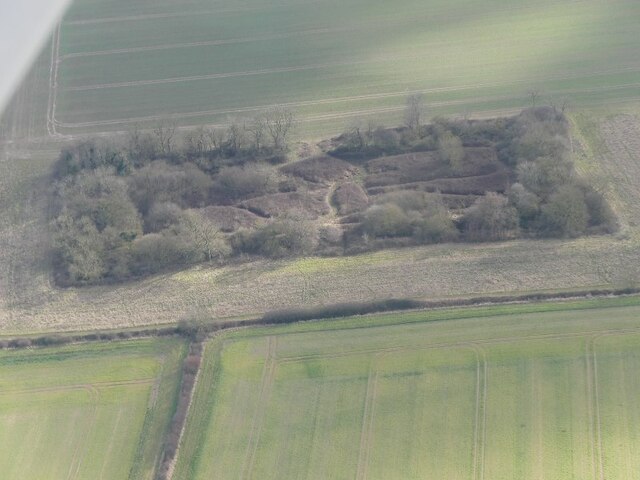
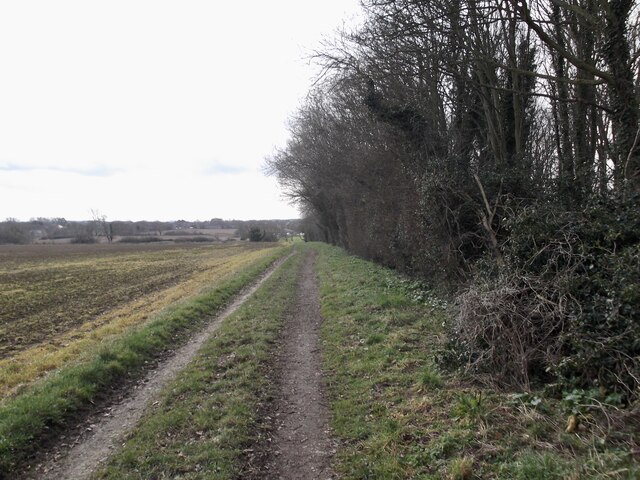
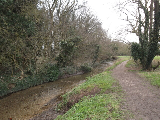
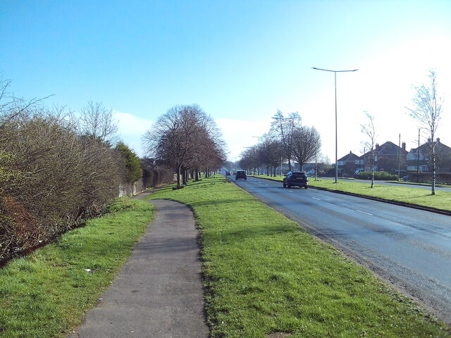
The surrounding countryside offers scenic walking and cycling routes, with the nearby Laceby Beck providing a tranquil setting for nature lovers. The parish is also home to several farms, contributing to the area's agricultural character.

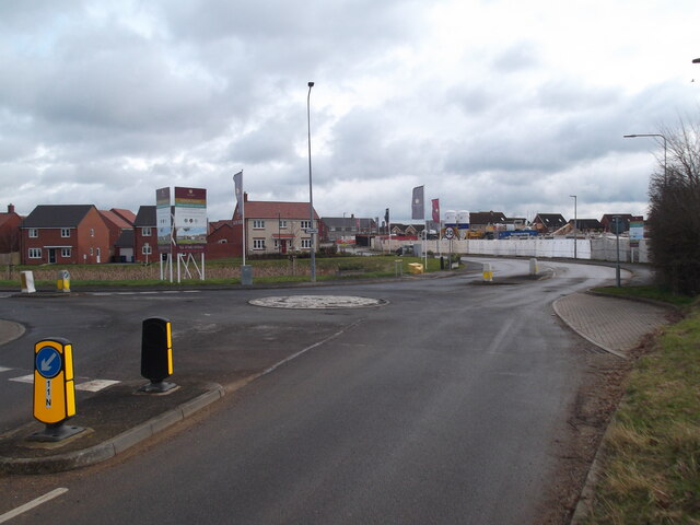
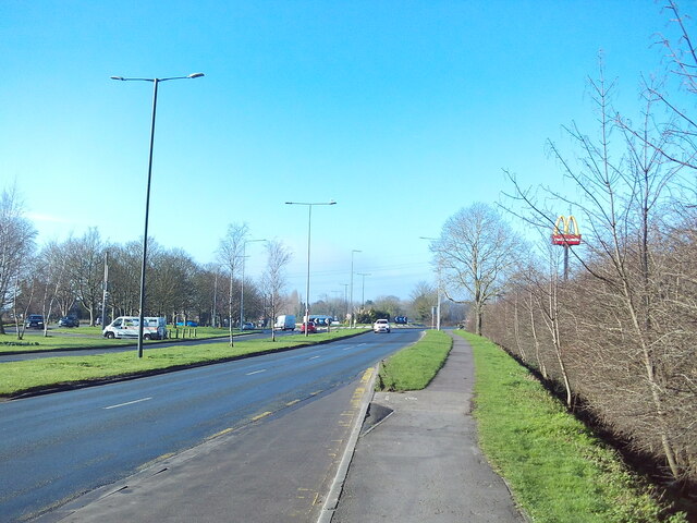
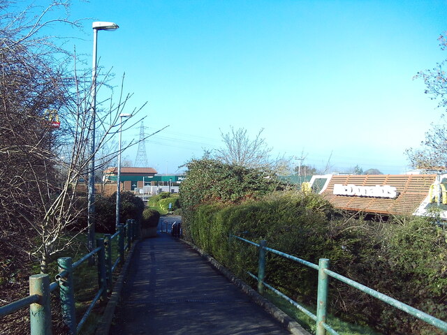
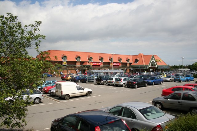
Laceby benefits from good transport links, with the A46 road passing nearby, connecting it to Grimsby and the wider region. The nearby town of Grimsby provides further amenities, including shopping centers, leisure facilities, and secondary schools.

Overall, Laceby is a peaceful and picturesque civil parish, offering a rural lifestyle within easy reach of larger towns and amenities.

If you have any feedback on the listing, please let us know in the comments section below.

Laceby Images

Images are sourced within 2km of 53.538391/-0.161091 or Grid Reference TA2106. Thanks to Geograph Open Source API. All images are credited.

Fields near Walk Farm
Oaklands Hotel and area, Irby upon Humber: aerial 2022
Oaklands Hotel, Irby upon Humber: aerial 2022
Civil War earthwork near Irby on Humber: aerial 2022 (1) Next to the Wanderlust Way.

Civil War earthwork fort, comprising a rectangular earthen rampart with projecting bastions at each of its four corners, an enclosing ditch, and a counterscarp bank. 

The fort is believed to have enclosed a hall belonging to the Holles family. The Holles family, ennobled by James I, was split by the Civil War; Denzil, an MP, commanded Parliamentary troops, while his cousin Gervase, MP for Grimsby, was a prominent supporter of Charles I. 

Such fortification of manors was fairly common during the first English Civil War (1642-46), and is also recorded in Humberside at Scorborough, home of the Hotham family. The battle to control Lincolnshire was fiercely contested throughout late 1642 and 1643. For much of this time the king's forces controlled much of the county and sought to prevent the Parliamentarians in Hull and Boston from communicating and from moving troops up and down the county. It is likely that this monument was built at about that time, by the king's forces, to keep a watch on the major north-south routes. 

See: <span class="nowrap"><a title="http://www.nelalhs.co.uk/?page_id=24," rel="nofollow ugc noopener" href="http://www.nelalhs.co.uk/?page_id=24,">Link</a><img style="margin-left:2px;" alt="External link" title="External link - shift click to open in new window" src="https://s1.geograph.org.uk/img/external.png" width="10" height="10"/></span> 
<span class="nowrap"><a title="https://www.heritagegateway.org.uk/Gateway/Results_Single.aspx?uid=MNL62&resourceID=1039," rel="nofollow ugc noopener" href="https://www.heritagegateway.org.uk/Gateway/Results_Single.aspx?uid=MNL62&resourceID=1039,">Link</a><img style="margin-left:2px;" alt="External link" title="External link - shift click to open in new window" src="https://s1.geograph.org.uk/img/external.png" width="10" height="10"/></span>
<a href="https://www.geograph.org.uk/photo/7144724">TA2104 : Civil War earthwork near Irby on Humber: aerial 2022 (2)</a> and <a href="https://www.geograph.org.uk/photo/4207609">TA2104 : Tree-edged Earthworks near Walk Farm, Irby</a>.
Civil War earthwork near Irby on Humber: aerial 2022 (1)
Next to the Wanderlust Way. Civil War earthwork fort, comprising a rectangular earthen rampart with projecting bastions at each of its four corners, an enclosing ditch, and a counterscarp bank. The fort is believed to have enclosed a hall belonging to the Holles family. The Holles family, ennobled by James I, was split by the Civil War; Denzil, an MP, commanded Parliamentary troops, while his cousin Gervase, MP for Grimsby, was a prominent supporter of Charles I. Such fortification of manors was fairly common during the first English Civil War (1642-46), and is also recorded in Humberside at Scorborough, home of the Hotham family. The battle to control Lincolnshire was fiercely contested throughout late 1642 and 1643. For much of this time the king's forces controlled much of the county and sought to prevent the Parliamentarians in Hull and Boston from communicating and from moving troops up and down the county. It is likely that this monument was built at about that time, by the king's forces, to keep a watch on the major north-south routes. See: LinkExternal link LinkExternal link TA2104 : Civil War earthwork near Irby on Humber: aerial 2022 (2) and TA2104 : Tree-edged Earthworks near Walk Farm, Irby.
Civil War earthwork near Irby on Humber: aerial 2022 (2) Next to the Wanderlust Way.

Civil War earthwork fort, comprising a rectangular earthen rampart with projecting bastions at each of its four corners, an enclosing ditch, and a counterscarp bank. 
The fort is believed to have enclosed a hall belonging to the Holles family. The Holles family, ennobled by James I, was split by the Civil War; Denzil, an MP, commanded Parliamentary troops, while his cousin Gervase, MP for Grimsby, was a prominent supporter of Charles I. 

Such fortification of manors was fairly common during the first English Civil War (1642-46), and is also recorded in Humberside at Scorborough, home of the Hotham family. The battle to control Lincolnshire was fiercely contested throughout late 1642 and 1643. For much of this time the king's forces controlled much of the county and sought to prevent the Parliamentarians in Hull and Boston from communicating and from moving troops up and down the county. It is likely that this monument was built at about that time, by the king's 
forces, to keep a watch on the major north-south routes. 

See: <span class="nowrap"><a title="http://www.nelalhs.co.uk/?page_id=24," rel="nofollow ugc noopener" href="http://www.nelalhs.co.uk/?page_id=24,">Link</a><img style="margin-left:2px;" alt="External link" title="External link - shift click to open in new window" src="https://s1.geograph.org.uk/img/external.png" width="10" height="10"/></span> 
<span class="nowrap"><a title="https://www.heritagegateway.org.uk/Gateway/Results_Single.aspx?uid=MNL62&resourceID=1039," rel="nofollow ugc noopener" href="https://www.heritagegateway.org.uk/Gateway/Results_Single.aspx?uid=MNL62&resourceID=1039,">Link</a><img style="margin-left:2px;" alt="External link" title="External link - shift click to open in new window" src="https://s1.geograph.org.uk/img/external.png" width="10" height="10"/></span>
<a href="https://www.geograph.org.uk/photo/7144721">TA2104 : Civil War earthwork near Irby on Humber: aerial 2022 (1)</a> and <a href="https://www.geograph.org.uk/photo/4207609">TA2104 : Tree-edged Earthworks near Walk Farm, Irby</a>.
Civil War earthwork near Irby on Humber: aerial 2022 (2)
Next to the Wanderlust Way. Civil War earthwork fort, comprising a rectangular earthen rampart with projecting bastions at each of its four corners, an enclosing ditch, and a counterscarp bank. The fort is believed to have enclosed a hall belonging to the Holles family. The Holles family, ennobled by James I, was split by the Civil War; Denzil, an MP, commanded Parliamentary troops, while his cousin Gervase, MP for Grimsby, was a prominent supporter of Charles I. Such fortification of manors was fairly common during the first English Civil War (1642-46), and is also recorded in Humberside at Scorborough, home of the Hotham family. The battle to control Lincolnshire was fiercely contested throughout late 1642 and 1643. For much of this time the king's forces controlled much of the county and sought to prevent the Parliamentarians in Hull and Boston from communicating and from moving troops up and down the county. It is likely that this monument was built at about that time, by the king's forces, to keep a watch on the major north-south routes. See: LinkExternal link LinkExternal link TA2104 : Civil War earthwork near Irby on Humber: aerial 2022 (1) and TA2104 : Tree-edged Earthworks near Walk Farm, Irby.
Aylesby Lane
Aylesby Lane
Cooper Lane, Laceby
Cooper Lane, Laceby
Stanford Centre and Library
New builds in Laceby
Laceby Beck
Laceby Beck
Grimsby Road, Laceby Acres (1) The A46 immediately west of Grimsby, looking towards Laceby village from the bus stop outside the Morrisons supermarket.
Grimsby Road, Laceby Acres (1)
The A46 immediately west of Grimsby, looking towards Laceby village from the bus stop outside the Morrisons supermarket.
Footpath off Grimsby Road, Laceby Acres Leading from the bus stop on Grimsby Road to the Morrisons supermarket car park. The supermarket itself is, of course, at the far end of the car park.
Footpath off Grimsby Road, Laceby Acres
Leading from the bus stop on Grimsby Road to the Morrisons supermarket car park. The supermarket itself is, of course, at the far end of the car park.
Grimsby Road, Laceby Acres (2) The A46 immediately west of Grimsby, looking towards the edge of the town (at which point it becomes Laceby Road) from the bus stop outside the Morrisons supermarket.
Grimsby Road, Laceby Acres (2)
The A46 immediately west of Grimsby, looking towards the edge of the town (at which point it becomes Laceby Road) from the bus stop outside the Morrisons supermarket.
St.Lawrence's church, Aylesby, Lincs. Solid N.Lincs. ironstone Victorian restoration of an otherwise medieval church interior.
St.Lawrence's church, Aylesby, Lincs.
Solid N.Lincs. ironstone Victorian restoration of an otherwise medieval church interior.
St.Margaret's church, Laceby, Lincs. A 13th century tower and curious 5 bay north arcade, the middle bay only is Norman. Much Victorian restoration, but well done.
St.Margaret's church, Laceby, Lincs.
A 13th century tower and curious 5 bay north arcade, the middle bay only is Norman. Much Victorian restoration, but well done.
Laceby Junction The A46 / A18 junction near Laceby
Laceby Junction
The A46 / A18 junction near Laceby
McAulay Memorial Homes, Aylesby The building was erected in the memory of Captain Francis Willmer McAulay RFA (TF) who was killed in action on May 21st, 1916. He was the only son of a family who for three generations farmed some 80 acres at Aylesby. The intention was to provide homes, not so much for old people as for anyone in difficult circumstances, such as widows with young children, or disabled ex-servicemen with families.
McAulay Memorial Homes, Aylesby
The building was erected in the memory of Captain Francis Willmer McAulay RFA (TF) who was killed in action on May 21st, 1916. He was the only son of a family who for three generations farmed some 80 acres at Aylesby. The intention was to provide homes, not so much for old people as for anyone in difficult circumstances, such as widows with young children, or disabled ex-servicemen with families.
Morrison's Supermarket On Laceby Road just outside Grimsby
Morrison's Supermarket
On Laceby Road just outside Grimsby
Show me another place!

Laceby is located at Grid Ref: TA2106 (Lat: 53.538391, Lng: -0.161091)

Unitary Authority: North East Lincolnshire

Police Authority: Humberside

What 3 Words

///faded.reputable.hovered. Near Laceby, Lincolnshire

Nearby Locations

Laceby Laceby

Related Wikis

Laceby

Laceby is a village and civil parish in North East Lincolnshire, England. It is situated on the A46 road, just outside the western boundary of Grimsby...

Church of St Margaret, Laceby

The Church of St Margaret is the Anglican Grade I listed parish church for the village of Laceby in Lincolnshire. Listed since 1967 and dedicated to St...

Borough of Cleethorpes

Cleethorpes was a local government district in Humberside, England from 1974 to 1996. It was granted borough status in 1975. It was formed on 1 April...

Aylesby

Aylesby is a village and civil parish in North East Lincolnshire, England. It is situated near the A18 road, approximately 4 miles (6 km) west from Cleethorpes...

Nearby Amenities

Located within 500m of 53.538391,-0.161091
Bus Stop
George Butler Close
Naptan AtcoCode: 228000059299
Naptan Bearing: W
Naptan CommonName: George Butler Close
Naptan Crossing: George Butler Close
Naptan Indicator: adj
Naptan NaptanCode: gritpdw
Naptan Notes: none
Naptan PlusbusZoneRef: GRMSBYT
Naptan Street: Grimsby Road
Naptan Verified: no
Source: naptan_import
Lat/Long: 53.5409765/-0.1647257
Bus Stop
Grimsby Road
Naptan AtcoCode: 228000059300
Naptan Bearing: E
Naptan CommonName: Grimsby Road
Naptan Indicator: E-bound
Naptan Landmark: Red Houses
Naptan NaptanCode: gritwdw
Naptan Notes: none
Naptan PlusbusZoneRef: GRMSBYT
Naptan Street: Grimsby Road
Naptan Verified: no
Source: naptan_import
Lat/Long: 53.5416915/-0.1621139
Bus Stop
George Butler Close
Naptan AtcoCode: 2280065045
Naptan Bearing: E
Naptan CommonName: George Butler Close
Naptan Crossing: George Butler Close
Naptan Indicator: opp
Naptan NaptanCode: gridagp
Naptan PlusbusZoneRef: GRMSBYT
Naptan Street: Grimsby Road
Naptan Verified: no
Source: naptan_import
Lat/Long: 53.5410935/-0.1647357
Bus Stop
Grimsby Road
Naptan AtcoCode: 2280065050
Naptan Bearing: SW
Naptan CommonName: Grimsby Road
Naptan Indicator: SW-bound
Naptan Landmark: Red Houses
Naptan NaptanCode: gridwgp
Naptan Street: Grimsby Road
Naptan Verified: no
Source: naptan_import
Lat/Long: 53.5414526/-0.1623657
Mini Roundabout
Lat/Long: 53.5401889/-0.157784
The data included in this document is from www.openstreetmap.org. The data is made available under ODbL.

Have you been to Laceby?

Leave your review of Laceby below (or comments, questions and feedback).