Kinwarton

Civil Parish in Warwickshire Stratford-on-Avon

England

Kinwarton

Arden Way  towards New End Farm Tree-lined banks to this lane with a lot of bluebells.
Arden Way towards New End Farm Credit: Trevor Rickard

Kinwarton is a civil parish located in the county of Warwickshire, England. It is situated approximately three miles east of the town of Alcester and covers an area of about 6.5 square kilometers. The parish is bordered by the River Alne to the north and is surrounded by picturesque countryside.

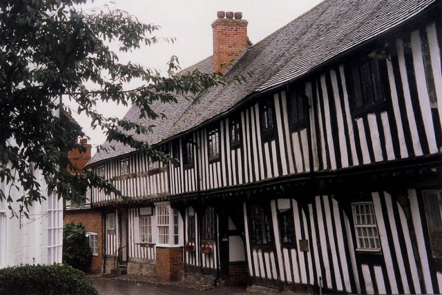
The village of Kinwarton itself is small and primarily residential, with a population of around 200 people. It features a mix of traditional stone cottages and more modern houses. The parish also includes a number of scattered farms and agricultural land.

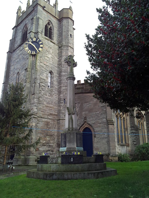
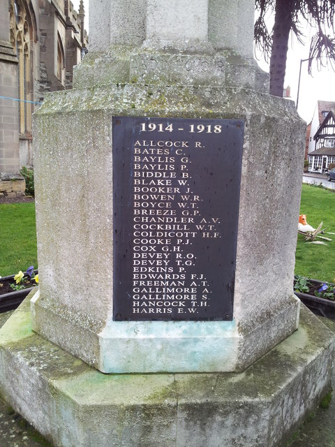
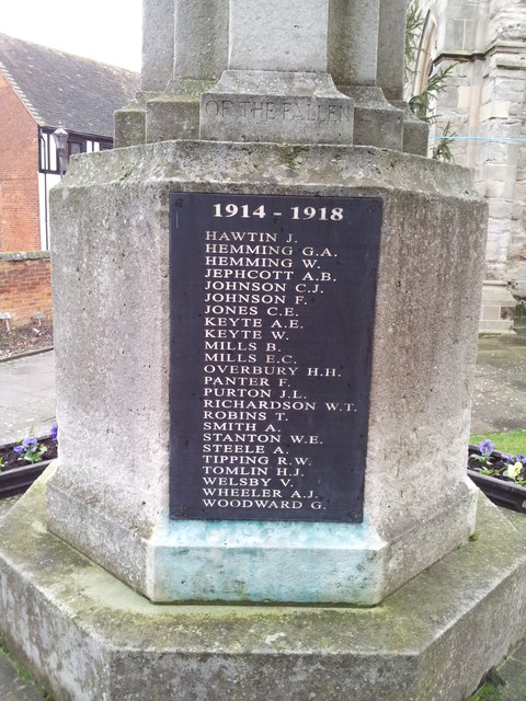
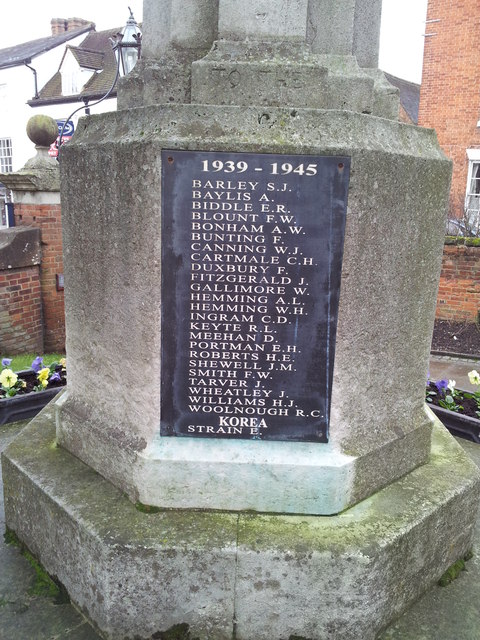
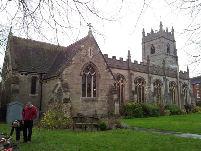
One notable landmark in Kinwarton is the Church of St. Mary the Virgin, which dates back to the 13th century. This historic church has a distinctive tower and a charming interior with stained glass windows and wooden pews. It serves as a focal point for the local community and holds regular religious services.

The surrounding countryside offers ample opportunities for outdoor activities such as walking, cycling, and horse riding. The River Alne is a popular spot for fishing and provides a tranquil setting for picnics and relaxation. The area is known for its scenic beauty, with rolling hills, meadows, and woodlands.

Despite its small size, Kinwarton benefits from good transportation links, with easy access to the nearby towns of Alcester and Stratford-upon-Avon. It provides a peaceful and idyllic rural setting, making it an attractive place to live for those seeking a quieter lifestyle away from the hustle and bustle of larger towns and cities.

If you have any feedback on the listing, please let us know in the comments section below.
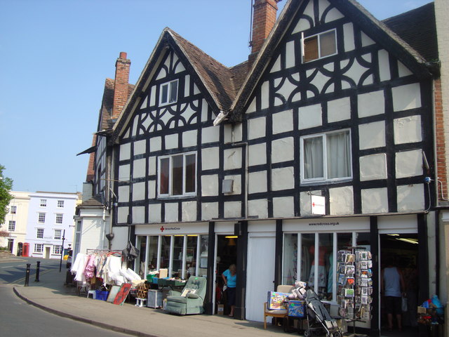
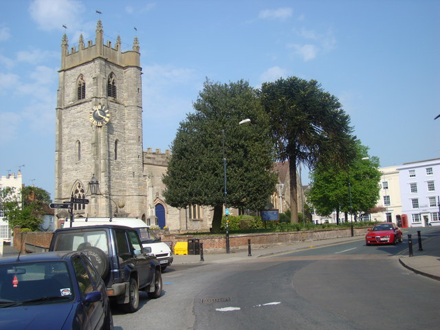
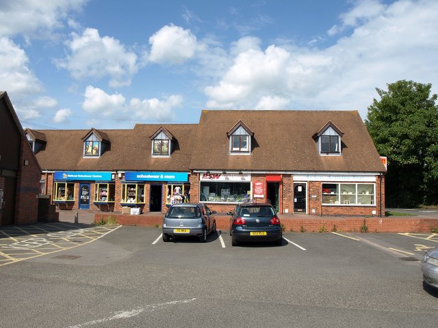
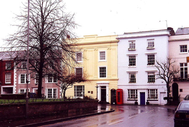
Kinwarton Images

Images are sourced within 2km of 52.22484/-1.853452 or Grid Reference SP1058. Thanks to Geograph Open Source API. All images are credited.

Arden Way  towards New End Farm Tree-lined banks to this lane with a lot of bluebells.
Arden Way towards New End Farm
Tree-lined banks to this lane with a lot of bluebells.
Ploughed field south of the Arden Way
The Arden Way The Arden Way to the east of Coughton.
The Arden Way
The Arden Way to the east of Coughton.
The Arden Way A shady section of the Arden Way to the east of Coughton.
The Arden Way
A shady section of the Arden Way to the east of Coughton.
Red Cross Shop, Alcester The Red Cross shop in Alcester is housed in a black and white beamed building on the High Street
Red Cross Shop, Alcester
The Red Cross shop in Alcester is housed in a black and white beamed building on the High Street
St Nicholas Church, Alcester Standing on the High St in Alcester is St Nicholas Church. The clock is placed in an unusual position on a corner of the tower, but located there it is visible for the length of the High St
St Nicholas Church, Alcester
Standing on the High St in Alcester is St Nicholas Church. The clock is placed in an unusual position on a corner of the tower, but located there it is visible for the length of the High St
Eddie Stobart Chilled Ltd, Alcester The Eddie Stobart Chilled Ltd distribution centre beside the A435 near Alcester.  I passed this distribution centre in July 2012 and Stobart's have moved out and the premises is to let.
Eddie Stobart Chilled Ltd, Alcester
The Eddie Stobart Chilled Ltd distribution centre beside the A435 near Alcester. I passed this distribution centre in July 2012 and Stobart's have moved out and the premises is to let.
Shops in Alcester Modern educationally-oriented shops on Bulls Head Yard at the north end of the town's main car park; they offer schoolwear, crafts and stationery, and activity toys.
Shops in Alcester
Modern educationally-oriented shops on Bulls Head Yard at the north end of the town's main car park; they offer schoolwear, crafts and stationery, and activity toys.
Church Street, Alcester On a rainy day
Church Street, Alcester
On a rainy day
Alcester war memorial in the grounds of St Nicholas Church
Names on the Alcester War Memorial 1 Close up of the War Memorial <a href="https://www.geograph.org.uk/photo/2806956">SP0957 : Alcester war memorial in the grounds of St Nicholas Church</a>
Names on the Alcester War Memorial 1
Names on the Alcester War Memorial 2 Close up of the War Memorial <a href="https://www.geograph.org.uk/photo/2806956">SP0957 : Alcester war memorial in the grounds of St Nicholas Church</a>
Names on the Alcester War Memorial 2
Names on the Alcester War Memorial 3 Close up of the War Memorial <a href="https://www.geograph.org.uk/photo/2806956">SP0957 : Alcester war memorial in the grounds of St Nicholas Church</a>
Names on the Alcester War Memorial 3
Names on the Alcester War Memorial 4 Close up of the War Memorial <a href="https://www.geograph.org.uk/photo/2806956">SP0957 : Alcester war memorial in the grounds of St Nicholas Church</a>
Names on the Alcester War Memorial 4
St Nicholas Church, Alcester Photographed from the rear
St Nicholas Church, Alcester
Photographed from the rear
Alcester High Street
St Nicholas Church & Church Street, Alcester
Medieval houses, Malt Mill Lane, Alcester
Show me another place!

Kinwarton is located at Grid Ref: SP1058 (Lat: 52.22484, Lng: -1.853452)

Administrative County: Warwickshire

District: Stratford-on-Avon

Police Authority: Warwickshire

What 3 Words

///obey.disco.yacht. Near Alcester, Warwickshire

Related Wikis

Alcester Academy

Alcester Academy (formerly known as Alcester High School Technology College) is a state secondary school that educates girls and boys aged between 11 and...

Kinwarton Dovecote

Kinwarton Dovecote is circular 14th-century dovecote situated on the edge of the village of Kinwarton, near Alcester, Warwickshire, England. The dovecote...

Alne End

Alne End is a village in Warwickshire, England. Population details can be found under Great Alne.

St Benedict's Catholic High School, Alcester

St Benedict's Catholic High School is a co-educational Roman Catholic secondary school and sixth form. It is located in Alcester in the English county...

Alcester Town F.C.

Alcester Town Football Club is a football club based in Alcester, Warwickshire, England. They are currently members of the Midland League Division Two...
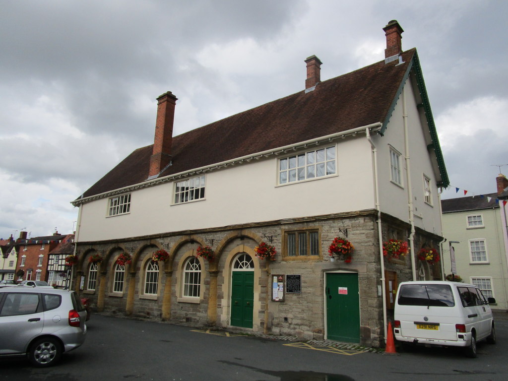
Alcester Town Hall

Alcester Town Hall is the town hall of Alcester, Warwickshire, England. It is a grade I listed building. == History == The lower part of the two-storey...

River Arrow Nature Reserve

River Arrow Nature Reserve is a local nature reserve located alongside the River Arrow in Alcester, Warwickshire, England. The reserve was set up by Stratford...

Alcester Abbey

Alcester Abbey was a Benedictine monastery in Alcester, Warwickshire in England, founded in 1138 by the Botellers of Oversley, Warwickshire. Its many endowments...

Nearby Amenities

Located within 500m of 52.22484,-1.853452
Barrier: kissing_gate
Lat/Long: 52.2251559/-1.8567887
Bus Stop
Alcester High School
Bus: yes
Naptan AtcoCode: 4200F131711
Naptan Bearing: NE
Naptan CommonName: Alcester High School
Naptan Indicator: Opp
Naptan NaptanCode: wardgapg
Naptan Street: Captains Hill
Naptan Verified: no
Public Transport: platform
Source: naptan_import
Lat/Long: 52.22151/-1.8574531
Bus Stop
Alcester High School
Bus: yes
Naptan AtcoCode: 4200F131712
Naptan Bearing: SW
Naptan CommonName: Alcester High School
Naptan Indicator: Adj
Naptan NaptanCode: wardgawj
Naptan Street: Captains Hill
Naptan Verified: no
Public Transport: platform
Source: naptan_import
Lat/Long: 52.2212999/-1.8577998
Power: pole
Lat/Long: 52.2268038/-1.8480527
Power: pole
Lat/Long: 52.227697/-1.8522553
Power: pole
Lat/Long: 52.2261789/-1.8467166
Power: pole
Lat/Long: 52.2281242/-1.8542616
Power: pole
Lat/Long: 52.2285168/-1.8561311
Power: pole
Lat/Long: 52.2272682/-1.8502035
Addr City: Alcester
Addr Housenumber: 12
Addr Street: Fisher Road
Survey Date: 2013-09-29
Lat/Long: 52.2239683/-1.8605851
Addr City: Alcester
Addr Housenumber: 14
Addr Street: Fisher Road
Survey Date: 2013-09-29
Lat/Long: 52.2240226/-1.8605673
Addr City: Alcester
Addr Housenumber: 16
Addr Street: Fisher Road
Survey Date: 2013-09-29
Lat/Long: 52.2241135/-1.8605629
Addr City: Alcester
Addr Housenumber: 23
Addr Street: Wakefield Way
Lat/Long: 52.2233305/-1.8602349
Addr City: Alcester
Addr Housenumber: 37
Addr Street: Kinnersley Road
Lat/Long: 52.2231572/-1.8602211
Noexit: yes
Lat/Long: 52.2238857/-1.8599483
Noexit: yes
Lat/Long: 52.2239402/-1.8599548
Man Made: survey_point
Ref: S5506
Source: survey
Lat/Long: 52.2241039/-1.8580505
Barrier: kissing_gate
Lat/Long: 52.2238988/-1.8472803
Post Box
Collection Times: Mo-Fr 09:00; Sa 07:00
Operator: Royal Mail
Post Box Type: lamp
Ref: B49 56D
Royal Cypher: EIIR
Royal Cypher Wikidata: Q33102113
Source: survey
Lat/Long: 52.2239718/-1.8509378
Cafe
Arden Café
Lat/Long: 52.2258755/-1.8596345
Arden Motorcycles
Shop: motorcycle
Lat/Long: 52.2258213/-1.8599805
Power: pole
Source: Warwicks CC Aerial Imagery 2013
Lat/Long: 52.2232825/-1.8480971
Power: pole
Source: Warwicks CC Aerial Imagery 2013
Lat/Long: 52.2235614/-1.8477857
Power: pole
Source: Warwicks CC Aerial Imagery 2013
Lat/Long: 52.2238425/-1.8474889
Power: pole
Source: Warwicks CC Aerial Imagery 2013
Lat/Long: 52.2248902/-1.8466894
Power: pole
Lat/Long: 52.2241829/-1.8532707
Power: pole
Ref: 774118
Source: wpd_opendata
Transformer: distribution
Lat/Long: 52.2243619/-1.8517679
Power: pole
Ref: 774113
Source: wpd_opendata
Transformer: distribution
Lat/Long: 52.2245058/-1.8505201
Power: pole
Lat/Long: 52.2244283/-1.8487056
Kinwarton Pumps
Power: pole
Source: Warwicks CC Aerial Imagery 2013
Transformer: distribution
Voltage Primary: 11000
Lat/Long: 52.2243494/-1.846792
Barrier: kissing_gate
Lat/Long: 52.2269993/-1.8596883
Barrier: stile
Foot: designated
Horse: permissive
Material: wood
Motor Vehicle: no
Stile: stepover_with_missing_post
Lat/Long: 52.2239051/-1.8473317
Barrier: stile
Foot: designated
Lat/Long: 52.2259979/-1.8493559
Power: pole
Source: bing
Lat/Long: 52.2230429/-1.859593
Power: pole
Source: bing
Lat/Long: 52.2233535/-1.8582907
Power: pole
Ref: 773518
Source: wpd_opendata
Transformer: distribution
Lat/Long: 52.2238037/-1.856373
Power: pole
Source: bing
Lat/Long: 52.2240304/-1.8547985
The data included in this document is from www.openstreetmap.org. The data is made available under ODbL.

Have you been to Kinwarton?

Leave your review of Kinwarton below (or comments, questions and feedback).