Kinver

Civil Parish in Staffordshire South Staffordshire

England

Kinver

Canal at Dunsley Tunnel near kinver, Staffordshire Looking east from Dunsley Tunnel (Bridge No 31) on the Staffordshire and Worcestershire Canal.
Canal at Dunsley Tunnel near kinver, Staffordshire Credit: Roger Kidd

Kinver is a civil parish located in the county of Staffordshire, England. It is situated approximately 10 miles west of Wolverhampton and 6 miles north of Kidderminster. The parish covers an area of around 12 square miles and has a population of approximately 7,000 residents.

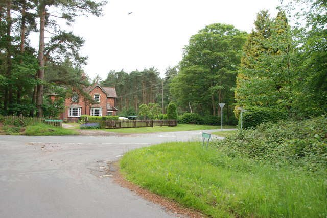
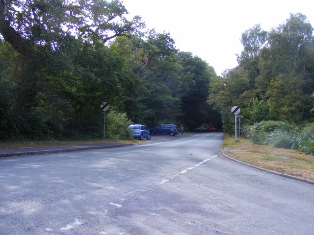
The village of Kinver is known for its picturesque setting, nestled within the Kinver Edge and the surrounding countryside. Kinver Edge is a prominent sandstone ridge that offers stunning views of the surrounding landscape, including the nearby Clent Hills and Worcestershire countryside. The Edge is also home to the Kinver Edge Rock Houses, a collection of cave dwellings that were inhabited until the early 20th century and are now managed by the National Trust.

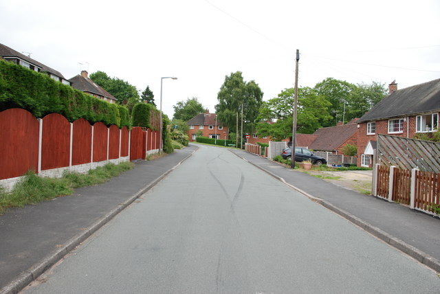
In addition to its natural beauty, Kinver has a rich history. The village has a number of historic buildings, including the 12th-century St. Peter's Church and the Tudor-era Kinver Court. The village also has a strong sense of community, with a range of amenities and facilities available to residents, including shops, pubs, a primary school, and a village hall.

Kinver is well-connected to the surrounding areas by road, with the A449 passing through the parish, providing easy access to nearby towns and cities. The village also has a regular bus service, providing further transport links.

Overall, Kinver is a charming village with a rich history, stunning natural surroundings, and a strong community spirit.

If you have any feedback on the listing, please let us know in the comments section below.

Kinver Images

Images are sourced within 2km of 52.45912/-2.216976 or Grid Reference SO8584. Thanks to Geograph Open Source API. All images are credited.

Canal at Dunsley Tunnel near kinver, Staffordshire Looking east from Dunsley Tunnel (Bridge No 31) on the Staffordshire and Worcestershire Canal.
Canal at Dunsley Tunnel near kinver, Staffordshire
Looking east from Dunsley Tunnel (Bridge No 31) on the Staffordshire and Worcestershire Canal.
Canal at Dunsley Tunnel near kinver, Staffordshire Looking east from Dunsley Tunnel (Bridge No 31) on the Staffordshire and Worcestershire Canal.
Canal at Dunsley Tunnel near kinver, Staffordshire
Looking east from Dunsley Tunnel (Bridge No 31) on the Staffordshire and Worcestershire Canal.
Canal north-east of Kinver in Staffordshire The Staffordshire and Worcestershire Canal is meandering towards Kinver and Kidderminster. The Kinver Light Railway (from Amblecote) ran alongside the towpath from 1901 until it closed in February 1930. This is a very popular rural mooring place for crews not obsessed with stopping by a pub.
Canal north-east of Kinver in Staffordshire
The Staffordshire and Worcestershire Canal is meandering towards Kinver and Kidderminster. The Kinver Light Railway (from Amblecote) ran alongside the towpath from 1901 until it closed in February 1930. This is a very popular rural mooring place for crews not obsessed with stopping by a pub.
Canal north-east of Kinver in Staffordshire The Staffordshire and Worcestershire Canal is meandering towards Kinver and Kidderminster. The Kinver Light Railway (from Amblecote) ran alongside the towpath here from 1901 until it closed in February 1930. This is a very popular rural mooring place for crews not requiring the services of a pub.
Canal north-east of Kinver in Staffordshire
The Staffordshire and Worcestershire Canal is meandering towards Kinver and Kidderminster. The Kinver Light Railway (from Amblecote) ran alongside the towpath here from 1901 until it closed in February 1930. This is a very popular rural mooring place for crews not requiring the services of a pub.
Staffordshire and Worcestershire Canal near Kinver in Staffordshire The Staffordshire and Worcestershire Canal is meandering towards Kinver and Kidderminster. The Kinver Light Railway (from Amblecote) ran alongside the towpath here from 1901 until it closed in February 1930. This is a very popular rural mooring place for crews not requiring the services of a pub.
Staffordshire and Worcestershire Canal near Kinver in Staffordshire
The Staffordshire and Worcestershire Canal is meandering towards Kinver and Kidderminster. The Kinver Light Railway (from Amblecote) ran alongside the towpath here from 1901 until it closed in February 1930. This is a very popular rural mooring place for crews not requiring the services of a pub.
River Stour near Kinver in Staffordshire This is looking north (upstream) from close to the canal towpath.
River Stour near Kinver in Staffordshire
This is looking north (upstream) from close to the canal towpath.
Visitor moorings near Kinver in Staffordshire The Staffordshire and Worcestershire Canal meanders on towards Kidderminster and Stourport. Moorings here at Dunsley near Kinver are very good, but can be busy during the summer. If you are travelling north towards Stourton you may need to moor here, east of Kinver Lock. because private moorings dominate the towpath as far as Hyde Lock, nearly three quarters of a mile and two locks distant!
Visitor moorings near Kinver in Staffordshire
The Staffordshire and Worcestershire Canal meanders on towards Kidderminster and Stourport. Moorings here at Dunsley near Kinver are very good, but can be busy during the summer. If you are travelling north towards Stourton you may need to moor here, east of Kinver Lock. because private moorings dominate the towpath as far as Hyde Lock, nearly three quarters of a mile and two locks distant!
Canal at Dunsley near Kinver in Staffordshire Looking east here, the Staffordshire and Worcestershire Canal meanders on sothwards towards Kidderminster and Stourport. Moorings here at Dunsley near Kinver are very good, but can be busy during the summer. If you are travelling north towards Stourton you may need to moor here, east of Kinver Lock. because private moorings dominate the towpath as far as Hyde Lock, nearly three quarters of a mile and two locks distant!
Canal at Dunsley near Kinver in Staffordshire
Looking east here, the Staffordshire and Worcestershire Canal meanders on sothwards towards Kidderminster and Stourport. Moorings here at Dunsley near Kinver are very good, but can be busy during the summer. If you are travelling north towards Stourton you may need to moor here, east of Kinver Lock. because private moorings dominate the towpath as far as Hyde Lock, nearly three quarters of a mile and two locks distant!
Whittington Horse Bridge near Kinver in Staffordshire Whittington Horse Bridge is No 28 across the Staffordshire and Worcestershire Canal. Horse Bridge Lane is reduced to a narrow bridleway as it crosses the water.
<a href="https://www.geograph.org.uk/photo/2899537">SO8582 : Whittington Horse Bridge (No. 28) on the Staffs & Worcs Canal</a>
Whittington Horse Bridge near Kinver in Staffordshire
Whittington Horse Bridge is No 28 across the Staffordshire and Worcestershire Canal. Horse Bridge Lane is reduced to a narrow bridleway as it crosses the water. SO8582 : Whittington Horse Bridge (No. 28) on the Staffs & Worcs Canal
The Old Grammar School The school from 1511 stands alongside the Holloway in Kinver and is now a private house.
The Old Grammar School
The school from 1511 stands alongside the Holloway in Kinver and is now a private house.
The Cross Inn The Kinver Pub stands on the corner of Church Hill and Dark Lane.
The Cross Inn
The Kinver Pub stands on the corner of Church Hill and Dark Lane.
Inside the Cross Inn The Kinver Pub on Church Hill.
Inside the Cross Inn
The Kinver Pub on Church Hill.
Grammar School Plaque The plaque on the front of the former school house in Dark Lane Kinver. See <a href="https://www.geograph.org.uk/photo/2338355">SO8483 : The Old Grammar School</a>
Grammar School Plaque
The plaque on the front of the former school house in Dark Lane Kinver. See SO8483 : The Old Grammar School
Devil's Den stretch of the Staffs Worcs Canal at Prestwood Curious name and curious, spooky boat house cut into the cliff face.
Devil's Den stretch of the Staffs Worcs Canal at Prestwood
Curious name and curious, spooky boat house cut into the cliff face.
Gamekeepers Cottages. These Cottages are on the Enville Road, Compton Road crossroads. Just outside Kinver.
Gamekeepers Cottages.
These Cottages are on the Enville Road, Compton Road crossroads. Just outside Kinver.
Entrance To Huntsmans Drive, Kinver
Heading south along Greensforge Lane
Kinver Lane Junction The view along Compton Road from Meddings Lane, next to Kinver Edge National Trust woodland.
Kinver Lane Junction
The view along Compton Road from Meddings Lane, next to Kinver Edge National Trust woodland.
Show me another place!

Kinver is located at Grid Ref: SO8584 (Lat: 52.45912, Lng: -2.216976)

Administrative County: Staffordshire

District: South Staffordshire

Police Authority: Staffordshire

What 3 Words

///tummy.outfit.otherwise. Near Kinvere, Staffordshire

Nearby Locations

Dunsley Kinver

Related Wikis

Dunsley, Staffordshire

Dunsley is a hamlet in Kinver, Staffordshire, England. The settled part of the hamlet is the part of the village of Kinver, lying east of the River Stour...

Kinver High School

Kinver High School (formerly Edgecliff High School) is a mixed secondary school and sixth form located in Kinver in the English county of Staffordshire...

Smestow Brook

The Smestow Brook, sometimes called the River Smestow, is a small river that plays an important part in the drainage of Wolverhampton, South Staffordshire...

Kinver

Kinver is a large village in the District of South Staffordshire in Staffordshire, England. It is in the far south-west of the county, at the end of the...

Stourton, Staffordshire

Stourton is a hamlet in Staffordshire, England a few miles to the northwest of Stourbridge. There is a fair amount of dispute over the pronunciation, being...

Prestwood (Kinver)

Prestwood is a hamlet now in the parish of Kinver, but in the Kingswinford until the creation of Brierley Hill Urban District in the 1930s. == History... ==

Kinver Edge

Kinver Edge is a high heath and woodland escarpment just west of Kinver, about four miles west of Stourbridge, and four miles north of Kidderminster, and...

Kinver Edge Hillfort

Kinver Edge Hillfort, is a univallate Iron Age hillfort with a massive rampart and outer ditch along the south-west and south-east sides, with natural...

Nearby Amenities

Located within 500m of 52.45912,-2.216976
Hyde Dovecote
Building: yes
Lat/Long: 52.4580496/-2.2226706
Seamark Type: gate
Waterway: lock_gate
Lat/Long: 52.4555247/-2.2213008
Barrier: stile
Lat/Long: 52.4600937/-2.2137114
The data included in this document is from www.openstreetmap.org. The data is made available under ODbL.

Have you been to Kinver?

Leave your review of Kinver below (or comments, questions and feedback).