King's Stanley

Civil Parish in Gloucestershire Stroud

England

King's Stanley

Lake at Woodchester Park
Lake at Woodchester Park Credit: Helena Downton

King's Stanley is a civil parish located in the county of Gloucestershire, England. It is situated approximately 3 miles south of Stroud, a market town within the Stroud district. The parish encompasses a total area of about 6 square miles and has a population of around 3,000 residents.

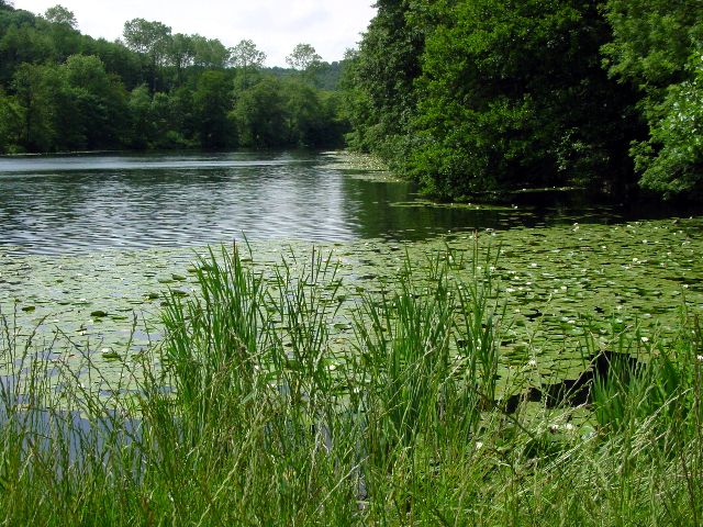
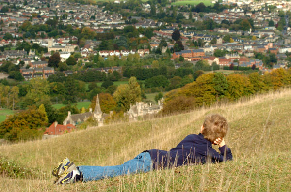
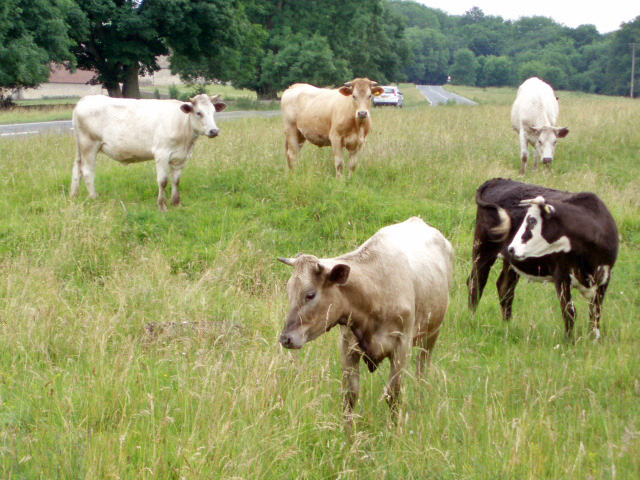
The village of King's Stanley is nestled in the beautiful Cotswold Hills, offering picturesque views and a tranquil atmosphere. It is surrounded by lush countryside and rolling hills, making it an idyllic location for those seeking a peaceful rural setting.

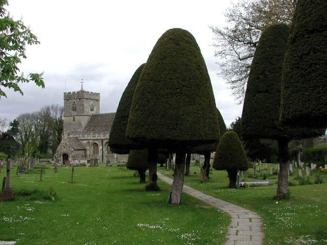
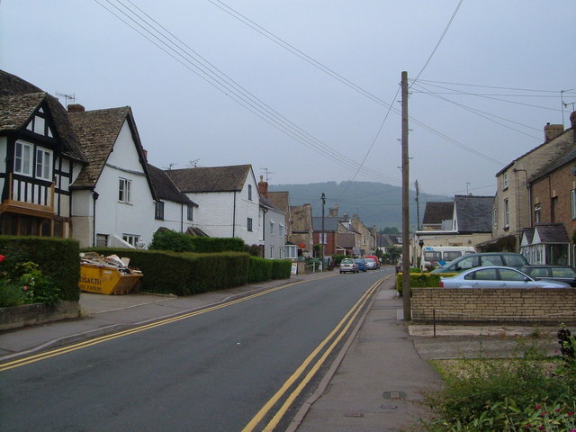
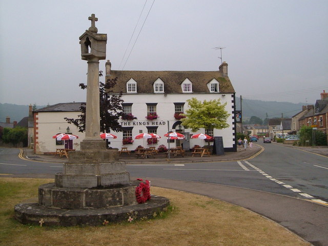
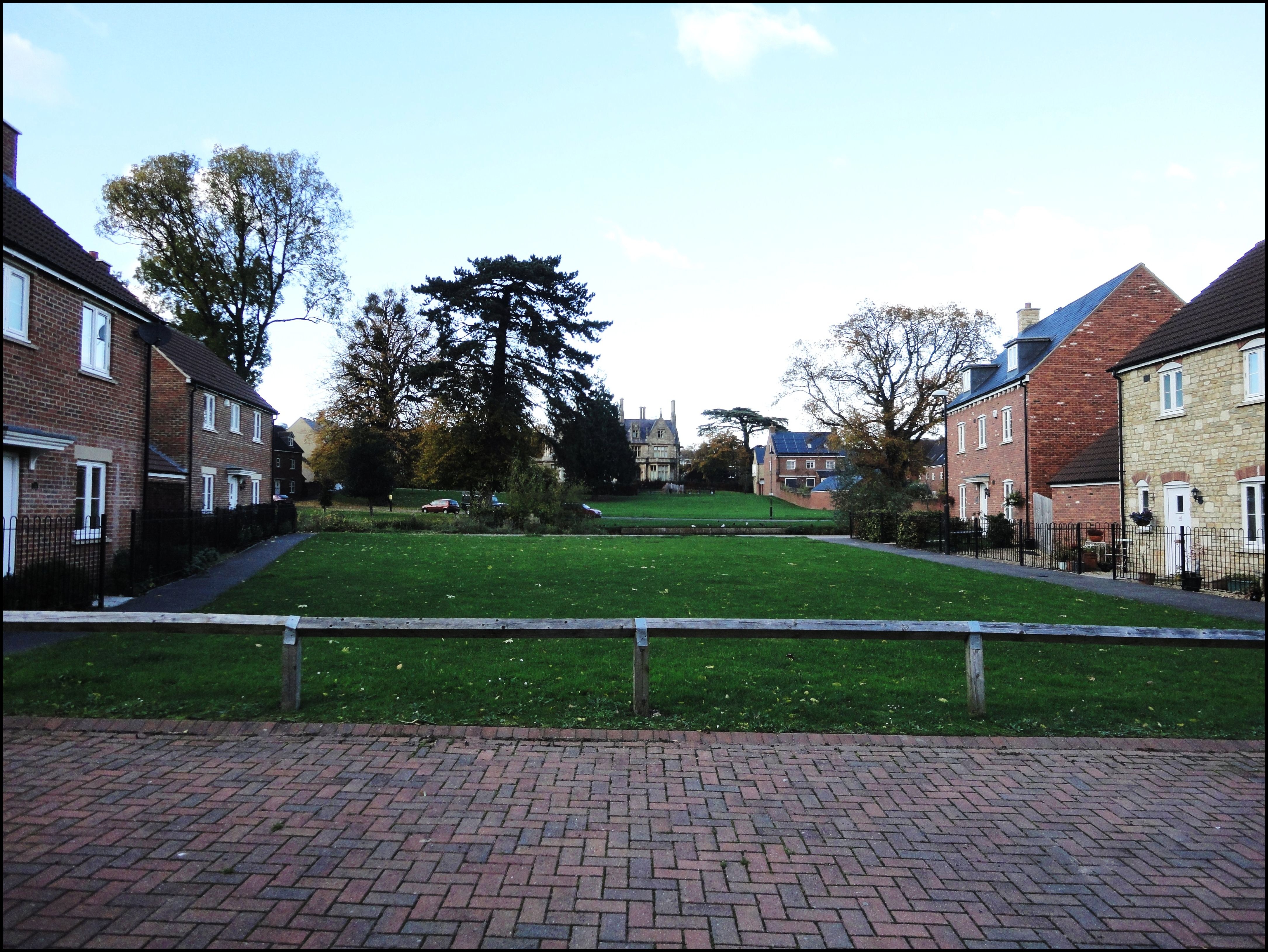
The village itself has a rich history, with evidence of human settlement dating back to the prehistoric era. It was mentioned in the Domesday Book of 1086 and has since developed into a charming community with a mix of historic and modern buildings.

The parish is well-served by amenities, including a primary school, a village hall, a post office, and several shops and pubs. It also benefits from good transport links, with regular bus services connecting it to neighboring towns and villages.

Nature enthusiasts will appreciate the abundance of walking and hiking trails in the area, allowing them to explore the surrounding countryside and enjoy the natural beauty of the Cotswolds. Additionally, the nearby Woodchester Park offers a stunning landscape and a variety of wildlife.

Overall, King's Stanley is a delightful civil parish that combines historical charm with a picturesque rural setting, making it an attractive place to live or visit for those seeking a peaceful and scenic environment.

If you have any feedback on the listing, please let us know in the comments section below.

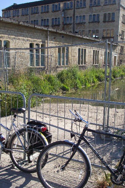
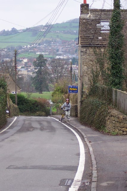
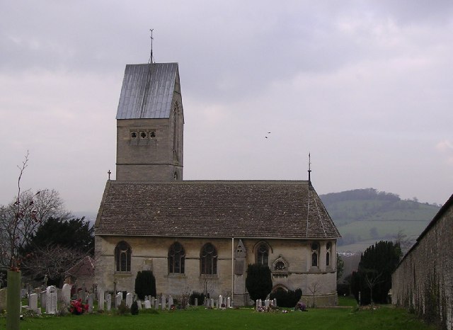
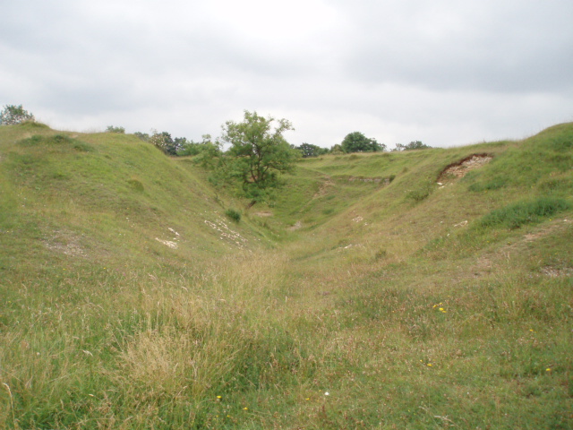
King's Stanley Images

Images are sourced within 2km of 51.727522/-2.261989 or Grid Reference SO8203. Thanks to Geograph Open Source API. All images are credited.

Lake at Woodchester Park
King's Stanley (Glos) St George's Church The churchyard is exceptionally large and there is an avenue of clipped yew trees .
King's Stanley (Glos) St George's Church
The churchyard is exceptionally large and there is an avenue of clipped yew trees .
Leonard Stanley (Glos) Priory Church Dedicated to St Swithun, remains of the domestic buildings are incorporated in nearby farm buildings.
Leonard Stanley (Glos) Priory Church
Dedicated to St Swithun, remains of the domestic buildings are incorporated in nearby farm buildings.
Views from Selsley Ridge View of Selsley and Caincross
Views from Selsley Ridge
View of Selsley and Caincross
Dudbridge Cycle Track Former Midland Railway line linking Nailsworth and Stonehouse now a cycle track. The bridge is where the B4066 climbs towards Selsley.
Dudbridge Cycle Track
Former Midland Railway line linking Nailsworth and Stonehouse now a cycle track. The bridge is where the B4066 climbs towards Selsley.
Ebley Mill Ebley mill is next to the Stroudwater canal. This particular bit of the mill is now a fitness club. The canal is being restored and excavated and this viewpoint will soon only be possible from a boat.
Ebley Mill
Ebley mill is next to the Stroudwater canal. This particular bit of the mill is now a fitness club. The canal is being restored and excavated and this viewpoint will soon only be possible from a boat.
Selsley The B4066 road rises through Selsley a bit too steeply for this cyclist. Randwick rises across the other side of the valley.
Selsley
The B4066 road rises through Selsley a bit too steeply for this cyclist. Randwick rises across the other side of the valley.
Selsley.  All Saints church This church which was built in 1862, was copied from one in the Austrian Tyrol, the designer was G.F.Bodley.
Selsley. All Saints church
This church which was built in 1862, was copied from one in the Austrian Tyrol, the designer was G.F.Bodley.
Uneven ground on Selsley Common The humpy, bumpy nature of the ground in this area of Selsey Common is because there was once a fairly large Cotswold stone (oolitic limestone) quarry here.  The quarry was already disused by 1888, as indicated on maps of that date.
Uneven ground on Selsley Common
The humpy, bumpy nature of the ground in this area of Selsey Common is because there was once a fairly large Cotswold stone (oolitic limestone) quarry here. The quarry was already disused by 1888, as indicated on maps of that date.
Cows on Selsley Common With so much land to roam on, these cows have chosen to find pasture perilously close to the B4066.  Cattle grids placed a strategic locations prevent the cattle from straying from the commonland.
Cows on Selsley Common
With so much land to roam on, these cows have chosen to find pasture perilously close to the B4066. Cattle grids placed a strategic locations prevent the cattle from straying from the commonland.
High Street, King's Stanley Looking up the High Street from the edge of the green opposite the King's Head.
High Street, King's Stanley
Looking up the High Street from the edge of the green opposite the King's Head.
Kings' Stanley: War Memorial and King's Head On the green at King's Stanley, with the High Street on the right.
Kings' Stanley: War Memorial and King's Head
On the green at King's Stanley, with the High Street on the right.
Stanley Mills Important woollen mill. Built 1812-13 and one of the first truly fireproof cloth mills being built of brick with a skeleton of iron arches. Very decorative and much photographed. Now in multiple occupancy.
Stanley Mills
Important woollen mill. Built 1812-13 and one of the first truly fireproof cloth mills being built of brick with a skeleton of iron arches. Very decorative and much photographed. Now in multiple occupancy.
Ebley Mill Very fine woollen mill with beam engine and waterwheel power originally. Now Stroud Council offices.
Ebley Mill
Very fine woollen mill with beam engine and waterwheel power originally. Now Stroud Council offices.
Track to Woodside Farm Farm located high above Leonard Stanley and just below the wooded Cotswold Scarp. The shadow of the wooden fence creates a nice pattern across the farm track.
Track to Woodside Farm
Farm located high above Leonard Stanley and just below the wooded Cotswold Scarp. The shadow of the wooden fence creates a nice pattern across the farm track.
Cotswold Way path through Pen Wood This stretch of the Cotswold Scarp is heavily wooded, in common with many steep limestone slopes. The Cotswold Way is following the scarp here, though just round the next bend it descends to Middleyard and Kings Stanley before crossing the Frome.
Cotswold Way path through Pen Wood
This stretch of the Cotswold Scarp is heavily wooded, in common with many steep limestone slopes. The Cotswold Way is following the scarp here, though just round the next bend it descends to Middleyard and Kings Stanley before crossing the Frome.
Boathouse on the Middle Pond, Woodchester Park This boathouse would have been built for the use of Woodchester Mansion see <a href="https://www.geograph.org.uk/gridref/SO8001">SO8001</a>. The mansion is now an empty shell and the resident bats have little use for boats, but the National Trust continues to maintain this attractive little building.
Boathouse on the Middle Pond, Woodchester Park
This boathouse would have been built for the use of Woodchester Mansion see SO8001. The mansion is now an empty shell and the resident bats have little use for boats, but the National Trust continues to maintain this attractive little building.
Selsley church from across the fields The church is positioned on a slight ridge and so is visible from all around. Cainscross is in the background.
Selsley church from across the fields
The church is positioned on a slight ridge and so is visible from all around. Cainscross is in the background.
Show me another place!

King's Stanley is located at Grid Ref: SO8203 (Lat: 51.727522, Lng: -2.261989)

Administrative County: Gloucestershire

District: Stroud

Police Authority: Gloucestershire

What 3 Words

///pleaser.playfully.knocking. Near Stonehouse, Gloucestershire

Related Wikis

King's Stanley

King's Stanley is a civil parish and village in Gloucestershire, England, to the south of Stonehouse and southwest of the town of Stroud. == Geography... ==

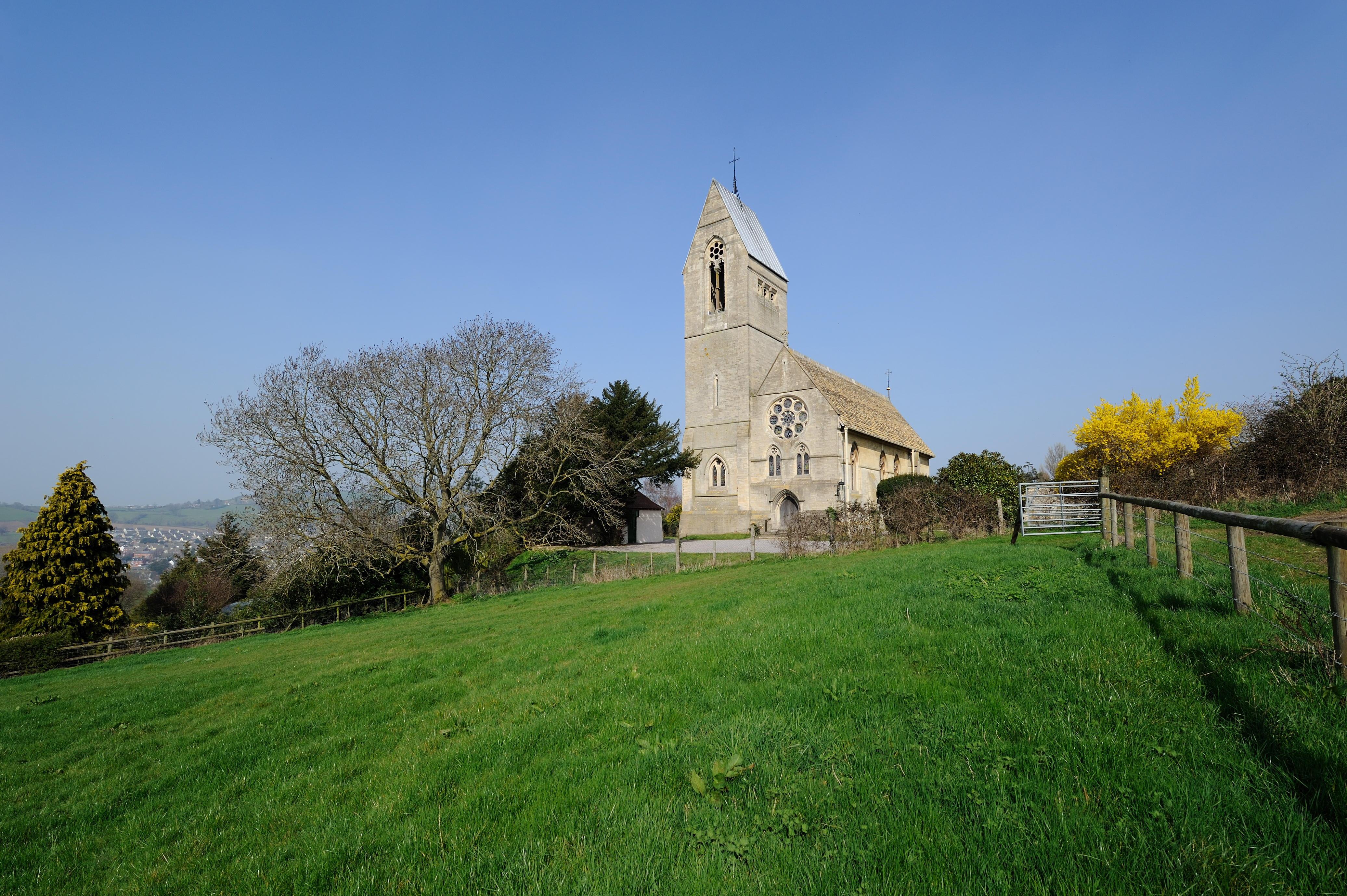
All Saints Church, Selsley

All Saints Church is the parish church for Selsley in Gloucestershire. == Background == It is a celebrated early work by the important church architect...

Selsley

Selsley is a village within the civil parish of King's Stanley and district of Stroud, in Gloucestershire, England. It is composed of around 175 houses...
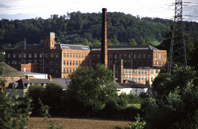
Stanley Mills

The Stanley Mills woollen mill at Ryeford, near Stonehouse, Gloucestershire, England was built in the early 19th century. The main building is Grade I...

Ryeford railway station

Ryeford railway station served the villages of Ryeford, King's Stanley and Leonard Stanley in Gloucestershire, England. It was on the 5.8-mile (9.3 km...

Ebley

Ebley is a community in Gloucestershire, England. It was once a village, and is now part of the Stroud urban area. It lies in the valley of the River...

Leonard Stanley

Leonard Stanley, or Stanley St.Leonard, is a village and parish in Gloucestershire, England, 95 miles (150 km) west of London and 3.5 miles (5.5 km) southwest...

Dudbridge railway station

Dudbridge railway station served the Stroud suburb of Dudbridge and the village of Selsley, little more than 1 mile (1.6 km) from Stroud, in Gloucestershire...

Related Videos

Walking in the Cotswolds | Woodchester Mansion Grounds

Explore the breathtaking beauty of the Cotswolds with our mesmerizing video of a walk through the Woodchester Mansion ...

Dog walking in the Cotswolds.

The beautiful selsley common. The Cotswolds Gloucestershire.

15-Minute Indoor Walking workout

Up your step count without leaving the house with this 15-minute walking workout. Disclaimer: As with all fitness and exercise ...

Nearby Amenities

Located within 500m of 51.727522,-2.261989
Middleyard
Is In: Gloucestershire, England, UK
Place: hamlet
Postal Code: GL10 3
Lat/Long: 51.7268454/-2.2623146
Telephone
Booth: K6
Covered: booth
Man Made: telephone_box
Lat/Long: 51.7270847/-2.2644555
Post Box
Post Box Type: lamp
Lat/Long: 51.7270771/-2.2643851
Bus Stop
Coldwell
Bus: yes
Naptan AtcoCode: 1600GLS329
Naptan Bearing: E
Naptan CommonName: Coldwell
Naptan Indicator: Opp
Naptan NaptanCode: gloawjam
Naptan PlusbusZoneRef: STRUD
Naptan Street: Main Street
Naptan Verified: no
Public Transport: platform
Shelter: yes
Source: naptan_import
Lat/Long: 51.7270659/-2.2643277
Bus Stop
Coldwell
Bus: yes
Naptan AtcoCode: 1600GLS330
Naptan Bearing: W
Naptan CommonName: Coldwell
Naptan NaptanCode: gloawgwt
Naptan PlusbusZoneRef: STRUD
Naptan Street: Main Street
Naptan Verified: no
Public Transport: platform
Source: naptan_import
Lat/Long: 51.7271085/-2.2652633
Bus Stop
Coombe Ln
Bus: yes
Naptan AtcoCode: 1600GLS331
Naptan Bearing: SE
Naptan CommonName: Coombe Ln
Naptan Indicator: Opp
Naptan NaptanCode: gloawjgm
Naptan PlusbusZoneRef: STRUD
Naptan Street: Main Rd
Naptan Verified: no
Public Transport: platform
Source: naptan_import
Lat/Long: 51.7265426/-2.2615048
Bus Stop
Coombe Ln
Bus: yes
Naptan AtcoCode: 1600GLS332
Naptan Bearing: NW
Naptan CommonName: Coombe Ln
Naptan NaptanCode: gloawjgd
Naptan PlusbusZoneRef: STRUD
Naptan Street: Main Road
Naptan Verified: no
Public Transport: platform
Source: naptan_import
Lat/Long: 51.7264442/-2.2617577
Bus Stop
The Knapp
Bus: yes
Naptan AtcoCode: 1600GLS333
Naptan Bearing: NE
Naptan CommonName: The Knapp
Naptan NaptanCode: gloawjwm
Naptan PlusbusZoneRef: STRUD
Naptan Street: Broad St
Naptan Verified: no
Public Transport: platform
Source: naptan_import
Lat/Long: 51.7278557/-2.256783
Bus Stop
The Knapp
Bus: yes
Naptan AtcoCode: 1600GLS334
Naptan Bearing: SW
Naptan CommonName: The Knapp
Naptan Indicator: Opp
Naptan NaptanCode: gloawjwj
Naptan PlusbusZoneRef: STRUD
Naptan Street: Broad St
Naptan Verified: no
Public Transport: platform
Source: naptan_import
Lat/Long: 51.7276483/-2.257028
Barrier: kissing_gate
Foot: designated
Lat/Long: 51.7266348/-2.2608332
Power: pole
Lat/Long: 51.7305709/-2.2616373
Power: pole
Lat/Long: 51.7313069/-2.2622864
Power: pole
Lat/Long: 51.730747/-2.2613288
Power: pole
Lat/Long: 51.7259707/-2.2576019
Material: wood
Power: pole
Lat/Long: 51.7251372/-2.2569261
Power: pole
Lat/Long: 51.7275631/-2.2589283
Material: wood
Power: pole
Lat/Long: 51.724654/-2.2565479
Power: pole
Lat/Long: 51.7282955/-2.2595935
Power: pole
Lat/Long: 51.7268138/-2.2583041
Power: pole
Lat/Long: 51.7290979/-2.2602963
Power: pole
Lat/Long: 51.7299123/-2.2610211
Barrier: stile
Foot: designated
Lat/Long: 51.7231364/-2.2611595
Barrier: stile
Foot: designated
Lat/Long: 51.7243319/-2.2610098
Post Box
Collection Times: Mo-Fr 09:00; Sa 07:00; Su off
Drive Through: no
Operator: Royal Mail
Operator Wikidata: Q638098
Post Box Type: wall
Ref: GL5 31D
Royal Cypher: GVIR
Royal Cypher Wikidata: Q33102169
Source: survey
Lat/Long: 51.7284163/-2.2558112
Barrier: stile
Material: stone
Stile: stepover
Lat/Long: 51.729988/-2.2609834
Generator Method: photovoltaic
Generator Output Electricity: yes
Generator Source: solar
Generator Type: solar_photovoltaic_panel
Location: surface
Power: generator
Lat/Long: 51.7255885/-2.2589296
Generator Method: photovoltaic
Generator Output Electricity: yes
Generator Source: solar
Generator Type: solar_photovoltaic_panel
Location: roof
Power: generator
Lat/Long: 51.7246008/-2.2637871
Generator Method: photovoltaic
Generator Output Electricity: yes
Generator Source: solar
Generator Type: solar_photovoltaic_panel
Location: roof
Power: generator
Lat/Long: 51.7267125/-2.2633982
Generator Method: photovoltaic
Generator Output Electricity: yes
Generator Source: solar
Generator Type: solar_photovoltaic_panel
Location: roof
Power: generator
Lat/Long: 51.7263586/-2.2630978
Generator Method: photovoltaic
Generator Output Electricity: yes
Generator Source: solar
Generator Type: solar_photovoltaic_panel
Location: roof
Power: generator
Lat/Long: 51.7252687/-2.2629127
Generator Method: photovoltaic
Generator Output Electricity: yes
Generator Source: solar
Generator Type: solar_photovoltaic_panel
Location: roof
Power: generator
Lat/Long: 51.726131/-2.2636932
Generator Method: photovoltaic
Generator Output Electricity: yes
Generator Source: solar
Generator Type: solar_photovoltaic_panel
Location: roof
Power: generator
Lat/Long: 51.7260429/-2.2638622
Generator Method: photovoltaic
Generator Output Electricity: yes
Generator Source: solar
Generator Type: solar_photovoltaic_panel
Location: roof
Power: generator
Lat/Long: 51.7253767/-2.265721
Generator Method: photovoltaic
Generator Output Electricity: yes
Generator Source: solar
Generator Type: solar_photovoltaic_panel
Location: roof
Power: generator
Lat/Long: 51.7255728/-2.267231
Generator Method: photovoltaic
Generator Output Electricity: yes
Generator Source: solar
Generator Type: solar_photovoltaic_panel
Location: roof
Power: generator
Lat/Long: 51.7267407/-2.2654662
Generator Method: photovoltaic
Generator Output Electricity: yes
Generator Source: solar
Generator Type: solar_photovoltaic_panel
Location: roof
Power: generator
Lat/Long: 51.7257273/-2.2668059
Generator Method: photovoltaic
Generator Output Electricity: yes
Generator Source: solar
Generator Type: solar_photovoltaic_panel
Location: roof
Power: generator
Lat/Long: 51.7257597/-2.2667389
Generator Method: photovoltaic
Generator Output Electricity: yes
Generator Source: solar
Generator Type: solar_photovoltaic_panel
Location: roof
Power: generator
Lat/Long: 51.7259607/-2.2662963
Generator Method: photovoltaic
Generator Output Electricity: yes
Generator Source: solar
Generator Type: solar_photovoltaic_panel
Location: roof
Power: generator
Lat/Long: 51.7261219/-2.2668354
Generator Method: photovoltaic
Generator Output Electricity: yes
Generator Source: solar
Generator Type: solar_photovoltaic_panel
Location: roof
Power: generator
Lat/Long: 51.7263221/-2.2681779
Generator Method: photovoltaic
Generator Output Electricity: yes
Generator Source: solar
Generator Type: solar_photovoltaic_panel
Location: roof
Power: generator
Lat/Long: 51.726288/-2.2681323
Generator Method: photovoltaic
Generator Output Electricity: yes
Generator Source: solar
Generator Type: solar_photovoltaic_panel
Location: roof
Power: generator
Lat/Long: 51.7261335/-2.2679459
Generator Method: photovoltaic
Generator Output Electricity: yes
Generator Source: solar
Generator Type: solar_photovoltaic_panel
Location: roof
Power: generator
Lat/Long: 51.7262033/-2.267848
Generator Method: photovoltaic
Generator Output Electricity: yes
Generator Source: solar
Generator Type: solar_photovoltaic_panel
Location: roof
Power: generator
Lat/Long: 51.7262697/-2.267742
Generator Method: photovoltaic
Generator Output Electricity: yes
Generator Source: solar
Generator Type: solar_photovoltaic_panel
Location: roof
Power: generator
Lat/Long: 51.7263295/-2.2676575
Generator Method: photovoltaic
Generator Output Electricity: yes
Generator Source: solar
Generator Type: solar_photovoltaic_panel
Location: roof
Power: generator
Lat/Long: 51.7264134/-2.2675301
Generator Method: photovoltaic
Generator Output Electricity: yes
Generator Source: solar
Generator Type: solar_photovoltaic_panel
Location: roof
Power: generator
Lat/Long: 51.7264965/-2.2681269
Generator Method: photovoltaic
Generator Output Electricity: yes
Generator Source: solar
Generator Type: solar_photovoltaic_panel
Location: roof
Power: generator
Lat/Long: 51.7265397/-2.2680612
Generator Method: photovoltaic
Generator Output Electricity: yes
Generator Source: solar
Generator Type: solar_photovoltaic_panel
Location: roof
Power: generator
Lat/Long: 51.7265862/-2.2679955
Generator Method: photovoltaic
Generator Output Electricity: yes
Generator Source: solar
Generator Type: solar_photovoltaic_panel
Location: roof
Power: generator
Lat/Long: 51.7266236/-2.2679365
Generator Method: photovoltaic
Generator Output Electricity: yes
Generator Source: solar
Generator Type: solar_photovoltaic_panel
Location: roof
Power: generator
Lat/Long: 51.7267009/-2.2679056
Generator Method: photovoltaic
Generator Output Electricity: yes
Generator Source: solar
Generator Type: solar_photovoltaic_panel
Location: roof
Power: generator
Lat/Long: 51.7265588/-2.2672579
Generator Method: photovoltaic
Generator Output Electricity: yes
Generator Source: solar
Generator Type: solar_photovoltaic_panel
Location: roof
Power: generator
Lat/Long: 51.726597/-2.2671962
Generator Method: photovoltaic
Generator Output Electricity: yes
Generator Source: solar
Generator Type: solar_photovoltaic_panel
Location: roof
Power: generator
Lat/Long: 51.7267034/-2.2674684
Generator Method: photovoltaic
Generator Output Electricity: yes
Generator Source: solar
Generator Type: solar_photovoltaic_panel
Location: roof
Power: generator
Lat/Long: 51.7267382/-2.2675315
Generator Method: photovoltaic
Generator Output Electricity: yes
Generator Source: solar
Generator Type: solar_photovoltaic_panel
Location: roof
Power: generator
Lat/Long: 51.7268221/-2.2677286
Leisure: playground
Lat/Long: 51.7264424/-2.2637527
The data included in this document is from www.openstreetmap.org. The data is made available under ODbL.

Have you been to King's Stanley?

Leave your review of King's Stanley below (or comments, questions and feedback).