Iwerne Minster

Civil Parish in Dorset North Dorset

England

Iwerne Minster

Crossroads, Hill Farm Approaching a very busy minor road.
Crossroads, Hill Farm Credit: Richard Webb

Iwerne Minster is a civil parish located in the county of Dorset, England. Situated in the Blackmore Vale, it is part of the North Dorset district. The parish covers an area of approximately 8 square miles and is home to a population of around 500 people.

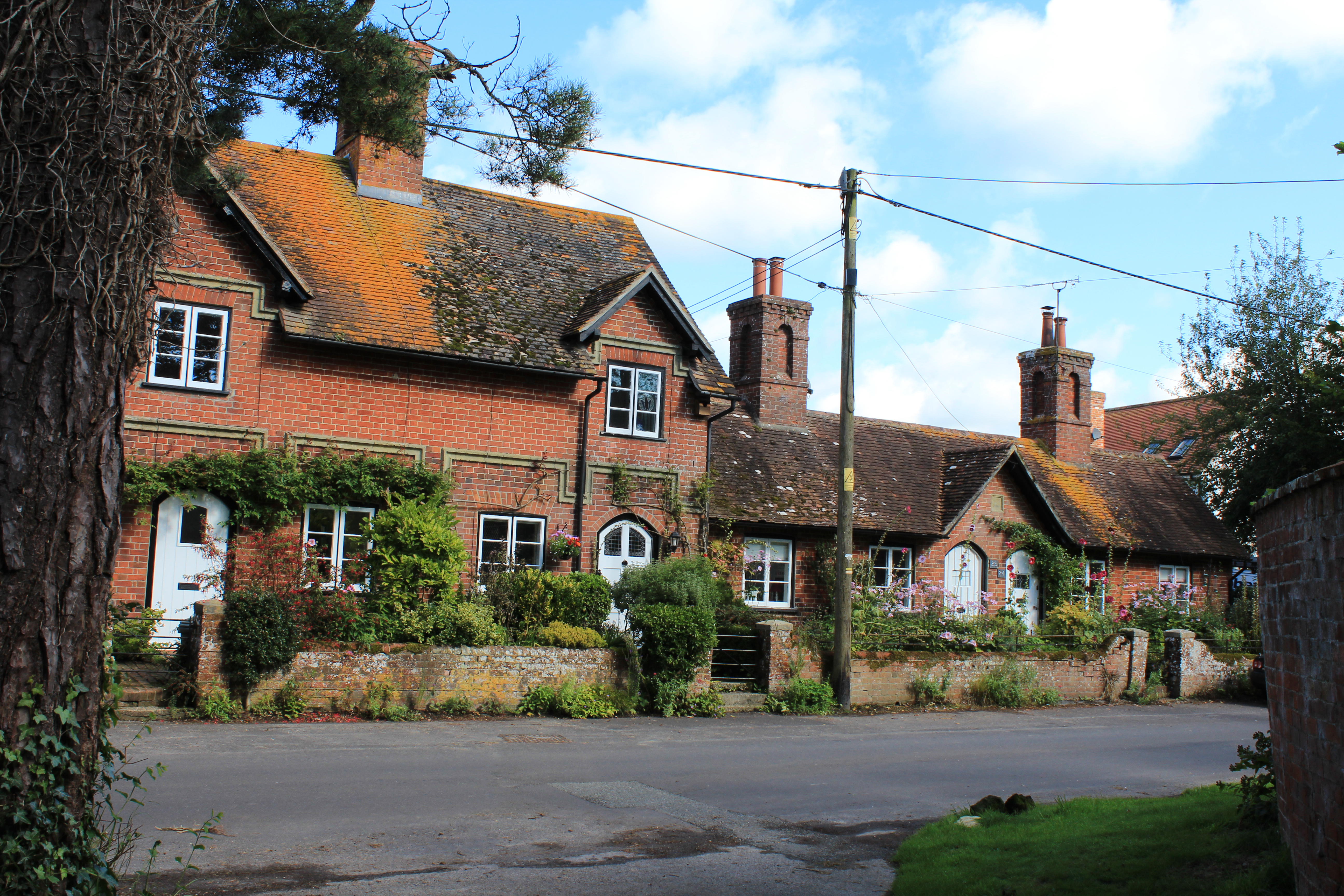
The village of Iwerne Minster is the main settlement within the parish. It is located about 4 miles northeast of the town of Blandford Forum and is surrounded by picturesque countryside. The village is known for its charming thatched cottages, historic buildings, and scenic views.

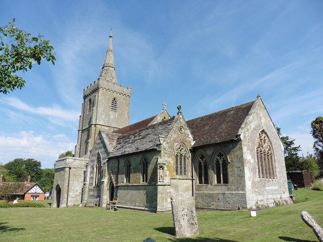
One of the prominent landmarks in the area is Iwerne Minster Church, which dates back to the 12th century. The church is dedicated to St. Mary and St. Nicholas and features stunning architecture and intricate stained glass windows.

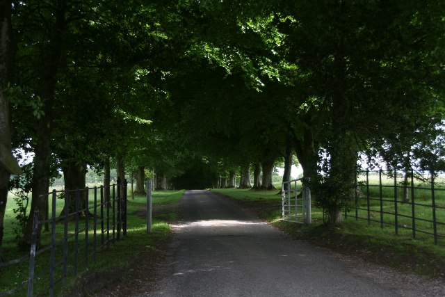
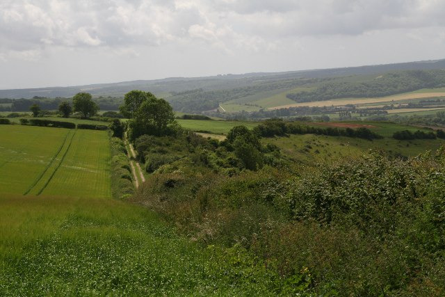
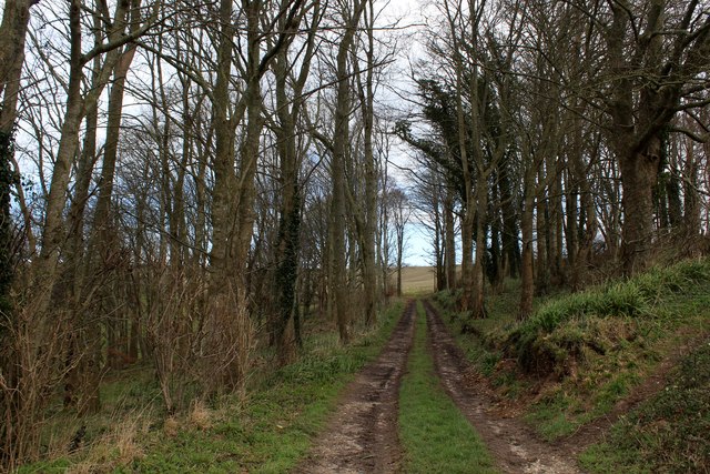
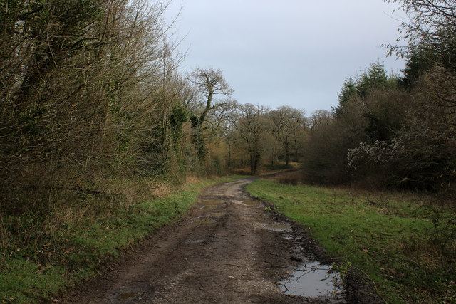
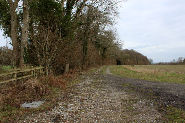
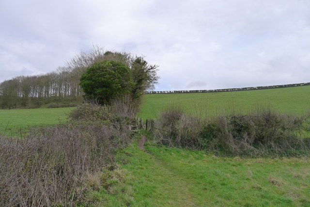
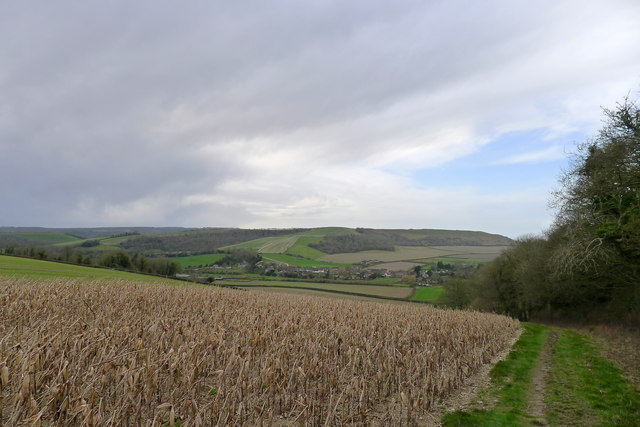
The parish is also known for its natural beauty and offers opportunities for outdoor activities. There are several walking trails and footpaths that allow visitors to explore the surrounding countryside, including the nearby hills and valleys. The River Iwerne flows through the parish, adding to the scenic charm of the area.

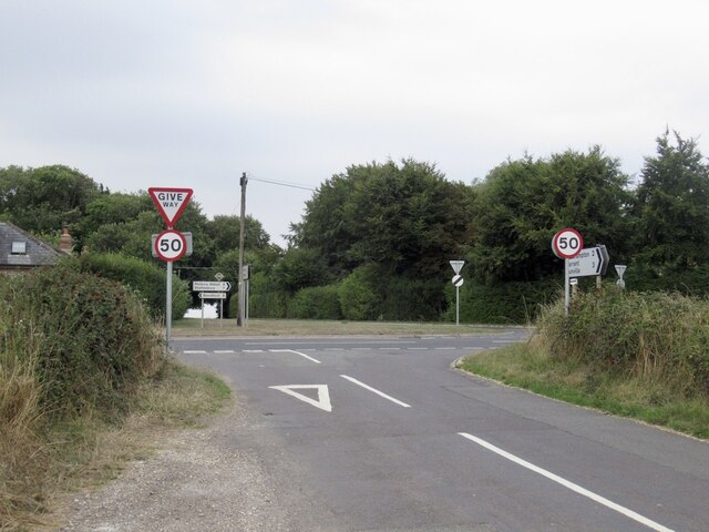
Although primarily a rural area, Iwerne Minster is well-connected to neighboring towns and villages. The A350 road runs through the parish, providing convenient access to nearby transport links.

Overall, Iwerne Minster is a peaceful and picturesque civil parish in Dorset, offering a tranquil countryside setting and a rich historical heritage.

If you have any feedback on the listing, please let us know in the comments section below.

Iwerne Minster Images

Images are sourced within 2km of 50.930689/-2.183975 or Grid Reference ST8714. Thanks to Geograph Open Source API. All images are credited.

Crossroads, Hill Farm Approaching a very busy minor road.
Crossroads, Hill Farm
Approaching a very busy minor road.
Wooded driveway to Ashmore Wood
Track to Satan's Square Plantation
Karen the cow - part of the K herd at Fontwell Magna
Iwerne Minster, St Mary
Old Milestone by the A350, north of Iwerne Minster Carved stone post by the A350, in parish of IWERNE MINSTER (NORTH DORSET District), 50m North of turning to Child Okeford, on the verge in small copse, on West side of road. Dorset 1 (limestone), erected by the Shaftesbury & New Road to Blandford turnpike trust in the 19th century. 

Inscription reads:-
: IWERNE MINSTER : : (7 / From) Blandford / 5 / From / Shaftesbury / BATH 37 : : IWERNE MINSTER : 

Milestone Society National ID: DO_BFSF05.
Old Milestone by the A350, north of Iwerne Minster
Carved stone post by the A350, in parish of IWERNE MINSTER (NORTH DORSET District), 50m North of turning to Child Okeford, on the verge in small copse, on West side of road. Dorset 1 (limestone), erected by the Shaftesbury & New Road to Blandford turnpike trust in the 19th century. Inscription reads:- : IWERNE MINSTER : : (7 / From) Blandford / 5 / From / Shaftesbury / BATH 37 : : IWERNE MINSTER : Milestone Society National ID: DO_BFSF05.
Old Milepost by the A350, Iwerne Minster Cast iron post by the A350, in parish of IWERNE MINSTER (NORTH DORSET District), South of village, 50m South of 30mph signs, where overhead cables cross road, on North West side of road. Well hidden in roadside vegetation. Dorset 5 (limestone), erected by the Shaftesbury & New Road to Blandford turnpike trust in the 19th century. 

Inscription reads:-
BLANDFORD
6
SHAFTESBURY
6  

Milestone Society National ID: DO_BFSF06.
Old Milepost by the A350, Iwerne Minster
Cast iron post by the A350, in parish of IWERNE MINSTER (NORTH DORSET District), South of village, 50m South of 30mph signs, where overhead cables cross road, on North West side of road. Well hidden in roadside vegetation. Dorset 5 (limestone), erected by the Shaftesbury & New Road to Blandford turnpike trust in the 19th century. Inscription reads:- BLANDFORD 6 SHAFTESBURY 6 Milestone Society National ID: DO_BFSF06.
Frog Lane, Iwerne Courtney or Shrorton Adopted by the Wessex Ridgeway Long Distance Footpath, heading east towards the A350.
Frog Lane, Iwerne Courtney or Shrorton
Adopted by the Wessex Ridgeway Long Distance Footpath, heading east towards the A350.
Looking East from Iwerne Courtney or Shroton
Track in Beech Clump on Preston Hill
Wessex Ridgeway in Preston Wood The long distance footpath adopts a good wide track as it makes its way through Preston Wood
Wessex Ridgeway in Preston Wood
The long distance footpath adopts a good wide track as it makes its way through Preston Wood
Wessex Ridgeway approaching Preston Wood The Wessex Ridgeway is a 136-mile long-distance footpath which runs from Marlborough in Wiltshire to Lyme Regis in Dorset. It was opened in 1994. 

Wikipedia entry: <span class="nowrap"><a title="https://en.wikipedia.org/wiki/Wessex_Ridgeway" rel="nofollow ugc noopener" href="https://en.wikipedia.org/wiki/Wessex_Ridgeway">Link</a><img style="margin-left:2px;" alt="External link" title="External link - shift click to open in new window" src="https://s1.geograph.org.uk/img/external.png" width="10" height="10"/></span>
Wessex Ridgeway approaching Preston Wood
The Wessex Ridgeway is a 136-mile long-distance footpath which runs from Marlborough in Wiltshire to Lyme Regis in Dorset. It was opened in 1994. Wikipedia entry: LinkExternal link
Landscape between Preston Wood and Ranston Hill Sweeping chalk country as seen from the Wessex Ridgeway
Landscape between Preston Wood and Ranston Hill
Sweeping chalk country as seen from the Wessex Ridgeway
Wessex Ridgeway on Preston Hill The long distance footpath between Preston Wood and the village of Iwerne Courtney.
Wessex Ridgeway on Preston Hill
The long distance footpath between Preston Wood and the village of Iwerne Courtney.
Wessex Ridgeway heading East from Boyne's Lane The long distance footpath heading towards Heth Wood
Wessex Ridgeway heading East from Boyne's Lane
The long distance footpath heading towards Heth Wood
Wessex Ridgeway, Boyne's Lane Pleck The Wessex Ridgeway is a 136-mile long-distance footpath which runs from Marlborough in Wiltshire to Lyme Regis in Dorset. It was opened in 1994. 

Wikipedia entry: <span class="nowrap"><a title="https://en.wikipedia.org/wiki/Wessex_Ridgeway" rel="nofollow ugc noopener" href="https://en.wikipedia.org/wiki/Wessex_Ridgeway">Link</a><img style="margin-left:2px;" alt="External link" title="External link - shift click to open in new window" src="https://s1.geograph.org.uk/img/external.png" width="10" height="10"/></span>
Wessex Ridgeway, Boyne's Lane Pleck
The Wessex Ridgeway is a 136-mile long-distance footpath which runs from Marlborough in Wiltshire to Lyme Regis in Dorset. It was opened in 1994. Wikipedia entry: LinkExternal link
The Wessex Ridgeway path climbing Ranston Hill Heading east from Iwerne Courtney
The Wessex Ridgeway path climbing Ranston Hill
Heading east from Iwerne Courtney
The Wessex Ridgeway path alongside Beech Clump A maize cover crop on the left.
The Wessex Ridgeway path alongside Beech Clump
A maize cover crop on the left.
Show me another place!

Iwerne Minster is located at Grid Ref: ST8714 (Lat: 50.930689, Lng: -2.183975)

Administrative County: Dorset

District: North Dorset

Police Authority: Dorset

What 3 Words

///forgiven.dabbing.covenants. Near Child Okeford, Dorset

Related Wikis

Iwerne Minster

Iwerne Minster ( YOO-ern) is a village and civil parish in Dorset, England. It lies on the edge of the Blackmore Vale, approximately midway between the...

Clayesmore School

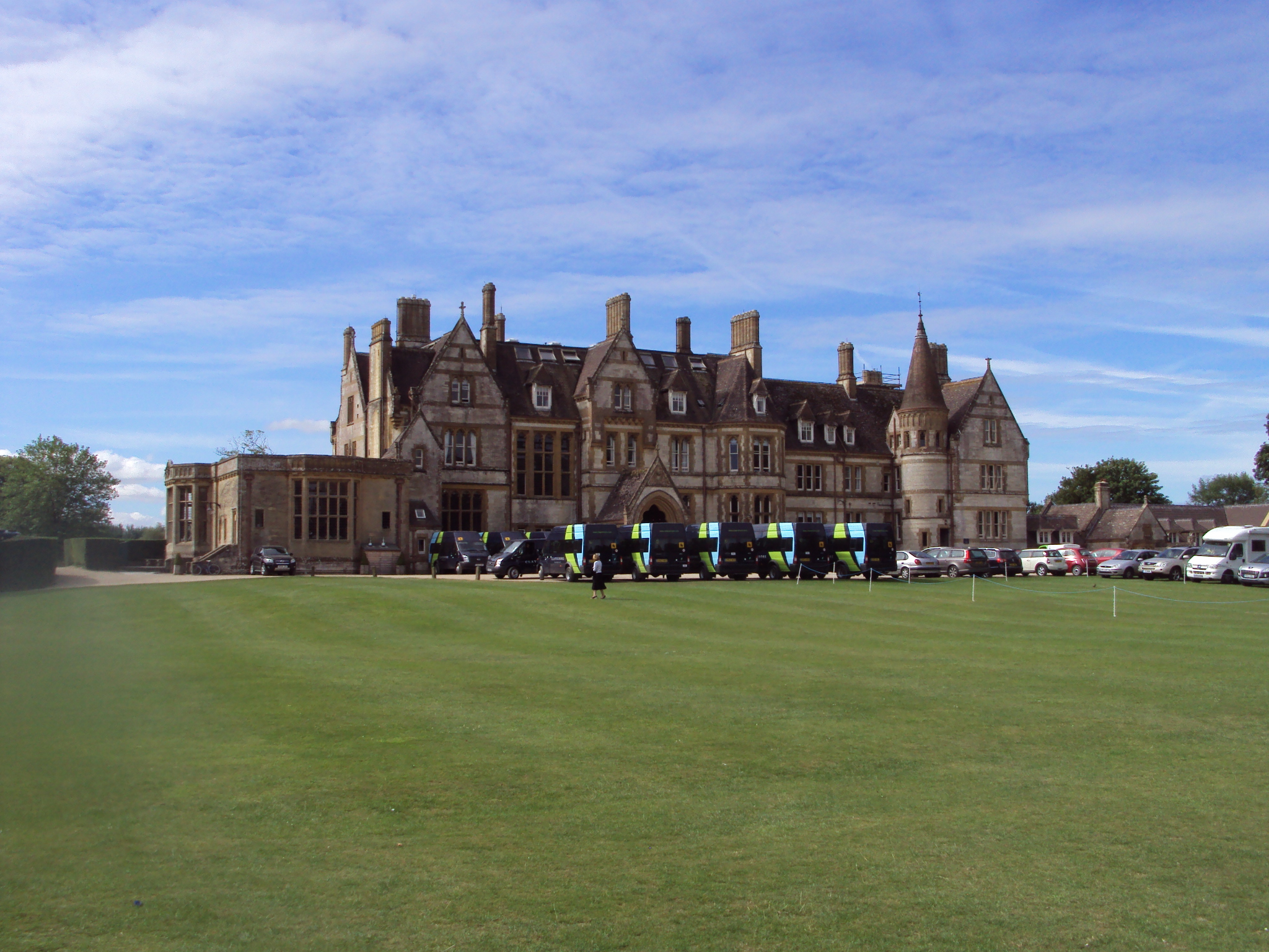
Clayesmore School is an independent school for boys and girls, aged 8 – 18 years, in the village of Iwerne Minster, Dorset, England. It is both a day...

Sutton Waldron

Sutton Waldron is a village and civil parish in north Dorset, England, situated on the A350 road between Iwerne Minster and Fontmell Magna, in the Blackmore...

Iwerne Courtney

Iwerne Courtney (), also known as Shroton, is a village and civil parish in the English county of Dorset. It lies approximately 4 miles (6 kilometres)...

Fontmell Magna

Fontmell Magna is a village and civil parish in Dorset, England. It is situated in the Blackmore Vale, close to the chalk hills of Cranborne Chase, on...

Iwerne Stepleton

Iwerne Stepleton (anciently Ewern Stapleton, etc.) is a small civil parish and former manor in the county of Dorset, England. The parish comprises about...

Redlane Hundred

Redlane Hundred or Redland Hundred was a hundred in the county of Dorset, England, containing the following parishes: Buckhorn Weston Child Okeford East...

Hambledon Hill

Hambledon Hill is a prehistoric hill fort in Dorset, England, in the Blackmore Vale five miles northwest of Blandford Forum. The hill itself is a chalk...

Related Videos

Stourpaine, the River Iwerne and Hod Hill

Tweedy Outdoors suggested the village of Iwerne Courtney. I didn't quite make it to the village but I did manage to get to an Iron ...

Weekend madness

Weekend of parkour and scooter fun.

Country Ways: Iwerne Vally

Narrated by Jill Cochrane & Jim Flegg. Country Ways was produced in 1998 and captured all the sights and sounds of country life, ...

Nearby Amenities

Located within 500m of 50.930689,-2.183975
Turning Circle
Lat/Long: 50.9271654/-2.1882371
Material: wood
Power: pole
Source: bing
Lat/Long: 50.9274823/-2.1860546
Material: wood
Power: pole
Source: bing
Lat/Long: 50.9276757/-2.1829779
Material: wood
Power: pole
Source: bing
Lat/Long: 50.9276882/-2.1818473
Material: wood
Power: pole
Source: bing
Lat/Long: 50.927726/-2.1794772
Material: wood
Power: pole
Source: bing
Lat/Long: 50.9277306/-2.1807539
Material: wood
Power: pole
Source: bing
Lat/Long: 50.928503/-2.186174
Material: wood
Power: pole
Source: bing
Lat/Long: 50.9292045/-2.1856273
Material: wood
Power: pole
Source: bing
Lat/Long: 50.9299806/-2.185413
Material: wood
Power: pole
Source: bing
Lat/Long: 50.9310125/-2.1851218
Material: wood
Power: pole
Source: bing
Lat/Long: 50.9312912/-2.1883626
Material: wood
Power: pole
Source: bing
Lat/Long: 50.9313459/-2.1852286
Material: wood
Power: pole
Source: bing
Lat/Long: 50.9317474/-2.187327
Material: wood
Power: pole
Source: bing
Lat/Long: 50.9318722/-2.1854157
Material: wood
Power: pole
Source: bing
Lat/Long: 50.9320943/-2.1865055
Material: wood
Power: pole
Source: bing
Lat/Long: 50.9324948/-2.1856147
Addr Housename: Chetwynd
Addr Postcode: DT11 8LT
Addr Street: Home Farm
Lat/Long: 50.930787/-2.1905708
Post Box
Operator: Royal Mail
Post Box Type: lamp
Ref: DT11 135
Ref GB Uprn: 10015308738
Royal Cypher: EIIR
Royal Cypher Wikidata: Q33102113
Lat/Long: 50.9306453/-2.1872073
Entrance: main
Lat/Long: 50.9294198/-2.1887872
The data included in this document is from www.openstreetmap.org. The data is made available under ODbL.

Have you been to Iwerne Minster?

Leave your review of Iwerne Minster below (or comments, questions and feedback).