Brookman's Valley

Valley in Dorset

England

Brookman's Valley

Crossroads, Hill Farm Approaching a very busy minor road.
Crossroads, Hill Farm Credit: Richard Webb

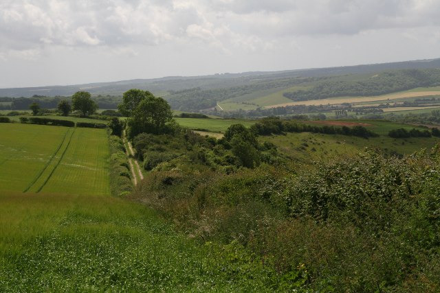
Brookman's Valley, located in the county of Dorset, is a quaint and picturesque village nestled between lush green hills and meandering streams. This idyllic countryside retreat is famed for its stunning natural beauty and rich historical heritage.

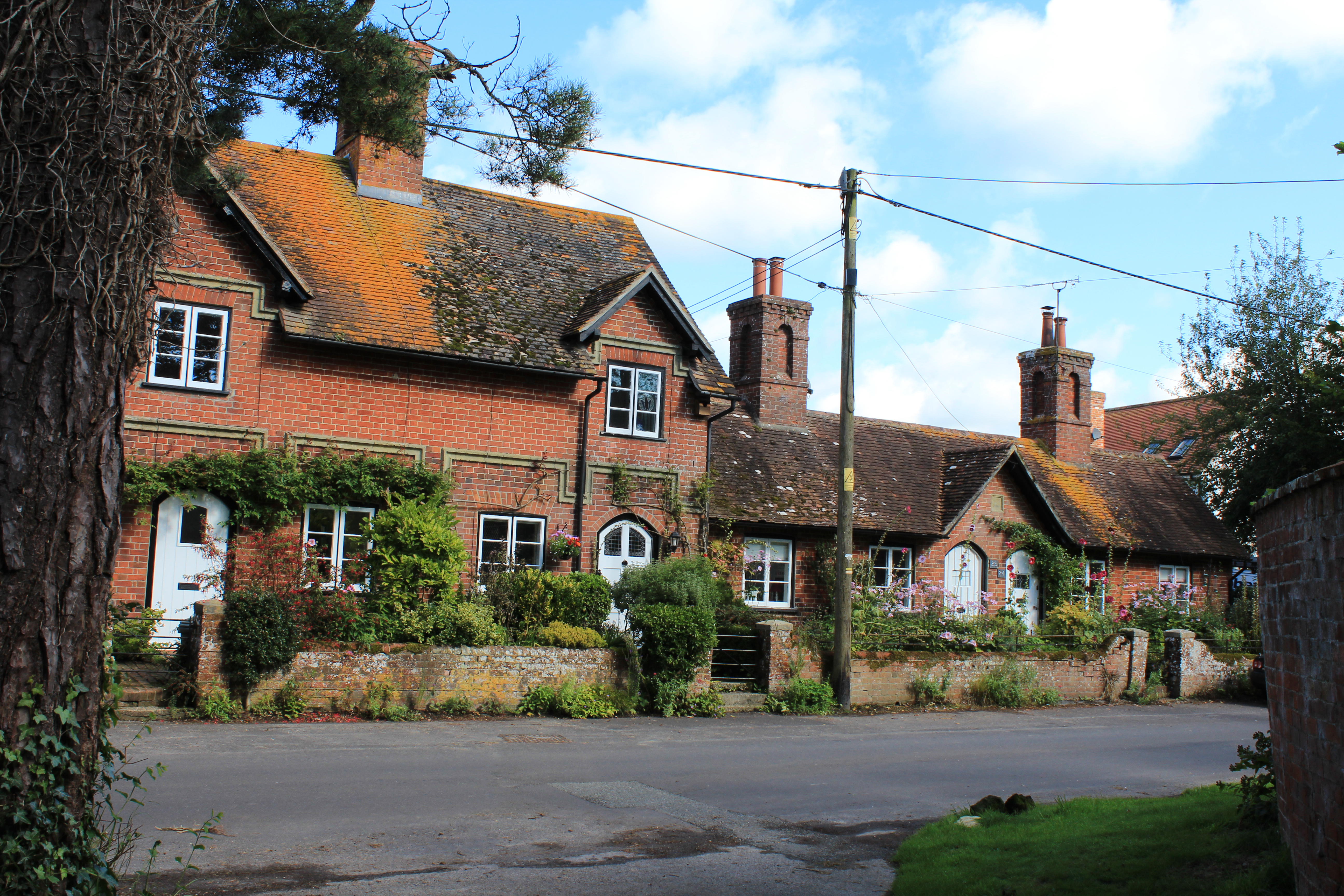
The valley is home to a small population of around 500 residents, creating a close-knit and friendly community atmosphere. The village is primarily residential, with charming cottages and traditional stone houses dotting the landscape. The well-maintained gardens and colorful flower beds add to the village's charm and appeal.

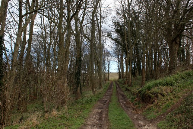
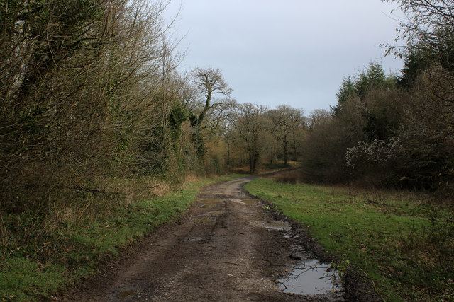
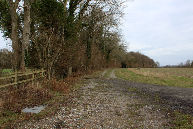
One of the key attractions in Brookman's Valley is its stunning countryside, making it a haven for outdoor enthusiasts. The rolling hills offer ample opportunities for hiking, cycling, and horseback riding, with numerous scenic trails crisscrossing the area. The valley is also known for its abundance of wildlife, including deer, rabbits, and a variety of bird species, making it a popular spot for nature lovers and birdwatchers.

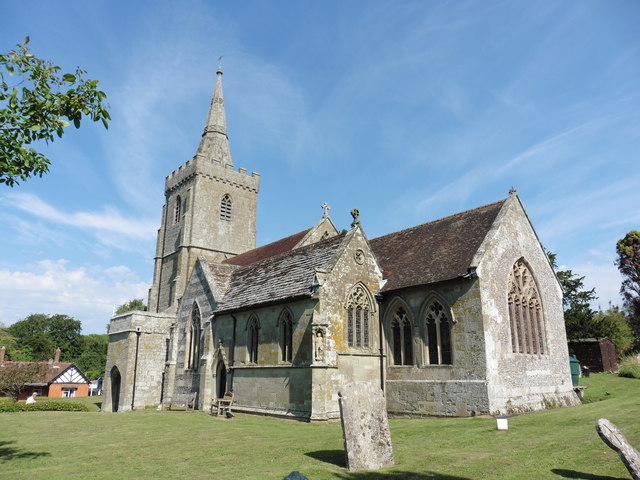
The village boasts a rich history, with several historical landmarks and buildings. The 12th-century St. Mary's Church is a prominent feature, known for its beautiful architecture and stained glass windows. The village also has a small museum that showcases the local history and heritage, offering visitors a glimpse into the area's past.

In terms of amenities, Brookman's Valley has a village shop, a cozy pub serving traditional English fare, and a primary school catering to the local children. For further amenities, residents can easily access nearby towns and cities, such as Dorchester and Bournemouth, which offer a wider range of services and facilities.

Overall, Brookman's Valley is a tranquil and picturesque village that offers a perfect blend of natural beauty, outdoor activities, and historical charm. It is an ideal destination for those seeking a peaceful retreat amidst the Dorset countryside.

If you have any feedback on the listing, please let us know in the comments section below.

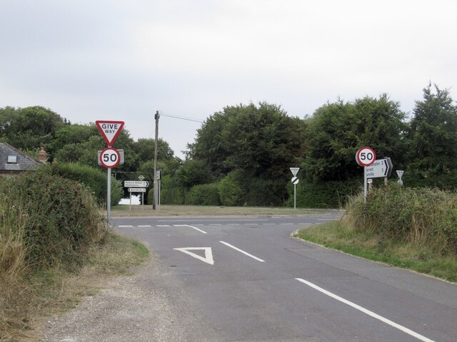
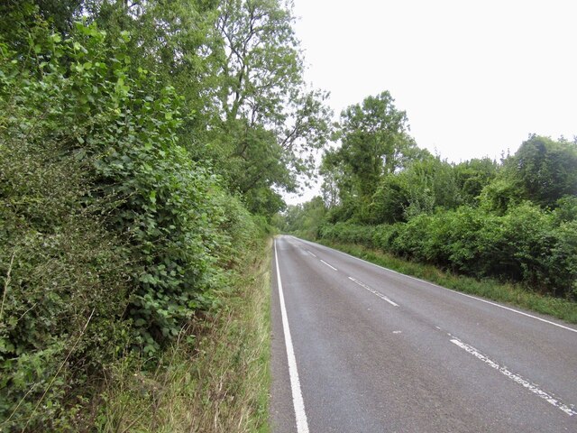
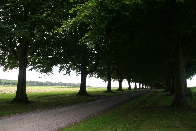
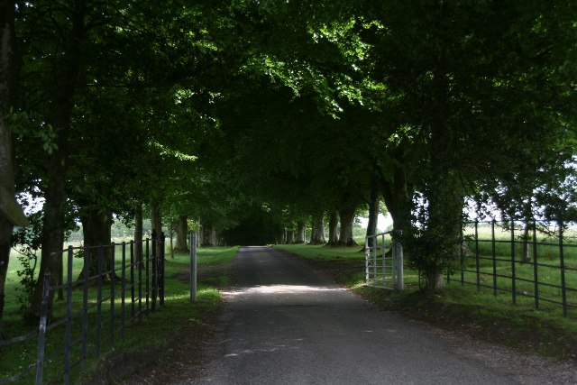
Brookman's Valley Images

Images are sourced within 2km of 50.928216/-2.1767989 or Grid Reference ST8714. Thanks to Geograph Open Source API. All images are credited.

Crossroads, Hill Farm Approaching a very busy minor road.
Crossroads, Hill Farm
Approaching a very busy minor road.
Boyne's Lane A very busy road.
Boyne's Lane
A very busy road.
Wooded driveway near Freak's Coppice
Wooded driveway to Ashmore Wood
Track to Satan's Square Plantation
Iwerne Minster, St Mary
Old Milestone by the A350, north of Iwerne Minster Carved stone post by the A350, in parish of IWERNE MINSTER (NORTH DORSET District), 50m North of turning to Child Okeford, on the verge in small copse, on West side of road. Dorset 1 (limestone), erected by the Shaftesbury & New Road to Blandford turnpike trust in the 19th century. 

Inscription reads:-
: IWERNE MINSTER : : (7 / From) Blandford / 5 / From / Shaftesbury / BATH 37 : : IWERNE MINSTER : 

Milestone Society National ID: DO_BFSF05.
Old Milestone by the A350, north of Iwerne Minster
Carved stone post by the A350, in parish of IWERNE MINSTER (NORTH DORSET District), 50m North of turning to Child Okeford, on the verge in small copse, on West side of road. Dorset 1 (limestone), erected by the Shaftesbury & New Road to Blandford turnpike trust in the 19th century. Inscription reads:- : IWERNE MINSTER : : (7 / From) Blandford / 5 / From / Shaftesbury / BATH 37 : : IWERNE MINSTER : Milestone Society National ID: DO_BFSF05.
Old Milepost by the A350, Iwerne Minster Cast iron post by the A350, in parish of IWERNE MINSTER (NORTH DORSET District), South of village, 50m South of 30mph signs, where overhead cables cross road, on North West side of road. Well hidden in roadside vegetation. Dorset 5 (limestone), erected by the Shaftesbury & New Road to Blandford turnpike trust in the 19th century. 

Inscription reads:-
BLANDFORD
6
SHAFTESBURY
6  

Milestone Society National ID: DO_BFSF06.
Old Milepost by the A350, Iwerne Minster
Cast iron post by the A350, in parish of IWERNE MINSTER (NORTH DORSET District), South of village, 50m South of 30mph signs, where overhead cables cross road, on North West side of road. Well hidden in roadside vegetation. Dorset 5 (limestone), erected by the Shaftesbury & New Road to Blandford turnpike trust in the 19th century. Inscription reads:- BLANDFORD 6 SHAFTESBURY 6 Milestone Society National ID: DO_BFSF06.
Frog Lane, Iwerne Courtney or Shrorton Adopted by the Wessex Ridgeway Long Distance Footpath, heading east towards the A350.
Frog Lane, Iwerne Courtney or Shrorton
Adopted by the Wessex Ridgeway Long Distance Footpath, heading east towards the A350.
Looking East from Iwerne Courtney or Shroton
Track in Beech Clump on Preston Hill
Wessex Ridgeway in Preston Wood The long distance footpath adopts a good wide track as it makes its way through Preston Wood
Wessex Ridgeway in Preston Wood
The long distance footpath adopts a good wide track as it makes its way through Preston Wood
Wessex Ridgeway approaching Preston Wood The Wessex Ridgeway is a 136-mile long-distance footpath which runs from Marlborough in Wiltshire to Lyme Regis in Dorset. It was opened in 1994. 

Wikipedia entry: <span class="nowrap"><a title="https://en.wikipedia.org/wiki/Wessex_Ridgeway" rel="nofollow ugc noopener" href="https://en.wikipedia.org/wiki/Wessex_Ridgeway">Link</a><img style="margin-left:2px;" alt="External link" title="External link - shift click to open in new window" src="https://s1.geograph.org.uk/img/external.png" width="10" height="10"/></span>
Wessex Ridgeway approaching Preston Wood
The Wessex Ridgeway is a 136-mile long-distance footpath which runs from Marlborough in Wiltshire to Lyme Regis in Dorset. It was opened in 1994. Wikipedia entry: LinkExternal link
Landscape between Preston Wood and Ranston Hill Sweeping chalk country as seen from the Wessex Ridgeway
Landscape between Preston Wood and Ranston Hill
Sweeping chalk country as seen from the Wessex Ridgeway
Wessex Ridgeway on Preston Hill The long distance footpath between Preston Wood and the village of Iwerne Courtney.
Wessex Ridgeway on Preston Hill
The long distance footpath between Preston Wood and the village of Iwerne Courtney.
Wessex Ridgeway heading East from Boyne's Lane The long distance footpath heading towards Heth Wood
Wessex Ridgeway heading East from Boyne's Lane
The long distance footpath heading towards Heth Wood
Wessex Ridgeway, Boyne's Lane Pleck The Wessex Ridgeway is a 136-mile long-distance footpath which runs from Marlborough in Wiltshire to Lyme Regis in Dorset. It was opened in 1994. 

Wikipedia entry: <span class="nowrap"><a title="https://en.wikipedia.org/wiki/Wessex_Ridgeway" rel="nofollow ugc noopener" href="https://en.wikipedia.org/wiki/Wessex_Ridgeway">Link</a><img style="margin-left:2px;" alt="External link" title="External link - shift click to open in new window" src="https://s1.geograph.org.uk/img/external.png" width="10" height="10"/></span>
Wessex Ridgeway, Boyne's Lane Pleck
The Wessex Ridgeway is a 136-mile long-distance footpath which runs from Marlborough in Wiltshire to Lyme Regis in Dorset. It was opened in 1994. Wikipedia entry: LinkExternal link
Wessex Ridgeway beside Heth Woods The long distance footpath gradually descending beside woodland, east of Boyne's Lane
Wessex Ridgeway beside Heth Woods
The long distance footpath gradually descending beside woodland, east of Boyne's Lane
Show me another place!

Brookman's Valley is located at Grid Ref: ST8714 (Lat: 50.928216, Lng: -2.1767989)

Unitary Authority: Dorset

Police Authority: Dorset

What 3 Words

///shot.clots.shuffles. Near Child Okeford, Dorset

Related Wikis

Iwerne Minster

Iwerne Minster ( YOO-ern) is a village and civil parish in Dorset, England. It lies on the edge of the Blackmore Vale, approximately midway between the...
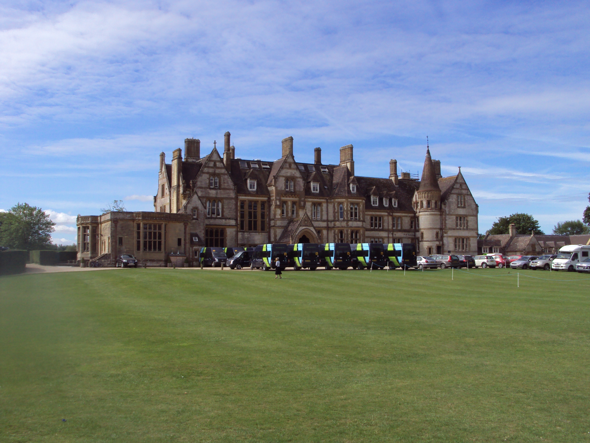
Clayesmore School

Clayesmore School is an independent school for boys and girls, aged 8 – 18 years, in the village of Iwerne Minster, Dorset, England. It is both a day...

Sutton Waldron

Sutton Waldron is a village and civil parish in north Dorset, England, situated on the A350 road between Iwerne Minster and Fontmell Magna, in the Blackmore...

Iwerne Stepleton

Iwerne Stepleton (anciently Ewern Stapleton, etc.) is a small civil parish and former manor in the county of Dorset, England. The parish comprises about...

Iwerne Courtney

Iwerne Courtney (), also known as Shroton, is a village and civil parish in the English county of Dorset. It lies approximately 4 miles (6 kilometres)...

Fontmell Magna

Fontmell Magna is a village and civil parish in Dorset, England. It is situated in the Blackmore Vale, close to the chalk hills of Cranborne Chase, on...

Stepleton House

Stepleton House is a 17th-century country house in the parish of Iwerne Stepleton in Dorset, situated about 5 kilometres (3 mi) north of Blandford Forum...

Redlane Hundred

Redlane Hundred or Redland Hundred was a hundred in the county of Dorset, England, containing the following parishes: Buckhorn Weston Child Okeford East...

Nearby Amenities

Located within 500m of 50.928216,-2.1767989
Power: tower
Source: bing
Lat/Long: 50.9272483/-2.1699763
Power: tower
Source: bing
Lat/Long: 50.9292844/-2.1725856
Power: tower
Source: bing
Lat/Long: 50.9300955/-2.1736464
Power: tower
Source: bing
Lat/Long: 50.9314177/-2.1753291
Power: tower
Source: bing
Lat/Long: 50.9325006/-2.1767473
Material: wood
Power: pole
Source: bing
Lat/Long: 50.9248318/-2.1768647
Material: wood
Power: pole
Source: bing
Lat/Long: 50.9276757/-2.1829779
Material: wood
Power: pole
Source: bing
Lat/Long: 50.9276882/-2.1818473
Material: wood
Power: pole
Source: bing
Lat/Long: 50.9277182/-2.1769485
Material: wood
Power: pole
Source: bing
Lat/Long: 50.9277213/-2.1782227
Material: wood
Power: pole
Source: bing
Lat/Long: 50.927726/-2.1756719
Material: wood
Power: pole
Source: bing
Lat/Long: 50.927726/-2.1794772
Material: wood
Power: pole
Source: bing
Lat/Long: 50.9277306/-2.1807539
Material: wood
Power: pole
Source: bing
Lat/Long: 50.9280056/-2.1745529
Material: wood
Power: pole
Source: bing
Lat/Long: 50.9283101/-2.173397
Material: wood
Power: pole
Source: bing
Lat/Long: 50.928613/-2.1722805
Material: wood
Power: pole
Source: bing
Lat/Long: 50.9289097/-2.1711468
The data included in this document is from www.openstreetmap.org. The data is made available under ODbL.

Have you been to Brookman's Valley?

Leave your review of Brookman's Valley below (or comments, questions and feedback).