Iken

Civil Parish in Suffolk East Suffolk

England

Iken

Lower Troublesome Reach, Iken, Suffolk An appropriate name for this stretch of the River Alde. Photograph taken at high tide looking north-east towards Iken church.
Lower Troublesome Reach, Iken, Suffolk Credit: John Winfield

Iken is a picturesque civil parish located in the county of Suffolk, England. Situated on the east coast of the county, it lies within the Suffolk Coast and Heaths Area of Outstanding Natural Beauty, making it a popular destination for nature enthusiasts and tourists alike.

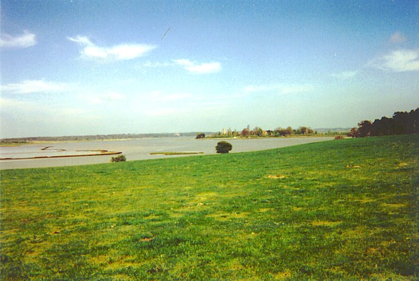
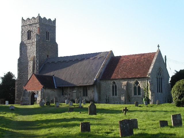
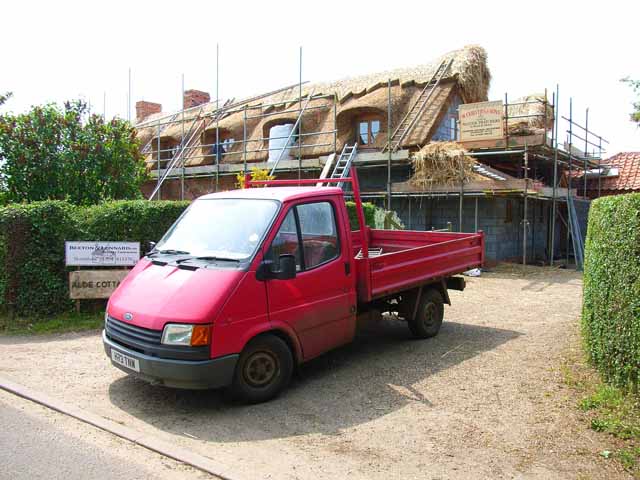
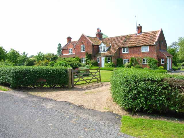
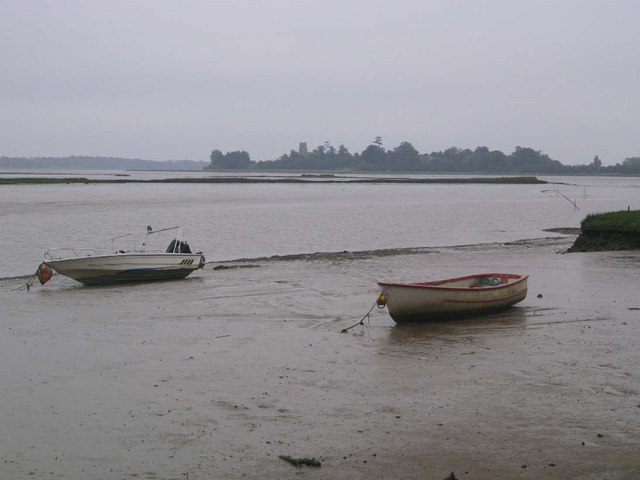
The village of Iken is nestled on the banks of the River Alde, offering stunning views of the surrounding marshland and estuary. It is home to a small population, with only around 100 residents according to the latest estimates. The village features a mix of historic thatched cottages, traditional brick houses, and a beautiful church, St. Botolph's, which dates back to the 12th century.

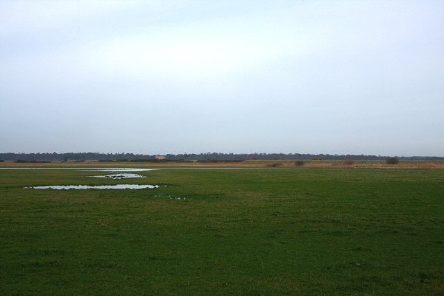
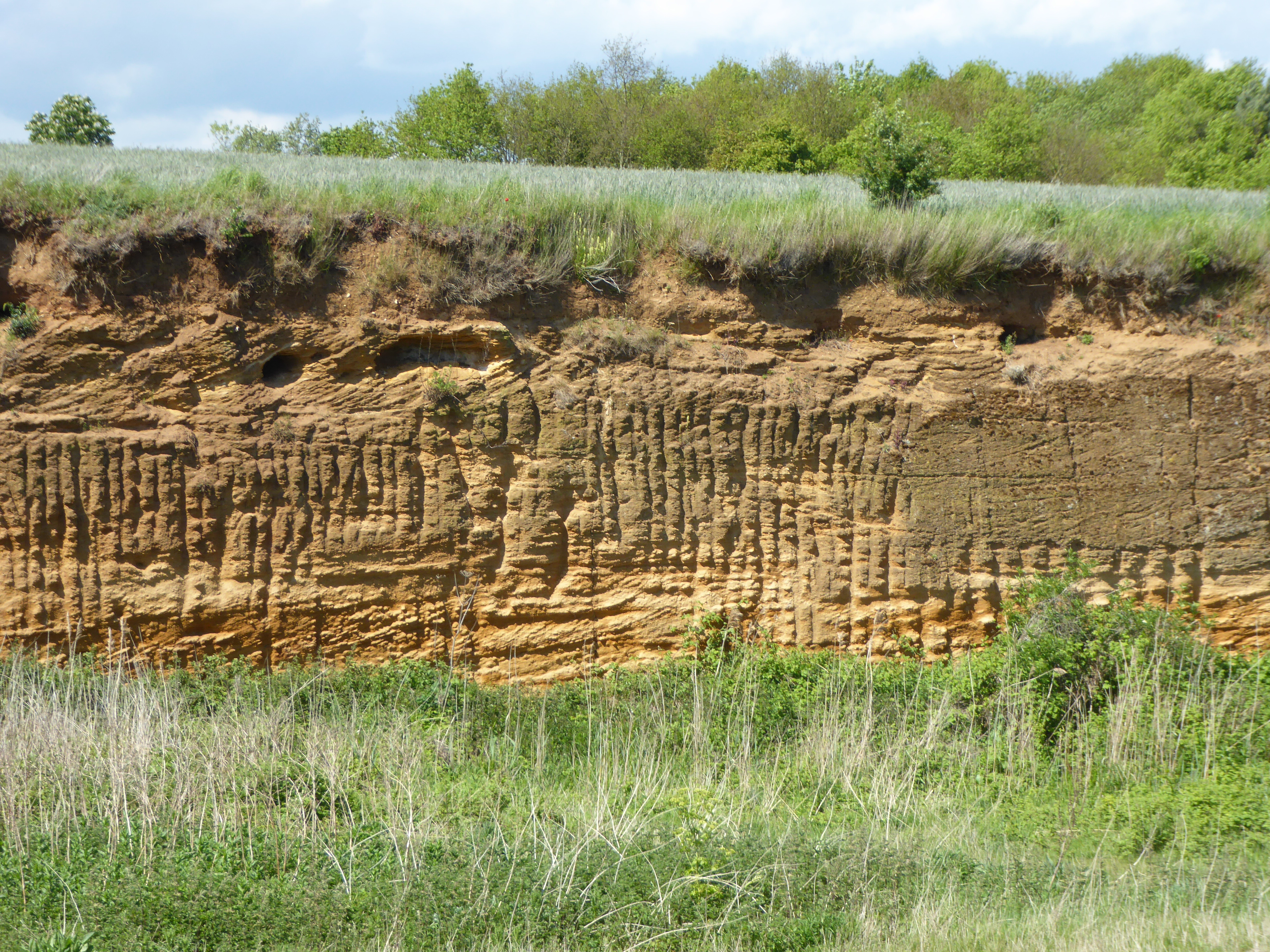
The area is renowned for its natural beauty and wildlife. The marshes and mudflats of the River Alde estuary provide a habitat for a wide range of bird species, including avocets, terns, and curlews, making it a haven for birdwatchers. The nearby Alde-Ore Estuary is also home to the famous National Nature Reserve, Orford Ness, which offers unique landscapes and rare flora and fauna.

The village itself offers limited amenities, with a pub and a farm shop providing essential services to the local community and visitors. However, the nearby town of Aldeburgh, just a short drive away, offers a wider range of facilities, including shops, restaurants, and entertainment options.

Overall, Iken is a charming and tranquil village that offers a peaceful escape from the hustle and bustle of city life, while also providing access to the stunning natural beauty of the Suffolk coast.

If you have any feedback on the listing, please let us know in the comments section below.
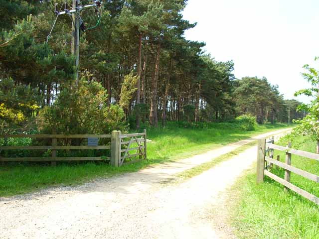
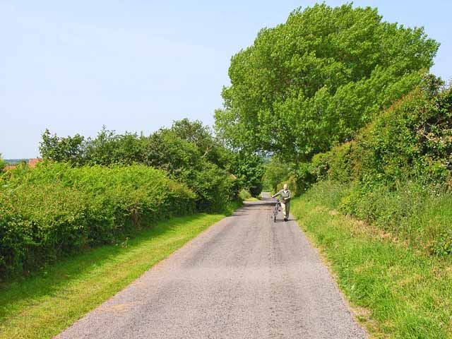
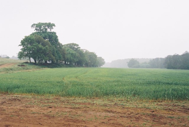
Iken Images

Images are sourced within 2km of 52.146239/1.532746 or Grid Reference TM4155. Thanks to Geograph Open Source API. All images are credited.

Lower Troublesome Reach, Iken, Suffolk An appropriate name for this stretch of the River Alde. Photograph taken at high tide looking north-east towards Iken church.
Lower Troublesome Reach, Iken, Suffolk
An appropriate name for this stretch of the River Alde. Photograph taken at high tide looking north-east towards Iken church.
Iken, near Snape, looking towards the river In the background is the River Alde and in the far distance is St. Botolph's Church on its promontory.
Iken, near Snape, looking towards the river
In the background is the River Alde and in the far distance is St. Botolph's Church on its promontory.
The River Alde at Iken
St Botolph's Church, Iken The Anglo-Saxon Chronicle records that in AD 654 'Botwulf began to build the minster at Icanho'. Better known now as St Botolph.
St Botolph's Church, Iken
The Anglo-Saxon Chronicle records that in AD 654 'Botwulf began to build the minster at Icanho'. Better known now as St Botolph.
Thatching in progress Alde Cottage, Iken
Thatching in progress
Alde Cottage, Iken
Decoy Cottage, Iken Very large for a cottage! The "decoy" refers to a duck decoy pond, about 500 m to the east.
Decoy Cottage, Iken
Very large for a cottage! The "decoy" refers to a duck decoy pond, about 500 m to the east.
Shelter belt and driveway leading to Marshland House Near Sudbourne.
Shelter belt and driveway leading to Marshland House
Near Sudbourne.
Who said Suffolk was flat? Even in the coastal plain, steep little hills, like this one at the appropriately named Hill Farm which is only 15 metres high, can still cause cyclists to get off and push.
Who said Suffolk was flat?
Even in the coastal plain, steep little hills, like this one at the appropriately named Hill Farm which is only 15 metres high, can still cause cyclists to get off and push.
Field near High Street, Iken The Long Reach of the Alde Estuary can be seen in the background.
Field near High Street, Iken
The Long Reach of the Alde Estuary can be seen in the background.
Interior of St. Botolph, Iken, Suffolk Interior of St. Botolph, Iken, Suffolk. It was at this place that St. Botolph founded his monastery and brought Christianity to Suffolk. There has been a church on this site for over 1350 years.

See also this photograph <a href="https://www.geograph.org.uk/photo/434060">TM4156 : East Window and Altar, St. Botolph</a>.
Interior of St. Botolph, Iken, Suffolk
Interior of St. Botolph, Iken, Suffolk. It was at this place that St. Botolph founded his monastery and brought Christianity to Suffolk. There has been a church on this site for over 1350 years. See also this photograph TM4156 : East Window and Altar, St. Botolph.
Northern Edge of Sudbourne Great Wood Looking southeast from near Wood Farm.
Northern Edge of Sudbourne Great Wood
Looking southeast from near Wood Farm.
East Window and Altar, St. Botolph The east window and altar of St. Botolph’s church. It was at this place that St. Botolph founded his monastery and brought Christianity to Suffolk. There has been a church on this site for over 1350 years.

See also <a href="https://www.geograph.org.uk/photo/212507">TM4156 : Interior of St. Botolph, Iken, Suffolk</a>.
East Window and Altar, St. Botolph
The east window and altar of St. Botolph’s church. It was at this place that St. Botolph founded his monastery and brought Christianity to Suffolk. There has been a church on this site for over 1350 years. See also TM4156 : Interior of St. Botolph, Iken, Suffolk.
Cliff Reach - Iken Looking north-east across the River Alde at low tide. Iken Church can be seen on the skyline.
Cliff Reach - Iken
Looking north-east across the River Alde at low tide. Iken Church can be seen on the skyline.
Track to Iken Marshes This farm track winds around the base of Yarn Hill and leads out onto low-lying marshland.
Track to Iken Marshes
This farm track winds around the base of Yarn Hill and leads out onto low-lying marshland.
St Botolph's Church, Iken A remote church on a peninsula of land that juts into the River Alde. The 'village' of Iken is no more than a few scattered houses.
St Botolph's Church, Iken
A remote church on a peninsula of land that juts into the River Alde. The 'village' of Iken is no more than a few scattered houses.
Iken Marshes Looking northwards from the track at the base of Yarn Hill. The building in the distance is Black Heath, on the far side of the River Alde.
Iken Marshes
Looking northwards from the track at the base of Yarn Hill. The building in the distance is Black Heath, on the far side of the River Alde.
Footpath at High Street The path follows the line of trees towards the River Alde. High Street is a small hamlet consisting of half a dozen houses.
Footpath at High Street
The path follows the line of trees towards the River Alde. High Street is a small hamlet consisting of half a dozen houses.
Cliff Reach, River Alde Looking across Cliff Reach from Iken Cliff. Iken church can be seen in the distance.
Cliff Reach, River Alde
Looking across Cliff Reach from Iken Cliff. Iken church can be seen in the distance.
Show me another place!

Iken is located at Grid Ref: TM4155 (Lat: 52.146239, Lng: 1.532746)

Administrative County: Suffolk

District: East Suffolk

Police Authority: Suffolk

What 3 Words

///disbanded.implanted.miss. Near Aldeburgh, Suffolk

Nearby Locations

Iken

Related Wikis

Iken

Iken is a small village and civil parish in the sandlands of the English county of Suffolk, an area formerly of heathland and sheep pasture. It is near...

Red House Farm Pit

Red House Farm Pit is a 0.5-hectare (1.2-acre) geological Site of Special Scientific Interest east of Wickham Market in Suffolk. It is a Geological Conservation...

Alde Mudflats

Alde Mudflats is a 22 hectare nature reserve west of Iken in Suffolk. It is owned by the Crown Estate and managed by the Suffolk Wildlife Trust. It is...

Suffolk Coastal (UK Parliament constituency)

Suffolk Coastal (sometimes known as Coastal Suffolk) is a parliamentary constituency in the county of Suffolk, England which has been represented in the...

Plomesgate Hundred

Plomesgate is a hundred of Suffolk, consisting of 41,579 acres (168.26 km2).Plomesgate Hundred comprises the historic ports of Aldeburgh and Orford, the...

Iken Wood

Iken Wood is a 5.3-hectare (13-acre) biological Site of Special Scientific Interest south of Snape in Suffolk. It is in the Suffolk Coast and Heaths Area...

Sudbourne

Sudbourne is a village and civil parish in Suffolk, England, located approximately 2 miles (3 km) north of Orford. All Saints' Church dates from the 14th...

Snape Warren

Snape Warren is a 48 hectare biological Site of Special Scientific Interest east of Snape in Suffolk. It is part of the Sandlings Special Protection Area...

Nearby Amenities

Located within 500m of 52.146239,1.532746
Bus Stop
Swallow Corner
Naptan AtcoCode: 390060128
Naptan Bearing: NW
Naptan BusStopType: CUS
Naptan CommonName: Swallow Corner
Naptan Indicator: adj
Naptan Landmark: Swallow Corner
Naptan NaptanCode: sufgmtgm
Naptan Street: Sandy Lane
Naptan Verified: no
Source: naptan_import
Lat/Long: 52.1436184/1.532724
Bus Stop
Swallow Corner
Naptan AtcoCode: 390060129
Naptan Bearing: SW
Naptan BusStopType: CUS
Naptan CommonName: Swallow Corner
Naptan Indicator: opp
Naptan Landmark: Swallow Corner
Naptan NaptanCode: sufgmtgp
Naptan Street: Sandy Lane
Naptan Verified: no
Source: naptan_import
Lat/Long: 52.143638/1.5328592
Post Box
Collection Times: Mo-Fr 09:00; Sa 09:00
Post Box Type: lamp
Ref: IP12 6314
Royal Cypher: EIIR
Royal Cypher Wikidata: Q33102113
Lat/Long: 52.14376/1.5326563
Power: pole
Lat/Long: 52.1422082/1.5333854
Power: pole
Lat/Long: 52.144295/1.5267147
Power: pole
Lat/Long: 52.1438016/1.528033
Power: pole
Lat/Long: 52.1432781/1.5294439
Power: pole
Lat/Long: 52.1427251/1.53097
Power: pole
Lat/Long: 52.1424551/1.5316594
Parking
Access: private
Lat/Long: 52.1440649/1.5324466
Parking
Access: private
Lat/Long: 52.1487328/1.5266651
Parking
Access: private
Lat/Long: 52.142581/1.5361038
Parking
Access: private
Lat/Long: 52.1427415/1.5373296
Turning Circle
Lat/Long: 52.1431646/1.5350443
The data included in this document is from www.openstreetmap.org. The data is made available under ODbL.

Have you been to Iken?

Leave your review of Iken below (or comments, questions and feedback).