Ickham and Well

Civil Parish in Kent Canterbury

England

Ickham and Well

Established orchard The view of <a href="https://www.geograph.org.uk/photo/6185399">TR2257 : Establishing a new orchard</a> was taken before the trees had been planted.
Established orchard Credit: John Baker

Ickham and Well is a civil parish located in the county of Kent, England. It is situated in the district of Canterbury and covers an area of approximately 9.5 square kilometers. The parish is made up of two villages, Ickham and Well, which are located in close proximity to each other.

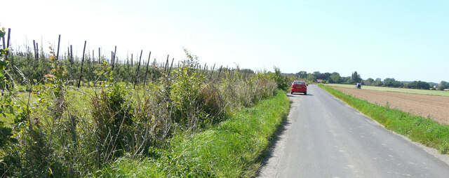
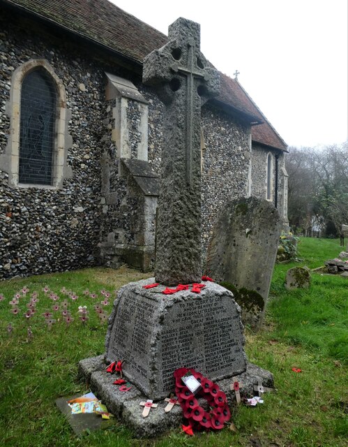
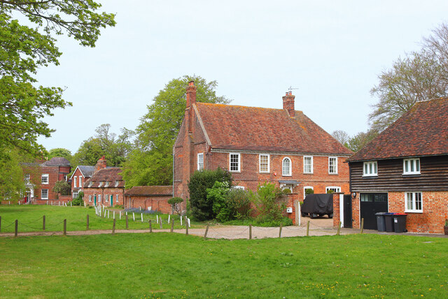
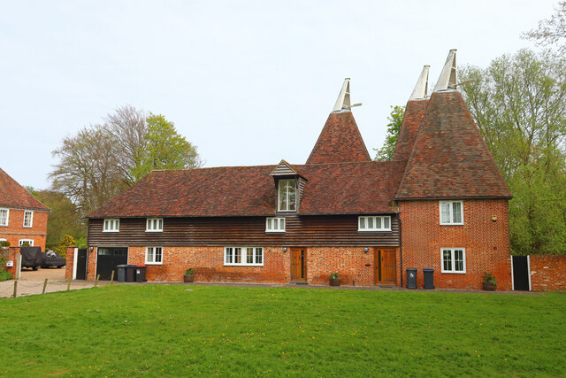
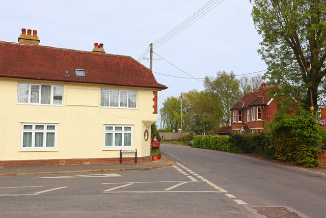
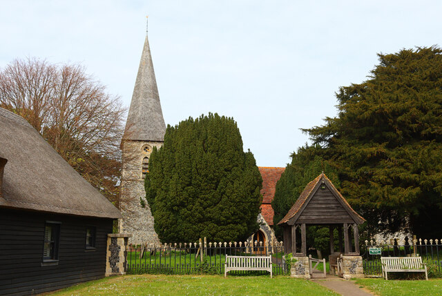
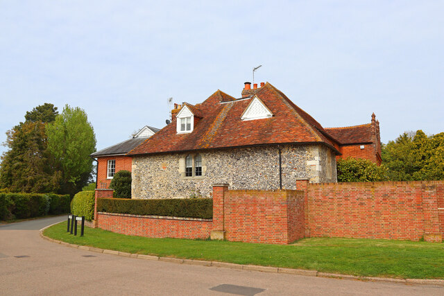
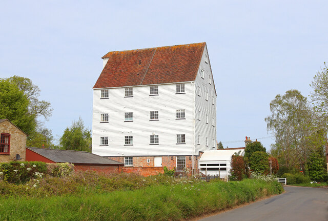
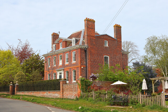
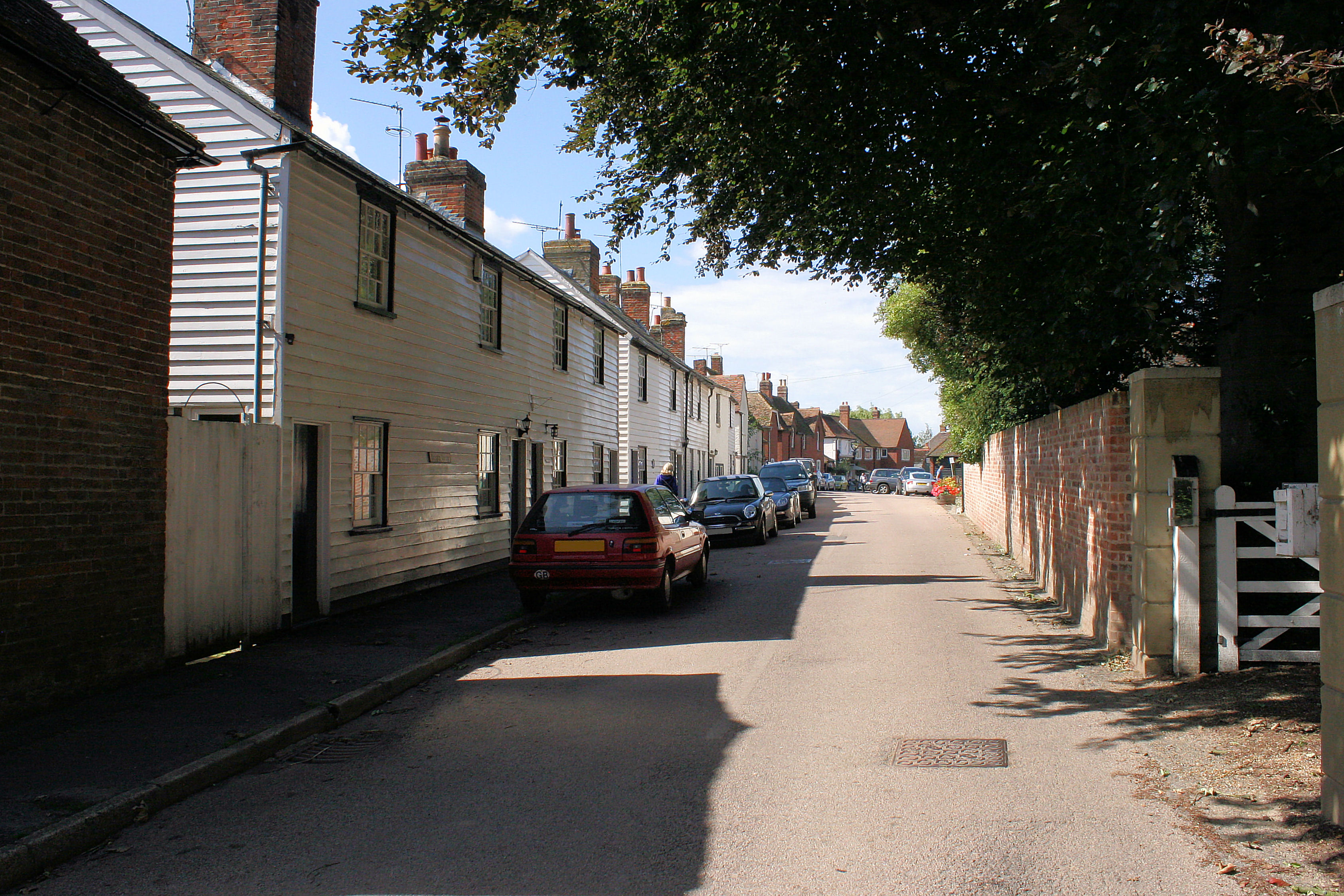
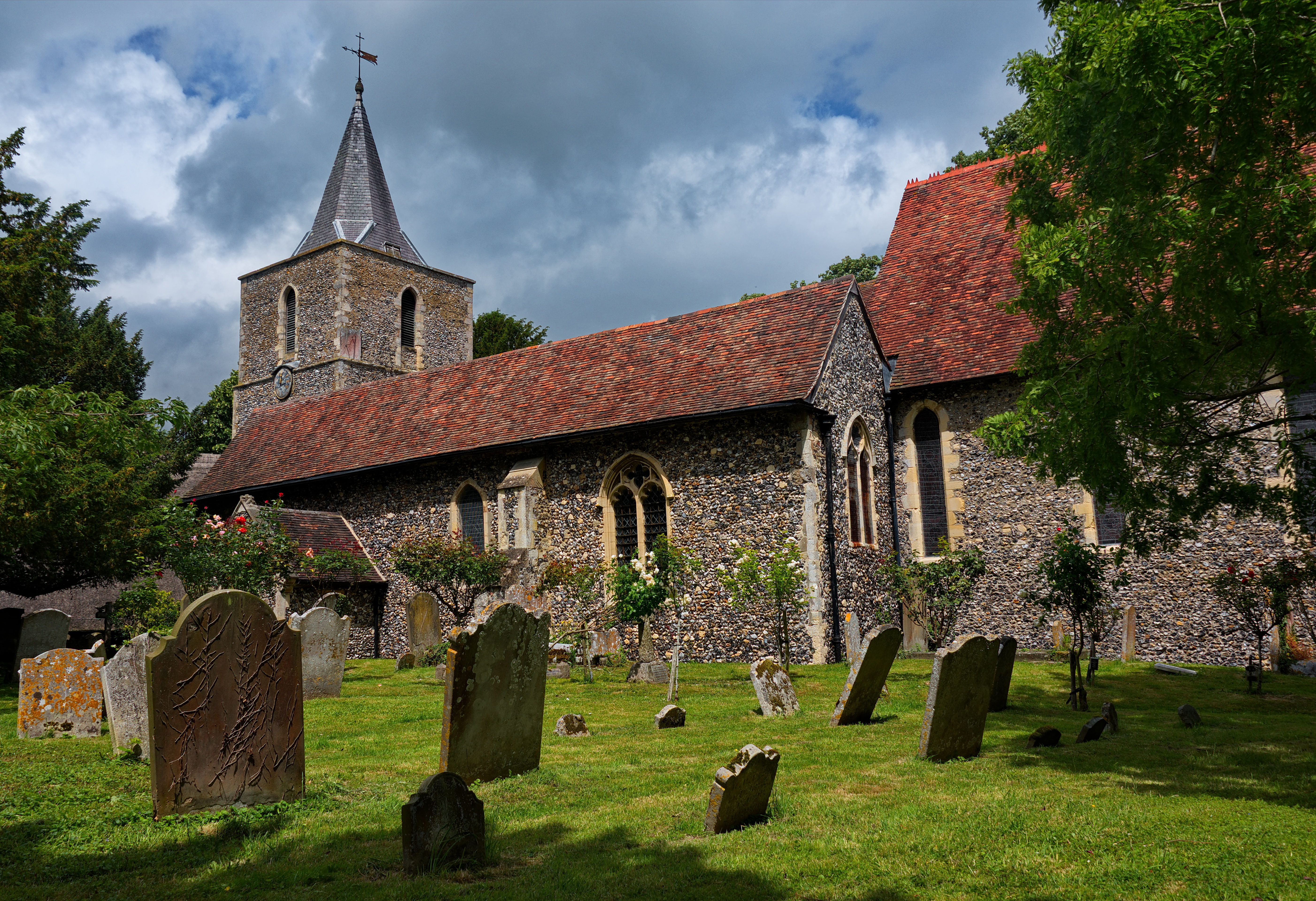
Ickham is a picturesque village with a rich history dating back to the medieval period. It is known for its charming thatched cottages, historic church, and traditional village green. The village is surrounded by beautiful countryside, with rolling hills and meadows providing a peaceful and idyllic setting.

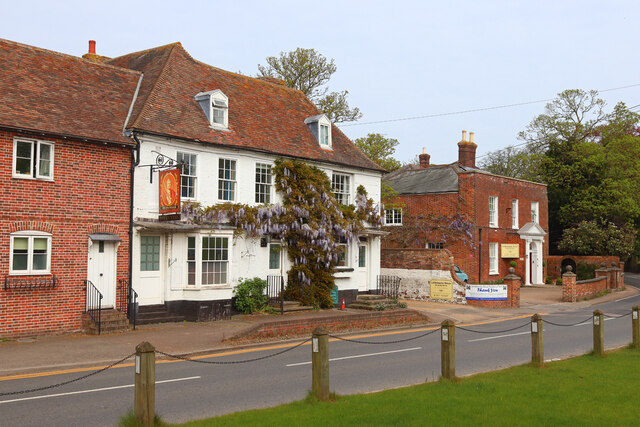
Well, on the other hand, is a smaller village located just to the east of Ickham. It is characterized by its quaint cottages and scenic surroundings. Well is home to a number of historic buildings, including a 13th-century church and a traditional pub that has been serving locals for generations.

Both villages are well-connected to nearby towns and cities, with Canterbury being just a short drive away. This offers residents easy access to a wide range of amenities, including shopping centers, schools, and healthcare facilities.

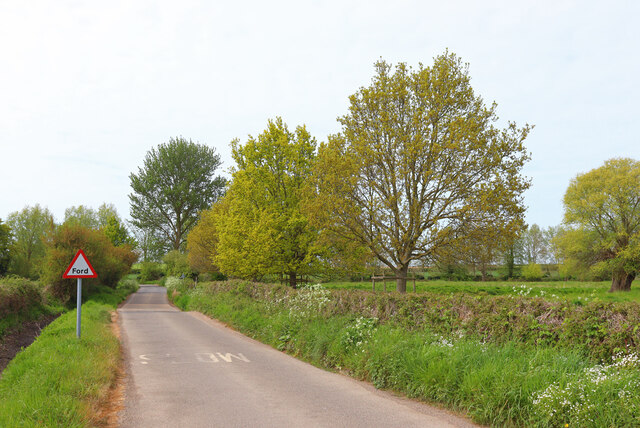
The area is popular with both locals and visitors alike, thanks to its natural beauty and rural charm. It provides opportunities for outdoor activities such as hiking, cycling, and horse riding, with many scenic trails and bridleways to explore.

Overall, Ickham and Well offer a peaceful and picturesque setting with a rich history, making it a desirable place to live or visit for those seeking a quiet and rural lifestyle.

If you have any feedback on the listing, please let us know in the comments section below.

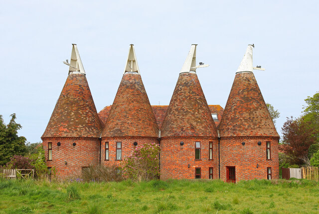
Ickham and Well Images

Images are sourced within 2km of 51.269169/1.18254 or Grid Reference TR2257. Thanks to Geograph Open Source API. All images are credited.

Established orchard The view of <a href="https://www.geograph.org.uk/photo/6185399">TR2257 : Establishing a new orchard</a> was taken before the trees had been planted.
Established orchard
The view of TR2257 : Establishing a new orchard was taken before the trees had been planted.
Wickham Mill Repairs are being undertaken to the boards over the waterwheel with a framework in place to attach new boards to. 

The watermill is a grade II listed early 19th century building with four storeys and attics in the gable end. The ground floor is of red brick, faced with weatherboarding above. There are gable ends east and west and the roof is tiled. In the west gable end is a small projection of one window to which a hoist was once fixed. The windows have modern casements. There is an overshot waterwheel <span class="nowrap"><a title="https://britishlistedbuildings.co.uk/101336608-wickham-mill-wickhambreaux#.YRgJyIySncc" rel="nofollow ugc noopener" href="https://britishlistedbuildings.co.uk/101336608-wickham-mill-wickhambreaux#.YRgJyIySncc">Link</a><img style="margin-left:2px;" alt="External link" title="External link - shift click to open in new window" src="https://s1.geograph.org.uk/img/external.png" width="10" height="10"/></span>
Wickham Mill
Repairs are being undertaken to the boards over the waterwheel with a framework in place to attach new boards to. The watermill is a grade II listed early 19th century building with four storeys and attics in the gable end. The ground floor is of red brick, faced with weatherboarding above. There are gable ends east and west and the roof is tiled. In the west gable end is a small projection of one window to which a hoist was once fixed. The windows have modern casements. There is an overshot waterwheel LinkExternal link
Wickham Mill Repairs are being undertaken to the boards over the waterwheel with a framework in place to attach new boards to. This is a closer view of the repairs to the boards above the waterwheel of <a href="https://www.geograph.org.uk/photo/6932932">TR2258 : Wickham Mill</a>, from the east-northeast

The watermill is a grade II listed early 19th century building with four storeys and attics in the gable end. The ground floor is of red brick, faced with weatherboarding above. There are gable ends east and west and the roof is tiled. In the west gable end is a small projection of one window to which a hoist was once fixed. The windows have modern casements. There is an overshot waterwheel <span class="nowrap"><a title="https://britishlistedbuildings.co.uk/101336608-wickham-mill-wickhambreaux#.YRgJyIySncc" rel="nofollow ugc noopener" href="https://britishlistedbuildings.co.uk/101336608-wickham-mill-wickhambreaux#.YRgJyIySncc">Link</a><img style="margin-left:2px;" alt="External link" title="External link - shift click to open in new window" src="https://s1.geograph.org.uk/img/external.png" width="10" height="10"/></span>
Wickham Mill
Repairs are being undertaken to the boards over the waterwheel with a framework in place to attach new boards to. This is a closer view of the repairs to the boards above the waterwheel of TR2258 : Wickham Mill, from the east-northeast The watermill is a grade II listed early 19th century building with four storeys and attics in the gable end. The ground floor is of red brick, faced with weatherboarding above. There are gable ends east and west and the roof is tiled. In the west gable end is a small projection of one window to which a hoist was once fixed. The windows have modern casements. There is an overshot waterwheel LinkExternal link
Wickhambreaux Court, The List The view shows retiling of the roof is being carried out.

The house, which is grade II listed, is probably an 18th  century building, which was  refaced around 1800  
<span class="nowrap"><a title="https://britishlistedbuildings.co.uk/101085494-wickham-court-wickhambreaux#.YRlolXmSncc" rel="nofollow ugc noopener" href="https://britishlistedbuildings.co.uk/101085494-wickham-court-wickhambreaux#.YRlolXmSncc">Link</a><img style="margin-left:2px;" alt="External link" title="External link - shift click to open in new window" src="https://s1.geograph.org.uk/img/external.png" width="10" height="10"/></span>
Wickhambreaux Court, The List
The view shows retiling of the roof is being carried out. The house, which is grade II listed, is probably an 18th century building, which was refaced around 1800 LinkExternal link
Stained glass window, St. Vincent's Church, Littlebourne At the east end of the south aisle. The church of St Vincent of Saragossa dates from the 13th century and is thought to have been founded by the monks of St Augustine's Abbey in Canterbury. It is a Grade I listed building.
Stained glass window, St. Vincent's Church, Littlebourne
At the east end of the south aisle. The church of St Vincent of Saragossa dates from the 13th century and is thought to have been founded by the monks of St Augustine's Abbey in Canterbury. It is a Grade I listed building.
War memorial, St. Vincent's Church, Littlebourne The church of St Vincent of Saragossa dates from the 13th century and is thought to have been founded by the monks of St Augustine's Abbey in Canterbury. It is a Grade I listed building.
War memorial, St. Vincent's Church, Littlebourne
The church of St Vincent of Saragossa dates from the 13th century and is thought to have been founded by the monks of St Augustine's Abbey in Canterbury. It is a Grade I listed building.
Copperfields, Canterbury Road The house was built in a <a href="https://www.geograph.org.uk/photo/6524473">TR2357 : Field, Canterbury Road</a>.
Copperfields, Canterbury Road
The house was built in a TR2357 : Field, Canterbury Road.
Littlebourne House Green in Littlebourne.
Littlebourne House
Green in Littlebourne.
Footpath near Littlebourne Footpath and power lines with Littlebourne in the distance.
Footpath near Littlebourne
Footpath and power lines with Littlebourne in the distance.
The Oast Holiday accommodation in Littlebourne.
The Oast
Holiday accommodation in Littlebourne.
King William King William Day Centre, in Littlebourne.
King William
King William Day Centre, in Littlebourne.
Nargate Street / Church Road Road Junction in Littlebourne.
Nargate Street / Church Road
Road Junction in Littlebourne.
Drill Lane Ford on Drill Lane, Near Ickham.
Drill Lane
Ford on Drill Lane, Near Ickham.
Oast Cottages Houses in the village of Ickham.
Oast Cottages
Houses in the village of Ickham.
St John's St John the Evangelist in Ickham.
St John's
St John the Evangelist in Ickham.
The Old Rectory Old Rectory in Ickham.
The Old Rectory
Old Rectory in Ickham.
The Mill Mill at Wickhambreaux.
The Mill
Mill at Wickhambreaux.
The Old Rectory Old Rectory in Wickhambreaux.
The Old Rectory
Old Rectory in Wickhambreaux.
Show me another place!

Ickham and Well is located at Grid Ref: TR2257 (Lat: 51.269169, Lng: 1.18254)

Administrative County: Kent

District: Canterbury

Police Authority: Kent

What 3 Words

///troubles.watchdogs.hotdog. Near Littlebourne, Kent

Nearby Locations

Ickham Ickham and Well

Related Wikis

Ickham and Well

Ickham and Well is a mostly rural civil parish east of Canterbury in Kent, South East England. The parish covers the villages of Ickham and Bramling just...

Bramling

Bramling is a hamlet five miles (8 km) east of Canterbury in Kent, England. It lies on the A257 road between Littlebourne and Wingham. The local public...

St Vincent of Saragossa Church, Littlebourne

St Vincent of Saragossa's Church is the Church of England parish church of Littlebourne, Kent, England. The parish is part of the Benefice of Littlebourne...

Littlebourne

Littlebourne is a village and civil parish 4 miles (6.4 km) east of Canterbury in Kent, South East England. == History == The significant Howletts Anglo...

Wingham (Canterbury Road) railway station

Wingham (Canterbury Road) railway station was a terminus on the East Kent Light Railway. It opened in 1925 (named Wingham) and the last passenger train...

Wickhambreaux

Wickhambreaux ( WIK-əm-brew) is a village and civil parish in the Canterbury district, in the county of Kent, England. The village is just off the A257...

St Mary's Church, Wingham

St Mary's Church, Wingham, is an Anglican parish church in Wingham, Kent. It is recorded in the National Heritage List for England as a designated Grade...

Wingham Town railway station

Wingham Town railway station was a railway station on the East Kent Light Railway, which served the village of Wingham. It opened in 1920 and closed to...

Nearby Amenities

Located within 500m of 51.269169,1.18254
Bus Stop
Lee Priory
Bus: yes
Flag: no
Naptan AtcoCode: 240096792
Naptan Bearing: E
Naptan BusStopType: CUS
Naptan CommonName: Lee Priory
Naptan Indicator: opp
Naptan Landmark: Barton Fields Farm
Naptan NaptanCode: kntgmdmd
Naptan Street: Canterbury Road
Naptan Verified: no
Public Transport: platform
Source: naptan_import
Lat/Long: 51.270562/1.1770938
Bus Stop
Lee Priory
Bus: yes
Flag: no
Naptan AtcoCode: 240096794
Naptan Bearing: W
Naptan BusStopType: CUS
Naptan CommonName: Lee Priory
Naptan Indicator: adj
Naptan Landmark: Barton Fields Farm
Naptan NaptanCode: kntgmdmg
Naptan Street: Canterbury Road
Naptan Verified: no
Public Transport: platform
Source: naptan_import
Lat/Long: 51.2704756/1.1759693
Bus Stop
Cherville Lane
Bus: yes
Flag: no
Naptan AtcoCode: 240096796
Naptan Bearing: E
Naptan BusStopType: CUS
Naptan CommonName: Cherville Lane
Naptan Indicator: adj
Naptan Landmark: Cherville Lane
Naptan NaptanCode: kntgmdmj
Naptan Street: A257
Naptan Verified: no
Public Transport: platform
Source: naptan_import
Lat/Long: 51.2688157/1.1837556
Bus Stop
Cherville Lane
Bus: yes
Flag: no
Naptan AtcoCode: 240096798
Naptan Bearing: W
Naptan BusStopType: CUS
Naptan CommonName: Cherville Lane
Naptan Indicator: opp
Naptan Landmark: Cherville Lane
Naptan NaptanCode: kntgmdmp
Naptan Street: A257
Naptan Verified: no
Public Transport: platform
Source: naptan_import
Lat/Long: 51.2685409/1.1839373
Power: pole
Lat/Long: 51.2695509/1.1884079
Power: pole
Lat/Long: 51.2724806/1.1820883
Power: pole
Lat/Long: 51.2704803/1.1864121
Power: pole
Lat/Long: 51.2715125/1.1842167
Power: pole
Lat/Long: 51.2730458/1.1808779
Power: pole
Lat/Long: 51.2709584/1.1853842
Power: pole
Lat/Long: 51.2719713/1.1831903
Power: pole
Lat/Long: 51.270009/1.1874256
Power: pole
Lat/Long: 51.2690912/1.1894307
Power: pole
Lat/Long: 51.2701213/1.1827428
Power: pole
Lat/Long: 51.2693867/1.1820896
Power: pole
Lat/Long: 51.2707325/1.1834817
The data included in this document is from www.openstreetmap.org. The data is made available under ODbL.

Have you been to Ickham and Well?

Leave your review of Ickham and Well below (or comments, questions and feedback).