Ickham

Settlement in Kent Canterbury

England

Ickham

Established orchard The view of <a href="https://www.geograph.org.uk/photo/6185399">TR2257 : Establishing a new orchard</a> was taken before the trees had been planted.
Established orchard Credit: John Baker

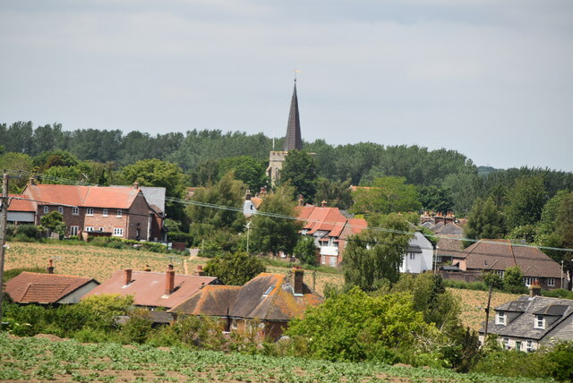
Ickham is a small village located in the county of Kent, in southeastern England. Situated about 7 miles south of the historic city of Canterbury, Ickham falls within the administrative district of Dover. With a population of around 600 residents, the village is characterized by its tranquil and rural setting.

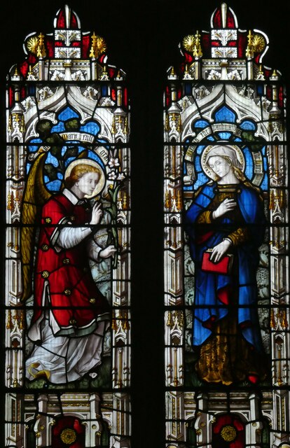
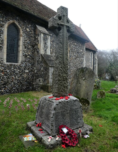
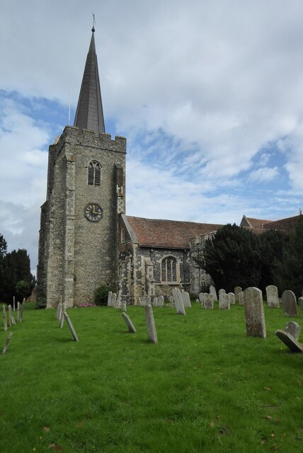
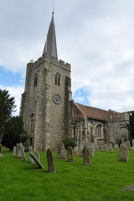
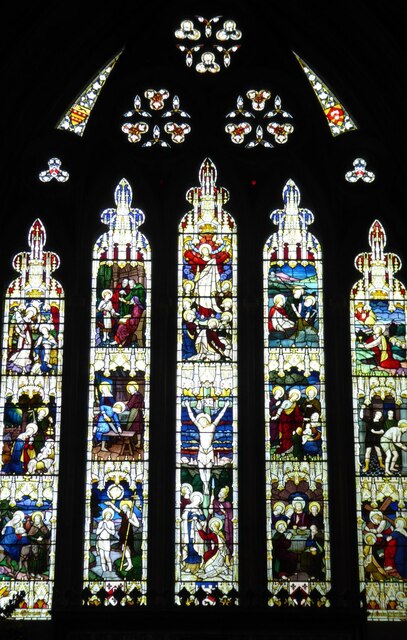
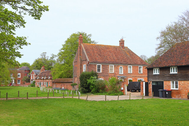
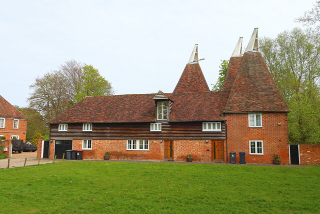
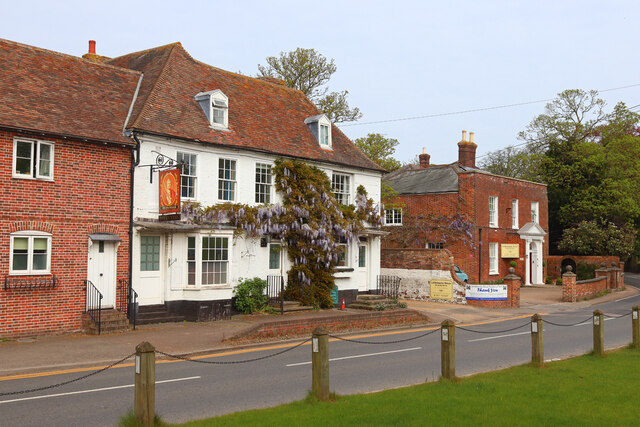
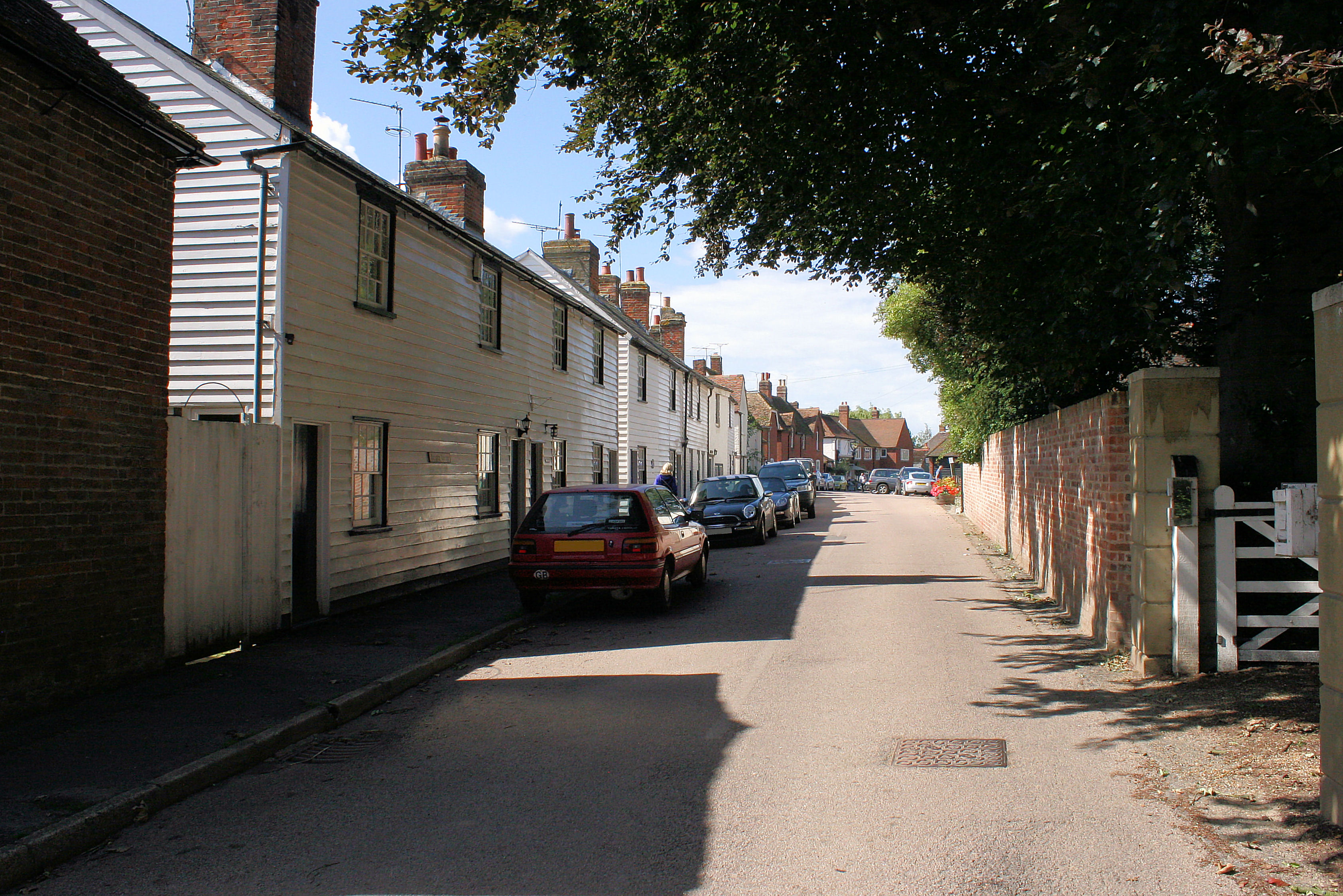
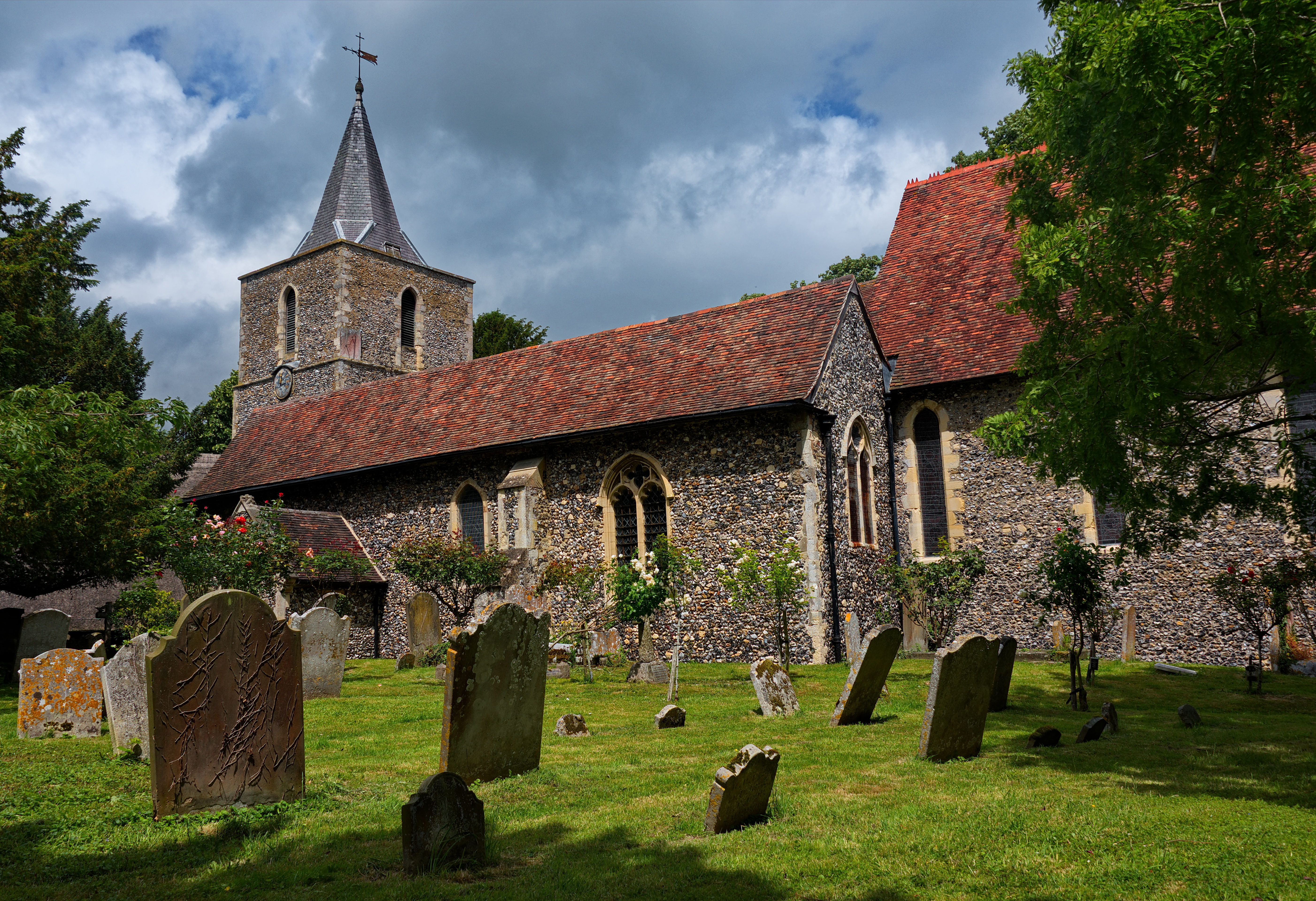
The origins of Ickham can be traced back to medieval times, and its name is believed to derive from the Old English words meaning "homestead of Icca's people." The village is known for its picturesque and quintessentially English appearance, with a mix of traditional thatched cottages, timber-framed houses, and Georgian buildings. The local church, St. John the Evangelist, is a notable landmark, dating back to the 12th century and featuring beautiful stained glass windows.

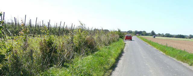
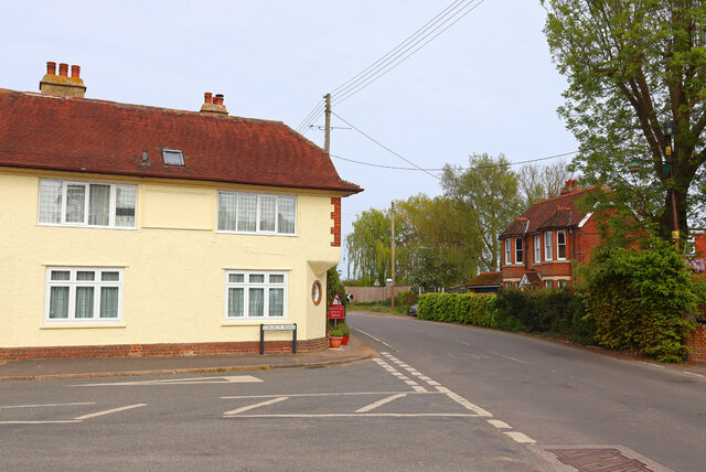
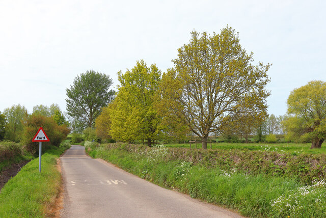
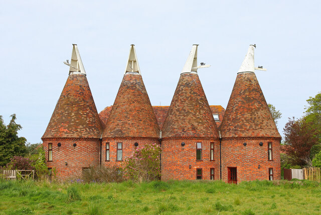
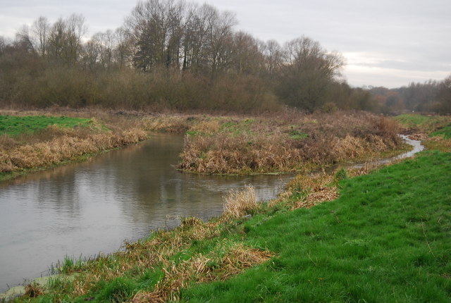
Ickham is surrounded by the scenic Kentish countryside, offering residents and visitors the opportunity to explore the area's natural beauty. The nearby Great Stour River provides pleasant walks and boating opportunities, while the surrounding fields and woodlands are popular among hikers and nature enthusiasts.

Despite its small size, Ickham boasts a close-knit community spirit and a range of amenities. These include a village hall, a primary school, a pub, and a local shop. Additionally, the village is well-connected to larger towns and cities. Canterbury is easily accessible by car or public transport, offering a wide range of amenities, shopping centers, and cultural attractions.

Overall, Ickham is a charming and idyllic village that offers a peaceful and picturesque living environment, combined with convenient access to nearby urban areas.

If you have any feedback on the listing, please let us know in the comments section below.

Ickham Images

Images are sourced within 2km of 51.276954/1.185689 or Grid Reference TR2257. Thanks to Geograph Open Source API. All images are credited.

Established orchard The view of <a href="https://www.geograph.org.uk/photo/6185399">TR2257 : Establishing a new orchard</a> was taken before the trees had been planted.
Established orchard
The view of TR2257 : Establishing a new orchard was taken before the trees had been planted.
Wickham Mill Repairs are being undertaken to the boards over the waterwheel with a framework in place to attach new boards to. 

The watermill is a grade II listed early 19th century building with four storeys and attics in the gable end. The ground floor is of red brick, faced with weatherboarding above. There are gable ends east and west and the roof is tiled. In the west gable end is a small projection of one window to which a hoist was once fixed. The windows have modern casements. There is an overshot waterwheel <span class="nowrap"><a title="https://britishlistedbuildings.co.uk/101336608-wickham-mill-wickhambreaux#.YRgJyIySncc" rel="nofollow ugc noopener" href="https://britishlistedbuildings.co.uk/101336608-wickham-mill-wickhambreaux#.YRgJyIySncc">Link</a><img style="margin-left:2px;" alt="External link" title="External link - shift click to open in new window" src="https://s1.geograph.org.uk/img/external.png" width="10" height="10"/></span>
Wickham Mill
Repairs are being undertaken to the boards over the waterwheel with a framework in place to attach new boards to. The watermill is a grade II listed early 19th century building with four storeys and attics in the gable end. The ground floor is of red brick, faced with weatherboarding above. There are gable ends east and west and the roof is tiled. In the west gable end is a small projection of one window to which a hoist was once fixed. The windows have modern casements. There is an overshot waterwheel LinkExternal link
Wickham Mill Repairs are being undertaken to the boards over the waterwheel with a framework in place to attach new boards to. This is a closer view of the repairs to the boards above the waterwheel of <a href="https://www.geograph.org.uk/photo/6932932">TR2258 : Wickham Mill</a>, from the east-northeast

The watermill is a grade II listed early 19th century building with four storeys and attics in the gable end. The ground floor is of red brick, faced with weatherboarding above. There are gable ends east and west and the roof is tiled. In the west gable end is a small projection of one window to which a hoist was once fixed. The windows have modern casements. There is an overshot waterwheel <span class="nowrap"><a title="https://britishlistedbuildings.co.uk/101336608-wickham-mill-wickhambreaux#.YRgJyIySncc" rel="nofollow ugc noopener" href="https://britishlistedbuildings.co.uk/101336608-wickham-mill-wickhambreaux#.YRgJyIySncc">Link</a><img style="margin-left:2px;" alt="External link" title="External link - shift click to open in new window" src="https://s1.geograph.org.uk/img/external.png" width="10" height="10"/></span>
Wickham Mill
Repairs are being undertaken to the boards over the waterwheel with a framework in place to attach new boards to. This is a closer view of the repairs to the boards above the waterwheel of TR2258 : Wickham Mill, from the east-northeast The watermill is a grade II listed early 19th century building with four storeys and attics in the gable end. The ground floor is of red brick, faced with weatherboarding above. There are gable ends east and west and the roof is tiled. In the west gable end is a small projection of one window to which a hoist was once fixed. The windows have modern casements. There is an overshot waterwheel LinkExternal link
Wickhambreaux Court, The List The view shows retiling of the roof is being carried out.

The house, which is grade II listed, is probably an 18th  century building, which was  refaced around 1800  
<span class="nowrap"><a title="https://britishlistedbuildings.co.uk/101085494-wickham-court-wickhambreaux#.YRlolXmSncc" rel="nofollow ugc noopener" href="https://britishlistedbuildings.co.uk/101085494-wickham-court-wickhambreaux#.YRlolXmSncc">Link</a><img style="margin-left:2px;" alt="External link" title="External link - shift click to open in new window" src="https://s1.geograph.org.uk/img/external.png" width="10" height="10"/></span>
Wickhambreaux Court, The List
The view shows retiling of the roof is being carried out. The house, which is grade II listed, is probably an 18th century building, which was refaced around 1800 LinkExternal link
Stained glass window, St. Vincent's Church, Littlebourne At the east end of the south aisle. The church of St Vincent of Saragossa dates from the 13th century and is thought to have been founded by the monks of St Augustine's Abbey in Canterbury. It is a Grade I listed building.
Stained glass window, St. Vincent's Church, Littlebourne
At the east end of the south aisle. The church of St Vincent of Saragossa dates from the 13th century and is thought to have been founded by the monks of St Augustine's Abbey in Canterbury. It is a Grade I listed building.
War memorial, St. Vincent's Church, Littlebourne The church of St Vincent of Saragossa dates from the 13th century and is thought to have been founded by the monks of St Augustine's Abbey in Canterbury. It is a Grade I listed building.
War memorial, St. Vincent's Church, Littlebourne
The church of St Vincent of Saragossa dates from the 13th century and is thought to have been founded by the monks of St Augustine's Abbey in Canterbury. It is a Grade I listed building.
Copperfields, Canterbury Road The house was built in a <a href="https://www.geograph.org.uk/photo/6524473">TR2357 : Field, Canterbury Road</a>.
Copperfields, Canterbury Road
The house was built in a TR2357 : Field, Canterbury Road.
St Mary's Church, Wingham St Mary's church, Wingham is Grade I listed, see: <span class="nowrap"><a title="https://historicengland.org.uk/listing/the-list/list-entry/1070091?section=official-list-entry" rel="nofollow ugc noopener" href="https://historicengland.org.uk/listing/the-list/list-entry/1070091?section=official-list-entry">Link</a><img style="margin-left:2px;" alt="External link" title="External link - shift click to open in new window" src="https://s1.geograph.org.uk/img/external.png" width="10" height="10"/></span>
St Mary's Church, Wingham
St Mary's church, Wingham is Grade I listed, see: LinkExternal link
East window, Wingham Church The Stained glass east window in St Mary's church, Wingham.
East window, Wingham Church
The Stained glass east window in St Mary's church, Wingham.
Reredos in St Mary's Church, Wingham The 15th-century reredos in St Mary's church, Wingham, which was brought from Troyes in France. The upper section depicts the Passion of Christ, the lower half shows the Last Supper and the Adoration of the Kings.
Reredos in St Mary's Church, Wingham
The 15th-century reredos in St Mary's church, Wingham, which was brought from Troyes in France. The upper section depicts the Passion of Christ, the lower half shows the Last Supper and the Adoration of the Kings.
Wingham Church spire Christians have been worshipping on this site since shortly after St. Augustine's mission to England in 597 AD. The building we see today, though, is essentially medieval, with major work from the late 13th century (chancel), early 15th (tower and south porch) and mid-16th (nave), with some Georgian and Victorian alterations.
The church’s size and prominence stem from its status as a College of Canons, founded by Archbishop Peckham in 1286 (The fine timber-framed buildings opposite the church were originally canons’ houses.) By Elizabethan times the building was in poor repair; in consequence, the old north aisle was pulled down and the south aisle rebuilt. The story goes that money collected for restoration by George Ffogarde, a Canterbury brewer, was embezzled - hence pillars made of chestnut rather than the traditional stone. 
Some fine monuments embellish the church, including one in the north chapel, now the vestry, to Sir Thomas Palmer (1624) and the remarkable Oxenden memorial (1682) in the form of a highly decorated obelisk. In the chancel, misericords with interesting wood-carvings survive from the early 14th century. Far plainer, but much more modern, is a plaque to General Miller, the Wingham-born hero of Peru's struggle for independence from Spain. 
Grade I listed. <span class="nowrap"><a title="http://www.britishlistedbuildings.co.uk/en-178359-church-of-st-mary-wingham-kent" rel="nofollow ugc noopener" href="http://www.britishlistedbuildings.co.uk/en-178359-church-of-st-mary-wingham-kent">Link</a><img style="margin-left:2px;" alt="External link" title="External link - shift click to open in new window" src="https://s1.geograph.org.uk/img/external.png" width="10" height="10"/></span>
Wingham Church spire
Christians have been worshipping on this site since shortly after St. Augustine's mission to England in 597 AD. The building we see today, though, is essentially medieval, with major work from the late 13th century (chancel), early 15th (tower and south porch) and mid-16th (nave), with some Georgian and Victorian alterations. The church’s size and prominence stem from its status as a College of Canons, founded by Archbishop Peckham in 1286 (The fine timber-framed buildings opposite the church were originally canons’ houses.) By Elizabethan times the building was in poor repair; in consequence, the old north aisle was pulled down and the south aisle rebuilt. The story goes that money collected for restoration by George Ffogarde, a Canterbury brewer, was embezzled - hence pillars made of chestnut rather than the traditional stone. Some fine monuments embellish the church, including one in the north chapel, now the vestry, to Sir Thomas Palmer (1624) and the remarkable Oxenden memorial (1682) in the form of a highly decorated obelisk. In the chancel, misericords with interesting wood-carvings survive from the early 14th century. Far plainer, but much more modern, is a plaque to General Miller, the Wingham-born hero of Peru's struggle for independence from Spain. Grade I listed. LinkExternal link
Littlebourne House Green in Littlebourne.
Littlebourne House
Green in Littlebourne.
The Oast Holiday accommodation in Littlebourne.
The Oast
Holiday accommodation in Littlebourne.
King William King William Day Centre, in Littlebourne.
King William
King William Day Centre, in Littlebourne.
Nargate Street / Church Road Road Junction in Littlebourne.
Nargate Street / Church Road
Road Junction in Littlebourne.
Drill Lane Ford on Drill Lane, Near Ickham.
Drill Lane
Ford on Drill Lane, Near Ickham.
Oast Cottages Houses in the village of Ickham.
Oast Cottages
Houses in the village of Ickham.
Show me another place!

Ickham is located at Grid Ref: TR2257 (Lat: 51.276954, Lng: 1.185689)

Administrative County: Kent

District: Canterbury

Police Authority: Kent

What 3 Words

///minerals.manifests.sparrows. Near Littlebourne, Kent

Nearby Locations

Ickham Ickham and Well

Related Wikis

Ickham and Well

Ickham and Well is a mostly rural civil parish east of Canterbury in Kent, South East England. The parish covers the villages of Ickham and Bramling just...

Wickhambreaux

Wickhambreaux ( WIK-əm-brew) is a village and civil parish in the Canterbury district, in the county of Kent, England. The village is just off the A257...

St Vincent of Saragossa Church, Littlebourne

St Vincent of Saragossa's Church is the Church of England parish church of Littlebourne, Kent, England. The parish is part of the Benefice of Littlebourne...

Bramling

Bramling is a hamlet five miles (8 km) east of Canterbury in Kent, England. It lies on the A257 road between Littlebourne and Wingham. The local public...

Littlebourne

Littlebourne is a village and civil parish 4 miles (6.4 km) east of Canterbury in Kent, South East England. == History == The significant Howletts Anglo...

Wingham (Canterbury Road) railway station

Wingham (Canterbury Road) railway station was a terminus on the East Kent Light Railway. It opened in 1925 (named Wingham) and the last passenger train...

Wingham River

The River Wingham is a tributary of the Little Stour in Kent, England. The river runs from its source near Ash, west, through Wingham to the Little Stour...

St Mary's Church, Wingham

St Mary's Church, Wingham, is an Anglican parish church in Wingham, Kent. It is recorded in the National Heritage List for England as a designated Grade...

Nearby Amenities

Located within 500m of 51.276954,1.185689
Ickham
Is In: Kent,England,UK
Place: village
Source: survey
Wikidata: Q2739801
Lat/Long: 51.2786172/1.184417
Telephone
Booth: K6
Covered: booth
Listed Status: Grade II
Payment Coins: yes
Payment Credit Cards: yes
Payment Debit Cards: yes
Phone: +44 1227 721287
Lat/Long: 51.2776426/1.1848642
Post Box
Collection Times: Mo-Fr 09:00; Sa 07:00
Operator: Royal Mail
Operator Wikidata: Q638098
Post Box Mounting: brick_pillar
Post Box Type: wall
Postal Code: CT3
Ref: CT3 161
Royal Cypher: GR
Royal Cypher Wikidata: Q33102273
Source: survey
Lat/Long: 51.2778207/1.1845407
Turning Circle
Lat/Long: 51.2753464/1.1826404
Bus Stop
Duke William
Bus: yes
Flag: no
Local Ref: adj
Naptan AtcoCode: 2400A071620A
Naptan Bearing: NW
Naptan BusStopType: CUS
Naptan CommonName: Duke William
Naptan Indicator: adj
Naptan Landmark: Duke William
Naptan NaptanCode: kntgdpdm
Naptan RevisionNumber: 4
Naptan Status: act
Naptan Street: The Street
Naptan Verified: no
Public Transport: platform
Ref: kntgdpdm
Source: naptan_import
Source Date: 2018-06-27
Lat/Long: 51.2783959/1.183264
Bus Stop
Pond
Bus: yes
Flag: no
Local Ref: adj
Naptan AtcoCode: 240097608
Naptan Bearing: NW
Naptan BusStopType: CUS
Naptan CommonName: Pond
Naptan Indicator: adj
Naptan Landmark: Pond
Naptan NaptanCode: kntgtdjp
Naptan RevisionNumber: 2
Naptan Status: act
Naptan Street: The Street
Naptan Verified: no
Public Transport: platform
Ref: kntgtdjp
Source: naptan_import
Source Date: 2018-06-27
Lat/Long: 51.2771537/1.1854224
Bus Stop
Pond
Bus: yes
Flag: no
Local Ref: opp
Naptan AtcoCode: 240097612
Naptan Bearing: SE
Naptan BusStopType: CUS
Naptan CommonName: Pond
Naptan Indicator: opp
Naptan Landmark: Pond
Naptan NaptanCode: kntgtdjt
Naptan RevisionNumber: 2
Naptan Status: act
Naptan Street: The Street
Naptan Verified: no
Public Transport: platform
Ref: kntgtdjt
Source: naptan_import
Source Date: 2018-06-27
Lat/Long: 51.2771983/1.1856007
Power: pole
Lat/Long: 51.2753208/1.1810004
Power: pole
Lat/Long: 51.2747863/1.1798197
Power: pole
Lat/Long: 51.2762959/1.1831806
Power: pole
Lat/Long: 51.2758084/1.1820983
Power: pole
Lat/Long: 51.2792581/1.1795871
Power: pole
Lat/Long: 51.2791641/1.1815425
Power: pole
Lat/Long: 51.2792044/1.1805527
Power: pole
Lat/Long: 51.2786906/1.1820078
Power: pole
Lat/Long: 51.278345/1.1823807
Pub
Duke William
Addr City: Canterbury
Addr Postcode: CT3 1QP
Addr Street: The Street
Addr Village: Ickham
Alt Name: The Duke William
Contact Facebook: https://www.facebook.com/dukewilliamickham
Contact Phone: +44 1227 721308
Contact Twitter: DukeWilliamKent
Contact Website: https://www.thedukewilliamickham.com/
Fhrs Id: 1103283
Source Addr: FHRS Open Data
Lat/Long: 51.2784298/1.1830281
Bus Stop
Duke William
Bus: yes
Flag: no
Local Ref: opp
Naptan AtcoCode: 240097552
Naptan Bearing: SE
Naptan BusStopType: CUS
Naptan CommonName: Duke William
Naptan Indicator: opp
Naptan Landmark: Duke William
Naptan NaptanCode: kntjmjmw
Naptan RevisionNumber: 4
Naptan Status: act
Naptan Street: The Street
Naptan Verified: no
Public Transport: platform
Ref: kntjmjmw
Source: naptan_import
Source Date: 2018-06-27
Lat/Long: 51.278276/1.1836818
Crossing
Lat/Long: 51.2755393/1.1836636
The data included in this document is from www.openstreetmap.org. The data is made available under ODbL.

Have you been to Ickham?

Leave your review of Ickham below (or comments, questions and feedback).