Hoon

Civil Parish in Derbyshire South Derbyshire

England

Hoon

Renaissance Hair Lounge Main Street, Hilton.
Renaissance Hair Lounge Credit: Ian S

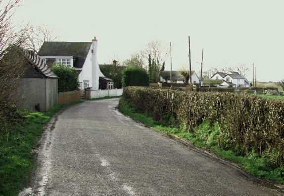
Hoon is a civil parish located in the district of South Derbyshire, in the county of Derbyshire, England. It is nestled in the beautiful countryside of the Trent Valley, approximately 6 miles west of Derby. The parish covers an area of approximately 1,446 acres and is home to a small population of around 200 residents.

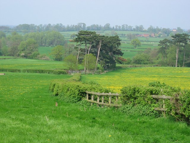
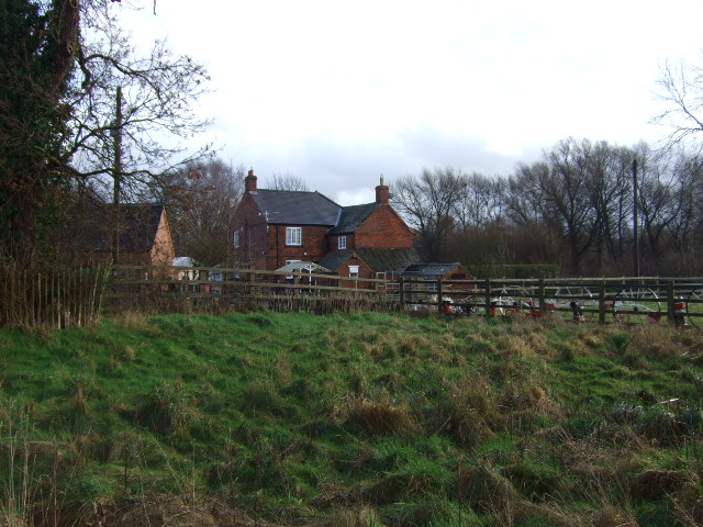
Hoon is predominantly an agricultural area, with lush green fields and farmland dominating the landscape. The picturesque village is characterized by its charming cottages and traditional farmhouses, which add to its rural charm.

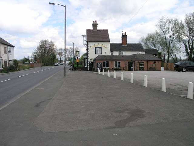
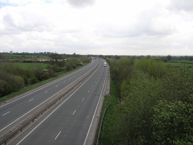
The parish is well connected to the surrounding areas, with good transport links to Derby and nearby towns. The A516 road runs through Hoon, providing easy access to the nearby A50 and A38, which connect to major cities such as Birmingham and Nottingham.

Despite its small size, Hoon offers a range of amenities to its residents. The village has a village hall, which serves as a hub for community activities and events. There are also several local businesses, including a farm shop and a pub, where residents and visitors can enjoy a drink or a meal.

The natural beauty surrounding Hoon makes it a popular destination for nature lovers and outdoor enthusiasts. The River Dove, a renowned river for fishing, flows nearby, offering opportunities for angling. The area is also dotted with scenic walking trails, providing stunning views of the countryside.

In summary, Hoon is a peaceful and idyllic civil parish in Derbyshire, known for its rural charm, agricultural landscapes, and access to natural beauty.

If you have any feedback on the listing, please let us know in the comments section below.
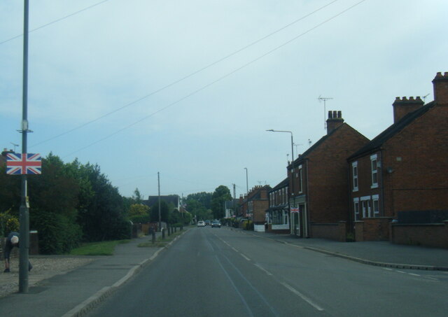
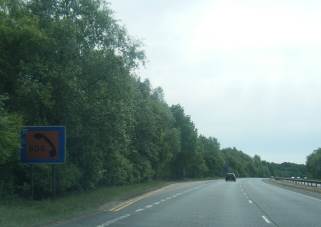
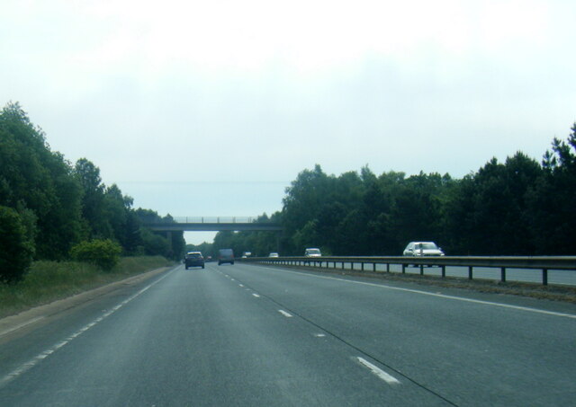
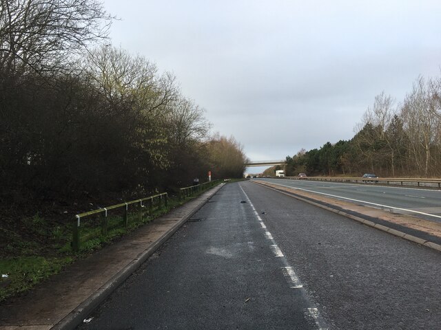
Hoon Images

Images are sourced within 2km of 52.882247/-1.660795 or Grid Reference SK2231. Thanks to Geograph Open Source API. All images are credited.

Renaissance Hair Lounge Main Street, Hilton.
Renaissance Hair Lounge
Main Street, Hilton.
A511 at Hassall Road, Hatton
A50 Foston-Hatton-Hilton Bypass
A50 nearing Sutton Lane overbridge
Lay-by on the A50
Lay-by on the A50
Hoon Ridge Buttercup meadows running down to the Sutton Brook.
Hoon Ridge
Buttercup meadows running down to the Sutton Brook.
Railway Tavern Situated some way from the current railway I assume this tavern relates to a long gone railway.  The awkward geometry of the building looks as if the two storey part has been cut in half at some time.
Railway Tavern
Situated some way from the current railway I assume this tavern relates to a long gone railway. The awkward geometry of the building looks as if the two storey part has been cut in half at some time.
Footpath to the A50 This footpath was interrupted by the building of the A50.  It ultimately leads to Sutton on the Hill. The A50 is just behind the hedge at the end of this field.
Footpath to the A50
This footpath was interrupted by the building of the A50. It ultimately leads to Sutton on the Hill. The A50 is just behind the hedge at the end of this field.
A50 East A50 west too.  This busy road carries traffic from the M1 near the airport formerly known as East Midlands to Stoke on Trent.  On it way it crosses the A38 west of Derby.
A50 East
A50 west too. This busy road carries traffic from the M1 near the airport formerly known as East Midlands to Stoke on Trent. On it way it crosses the A38 west of Derby.
Track in Blossom This short track is used to access local fields.
Track in Blossom
This short track is used to access local fields.
Footpath to Sutton This footpath crosses Sutton Brook on its way to Sutton on the Hill.
Footpath to Sutton
This footpath crosses Sutton Brook on its way to Sutton on the Hill.
Hilton Methodist Church Hlton's Methodist Church dates from 1841.
Hilton Methodist Church
Hlton's Methodist Church dates from 1841.
Hoon Lane Hoon Lane between Hilton and Hatton crosses the A50 on a bridge and then leads to Hoon Ridge and Hoon Mount.
Hoon Lane
Hoon Lane between Hilton and Hatton crosses the A50 on a bridge and then leads to Hoon Ridge and Hoon Mount.
Path and Gate and Fence and Cattle Grid This complex field entrance is also home to a footpath that leads to Marston on Dove.
Path and Gate and Fence and Cattle Grid
This complex field entrance is also home to a footpath that leads to Marston on Dove.
Blakelow Farm Blakelow Farm at Burntheath.
Blakelow Farm
Blakelow Farm at Burntheath.
Hilton Fields Lane The back lane to Hilton Fields Farm.
Hilton Fields Lane
The back lane to Hilton Fields Farm.
Mere on Dishfields Lane A mere on Dishfields lane,the farm at Dishfields is in the background.
Mere on Dishfields Lane
A mere on Dishfields lane,the farm at Dishfields is in the background.
Hilton Fields Farm The farm at the end of the green lane.
Hilton Fields Farm
The farm at the end of the green lane.
Show me another place!

Hoon is located at Grid Ref: SK2231 (Lat: 52.882247, Lng: -1.660795)

Administrative County: Derbyshire

District: South Derbyshire

Police Authority: Derbyshire

What 3 Words

///bother.tags.plugs. Near Etwall, Derbyshire

Nearby Locations

Hoon Hatton Fields

Related Wikis

Hoon, Derbyshire

Hoon is a hamlet and civil parish within the South Derbyshire district, which is in the county of Derbyshire, England. It is a predominantly rural area...

Burntheath

Burntheath is a hamlet in Derbyshire, England. It is located 1 mile north of Hilton, and adjacent to the A50 road.

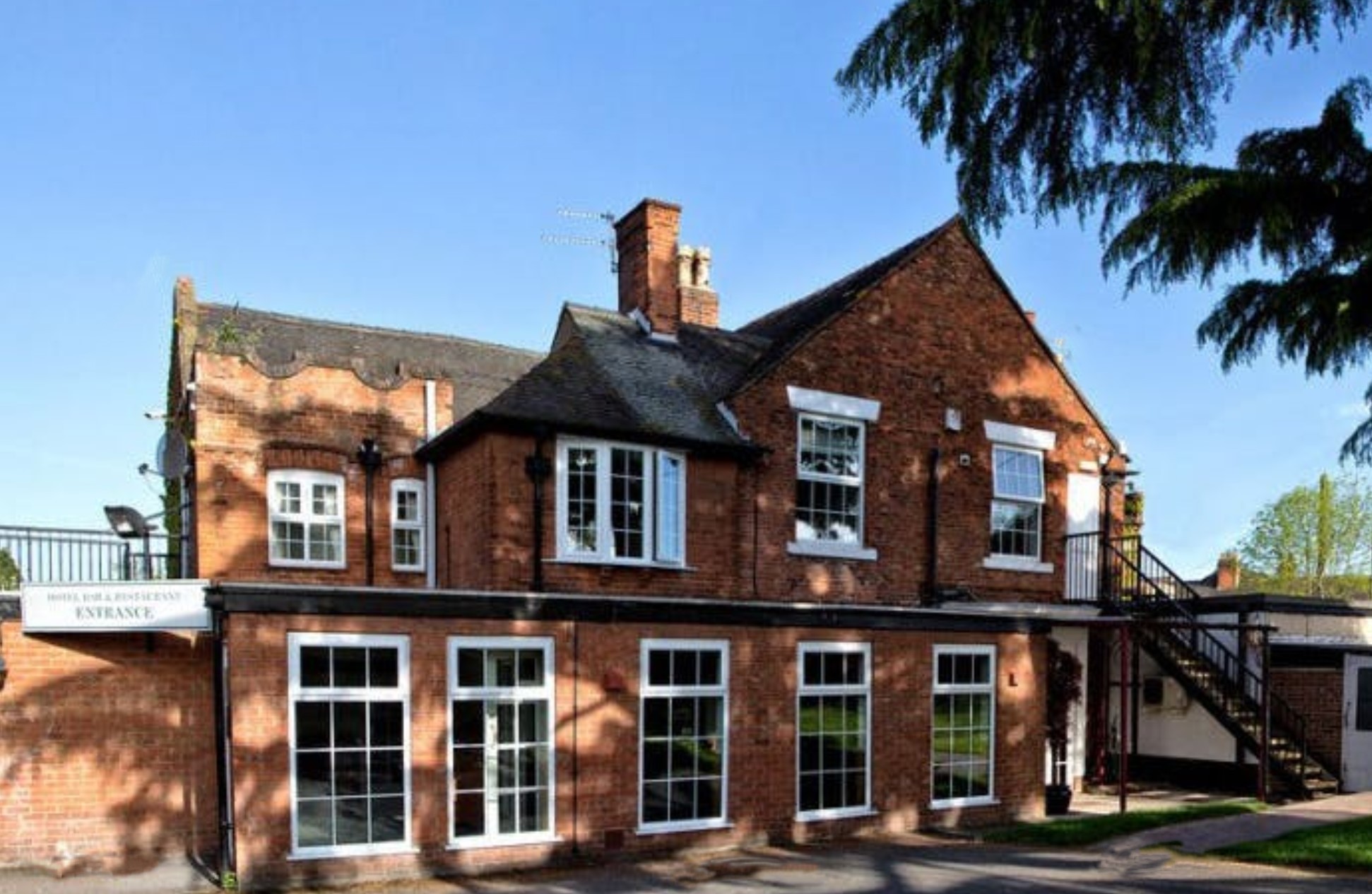
Hilton House Hotel, Derby

Hilton House Hotel, in Derby, England, is a building of historical significance. It is a Georgian house which was the ancestorial home of Herbert Martin...

Marston on Dove

Marston on Dove (historically Marston Upon Dove) is a village and civil parish in South Derbyshire, nine miles (14 km) south west of Derby and two miles...

Nearby Amenities

Located within 500m of 52.882247,-1.660795
Phone
Emergency: phone
Source: survey
Lat/Long: 52.8797813/-1.6652446
Parking
Fee: no
Note: Layby
Parking: surface
Source: Bing;survey
Lat/Long: 52.8798353/-1.66582
Barrier: stile
Lat/Long: 52.8854375/-1.6643241
Barrier: stile
Stile: stepover
Lat/Long: 52.8834667/-1.659829
Barrier: stile
Lat/Long: 52.8856718/-1.6641678
Barrier: stile
Lat/Long: 52.8837077/-1.6612031
Man Made: water_tank
Lat/Long: 52.8842269/-1.6627899
Passing Place
Lat/Long: 52.8794932/-1.6566941
Emergency Bay
Lat/Long: 52.8797285/-1.6667982
Hoon Mount
Archaeological Site: tumulus
Historic: archaeological_site
Tumulus: mound
Lat/Long: 52.8833727/-1.6595214
Barrier: stile
Stile: stepover
Lat/Long: 52.8828751/-1.6575836
Man Made: survey_point
Openplaques Id: 57805
Survey Point Structure: pillar
Lat/Long: 52.8833988/-1.6594975
Barrier: stile
Stile: stepover
Lat/Long: 52.882894/-1.6576886
Barrier: stile
Stile: stepover
Lat/Long: 52.8807801/-1.6569484
Power: pole
Lat/Long: 52.8805589/-1.6584447
Power: pole
Lat/Long: 52.8799859/-1.6599387
The data included in this document is from www.openstreetmap.org. The data is made available under ODbL.

Have you been to Hoon?

Leave your review of Hoon below (or comments, questions and feedback).