Hargrave and Huxley

Civil Parish in Cheshire

England

Hargrave and Huxley

River Gowey River Gowey seen from Huxley Bridge.
River Gowey Credit: Peter McDermott

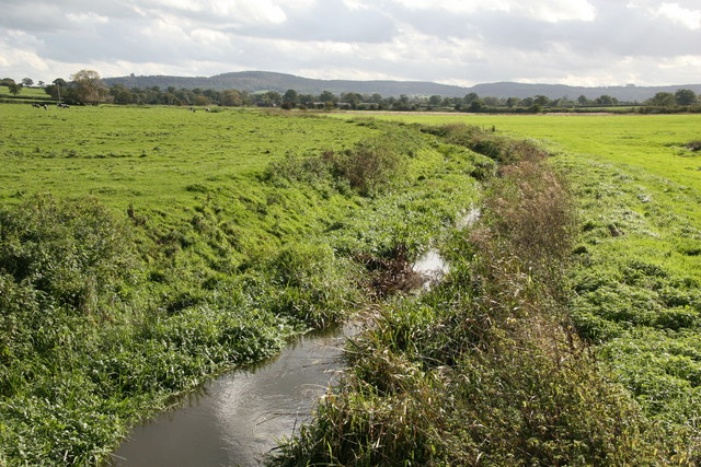
Hargrave and Huxley is a civil parish located in the county of Cheshire, England. It is situated near the border with Wales, about 10 miles southwest of the city of Chester. The parish is made up of two small villages, Hargrave and Huxley, which are separated by the Shropshire Union Canal.

Hargrave, the larger of the two villages, is a picturesque rural settlement with a population of around 400 residents. The village is known for its charming traditional cottages and historic buildings, including the 12th-century St. Peter's Church. The surrounding countryside offers beautiful views and is popular among walkers and nature enthusiasts.

Huxley, on the other hand, is a smaller village with a population of approximately 200 people. It is located on the banks of the Shropshire Union Canal and is characterized by its peaceful and tranquil atmosphere. The village is known for its well-preserved canal-side cottages and the Huxley Hall, a Grade II listed building that dates back to the 18th century.

Both Hargrave and Huxley are primarily residential areas, with a mix of old and new houses. The villages have limited amenities, but there are a few local businesses and a primary school serving the area. The close-knit community organizes various social events throughout the year, including summer fairs and Christmas celebrations. Overall, Hargrave and Huxley offer a peaceful and idyllic countryside living experience.

If you have any feedback on the listing, please let us know in the comments section below.

Hargrave and Huxley Images

Images are sourced within 2km of 53.15267/-2.763409 or Grid Reference SJ4962. Thanks to Geograph Open Source API. All images are credited.

River Gowey River Gowey seen from Huxley Bridge.
River Gowey
River Gowey seen from Huxley Bridge.
View from Leadgate Farm towards Southley Brook. Leadgate Farm (behind the photographer) is in the N of the parish of Huxley - mostly dairy farming, with free-range chickens. The image shows the fields dropping down (bearing 160 deg) towards Southley Brook , beyond which lies the main village. Huxley footpath 10 runs beside the hedge down to the brook.
View from Leadgate Farm towards Southley Brook.
Leadgate Farm (behind the photographer) is in the N of the parish of Huxley - mostly dairy farming, with free-range chickens. The image shows the fields dropping down (bearing 160 deg) towards Southley Brook , beyond which lies the main village. Huxley footpath 10 runs beside the hedge down to the brook.
River Gowy and its plain near Huxley The River Gowy and its plain looking to the Peckforton Hills where it rises close to the source of the River Weaver. While the Weaver flows south initially, the Gowy flows north and for several miles provides the valley used by the Shropshire Union Canal. It runs just to the east of Chester and passes under the Manchester Ship Canal to meet the Mersey near Stanlow.
River Gowy and its plain near Huxley
The River Gowy and its plain looking to the Peckforton Hills where it rises close to the source of the River Weaver. While the Weaver flows south initially, the Gowy flows north and for several miles provides the valley used by the Shropshire Union Canal. It runs just to the east of Chester and passes under the Manchester Ship Canal to meet the Mersey near Stanlow.
River Gowy looking north from Huxley Bridge A view downstream of the River Gowy as it makes its way across the Cheshire Plain to where it joins the River Mersey at Stanlow
River Gowy looking north from Huxley Bridge
A view downstream of the River Gowy as it makes its way across the Cheshire Plain to where it joins the River Mersey at Stanlow
Park Lane A cul-de-sac road leading to Bretton Farm
Park Lane
A cul-de-sac road leading to Bretton Farm
Junction of paths near Huxley Footbridge (over Southley Brook) and stile to right lead to Huxley village; straight ahead leads ultimately to Hoofield Lane.
Junction of paths near Huxley
Footbridge (over Southley Brook) and stile to right lead to Huxley village; straight ahead leads ultimately to Hoofield Lane.
Farmers Arms, Huxley From the garden. Three real ales and a good-looking menu.
Farmers Arms, Huxley
From the garden. Three real ales and a good-looking menu.
The Farmers' Arms (closed), Huxley Another closed pub, now demolished.
The Farmers' Arms (closed), Huxley
Another closed pub, now demolished.
Huxley Lane, Huxley Taken from outside The Farmers' Arms.
Huxley Lane, Huxley
Taken from outside The Farmers' Arms.
Entrance to Leadgate Farm The entrance to Leadgate Farm from Leadgate Lane.
Entrance to Leadgate Farm
The entrance to Leadgate Farm from Leadgate Lane.
Park Lane, Hoofield Park Lane near Upper Brereton Park Farm.
Park Lane, Hoofield
Park Lane near Upper Brereton Park Farm.
Park Lane near Hoofield Park Lane as it heads west.
Park Lane near Hoofield
Park Lane as it heads west.
Huxley Lane at Green Farm
The River Gower View from Huxley Bridge.
The River Gower
View from Huxley Bridge.
Huxley Lane Looking east from Huxley Bridge.
Huxley Lane
Looking east from Huxley Bridge.
Pump Cottage
Pump Cottage
Abbeydale House
Abbeydale House
St Peter's Church St Peter's Church in Hargrave.
St Peter's Church
St Peter's Church in Hargrave.
Show me another place!

Hargrave and Huxley is located at Grid Ref: SJ4962 (Lat: 53.15267, Lng: -2.763409)

Unitary Authority: Cheshire West and Chester

Police Authority: Cheshire

What 3 Words

///truckload.inclined.haunt. Near Waverton, Cheshire

Related Wikis

Hargrave, Cheshire

Hargrave is a village in the civil parish of Hargrave and Huxley (before 2015, Foulk Stapleford), the unitary authority of Cheshire West and Chester, and...

St Peter's Church, Hargrave

St Peter's Church is in the village of Hargrave, Cheshire, England. It is recorded in the National Heritage List for England as a designated Grade II*...

Lower Huxley Hall

Lower Huxley Hall is a moated manor house in Cheshire, England, located about 6.5 miles (10 km) southeast of Chester. It lies roughly halfway between...

Foulk Stapleford

Foulk Stapleford is a former civil parish, now in the parish of Hargrave and Huxley, in the unitary authority of Cheshire West and Chester and the ceremonial...

Nearby Amenities

Located within 500m of 53.15267,-2.763409
Bus Stop
Huxley, Long Lane / The Poplars
Bus: yes
Naptan AtcoCode: 0610CHM1270
Naptan Bearing: SE
Naptan BusStopType: CUS
Naptan CommonName: The Poplars
Naptan Indicator: opp
Naptan Landmark: The Poplars
Naptan LocalityName: Huxley
Naptan NaptanCode: chwtpmd
Naptan ShortCommonName: The Poplars
Naptan Street: Long Lane
Naptan Verified: no
Public Transport: platform
Source: naptan_import
Lat/Long: 53.1490706/-2.7654774
Barrier: stile
Foot: yes
Lat/Long: 53.1550443/-2.7689734
Barrier: stile
Foot: yes
Lat/Long: 53.1543648/-2.7702804
Post Box
Brand: Royal Mail
Brand Wikidata: Q638098
Brand Wikipedia: en:Royal Mail
Collection Times: Mo-Fr 16:00; Sa 10:00, Su off
Drive Through: no
Note: Priority Post Box
Operator: Royal Mail
Operator Wikidata: Q638098
Post Box Type: lamp
Ref: CH3 101
Lat/Long: 53.1543041/-2.7703609
Post Box
Brand: Royal Mail
Brand Wikidata: Q638098
Brand Wikipedia: en:Royal Mail
Collection Times: Mo-Fr 09:00; Sa 07:00, Su off
Drive Through: no
Operator: Royal Mail
Operator Wikidata: Q638098
Post Box Type: lamp
Ref: CH3 284D
Lat/Long: 53.1544211/-2.7571537
The data included in this document is from www.openstreetmap.org. The data is made available under ODbL.

Have you been to Hargrave and Huxley?

Leave your review of Hargrave and Huxley below (or comments, questions and feedback).