Bromley Heath

Settlement in Gloucestershire

England

Bromley Heath

Bury Hill Fort An Iron Age hill fort at Winterbourne near Bristol
Bury Hill Fort Credit: John Phillips

Bromley Heath is a small village located in Gloucestershire, England. It is situated in the South West region of the country, approximately 8 miles north of the city of Bristol. The village is known for its picturesque countryside, with rolling hills and scenic views.

Bromley Heath has a population of around 3,000 residents, making it a close-knit community where people tend to know each other. The village has a strong sense of community spirit, with various local events and activities organized throughout the year to bring residents together.

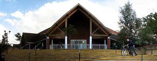
In terms of amenities, Bromley Heath has a few local shops and services, including a convenience store, a post office, and a primary school. The village also benefits from good transport links, with regular bus services connecting it to nearby towns and cities.

The surrounding area offers plenty of opportunities for outdoor activities. The village is surrounded by beautiful countryside, making it a popular destination for walkers and nature enthusiasts. There are also several parks and green spaces nearby, providing ideal spots for picnics or leisurely strolls.

Overall, Bromley Heath is a peaceful and charming village in Gloucestershire, offering a tranquil countryside setting while still being within easy reach of larger towns and cities.

If you have any feedback on the listing, please let us know in the comments section below.

Bromley Heath Images

Images are sourced within 2km of 51.501763/-2.508681 or Grid Reference ST6478. Thanks to Geograph Open Source API. All images are credited.

Bury Hill Fort An Iron Age hill fort at Winterbourne near Bristol
Bury Hill Fort
An Iron Age hill fort at Winterbourne near Bristol
The London line with new houses at Stoke Gifford Looking E. down the railway line to a footbridge at Tudor Lodge
The London line with new houses at Stoke Gifford
Looking E. down the railway line to a footbridge at Tudor Lodge
Frome Valley tranquillity and thunder The Frome Valley Walkway at Hambrook where the path goes under the noisy M4 just east of the junction with the M32 to Bristol centre
Frome Valley tranquillity and thunder
The Frome Valley Walkway at Hambrook where the path goes under the noisy M4 just east of the junction with the M32 to Bristol centre
M32 - Junction with M4 (Junction 19) Taken from the bridge on B4427 looking NE
M32 - Junction with M4 (Junction 19)
Taken from the bridge on B4427 looking NE
Downend (Glos) St Augustine of Canterbury RC Church Really a suburb of Bristol, but South Glos people  are fiercely independent. This Catholic Church is a notable feature in this sea of 1950s and 1960s housing.
Downend (Glos) St Augustine of Canterbury RC Church
Really a suburb of Bristol, but South Glos people are fiercely independent. This Catholic Church is a notable feature in this sea of 1950s and 1960s housing.
Frenchay (Glos) St John the Baptist Church
Frenchay (Glos) Friends Meeting House The C18 Quakers church on the edge of the Common
Frenchay (Glos) Friends Meeting House
The C18 Quakers church on the edge of the Common
Frenchay Christmas Tree Farm Presumably gearing up for its busy season, this plantation is situated in Frenchay, north Bristol. The van just visible in the trees above the right hand gatepost is travelling south on the M32 towards Bristol centre.
Frenchay Christmas Tree Farm
Presumably gearing up for its busy season, this plantation is situated in Frenchay, north Bristol. The van just visible in the trees above the right hand gatepost is travelling south on the M32 towards Bristol centre.
Filton Road. Looking west towards the bridge carrying the M32 over Filton Road, north Bristol.
Filton Road.
Looking west towards the bridge carrying the M32 over Filton Road, north Bristol.
Bromley Heath Park summer fete 2003 Always get sunshine each year!
Bromley Heath Park summer fete 2003
Always get sunshine each year!
M4 looking East from footbridge The old road between Downend and Winterbourne not open for cars, now provides a good vantage point for police speed cameras
M4 looking East from footbridge
The old road between Downend and Winterbourne not open for cars, now provides a good vantage point for police speed cameras
Can you spot the speed camera? Footbridge over both the Bristol northern ring road [A4174] and the M4
Can you spot the speed camera?
Footbridge over both the Bristol northern ring road [A4174] and the M4
A sad spot for a family From the footbridge over the A4174 Bristol Ring road at Downend. Note the flowers by the first lamp post
A sad spot for a family
From the footbridge over the A4174 Bristol Ring road at Downend. Note the flowers by the first lamp post
Crossroads at the top of Croome Hill Part of a thatched single-story house can be seen on the right. Thatch is unusual in this area.
Crossroads at the top of Croome Hill
Part of a thatched single-story house can be seen on the right. Thatch is unusual in this area.
Frenchay Bridge Built by private subscription in 1788 to replace the ford across the River Frome.
Frenchay Bridge
Built by private subscription in 1788 to replace the ford across the River Frome.
Frenchay Manor House Palladian style house built c.1736 for Joseph Beck, a wealthy Quaker merchant.
Frenchay Manor House
Palladian style house built c.1736 for Joseph Beck, a wealthy Quaker merchant.
River Frome at Frenchay The River Frome flows for 18 miles to join the Avon in the centre of Bristol. It powered a number of mills along its length.
River Frome at Frenchay
The River Frome flows for 18 miles to join the Avon in the centre of Bristol. It powered a number of mills along its length.
Unitarian Chapel & the Old House Frenchay 17th century Unitarian chapel with The Old House on Frenchay Common.
Unitarian Chapel & the Old House Frenchay
17th century Unitarian chapel with The Old House on Frenchay Common.
Show me another place!

Bromley Heath is located at Grid Ref: ST6478 (Lat: 51.501763, Lng: -2.508681)

Unitary Authority: South Gloucestershire

Police Authority: Avon and Somerset

What 3 Words

///mercy.back.weep. Near Mangotsfield, Gloucestershire

Nearby Locations

Bromley Heath Hambrook

Related Wikis

A4174 road

The A4174 is a major ring road in England which runs around the northern and eastern edge of Bristol, mainly in South Gloucestershire, and through the...

Downend, South Gloucestershire

Downend is an affluent residential suburb of Greater Bristol, England, the housing stock is typically terraced Victorian, 1930s and 1950s semi-detached...

Emersons Green

Emersons Green is a parish in the unitary authority of South Gloucestershire. Sitting 7 miles northeast of Bristol, England. It was developed from farming...

Frenchay

Frenchay is a village in the north east of the city of Bristol. Frenchay was designated as a conservation area in 1975 in recognition of its unique architectural...

Nearby Amenities

Located within 500m of 51.501763,-2.508681
Traffic Signals
Traffic Signals: signal
Lat/Long: 51.501951/-2.5096618
Traffic Signals
Traffic Signals: signal
Lat/Long: 51.5013766/-2.5102361
Traffic Signals
Traffic Signals: signal
Lat/Long: 51.5019672/-2.5103971
Traffic Signals
Traffic Signals: signal
Traffic Signals Direction: forward
Lat/Long: 51.5000623/-2.5099682
Post Box
Post Box Type: pillar
Postal Code: BS16
Ref: BS16 300
Lat/Long: 51.498433/-2.5088116
Traffic Signals
Button Operated: yes
Crossing Island: no
Traffic Signals: pedestrian_crossing
Traffic Signals Direction: both
Lat/Long: 51.4983974/-2.5090609
Traffic Signals
Traffic Signals: signal
Lat/Long: 51.502146/-2.5103644
Traffic Signals
Traffic Signals: signal
Traffic Signals Direction: backward
Lat/Long: 51.4997657/-2.5095996
Barrier: bollard
Bollard: fixed
Lat/Long: 51.5020938/-2.5115942
Crossing
Crossing: traffic_signals
Crossing Ref: toucan
Lat/Long: 51.5002654/-2.5098383
Bus Stop
Queensholm Drive
Naptan AtcoCode: 0170SGB20441
Naptan Bearing: SE
Naptan CommonName: Queensholm Drive
Naptan Crossing: Queensholm Drive
Naptan NaptanCode: sgldwgw
Naptan PlusbusZoneRef: BRSTLTM
Naptan Street: Four Acre Road
Naptan Verified: no
Source: naptan_import
Lat/Long: 51.5014542/-2.5022589
Bus Stop
Queensholm Drive
Naptan AtcoCode: 0170SGB20442
Naptan Bearing: S
Naptan CommonName: Queensholm Drive
Naptan Crossing: Greystones
Naptan NaptanCode: sgldwdm
Naptan PlusbusZoneRef: BRSTLTM
Naptan Street: Queensholm Drive
Naptan Verified: no
Source: naptan_import
Lat/Long: 51.5012988/-2.5028479
Bus Stop
Queensholm Close
Bus: yes
Naptan AtcoCode: 0170SGB20443
Naptan Bearing: S
Naptan CommonName: Queensholm Close
Naptan Crossing: Queensholm Close
Naptan NaptanCode: sgldtwp
Naptan PlusbusZoneRef: BRSTLTM
Naptan Street: Queensholm Drive
Naptan Verified: no
Public Transport: platform
Source: naptan_import
Lat/Long: 51.4994967/-2.5037212
Bus Stop
Queensholm Close
Bus: yes
Naptan AtcoCode: 0170SGB20444
Naptan Bearing: N
Naptan CommonName: Queensholm Close
Naptan Crossing: Quaker's Road
Naptan NaptanCode: sgldtwd
Naptan PlusbusZoneRef: BRSTLTM
Naptan Street: Queensholm Drive
Naptan Verified: no
Public Transport: platform
Source: naptan_import
Lat/Long: 51.4998114/-2.5037103
Bus Stop
Queensholm Crescent
Naptan AtcoCode: 0170SGB20446
Naptan Bearing: W
Naptan CommonName: Queensholm Crescent
Naptan Crossing: Bromley Drive
Naptan NaptanCode: sgldtgm
Naptan PlusbusZoneRef: BRSTLTM
Naptan Street: Quaker's Road
Naptan Verified: no
Source: naptan_import
Lat/Long: 51.4993432/-2.5059525
Bus Stop
Queensholm Crescent
Naptan AtcoCode: 0170SGB20447
Naptan Bearing: E
Naptan CommonName: Queensholm Crescent
Naptan Crossing: Queensholm Crescent
Naptan NaptanCode: sgldtgw
Naptan PlusbusZoneRef: BRSTLTM
Naptan Street: Quaker's Road
Naptan Verified: no
Source: naptan_import
Lat/Long: 51.4993452/-2.5054772
Bus Stop
Quakers Road
Naptan AtcoCode: 0170SGB20448
Naptan Bearing: E
Naptan CommonName: Quakers Road
Naptan Crossing: Wedgewood Road
Naptan NaptanCode: sgldpjp
Naptan PlusbusZoneRef: BRSTLTM
Naptan Street: Quaker's Road
Naptan Verified: no
Source: naptan_import
Lat/Long: 51.5000607/-2.5084529
Bus Stop
Quakers Road
Naptan AtcoCode: 0170SGB20449
Naptan Bearing: W
Naptan CommonName: Quakers Road
Naptan Crossing: Quaker's Road
Naptan NaptanCode: sgldmwd
Naptan PlusbusZoneRef: BRSTLTM
Naptan Street: Bromley Heath Road
Naptan Verified: no
Source: naptan_import
Lat/Long: 51.5000565/-2.5094325
Bus Stop
Quakers Road
Naptan AtcoCode: 0170SGB20450
Naptan Bearing: N
Naptan CommonName: Quakers Road
Naptan Crossing: Bampton Drive
Naptan NaptanCode: sgldmtm
Naptan PlusbusZoneRef: BRSTLTM
Naptan Street: Bromley Heath Road
Naptan Verified: no
Source: naptan_import
Lat/Long: 51.4998119/-2.5098331
Bus Stop
Quakers Road
Naptan AtcoCode: 0170SGB20451
Naptan Bearing: S
Naptan CommonName: Quakers Road
Naptan Crossing: Quakers Road
Naptan NaptanCode: sgldmwm
Naptan PlusbusZoneRef: BRSTLTM
Naptan Street: Bromley Heath Road
Naptan Verified: no
Source: naptan_import
Lat/Long: 51.499553/-2.5094124
Bus Stop
Oakdale Road
Naptan AtcoCode: 0170SGB20487
Naptan Bearing: S
Naptan CommonName: Oakdale Road
Naptan Crossing: Quaker's Road
Naptan NaptanCode: sgldtma
Naptan PlusbusZoneRef: BRSTLTM
Naptan Street: Oakdale Road
Naptan Verified: no
Source: naptan_import
Lat/Long: 51.4990426/-2.5047679
Bus Stop
Oakdale Road
Naptan AtcoCode: 0170SGB20488
Naptan Bearing: N
Naptan CommonName: Oakdale Road
Naptan Crossing: Quaker's Road
Naptan NaptanCode: sgldtjt
Naptan PlusbusZoneRef: BRSTLTM
Naptan Street: Oakdale Road
Naptan Verified: no
Source: naptan_import
Lat/Long: 51.4990867/-2.5049701
Post Box
Post Box Type: pillar
Ref: BS16 1004
Lat/Long: 51.4993528/-2.5037026
Premier MS-2 Store
Brand: Premier
Brand Wikidata: Q7240340
Brand Wikipedia: en:Premier Stores
Shop: convenience
Website: https://www.premier-stores.co.uk/our-stores/ms2-stores
Lat/Long: 51.4994491/-2.5034054
Barrier: bollard
Bollard: fixed
Lat/Long: 51.5027254/-2.5136052
Communication Mobile Phone: yes
Man Made: mast
Lat/Long: 51.5012882/-2.5104584
Communication Mobile Phone: yes
Man Made: mast
Lat/Long: 51.5019008/-2.5112235
Barrier: cycle_barrier
Lat/Long: 51.5021822/-2.5084143
Barrier: bollard
Lat/Long: 51.5035935/-2.5090402
Crossing
Button Operated: optional
Crossing: traffic_signals
Crossing Island: yes
Lat/Long: 51.4998692/-2.5096467
Traffic Signals
Traffic Signals: signal
Lat/Long: 51.5013619/-2.5103258
Barrier: kissing_gate
Lat/Long: 51.500884/-2.510376
Cafe
The Bromley
Addr City: Bristol
Addr Housenumber: 73
Addr Postcode: BS16 6NH
Addr Street: Quakers Road
Cuisine: coffee_shop;sandwich
Opening Hours: Mo-Sa 08:00-16:00
Outdoor Seating: yes
Lat/Long: 51.499445/-2.5034995
SadiePaul Hairdressing
Addr City: Bristol
Addr Housenumber: 77
Addr Postcode: BS16 6NH
Addr Street: Quakers Road
Email: enquiries@sadieshairstudio.co.uk
Opening Hours: Tu-We 09:00-17:00, Th 10:00-19:00, Fr 09:00-17:00, Sa 09:00-16:00
Phone: +44 117 956 8851
Shop: hairdresser
Website: https://sadiepaulhairdressing.co.uk/
Lat/Long: 51.4994558/-2.5032516
Silhouette hair and beauty
Addr City: Bristol
Addr Housenumber: 81
Addr Postcode: BS16 6NH
Addr Street: Quakers Road
Email: enquiries@silhouettehairandbeauty.co.uk
Opening Hours: Tu 09:00-16:30, We 09:00-19:00, Th 09:00-17:30, Fr 09:00-18:00, Sa 09:00-13:30
Phone: +44 117 956 1414
Shop: hairdresser
Website: http://silhouettehairandbeauty.co.uk/
Lat/Long: 51.4994635/-2.5030726
Freak or Unique Tattoo Studio
Addr City: Bristol
Addr Housenumber: 83
Addr Postcode: BS16 6NH
Addr Street: Quakers Road
Opening Hours: Tu 12:00-20:00, We-Sa 09:30-18:00
Phone: +44 117 329 0146
Shop: tattoo
Lat/Long: 51.4994684/-2.5029595
The H's Barbershop
Addr City: Bristol
Addr Housenumber: 77a
Addr Postcode: BS16 6NH
Addr Street: Quakers Road
Opening Hours: Mo-Fr 09:00-18:00, Sa 08:00-16:00
Payment Cash: yes
Payment Credit Cards: yes
Shop: hairdresser
Website: https://www.thehsbarbershop.co.uk/
Lat/Long: 51.4994531/-2.5033131
Wedgewood Rd O/D S/S
Building: hut
Power: substation
Ref: 1178
Substation: yes
Lat/Long: 51.501755/-2.5075289
Power: substation
Lat/Long: 51.5011144/-2.5038748
OAKDALE ROAD O/D
Brand: National Grid
Brand Wikidata: Q1465461
Operator: National Grid Electricity Distribution Plc
Operator Old: Western Power Distribution
Operator Wikidata: Q7988183
Owner: National Grid Electricity Distribution (South West) Plc
Owner Wikidata: Q114397866
Power: substation
Ref: 1972
Lat/Long: 51.4988738/-2.504634
Waste Basket
Lat/Long: 51.4993543/-2.5035465
Waste Basket
Lat/Long: 51.4995517/-2.5036684
Waste Basket
Lat/Long: 51.5012549/-2.5028797
Waste Basket
Lat/Long: 51.502171/-2.5021154
Waste Basket
Waste: dog_excrement
Lat/Long: 51.5025936/-2.5028716
Waste Basket
Waste: dog_excrement
Lat/Long: 51.5024342/-2.5071647
Waste Basket
Lat/Long: 51.4991612/-2.5042855
Waste Basket
Waste: dog_excrement
Lat/Long: 51.5035943/-2.5022814
Waste Basket
Lat/Long: 51.5020394/-2.5069407
Bench
Lat/Long: 51.5035079/-2.502412
Grit Bin
Colour: green
Material: plastic
Lat/Long: 51.5017463/-2.5028388
Man Made: street_cabinet
Street Cabinet: telecom
Lat/Long: 51.4992892/-2.5041339
Man Made: street_cabinet
Street Cabinet: telecom
Lat/Long: 51.4991808/-2.5042184
Man Made: street_cabinet
Street Cabinet: telecom
Lat/Long: 51.4991808/-2.5041834
Bench
Lat/Long: 51.4991242/-2.5043305
Man Made: street_cabinet
Street Cabinet: telecom
Lat/Long: 51.4992433/-2.502932
Man Made: street_cabinet
Street Cabinet: telecom
Lat/Long: 51.4992653/-2.5029108
Man Made: street_cabinet
Street Cabinet: telecom
Lat/Long: 51.5008973/-2.5042401
Man Made: street_cabinet
Street Cabinet: telecom
Lat/Long: 51.4984384/-2.5086032
Waste Basket
Waste: dog_excrement
Lat/Long: 51.498391/-2.5088619
Man Made: street_cabinet
Operator: Openreach
Street Cabinet: telecom
Lat/Long: 51.4983843/-2.5088968
Colour: green
Man Made: street_cabinet
Utility: telecom
Lat/Long: 51.5007266/-2.5144838
Colour: green
Man Made: street_cabinet
Utility: telecom
Lat/Long: 51.5006985/-2.5151508
Traffic Calming: choker
Lat/Long: 51.4985069/-2.5120193
Traffic Calming: choker
Lat/Long: 51.4988308/-2.5122714
Traffic Calming: choker
Lat/Long: 51.4989891/-2.5116923
Traffic Calming: choker
Lat/Long: 51.499886/-2.5104541
Barrier: stile
Lat/Long: 51.498038/-2.5115652
Traffic Calming: choker
Lat/Long: 51.4978229/-2.510517
QUAKERS RD OD
Brand: National Grid
Brand Wikidata: Q1465461
Operator: National Grid Electricity Distribution Plc
Operator Old: Western Power Distribution
Operator Wikidata: Q7988183
Owner: National Grid Electricity Distribution (South West) Plc
Owner Wikidata: Q114397866
Power: substation
Ref: 11-0327
Lat/Long: 51.4989549/-2.5084999
Downend & Bromley Heath Parish Council
Information: board
Tourism: information
Lat/Long: 51.4993693/-2.503605
Power: pole
Lat/Long: 51.5058416/-2.5111204
Power: pole
Lat/Long: 51.5047351/-2.5113375
Power: pole
Transformer: distribution
Lat/Long: 51.502909/-2.508173
Power: pole
Lat/Long: 51.5045886/-2.5096501
Material: wood
Power: pole
Lat/Long: 51.5043672/-2.5069408
Power: pole
Lat/Long: 51.5046648/-2.5105278
Barrier: block
Bicycle: yes
Bollard: yes
Foot: yes
Motor Vehicle: no
Lat/Long: 51.4999676/-2.5094194
Street Lamp
Lat/Long: 51.5005968/-2.5056159
Street Lamp
Lat/Long: 51.5002317/-2.505807
Street Lamp
Lat/Long: 51.499997/-2.5058243
Street Lamp
Lat/Long: 51.4999616/-2.5053141
Street Lamp
Lat/Long: 51.500102/-2.5063609
Street Lamp
Lat/Long: 51.5001046/-2.506737
Defibrillator
Emergency: defibrillator
Indoor: no
Lat/Long: 51.4994489/-2.5035406
Power: pole
Lat/Long: 51.5044827/-2.5082979
Power: pole
Lat/Long: 51.5034748/-2.5074982
Traffic Signals
Traffic Signals: signal
Lat/Long: 51.5014807/-2.5101018
Traffic Signals
Traffic Signals: signal
Lat/Long: 51.501961/-2.5094468
Traffic Signals
Traffic Signals: signal
Lat/Long: 51.5020704/-2.5104761
Traffic Signals
Traffic Signals: signal
Traffic Signals Direction: forward
Lat/Long: 51.5002968/-2.5098534
Cycleway: asl
Direction: backward
Lat/Long: 51.4998018/-2.509616
Traffic Signals
Traffic Signals: signal
Traffic Signals Direction: backward
Lat/Long: 51.5000585/-2.5095597
Give Way
Direction: forward
Lat/Long: 51.5001157/-2.5094958
Give Way
Direction: backward
Lat/Long: 51.5000325/-2.5094545
The data included in this document is from www.openstreetmap.org. The data is made available under ODbL.

Have you been to Bromley Heath?

Leave your review of Bromley Heath below (or comments, questions and feedback).