Hanbury

Civil Parish in Worcestershire Wychavon

England

Hanbury

NT Hanbury Hall View across the autumnal formal garden towards the South-west facade.
NT Hanbury Hall Credit: Jonathan Billinger

Hanbury is a civil parish located in the district of Wychavon, Worcestershire, England. Situated approximately four miles east of Droitwich Spa, the parish covers an area of about 16 square kilometers. It is surrounded by the picturesque countryside of the county, characterized by rolling hills and farmland.

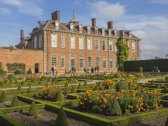
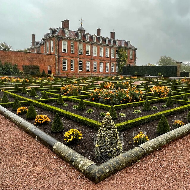
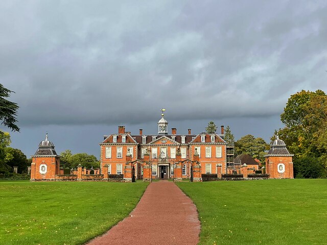
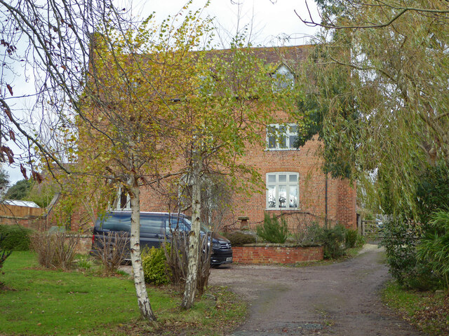
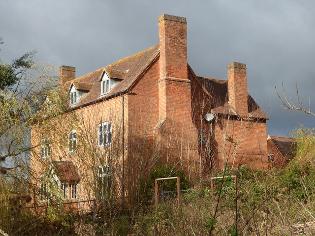
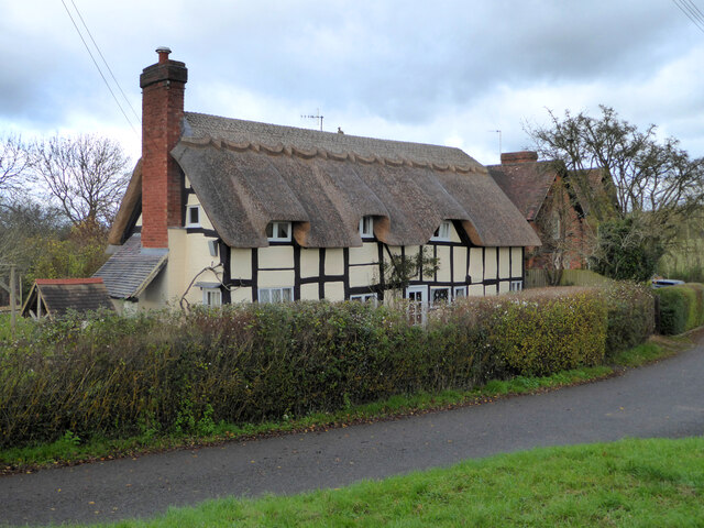
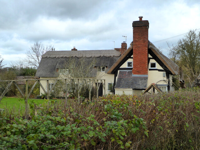
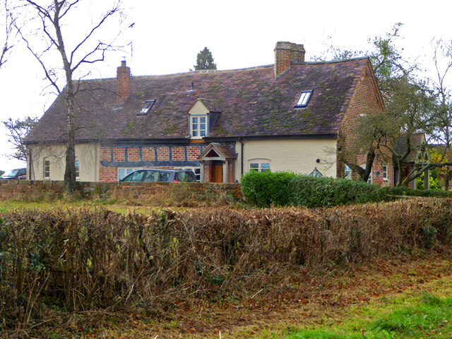
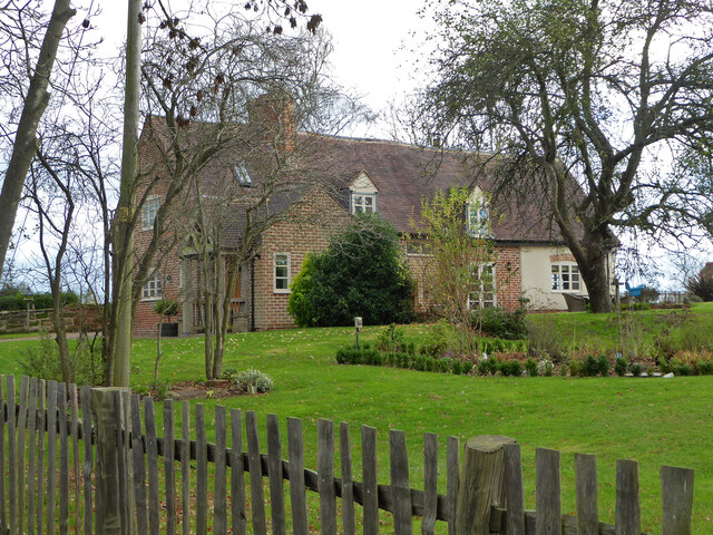
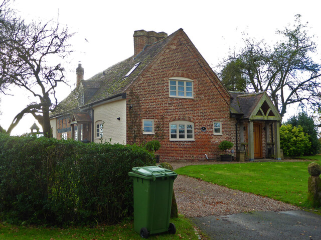
The village of Hanbury is the main settlement within the parish, with a population of around 1,000 residents. It is known for its charming rural atmosphere and historic architecture. The centerpiece of the village is Hanbury Hall, an exquisite William and Mary-style country house built in the early 18th century. Hanbury Hall is now managed by the National Trust and attracts visitors from far and wide.

The parish also includes several smaller hamlets, such as Stone, Dunhampstead, and Hanbury Junction. These hamlets provide a mix of residential properties and agricultural buildings, reflecting the area's agricultural heritage.

Hanbury is well-connected to the surrounding towns and cities. The nearby M5 motorway provides easy access to Worcester, Birmingham, and other major urban centers. The village is also served by a network of local roads and public transportation, making it accessible for both residents and visitors.

The local economy is predominantly based on agriculture, with a number of farms and agricultural businesses located within the parish. Additionally, tourism plays a significant role in the area's economy, thanks to the popularity of Hanbury Hall and the natural beauty of the surrounding countryside.

Overall, Hanbury, Worcestershire, offers a unique blend of historical charm, rural tranquility, and easy access to urban amenities.

If you have any feedback on the listing, please let us know in the comments section below.

Hanbury Images

Images are sourced within 2km of 52.260148/-2.063365 or Grid Reference SO9562. Thanks to Geograph Open Source API. All images are credited.

NT Hanbury Hall View across the autumnal formal garden towards the South-west facade.
NT Hanbury Hall
View across the autumnal formal garden towards the South-west facade.
Still Life at Hanbury An autumnal display near the entrance to Hanbury Hall.
Still Life at Hanbury
An autumnal display near the entrance to Hanbury Hall.
Dahlia display Within the walled garden at Hanbury Hall.
Dahlia display
Within the walled garden at Hanbury Hall.
The parterre garden at Hanbury Hall A recreation of the garden designed by George London in 1705.
The parterre garden at Hanbury Hall
A recreation of the garden designed by George London in 1705.
Hanbury Hall National Trust property in Worcestershire built in 1701.
Hanbury Hall
National Trust property in Worcestershire built in 1701.
Mere Green Farmhouse Grade II Listed. Listed as in Hanbury ward. The view from the public road. There are two further listed buildings in the complex but there are no good trespass free views.
Mere Green Farmhouse
Grade II Listed. Listed as in Hanbury ward. The view from the public road. There are two further listed buildings in the complex but there are no good trespass free views.
Mere Green Farmhouse Grade II Listed. This was the best view I could manage from a public place. The complex includes two further listed buildings but I could not get a meaningful view of those from public places.
Mere Green Farmhouse
Grade II Listed. This was the best view I could manage from a public place. The complex includes two further listed buildings but I could not get a meaningful view of those from public places.
Well Cottage, Hanbury A 17th century house with a thatched roof, Listed Grade II.
Well Cottage, Hanbury
A 17th century house with a thatched roof, Listed Grade II.
Well Cottage, Hanbury A 17th century thatched dwelling, Listed Grade II.
Well Cottage, Hanbury
A 17th century thatched dwelling, Listed Grade II.
Dovecote by Pumphouse Farm Early 17th century dovecote, Listed Grade II. Difficult to get a clear view over the hedge from the public road. There is no convenient public footpath here.
Dovecote by Pumphouse Farm
Early 17th century dovecote, Listed Grade II. Difficult to get a clear view over the hedge from the public road. There is no convenient public footpath here.
Barn at Pumphouse Farm, Hanbury Grade II Listed.
Barn at Pumphouse Farm, Hanbury
Grade II Listed.
Pumphouse Farmhouse, Hanbury Grade II Listed.
Pumphouse Farmhouse, Hanbury
Grade II Listed.
White House Cottage, Hanbury Early 18th century with late 19th and early 20th century alterations. Grade II Listed.
White House Cottage, Hanbury
Early 18th century with late 19th and early 20th century alterations. Grade II Listed.
Appleby, Hanbury An early 17th century house with late 19th and mid-20th century alterations and additions. Listed Grade II.
Appleby, Hanbury
An early 17th century house with late 19th and mid-20th century alterations and additions. Listed Grade II.
Appleby, Hanbury An early 17th century house with late 19th and mid-20th century alterations and additions. Listed Grade II.
Appleby, Hanbury
An early 17th century house with late 19th and mid-20th century alterations and additions. Listed Grade II.
Appleby, Hanbury An early 17th century house with late 19th and mid-20th century alterations and additions. Listed Grade II.
Appleby, Hanbury
An early 17th century house with late 19th and mid-20th century alterations and additions. Listed Grade II.
Public footpath off Pumphouse Lane, Hanbury Hanbury Church is seen on the hill in the background
Public footpath off Pumphouse Lane, Hanbury
Hanbury Church is seen on the hill in the background
The White House, Hanbury A large old house in this Worcestershire village. I thought at first it must be one of the local listed buildings but soon realised it does not have any statutory protection.
The White House, Hanbury
A large old house in this Worcestershire village. I thought at first it must be one of the local listed buildings but soon realised it does not have any statutory protection.
Show me another place!

Hanbury is located at Grid Ref: SO9562 (Lat: 52.260148, Lng: -2.063365)

Administrative County: Worcestershire

District: Wychavon

Police Authority: West Mercia

What 3 Words

///sing.drives.autumn. Near Stoke Prior, Worcestershire

Related Wikis

Mere Green, Worcestershire

Mere Green is a hamlet in the English county of Worcestershire. It is located south of the village of Hanbury roughly midway between Worcester and Redditch...

Hanbury, Worcestershire

Hanbury is a rural village in Worcestershire, England near Droitwich Spa and the M5 motorway. The population of Hanbury has remained around 1,000 since...

Hanbury Hall

Hanbury Hall is a large 18th-century stately home standing in parkland at Hanbury, Worcestershire. The main range has two storeys and is built of red brick...

St Mary the Virgin, Hanbury

The church of St Mary the Virgin is an Anglican parish church in the village of Hanbury, Worcestershire. Its earliest parts date from about 1210 and it...

Droitwich Road railway station

Droitwich Road railway station served the town of Droitwich Spa, Worcestershire, England, from 1840 to 1855 on the Birmingham and Gloucester Railway....

Feckenham Forest

Feckenham Forest was a royal forest, centred on the village of Feckenham, covering large parts of Worcestershire and west Warwickshire. It was not entirely...

Earls Common

Earls Common is a village in Worcestershire, England. Villages nearby include Himbleton and Stock Green.

Bradley Green, Worcestershire

Bradley Green is a village in the Wychavon district of Worcestershire, England. It is located just south of the town of Redditch and south of Feckenham...

Nearby Amenities

Located within 500m of 52.260148,-2.063365
Power: pole
Lat/Long: 52.2613481/-2.0632305
Power: pole
Lat/Long: 52.2613185/-2.0645448
Power: pole
Lat/Long: 52.2578618/-2.0655305
Power: pole
Lat/Long: 52.2567619/-2.0655828
Power: pole
Lat/Long: 52.2613818/-2.067939
Power: pole
Lat/Long: 52.2595127/-2.0648398
Power: pole
Lat/Long: 52.2615008/-2.0696019
Power: pole
Lat/Long: 52.2612587/-2.0664289
Power: pole
Lat/Long: 52.262934/-2.0678277
Power: pole
Lat/Long: 52.2608917/-2.0634907
Power: pole
Lat/Long: 52.2588839/-2.0654996
Power: pole
Lat/Long: 52.2600266/-2.0643275
Power: pole
Lat/Long: 52.2622601/-2.066563
Power: pole
Lat/Long: 52.2641439/-2.0605749
Power: pole
Lat/Long: 52.2635899/-2.0611905
Power: pole
Lat/Long: 52.2630211/-2.061802
Power: pole
Lat/Long: 52.2620747/-2.0628387
Woolmere Green
Power: pole
Transformer: distribution
Voltage Primary: 11000
Lat/Long: 52.2623677/-2.0576774
Power: pole
Lat/Long: 52.2625667/-2.0573395
The data included in this document is from www.openstreetmap.org. The data is made available under ODbL.

Have you been to Hanbury?

Leave your review of Hanbury below (or comments, questions and feedback).