Mere Green

Settlement in Worcestershire Wychavon

England

Mere Green

NT Hanbury Hall View across the autumnal formal garden towards the South-west facade.
NT Hanbury Hall Credit: Jonathan Billinger

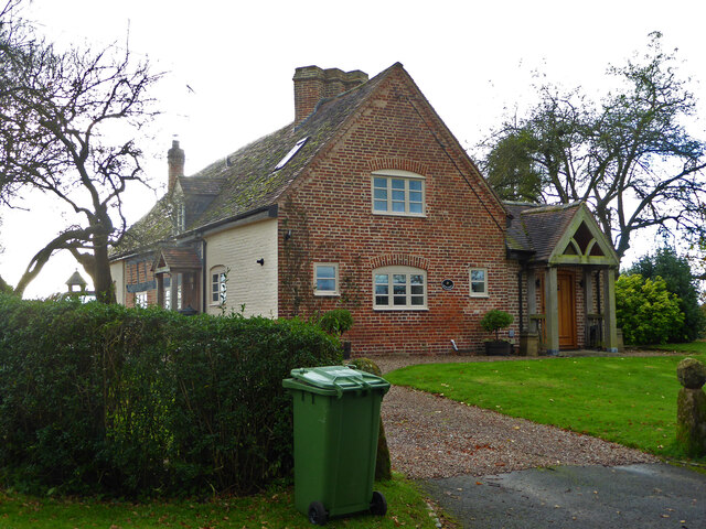
Mere Green is a small village located in Worcestershire, England. Situated in the West Midlands region, the village is approximately 8 miles north of the city of Worcester and 3 miles south of the town of Droitwich Spa. Mere Green is nestled in the picturesque countryside, surrounded by rolling hills, lush green fields, and charming rural landscapes.

The village has a population of approximately 1,000 residents, creating a close-knit community atmosphere. Mere Green offers a peaceful and tranquil setting, making it an ideal place for those seeking a quieter lifestyle away from the hustle and bustle of larger towns and cities.

Despite its small size, Mere Green boasts a few amenities for its residents. There is a local pub, providing a gathering place for locals to socialize and enjoy a drink or meal. Additionally, the village has a community center that hosts various events and activities throughout the year, fostering a sense of community spirit.

Mere Green benefits from its proximity to Worcester and Droitwich Spa, which offer a wider range of amenities, including shopping centers, supermarkets, schools, and healthcare facilities. The village is also well-connected transport-wise, with regular bus services and easy access to major road networks, making it convenient for commuting or exploring the surrounding areas.

Overall, Mere Green offers a picturesque and peaceful setting, making it an attractive place to live for those seeking a rural lifestyle with the convenience of nearby towns and cities.

If you have any feedback on the listing, please let us know in the comments section below.
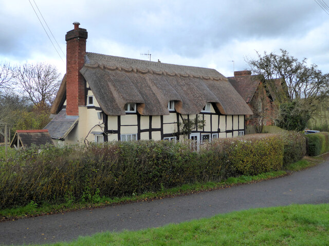
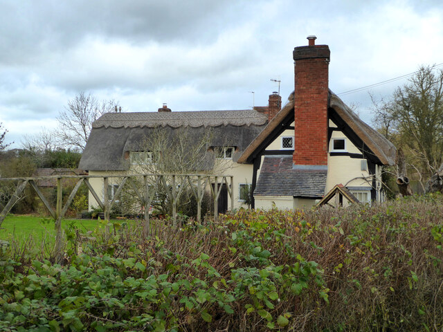
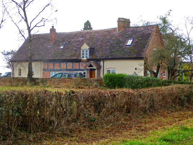
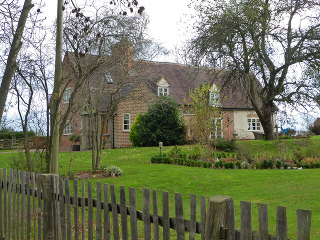
Mere Green Images

Images are sourced within 2km of 52.260095/-2.072244 or Grid Reference SO9562. Thanks to Geograph Open Source API. All images are credited.

NT Hanbury Hall View across the autumnal formal garden towards the South-west facade.
NT Hanbury Hall
View across the autumnal formal garden towards the South-west facade.
Still Life at Hanbury An autumnal display near the entrance to Hanbury Hall.
Still Life at Hanbury
An autumnal display near the entrance to Hanbury Hall.
Dahlia display Within the walled garden at Hanbury Hall.
Dahlia display
Within the walled garden at Hanbury Hall.
A walk in the park A fine autumn afternoon at NT Hanbury Hall.
A walk in the park
A fine autumn afternoon at NT Hanbury Hall.
Gate on the estate A fine piece of ironwork on a public path through the NT Hanbury Hall estate.
Gate on the estate
A fine piece of ironwork on a public path through the NT Hanbury Hall estate.
The parterre garden at Hanbury Hall A recreation of the garden designed by George London in 1705.
The parterre garden at Hanbury Hall
A recreation of the garden designed by George London in 1705.
Hanbury Hall National Trust property in Worcestershire built in 1701.
Hanbury Hall
National Trust property in Worcestershire built in 1701.
Mere Green Farmhouse Grade II Listed. Listed as in Hanbury ward. The view from the public road. There are two further listed buildings in the complex but there are no good trespass free views.
Mere Green Farmhouse
Grade II Listed. Listed as in Hanbury ward. The view from the public road. There are two further listed buildings in the complex but there are no good trespass free views.
Mere Green Farmhouse Grade II Listed. This was the best view I could manage from a public place. The complex includes two further listed buildings but I could not get a meaningful view of those from public places.
Mere Green Farmhouse
Grade II Listed. This was the best view I could manage from a public place. The complex includes two further listed buildings but I could not get a meaningful view of those from public places.
Well Cottage, Hanbury A 17th century house with a thatched roof, Listed Grade II.
Well Cottage, Hanbury
A 17th century house with a thatched roof, Listed Grade II.
Well Cottage, Hanbury A 17th century thatched dwelling, Listed Grade II.
Well Cottage, Hanbury
A 17th century thatched dwelling, Listed Grade II.
Dovecote by Pumphouse Farm Early 17th century dovecote, Listed Grade II. Difficult to get a clear view over the hedge from the public road. There is no convenient public footpath here.
Dovecote by Pumphouse Farm
Early 17th century dovecote, Listed Grade II. Difficult to get a clear view over the hedge from the public road. There is no convenient public footpath here.
Barn at Pumphouse Farm, Hanbury Grade II Listed.
Barn at Pumphouse Farm, Hanbury
Grade II Listed.
Pumphouse Farmhouse, Hanbury Grade II Listed.
Pumphouse Farmhouse, Hanbury
Grade II Listed.
White House Cottage, Hanbury Early 18th century with late 19th and early 20th century alterations. Grade II Listed.
White House Cottage, Hanbury
Early 18th century with late 19th and early 20th century alterations. Grade II Listed.
Appleby, Hanbury An early 17th century house with late 19th and mid-20th century alterations and additions. Listed Grade II.
Appleby, Hanbury
An early 17th century house with late 19th and mid-20th century alterations and additions. Listed Grade II.
Appleby, Hanbury An early 17th century house with late 19th and mid-20th century alterations and additions. Listed Grade II.
Appleby, Hanbury
An early 17th century house with late 19th and mid-20th century alterations and additions. Listed Grade II.
Appleby, Hanbury An early 17th century house with late 19th and mid-20th century alterations and additions. Listed Grade II.
Appleby, Hanbury
An early 17th century house with late 19th and mid-20th century alterations and additions. Listed Grade II.
Show me another place!

Mere Green is located at Grid Ref: SO9562 (Lat: 52.260095, Lng: -2.072244)

Administrative County: Worcestershire

District: Wychavon

Police Authority: West Mercia

What 3 Words

///panther.twitching.depravity. Near Stoke Prior, Worcestershire

Related Wikis

Mere Green, Worcestershire

Mere Green is a hamlet in the English county of Worcestershire. It is located south of the village of Hanbury roughly midway between Worcester and Redditch...
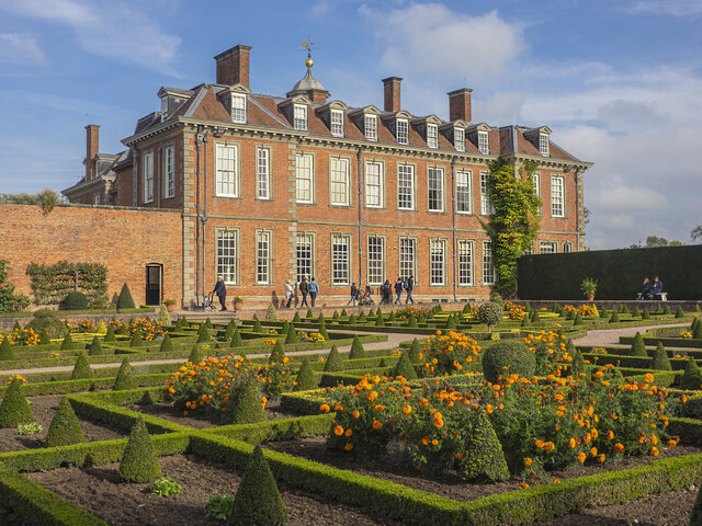
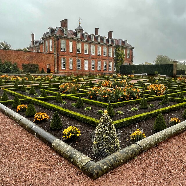
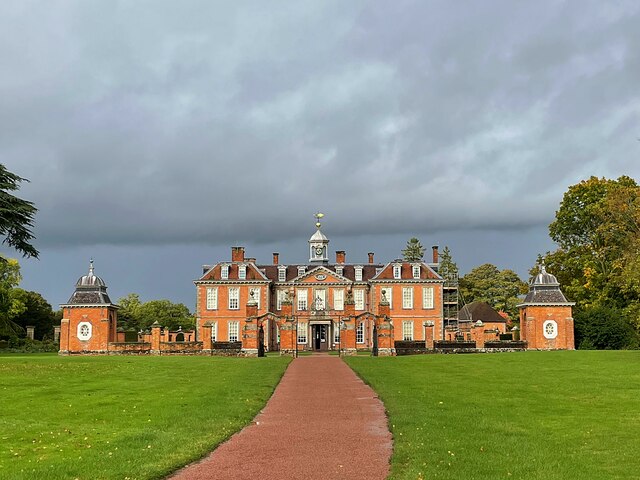
Hanbury Hall

Hanbury Hall is a large 18th-century stately home standing in parkland at Hanbury, Worcestershire. The main range has two storeys and is built of red brick...

Hanbury, Worcestershire

Hanbury is a rural village in Worcestershire, England near Droitwich Spa and the M5 motorway. The population of Hanbury has remained around 1,000 since...

St Mary the Virgin, Hanbury

The church of St Mary the Virgin is an Anglican parish church in the village of Hanbury, Worcestershire. Its earliest parts date from about 1210 and it...

Droitwich Road railway station

Droitwich Road railway station served the town of Droitwich Spa, Worcestershire, England, from 1840 to 1855 on the Birmingham and Gloucester Railway....

Earls Common

Earls Common is a village in Worcestershire, England. Villages nearby include Himbleton and Stock Green.

Feckenham Forest

Feckenham Forest was a royal forest, centred on the village of Feckenham, covering large parts of Worcestershire and west Warwickshire. It was not entirely...

Hadzor

Hadzor is a small village near Droitwich, Worcestershire, England. There are around fourteen houses and a Roman Catholic church in the village, although...

Nearby Amenities

Located within 500m of 52.260095,-2.072244
Bus Stop
Crossroads
Bus: yes
Naptan AtcoCode: 2000G019200
Naptan Bearing: W
Naptan BusStopType: CUS
Naptan CommonName: Crossroads
Naptan Indicator: adj
Naptan Landmark: Saltway
Naptan NaptanCode: wocdgapt
Naptan Street: B4090
Naptan Verified: no
Public Transport: platform
Source: naptan_import
Lat/Long: 52.2600013/-2.0721149
Bus Stop
Crossroads
Bus: yes
Naptan AtcoCode: 2000G323311
Naptan Bearing: E
Naptan BusStopType: CUS
Naptan CommonName: Crossroads
Naptan Indicator: opp
Naptan Landmark: Saltway
Naptan NaptanCode: wocgmagm
Naptan Street: B4090
Naptan Verified: no
Public Transport: platform
Source: naptan_import
Lat/Long: 52.2601452/-2.0719247
Mere Green
Place: hamlet
Source: NPE
Wikidata: Q6818863
Lat/Long: 52.2604162/-2.0736216
Power: pole
Lat/Long: 52.2618734/-2.0761641
Power: pole
Lat/Long: 52.2616107/-2.0758771
Mere Green
Power: pole
Transformer: distribution
Voltage Primary: 11000
Lat/Long: 52.261051/-2.0752936
Power: pole
Lat/Long: 52.2633559/-2.0686095
Power: pole
Lat/Long: 52.2618653/-2.0741966
Power: pole
Lat/Long: 52.2613818/-2.067939
Power: pole
Lat/Long: 52.2618891/-2.0781126
Power: pole
Lat/Long: 52.2615008/-2.0696019
Power: pole
Lat/Long: 52.2615936/-2.0708626
Power: pole
Lat/Long: 52.2612587/-2.0664289
Power: pole
Lat/Long: 52.262934/-2.0678277
Power: pole
Lat/Long: 52.2617151/-2.0723847
Power: pole
Lat/Long: 52.2588839/-2.0654996
Power: pole
Lat/Long: 52.2622601/-2.066563
Generator Method: photovoltaic
Generator Output Electricity: yes
Generator Source: solar
Generator Type: solar_photovoltaic_panel
Location: roof
Power: generator
Lat/Long: 52.2638813/-2.0682769
Mere Green Farm
Power: pole
Transformer: distribution
Voltage Primary: 11000
Lat/Long: 52.2608081/-2.0731182
The data included in this document is from www.openstreetmap.org. The data is made available under ODbL.

Have you been to Mere Green?

Leave your review of Mere Green below (or comments, questions and feedback).