Hambridge and Westport
Civil Parish in Somerset South Somerset
England
Hambridge and Westport

Hambridge and Westport is a civil parish located in the county of Somerset, England. Situated in the South West region, it spans an area of approximately 13.5 square kilometers. The parish is composed of two distinct villages, Hambridge and Westport, which are located on either side of the River Isle.
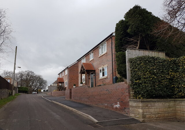
Hambridge, the larger of the two villages, is located to the north of the river. It is a picturesque village with a population of around 500 residents. The village is known for its charming thatched cottages, traditional stone buildings, and beautiful countryside surroundings. It features a village hall, a primary school, and a historic church dedicated to St. James.
On the southern side of the river lies the smaller village of Westport. With a population of around 150 residents, Westport offers a peaceful and idyllic setting. The village is home to a few small businesses and has a close-knit community feel. It boasts a quaint church called St. Anne's Church, which dates back to the 12th century.
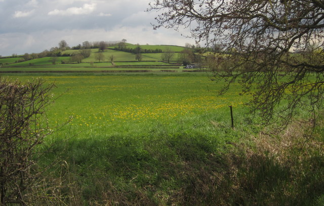
Both villages are surrounded by stunning natural landscapes, with rolling hills, green fields, and woodlands. The area is known for its agricultural heritage, with farming being an important part of the local economy. Additionally, the River Isle provides opportunities for recreational activities such as fishing and boating.
Overall, Hambridge and Westport offer a tranquil and picturesque setting, making it an attractive place to live for those seeking a peaceful rural lifestyle in the heart of Somerset.
If you have any feedback on the listing, please let us know in the comments section below.
Hambridge and Westport Images
Images are sourced within 2km of 50.990735/-2.870671 or Grid Reference ST3821. Thanks to Geograph Open Source API. All images are credited.


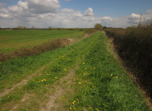
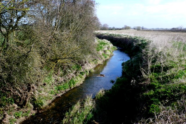
![Towpath, Westport Canal, south from Westmoor Bridge The former canal is on the right [east], the Westmoor catchwater drain on the left.](https://s3.geograph.org.uk/geophotos/04/07/24/4072495_386a19e7.jpg)


Hambridge and Westport is located at Grid Ref: ST3821 (Lat: 50.990735, Lng: -2.870671)
Administrative County: Somerset
District: South Somerset
Police Authority: Avon and Somerset
What 3 Words
///dining.blemishes.hammer. Near Curry Rivel, Somerset
Nearby Locations
Related Wikis
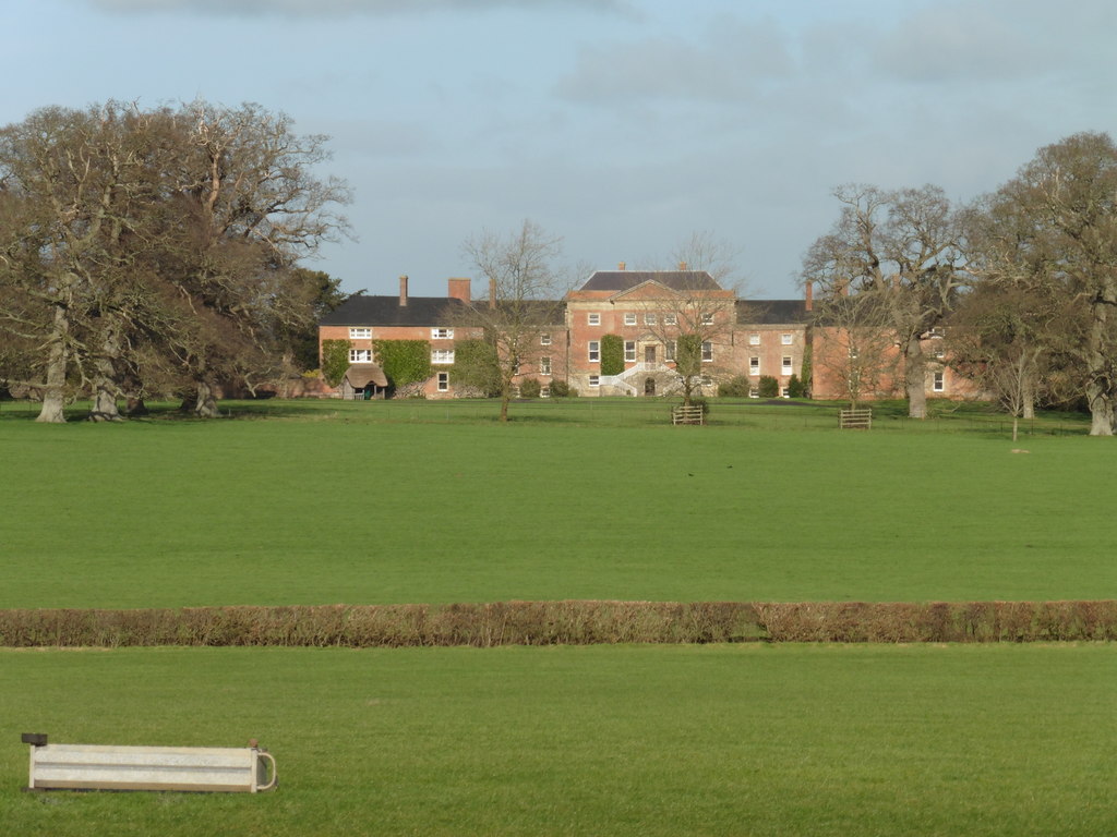
Earnshill House
Earnshill House in Hambridge, near Curry Rivel, Somerset, England is a manor house, set in parkland. It was built in 1725 for Henry Combe, a Bristol merchant...

Hambridge and Westport
Hambridge and Westport is a civil parish in Somerset, England. It had a population of 514 in 2011. The parish includes the villages of Hambridge and Westport...

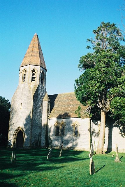
Church of St James the Less, Hambridge
The Church of St James the Less is a Church of England parish church in Hambridge, Somerset, England. It was designed by Benjamin Ferrey and built in 1842...
Fivehead River
Fivehead River (also known as the River Earn or Rag or Ragg River) flows through south Somerset, England. It is named after the village of Fivehead, near...
All Saints Church, Isle Brewers
All Saints Church is a Church of England parish church in Isle Brewers, Somerset, England. Designed by Charles Edmund Giles, it was built in 1859-61 and...
Isle Brewers
Isle Brewers is a village and parish in Somerset, England, situated on the River Isle, 7 miles (11.3 km) south east of Taunton in the South Somerset district...

Midelney Manor
Midelney Manor in Drayton, Somerset, England was built in the late 16th century in two distinct halves by Richard and Thomas Trevillian. It has been designated...

Swell Court Farmhouse, Fivehead
Swell Court Farmhouse in Swell Lane, Fivehead, Somerset, England dates from the 15th century and has been designated as a Grade I listed building.It is...
Nearby Amenities
Located within 500m of 50.990735,-2.870671Have you been to Hambridge and Westport?
Leave your review of Hambridge and Westport below (or comments, questions and feedback).