Hambleton

Civil Parish in Lancashire Wyre

England

Hambleton

River Wyre from Shard Bridge (1) This is the River Wyre flowing upriver towards Garstang as seen from Shard Bridge. The birds on the shoreline are (for the most part) lapwings. Hambleton, Lancashire.
River Wyre from Shard Bridge (1) Credit: Carroll Pierce

Hambleton is a civil parish located in the county of Lancashire, England. It is situated on the southern edge of the Lake District National Park, near the eastern shore of the picturesque Lake Windermere. The parish covers an area of approximately 13 square kilometers and has a population of around 1,000 residents.

The village of Hambleton is characterized by its charming rural setting, with rolling hills, green fields, and stunning views of the surrounding countryside. It is a popular destination for nature lovers and outdoor enthusiasts, offering ample opportunities for walking, hiking, and cycling in the nearby fells and woodlands.

Historically, Hambleton was primarily an agricultural community, with farming playing a significant role in the local economy. While agriculture still remains important, the village has also seen some diversification in recent years, with the growth of tourism and small businesses.

The village has a strong sense of community, with various amenities and services available to residents and visitors. These include a village hall, a primary school, a post office, a pub, and a few local shops. The parish also has a beautiful medieval church, St. Stephen's Church, which is a notable landmark in the area.

Overall, Hambleton offers a peaceful and idyllic countryside setting, combining natural beauty with a close-knit community. Whether it is exploring the stunning landscapes or enjoying the tranquility of rural life, Hambleton provides a perfect retreat for those seeking a slice of rural England.

If you have any feedback on the listing, please let us know in the comments section below.
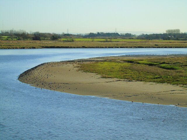
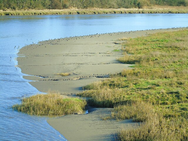
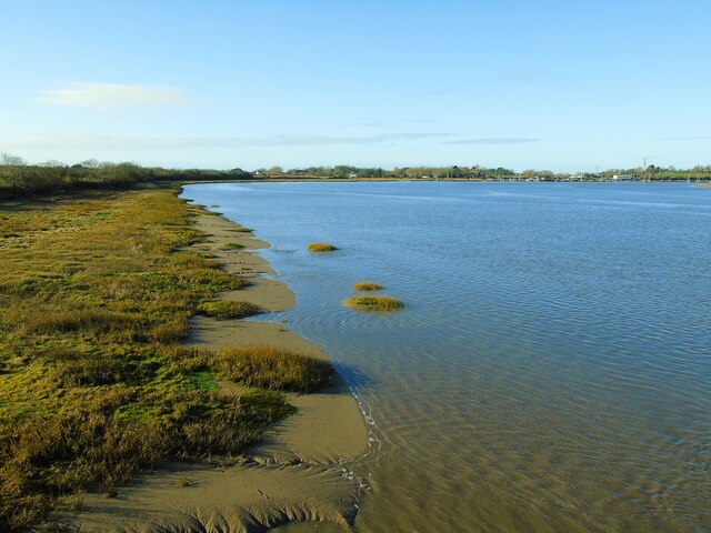
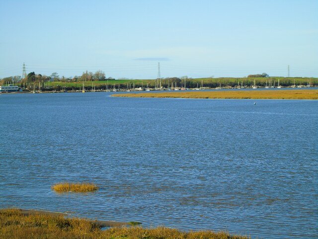
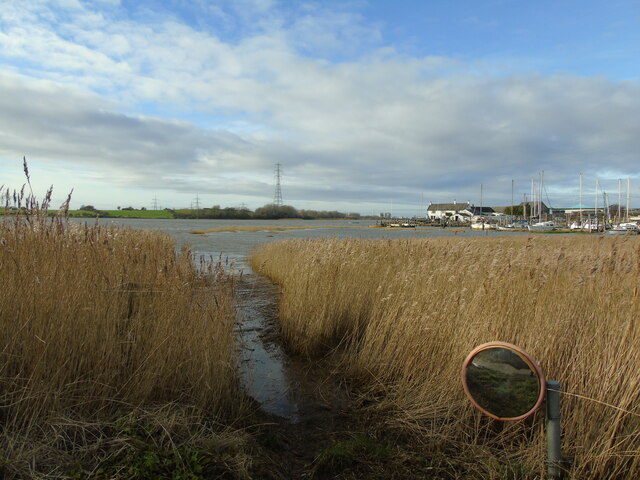
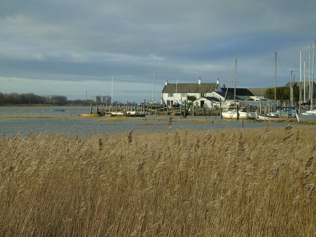
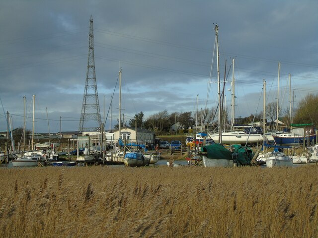
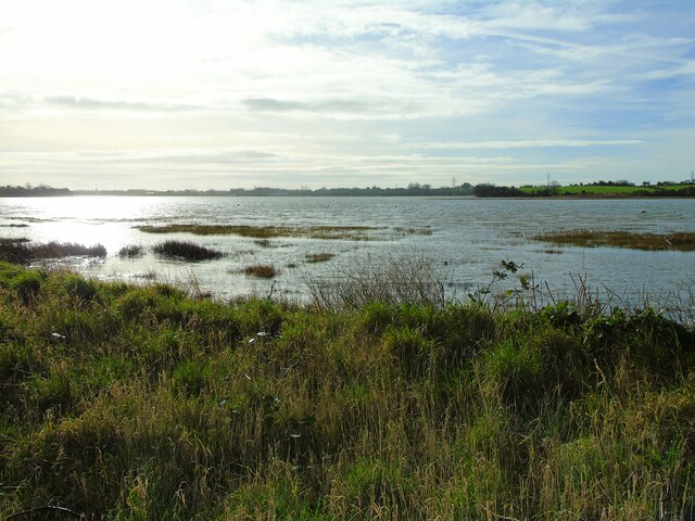
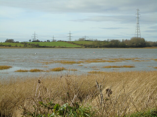
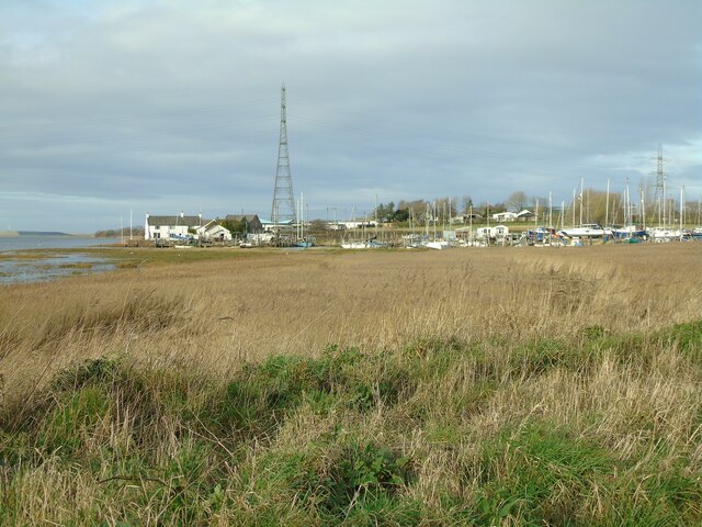
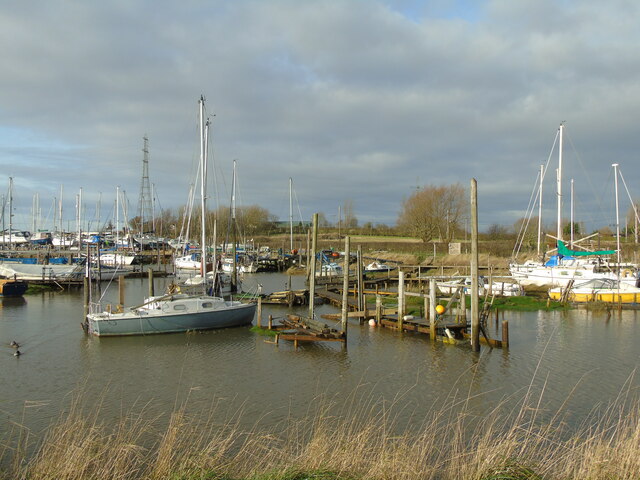
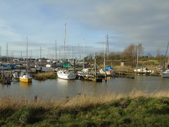
Hambleton Images

Images are sourced within 2km of 53.873578/-2.951438 or Grid Reference SD3742. Thanks to Geograph Open Source API. All images are credited.

River Wyre from Shard Bridge (1) This is the River Wyre flowing upriver towards Garstang as seen from Shard Bridge. The birds on the shoreline are (for the most part) lapwings. Hambleton, Lancashire.
River Wyre from Shard Bridge (1)
This is the River Wyre flowing upriver towards Garstang as seen from Shard Bridge. The birds on the shoreline are (for the most part) lapwings. Hambleton, Lancashire.
A desert of lapwings These lapwings were spotted on the south bank of the River Wyre at the Shard Bridge, Hambleton, Lancashire.
A desert of lapwings
These lapwings were spotted on the south bank of the River Wyre at the Shard Bridge, Hambleton, Lancashire.
River Wyre from Shard Bridge (2) Taken from the Shard Bridge, this is the River Wyre as it flows downriver towards Fleetwood. Skippool, Poulton-le-Fylde, Lancashire.
River Wyre from Shard Bridge (2)
Taken from the Shard Bridge, this is the River Wyre as it flows downriver towards Fleetwood. Skippool, Poulton-le-Fylde, Lancashire.
Blackpool and Fleetwood Yacht Club Blackpool and Fleetwood Yacht Club, River Wyre at Skippool, near Thornton, Lancashire.
Blackpool and Fleetwood Yacht Club
Blackpool and Fleetwood Yacht Club, River Wyre at Skippool, near Thornton, Lancashire.
To Stanah and Thornton Taken on The Shore, Wardley's Creek, Hambleton, Lancashire, I am looking west across the River Wyre to Stanah and Thornton.
To Stanah and Thornton
Taken on The Shore, Wardley's Creek, Hambleton, Lancashire, I am looking west across the River Wyre to Stanah and Thornton.
Wardley's Cottage Taken on The Shore at the mouth of Wardley's Creek, I am looking northwards across the pool to Wardley's Cottage. Hambleton, Over Wyre, Lancashire.
Wardley's Cottage
Taken on The Shore at the mouth of Wardley's Creek, I am looking northwards across the pool to Wardley's Cottage. Hambleton, Over Wyre, Lancashire.
Wardley's Yacht Club Taken where The Shore meets Kiln Lane, Hambleton, Lancashire, I am looking across Wardley's Creek and Wardley's Yacht Club.
Wardley's Yacht Club
Taken where The Shore meets Kiln Lane, Hambleton, Lancashire, I am looking across Wardley's Creek and Wardley's Yacht Club.
To Little Thornton and Skippool I am on The Sbore at Wardley's Creek, Hambleton, Lancashire and looking south west across the River Wyre towards Little Thornton and Skippool.
To Little Thornton and Skippool
I am on The Sbore at Wardley's Creek, Hambleton, Lancashire and looking south west across the River Wyre towards Little Thornton and Skippool.
Across the Wyre to Stanah I am on The Shore at Wardley's Creek and looking across the River Wyre to Stanah, west of Thornton, with Wyre Estuary Country Park located northwards around the bend in the river. Hambleton, Over Wyre, Lancashire.
Across the Wyre to Stanah
I am on The Shore at Wardley's Creek and looking across the River Wyre to Stanah, west of Thornton, with Wyre Estuary Country Park located northwards around the bend in the river. Hambleton, Over Wyre, Lancashire.
To Staynall Taken where Kiln Lane meets The Shore at Wardley's Creek, I am looking north across the pool past Wardley's Cottage towards Wardley's Lane and Staynall. Hambleton, Lancashire.
To Staynall
Taken where Kiln Lane meets The Shore at Wardley's Creek, I am looking north across the pool past Wardley's Cottage towards Wardley's Lane and Staynall. Hambleton, Lancashire.
Landing stages (1) Wardley's Yacht Club, Wardley's Creek, Hambleton, Lancashire
Landing stages (1)
Wardley's Yacht Club, Wardley's Creek, Hambleton, Lancashire
Landing stages (2) Wardley's Yacht Club, Wardley's Creek, Hambleton, Lancashire
Landing stages (2)
Wardley's Yacht Club, Wardley's Creek, Hambleton, Lancashire
Wardley's Creek Tidal Door Taken beside Wardley's Yacht Club, Wardley's Creek, and looking south across the landing stages to The Shore. Hambleton, Lancashire.
Wardley's Creek Tidal Door
Taken beside Wardley's Yacht Club, Wardley's Creek, and looking south across the landing stages to The Shore. Hambleton, Lancashire.
Duck Island Refuge for the local duck population at Wardley's Yacht Club, Wardley's Creek, Hambleton, Lancashire.
Duck Island
Refuge for the local duck population at Wardley's Yacht Club, Wardley's Creek, Hambleton, Lancashire.
High Tide at Stannah I took this photo during a 10.1 metre high tide. The Wyre Way south of the Wyre Estuary Country Park at Stannah was submerged at several places along this stretch. The blue boat in the foreground has been abandoned for some time and is normally high and dry. The sailing boats just visible in the far distance belong to the Blackpool & Fylde Yacht Club.
High Tide at Stannah
I took this photo during a 10.1 metre high tide. The Wyre Way south of the Wyre Estuary Country Park at Stannah was submerged at several places along this stretch. The blue boat in the foreground has been abandoned for some time and is normally high and dry. The sailing boats just visible in the far distance belong to the Blackpool & Fylde Yacht Club.
Abandoned Jetties at Skippool These moorings, in the tidal waters of the Wyre Estuary, have always been popular with boat owners. However quite a few are now abandoned and derelict, like this broken jetty with disused boat still moored. The photo was taken at high tide, looking north along the Wyre with the Cumbrian hills just visible in the far distance.
Abandoned Jetties at Skippool
These moorings, in the tidal waters of the Wyre Estuary, have always been popular with boat owners. However quite a few are now abandoned and derelict, like this broken jetty with disused boat still moored. The photo was taken at high tide, looking north along the Wyre with the Cumbrian hills just visible in the far distance.
Shard Bridge from Skippool I took this view from the public footpath between Skippool Creek and the Yacht Club using a zoom lens. The tide was at about its lowest point at the time. The white building on the left bank is the Shard Riversid Inn. Shard Bridge used to be a toll road - I remember the fury in the 1970s when the charge was raised to 5p per car.
Shard Bridge from Skippool
I took this view from the public footpath between Skippool Creek and the Yacht Club using a zoom lens. The tide was at about its lowest point at the time. The white building on the left bank is the Shard Riversid Inn. Shard Bridge used to be a toll road - I remember the fury in the 1970s when the charge was raised to 5p per car.
Stannah at low tide A view of the Wyre looking across from Stannah towards Hambleton. The River Wyre is tidal at this point and at low tide most of the estuary bed is exposed.The yachts have been left high and dry. This photo was taken on a warm dry day and the mud was already beginning to crack.
Stannah at low tide
A view of the Wyre looking across from Stannah towards Hambleton. The River Wyre is tidal at this point and at low tide most of the estuary bed is exposed.The yachts have been left high and dry. This photo was taken on a warm dry day and the mud was already beginning to crack.
Show me another place!

Hambleton is located at Grid Ref: SD3742 (Lat: 53.873578, Lng: -2.951438)

Administrative County: Lancashire

District: Wyre

Police Authority: Lancashire

What 3 Words

///passwords.besotted.microchip. Near Thornton-Cleveleys, Lancashire

Related Wikis

Hambleton, Lancashire

Hambleton is a village and civil parish in the English county of Lancashire. It is situated on a coastal plain called the Fylde and in an area east of...

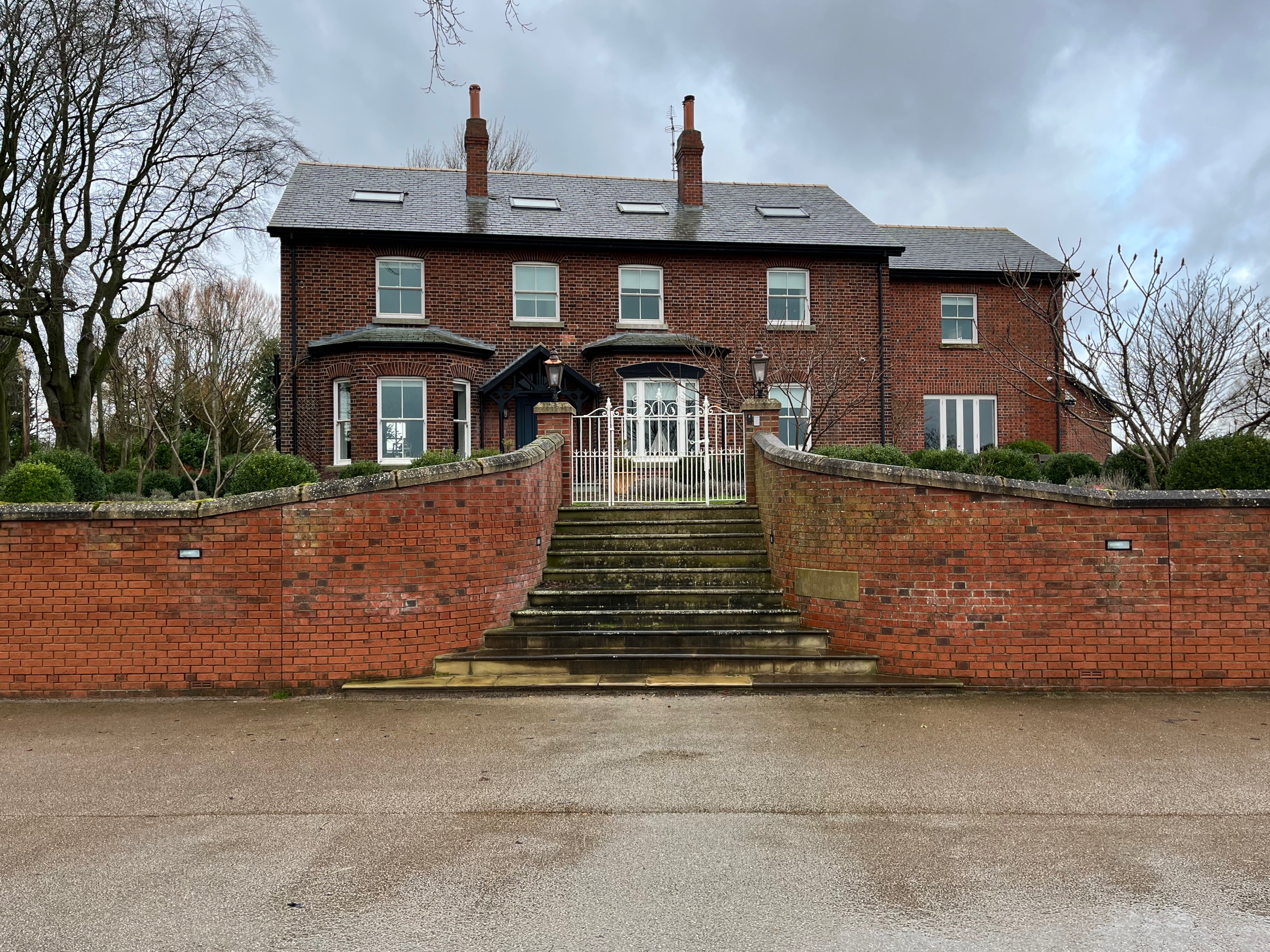
Hambleton Hall, Lancashire

Hambleton Hall is an historic building in Hambleton, Lancashire, England. Built in 1710, it is a house in pebbledashed brick with a slate roof, in two...

Wardleys, Hambleton

Wardleys was a pub on Wardley's Lane in the civil parish of Stalmine-with-Staynall, near the village of Hambleton, Lancashire. The building dated to the...

Shard Riverside Inn

Shard Riverside Inn is a public house and boutique hotel in the English village of Hambleton, Lancashire. Dating to 1766, it stands on the northern banks...

Shard Bridge

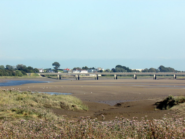
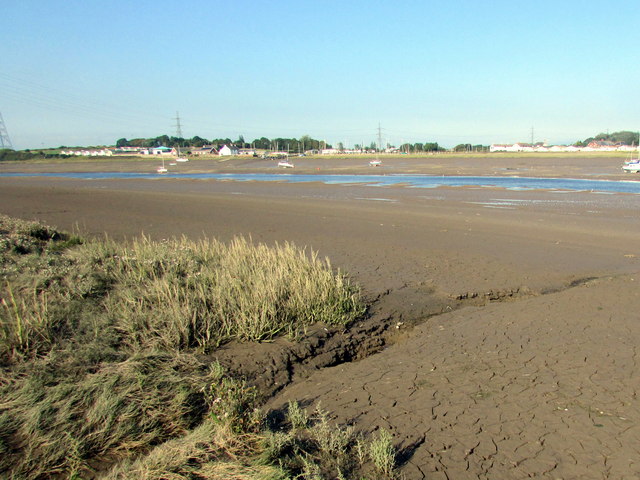
Shard Bridge is a bridge in the English county of Lancashire. It spans the River Wyre, connecting Singleton, on the southern side of the river, to Hambleton...

Hillylaid Pool

Hillylaid Pool is a water channel running through the Fylde and Wyre areas of Lancashire in England. It is 4.55 miles (7.32 km) long, and it is part of...

Wyre Estuary Country Park

Wyre Estuary Country Park is located in Thornton-Cleveleys, Lancashire, England. Established in 1991 and covering 0.79 acres (0.32 ha), it is situated...

The River House

The River House is an historic building in the Skippool area of Thornton-Cleveleys, Lancashire, England. Overlooking the River Wyre, it was built in 1830...

Nearby Amenities

Located within 500m of 53.873578,-2.951438
Hambleton
Place: village
Source: npe
Lat/Long: 53.8750597/-2.954625
Community Centre
Hambleton Village Hall
Addr City: Poulton-le-Fylde
Addr Postcode: FY6 9BZ
Addr Street: Church Lane
Addr Suburb: Hambleton
Community Centre: village_hall
Fhrs Id: 568543
Lat/Long: 53.8742165/-2.9507888
Pub
The Shovels Inn
Addr City: Poulton-le-Fylde
Addr Postcode: FY6 9AL
Addr Street: Green Meadow Lane
Addr Village: Hambleton
Contact Facebook: https://www.facebook.com/theshovels
Cuisine: regional
Email: shovelsinnhambleton@gmail.com
Fhrs Id: 374486
Opening Hours: Mo-Su 12:00
Phone: +441253700209
Smoking: outside
Website: http://www.shovelshambleton.co.uk/
Lat/Long: 53.8741889/-2.9586806
Restaurant
Ryecroft Hall
Addr City: Poulton-le-Fylde
Addr Postcode: FY6 9AE
Addr Street: Paul's Lane
Addr Village: Hambleton
Fhrs Id: 730358
Lat/Long: 53.8754356/-2.9543747
Country Pantry
Addr City: Poulton-le-Fylde
Addr Housenumber: 1 West Lodge
Addr Postcode: FY6 9AG
Addr Street: Broadpool Lane
Addr Village: Hambleton
Fhrs Id: 247395
Shop: bakery
Lat/Long: 53.8744418/-2.9564534
R & J Cardwell
Addr City: Poulton-le-Fylde
Addr Housenumber: 2 West Lodge
Addr Postcode: FY6 9AG
Addr Street: Broadpool Lane
Addr Village: Hambleton
Fhrs Id: 374921
Shop: butcher
Lat/Long: 53.874505/-2.9565889
Hambleton Sports & Social Club
Addr City: Poulton-le-Fylde
Addr Postcode: FY6 9BZ
Addr Street: Church Lane
Addr Suburb: Hambleton
Club: social_club
Fhrs Id: 374491
Lat/Long: 53.8744272/-2.9506391
Village Off-licence
Addr City: Poulton-le-Fylde
Addr Housenumber: 5 West Lodge
Addr Postcode: FY6 9AG
Addr Street: Broadpool Lane
Addr Village: Hambleton
Fhrs Id: 1113222
Shop: alcohol
Lat/Long: 53.874451/-2.9567144
Crossing
Crossing: zebra
Kerb: lowered
Tactile Paving: yes
Lat/Long: 53.8746475/-2.9568915
Village Vogue
Addr City: Poulton-le-Fylde
Addr Housenumber: 3 West Lodge
Addr Street: Broadpool Lane
Addr Village: Hambleton
Shop: hairdresser
Lat/Long: 53.874336/-2.9563686
Village Nails
Addr City: Poulton-le-Fylde
Addr Housenumber: 4 West Lodge
Addr Street: Broadpool Lane
Addr Village: Hambleton
Shop: beauty
Lat/Long: 53.87447/-2.9566598
Entrance: main
Wheelchair: yes
Lat/Long: 53.8750183/-2.9467787
Post Box
Brand: Royal Mail
Brand Wikidata: Q638098
Brand Wikipedia: en:Royal Mail
Collection Times: Mo-Fr 09:00; Sa 07:00; Su off
Drive Through: no
Operator: Royal Mail
Operator Wikidata: Q638098
Post Box Mounting: pier
Post Box Type: lamp
Ref: FY6 156D
Royal Cypher: EIIR
Royal Cypher Wikidata: Q33102113
Source: survey;streetlevel imagery;aerial imagery
Lat/Long: 53.8755232/-2.9548188
Turning Circle
Lat/Long: 53.8779371/-2.9516385
Give Way
Direction: forward
Lat/Long: 53.8739274/-2.9499333
Give Way
Direction: forward
Lat/Long: 53.8741119/-2.9514251
Generator Method: photovoltaic
Generator Output Electricity: yes
Generator Source: solar
Generator Type: solar_photovoltaic_panel
Location: roof
Power: generator
Lat/Long: 53.8744781/-2.9493385
Give Way
Direction: backward
Lat/Long: 53.8743455/-2.9482561
Charging Station
Authentication App: yes
Capacity: 1
Fee: yes
Motorcar: yes
Network: Charge My Street
Operator: Hambleton Village Hall
Payment App: yes
Ref: EG-08663
Socket Type2: 1
Socket Type2 Current: 33
Socket Type2 Output: 7kW
Socket Type2 Voltage: 230
Lat/Long: 53.8742649/-2.9507462
Charging Station
Authentication App: yes
Capacity: 1
Fee: yes
Motorcar: yes
Network: Charge My Street
Operator: Hambleton Village Hall
Payment App: yes
Ref: EG-08704
Socket Type2: 1
Socket Type2 Current: 33
Socket Type2 Output: 7kW
Socket Type2 Voltage: 230
Lat/Long: 53.8742617/-2.9507436
Parking
Access: customers
Lat/Long: 53.8754166/-2.9541031
Parking
Access: customers
Lat/Long: 53.875046/-2.9541355
Barrier: bollard
Lat/Long: 53.8775196/-2.9550229
Car Wash
Hambleton Car Wash Centre
Lat/Long: 53.8715144/-2.9577738
Parking
Access: customers
Lat/Long: 53.8713237/-2.9577184
Defibrillator
Defibrillator Location: outside Hambleton Village Hall
Emergency: defibrillator
Indoor: no
Lat/Long: 53.8741688/-2.9507161
Defibrillator
Defibrillator Location: On outside wall of The Shovels Inn, facing Broadpool Lane.
Emergency: defibrillator
Lat/Long: 53.8741764/-2.9585594
The data included in this document is from www.openstreetmap.org. The data is made available under ODbL.

Have you been to Hambleton?

Leave your review of Hambleton below (or comments, questions and feedback).